Mori Atlas logo
Park earthquake history

Review documented earthquake records by proximity, event magnitude, and epicentre location

Historical Catalogue of Recorded Seismic Events Near Gargano National Park in Apulia

Access a detailed collection of historical earthquake records associated with the geography of Gargano National Park. This catalogue provides a structured view of past seismic activity mapped relative to the protected landscapes of the Gargano promontory and the surrounding Apulia region. Each entry identifies event characteristics, including reported magnitudes and focal depths, enabling a clear perspective on the regional seismic environment without implying future risk or specific geological causation.

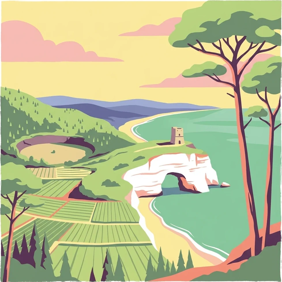
Illustrated coastal landscape with a white rock arch, a tower on a cliff, green agricultural fields, forested hills, and a shoreline with blue water under a yellow sky with pink clouds

Mediterranean promontory wilderness with ancient forests and coastal islands

Gargano National Park

Gargano National Park is a vast protected area in southern Italy spanning the Gargano promontory, its offshore archipelago, and adjacent wetlands in the region of Apulia. Established in 1991, it covers approximately 118,000 hectares, making it the largest national park in Apulia and one of the most ecologically significant protected areas in Western Europe. The park encompasses the rugged limestone mountains of the Gargano headland, the ancient beech woodlands of the Foresta Umbra, the Tremiti Islands in the Adriatic Sea, and the coastal wetland complex of Lago Salso. This extraordinary concentration of Mediterranean, forest, and wetland habitats within a single protected landscape creates one of Italy's most biologically diverse territories.

Location
Italy
Park type
National park
Established
1991
Area
1,181.4 km²
Gargano National Park Atlas

Navigate Gargano National Park events by place, depth, and distance

Examine historical earthquake observations near Gargano National Park

Gargano National Park’s earthquake view positions reported epicentres around its Apulian promontory by calculated distance, separating the catalogue from limestone ridges, Adriatic coast, ancient forest, wetlands, and islands. Each record provides a date, magnitude, depth, locality, source, and park distance for historical comparison without attributing landscape effects, current danger, or future activity.

Sort by
Magnitude
Location

This page describes catalogued earthquakes associated with the park by epicentre location and distance. It does not establish causation, assess current danger, or predict future earthquakes.

No earthquake records match the current filters

Park atlas

Expand beyond Gargano National Park historical earthquake data

Browse further protected parks after Gargano National Park

After the earthquake evidence around Gargano National Park, the atlas turns from one Italian Mediterranean promontory of ancient woodland to wider park discovery. Those destinations are not presented as sharing forest landscape, national-park designation, geographic closeness, geology, earthquake records, hazards, risk, orchid habitat, or equivalent documentation.
Watercolor illustration showing green grasslands, distant hills, and a winding path under a light sky
National parkItaly
44 km away#1 closest

South

Alta Murgia National Park: National Park Exploration and Protected Landscape Context

Explore mapped terrain and regional geography.

Alta Murgia National Park is a designated national park offering unique opportunities for geographic discovery. Delve into its protected landscape, understand its mapped boundaries, and situate it within the broader Italian atlas. This entry provides essential context for exploring the park's terrain and regional significance.

Area
677.39 km²
Established
2004
IUCN
II
Relief
Mixed relief
A wide panoramic watercolor painting showing a landscape with a body of water in the foreground, green grasses and trees on the banks, and layers of purple and pink hills in the distance under a pale sky.
Nature reserveAbruzzo
About 45 km away#2 closest

West

Riserva naturale regionale Marina di Vasto: Coastal Nature Reserve in Abruzzo, Italy

Mapping protected Adriatic dune and wetland ecosystems

This nature reserve protects a vital 3-kilometer strip of the Adriatic coastline in Abruzzo, acting as a rare sanctuary for specialized flora and fauna. By managing a delicate ecotone of shifting sand dunes and brackish wetland basins, the area maintains a high degree of ecological significance within the regional landscape. The geography provides an important look at integrated coastal conservation at the meeting point of urbanized hinterlands and the Adriatic sea.

Area
0.57 km²
Established
2007
Relief
Lowland
Climate
Mediterranean
A soft watercolor painting of a coastal landscape with rolling green hills, scattered trees, and a light-colored sandy foreground, rendered in a minimalist style.
Nature reserveAbruzzo
About 81 km away#3 closest

Northwest

Punta dell'Acquabella Nature Reserve: Adriatic Coastal Landscape and Geography

Protected Mediterranean shoreline in the Abruzzo region of Italy

Punta dell'Acquabella is a distinct nature reserve on the Adriatic coast of Abruzzo, characterized by its promontory, cliff habitats, and clear coastal waters. The area serves as a significant intersection of natural heritage and cultural landscape within the Trabocchi coast, offering a deep look into the regional geography and environmental features that define this protected territory.

Area
0.28 km²
Established
2007
Relief
Upland
Climate
Mediterranean
Watercolor painting showing mountains, forests, and a body of water in a scenic landscape
National parkAbruzzo
81 km away#4 closest

West

Maiella National Park: Abruzzo's Protected Landscape and Regional Geography

Explore mapped park boundaries and natural terrain.

Delve into the protected landscape of Maiella National Park, situated within the Abruzzo region of southern Italy. This page offers detailed atlas-level insights into its mapped boundaries, allowing for a clear understanding of its geographic setting. Discover how this national park contributes to the regional natural terrain and protected area context, providing a foundation for structured geographic exploration.

Area
628.38 km²
Established
1991
IUCN
II
Relief
Mountain
Watercolor illustration of rolling hills, green vegetation, and distant mountains under a light sky
Protected areaCroatia
83 km away#5 closest

Northeast

Lastovo Nature Park: Discover the Adriatic Karst Archipelago's Protected Landscape

Mapped karst terrain, ancient architecture, and natural island geography.

Lastovo Nature Park protects a remote Croatian archipelago characterized by its striking karst landscape, featuring 46 hills and 46 karstic fields. This protected area offers significant natural biodiversity and remarkably preserved cultural heritage, with extensive Holm Oak and Aleppo Pine forests covering over 60% of the island. Explore Lastovo's unique geography, mapped terrain, and its distinct place within the Adriatic region.

Area
46.87 km²
Established
2006
IUCN
V
Relief
Upland
Watercolor illustration showing a landscape with mountains, green forests, and a river under a soft sky
National parkBasilicata
105 km away#6 closest

South

Appennino Lucano - Val d'Agri - Lagonegrese National Park: Protected Mountain Landscape in Basilicata, Italy

Explore its geography, mapped terrain, and ecological role.

Gain insight into Appennino Lucano - Val d'Agri - Lagonegrese National Park, a significant protected mountain landscape in the heart of Basilicata. This detailed page focuses on the park's distinct geographic features, its role as a crucial ecological corridor connecting major southern Italian protected areas, and the mapped contours of its diverse terrain. Understand its place within the Lucano Apennine range and the broader natural atlas of Italy.

Area
689.96 km²
Established
2007
IUCN
II
Relief
Mountain
Watercolor painting showing a landscape with rolling green hills, a river, and scattered trees
National parkItaly
About 114 km away#7 closest

West

Abruzzo, Lazio and Molise National Park

Protected landscape in Italy's Apennines.

Explore the mapped boundaries and protected status of Abruzzo, Lazio and Molise National Park. This historic Italian national park offers a detailed look at Apennine mountain geography and landscape.

Established
1923
IUCN
II
Watercolor painting of mountains, green valleys, and a river
National parkItaly
115 km away#8 closest

Northwest

Gran Sasso and Monti della Laga National Park: Italy's National Park Geographic Context

Mapped protected areas and regional natural landscape details.

Delve into the geography of Gran Sasso and Monti della Laga National Park, a prominent national park in Italy. This resource provides essential context for understanding its protected landscape, mapped boundaries, and integration within the regional geography. Ideal for users seeking detailed atlas-style information on protected areas and their natural terrain, it serves as a foundational point for exploring the park's unique geographic character and landscape significance.

IUCN
II
MoriAtlas Explorer

Continue your exploration of Gargano National Park's protected landscape and Apulia geography

Deepen your understanding of Gargano National Park by examining its mapped terrain and protected landscape features. This detailed view of Apulia's geography provides essential context for appreciating the park's unique place within the Italian atlas. Continue your structured discovery journey into this significant protected area and its surrounding natural context.

Global natural geography