Peaks
Mount Jupiter
2,781 m

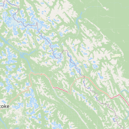
Detailed terrain analysis, administrative location data, and defined park boundaries.
Glacier National Park encompasses 1349 square kilometers within the Columbia-Shuswap Regional District of British Columbia, Canada. This geographic record provides a structured breakdown of the park boundaries, spanning peaks like Mount Sir Donald and Mount Tupper, and defines the regional terrain context including alpine meadows, temperate forests, and glaciers.
Related tags
Glaciated mountain wilderness in the Selkirks of British Columbia
Glacier National Park is one of Canada's oldest national parks, established in 1886 as the second protected area in the country's park system. Located in the Selkirk Mountains of British Columbia, the park encompasses over 1,300 square kilometers of rugged alpine terrain featuring dramatic peaks, extensive glacier systems, and deep U-shaped valleys carved by ancient ice. The park is bisected by the Trans-Canada Highway and Canadian Pacific Railway, which follows Rogers Pass, a historic mountain corridor that was the key to connecting eastern and western Canada. The park's landscape is defined by its glaciers, with more than 130 ice bodies covering over 130 square kilometers, making it one of the most heavily glaciated regions in North America. Its ecological diversity spans from lush western temperate rainforests to harsh alpine tundra, supporting populations of large mammals including grizzly bears, black bears, mountain goats, and caribou.
Provincial and regional positioning within British Columbia, Canada
Mapping the 1,349 square kilometer conservation footprint and physical limits
Vertical relief data and recorded natural features across protected terrain
Peaks
2,781 m
Mountain saddles
1,336 m
Streams
Lakes
Peaks
2,897 m
Peaks
2,490 m
Interpreting subpolar relief, forest cover, and habitat types across protected terrain
Mountains · Valleys · Glacier · Cave · Rivers · Cliffs · Forest · Wetland
Temperate broadleaf forest · Temperate coniferous forest · Montane forest · Alpine meadow · Wetland · Riverine habitat
Map the surrounding protected landscapes and compare their unique alpine geography near Glacier National Park.
Southwest

British Columbia's National Park Atlas Entry
Delve into the protected landscape of Mount Revelstoke National Park, a critical national park located in British Columbia. This entry provides a detailed look at its mapped geographic extent and protected area identity, offering valuable context for regional atlas exploration. Understand the park's distinct contribution to the mapped natural landscapes of Canada.
East
Exploring the park's protected boundaries and terrain.
Yoho National Park is presented here as a distinct national park within British Columbia's vast geographic framework. This page provides a structured view of its protected land status, allowing for detailed exploration of its mapped boundaries and surrounding natural landscapes. Understand Yoho National Park's place in the Canadian atlas through its specific geographic features and protected area context.
East
Mapped park boundaries and regional geographic context for Banff National Park.
Gain a structured understanding of Banff National Park as a key protected area within Canada. This resource details its identity as a national park, providing insights into its geographic setting and mapped landscape. It serves as a vital point for atlas-based discovery, helping to contextualize Banff National Park's significance within Canada's protected lands and natural terrain.
Southeast
Explore Kootenay National Park's mapped terrain and regional geography.
Kootenay National Park is a protected national park located in British Columbia, Canada. This dedicated detail page provides an atlas-style exploration of its geographic identity, focusing on its mapped boundaries and the surrounding natural terrain. Understand how Kootenay National Park fits into the larger regional geography, offering rich context for protected landscape discovery and analysis.
North
Explore Alberta's regional park context and natural terrain.
Jasper National Park is a key protected national park in Alberta, Canada, offering extensive natural landscapes. This park page details its precise geographic location, outlines its protected boundaries, and provides context within the regional geography of Western Canada. Discover the mapped terrain and the park's significance as a protected area within a broader atlas perspective.
Southwest
Mapping the Shuswap region's essential day-use lakeshore environment
Situated on the southern edge of Mara Lake, Mara Provincial Park functions as a key protected site in the Shuswap region of British Columbia. This area provides public access to sandy beaches and serves as the primary boat launch for the surrounding interior lake system, preserving natural terrain against private lakeshore development.
Northwest
Glacial cascades and North Thompson River valley terrain
This protected area centers on a vertical, two-stage waterfall spilling from a hanging valley high above the North Thompson River. Characterized by its glacier-fed creek and steep forested slopes, the park functions as a key geological landmark within the rugged, mountainous interior of British Columbia.
Southwest
Exploring the Okanagan Highland plateau and alpine wetland systems
Graystokes Provincial Park functions as a key protected landscape in the British Columbia interior. This backcountry expanse is defined by its rolling plateau terrain, encompassing alpine wetlands, meadows, and riparian habitats set against a backdrop of Engelmann spruce and subalpine fir forests.
Deepen your understanding of Glacier National Park's geographic significance. By exploring this national park's context, you gain valuable insights into its mapped protected area features and regional landscape. This atlas perspective helps to contextualize Glacier National Park within Canada's conservation network, offering a factual exploration of its protected land identity.