
Mori Atlas logo
Nature reserveGlockenborn bei Bründersen

Understanding the mapped boundaries and natural terrain of this unique Hessen compensatory habitat

Glockenborn bei Bründersen Nature Reserve: A Detailed Geographic Atlas of Wetland Landscapes

(Naturschutzgebiet Glockenborn bei Bründersen)

Glockenborn bei Bründersen represents a refined mosaic of open water, wet meadows, and grassland in northern Hesse. This nature reserve serves as an ecologically successful wetland, providing vital breeding grounds for migratory bird species and amphibians. The managed landscape features shallow lakes and year-round grazing by Highland cattle, which preserves the open horizon and structurally diverse terrain within this agricultural region.

wetlandnature reserveshallow lakebirdwatchingmigratory birdsamphibians
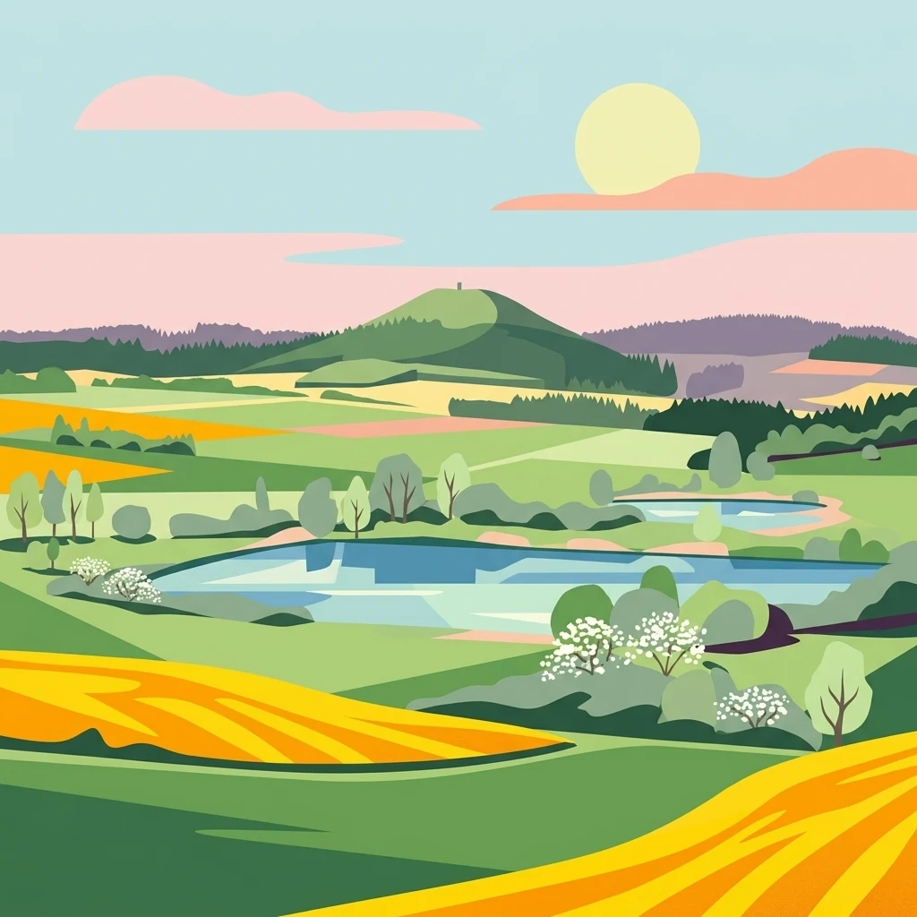
A vibrant, flat-style digital illustration of a nature reserve landscape with a central pond, rolling green and yellow hills, blooming white trees, a distant rounded hill under a soft sun, and pale pink clouds.

Glockenborn bei Bründersen

Nature reserve

Park overview

Structured park overview, official facts, and landscape profile for Glockenborn bei Bründersen

Glockenborn bei Bründersen park facts, protected area profile, and essential visitor context

Review the core facts for Glockenborn bei Bründersen, including designation, size, terrain, visitor scale, habitats, and operating context in one park-focused overview.

About Glockenborn bei Bründersen

Glockenborn bei Bründersen is a nature reserve in the northern part of the German state of Hesse, situated in the Landkreis Kassel between Wolfhagen and the Bründersen district. Despite its modest size of around seven hectares, the reserve plays an outsized ecological role within the surrounding rural region, which is otherwise dominated by agriculture and small villages.

The site's character is defined by water. Two large shallow lakes form the visual and ecological centerpiece of the reserve, complemented by several smaller still waters and a network of extensively managed grassland that extends across the rest of the protected area. The combination of open water surfaces, wet margins, and open meadow creates a mosaic of habitats that is rare within the intensively farmed countryside of northern Hesse.

Glockenborn was not originally a naturally formed wetland. It was created in 2004 as a compensatory measure for the construction of a bypass road near the village of Istha, designed to provide replacement habitat for the ecological value lost to that infrastructure project. Within a short time, the artificially established wetland developed into a thriving refuge for both resident and migratory species, demonstrating how carefully designed artificial biotopes can rapidly acquire genuine ecological value.

Although the site is officially owned by the town of Wolfhagen, its day-to-day conservation is a collaborative effort between the municipality, the Wolfhagen Forestry Office, and the Kassel Regional Council. This multi-agency approach reflects the broader importance attached to the reserve within the regional nature conservation framework, and underscores the site's role as a demonstration of integrated habitat management in a heavily modified landscape.

Quick facts and research context for Glockenborn bei Bründersen

Glockenborn bei Bründersen lies in northern Hesse, in the Landkreis Kassel, between the town of Wolfhagen and the village of Bründersen. The protected area covers roughly seven hectares and was formally designated as a nature reserve in 2004.

The reserve was originally created as an artificial wetland biotope to compensate for the construction of a bypass road near Istha. It includes two main shallow lakes, several smaller still-water bodies, and extensive grassland managed through year-round grazing by a herd of Scottish Highland cattle. The area is co-managed by the town of Wolfhagen, the Wolfhagen Forestry Office, and the Kassel Regional Council.

Protection and recognition

Examine documented protection records and administrative status details

Glockenborn bei Bründersen Protection Status and Designation Records

Glockenborn bei Bründersen conservation metrics compile baseline protection status and official designation history from verified global databases. Structured management records outline formal administrative boundaries and international framework recognitions for this protected area.

Protection details

WDPA ID
163264
Park context

Deeper park guide and search-rich context for Glockenborn bei Bründersen

Glockenborn bei Bründersen history, landscape, wildlife, and travel context

Explore Glockenborn bei Bründersen through its history, landscape character, ecosystems, wildlife, conservation priorities, cultural context, and seasonal travel timing in a structured park guide built for atlas discovery and search intent.

Why Glockenborn bei Bründersen stands out

Glockenborn is best known as a small but ecologically rich wetland reserve that has become an important breeding and stopover site for birds in northern Hesse. Birdwatchers and ornithologists have recorded at least 40 breeding species and 163 migratory species on the site, including breeding storks that have been encouraged through the construction of a dedicated nesting platform. The reserve is also recognized for its distinctive management approach, where a herd of Scottish Highland cattle grazes the area year-round to keep the wetland open and to maintain the diverse flora of the grassland and lake margins. This combination of open water, wet meadows, and large mammal grazing gives the reserve a distinctive, semi-natural character unusual within the broader agricultural landscape of the region.

Panoramic landscape view of a small lake surrounded by green and yellow fields in the foreground, with rolling hills and a prominent forested hill in the background under an overcast sky.
A panoramic view of the Glockenborn wetland area near Bründersen, featuring rolling agricultural fields and a small lake.

Glockenborn bei Bründersen history and protected-area timeline

The present-day nature reserve Glockenborn bei Bründersen dates only from 2004, when it was formally designated as a protected area. The landscape it encompasses, however, has a much longer cultural history. Before becoming a wetland reserve, the site was known as the Glockenborn spring, an important source of drinking water for the town of Wolfhagen. Its significance for the town's water supply is preserved in local folklore, where the Glockenborn features in several traditional Wolfhagen sagas.

The ecological transformation of the site began in 2004, when the area was artificially reshaped into a wetland biotope as an environmental compensation measure for the construction of a bypass road near Istha. The creation of the wetland was not a passive conservation decision but an active effort to offset habitat loss elsewhere.

Since its establishment, the reserve has been managed jointly by the town of Wolfhagen, the local forestry office, and regional authorities, a structure that has shaped its continuing development into a recognized site for birdlife and wetland conservation.

Glockenborn bei Bründersen landscape and geographic character

The landscape of Glockenborn bei Bründersen is defined by open water and open ground rather than woodland or relief. The two main shallow lakes dominate the visual character of the site and account for much of its area, with the surrounding grassland and smaller standing waters creating a layered mosaic of wet and dry microhabitats.

The terrain is gentle and low-lying, typical of the undulating agricultural countryside of northern Hesse, with no significant elevation changes within the reserve itself. A historic road still runs through the protected area, hinting at the site's earlier integration into the local landscape as a working spring and its later cultural role.

Around the lakes, the landscape transitions into extensive grassland, kept open and structurally diverse through direct grazing. This open horizon, punctuated by water surfaces and broken by the occasional grazing Highland cattle, gives the reserve a wide, airy feeling that contrasts strongly with the more enclosed farmland surrounding it.

Glockenborn bei Bründersen ecosystems, habitats, and plant life

The nature of Glockenborn is centered on wetland ecology. The reserve combines two large shallow lakes with a network of smaller still waters, creating a gradient of aquatic and semi-aquatic habitats that support rich invertebrate communities and, in turn, a complex food web of fish, amphibians, and birds.

Surrounding the water bodies are extensive areas of extensively managed grassland, which contribute additional habitat value through their varied plant communities and their role as feeding and nesting areas for ground-nesting and wetland-associated birds. The mosaic of open water, wet margin, and open meadow represents a rare habitat configuration within the broader agricultural matrix of the region.

The site demonstrates how artificial wetland construction can, given appropriate design and management, develop the ecological complexity typical of naturally formed wetland systems within just a few years. This ecological succession is one of the defining features of Glockenborn and explains why the reserve has attracted such a wide diversity of species despite its small size.

Glockenborn bei Bründersen wildlife and species highlights

Wildlife is the most visible expression of the reserve's ecological value. Glockenborn has become a notable location for birdlife, with documented records of at least 40 breeding bird species and 163 migratory species using the area either as a nesting site or as a stopover during migration.

Among the breeding species, storks receive particular attention. A nesting platform (Horst) has been deliberately installed within the reserve to encourage stork breeding, reflecting both the species' conservation significance in the region and the site's suitability as a breeding location. The reserve's mix of open water, wet meadow, and accessible foraging habitat makes it particularly attractive to wading and water-associated birds during the breeding season.

Amphibians are also a significant component of the site's fauna, exploiting both the standing water bodies and the surrounding wet grassland habitats. The conservation of these amphibian populations is closely linked to the maintenance of open water surfaces and clean, structurally diverse shoreline vegetation.

On a larger scale, the reserve is grazed year-round by a herd of Scottish Highland cattle, whose presence shapes habitat structure and contributes to nutrient cycling. While not part of the native wildlife, these cattle function as an important ecological management tool, keeping vegetation open and preventing scrub encroachment.

Glockenborn bei Bründersen conservation status and protection priorities

Glockenborn is a clear example of conservation through habitat creation. Its designation as a nature reserve in 2004 was not simply the protection of an existing natural site but the formal recognition of an ecologically valuable landscape deliberately constructed to offset infrastructure development nearby. The site's continuing role as a refuge for rare birds and amphibians underlines the success of this compensatory approach.

Management of the reserve is shaped by a cooperative model that brings together the town of Wolfhagen as landowner, the Wolfhagen Forestry Office, and the Kassel Regional Council. This partnership reflects the recognition that the reserve's ecological value requires sustained, multi-disciplinary management rather than passive protection.

The combination of breeding bird presence, amphibian populations, and the use of large grazers as a conservation tool positions Glockenborn as a small but instructive case study in modern, integrated nature conservation in agricultural landscapes of northern Hesse.

Glockenborn bei Bründersen cultural meaning and human context

The cultural context of Glockenborn is closely tied to the identity of Wolfhagen. Before its ecological transformation, the site was a key spring that supplied the town with drinking water, and it remains embedded in the local saga tradition. Wolfhager Sagen (Wolfhagen sagas) include stories set around the Glockenborn that reflect the spring's importance to the community.

These traditions link the reserve to the older rural and civic identity of the region, providing a cultural layer that sits alongside its modern ecological function. The coexistence of an active conservation area with a continuing local folklore presence gives the site a dual identity as both a modern nature reserve and a place of long-standing cultural memory.

Top sights and standout views in Glockenborn bei Bründersen

Two large shallow lakes forming the wetland's visual core.

A documented bird list of more than 40 breeding species and over 160 migratory species.

Breeding stork platform installed within the reserve.

Year-round grazing by Scottish Highland cattle as a habitat management tool.

Origin as a compensatory wetland created for a road-building project, now recognized for its ecological success.

Cultural location rooted in Wolfhagen's historical saga tradition and former role as a town water source.

Best time to visit Glockenborn bei Bründersen

The reserve can be appreciated year-round, but the early spring and late spring months tend to be especially rewarding for visitors interested in bird activity, as breeding and migratory species are most visible in this period. Late spring and early summer bring amphibian activity in and around the lake margins.

Autumn offers a quieter atmosphere with seasonal changes in water levels and vegetation, while winter can highlight the open character of the landscape and the Highland cattle grazing across the site. Because the reserve is managed primarily for wildlife conservation rather than visitor infrastructure, planning around wildlife seasons will generally produce the richest experience.

Monthly climate preview

Long-term monthly temperature averages and precipitation patterns for Hesse

Glockenborn bei Bründersen Climate Normals and Annual Temperature Rhythm

Glockenborn bei Bründersen records measured monthly temperature swings and precipitation averages across the year at a representative elevation of 293 meters. Accessing the complete twelve-month climate profile reveals detailed monthly distributions for thermal ranges and moisture levels.
Annual mean8 °C
-1 °C18 °C
Jan-1°
Feb
Mar
Apr
May12°
Jun16°
Jul18°
Aug18°
Sep14°
Oct
Nov
Dec
Warmest month
July

18 °C

Coolest month
January

-0.6 °C

Wettest month
July

2.5 mm/day

Driest month
April

1.5 mm/day

Park location guide

Geography guide, regional context, and park location map for Glockenborn bei Bründersen

Glockenborn bei Bründersen park geography, regions, and map view in Germany

Understand where Glockenborn bei Bründersen sits in Germany through a broader geographic reading of the surrounding landscape, nearby location context, and its mapped position within the national park landscape.

How Glockenborn bei Bründersen fits into Germany

Germany is a federal republic in Western and Central Europe with a population of over 83 million across sixteen constituent states. It is Europe's largest economy by nominal GDP and a major global exporter and importer. The capital is Berlin, and the country borders Denmark, Poland, Czech Republic, Austria, Switzerland, France, Luxembourg, Belgium, and the Netherlands.

Wider geography shaping Glockenborn bei Bründersen in Germany

Germany is located in Western and Central Europe, spanning 357,022 km². It borders Denmark to the north, Poland and the Czech Republic to the east, Austria and Switzerland to the south, and France, Luxembourg, Belgium, and the Netherlands to the west. The country has coastlines on the Baltic Sea and North Sea to the north, with the Alps located in the southern region.

Map view of Glockenborn bei Bründersen

Use this park location map to pinpoint Glockenborn bei Bründersen in Germany, understand its exact geographic position, and read its mapped placement within the surrounding landscape more clearly.

Pigeon | © OpenStreetMap contributors

Location context for Glockenborn bei Bründersen

Hesse

Visual reference for shallow lakes, grazing habitats, and protected northern Hesse scenery.

Glockenborn bei Bründersen Photos and Wetland Landscapes

Examine detailed photographs showcasing the open water, wet meadows, and grazing landscapes of Glockenborn bei Bründersen. Visual records illustrate the distinctive protected area environment, revealing the wetland character and habitat structure across northern Hesse.

Panoramic landscape view of a small lake surrounded by green and yellow fields in the foreground, with rolling hills and a prominent forested hill in the background under an overcast sky.

A narrow, straight paved path extending into the distance through a flat, rural landscape with shrubs, dormant grasses, and small patches of standing water.

Park atlas

Compare adjacent wetland reserves and regional conservation areas in northern Hesse

Explore Parks Near Glockenborn bei Bründersen and Surrounding Protected Landscapes

Visitors exploring Glockenborn bei Bründersen can browse nearby protected areas and wetland habitats across the surrounding region. Comparing adjacent nature reserves reveals broader ecological patterns and regional terrain differences throughout northern Hesse.
A soft watercolor painting depicting rolling green hills against a faint, light-colored background.
Nature reserveHessen
About 3.7 km away#1 closest

Northeast

Festberg bei Philippinenthal Nature Reserve: Geography and Protected Landscape Context

A rare calcareous grassland ecosystem in northern Hessen.

Festberg bei Philippinenthal encompasses a ridge of tilted Muschelkalk limestone rising above the Lohbach stream in Hessen. This nature reserve protects a vital combination of juniper heath, dry calcareous grassland, and small-scale forest habitats maintained by historic and modern conservation grazing, offering a clear example of local geology shaping biodiversity.

Area
0.143 km²
Established
1992
IUCN
IV
Nature reserveHessen
About 5.5 km away#2 closest

Northwest

Dörneberg bei Viesebeck: Protected Calcareous Grassland and Beech Forest in Hessen

Mapped nature reserve and orchid-rich protected landscape in northern Hessen.

Located in the Hessen region of Germany, Dörneberg bei Viesebeck is a carefully managed nature reserve characterized by its thin, lime-rich soils and diverse habitat mosaic. The reserve preserves rare calcareous dry grasslands, historical quarry features, and orchid-bearing beech woodlands. As part of a protected Natura 2000 site, it offers a condensed look at the ecologically significant limestone landscapes found within northern Hessen.

Area
0.256 km²
Established
1982
A pale watercolor painting showing a rolling landscape with soft green hills, scattered trees, and a hazy mountain silhouette against a white background.
Nature reserveHesse
About 7.7 km away#3 closest

South

Auf den Hesseln bei Naumburg Nature Reserve: Protected Landscape and Geography Atlas

A calcareous grassland mosaic within the Kassel district of Hesse

This protected area in northern Hesse encompasses a complex relief of Triassic mussel limestone slopes and alluvial woodland. The site highlights the importance of managed limestone dry grasslands and former quarry habitats in supporting specialized flora, serving as a concentrated example of habitat diversity within the surrounding agricultural landscape.

Area
0.196 km²
Established
1996
Relief
Upland
Climate
Temperate
Watercolor painting of a soft, rolling landscape with green fields, distant hills, and low foreground vegetation.
Protected areaGermany
About 9.2 km away#4 closest

East

Langenberger Huete bei Breitenbach: Mapped Geography and Protected Area Landscape Context

Nature reserve terrain and grassland boundaries in northern Hesse

Examine the geographic layout of Langenberger Huete bei Breitenbach, a protected dry grassland area near Schauenburg, Germany. This site preserves open meadow habitats along the forested Langenberg ridge, offering insight into traditional land use and small-scale conservation within the Habichtswald region. Access detailed boundary data and terrain information to understand its position within the surrounding agricultural and woodland zones.

Area
0.14 km²
Established
1992
Relief
Upland
Climate
Temperate
Watercolor painting of a rolling forested landscape with distant hills under a soft light.
Nature reserveHesse
About 10 km away#5 closest

East

Erlebach bei Ehlen Nature Reserve: Protected Terrain and Brook Valley Geography in Hesse

Mapped beech forest mosaic and riparian habitat corridors

Located in the Hoher Habichtswald, Erlebach bei Ehlen preserves a distinctive transition between mature beech forest and open grassland valley. This nature reserve serves as an essential case study for understanding riparian ecology, stream-side woodland distribution, and habitat connectivity within the regional topography of Hesse, Germany.

Area
0.342 km²
Established
1996
A horizontal watercolor painting depicting a soft, rolling landscape with green hills, conifer trees, and misty purple mountains in the background against a white backdrop.
Nature reserveLandkreis Kassel
About 12 km away#6 closest

Northeast

Dörnberg Nature Reserve: Geographic Map and Protected Landscape Overview in Landkreis Kassel

Analyzing the limestone slopes and volcanic terrain of the Dörnberg massif.

Explore the Dörnberg nature reserve through a geographic lens, focusing on its protected status within the Landkreis Kassel region. This area encompasses 116 hectares of steep limestone slopes, supporting a dense collection of calcareous grasslands and rare orchid species. The site is physically defined by its striking Miocene basalt outcrop, providing a clear focal point for studying regional Hessian topography and conservation-led land management.

Area
1.166 km²
Established
1978
Relief
Mountain
Climate
Temperate
A minimalist watercolor painting of rolling hills and a stream, using soft greens, purples, and pale yellows on a white background.
Protected landscapeHesse
About 13 km away#7 closest

South

Naturpark Habichtswald: Protected Landscape and Basalt Terrain Atlas in Northern Hesse

Exploration of forested ridges and medieval castle ruins.

Explore the geographic identity of Naturpark Habichtswald, a prominent protected landscape in northern Hesse. This record covers the park's volcanic basalt hills, broad wooded ridges, and the diverse historical ruins that define its unique topographic character across the Habichtswälder Bergland.

Area
474.28 km²
Established
1962
Relief
Mountain
Climate
Temperate
Watercolor painting showing a landscape with hills, forest, and a body of water
National parkHesse
About 14 km away#8 closest

Southwest

Kellerwald-Edersee National Park: Hesse's Protected Landscape Exploration

Mapped boundaries and geographic context for this German national park.

Navigate the protected landscape of Kellerwald-Edersee National Park, a key national park situated in the German state of Hesse. This atlas entry focuses on its precise geographic definition, mapped terrain features, and the broader regional context it occupies within central Germany. Gain structured insights into the park's conservation significance and its place in the mapped landscape.

Area
76.88 km²
Established
2004
IUCN
II
Relief
Highland

Common questions about visiting, size, designation, and location context for Glockenborn bei Bründersen

Glockenborn bei Bründersen FAQs for park facts, access, geography, and protected area context

Find quick answers about Glockenborn bei Bründersen, including protected-area facts, park geography, trail and visitor context, and how the park fits into its surrounding country and regional landscape.
MoriAtlas Explorer

Continue Your Protected Areas Search Across the Global Atlas

Deepen your exploration by continuing the structured search for national parks and protected areas worldwide. Utilize the comprehensive filtering capabilities to compare different conservation landscapes and refine your understanding of global park geography. Discover more about the distribution and characteristics of protected natural areas.

Global natural geography