Mori Atlas logo
State or regional parkGreat Glacier Provincial Park

Explore the geography of active ice fields, mountainous terrain, and the remote Stikine River corridor.

Great Glacier Provincial Park: A Protected Glacial Landscape within the Boundary Ranges of British Columbia

Great Glacier Provincial Park preserves a distinctive alpine corridor in the remote Stikine Country of northwestern British Columbia. The landscape centers on the active Great Glacier as it descends from the high Boundary Ranges toward the Stikine River, creating a dramatic interface between dense mountain forests and powerful ice-driven outwash systems. This protected area stands as a focal point for understanding the natural history and rugged glacial terrain that defines this isolated segment of the Pacific Northwest.

glacial landscaperemote wildernessmountain parkStikine RiverBoundary Rangesnorthern British Columbia

Great Glacier Provincial Park

State or regional park

Park overview

Structured park overview, official facts, and landscape profile for Great Glacier Provincial Park

Great Glacier Provincial Park park facts, protected area profile, and essential visitor context

Review the core facts for Great Glacier Provincial Park, including designation, size, terrain, visitor scale, habitats, and operating context in one park-focused overview.

About Great Glacier Provincial Park

Great Glacier Provincial Park sits in one of the most remote and storied valleys in northwestern British Columbia. The park occupies a narrow slice of the Boundary Ranges, set between the lower Stikine River and the international border with Alaska. Its purpose is sharply focused: to protect Great Glacier and the rugged mountain terrain that frames its outflow, preserving a key section of the Stikine corridor from future development and disturbance.

The park belongs to the Stikine Country region, a part of British Columbia defined by deep river valleys, heavy snowfall, and persistent glacial activity. Great Glacier itself is tied to the wider icefield systems of the Coast Mountains and Boundary Ranges, and its outflow feeds into the Stikine, one of the great wild rivers of the province. The lower elevation of the park, right at the river, combined with the surrounding peaks, gives the protected area an unusually compressed sense of vertical scale.

A defining aspect of the park is its cultural landscape. It lies within the traditional territory of the Tahltan First Nation, and the broader river valley has long been an important travel, fishing, and trade route for Indigenous peoples of the region. First Nations legends describe a time when Great Glacier spanned the entire valley floor, meeting Choquette Glacier on the far side. The same landscape is remembered as the location of the last major battle between the Tahltan and Tlingit, making the park a place where natural and cultural heritage are tightly interwoven.

In practical terms, the park offers a small but functional point of access to this larger landscape. A primitive campground sits near the river, providing tent sites, basic amenities, and a starting point for a short hike to a glacial outwash lake. There are no major roads into the area, and the sense of remoteness is part of what makes the park distinctive. Great Glacier Provincial Park is not a destination designed for crowds; it is a place for travelers willing to venture into the Stikine corridor to experience one of the few protected stretches where an active glacier meets a major wild river valley.

Quick facts and research context for Great Glacier Provincial Park

Great Glacier Provincial Park is a BC Parks provincial park in the Regional District of Kitimat-Stikine, in the Stikine Country of northwestern British Columbia. It was established on January 25, 2001 and is managed by BC Parks under IUCN Category II standards. The park covers roughly 9,300 hectares and is oriented around Great Glacier and the surrounding valley landscape near the Canada-United States border.

Protection and recognition

Documented protection records and management designations for Great Glacier Provincial Park

Great Glacier Provincial Park Protection Status and Regional Conservation Scope

Terrestrial protection status and designation details establish the formal baseline for Great Glacier Provincial Park. Structured preservation records outline the documented management scope without assuming external conservation outcomes.

Protection details

Protection scope
Terrestrial
Transboundary protection
No
Park context

Deeper park guide and search-rich context for Great Glacier Provincial Park

Great Glacier Provincial Park history, landscape, wildlife, and travel context

Explore Great Glacier Provincial Park through its history, landscape character, ecosystems, wildlife, conservation priorities, cultural context, and seasonal travel timing in a structured park guide built for atlas discovery and search intent.

Why Great Glacier Provincial Park stands out

Great Glacier Provincial Park is best known for protecting Great Glacier itself, one of the notable outlet glaciers that drain the high snow and ice fields of the northern Boundary Ranges into the Stikine River system. The park is widely associated with the dramatic spectacle of an active glacier flowing down toward a major river valley, with the broader backdrop of the Stikine country and the Alaska boundary. Beyond the glacier itself, the park is known for its strong connection to Tahltan and Tlingit oral history. According to traditional accounts, the glacier once extended fully across the Stikine valley, meeting Choquette Glacier on the opposite side, and the area is remembered as the site of a historic inter-tribal battle. This blend of raw glacial geography and deep cultural memory gives the park a distinctive identity among British Columbia's small northern protected areas.

Great Glacier Provincial Park history and protected-area timeline

Great Glacier Provincial Park has a relatively short administrative history but a deep cultural past. The park was officially established on January 25, 2001, when the British Columbia government formally protected Great Glacier and its surrounding mountain terrain. The designation brought roughly 9,300 hectares of remote Stikine Country into the provincial park system, managed by BC Parks and classified under IUCN Category II standards.

Long before formal protection, the area had a powerful presence in the oral histories of the Tahltan and Tlingit First Nations. According to traditional accounts, Great Glacier once extended fully across the Stikine valley, merging at its toe with Choquette Glacier on the opposite side. The location is also remembered in Indigenous legend as the site of the last major battle between the Tahltan and Tlingit, an event that shaped relations between the two nations many generations ago.

The establishment of the park in 2001 effectively recognized and locked in protection for a landscape that had long carried meaning for the Indigenous peoples of the Stikine watershed. Today, the park continues to be managed as a wilderness-oriented protected area, with development kept minimal so that the glacier and valley can be experienced in much the same way they have been for centuries.

Great Glacier Provincial Park landscape and geographic character

The landscape of Great Glacier Provincial Park is dominated by the contrast between the deep, fast-moving Stikine River valley and the steep, heavily glaciated mountains of the Boundary Ranges that rise sharply on either side. Great Glacier itself descends from the high snowfields of this range, funneling meltwater and sediment down through a series of channels and outwash features toward the river. The result is a classic tidewater-style glacial valley setting, compressed by elevation and accentuated by vertical relief.

Within the park, the lower elevation terrain along the Stikine provides the only practical ground for travel and camping. Here, broad gravel bars, river terraces, and the outwash fan from Great Glacier create a transition zone between the river and the ice above. The campground area sits in this lower band, immediately downriver of where the glacier's main outflow enters the Stikine.

Above the valley floor, the surrounding mountains fall into the broader Boundary Ranges character: dense forest on lower slopes, broken rock and ice higher up, and persistent snow and glacier cover toward the ridgelines. The narrow, river-controlled geography keeps the protected area small but visually intense. Across the Stikine, Choquette Hot Springs Provincial Park offers a markedly different landscape texture, with thermal features and associated wetlands contrasting against Great Glacier's cold, ice-dominated scenery.

Great Glacier Provincial Park ecosystems, habitats, and plant life

Great Glacier Provincial Park protects an unusually compact but ecologically expressive slice of the Stikine River valley. The park's natural character is shaped by the constant interaction between Great Glacier, the surrounding mountain slopes, and the powerful hydrology of the Stikine River. Seasonal melt drives pulses of sediment and cold water into the river system, shaping both the outwash environments at the glacier's toe and the broader aquatic conditions of the lower Stikine.

At lower elevations, the valley supports a mix of coniferous forest typical of northwestern British Columbia, along with riparian plant communities along the river and along the glacial outwash channels. Wetland pockets and small tarns, including the glacial outwash lake reached by a short trail from the campground, add further habitat diversity in an otherwise steep setting. The transition between forest, river gravels, exposed rock, and glacial ice provides a compressed ecological gradient within a very small area.

The park is small, and its ecological footprint is best understood as part of a larger regional system. Combined with adjacent protected areas along the Stikine, including Choquette Hot Springs Provincial Park directly across the river, Great Glacier contributes to a protected corridor that encompasses glacial, riparian, wetland, and geothermal habitats. This regional context gives the park more ecological significance than its compact size alone would suggest.

Great Glacier Provincial Park wildlife and species highlights

Wildlife in Great Glacier Provincial Park is closely tied to the Stikine River corridor and the surrounding Boundary Ranges. The river itself and its margins are important habitat for fish, and the lower valley's mix of forest, wetland, and open gravel bars provides feeding and travel habitat for a range of birdlife typical of northwestern British Columbia. Raptor species, waterfowl, and other river-associated birds can be expected along the Stikine valley near the park.

In the surrounding forest and mountain terrain, terrestrial wildlife reflects the broader character of the Stikine Country. Mammals typical of this region, including ungulates that use valley-bottom habitats in winter and forested slopes in summer, are part of the wider ecosystem within which the park sits. The park's compact footprint means it functions less as a self-contained wildlife refuge and more as a key node within a larger network of valley and mountain habitats along the Stikine.

The cold, glacier-influenced waters of the Stikine also help shape downstream aquatic ecosystems. Great Glacier's outflow contributes to seasonal variation in water temperature, sediment load, and flow patterns, all of which influence fish habitat and the broader food web in the valley. While the park is not primarily managed as a wildlife sanctuary, its protection of the glacial source area has indirect benefits for aquatic and riparian species throughout the lower Stikine.

Great Glacier Provincial Park conservation status and protection priorities

Great Glacier Provincial Park's conservation value centers on the protection of a named glacier and its immediate mountain catchment in the Stikine watershed. By formally protecting Great Glacier and the surrounding terrain in 2001, BC Parks secured a representative piece of the Boundary Ranges against future development, ensuring that the glacier's outflow, the outwash environment at its base, and the associated valley habitats remain in a relatively undisturbed state.

The park also contributes to a broader conservation network along the lower Stikine River. With Choquette Hot Springs Provincial Park on the opposite bank, the two parks collectively protect contrasting but complementary ecosystems: a cold, glacier-driven system on one side, and a warm, geothermal wetland system on the other. Together they form a paired conservation unit that preserves both the hydrological integrity and the habitat diversity of this stretch of the Stikine valley.

Indigenous cultural values add another dimension to the park's conservation significance. The Tahltan and Tlingit histories associated with Great Glacier emphasize the long-standing relationship between local First Nations and this landscape, reinforcing the importance of protecting it not only for its physical features but also for its cultural and historical meaning. Maintaining the park in a largely undeveloped state supports both ecological integrity and the continuity of that cultural connection.

Great Glacier Provincial Park cultural meaning and human context

Great Glacier Provincial Park lies within the traditional territory of the Tahltan First Nation, and the broader Stikine valley has long been a vital travel and trade corridor for Indigenous peoples of the region. The Tahltan, along with neighboring Tlingit communities, used the Stikine as a major route connecting inland and coastal regions, and the area around Great Glacier has been part of that movement for countless generations.

According to Tahltan and Tlingit oral tradition, Great Glacier once stretched fully across the Stikine valley, meeting the toe of Choquette Glacier on the opposite side. The same landscape is remembered as the location of the last major battle between the Tahltan and Tlingit, an event that became part of the cultural memory of both nations and that continues to give the site historical meaning.

These cultural associations strengthen the significance of the park's formal protection. The decision to set aside the area in 2001 not only safeguarded glacial and mountain habitat but also acknowledged the deep human history of the valley, where Indigenous life, glacial change, and dramatic geography have long been intertwined.

Top sights and standout views in Great Glacier Provincial Park

Great Glacier Provincial Park's standout qualities come from the strength of its setting rather than its size. The active presence of Great Glacier itself, flowing into the Stikine valley from the Boundary Ranges, is the park's defining feature and the reason for its establishment. Combined with the dramatic relief of the surrounding mountains and the scale of the Stikine River corridor, the park offers a compact but visually powerful example of northwestern British Columbia's glacier-river landscape.

Equally notable is the park's pairing with Choquette Hot Springs Provincial Park across the Stikine, creating a protected landscape that includes glacier, hot spring, and wetland systems together in a single valley. The deep Tahltan and Tlingit histories associated with the glacier add further character, making the park a place where natural and cultural heritage converge.

Best time to visit Great Glacier Provincial Park

Summer is generally the most practical season for visiting Great Glacier Provincial Park. By mid to late summer, river and trail conditions along the Stikine tend to be most stable, snow has retreated from lower elevations, and the glacier's outflow is active and visually expressive. Warm, drier weather also makes access by river easier and brings the outwash lake trail at the campground within reach for most visitors.

Outside of summer, conditions become more challenging. Shoulder seasons bring unstable temperatures, lingering snow at higher elevations, and changing river conditions. Winter brings heavy snowfall, extreme cold, and limited access, making the park effectively impractical for non-specialist visitors. Travelers considering a visit should plan for the inherent variability of the Stikine watershed and prepare for remote conditions regardless of the time of year.

Monthly climate preview

Long-term temperature and precipitation patterns sampled from representative park terrain

Great Glacier Provincial Park Climate Normals and Monthly Weather Records

Recorded monthly averages track temperature variations from sub-zero winter minimums to moderate summer peaks alongside concurrent precipitation measurements at the representative elevation point. Opening the comprehensive climate profile reveals full twelve-month statistical tables for detailed temperature and precipitation comparisons across the entire protected landscape.
Annual mean-1 °C
-9 °C8 °C
Jan-9°
Feb-8°
Mar-7°
Apr-3°
May
Jun
Jul
Aug
Sep
Oct-1°
Nov-6°
Dec-9°
Warmest month
August

8.2 °C

Coolest month
January

-9.1 °C

Wettest month
October

12.2 mm/day

Driest month
May

4.5 mm/day

Park location guide

Geography guide, regional context, and park location map for Great Glacier Provincial Park

Great Glacier Provincial Park park geography, regions, and map view in Canada

Understand where Great Glacier Provincial Park sits in Canada through a broader geographic reading of the surrounding landscape, nearby location context, and its mapped position within the national park landscape.

How Great Glacier Provincial Park fits into Canada

Canada is a federal parliamentary constitutional monarchy spanning North America from the Atlantic to the Pacific and Arctic Oceans. With a population of over 41 million, it is officially bilingual in English and French at the federal level. The country gained independence from the United Kingdom through a gradual process culminating in 1982.

Wider geography shaping Great Glacier Provincial Park in Canada

Canada occupies the northern portion of North America, sharing its longest international border with the United States. The country extends from the Atlantic Ocean to the Pacific Ocean and northward into the Arctic Ocean, giving it the longest coastline of any nation.

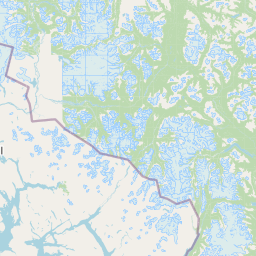
Map view of Great Glacier Provincial Park

Use this park location map to pinpoint Great Glacier Provincial Park in Canada, understand its exact geographic position, and read its mapped placement within the surrounding landscape more clearly.

Pigeon | © OpenStreetMap contributors

Location context for Great Glacier Provincial Park

British Columbia
Park atlas

Compare regional mountain terrain and connected wilderness corridors across the northern Boundary Ranges.

Explore Other Parks Near Great Glacier Provincial Park and Surrounding Protected Landscapes

Visitors concluding a review of Great Glacier Provincial Park can examine adjacent protected areas and connected river valleys within the surrounding region. Extending the geographic comparison reveals broader patterns in glacial terrain and northern wilderness preservation.
State or regional parkBritish Columbia
About 71 km away#1 closest

Southeast

Lava Forks Provincial Park: Geological Mapping and Protected Area Overview

Remote volcanic wilderness in northern British Columbia

This protected area preserves the fresh geological features created by the 1904 eruption of The Volcano. The site offers a detailed look at ash dunes, lava flows, and water-filled potholes within a remote northern British Columbia setting. Use this atlas resource to examine the park boundaries and the unique terrain that characterizes this significant transboundary conservation landscape.

Area
74.63 km²
Established
2001
IUCN
III
Relief
Mountain
Wildlife reserveAlaska
About 129 km away#2 closest

Northwest

Kootznoowoo Wilderness: Coastal Rainforest and Island Protected Area Map in Alaska

A vast temperate wilderness within the Tongass National Forest

Kootznoowoo Wilderness stands as a landmark protected landscape in Southeast Alaska, spanning the majority of Admiralty Island. Its geography is characterized by towering old-growth conifers, fern-covered understories, and a rugged coastline carved by glacial forces. This wildlife reserve provides a vital refuge for dense brown bear populations and remains one of the most intact examples of a maritime temperate rainforest in North America.

Area
3,962.19 km²
Established
1980
IUCN
Ib
Relief
Mixed relief
A minimalist watercolor painting showing layered hills and coastal terrain in soft shades of green, gray, and pink, resembling the Alaskan wilderness.
Wildlife reserveAlaska
About 151 km away#3 closest

Southwest

Kuiu Wilderness: An Alaska Protected Area of Temperate Rainforest and Fjord Geography

A remote wilderness expanse within the Alexander Archipelago

The Kuiu Wilderness serves as a primary example of coastal conservation in Alaska, offering a vast roadless territory that spans from sea level to alpine elevations. Mapped through a series of deep fjords and temperate rainforests, this reserve provides a critical look at the complex landscape transitions that define the ecology of the Alexander Archipelago.

Area
245.16 km²
Established
1990
Relief
Mountain
Climate
Temperate
Nature reserveBritish Columbia
About 198 km away#4 closest

Northeast

Gladys Lake Ecological Reserve: Remote Wilderness and Alpine Geography in British Columbia

Scientific reference area on the Spatsizi Plateau

Explore the expansive geography of Gladys Lake Ecological Reserve, a major protected area located in the remote interior of British Columbia. This reserve provides a strictly preserved natural landscape defined by high-elevation ridges, subalpine transitions, and the pristine wilderness of the Eaglenest Range, serving as a benchmark for ecological research in Canada.

Area
440.98 km²
Established
1975
IUCN
Ia
Relief
Mountain
Wildlife reserveAlaska
About 250 km away#5 closest

Southwest

Forrester Island Wilderness: Mapped Protected Landscapes and Wildlife Reserve Geography

Isolated island terrain in the Alaska Maritime National Wildlife Refuge

This remote wilderness area in Alaska features a mountainous, forested profile and sheer coastal cliffs that drop directly into the Pacific Ocean. Its protected boundaries are vital for maintaining undisturbed marine mammal habitat and temperate coastal forest ecosystems, offering a distinct example of isolated island geography within the United States.

Area
10.29 km²
Established
1912
Relief
Upland
Climate
Temperate
Protected landscapeAlaska
About 257 km away#6 closest

West

Tongass National Forest: Geographic Overview of Alaska Coastal Wilderness

Mapped temperate rainforests, fjords, and mountain ranges

Trace the extensive boundaries of Tongass National Forest, a massive protected landscape in Southeast Alaska. This atlas detail covers the unique geography of the Alexander Archipelago, where island wilderness meets the tidewater glaciers and old growth forests of the Coast Mountains. Gain insight into the terrain, ecosystem distribution, and regional context of this globally rare coastal rainforest environment.

Area
68,000 km²
Established
1907
Visitors
1.9M annual
Relief
Mountain
State or regional parkBritish Columbia
About 277 km away#7 closest

Southeast

Khutzeymateen Provincial Park: Protected Wilderness and Coastal Forest Geography

North Coast British Columbia protected area and estuary map.

Khutzeymateen Provincial Park represents a pivotal conservation achievement on the British Columbia North Coast. This wilderness sanctuary protects a critical estuarine complex where rugged mountain ranges meet a sheltered Pacific inlet. Beyond its designation as a grizzly bear stronghold, the park holds globally significant old-growth Sitka spruce forests, providing a rare look at an intact temperate rainforest landscape.

Area
450.52 km²
Established
1994
IUCN
Ib
Relief
Mountain
Protected landscapeBritish Columbia
About 293 km away#8 closest

South

Duu Guusd Heritage Site/Conservancy: Coastal Geography and Protected Land Map

A unified land and sea protected landscape in Haida Gwaii, British Columbia

Spanning over 227,000 hectares, Duu Guusd Heritage Site/Conservancy creates a massive protected corridor along the Pacific coast of British Columbia. This area links terrestrial forest ecosystems with marine waters, preserving complex island landscapes and significant Haida cultural sites throughout the northwestern corner of Graham Island.

Area
2,277.12 km²
Established
2008
IUCN
II
Relief
Mixed relief

Common questions about visiting, size, designation, and location context for Great Glacier Provincial Park

Great Glacier Provincial Park FAQs for park facts, access, geography, and protected area context

Find quick answers about Great Glacier Provincial Park, including protected-area facts, park geography, trail and visitor context, and how the park fits into its surrounding country and regional landscape.
MoriAtlas Explorer

Continue Your Protected Areas Search Across the Global Atlas

Deepen your exploration by continuing the structured search for national parks and protected areas worldwide. Utilize the comprehensive filtering capabilities to compare different conservation landscapes and refine your understanding of global park geography. Discover more about the distribution and characteristics of protected natural areas.

Global natural geography