
Why Guadeloupe National Park stands out
Guadeloupe National Park is best known for its spectacular volcanic rainforest landscapes centered on La Soufrière, an active stratovolcano that dominates the eastern Caribbean skyline. The park protects one of the most extensive and intact tropical forest systems in the Lesser Antilles, with montane rainforests characterized by towering tabonuco and acomat boucan trees, dense understory vegetation, and frequent cloud cover at higher elevations. The Carbet Falls, cascading dramatically through the rainforest, represent one of the Caribbean region's most iconic waterfall landscapes. The park's designation as a UNESCO biosphere reserve, combined with its unique status as France's oldest national park in the overseas territories, reinforces its significance as a conservation landmark. The dual terrestrial and marine protection framework, encompassing both cloud forest ecosystems and the Grand Cul-de-Sac Marin marine environment, provides exceptional ecological diversity within a single protected area system.
Guadeloupe National Park history and protected-area timeline
The protection of Guadeloupe's mountain forests began with the creation of the Guadeloupe Natural Park in 1970 by the General Council of Guadeloupe, an administrative body recognizing the exceptional biodiversity and scenic value of Basse-Terre's tropical forest and volcanic landscape. Although initially managed by the National Forests Office, the natural park status was viewed as an intermediate step toward stronger protection. Proposals emerged in 1977 to establish a national park, citing the need for improved management frameworks and enhanced control over park lands facing development pressures and unregulated resource use.
These proposals culminated in the official establishment of Guadeloupe National Park on February 20, 1989, creating France's first national park in its overseas territories. This status brought the park under the national park system administered by Parcs nationaux de France, providing standardized management protocols and increased resources for conservation. The Grand Cul-de-Sac Marin Nature Reserve, created in 1987, was subsequently placed under the park's management, establishing the integrated terrestrial-marine protected area framework that characterizes the current system.
The park achieved significant international recognition in 1992 when UNESCO designated the core area and the Grand Cul-de-Sac Marin Nature Reserve as the Guadeloupe Archipelago biosphere reserve. This designation acknowledged both the ecological importance of the protected areas and the region's potential to demonstrate sustainable development practices. For most of its history, Guadeloupe National Park remained the sole French national park outside metropolitan France, a distinction it held until 2007 when Réunion National Park and Guiana Amazonian Park were established, expanding France's national park network to its overseas territories.
Guadeloupe National Park landscape and geographic character
The landscape of Guadeloupe National Park is defined by the dramatic volcanic geology of Basse-Terre, a mountainous island formed through complex tectonic processes involving subduction zones along the Caribbean plate boundary. The park's highest and most commanding feature is La Soufrière, an active stratovolcano whose 1,467-meter summit represents the highest point in Guadeloupe and one of the most prominent peaks in the eastern Caribbean. This volcanic cone, still geothermally active with fumarolic activity, creates a landscape of steep ridges, craggy slopes, and volcanic debris that distinguishes the park from the flatter limestone formations typical of other Caribbean islands.
The volcanic massif includes several notable peaks besides La Soufrière, including Échelle at 1,397 meters and Grand-Sans-Toucher at 1,354 meters, while the twin volcanic plugs known as the Mamelles rise to 768 meters on the western slopes. These peaks are dissected by deep ravines and valleys carved by water runoff from the high rainfall zones, creating a terrain of exceptional topographic complexity. The elevation range from approximately 250 meters in the lower forest zones to the summit produces dramatic changes in landscape character across short distances, with ridges transitioning from steep agricultural terraces to dense forest and ultimately to the cloud-shrouded summit zones.
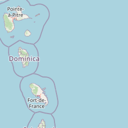
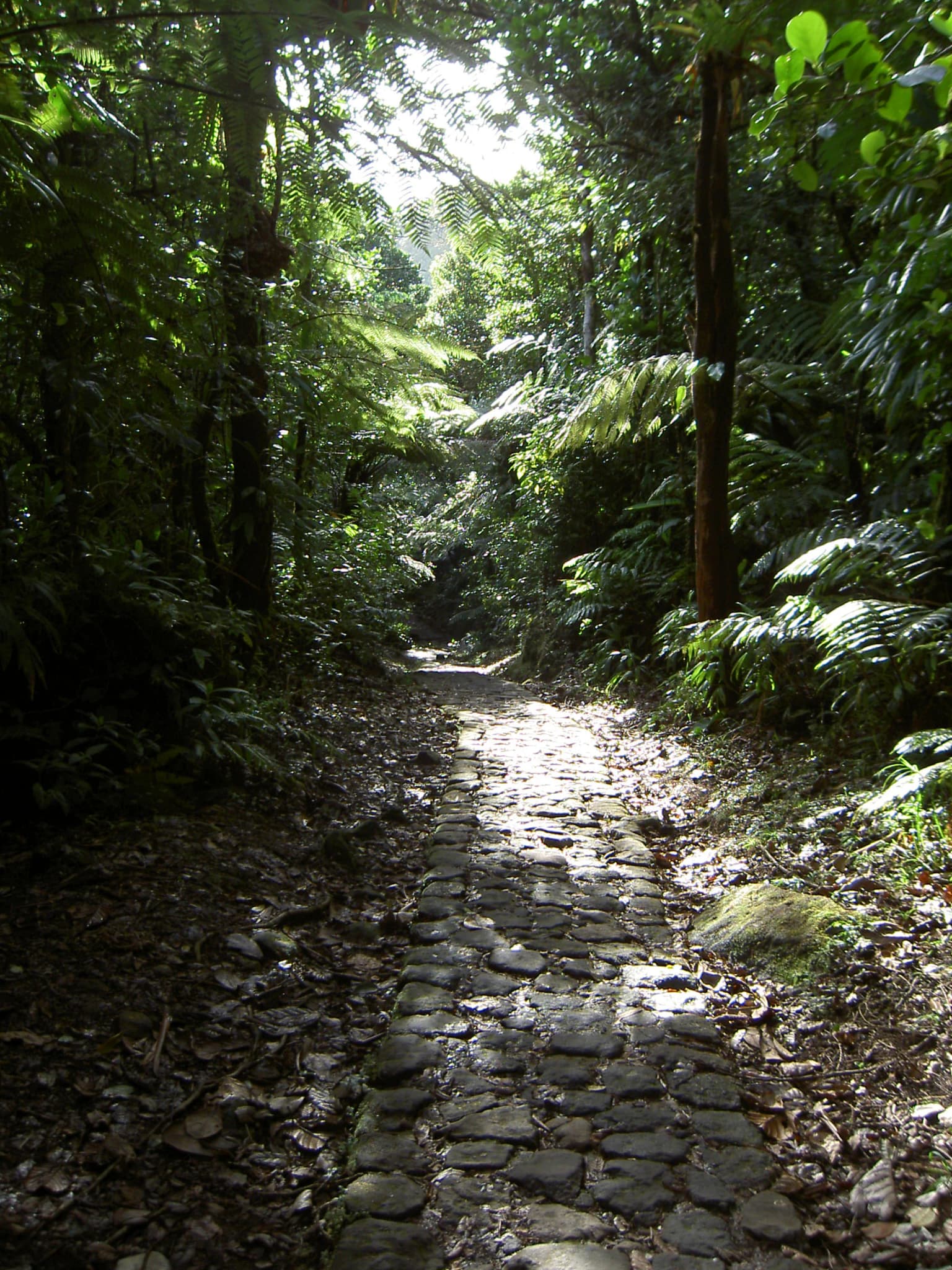
The park's coastal interface includes dramatic contrasts between the wave-exposed western cliffs and the more sheltered eastern shoreline where the Grand Cul-de-Sac Marin provides protected marine waters. Mangrove forests fringe the coastlines, creating a distinctive wetland landscape where tidal influence produces complex hydrological patterns. The Traversée road crossing the park provides access through the mountain interior, offering views of the dramatic terrain while traversing the range of elevational zones that characterize this volcanic landscape.
Guadeloupe National Park ecosystems, habitats, and plant life
The ecological character of Guadeloupe National Park reflects the complex interplay of elevation, moisture, and volcanic substrate that produces distinct habitat zones across the protected area. The tropical rainforest ecosystems vary substantially with altitude, creating a mosaic of forest types from the coastal zone through montane forest to the unusual high-elevation forest above 1,000 meters. The lower elevations up to 500 meters support mesophilic forests featuring white and red mahogany, rosewood, and jatobá, a zone that also contains agricultural land use including banana plantations. The montane moist forest covering approximately 80 percent of the core area represents the park's dominant ecosystem, characterized by towering trees exceeding 30 meters in height including tabonuco and acomat boucan, mid-level canopy species, and a dense understory of palms, heliconia, and ferns.
The high-elevation forest above 1,000 meters presents a distinctive ecological character quite different from the dense lower forests. Constant cloud cover and extreme wet conditions produce a more open forest structure with shorter trees, creating an appearance more reminiscent of savanna than the lush rainforest below. This unique ecosystem results from the combination of high rainfall, persistent fog drip, and nutrient-poor soils that limit tree growth and density. The coastal forest zone faces the particular challenges of salinity, intense solar heating, and wind exposure, with specialized species like seagrape adapted to these harsh conditions.
The Grand Cul-de-Sac Marin Nature Reserve extends the park's ecological diversity into marine and wetland environments. Nearly half of Guadeloupe's mangrove ecosystems, approximately 37 square kilometers of the island's total 80 square kilometers, are protected within this reserve. These mangrove forests provide critical ecological functions including coastal protection, nutrient cycling, and habitat for marine species, representing some of the most productive ecosystems in the Caribbean. The combination of terrestrial forest ecosystems and marine-coastal wetlands creates an integrated protected area system of exceptional ecological breadth.
Guadeloupe National Park wildlife and species highlights
The wildlife community of Guadeloupe National Park reflects both the park's role as a biodiversity refuge and the historical impacts of hunting and habitat modification that have reduced native populations across Guadeloupe. Mammalian fauna includes 17 species, with the Guadeloupe raccoon being among the most commonly encountered mammals in the park. Two bat species endemic to Guadeloupe represent important components of the nocturnal fauna, while the introduced mongoose from India has become established despite not being native. The endangered agouti represents a significant conservation concern, and park authorities are planning reintroduction programs for the manatee, which has been extinct in Guadeloupe for some time.
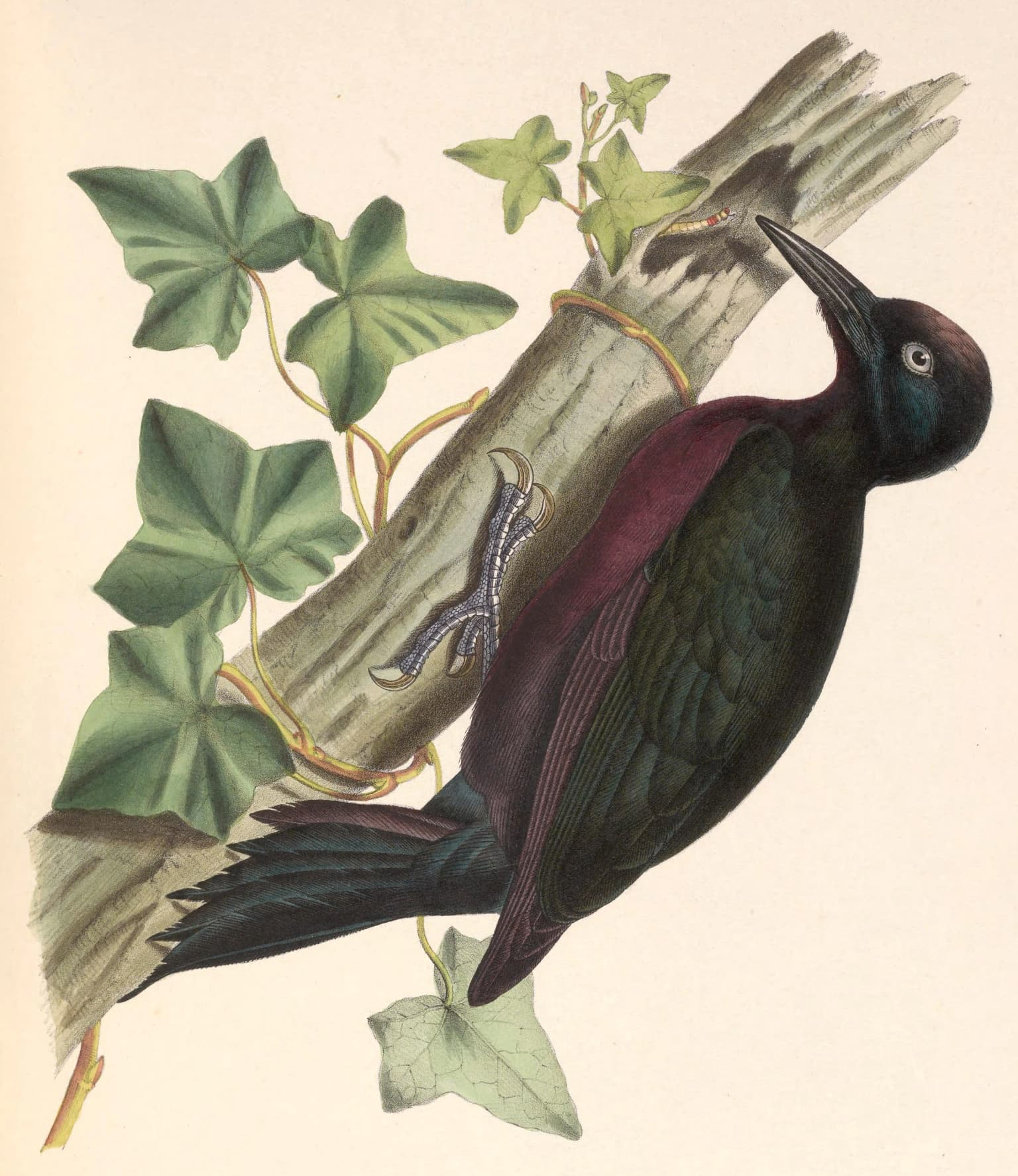
Birdlife is more diverse than mammalian communities, with 33 bird species recorded within the park. Visitors may encounter hummingbirds, frigatebirds, thrushes, partridges, pigeons, tyrant flycatchers, and pelicans. The Guadeloupe woodpecker, endemic to the islands, represents a particularly significant species for conservation. However, historical hunting pressure eradicated parrots and parakeets from the island entirely, illustrating the severe historical impacts on native wildlife that the park now works to address through protection and potential reintroduction programs.
Reptiles including sea turtles use the marine environments, while fish and crustaceans inhabit both freshwater streams and marine waters within the reserve. The most diverse animal group in the park is insects, whose exceptional diversity produces a remarkable variety of forms including notably large species such as Hercules beetles, duppy bats (black witch moths), and walking sticks. This insect diversity reflects the complex forest structures and multiple habitat zones that characterize the park's ecosystems, supporting complex food webs and ecological interactions throughout the protected area.
Guadeloupe National Park conservation status and protection priorities
Guadeloupe National Park serves as the primary conservation instrument for protecting Guadeloupe's most significant natural heritage, encompassing both terrestrial and marine ecosystems of critical importance in the Caribbean context. The park's designation as a biosphere reserve by UNESCO in 1992 reflects international recognition of its conservation significance, acknowledging the successful integration of biodiversity protection with sustainable development objectives. As one of the few substantial protected forest areas remaining in the Lesser Antilles, the park plays an essential role in maintaining ecological processes and species populations that have been severely impacted by habitat loss and degradation across the region.
The conservation challenges facing the park include addressing the legacy of historical hunting that eliminated certain species entirely and continues to pressure others, managing invasive species such as the mongoose introduced from India, and maintaining connectivity between protected areas and surrounding agricultural landscapes. The management framework must balance conservation objectives with the needs of local communities whose activities span the park's boundaries, requiring approaches that address human-wildlife conflict and sustainable resource use. The planned reintroduction of the manatee represents one example of active conservation management aimed at restoring ecological integrity by reestablishing species that have been lost from the ecosystem.
The integration of the Grand Cul-de-Sac Marin Nature Reserve within the management framework provides comprehensive protection spanning coastal wetlands, mangroves, and marine waters. This integrated approach recognizes the ecological connections between terrestrial and marine systems, where forest streams deliver nutrients to coastal waters and mangrove forests provide critical nursery habitat for marine species. The protection of nearly half of Guadeloupe's mangrove ecosystems within this framework addresses habitat preservation at a regional scale, ensuring that these ecologically critical coastal systems remain functional despite development pressures across the island's coastlines.
Guadeloupe National Park cultural meaning and human context
Guadeloupe National Park occupies a landscape that has been shaped by centuries of human presence, though the steep terrain and dense forest limited intensive settlement in the park's core areas compared to the island's coastal zones. The park spans eleven communes where communities have maintained agricultural traditions, particularly banana cultivation in the lower elevation zones and hillside farming on the volcanic slopes. These traditional land uses have shaped the park's boundary areas and continue to influence management considerations, as the park exists within a landscape of ongoing human activity rather than in complete isolation.
The cultural identity of Guadeloupe reflects its complex history as a French overseas department with Caribbean, African, and European heritage influences. The park's management operates within this broader cultural context, where the relationship between local communities and the natural landscape reflects generations of adaptation to the island's volcanic terrain and tropical climate. The French administrative framework brings management standards from metropolitan France while addressing the distinct social and economic conditions of a Caribbean overseas territory.
The park's visitor infrastructure and interpretation programs engage with this cultural context, though the primary focus remains on natural heritage rather than cultural sites. The Traversée road and hiking trails provide access to the park's natural landscapes while supporting eco-tourism that contributes to the local economy. This approach recognizes that successful conservation in an overseas territory with limited economic alternatives depends on demonstrating the value of protected areas to local communities through employment, tourism revenue, and ecosystem services that benefit residents.
Top sights and standout views in Guadeloupe National Park
Guadeloupe National Park offers exceptional natural attractions centered on its dramatic volcanic landscapes and intact rainforest ecosystems. The ascent to La Soufrière's summit provides hikers with access to one of the Caribbean's most accessible active volcanic peaks, offering panoramic views across the island and the opportunity to observe geothermal activity. The Carbet Falls, cascading through the rainforest in multiple tiers, represent one of the region's most spectacular waterfall experiences, accessible via well-maintained trails. The twin Mamelles volcanic plugs and the Traversée road provide scenic driving routes through the park's mountainous interior, connecting the distinct ecological zones from coastal forest to cloud forest.
The Grand Cul-de-Sac Marin Nature Reserve offers complementary marine and wetland experiences, with mangrove forests, coastal birdlife, and marine ecosystems accessible through boat tours and kayaking. The combination of terrestrial and marine environments within a single protected area system distinguishes Guadeloupe National Park from most Caribbean parks, providing visitors with diverse experiences spanning rainforest hiking, volcanic exploration, coastal paddling, and wildlife observation. The park's status as France's pioneering overseas national park adds historical interest for visitors familiar with the French national park system.
Best time to visit Guadeloupe National Park
Guadeloupe National Park can be visited throughout the year, though the seasonal patterns of rainfall and temperature influence the visitor experience. The dry season from approximately December through May generally offers more comfortable conditions for hiking and outdoor activities, with reduced rainfall and clearer skies particularly favorable for summit views from La Soufrière. This period corresponds with the winter months in the northern hemisphere, coinciding with peak visitor season across the Caribbean region.
The wet season from June through November brings increased rainfall, particularly to the higher elevations where montane forests receive substantial precipitation. This period produces the waterfall flows that make the Carbet Falls particularly impressive, while the rainforest takes on a lush, verdant character distinctive to the wet season. However, hiking on higher trails may be more challenging during wet periods due to trail conditions and reduced visibility in cloud cover. The hurricane season overlapping with this period requires awareness of weather systems that can affect park access, though Guadeloupe's southern position within the Lesser Antilles provides some protection compared to more northern islands.