
Mori Atlas logo
Protected landscapeGuri i Nikës-Lenie-Valamarë Protected Landscape

A vital ecological corridor within the Pindus Mountains of southeastern Albania

Guri i Nikës-Lenie-Valamarë Protected Landscape: Mapped Boundaries and Mountain Forest Geography

(Peisazh i Mbrojtur Guri i Nikës-Lenie-Valamarë)

The Guri i Nikës-Lenie-Valamarë Protected Landscape represents a significant conservation area in southeastern Albania, characterized by its mosaic of dense Mediterranean-montane forests, aromatic scrub, and rolling hill terrain. Situated within the broader Pindus Mountains mixed forests ecoregion, this protected area serves as an essential biological refuge and corridor for native fauna, including brown bears and gray wolves. Its distinct topography and freshwater drainage patterns offer a representative look at the region’s natural biodiversity and sustained ecological health.

protected landscapeMediterranean forestsmixed forestsPindus Mountainsmountain forestsbiodiversity refuge
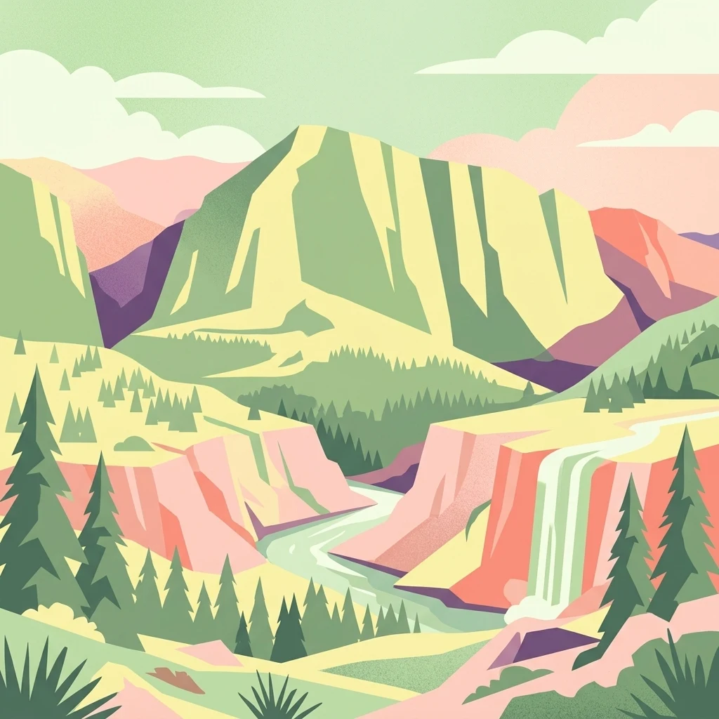
A vibrant, flat-style digital illustration showing a mountain range with a river winding through a valley and a waterfall cascading down a cliff face surrounded by evergreen forests.

Guri i Nikës-Lenie-Valamarë Protected Landscape

Protected landscape

Park overview

Structured park overview, official facts, and landscape profile for Guri i Nikës-Lenie-Valamarë Protected Landscape

Guri i Nikës-Lenie-Valamarë Protected Landscape park facts, protected area profile, and essential visitor context

Review the core facts for Guri i Nikës-Lenie-Valamarë Protected Landscape, including designation, size, terrain, visitor scale, habitats, and operating context in one park-focused overview.

About Guri i Nikës-Lenie-Valamarë Protected Landscape

Guri i Nikës-Lenie-Valamarë Protected Landscape represents one of the more ecologically meaningful protected zones in southeastern Albania. Its position near Pogradec places it within a transitional landscape where the eastern Mediterranean climate meets the montane conditions of the Pindus Mountains, producing a layered environment of forested hills, open scrub, and seasonally active freshwater sources.

Administratively, the area falls under Albania's national system of protected landscapes and is managed by the Ministry of Environment under an IUCN Category VI designation, a category that explicitly allows traditional and sustainable uses of natural resources while maintaining overall ecosystem integrity. This management posture balances conservation with the livelihood and cultural practices of nearby communities.

The landscape's protected status reflects a recognition that the Pindus foothills in this part of Albania retain habitat conditions capable of supporting wide-ranging mammals and intact plant communities. By integrating the area into a formal protection framework, Albania has extended ecological security to a region where fragmentation elsewhere in the Balkans has reduced the carrying capacity for sensitive species.

Visitors and researchers encounter a varied terrain of forest stands, Mediterranean shrub communities, and hill country that collectively illustrate the diversity of Albania's natural heritage. The area is increasingly relevant to discussions about transboundary conservation in the Balkans, especially given its role for carnivore populations that move across national borders.

Quick facts and research context for Guri i Nikës-Lenie-Valamarë Protected Landscape

Guri i Nikës-Lenie-Valamarë Protected Landscape is an IUCN Category VI protected area, allowing sustainable use of natural resources within its boundaries. It covers approximately 22 square kilometers and is administered by Albania's Ministry of Environment. The nearest city is Pogradec, placing the landscape within reach of one of southeastern Albania's principal lakeside towns.

The area lies inside the Pindus Mountains mixed forests ecoregion, a Mediterranean-influenced habitat zone that spans a significant portion of the Balkan Peninsula. Its establishment in January 1996 reflects Albania's broader movement toward formal biodiversity protection in the post-1990s period.

Protection and recognition

Documented terrestrial protection scope, management framework, and conservation recognition details.

Guri i Nikës-Lenie-Valamarë Protected Landscape Protection Status and Records

Guri i Nikës-Lenie-Valamarë Protected Landscape maintains a documented terrestrial protection scope without imported international recognition sources. Official designation records and management frameworks outline the foundational conservation status governing this protected area.

Protection details

Protection scope
Terrestrial
Transboundary protection
No
Park context

Deeper park guide and search-rich context for Guri i Nikës-Lenie-Valamarë Protected Landscape

Guri i Nikës-Lenie-Valamarë Protected Landscape history, landscape, wildlife, and travel context

Explore Guri i Nikës-Lenie-Valamarë Protected Landscape through its history, landscape character, ecosystems, wildlife, conservation priorities, cultural context, and seasonal travel timing in a structured park guide built for atlas discovery and search intent.

Why Guri i Nikës-Lenie-Valamarë Protected Landscape stands out

The protected landscape is best known for sustaining viable populations of large carnivores, particularly the brown bear and gray wolf, within a continuous mosaic of Mediterranean-montane forest and scrub habitat. This combination of intact habitat and threatened fauna gives the area outsized conservation value for Southern Europe. It is also recognized as a biological corridor linking wildlife populations across the Pindus range and as a representative example of Albania's Mediterranean woodland and forest ecoregion.
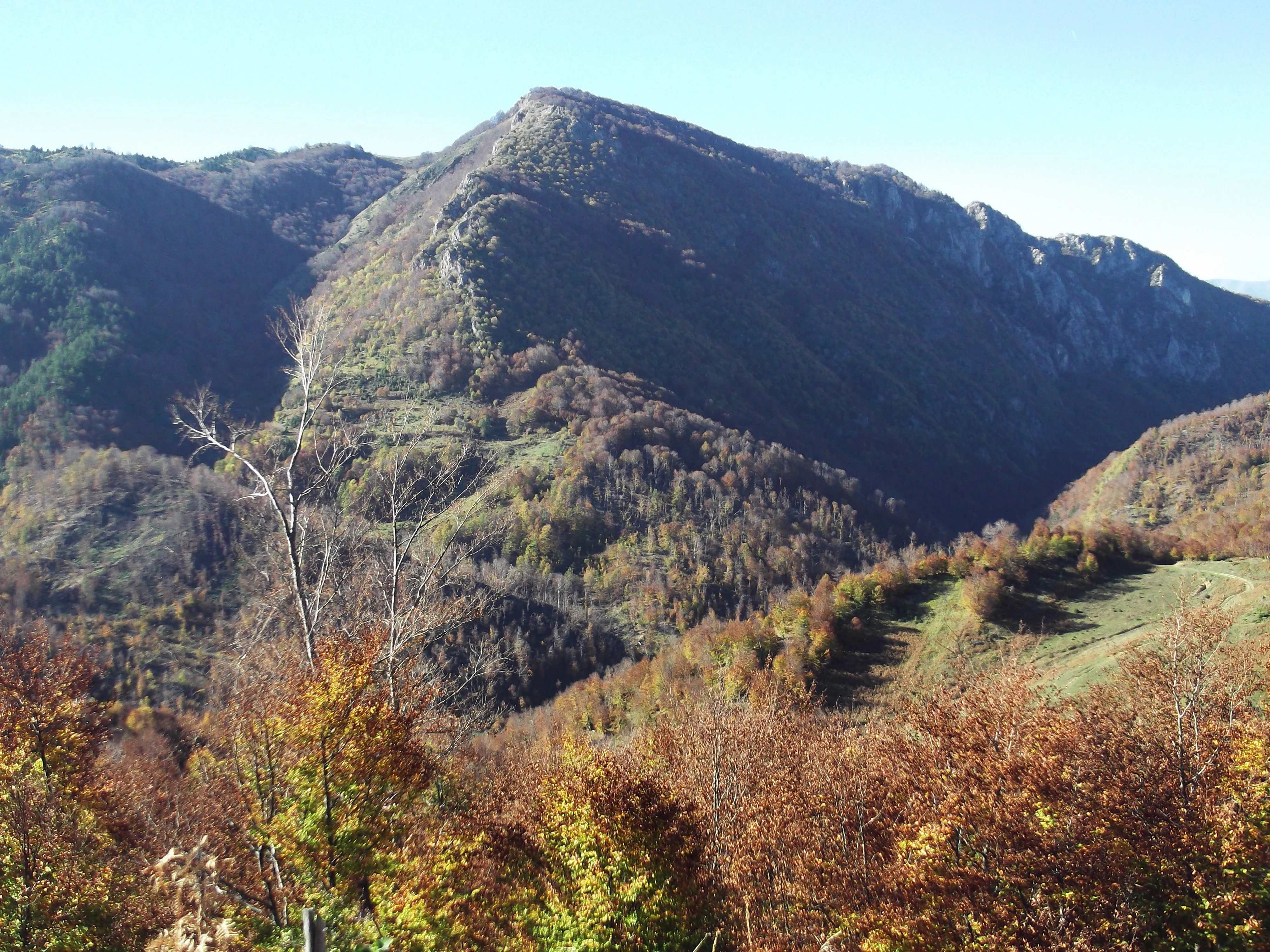
A wide, eye-level view of a prominent, rounded mountain peak covered in autumn-toned forest, with steep slopes and a deep valley visible below.
A scenic view of the rugged Guri i Nikës rock formation set within the mountainous terrain of the protected landscape.

Guri i Nikës-Lenie-Valamarë Protected Landscape history and protected-area timeline

The Guri i Nikës-Lenie-Valamarë Protected Landscape was formally established on 15 January 1996, during a period when Albania was actively expanding its system of protected natural areas. The designation was intended to formalize protection for several nationally important ecosystems and their associated biodiversity.

The area received protection under IUCN Category V, a protected landscape category, though in practice the area has also been described using Category VI language to reflect the coexistence of sustainable resource use with conservation objectives. Either way, the formal designation marked an institutional commitment to managing the area beyond a strict reserve model.

Since its establishment, the landscape has served as a focal point for environmental education, scientific study, and nature-based tourism. These activities have helped raise public awareness of biodiversity conservation while providing economic and cultural incentives for local sustainable development.

Guri i Nikës-Lenie-Valamarë Protected Landscape landscape and geographic character

The terrain of Guri i Nikës-Lenie-Valamarë reflects the transitional character of southeastern Albania's Pindus foothills. Visitors encounter a landscape that shifts between forested slopes, open hills, and valley bottoms shaped by freshwater drainage. The hills within the protected area are a defining visual feature, giving the landscape its undulating profile.

Forested areas dominate substantial portions of the reserve, with continuous tree cover creating shaded valleys and ridgelines typical of the wider Pindus mountain system. Between these forest blocks, Mediterranean-style scrub and aromatic shrub communities occupy more exposed slopes, contributing to the ecological and visual diversity of the landscape.

Freshwater sources enhance the setting by sustaining vegetation and supporting wildlife movement through otherwise drier terrain. The combination of hill, woodland, and water features produces a landscape that feels both structured and varied, with habitat patterns shifting over relatively short distances.
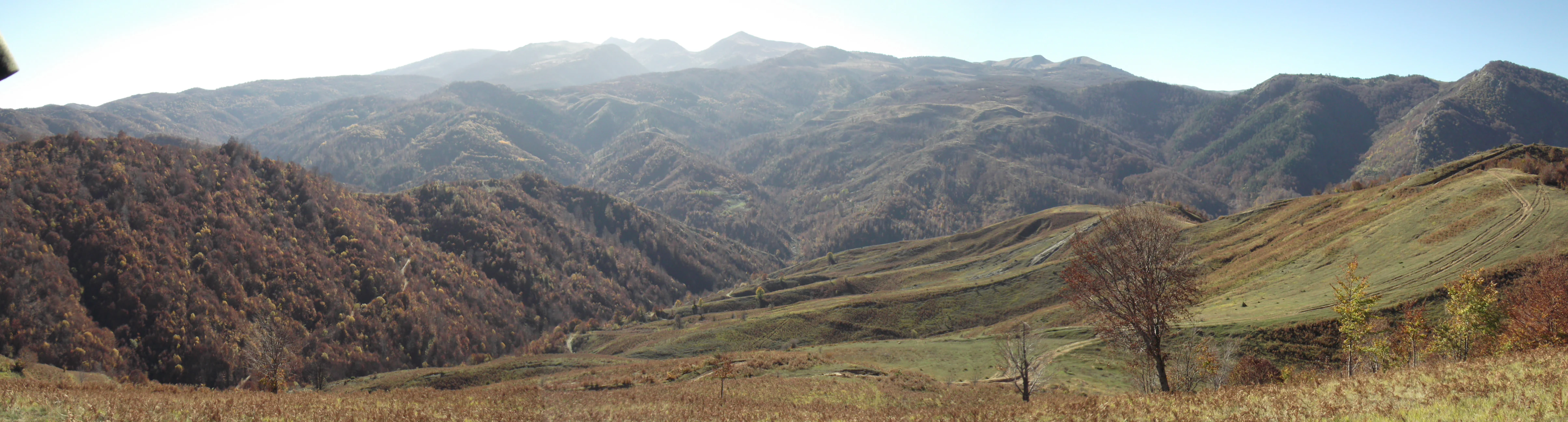
Panoramic landscape view of rolling hills and mountain ridges covered in autumn-colored trees and grassy slopes in Albania.
A panoramic view of the mountainous landscape within the Guri i Nikës-Lenie-Valamarë Protected Landscape in Albania.

Guri i Nikës-Lenie-Valamarë Protected Landscape ecosystems, habitats, and plant life

The protected landscape sits within the Pindus Mountains mixed forests terrestrial ecoregion, a recognized ecological unit within the Palearctic Mediterranean forests, woodlands, and scrub biome. This ecoregional context shapes the area's plant communities and the ecological processes that support them.

Within its borders, the area encompasses a mosaic of natural habitats, including mature and semi-mature forest stands, Mediterranean shrub formations, and freshwater-associated vegetation zones. These habitat types provide complementary resources for resident and transient species, from soil-dependent plants to canopy-dwelling birds and large ground-dwelling mammals.

The structural diversity of vegetation, combined with intact freshwater sources, gives the landscape a strong ecological infrastructure. This mosaic supports year-round habitat use and provides resilience against seasonal stress, a factor that strengthens the area's overall biodiversity value.
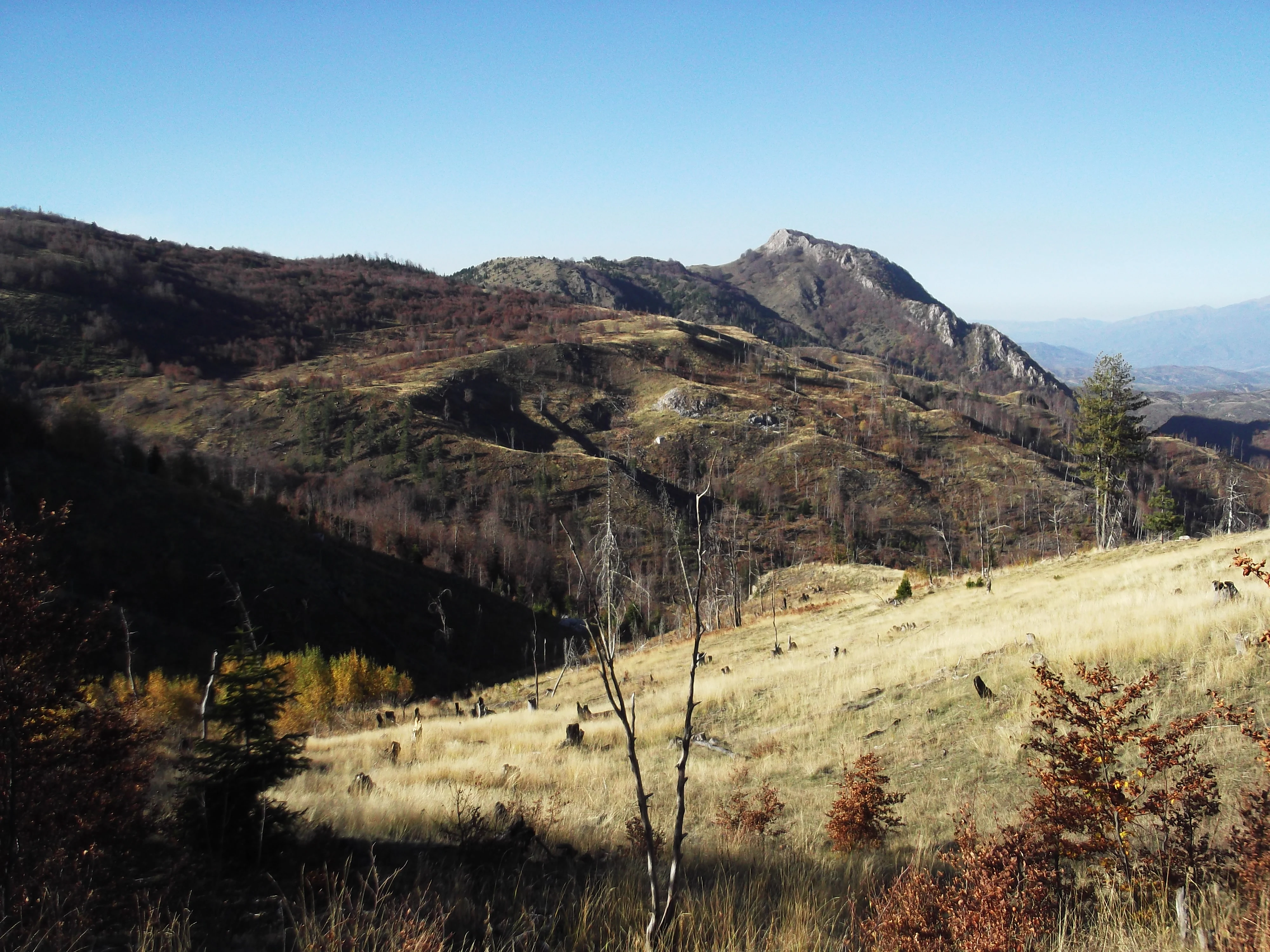
Wide landscape shot of a mountain range in autumn with dry grass, sparse trees, and rugged slopes under a clear blue sky.
A scenic view of the terrain within the Guri i Nikës-Lenie-Valamarë Protected Landscape, showcasing the mountainous landscape in autumn.

Guri i Nikës-Lenie-Valamarë Protected Landscape wildlife and species highlights

The most prominent wildlife feature of Guri i Nikës-Lenie-Valamarë is its sustained population of brown bears and gray wolves, two large carnivore species that have become increasingly rare across much of Southern Europe. Their continued presence in this Albanian landscape signals a functioning ecological balance and intact prey base.

The brown bear, as a wide-ranging omnivore, depends heavily on large blocks of relatively undisturbed habitat. Its survival here indicates that the landscape retains the forest continuity and seasonal food resources required by such a demanding species. The gray wolf similarly requires sufficient prey populations and minimal persecution pressure to maintain territorial packs; its presence reflects both ecological and management conditions favorable to large carnivores.

Beyond these flagship species, the area's mosaic of forest, scrub, and freshwater habitats supports a broader community of mammals, birds, and other fauna typical of the Pindus foothills. Together, these species underscore the area's significance as a refuge for wildlife that has declined elsewhere in the region, and as a biological corridor that helps maintain genetic and demographic connectivity across the Balkans.
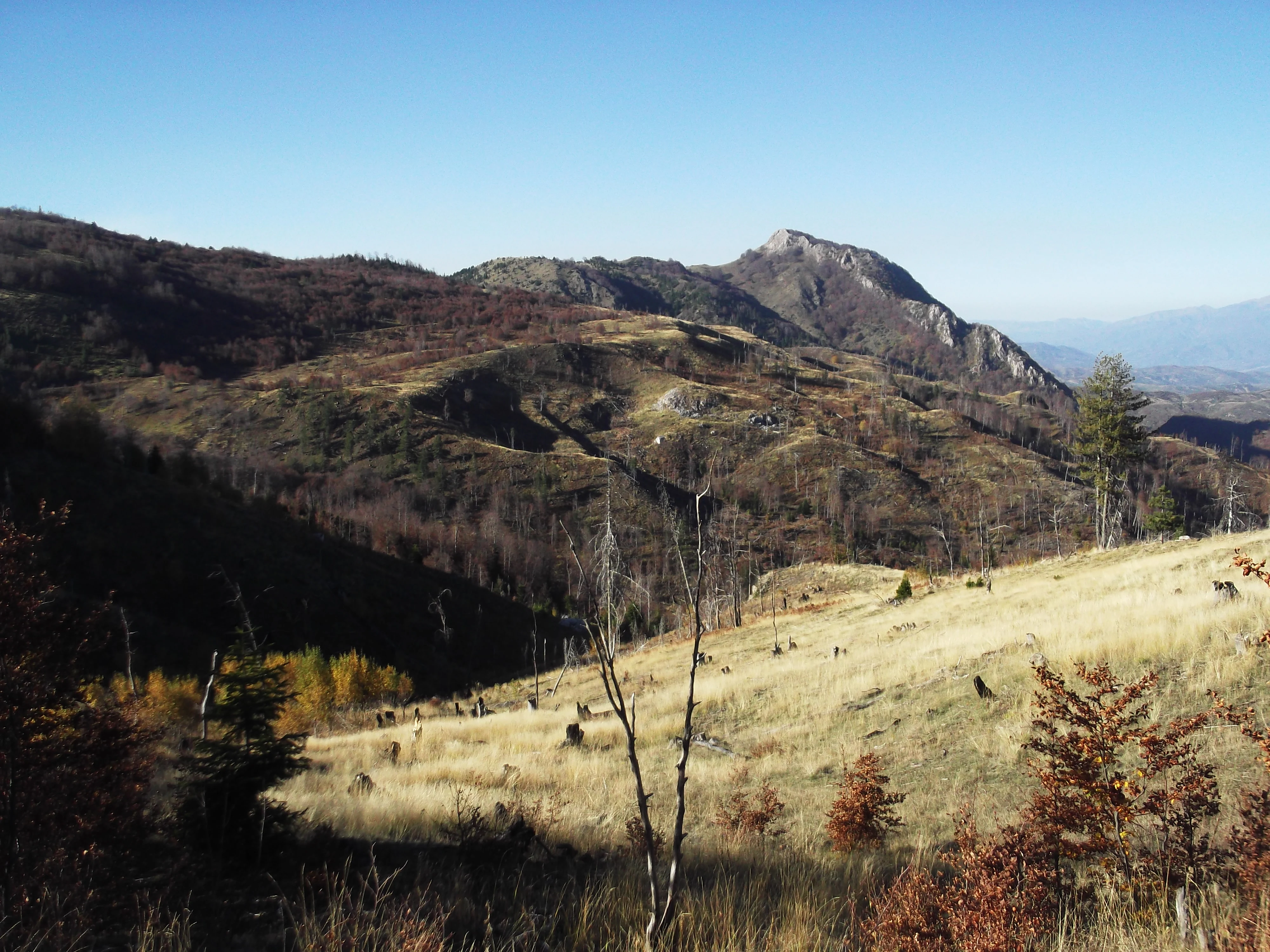
A wide mountain landscape showing a rocky, rounded peak rising above a grassy slope with sparse trees in an autumn or late-season setting.
A view of the Guri i Nikës rock formation within the protected landscape in southeastern Albania.

Guri i Nikës-Lenie-Valamarë Protected Landscape conservation status and protection priorities

The protected landscape holds substantial conservation importance because it maintains habitat conditions that support large carnivores and other wildlife under pressure across Southern Europe. In a regional context where forest fragmentation and human-wildlife conflict have reduced suitable habitat for many sensitive species, the area offers a relatively secure refuge.

Its designation under the national protected area framework and its management by the Ministry of Environment establish a baseline of institutional protection. The IUCN Category V/VI framework further formalizes the principle that sustainable use of natural resources is compatible with maintaining long-term ecological integrity.

The area also contributes to the broader Balkan conservation network by functioning as a biological corridor. Wildlife movement across the Pindus system depends on a chain of protected and connective habitats; Guri i Nikës-Lenie-Valamarë sits within that chain, making its protection regionally consequential beyond its own boundaries.

Guri i Nikës-Lenie-Valamarë Protected Landscape cultural meaning and human context

Beyond its natural values, the protected landscape holds cultural and recreational significance for the surrounding region. It serves as a setting for environmental education and nature-based tourism, activities that connect visitors and local communities to the landscape's ecological character.

The area's integration of conservation with sustainable use reflects a model of rural land stewardship that acknowledges the long-standing interaction between local communities and the natural environment. This approach encourages the continuation of traditional uses while embedding conservation principles into everyday regional practice.
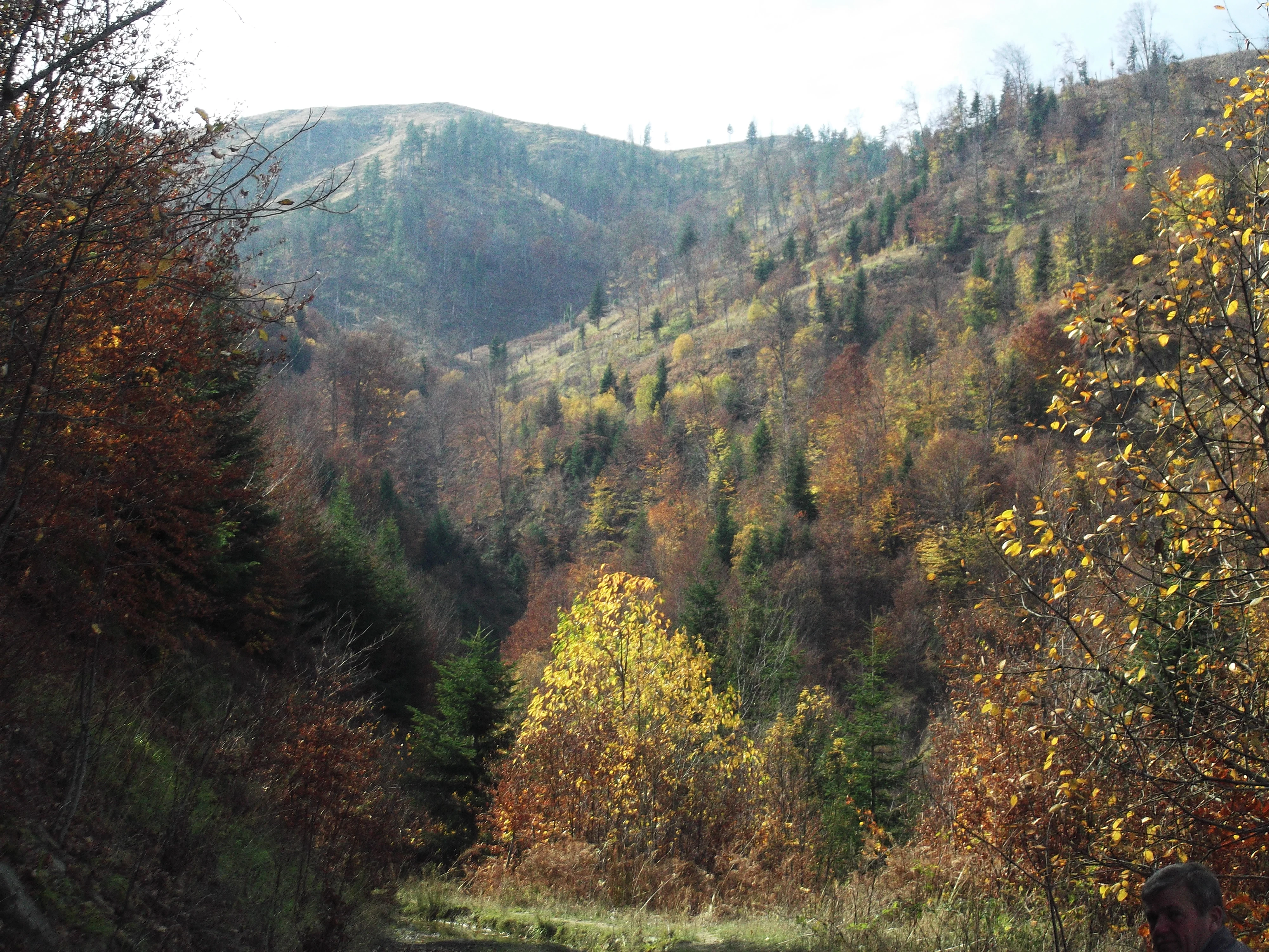
A wide outdoor shot of a forested hillside in autumn with a mix of deciduous and coniferous trees under a pale sky.
Autumn landscape within the Guri i Nikës-Lenie-Valamarë Protected Landscape in Albania.

Top sights and standout views in Guri i Nikës-Lenie-Valamarë Protected Landscape

The protected landscape stands out for combining intact Mediterranean-montane forest habitat with confirmed populations of brown bears and gray wolves, a combination increasingly difficult to find in Southern Europe. Its position within the Pindus Mountains mixed forests ecoregion grounds it in one of the most ecologically important forest systems of the Balkan Peninsula.

The mosaic of dense woodland, aromatic scrub, rolling hills, and freshwater sources gives the area both ecological richness and visual variety. National protection since 1996, combined with Ministry of Environment oversight, provides a durable institutional framework that supports continued biodiversity conservation and sustainable regional development.

Best time to visit Guri i Nikës-Lenie-Valamarë Protected Landscape

The protected landscape is best experienced in the warmer months, when Mediterranean forest and scrub habitats are most accessible and the overall landscape is at its most visually varied. During this period, forest cover is fully developed, wildlife is generally active, and conditions favor walking through the mosaic of hills, woodlands, and valley bottoms that define the area.

Visiting in cooler seasons can also be rewarding for observers seeking quieter conditions and a more contemplative experience of the forest and hill environment, supported by the area's stable freshwater sources and intact forest infrastructure.
Monthly climate preview

Long term representative point averages tracking monthly temperature and precipitation rhythm

Climate Normals and Annual Temperature Patterns for Guri i Nikës-Lenie-Valamarë Protected Landscape

Guri i Nikës-Lenie-Valamarë Protected Landscape records measured baseline temperatures and precipitation rates across a representative elevation of one thousand fourteen meters. Detailed monthly comparisons provide broader context regarding long term environmental rhythms throughout the protected terrain.
Annual mean10 °C
0 °C22 °C
Jan
Feb
Mar
Apr
May13°
Jun18°
Jul22°
Aug22°
Sep16°
Oct11°
Nov
Dec
Warmest month
August

22 °C

Coolest month
January

-0.3 °C

Wettest month
November

3.4 mm/day

Driest month
August

0.9 mm/day

Park location guide

Geography guide, regional context, and park location map for Guri i Nikës-Lenie-Valamarë Protected Landscape

Guri i Nikës-Lenie-Valamarë Protected Landscape park geography, regions, and map view in Albania

Understand where Guri i Nikës-Lenie-Valamarë Protected Landscape sits in Albania through a broader geographic reading of the surrounding landscape, nearby location context, and its mapped position within the national park landscape.

How Guri i Nikës-Lenie-Valamarë Protected Landscape fits into Albania

Albania is a unitary parliamentary republic in Southeast Europe, situated on the Balkan Peninsula along the Adriatic and Ionian coastal regions. With a population of approximately 2.4 million people, it borders Montenegro, Kosovo, North Macedonia, and Greece. The country features varied landscapes ranging from the Albanian Alps to fertile coastal plains, with Tirana as its capital and largest city.

Wider geography shaping Guri i Nikës-Lenie-Valamarë Protected Landscape in Albania

Albania occupies the western part of the Balkan Peninsula in Southeast Europe. The country features a varied terrain with rugged mountain ranges including the Albanian Alps (Accursed Mountains), Korab, Skanderbeg Mountains, Pindus, and Ceraunian Mountains. Fertile lowland plains extend along the Adriatic and Ionian coastal regions. The country borders Montenegro to the northwest, Kosovo to the northeast, North Macedonia to the east, and Greece to the south.

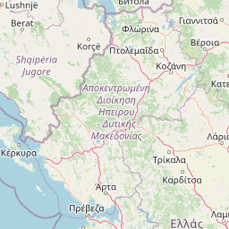
Map view of Guri i Nikës-Lenie-Valamarë Protected Landscape

Use this park location map to pinpoint Guri i Nikës-Lenie-Valamarë Protected Landscape in Albania, understand its exact geographic position, and read its mapped placement within the surrounding landscape more clearly.

Pigeon | © OpenStreetMap contributors

Visualizing Mediterranean forest habitats, rolling hills, and mountain ecosystems

Guri i Nikës-Lenie-Valamarë Protected Landscape Photos, Scenery, and Terrain

Photographic records illustrate the diverse topography and dense forest cover defining Guri i Nikës-Lenie-Valamarë Protected Landscape. Visual documentation reveals the mosaic of scrublands, woodland ridgelines, and freshwater valleys supporting regional wildlife corridors.

A wide, eye-level view of a prominent, rounded mountain peak covered in autumn-toned forest, with steep slopes and a deep valley visible below.

A wide scenic view of forested mountain slopes in autumn with patches of fall foliage and a clear blue sky.

Panoramic landscape view of rolling hills and mountain ridges covered in autumn-colored trees and grassy slopes in Albania.

Wide landscape shot of a mountain range in autumn with dry grass, sparse trees, and rugged slopes under a clear blue sky.

A wide mountain landscape showing a rocky, rounded peak rising above a grassy slope with sparse trees in an autumn or late-season setting.

A wide, eye-level shot of a hilly, forested landscape in autumn showing vibrant yellow and orange foliage on trees against a muted green hillside.

A wide outdoor shot of a forested hillside in autumn with a mix of deciduous and coniferous trees under a pale sky.

Park atlas

Discover connected protected areas and surrounding mountain ecosystems across the region.

Other Parks Near Guri i Nikës-Lenie-Valamarë Protected Landscape for Regional Comparison

Compare Guri i Nikës-Lenie-Valamarë Protected Landscape with other protected areas located throughout the surrounding region. Reviewing nearby national parks and regional forest reserves helps contextualize shared Balkan ecological corridors and mountain terrain.
A soft watercolor painting of a lake landscape with rolling green hills, distant mountains, and gentle reflections in pale greens, pinks, and yellows.
Nature reserveNorth Macedonia
About 22 km away#1 closest

Northeast

Lake Ohrid Nature Reserve: Mapped Geographic Boundaries and Ancient Balkan Lake Ecosystems

A tectonic mountain lake system in North Macedonia

Lake Ohrid represents a monumental protected landscape within the mountainous southwestern Balkans. As one of the oldest and deepest lakes in Europe, it serves as a critical refuge for unique endemic species that exist in its clear, oligotrophic waters. This area showcases the complex interplay between tectonic geological history, high-mountain terrain, and the sustained conservation of a globally significant natural basin.

Area
358 km²
Relief
Mixed relief
Climate
Mediterranean
Access
Easy access
Watercolor painting showing mountains, a river, and vegetation
National parkAlbania
About 25 km away#2 closest

Southwest

Tomorr Mountain National Park: Sacred Peak & Karst Protected Landscape in Albania

Explore Albania's dramatic mountain geography and protected areas.

Tomorr Mountain National Park offers a unique exploration of southern Albania's dramatic limestone anticline. Dominated by the sacred Mount Tomorr and featuring the spectacular Osum Canyon, this national park provides insight into karst terrain, old-growth forests, and significant biodiversity. Discover its mapped boundaries and regional geographic context within the Pindus Mountains for structured atlas exploration.

Area
271.855 km²
Established
1956
IUCN
II
Relief
Mountain
Watercolor painting of a river flowing through a valley with mountains and greenery
National parkKorçë County
About 30 km away#3 closest

East

Prespa National Park: Protected Landscape and High-Altitude Lakes in Korçë County, Albania

Explore the geography and mapped boundaries of this vital national park.

Prespa National Park, located in Korçë County, Albania, is a protected area characterized by its significant high-altitude tectonic lakes, dramatic mountain landscapes, and vital wetland habitats. This entry provides a structured atlas-style overview of the park's geographic identity, its protected landscape features, and its ecological importance, serving as a key point of reference for understanding this unique Balkan region.

Area
276.131 km²
Established
1999
IUCN
II
Relief
Mountain
Watercolor illustration of mountains, a lake, and rolling hills with grassy vegetation.
National parkElbasan County
About 37 km away#4 closest

North

Shebenik National Park: Mapped Protected Landscape and Glacial Terrain Atlas

Explore Elbasan County's significant mountain wilderness and protected natural features.

Shebenik National Park is a protected national park in Elbasan County, Albania, notable for its dramatic glacial terrain and extensive ancient forests. This park offers a deep dive into Albania's natural landscape, featuring 14 glacial lakes and serving as vital habitat. Its position within the Balkan Peninsula's geography makes it a key point of reference for understanding protected areas and mountain wilderness within a structured atlas.

Area
345.079 km²
Established
2008
IUCN
II
Relief
Mountain
A watercolor illustration of a landscape with soft green hills and a pinkish water area, set against a plain white background.
National parkWestern Macedonia
About 40 km away#5 closest

East

Prespa National Park: Mapping the Biodiversity and Lake Landscapes of Western Macedonia

A Ramsar wetland reserve and transboundary protected area

Prespa National Park encompasses 32,700 hectares of diverse habitats, from the shallow waters of Small Prespa Lake to the surrounding forested uplands. This protected area acts as a vital sanctuary for migratory bird species and endemic plants, offering a rich look at the ecological interplay between water, floodplains, and mountain terrain in northern Greece.

Area
327 km²
Established
2009
IUCN
VI
Relief
Mixed relief
Protected landscapeKorçë County
About 41 km away#6 closest

Southeast

Fir of Drenovë-Sinicë Protected Landscape: Forest and Geological Map of Korçë County

Mapping Albania's protected Silver fir woodland ecosystems

Explore the structured geography of the Fir of Drenovë-Sinicë Protected Landscape, a diverse expanse in Korçë County defined by its ancient Silver fir stands and karst cave systems. This area showcases a varied landscape of rocky monoliths, mountain lakes, and tectonic valleys that serve as a vital ecological record for the southeastern Albanian mountains.

Area
10.3 km²
Established
1966
IUCN
V
Relief
Mountain
A pale, soft-hued watercolor illustration of a natural landscape featuring rolling hills, a small waterfall, and sparse trees on a white background.
Protected areaAlbania
About 43 km away#7 closest

Southwest

Bogovë Nature Park: Protected Limestone Hills and Waterfall Geography in Southern Albania

Regional protected area within the Balkan forest ecoregion

Bogovë Nature Park protects 330 hectares of diverse Mediterranean forest and dramatic limestone ravines. Central to its identity are the cascading waterfalls and karst topography that characterize this portion of the Pindus Mountains mixed forests ecoregion in southern Albania, providing a significant example of Balkan woodland preservation.

Area
3.3 km²
Established
1977
IUCN
IV
Relief
Mountain
Watercolor painting of a landscape with green trees, rolling hills, and distant mountains under a light sky
National parkMunicipality of Bitola
About 51 km away#8 closest

East

Pelister National Park: North Macedonia's Oldest National Park and Alpine Protected Landscape

Explore unique glacial features and endemic forests within Municipality of Bitola.

Pelister National Park, a pioneering protected area in North Macedonia, offers a rich tapestry of alpine geography and unique geological formations. This page provides detailed information on the park's landscape, including its dramatic mountain massif within Municipality of Bitola, the rare Macedonian pine forests, the striking 'stone rivers' formed by ancient glacial processes, and the serene Pelister Eyes glacial lakes. Discover the park's mapped boundaries and its significance as a conservation heritage site within the Balkan Peninsula.

Area
171.5 km²
Established
1948
IUCN
II
Visitors
30K annual

Common questions about visiting, size, designation, and location context for Guri i Nikës-Lenie-Valamarë Protected Landscape

Guri i Nikës-Lenie-Valamarë Protected Landscape FAQs for park facts, access, geography, and protected area context

Find quick answers about Guri i Nikës-Lenie-Valamarë Protected Landscape, including protected-area facts, park geography, trail and visitor context, and how the park fits into its surrounding country and regional landscape.
MoriAtlas Explorer

Continue Your Protected Areas Search Across the Global Atlas

Deepen your exploration by continuing the structured search for national parks and protected areas worldwide. Utilize the comprehensive filtering capabilities to compare different conservation landscapes and refine your understanding of global park geography. Discover more about the distribution and characteristics of protected natural areas.

Global natural geography