Mori Atlas logo
Nature reserveHenderson Island

Analyzing the rugged limestone terrain and isolated ecosystem boundaries within the Pitcairn Islands.

Henderson Island: Geographic Mapping and Protected Landscape Analysis of a Pacific Atoll

Henderson Island represents a significant raised coral atoll situated in the South Pacific Ocean. This nature reserve, part of the Pitcairn Islands, serves as a focal point for understanding isolated island geomorphology and marine-influenced ecology. The landscape features jagged limestone cliffs, dense scrub forest, and an ancient raised lagoon floor, providing an essential subject for mapping remote protected areas and oceanic environmental research.

raised coral atolluninhabited islandSouth PacificPitcairn IslandsBritish Overseas TerritoryUNESCO World Heritage Site
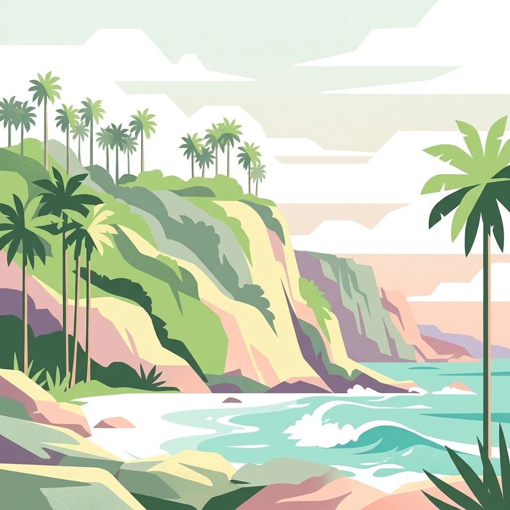
A stylized vector illustration of a tropical coral atoll coastline featuring steep cliffs, lush palm trees, and turquoise ocean waves.

Henderson Island

Nature reserve

Park overview

Structured park overview, official facts, and landscape profile for Henderson Island

Henderson Island park facts, protected area profile, and essential visitor context

Review the core facts for Henderson Island, including designation, size, terrain, visitor scale, habitats, and operating context in one park-focused overview.

About Henderson Island

Henderson Island is an uninhabited raised coral atoll lying in the south Pacific Ocean, roughly midway between the Equator and the Southern Ocean. It is the largest member of the Pitcairn Island Group, a cluster of four small islands and atolls that, together with their surrounding waters, form one of the most isolated administrative territories in the world as part of the British Overseas Territories. The nearest inhabited island, Pitcairn, lies about 193 kilometres to the southwest, while the nearest continental landmass, South America, is more than 5,000 kilometres away.

Physically, Henderson is a coral limestone island resting on a conical mound that rises thousands of metres from the surrounding ocean floor. Its surface is a rugged mixture of jagged reef-rubble pinnacles, shallow sinkholes, and dissected limestone, encircled for most of its perimeter by steep cliffs. A central depression is thought to represent the remnants of an ancient lagoon, now exposed. Three primary beaches lie along the northern shore, fringed by reef in places, while the rest of the coast drops sharply into the sea. Fresh water is essentially absent as a usable resource.

Ecologically, Henderson is one of the most remarkable islands of its size on Earth. Its 51 native species of flowering plants include ten found nowhere else. Its surviving terrestrial avifauna consists of four endemic land birds, and its seabird colonies include species that breed nowhere else. Roughly a third of its known insects and non-marine gastropods are endemic. These patterns reflect the island's long isolation and the absence of major man-made ecological disruption, which is why it is often compared with Aldabra as one of the two least disturbed raised coral atolls in the world.

Human presence on Henderson has been intermittent rather than continuous. Polynesians occupied the island for centuries before abandoning it, leaving behind archaeological traces. European contact began in the early seventeenth century, and the island later became a famous episode in the history of whaling after survivors of the whaleship Essex spent time on its shores. In the modern era, satellite-based conservation, scientific research, and concern over accumulating marine plastic have made Henderson an internationally important reference site for remote island ecology and oceanic pollution.

Quick facts and research context for Henderson Island

Henderson Island is the largest island in the Pitcairn Island Group, a British Overseas Territory in the south Pacific Ocean, and the only island in the group together with Pitcairn, Oeno, and Ducie that is uninhabited. It is a raised coral atoll composed of reef-rubble and dissected limestone, with steep coastal cliffs and a central depression believed to be a former lagoon.

The island was inscribed on the UNESCO World Heritage List in 1988 under natural criteria, recognized for the outstanding integrity of its island ecology. It is also identified by BirdLife International as an Important Bird Area due to its four surviving endemic land birds and large seabird colonies. The nearest inhabited place is Pitcairn Island, around 193 kilometres to the southwest, while the nearest continent, South America, lies more than 5,000 kilometres to the east.

Protection and recognition

Explore the official designation timeline and management scope for Henderson Island.

Henderson Island Protection Status and Documented Conservation History

Historical records indicate a mixed protection scope established in nineteen eighty eight for Henderson Island. Structured conservation facts outline the documented designation framework and administrative background.

Protection details

Protection scope
Mixed
Designated year
1988
Transboundary protection
No
Park context

Deeper park guide and search-rich context for Henderson Island

Henderson Island history, landscape, wildlife, and travel context

Explore Henderson Island through its history, landscape character, ecosystems, wildlife, conservation priorities, cultural context, and seasonal travel timing in a structured park guide built for atlas discovery and search intent.

Why Henderson Island stands out

Henderson Island is best known for being one of the last raised coral atolls in the world whose ecosystems remain essentially undisturbed by direct human influence, sharing that status only with Aldabra in the Indian Ocean. Its small land area holds an unusually high concentration of endemic species, including every surviving native land bird and a substantial proportion of its plants, insects, and land snails. The island is also widely recognized as a global hotspot for marine plastic pollution research. Studies on its remote beaches revealed some of the highest densities of plastic debris ever recorded, accumulated from the South Pacific Gyre. Together, these ecological and conservation qualities, combined with its extreme oceanic isolation and UNESCO World Heritage status, define Henderson Island's international profile.
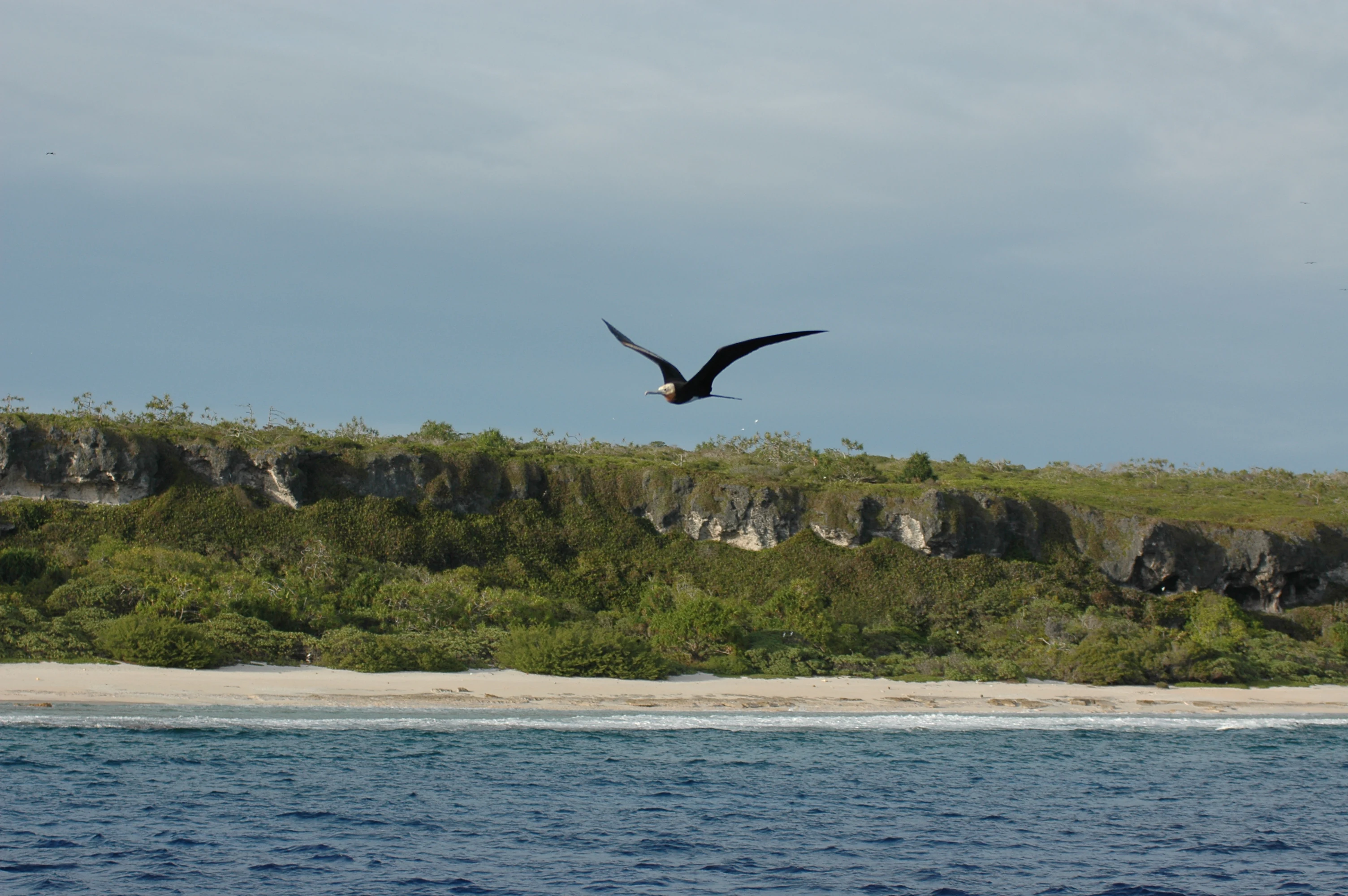
North Beach
A view of the sandy coastline at North Beach on Henderson Island.

Henderson Island history and protected-area timeline

Henderson Island was first inhabited by Polynesians, possibly as early as 800 AD, and archaeological evidence suggests continuous settlement for a period of some 600 years before the community vanished, likely because of resource exhaustion and the collapse of nearby Polynesian societies on Pitcairn and Mangareva. The eastern Polynesian route toward Easter Island may have passed through Henderson and Pitcairn, and shared cultural traits across these islands continue to influence interpretations of long-distance Polynesian voyaging.

The first European to sight the island was the Portuguese captain Pedro Fernandes de Queirós, sailing for Spain, who named it San Juan Bautista in 1606 while searching for the hypothesized southern continent. The island was largely forgotten for more than two centuries until 1819, when Captain Henderson of the British East India Company ship Hercules rediscovered it. A succession of names followed, including Elizabeth Island and Henderson's Island, depending on which visiting captain claimed precedence for its discovery.

In 1820, the American whaleship Essex was sunk by a sperm whale, an episode that later inspired Herman Melville's Moby-Dick. Its surviving crew reached Henderson in three open whaleboats and lived briefly on the island before making an open-ocean voyage to South America. Three crewmen chose to remain behind and survived on the island for months until rescue. In 1902, Henderson was formally annexed to the British Empire alongside Oeno and Ducie islands by Captain G. F. Jones, and an aerial survey in 1937 led by HMS Leander reaffirmed British sovereignty.

A second focal chapter of the island's more recent history concerns protection. In the early 1980s, the American businessman Arthur Ratliff proposed building a private mansion and airstrip on Henderson, a plan initially approved by the Pitcairn Island Council but blocked by the British Foreign and Commonwealth Office after environmental lobbying. The island was inscribed as a UNESCO World Heritage Site in 1988. Subsequent decades have seen scientific expeditions focused on plastic pollution, climate change, rat eradication efforts, and Royal Navy surveys, including a 2022 mapping mission that revealed the island's previously charted position to be inaccurate by roughly one nautical mile.

Henderson Island landscape and geographic character

Henderson Island is a raised coral atoll whose surface is shaped primarily by ancient reef debris and dissolved limestone. The island sits on a presumed volcanic seamount that rises from ocean depths of roughly 3,500 metres, with the land itself formed from compacted coral that was once a fringing reef around a now-elevated lagoon. Today, the result is a sharply rugged terrain of steep pinnacles, fissures, shallow sinkholes, and exposed reef-rubble that can be difficult to walk across even short distances inland.

Most of the coastline consists of vertical or undercut limestone cliffs rising up to about 15 metres above the sea, with only three principal accessible beaches along the northern shore: the northwest, north, and northeast beaches. The north and northwest beaches are fringed by reef platforms, while the central depression of the island is interpreted by geomorphologists as the desiccated floor of an ancient lagoon that has been lifted well above modern sea level. The tidal range around the island is modest, roughly a metre at spring tides, but the surrounding ocean is otherwise deep and open in every direction.

Fresh water is exceptionally scarce. The only known naturally potable source is a brackish spring on the north shore that emerges at about half-tide from a crevice in flat limestone exposed on the beach. There are no streams, no standing freshwater lakes, and no reliable catchment basins of usable scale. Vegetation is correspondingly adapted to dry, salt-spray-exposed conditions, lending much of the island a single dominant texture of tangled scrub forest broken by patches of bare coral rock.
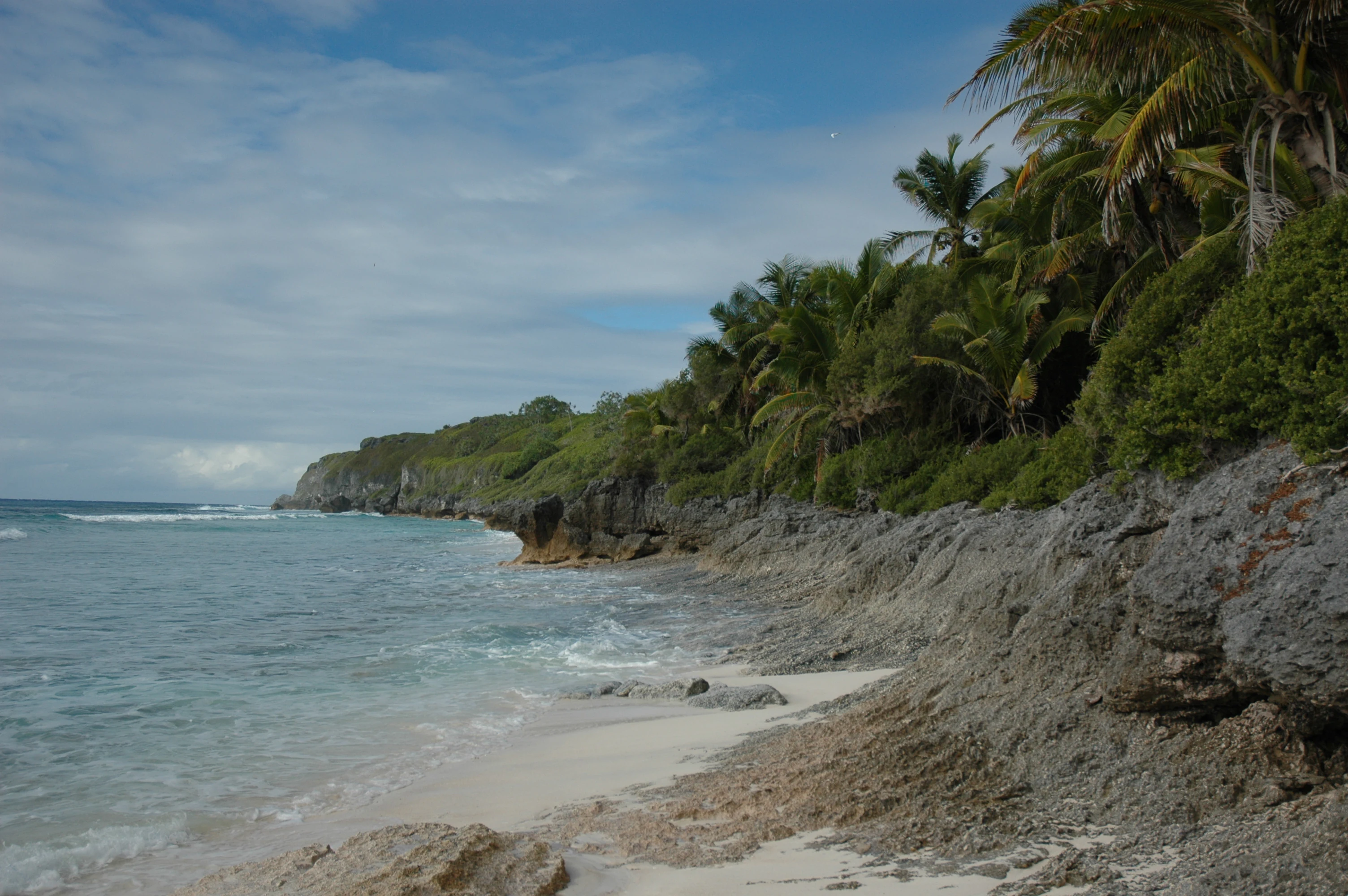
A coastal scene showing white sand meeting rough, grey limestone cliffs topped with lush green tropical vegetation on Henderson Island.
The rocky Northwest Beach shoreline of Henderson Island.

Henderson Island ecosystems, habitats, and plant life

The vegetation of Henderson Island is dominated by a continuous canopy of tangled scrub forest, generally between five and ten metres tall, with somewhat lower and thinner cover in the central depression. Apart from a narrow fringe of beach-edge species, which includes coconut palms, the vegetation has not been transformed by cultivation or large-scale clearing, giving the island an unusually complete native plant assemblage for such a small landmass. Of the 51 native flowering plant species recorded, ten are found nowhere else on Earth.

Among the dominant trees are Pandanus tectorius, Thespesia populnea (known locally as miro), Cordia subcordata (tou), Guettarda speciosa, Pisonia grandis, Heliotropium foertherianum, and the locally named endemic Geniostoma hendersonense, alongside representative species of Nesoluma, Hernandia, Myrsine, and Celtis. The composition reflects a typical eastern Polynesian raised-coral forest adapted to nutrient-poor limestone substrates and exposure to salt-laden winds. Because there are no land mammals and only limited herbivorous reptiles, the plant communities are shaped primarily by seabird nutrients, wind exposure, and competition among the trees themselves rather than by ongoing grazing pressure.

Marine and coastal habitats complement this terrestrial flora. Coral reef fringes protect the north and northwest beaches, while the steep offshore drop-offs around much of the island create habitats for pelagic species. Sandy beaches serve as nesting grounds for green sea turtles and provide roosting substrate for seabirds. The overall ecological picture is one of a tightly integrated island system in which a small terrestrial flora, a specialized avifauna, and a surrounding marine environment function together with minimal direct human interference.
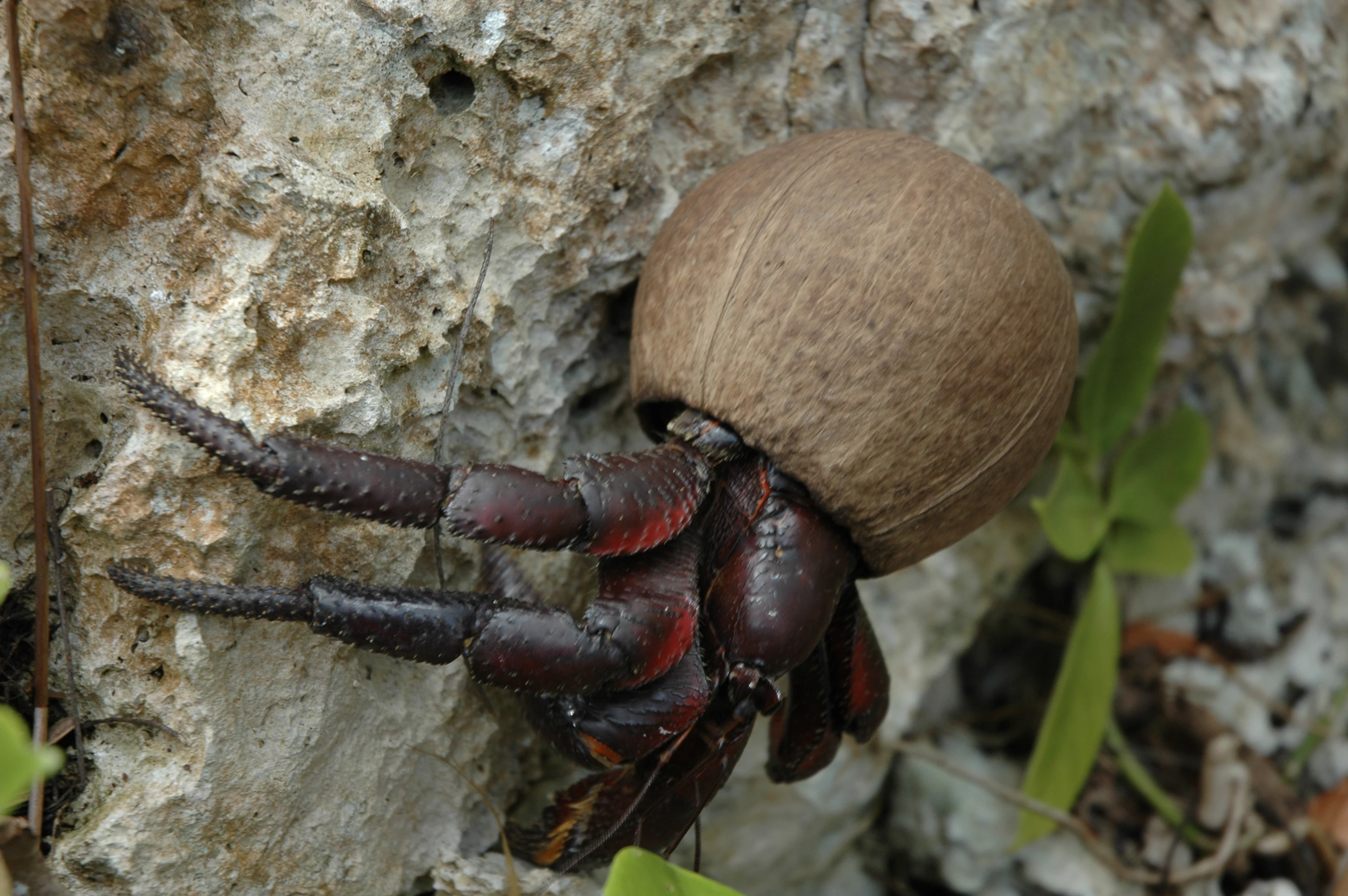
A close up view of a dark hermit crab with a large, round, brown coconut shell on its back, clinging to a rough, light-colored limestone rock surface.
A hermit crab using a coconut husk as a shell on the limestone terrain of Henderson Island.

Henderson Island wildlife and species highlights

Henderson Island supports one of the most distinctive small-island avifaunas in the Pacific. Four extant land birds are endemic to the island: the Henderson fruit dove, the Henderson lorikeet (also called Stephen's lorikeet), the Henderson reed warbler, and the flightless Henderson crake. The Henderson petrel, a globally endangered seabird whose former colonies on nearby Ducie Island were wiped out by invasive rats, now nests almost exclusively on Henderson.

Beyond these endemics, the island hosts around fifteen species of seabird, of which roughly nine are believed to breed locally, often in large colonies that benefit the surrounding ecosystems through nutrient transfer. BirdLife International has designated Henderson as an Important Bird Area because of the combination of endemic land birds and the scale of seabird breeding. The presence of a flightless rail and ground-dwelling lorikeet means the bird fauna is particularly vulnerable to introduced predators, which is why the island's isolation is itself a conservation asset.

Additional wildlife includes a rich invertebrate fauna in which approximately a third of known non-marine gastropods and insects are endemic. Coconut crabs and hermit crabs are conspicuous on the beaches and inland scrub, and the purple hermit crab has been documented making use of plastic containers washed ashore. Reptiles include a gecko and three skink species, likely introduced by early Polynesians, while green sea turtles nest on the beaches. There are no native land mammals; the only resident mammal is the Pacific rat, introduced by Polynesians around 800 years ago, whose ongoing presence remains a key conservation concern.
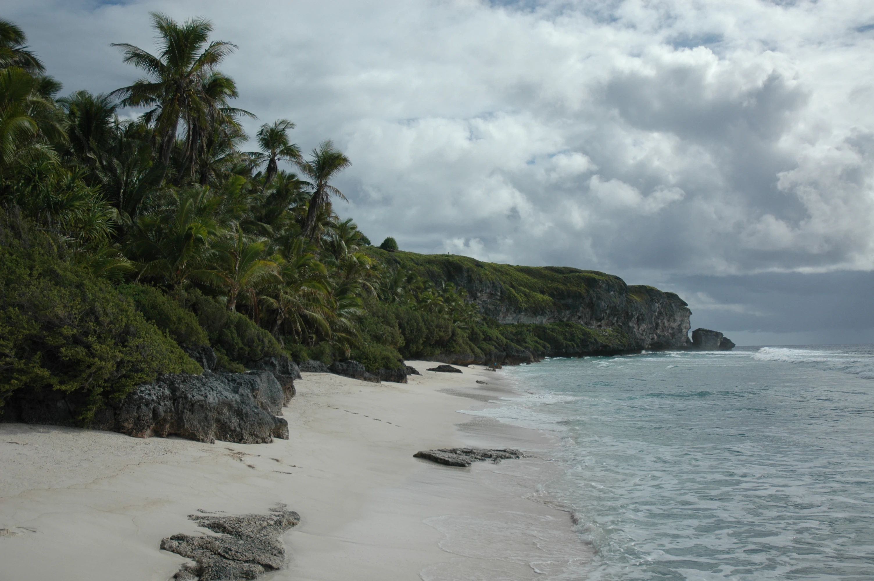
A sandy beach stretches along a shoreline with rocky limestone cliffs topped with dense tropical vegetation, leading to the ocean under a cloudy sky.
A coastal view of the beach and raised limestone cliffs on Henderson Island.

Henderson Island conservation status and protection priorities

Henderson Island's principal conservation significance lies in the integrity of its terrestrial and marine ecosystems. Because the island has poor soil, no agriculture, no permanent freshwater streams, and no settlement, its endemic flora and fauna have been shielded from most of the disruptive forces that have transformed comparable islands, including clearance for crops, logging, feral ungulates, and permanent human habitation. As a result, Henderson is regularly classed alongside Aldabra in the Indian Ocean as one of the last two raised coral atolls whose ecosystems remain essentially free of significant direct human impact.

International recognition of this value came in 1988 when Henderson was inscribed on the UNESCO World Heritage List under natural criteria, citing the island's ecological integrity and the concentration of endemic species. BirdLife International has separately recognized the island as an Important Bird Area. Management responsibility falls within the British Overseas Territory of the Pitcairn Islands, and the absence of permanent human residents means that the main day-to-day conservation threats are indirect rather than local: biosecurity from visiting vessels, climate-related stresses, and pollution arriving via ocean currents.

Two ongoing conservation concerns stand out. The first is the persistent population of Pacific rats, which threaten ground-nesting birds and invertebrates. A 2011 rat-poisoning programme by the Pitcairn Islands Government and the Royal Society for the Protection of Birds initially killed the vast majority of rats but left a residual population from which the colony rapidly recovered, leaving eradication as an unfinished goal. The second is plastic pollution. Research in 2017 reported the highest density of plastic debris of any beach system in the world on Henderson's shores, deposited by the South Pacific Gyre, with follow-up UK-led cleanup expeditions in 2019 and 2022 attempting to remove and recycle substantial volumes of debris.

Henderson Island cultural meaning and human context

Henderson Island carries a layered human history that, despite its current uninhabited status, has left lasting traces on how the island is perceived. The earliest cultural layer is Polynesian. Archaeological evidence indicates settlement over an extended period between roughly 800 and 1500 AD, with the community likely connected through trade, kinship, and material culture to Pitcairn and to Mangareva in the Gambier archipelago. Possible linguistic and physical anthropology links between Henderson, Pitcairn, and Easter Island have prompted ongoing scholarly interest in the long-distance voyaging corridors of eastern Polynesia.

The second cultural layer is European exploration and exploitation. The island's first recorded sighting by Pedro Fernandes de Queirós in 1606 reflects the era of Spanish and Portuguese quests for the southern continent. Its rediscovery in 1819 by Captain Henderson of the British East India Company marks the beginning of an extended period of naming disputes and informal claims, including the brief usage of Elizabeth Island following Captain Henry King's landing later the same year. The Essex shipwreck episode of 1820 gave the island a notable place in maritime and literary history, since the survivors' ordeal helped inspire Herman Melville's Moby-Dick.

A third layer is the modern connection to the present-day Pitcairn Islander community. Although Henderson has no permanent residents, Pitcairn Islanders have long travelled to the island in small aluminium boats to harvest the wood of miro and tou for carving curio objects sold to passing cruise ships, an economic relationship that integrates the uninhabited island into the living cultural economy of the inhabited one. Recent decades have added new layers of cultural significance, including high-profile scientific expeditions, environmental campaigns, and clean-up missions that have shaped Henderson's identity as both a heritage site and a symbol of planetary ecological concern.
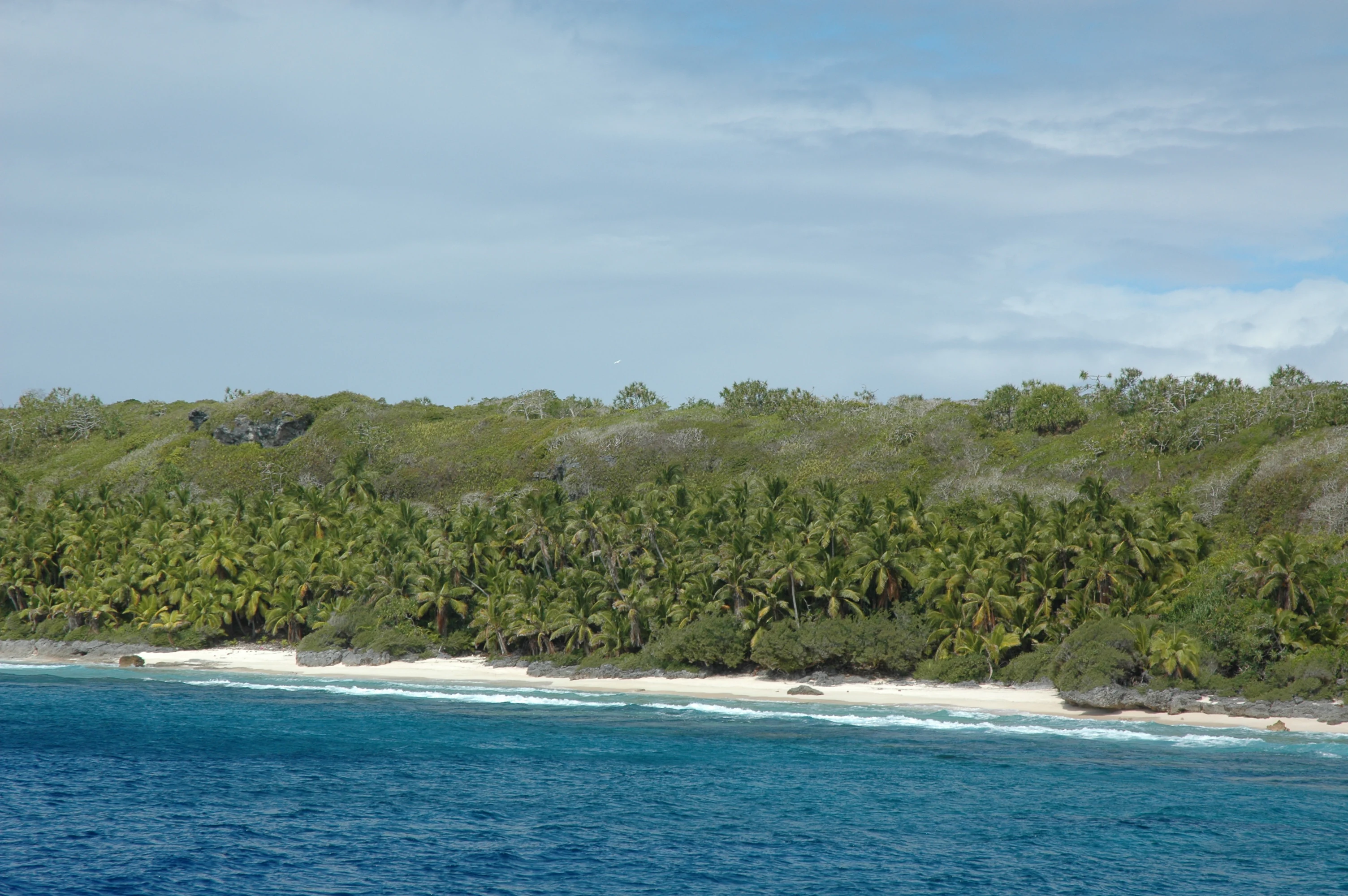
A wide shot of a tropical coastline with white sand, turquoise water, and a dense, elevated forest of palms and trees.
The pristine North West Beach of Henderson Island, an uninhabited coral atoll in the South Pacific.
Monthly climate preview

Long-term representative point measurements detailing monthly weather patterns across the protected reserve

Henderson Island Climate Normals, Annual Temperature and Precipitation Rhythm

Historical data compiled from 1991 to 2020 outlines the measured annual temperature and precipitation rhythm across a representative coordinate of Henderson Island. Examining the complete twelve-month climatology profile allows researchers to trace long-term atmospheric shifts and regional environmental trends in detail.
Annual mean23 °C
21 °C26 °C
Jan25°
Feb26°
Mar26°
Apr25°
May24°
Jun23°
Jul22°
Aug21°
Sep21°
Oct22°
Nov23°
Dec24°
Warmest month
March

25.6 °C

Coolest month
September

21.2 °C

Wettest month
December

4.6 mm/day

Driest month
March

2.6 mm/day

Park location guide

Geography guide, regional context, and park location map for Henderson Island

Henderson Island park geography, regions, and map view in Pitcairn

Understand where Henderson Island sits in Pitcairn through a broader geographic reading of the surrounding landscape, nearby location context, and its mapped position within the national park landscape.

How Henderson Island fits into Pitcairn

Scattered across a vast area of ocean, the four Pitcairn Islands form one of the world's most isolated inhabited territories. A tiny community lives around Adamstown on rugged Pitcairn, while the uninhabited outer islands support seabirds, endemic species and remarkably intact marine habitats.

Wider geography shaping Henderson Island in Pitcairn

The territory consists of four widely separated islands in the south-central Pacific. Pitcairn is a steep volcanic island with Adamstown above Bounty Bay; Oeno and Ducie are low coral atolls; Henderson is an uplifted coral island ringed by cliffs and reef. Together the islands govern an exclusive economic zone vastly larger than their combined land area.

Map view of Henderson Island

Use this park location map to pinpoint Henderson Island in Pitcairn, understand its exact geographic position, and read its mapped placement within the surrounding landscape more clearly.

Pigeon | © OpenStreetMap contributors

Location context for Henderson Island

Pitcairn Islands

Explore detailed imagery of rugged limestone cliffs, dense scrub forest, and isolated ocean habitats.

Henderson Island Photos and Landscapes: Visualizing the Remote Protected Coral Atoll

Visual records provide essential insight into the rugged limestone terrain, steep sea cliffs, and untouched scrub forest of Henderson Island. Examining these remote protected landscapes reveals the unique environmental character of a rare undisturbed oceanic atoll.

North Beach

A vintage watercolor illustration of a Stephen's lorikeet perched on a branch, displaying its vibrant red chest, green head, dark wings, and yellowish-green tail feathers against a white background.

A coastal scene showing white sand meeting rough, grey limestone cliffs topped with lush green tropical vegetation on Henderson Island.

A close up view of a dark hermit crab with a large, round, brown coconut shell on its back, clinging to a rough, light-colored limestone rock surface.

A sandy beach stretches along a shoreline with rocky limestone cliffs topped with dense tropical vegetation, leading to the ocean under a cloudy sky.

A coastal view showing a white sand beach meeting turquoise waters, backed by raised coral cliffs covered in green vegetation under a cloudy sky.

A wide shot of a tropical coastline with white sand, turquoise water, and a dense, elevated forest of palms and trees.

A coastal landscape on Henderson Island showing white sandy soil, exposed tree roots, dense green bushes, and a single bird near a tree trunk.

A wide shot of a white sand beach on Henderson Island with low coastal shrubs in the foreground and dark, raised rocky cliffs running along the shoreline.

Park atlas

Compare remote island ecosystems, raised coral atolls, and regional reserves

Other Parks Near Henderson Island and Connected Protected Areas

Browse protected areas and isolated island reserves located across the surrounding South Pacific region. Continuing beyond Henderson Island reveals broader geographic context and connects rare marine and coastal ecosystems.
National parkEaster Island
About 1,916 km away#1 closest

East

Rapa Nui National Park: Easter Island's Volcanic Protected Landscape Atlas

Explore mapped park boundaries and regional geography.

Rapa Nui National Park is a critical protected landscape centered on Easter Island, offering a unique opportunity for atlas-based exploration of its volcanic terrain and geographic context. This national park's detailed mapped boundaries and its isolation within the vast Pacific region provide significant value for understanding protected areas and regional geography. Discover the structured facts and landscape identity that define Rapa Nui National Park.

Area
68 km²
Established
1935
IUCN
II
Visitors
60.9K annual
Marine protected areaAmerican Samoa
About 4,185 km away#2 closest

West

National Marine Sanctuary of American Samoa: Mapped Marine Protected Area Geography

Discover protected marine landscapes across American Samoa's region.

Investigate the National Marine Sanctuary of American Samoa, a protected marine area with distinct geographic relevance. This detailed view focuses on its mapped boundaries and its role as a protected landscape within the broader atlas of American Samoa. Understand the unique environmental context and protected-area significance that shapes this marine sanctuary.

Area
35,170 km²
Established
1986
Climate
Tropical
Access
Easy access
Marine protected areaAmerican Samoa
About 4,185 km away#3 closest

West

Rose Atoll Marine National Monument: Protected Marine Area in American Samoa

Explore mapped boundaries and regional geographic context.

Rose Atoll Marine National Monument is designated as a marine protected area within the geographic scope of American Samoa. This page offers detailed insights into its protected status, mapped terrain, and the surrounding natural landscapes. It serves as a resource for understanding the park's specific boundaries and its role as a conservation area, providing a foundation for geographic discovery.

Relief
Lowland
Scope
Marine
Water
Water-dominated
Wildlife reserveAmerican Samoa
About 4,305 km away#4 closest

West

Rose Atoll National Wildlife Refuge: Southernmost U.S. Wildlife Reserve & Mapped Coral Ecosystem

Discover unique protected landscape geography in American Samoa.

Rose Atoll National Wildlife Refuge is a remote U.S. wildlife reserve situated in American Samoa, distinguished by its unique atoll structure and the southernmost geographical coordinates within the United States. This protected area is renowned for its exceptional marine biodiversity, including extensive coral reef ecosystems, a significant seabird nesting colony, and vital sea turtle habitats. Exploring this refuge offers a window into distinct regional geography, mapped marine protected areas, and the ecological significance of isolated Pacific atolls.

Area
158.09 km²
Established
1973
IUCN
Ia
Relief
Lowland
National parkUnited States of America
About 4,444 km away#5 closest

West

National Park of American Samoa: A Mapped Protected Landscape within the USA

Discover its island geography and protected area context.

National Park of American Samoa stands as a significant protected natural area, offering unique insights into island geography and conservation landscapes. Explore its detailed mapped boundaries and understand its placement within the broader atlas of United States of America protected lands. This entity provides a focal point for understanding distinct geographic features and the territorial spread of protected natural resources.

Area
33.414 km²
Established
1988
IUCN
V
Visitors
12.1K annual
National parkSamoa
About 4,685 km away#6 closest

West

O Le Pupu-Puʿe National Park: Explore Samoa's Protected National Park Geography and Boundaries

Mapped terrain and protected landscape context for this Samoan national park.

Understand O Le Pupu-Puʿe National Park as a significant protected area within Samoa's archipelago. This detail entry provides essential geographic context, mapping its boundaries and situating it within the nation's protected lands. Explore the park's role as a national park and its contribution to the mapped natural landscape of Samoa.

Area
50.2 km²
Established
1978
IUCN
II
Relief
Mixed relief
Watercolor painting depicting mountains, forests, a body of water, and distant hills
National parkValparaíso Region
About 4,698 km away#7 closest

Southeast

Archipiélago de Juan Fernández National Park: Chilean Volcanic Island Protected Landscape & Geography

Explore extreme endemism within a remote Biosphere Reserve.

Archipiélago de Juan Fernández National Park offers a rare glimpse into an isolated evolutionary laboratory, characterized by dramatic volcanic island geography and unique endemic flora and fauna. This protected national park, located in the Valparaíso Region of Chile, features steep mountainous terrain rising from the Pacific Ocean, creating a distinctive landscape context. Its status as a Biosphere Reserve highlights its global significance for conservation and provides a compelling case study for understanding island biogeography and protected-area mapping.

Area
96 km²
Established
1935
IUCN
II
Visitors
1.4K annual
National parkUpolu
About 4,701 km away#8 closest

West

Lake Lanoto'o National Park: Discover Its Protected Landscape and Geographic Setting on Upolu

Explore park boundaries and regional natural terrain.

Lake Lanoto'o National Park represents a crucial protected area on the island of Upolu, Samoa. This page provides detailed geographic information, focusing on the park's mapped boundaries and its contribution to the natural landscape of the region. Understand its role as a national park and its position within the broader atlas of protected lands, offering insight into the island's unique geography.

Area
4.7 km²
Established
2003
IUCN
II
Relief
Highland

Common questions about visiting, size, designation, and location context for Henderson Island

Henderson Island FAQs for park facts, access, geography, and protected area context

Find quick answers about Henderson Island, including protected-area facts, park geography, trail and visitor context, and how the park fits into its surrounding country and regional landscape.
MoriAtlas Explorer

Continue Your Protected Areas Search Across the Global Atlas

Deepen your exploration by continuing the structured search for national parks and protected areas worldwide. Utilize the comprehensive filtering capabilities to compare different conservation landscapes and refine your understanding of global park geography. Discover more about the distribution and characteristics of protected natural areas.

Global natural geography