
Mori Atlas logo
Protected landscapeHoosier National Forest

Understanding the geography of karst formations, sandstone cliffs, and wilderness boundaries.

Hoosier National Forest: A Comprehensive Mapping of Indiana Protected Landscapes and Terrain

Hoosier National Forest serves as a protected landscape encompassing rolling hills, dense hardwood forests, and unique river bluffs across southern Indiana. As the only federal forest in the state, its terrain features extensive karst geology, subterranean cave systems, and the notable Charles C. Deam Wilderness. This detailed atlas perspective reveals the complex distribution of woodland parcels, prairie barrens, and stream corridors that define this significant Midwestern regional landmark.

national forestsouthern Indianahardwood forestkarst geologycaveswilderness area
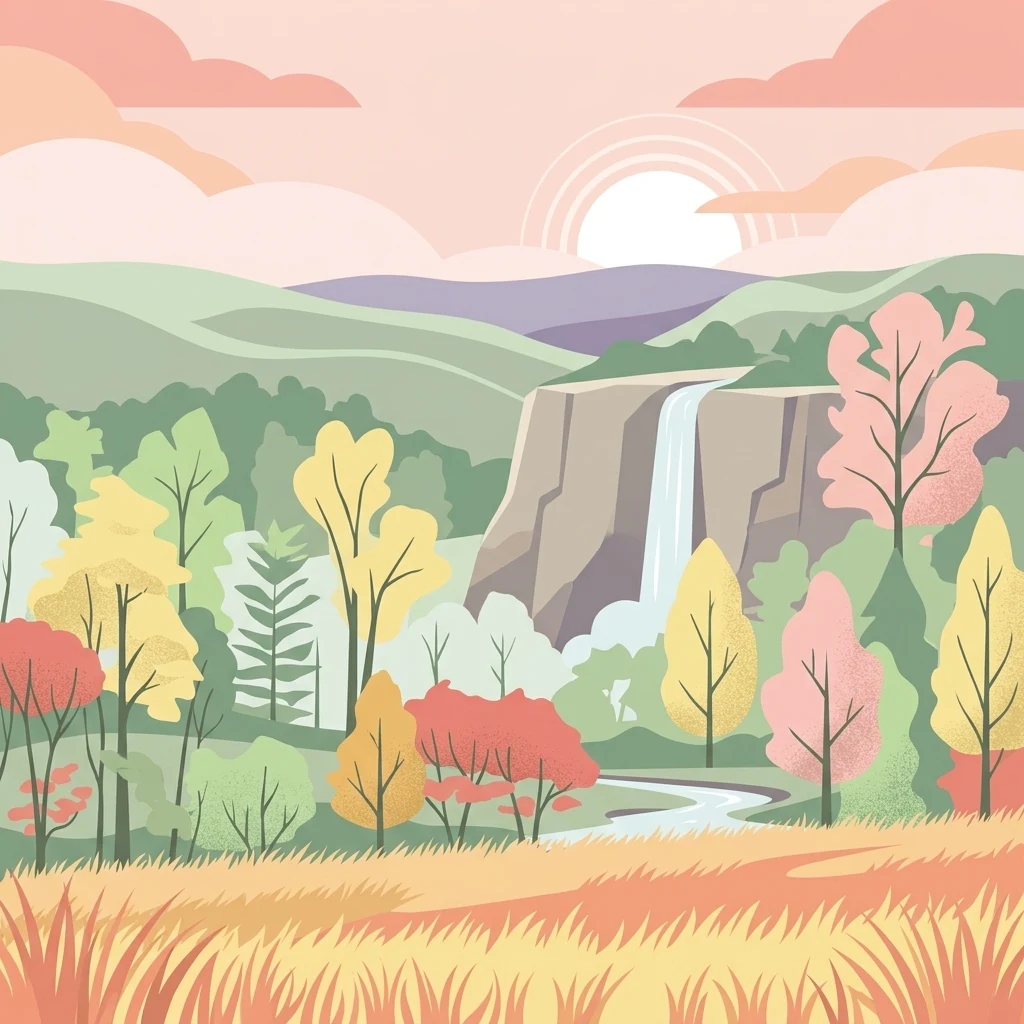
A flat-style digital illustration showing a tranquil landscape with a waterfall cascading over a cliff, surrounded by a lush forest in autumn hues of orange, yellow, and green, set against a background of rolling hills and a sunlit sky.

Hoosier National Forest

Protected landscape

Park overview

Structured park overview, official facts, and landscape profile for Hoosier National Forest

Hoosier National Forest park facts, protected area profile, and essential visitor context

Review the core facts for Hoosier National Forest, including designation, size, terrain, visitor scale, habitats, and operating context in one park-focused overview.

About Hoosier National Forest

Hoosier National Forest occupies a distinctive position in the American landscape as the only National Forest in the state of Indiana. Spread across the unglaciated hills of the south-central and southern part of the state, it provides a rare forested backdrop in a region historically shaped by farming, small towns, and limestone country. Unlike the dense coniferous forests of the western mountains or the coastal forests of the East, Hoosier National Forest is defined by mixed hardwoods, rugged ridges, river bluffs, and karst terrain riddled with caves and sinkholes.

The forest is unusual in being noncontiguous. It is divided into four geographic sections, each made up of many smaller parcels of land rather than one continuous block. This fragmented layout reflects the long history of settlement, agriculture, and timbering in southern Indiana, where federal forest lands were eventually assembled piecemeal to address erosion, deforestation, and rural decline. Today, the forest functions as both a conservation landscape and a working forest, maintaining habitat, protecting watersheds, and providing outdoor recreation near communities such as Bedford, Tell City, and Bloomington.

Ecologically, Hoosier National Forest protects a striking diversity of environments within a relatively compact area. The underlying karst geology produces caves, springs, and disappearing streams characteristic of southern Indiana, while upland ridges support hardwood forests dominated by oaks, hickories, and, in cooler microclimates, Eastern Hemlock. The Clover Lick Barrens in the southern part of the forest, near the Ohio River, harbor vegetation more typical of the Great Plains, an ecological anomaly in the region. The Charles C. Deam Wilderness preserves one of the largest contiguous tracts of relatively untouched forest in Indiana and offers a glimpse of what much of the state once looked like.

Beyond its natural features, the forest holds significant cultural and historical value. Indigenous peoples used these woodlands for thousands of years before European settlement, and the forest preserves archaeological sites such as the Potts Creek Rockshelter and the Lick Creek Settlement, a free Black community organized by the Quaker Jonathan Lindley in the nineteenth century. Pioneer Mothers Memorial Forest offers a rare example of old-growth Indiana forest, while the Hickory Ridge Lookout Tower recalls the era of fire suppression across the region. Together, these elements make Hoosier National Forest a place where natural beauty, ecological complexity, and deep human history intersect.

Quick facts and research context for Hoosier National Forest

Hoosier National Forest lies in the hills of southern Indiana and is made up of four noncontiguous sections composed of many individual parcels across parts of nine counties. Managed by the U.S. Forest Service, it was officially established in 1961 through an act signed on February 6, 1935, and covers just over 204,000 acres.

The forest contains Indiana's only designated wilderness area, the Charles C. Deam Wilderness, along with notable features such as the karst cave systems of southern Indiana, the prairie-like Clover Lick Barrens near the Ohio River, Pioneer Mothers Memorial Forest virgin forest tract, and the Hemlock Cliffs Recreation Area. It also preserves archaeological sites and the historic Lick Creek Settlement, reflecting both natural and cultural heritage.

Protection and recognition

Documented boundaries, management scope, and terrestrial protected area designation facts

Hoosier National Forest Protection Status and Terrestrial Management Scope

Hoosier National Forest maintains a documented terrestrial protection status within its regional forest landscape. Structured records detail the official management scope and conservation standing without external international recognition sources.

Protection details

Protection scope
Terrestrial
Transboundary protection
No
Park context

Deeper park guide and search-rich context for Hoosier National Forest

Hoosier National Forest history, landscape, wildlife, and travel context

Explore Hoosier National Forest through its history, landscape character, ecosystems, wildlife, conservation priorities, cultural context, and seasonal travel timing in a structured park guide built for atlas discovery and search intent.

Why Hoosier National Forest stands out

Hoosier National Forest is best known as the only National Forest in Indiana and for containing the Charles C. Deam Wilderness, the state's single designated wilderness area. Its rolling, forest-dominated hills, karst geology, and sandstone cliff formations give the region a more Appalachian feel than is typical for the Midwest. Another defining feature is the unusual Clover Lick Barrens near the Ohio River, where prairie-like vegetation persists in a setting surrounded by forest, a pattern linked to soil conditions that prevent tall oaks from dominating. The forest is also recognized for old-growth remnants like Pioneer Mothers Memorial Forest, the scenic Hemlock Cliffs trail, and an extensive trail network suitable for hiking, horseback riding, and mountain biking.
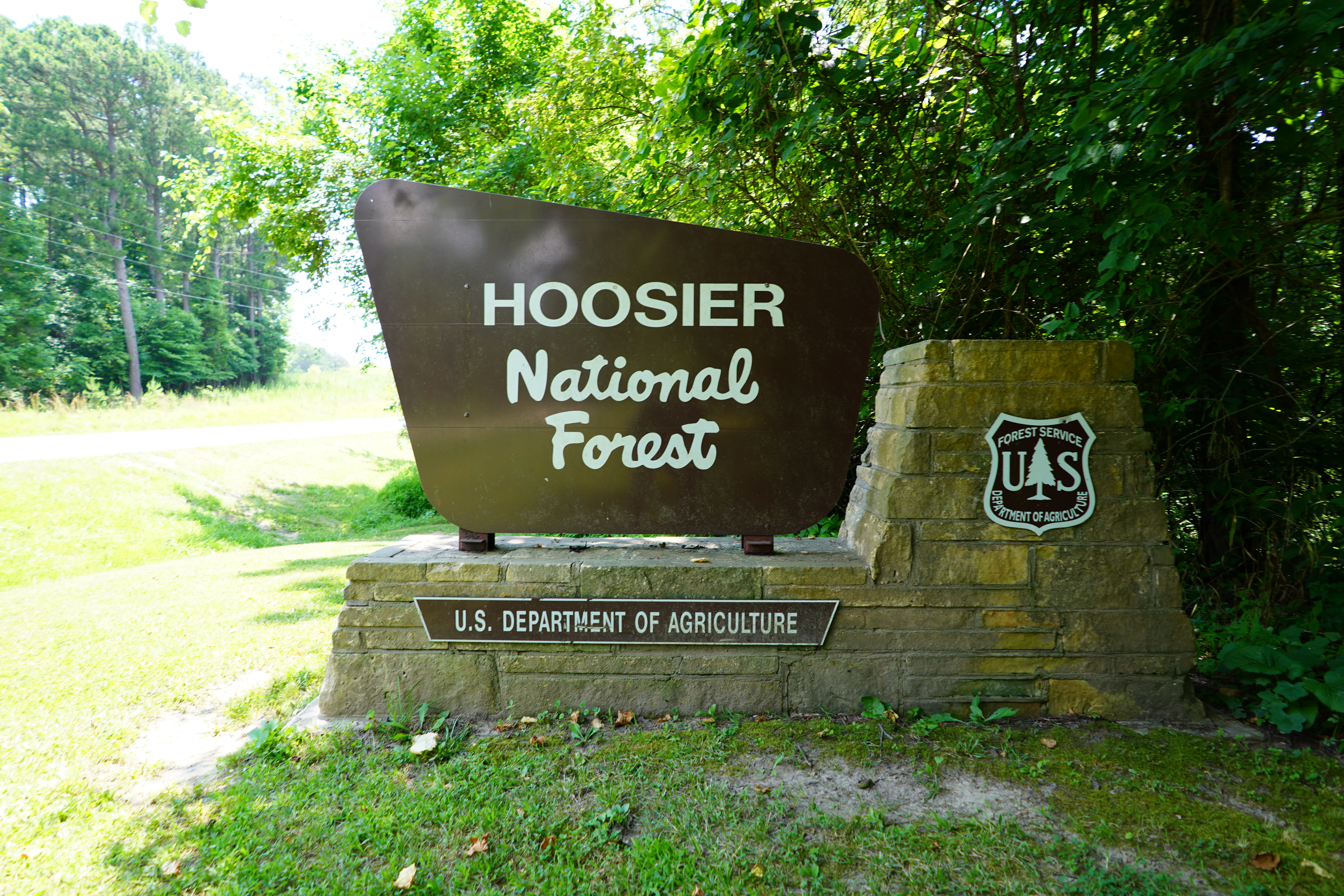
A brown, trapezoidal entrance sign for Hoosier National Forest, mounted on a stone base with the U.S. Forest Service logo to the right, surrounded by lush green trees.
The official entrance sign for Hoosier National Forest, displaying the U.S. Forest Service shield.

Hoosier National Forest history and protected-area timeline

Hoosier National Forest has a layered human history stretching back roughly 12,000 years, when Native American peoples hunted in the forests of what is now southern Indiana. European settlers arrived in the late seventeenth century and gradually established villages within the forest, beginning a long period of forest use and modification.

Commercial lumbering became a dominant activity in the nineteenth century, with the most difficult terrain being logged after 1865. By around 1910, much of the region had been cut over, leaving behind degraded, eroded lands. As rural populations declined during the early twentieth century, the governor of Indiana pushed for federal involvement to address the environmental and economic consequences of this widespread deforestation.

The legislation that created what would become Hoosier National Forest was signed on February 6, 1935, as part of broader efforts to restore American landscapes. The forest was officially established on October 1, 1961, working to consolidate fragmented parcels scattered across southern Indiana into a managed National Forest. Early federal restoration efforts sometimes introduced nonnative species to low-growth areas, but more recent management, particularly since 2006, has actively preserved the unusual open character of places like Clover Lick Barrens rather than converting them back to dense forest.

In 1972, the area around Clover Lick became the site of a landmark conservation effort when Indiana reintroduced wild turkeys to the state, dedicating about 6,000 acres to that program. This event marked an important step in restoring wildlife populations that had been lost from Indiana for generations. The forest's history of management, restoration, and selective land acquisition continues to shape its present-day character.

Hoosier National Forest landscape and geographic character

Hoosier National Forest is defined by the unglaciated hills of southern Indiana, a region of long ridges, narrow valleys, and deeply cut stream corridors. Unlike the flatter farmland that dominates much of Indiana, this part of the state feels topographically closer to the Appalachian foothills, with elevations rising and falling across mixed hardwood forests, exposed sandstone, and rolling ridges.

A defining geological feature of the forest is its karst terrain. The underlying limestone produces caves, sinkholes, springs, and underground drainage systems that shape both the surface landscape and the hydrology of the region. Much of the forest sits above this karst geology, which is responsible for the many caves found throughout southern Indiana.

Along the Ohio River, the southern portion of the forest opens into the unusual Clover Lick Barrens, a landscape more reminiscent of midwestern prairies than woodland. Here, thin soils and shallow bedrock prevent tall oaks from dominating, allowing grasses and prairie plants to persist amid the surrounding forest. Elsewhere, sandstone cliff formations and seasonal waterfalls define the Hemlock Cliffs area, while lakes such as Lake Tarzian, Patoka Lake edges, Indian-Celina Lake, Tipsaw Lake, and the smaller Sundance Lake dot the forest, providing breaks in the forest cover and important recreation sites.

Hoosier National Forest ecosystems, habitats, and plant life

Hoosier National Forest encompasses a remarkable concentration of ecological diversity within a relatively small region of the Midwest. Its mixed hardwood forests, karst systems, cliff microclimates, and prairie-like openings each support distinctive plant and animal communities. The forest acts as a refuge for species and habitats that have largely disappeared from the surrounding agricultural landscape.

The majority of the forest is covered in temperate hardwood forest typical of the unglaciated Midwest, with oaks and hickories forming much of the canopy. In cooler, sheltered microclimates such as Hemlock Cliffs, Eastern Hemlock and rare wintergreen plants persist, lending northern forests an unexpectedly Appalachian character. Pioneer Mothers Memorial Forest near Paoli preserves a remarkable example of virgin Indiana forest, offering a glimpse of original, unlogged woodland that is exceptionally rare in the state.

The Clover Lick Barrens in the southern section represent one of the forest's most unusual ecosystems. Instead of dense woodland, this area supports prairie vegetation more typical of the Great Plains, with grasses and herbaceous plants thriving where soil and bedrock conditions limit tree growth. This habitat is actively managed as open barrens, a conscious reversal of earlier forest restoration practices that emphasized tree planting. Together, these varied habitats give Hoosier National Forest an ecological richness well beyond what its modest geographic footprint might suggest.

Hoosier National Forest wildlife and species highlights

The varied habitats of Hoosier National Forest support a wide range of wildlife, from forest interior species adapted to large tracts of unbroken woodland to edge species that thrive where forest meets grassland and river. The forest's mix of hardwood ridges, cliffside habitats, wetlands, and prairie openings creates opportunities for animals with very different ecological needs.

One of the most significant wildlife stories associated with the forest is the reintroduction of wild turkeys to Indiana. In 1972, roughly 6,000 acres around Clover Lick were dedicated to this effort, helping restore a species that had been extirpated from the state. That program established a foundation for wild turkey recovery across Indiana and remains a defining chapter in the forest's conservation history.

Among the forest's large carnivores and browsing mammals, white-tailed deer are common throughout, and the mix of mature forest and edge habitats supports populations of small mammals, songbirds, and raptors. The Hemlock Cliffs area's combination of cliffs, hemlock trees, and moist microclimate provides habitat for more northern-associated species, while the open Clover Lick Barrens attract grassland birds and insects typical of prairie ecosystems. The Charles C. Deam Wilderness, with its restriction on motorized vehicles, offers relatively undisturbed habitat for species sensitive to human activity, protecting one of the most ecologically intact forest blocks in Indiana.

Hoosier National Forest conservation status and protection priorities

Hoosier National Forest plays an outsized role in conservation within Indiana, a state where most of the natural landscape has been converted to agriculture. By preserving more than 200,000 acres of mixed forest, karst systems, old-growth remnants, and rare prairie openings, the forest safeguards ecological communities that would otherwise be lost from the region.

The Charles C. Deam Wilderness is the centerpiece of this conservation mission. As Indiana's only federally designated wilderness area, it protects a large, contiguous block of forest from motorized access, mechanical maintenance, and modern development. Trails within it are maintained using mules and horses rather than vehicles, preserving the area's wilderness character and providing relatively undisturbed habitat for sensitive species.

Conservation work in Hoosier National Forest has also included deliberate preservation of open habitats. The Clover Lick Barrens, once mistakenly targeted for reforestation with nonnative species, are now actively managed to maintain their rare prairie-like vegetation, reflecting an evolving understanding of ecological restoration. The forest's program to reintroduce wild turkeys, targeted cave and karst conservation, and protection of archaeological and historic sites further underscore its broad conservation significance, spanning ecosystems, wildlife, water resources, and cultural heritage.

Hoosier National Forest cultural meaning and human context

Hoosier National Forest carries a rich cultural and human history layered across thousands of years. Indigenous peoples inhabited these woodlands for millennia, using them for hunting, travel, and seasonal life, leaving behind archaeological traces such as the Potts Creek Rockshelter that remain protected within the forest today. European American settlement in the eighteenth and nineteenth centuries brought farming, timbering, and small rural communities, transforming the landscape in profound ways.

One of the forest's most significant cultural landmarks is the Lick Creek Settlement, located about two miles south of Chambersburg. Beginning around 1819, the Quaker Jonathan Lindley led a community of free Black settlers into this area, where they lived and farmed in relative isolation until around 1865. This settlement represents an important chapter in African American history in Indiana and is preserved as part of the forest's cultural heritage.

The forest also preserves structures and landscapes from later eras, including the Jacob Rickenbaugh House and the Hickory Ridge Lookout Tower, one of the last remaining fire towers of the eight that once stood within the forest. Pioneer Mothers Memorial Forest commemorates early settler heritage while simultaneously protecting a rare ecological treasure. Together, these sites reflect the intertwined natural and human stories of southern Indiana.

Top sights and standout views in Hoosier National Forest

Hoosier National Forest is distinguished by being the only National Forest in Indiana, an unusual distinction that places it at the center of the state's natural heritage. Its wilderness character is anchored by the Charles C. Deam Wilderness, the state's sole designated wilderness area, providing a large block of unroaded forest exceptionally rare in the region.

Other standout features include the Clover Lick Barrens, where prairie vegetation persists in a forest setting along the Ohio River; the scenic sandstone cliffs, seasonal waterfalls, and Eastern Hemlock groves of the Hemlock Cliffs area; and Pioneer Mothers Memorial Forest, a rare example of virgin Indiana woodland. Historic sites such as the Lick Creek Settlement and the foundational wild turkey reintroduction effort lend the forest additional layers of significance beyond its natural beauty.

Best time to visit Hoosier National Forest

Hoosier National Forest offers a different experience in each season, shaped by the deciduous nature of its hardwood forests. Spring brings fresh green growth, blooming wildflowers, and swelling streams, while the karst geology means cave areas and waterfalls respond noticeably to rainfall, making spring a particularly dynamic time to explore Hemlock Cliffs and similar trails.

Summer provides dense forest cover, warm conditions for hiking and horseback riding, and access to the forest's lakes and recreation areas. The shaded trails and extensive network of about 266 miles of paths make it possible to find cooler hikes even in the warmer months. Fall is widely considered one of the most rewarding seasons to visit, as the hardwood canopy turns vibrant shades of red, orange, and gold across the hills of southern Indiana, a transformation that defines much of the regional landscape. Winter brings quieter trails, frozen waterfalls at Hemlock Cliffs, and a stark, peaceful atmosphere, though visitors should be prepared for variable winter conditions in the hills.

Monthly climate preview

Long-term representative monthly averages for temperature and precipitation rhythm

Hoosier National Forest Climate Normals and Annual Temperature Patterns

Hoosier National Forest records measured mean temperatures ranging from sub-zero winter lows to mid-twenties summer peaks alongside consistent year-round precipitation. Reviewing the complete twelve-month climate profile provides deeper context on long-term thermal swings and monthly moisture distribution.
Annual mean13 °C
-1 °C25 °C
Jan-1°
Feb
Mar
Apr12°
May18°
Jun23°
Jul25°
Aug25°
Sep21°
Oct14°
Nov
Dec
Warmest month
July

24.7 °C

Coolest month
January

-1 °C

Wettest month
May

4.4 mm/day

Driest month
August

2.8 mm/day

Park location guide

Geography guide, regional context, and park location map for Hoosier National Forest

Hoosier National Forest park geography, regions, and map view in United States of America

Understand where Hoosier National Forest sits in United States of America through a broader geographic reading of the surrounding landscape, nearby location context, and its mapped position within the national park landscape.

How Hoosier National Forest fits into United States of America

The United States of America is a federal presidential republic and one of the world's largest countries by area and population. It consists of 50 states across a vast territory spanning multiple time zones, with its capital in Washington, D.C. and largest city in New York City. The nation has a diverse economy, influential political system, and significant cultural and military presence globally.

Wider geography shaping Hoosier National Forest in United States of America

The United States occupies a vast territory in North America, bordered by Canada to the north and Mexico to the south. The 48 contiguous states stretch from the Atlantic to the Pacific Ocean, while Alaska occupies the northwestern region and Hawaii is an archipelago in the Pacific. The country encompasses diverse terrain including the Rocky Mountains, Appalachian Mountains, Great Plains, and extensive river systems.

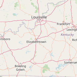
Map view of Hoosier National Forest

Use this park location map to pinpoint Hoosier National Forest in United States of America, understand its exact geographic position, and read its mapped placement within the surrounding landscape more clearly.

Pigeon | © OpenStreetMap contributors

Location context for Hoosier National Forest

Indiana
Recorded earthquake history

Browse the Historical Earthquake Catalogue for Hoosier National Forest

Investigate recorded seismic activity near the hills and karst terrain of Hoosier National Forest. This dataset provides a clear, historical perspective on past earthquakes associated with this unique Indiana protected landscape.

Hoosier National Forest Earthquake History

Catalogued events

3 events

Strongest magnitude

Magnitude 3.9

Most recent event

Jan 27, 1990

This history includes earthquakes recorded inside the park or within 50 km of its borders

Visualizing rugged terrain, karst geology, and protected habitats across Indiana

Hoosier National Forest Photos and Landscape Scenery

Visual records reveal the unglaciated hills, sandstone bluffs, and dense hardwood canopies that define southern Indiana. Examining these protected landscapes helps visitors understand regional topography, rare prairie barrens, and wilderness terrain.

A brown, trapezoidal entrance sign for Hoosier National Forest, mounted on a stone base with the U.S. Forest Service logo to the right, surrounded by lush green trees.

A wide, eye level landscape view of a dense, multi-colored forest during autumn, with thick mist obscuring the distant rolling hills and a field of tall, brown grasses in the foreground.

Park atlas

Compare regional protected areas and connected woodland terrain across the Midwest

Explore Parks Near Hoosier National Forest And Surrounding Protected Landscapes

Browse nearby national parks and protected areas sharing the rugged terrain of the surrounding region. Compare adjacent forest reserves and karst landscapes to expand your understanding of regional park geography.
National parkKentucky
75 km away#1 closest

South

Mammoth Cave National Park: Kentucky's Premier National Park for Protected Landscape Exploration

Explore its mapped boundaries and regional geography.

Mammoth Cave National Park in Kentucky presents a profound opportunity for protected-area discovery, anchored by its status as a national park. This resource focuses on providing a factual atlas-style view of its landscape, emphasizing its geographic context within the region and the extent of its protected boundaries. Users can engage with detailed information designed for structured exploration, understanding the park not just as a location but as a key component of natural landscape data.

Area
210.46 km²
Established
1941
IUCN
II
Visitors
747K annual
Watercolor painting of a wide, rolling landscape featuring layered sandstone bluffs and green forested hills against a light background.
Protected landscapeIllinois
125 km away#2 closest

Southwest

Shawnee National Forest: Exploring the Protected Landscapes of the Illinois Shawnee Hills

Mapped sandstone formations and glacial terrain in southern Illinois

Spanning nearly 289,000 hectares, Shawnee National Forest is the largest body of public land in Illinois. The area is defined by its dramatic sandstone bluffs, deep canyons, and seven designated wilderness areas that provide a rare rugged topography within the American Midwest. Explore the complex geography of this forest, from its glacial-sculpted river watersheds to its diverse hardwood habitats and historic reforestation sites.

Area
2,017.83 km²
Established
1933
Relief
Upland
Climate
Temperate
Watercolor painting of rock formations and surrounding green trees on a plain white background.
Wildlife reserveIllinois
146 km away#3 closest

Southwest

Garden of the Gods Wilderness: A Protected Sandstone Plateau in Southern Illinois

Explore geologic boundaries, sandstone hoodoos, and forested wilderness terrain

Garden of the Gods Wilderness represents a critical protected area within the Shawnee National Forest, notable for its unglaciated sandstone geography. This 3,318-acre wilderness offers an intimate view of ancient carboniferous rock formations, including prominent hoodoos and clifftop overlooks that provide expansive sightlines across the southern Illinois landscape.

Area
13.43 km²
Established
1990
Relief
Upland
Climate
Temperate
A watercolor painting showing a stylized landscape with rolling green hills, a band of trees, and a pale pink lake surface under a soft morning sky.
Protected landscapeUnited States of America
154 km away#4 closest

Southwest

Land Between the Lakes National Recreation Area: Mapped Geography and Protected Landscapes

An inland peninsula preserved between two major river reservoirs.

Land Between the Lakes National Recreation Area occupies a distinct narrow land bridge between Kentucky Lake and Lake Barkley. This protected landscape contains a dense mix of forested ridges, stream valleys, and managed wildlife prairies. The area is integral to the lower Ohio River Valley geography, showcasing the results of long-term watershed management and large-scale ecological restoration within the United States.

Area
693.1 km²
Established
1963
Visitors
2M annual
Relief
Lowland
Wildlife reserveIllinois
159 km away#5 closest

Southwest

Lusk Creek Wilderness: An Atlas of Protected Sandstone Canyons and Forests in Southern Illinois

Mapping rugged wilderness terrain and forest ecological recovery.

Lusk Creek Wilderness serves as a key protected landscape in southern Illinois, featuring extensive sandstone canyon systems and dense hardwood woodland. This area offers a unique look at the geological and forested character of the Shawnee region, documented through its boundaries, elevation changes, and natural landmarks. Use this geographic entry to examine the rugged, roadless character of the state largest wilderness designation and its place within the wider regional drainage system.

Area
25.47 km²
Established
1990
IUCN
Ib
Relief
Upland
National parkUnited States of America
277 km away#6 closest

North

Indiana Dunes National Park: Protected Landscape Geography and Map Exploration

Explore the National Park's geographic boundaries and regional context.

Indiana Dunes National Park represents a distinct protected area within the United States of America, characterized by its unique landscape setting. This entry provides a detailed atlas-style view, highlighting the park's mapped boundaries and its contribution to the regional geography. Understanding this National Park means appreciating its specific natural terrain and its place within the conservation landscape of North America.

Area
62.12 km²
Established
1966
IUCN
II
Visitors
2.8M annual
A watercolor painting showing a wide, panoramic view of a soft, green prairie landscape with rolling hills in the background and grassy reeds in the foreground.
Protected landscapeWill County
282 km away#7 closest

North

Midewin National Tallgrass Prairie: A Protected Landscape Map in Will County Illinois

Federal tallgrass prairie restoration and ecological geography

Located in Will County, Midewin National Tallgrass Prairie is a cornerstone of American grassland conservation. This protected landscape combines diverse dolomite prairies, woodland corridors, and open grasslands, offering a deep look into the recovery of rare Midwestern ecosystems. The site functions as a living laboratory for research into native biodiversity and large-grazer ecological impact.

Area
73.76 km²
Established
1996
Relief
Lowland
Climate
Temperate
National parkMissouri
291 km away#8 closest

West

Gateway Arch National Park: National Park Geographic Atlas and Map Boundaries

Explore protected landscape context and regional setting.

Gateway Arch National Park represents a unique protected landscape within Missouri, contributing to the broader national park atlas. This entry focuses on its specific geographic identity and mapped boundaries, offering structured data for understanding its role. Discover the factual landscape context and regional importance of Gateway Arch National Park for informed geographic exploration.

Area
0.78 km²
Established
2018
IUCN
II
Visitors
1.2M annual

Common questions about visiting, size, designation, and location context for Hoosier National Forest

Hoosier National Forest FAQs for park facts, access, geography, and protected area context

Find quick answers about Hoosier National Forest, including protected-area facts, park geography, trail and visitor context, and how the park fits into its surrounding country and regional landscape.
MoriAtlas Explorer

Continue Your Protected Areas Search Across the Global Atlas

Deepen your exploration by continuing the structured search for national parks and protected areas worldwide. Utilize the comprehensive filtering capabilities to compare different conservation landscapes and refine your understanding of global park geography. Discover more about the distribution and characteristics of protected natural areas.

Global natural geography