
Mori Atlas logo
National parkHossa National Park

Discover the mapped boundaries and regional context of this distinct Finnish protected area.

Hossa National Park: Explore Finland's Protected Landscape and National Park Geography

Hossa National Park represents a significant protected landscape within Finland, offering a unique geographic identity for atlas exploration. This page details the park's national park designation and its place within the broader mapped terrain of Northern Europe. Users can gain a structured understanding of Hossa National Park's protected boundaries and its contribution to Finland's extensive natural geography, serving as a key entry point for understanding Nordic protected areas.

National ParksBoreal ForestsEastern FinlandKainuuNew Parks 2017Lake Districts
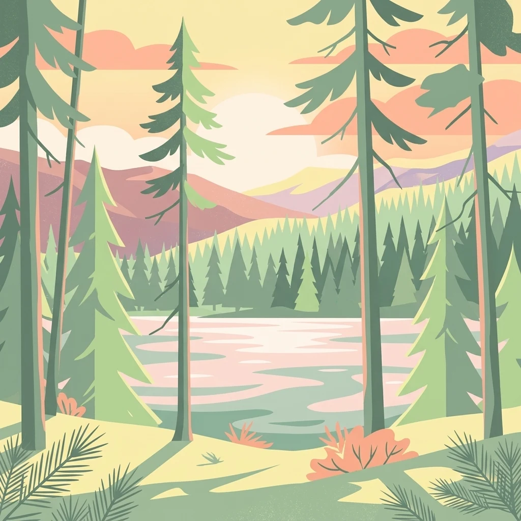
Illustration of a lake surrounded by pine trees with mountains in the background under a colorful sky

Hossa National Park

National park

Park overview

Structured park overview, official facts, and landscape profile for Hossa National Park

Hossa National Park park facts, protected area profile, and essential visitor context

Review the core facts for Hossa National Park, including designation, size, terrain, visitor scale, habitats, and operating context in one park-focused overview.

About Hossa National Park

Hossa National Park was established in 2017 as Finland's 40th national park, representing the most recent addition to the country's national park network. The park is located in the Kainuu region of eastern Finland, an area characterized by vast boreal forests, numerous lakes, and a sparse population. The creation of Hossa National Park was part of Finland's ongoing effort to expand and strengthen its network of protected areas, ensuring the preservation of the country's natural heritage for future generations. The park provides protected status to significant areas of boreal forest and lake ecosystems in eastern Finland, contributing to the conservation of Finland's natural landscapes. The establishment of the park also supports sustainable tourism and outdoor recreation in the region, offering visitors opportunities to experience the wilderness character of Kainuu.

Quick facts and research context for Hossa National Park

Hossa National Park is situated in Kainuu, eastern Finland, and was formally established in 2017. The park represents the newest addition to Finland's national park network, which now spans 40 protected areas across the country. The area features typical boreal forest ecosystems characteristic of northern Finland, with a landscape dominated by coniferous forests, lakes, and wetlands.

Protection and recognition

Documented terrestrial protection scope and international conservation framework details

Hossa National Park Protection Status and Natura 2000 Designation

Structured geographic records document the terrestrial protection status and conservation management scope of Hossa National Park. Atlas records track the formal designation history of the park, highlighting official recognition within the European Natura 2000 ecological network.

International recognition

Protection details

Protection scope
Terrestrial
Transboundary protection
No
Park context

Deeper park guide and search-rich context for Hossa National Park

Hossa National Park history, landscape, wildlife, and travel context

Explore Hossa National Park through its history, landscape character, ecosystems, wildlife, conservation priorities, cultural context, and seasonal travel timing in a structured park guide built for atlas discovery and search intent.

Why Hossa National Park stands out

Hossa National Park is best known as Finland's newest national park, representing the latest addition to the country's extensive network of protected areas. The park protects boreal forest landscapes in the Kainuu region and offers visitors wilderness experiences in one of Finland's least populated areas. The park's establishment marked a significant expansion of Finland's national park system.
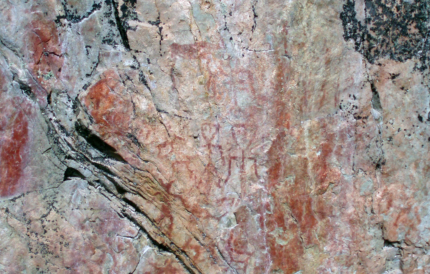
Prehistoric rock painting on stone surface with red and orange markings showing abstract patterns and figures
Prehistoric rock painting at Värikallio in Hossa National Park

Hossa National Park history and protected-area timeline

Hossa National Park was established in 2017, becoming Finland's 40th national park. The creation of the park represented the culmination of conservation efforts to protect the natural values of the Hossa area in Kainuu. The announcement of the new national park was made as part of Finland's centenary celebrations in 2017, marking a significant milestone in the country's environmental protection efforts. The establishment expanded Finland's national park network, which has grown from just one park in 1938 to 40 parks today.

Hossa National Park landscape and geographic character

The landscape of Hossa National Park features the characteristic terrain of eastern Finland, characterized by extensive boreal forests, numerous lakes, and wetlands. The region belongs to the Finnish Lakeland area, with a terrain shaped by glacial processes that created the lake-dotted landscape. Coniferous forests dominate the vegetation, with pine and spruce forests covering much of the area. The interplay between forest and water characterizes the visual character of the region.
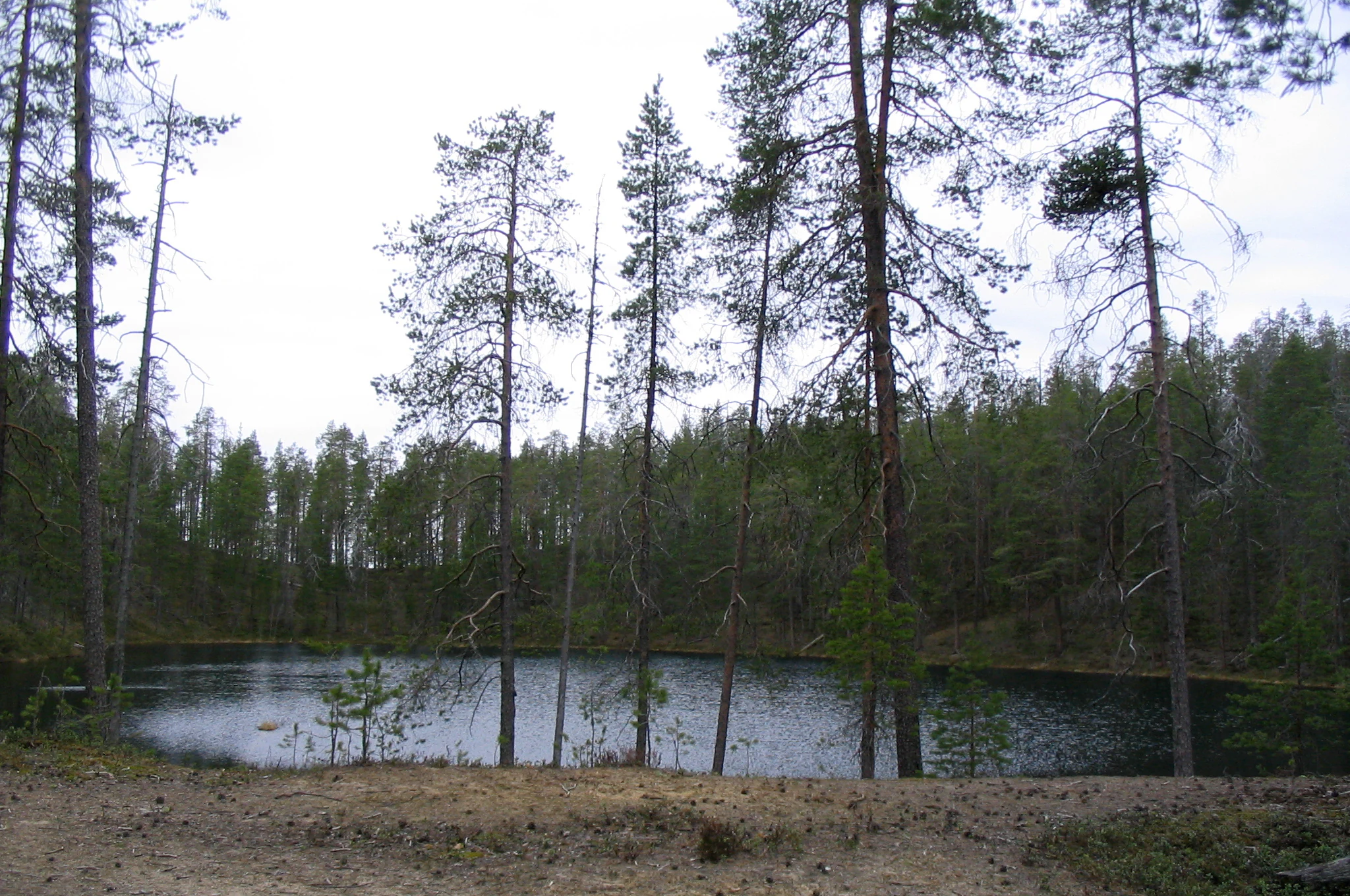
Tall pine trees and forest vegetation surrounding a small pond on an overcast day with open ground in the foreground
A kettle pond surrounded by forest in Hossa National Park, Finland

Hossa National Park ecosystems, habitats, and plant life

Hossa National Park protects important boreal forest ecosystems typical of eastern Finland. The forests of the region represent the northern boreal vegetation zone, characterized by coniferous species adapted to the continental climate. The park's natural values include old-growth forests, mires, and lake ecosystems that support biodiversity in the Kainuu region. The protected area contributes to the conservation of Finland's boreal natural heritage.

Hossa National Park conservation status and protection priorities

As a national park established in 2017, Hossa contributes to Finland's commitment to protecting representative samples of the country's natural landscapes. The park protects boreal forest and lake ecosystems in the Kainuu region, adding to the network of 40 national parks that cover diverse Finnish environments from southern archipelagos to northern fell regions. The national park status provides permanent protection to the area's natural values.

Hossa National Park cultural meaning and human context

The Hossa area is located in Kainuu, a region in eastern Finland known for its sparse population and extensive forests. The area has historically been shaped by forestry and subsistence activities typical of rural northern Finland. The establishment of the national park reflects contemporary values placed on wilderness conservation and sustainable nature tourism in Finland.

Top sights and standout views in Hossa National Park

Hossa National Park represents Finland's newest national park, established in 2017 as part of the country's centenary celebrations. The park protects boreal forest landscapes in the Kainuu region of eastern Finland and provides opportunities for wilderness recreation in one of Finland's least populated areas.

Best time to visit Hossa National Park

The best time to visit Hossa National Park follows the typical Finnish outdoor recreation season. Summer months offer opportunities for hiking, fishing, and boating in the lakes and forests. Winter provides possibilities for cross-country skiing and snowmobile excursions across the snowy landscape. The shoulder seasons of spring and autumn offer quieter visitor experiences with changing natural conditions.
Monthly climate preview

Measuring historical temperature cycles and precipitation averages across the subarctic landscape

Long-Term Climate Normals and Weather by Month in Hossa National Park

Historical measurements from a representative elevation of 246 meters reveal severe subarctic winters below minus ten degrees Celsius alongside mild summers with peak precipitation. Accessing the complete monthly profile provides essential statistics for comparing long-term average temperature shifts and monthly precipitation variations.
Annual mean0 °C
-13 °C15 °C
Jan-13°
Feb-12°
Mar-7°
Apr-2°
May
Jun12°
Jul15°
Aug13°
Sep
Oct
Nov-6°
Dec-10°
Warmest month
July

15.1 °C

Coolest month
January

-12.8 °C

Wettest month
July

3.8 mm/day

Driest month
February

1.4 mm/day

Park location guide

Geography guide, regional context, and park location map for Hossa National Park

Hossa National Park park geography, regions, and map view in Finland

Understand where Hossa National Park sits in Finland through a broader geographic reading of the surrounding landscape, nearby location context, and its mapped position within the national park landscape.

How Hossa National Park fits into Finland

Finland, officially the Republic of Finland, is a Nordic country in Northern Europe with a population of 5.6 million. It borders Sweden, Norway, and Russia, with the Gulf of Bothnia to the west and the Gulf of Finland to the south. The country gained independence from Russia in 1917 and is a unitary parliamentary republic. Its landscape is characterized by extensive boreal forests and over 180,000 lakes.

Wider geography shaping Hossa National Park in Finland

Finland is located in Northern Europe, occupying a peninsula bordered by the Gulf of Bothnia to the west and the Gulf of Finland to the south. It shares land borders with Sweden to the northwest, Norway to the north, and Russia to the east. The terrain is predominantly flat with extensive forest coverage and numerous lakes.

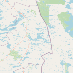
Map view of Hossa National Park

Use this park location map to pinpoint Hossa National Park in Finland, understand its exact geographic position, and read its mapped placement within the surrounding landscape more clearly.

Pigeon | © OpenStreetMap contributors
Recorded earthquake history

Explore the Historical Seismic Catalogue for Hossa National Park

Examine documented earthquake records associated with the area surrounding Hossa National Park. MoriAtlas provides a transparent, data-driven look at regional seismic history, offering details on event timing and proximity to help understand the geography of this boreal wilderness in Finland.

Hossa National Park Earthquake History

Catalogued events

1 event

Strongest magnitude

Magnitude 3.5

Most recent event

Feb 21, 1989

This history includes earthquakes recorded inside the park or within 50 km of its borders

A Visual Atlas of Hossa National Park: Terrain Features, Protected Habitats, and Wilderness Character in Eastern Finland

Hossa National Park Photos: Discover Finland's Boreal Forest Landscapes and Lake Scenery

Explore a curated collection of Hossa National Park images to visually understand its distinctive boreal forests, numerous glacial lakes, and the tranquil wilderness character of Eastern Finland. These park photos provide essential insight into the protected landscapes and diverse habitats, offering a clear visual reference for Finland's newest national park environment.

Prehistoric rock painting on stone surface with red and orange markings showing abstract patterns and figures

Modern visitor center building with parking lot, cars, and flagpoles surrounded by pine forest

Tall pine trees and forest vegetation surrounding a small pond on an overcast day with open ground in the foreground

Park atlas

Compare Hossa National Park with Finland's other protected areas, exploring the surrounding boreal forests and vast lake district geography.

Discover More National Parks and Protected Areas Near Hossa National Park in Finland

Explore other national parks and protected areas close to Hossa National Park, tracing the distinct boreal forest landscapes and lake regions of Eastern Finland. Understanding the regional spread of Finland's conservation landscapes offers valuable context for comparing park characteristics and their place within the broader Nordic geography.
Watercolor landscape featuring green hills, pine trees, and a yellowish field
National parkFinland
39 km away#1 closest

Northwest

Syöte National Park: Mapped Protected Landscape and Fell Geography in Finland

Explore Finland's southernmost fell and diverse northern wilderness.

Delve into the protected territory of Syöte National Park, a key national park in northern Finland. This page highlights the park's distinct geographic features, including its southernmost fell, Iso-Syöte, alongside expansive mire systems and old-growth boreal forests. Understand the mapped boundaries and the unique ecological transition zone it represents within the Finnish atlas, offering a comprehensive view of its landscape context and protected area status.

Area
299 km²
Established
2000
IUCN
II
Visitors
88.2K annual
National parkRepublic of Karelia
About 59 km away#2 closest

Southeast

Kalevalsky National Park: Protected Taiga and Boreal Landscapes in the Republic of Karelia

Ancient old-growth pine forests and glacial terrain.

Kalevalsky National Park protects one of the last remaining large, intact stretches of virgin taiga in Northern Europe. Situated along the border of the Republic of Karelia, this landscape includes dense coniferous forest, complex drainage networks, and peatland mires. The park functions as a major habitat for forest-dwelling mammals and maintains the ecological integrity of the Fennoscandian Shield region through its preserved forest cover and diverse freshwater environments.

Area
744 km²
Established
2007
IUCN
II
Relief
Lowland
National parkRepublic of Karelia
About 60 km away#3 closest

Southeast

Kalevalsky National Park: Boreal Wilderness and Protected Landscapes in the Republic of Karelia

Ancient taiga ecosystems and glacial terrain mapped.

Located near the Russian-Finnish border, Kalevalsky National Park encompasses 74,400 hectares of rare primeval boreal forest. The park offers insight into the Baltic Shield's geological history and provides a map of extensive marshlands and lake basins that define this remote Karelian region.

Area
744 km²
Established
2007
IUCN
II
Relief
Lowland
Watercolor illustration of a landscape with lake, trees, and hills
National parkRepublic of Karelia
72 km away#4 closest

North

Paanajärvi National Park: Protected Boreal Wilderness and Karelian Landscape Atlas

Mapping the old growth taiga forests and mountain terrain of northwestern Russia.

Located in the Republic of Karelia, Paanajärvi National Park is a significant protected area of boreal forest and lake ecosystems. This landscape, characterized by the Maanselkä hills and the summit of Nuorunen, offers a pristine look at the intact wilderness of northern Europe. Examine the mapped boundaries and geographic features that define this essential transboundary conservation area.

Area
1,043.71 km²
Established
1992
IUCN
II
Relief
Highland
Watercolor illustration showing a landscape with green vegetation, hills, and stylized human figures
National parkLapland
74 km away#5 closest

Northwest

Riisitunturi National Park: Explore Protected Landscape and Lapland Geography

Mapped boundaries of a national park in northern Finland.

Delve into the protected landscape of Riisitunturi National Park, a key national park situated in the expansive region of Lapland, Finland. This MoriAtlas entry provides detailed geographic context, focusing on the park's mapped boundaries and its role within the natural terrain of northern Finland. Understand its identity as a protected area and its significance within a broader atlas of natural landscapes.

Area
77 km²
Established
1982
IUCN
II
Visitors
58.8K annual
Watercolor illustration of a river flowing through a forested landscape with mountains in the background
National parkLapland
76 km away#6 closest

North

Oulanka National Park: Protected Landscape Atlas and Geographic Context in Lapland

Explore mapped boundaries and regional terrain.

Discover Oulanka National Park as a distinct protected landscape entity within the extensive northern region of Lapland, Finland. This page provides structured geographic information, focusing on the park's mapped area, its regional setting, and its identity as a national park. MoriAtlas facilitates an atlas-driven understanding of Oulanka National Park's place in Finland's protected lands and its inherent natural terrain.

Area
270 km²
Established
1956
IUCN
II
Visitors
187.4K annual
A watercolor painting showing a panoramic view of a river winding through a green taiga forest with distant mountains in the background.
National parkRepublic of Karelia
About 87 km away#7 closest

Northeast

Paanajärvi National Park: Mapping the Boreal Wilderness of the Republic of Karelia

Sub-Arctic taiga ecosystems and glacial mountain geography

Paanajärvi National Park represents a protected mosaic of boreal forests, mires, and high-altitude fells near the Arctic Circle. The area features internationally significant geological formations, including layered intrusions and complex river networks, which form a critical link in the broader Fennoscandian conservation landscape.

Area
1,045 km²
Established
1992
IUCN
II
Visitors
5K annual
Watercolor illustration showing a lake, trees, and hills under a light sky
National parkLapland
About 138 km away#8 closest

North

Salla National Park: Mapped Protected Landscape in Lapland, Finland

Explore its geographic context and protected area identity.

Understand Salla National Park as a distinct protected landscape situated within the expansive northern Finnish region of Lapland. This MoriAtlas entry focuses on its identity as a national park, detailing its mapped boundaries and geographic setting. Discover how Salla National Park contributes to the atlas of protected areas, offering a specific point of reference for exploring the natural terrain and regional geography of this subarctic territory.

Area
99.83 km²
Established
2022
IUCN
II
Visitors
55.9K annual

Common questions about visiting, size, designation, and location context for Hossa National Park

Hossa National Park FAQs for park facts, access, geography, and protected area context

Find quick answers about Hossa National Park, including protected-area facts, park geography, trail and visitor context, and how the park fits into its surrounding country and regional landscape.
MoriAtlas Explorer

Continue Your Protected Areas Search Across the Global Atlas

Deepen your exploration by continuing the structured search for national parks and protected areas worldwide. Utilize the comprehensive filtering capabilities to compare different conservation landscapes and refine your understanding of global park geography. Discover more about the distribution and characteristics of protected natural areas.

Global natural geography