

Mori Atlas logo
National parkIkara-Flinders Ranges National Park

Understand the protected area boundaries and natural terrain of this Australian national park.

Ikara-Flinders Ranges National Park: Mapped Protected Landscape Geography in Australia

Ikara-Flinders Ranges National Park stands as a significant protected landscape within Australia, offering a unique lens for exploring geographic context and natural terrain. This national park serves as a key entity for understanding regional patterns and mapped boundaries, providing structured insight into Australia's conservation areas. Delve into the specific geography of Ikara-Flinders Ranges National Park to appreciate its distinct role within the national atlas of protected lands.

mountain landscapesgeological heritageAboriginal cultural heritageWilpena Poundgorgessemi-arid ecosystems

Ikara-Flinders Ranges National Park

National park

Park overview

Structured park overview, official facts, and landscape profile for Ikara-Flinders Ranges National Park

Ikara-Flinders Ranges National Park park facts, protected area profile, and essential visitor context

Review the core facts for Ikara-Flinders Ranges National Park, including designation, size, terrain, visitor scale, habitats, and operating context in one park-focused overview.

About Ikara-Flinders Ranges National Park

Ikara-Flinders Ranges National Park stands as one of South Australia's premier protected areas, preserving a landscape of extraordinary geological, ecological, and cultural significance. The Flinders Ranges themselves represent an ancient mountain chain that began forming over 600 million years ago during the Precambrian era, with the park protecting some of the most visually spectacular and geologically informative sections of this ancient terrain. The park's central feature, Wilpena Pound, was formed through the erosion of a massive syncline, creating a natural bowl approximately 17 kilometers long and 8 kilometers wide, with peaks rising 500 to 700 meters above the surrounding plains. The landscape encompasses the main万年 range of the Flinders, including the Heysen Mountains, and features deeply incised gorges such as Bunyeroo Gorge, Brachina Gorge, and Aroona Gorge that reveal the region's complex geological history through exposed rock strata. Visitors to the park encounter a landscape of remarkable visual contrast, from the craggy peaks and ridgelines of theRanges to the relatively flat desert plains that surround them, with vegetation adapted to the semi-arid conditions creating distinctive patterns across the terrain.

Quick facts and research context for Ikara-Flinders Ranges National Park

Ikara-Flinders Ranges National Park is located in the Northern Flinders Ranges of South Australia, approximately 430 kilometers north of Adelaide. The park features the spectacular Wilpena Pound, a large quartzite formation creating a natural amphitheater roughly 80 square kilometers in extent. The landscape includes the Heysen Range, deeply eroded gorges, and ancient conformations that expose geological strata spanning hundreds of millions of years. The region experiences a semi-arid climate with hot summers and mild winters, influencing the park's distinct vegetation communities and wildlife adaptations.

Park context

Deeper park guide and search-rich context for Ikara-Flinders Ranges National Park

Ikara-Flinders Ranges National Park history, landscape, wildlife, and travel context

Explore Ikara-Flinders Ranges National Park through its history, landscape character, ecosystems, wildlife, conservation priorities, cultural context, and seasonal travel timing in a structured park guide built for atlas discovery and search intent.

Why Ikara-Flinders Ranges National Park stands out

The park is best known for Wilpena Pound, one of Australia's most recognizable natural landmarks, which rises dramatically from the surrounding plains as a massive eroded basin ringed by cliffs. The Flinders Ranges also contain some of Earth's oldest visible geological sequences, with rock formations exceeding 600 million years in age. The Adnyamathanha cultural landscape, with its extensive rock art sites, sacred sites, and living Aboriginal heritage, represents another defining feature that distinguishes this park from other Australian protected areas.

Ikara-Flinders Ranges National Park history and protected-area timeline

The Flinders Ranges have been continuously occupied by Aboriginal people for tens of thousands of years, with the Adnyamathanha people maintaining deep cultural connections to this landscape that persist today. European exploration of the region began in the early nineteenth century, with explorers including Matthew Flinders, after whom the ranges are named, documenting the dramatic terrain. The area's mineral deposits attracted mining activity in various periods, with some legacy impacts still visible in the landscape. Formal protection of the Flinders Ranges began with the establishment of the Flinders Ranges National Park in 1945, later expanded and renamed as Ikara-Flinders Ranges National Park to incorporate the Adnyamathanha language name Ikara, meaning meeting place. This renaming acknowledged the park's significance to Aboriginal people and represented a commitment to integrating Indigenous knowledge and perspectives into park management.

Ikara-Flinders Ranges National Park landscape and geographic character

The landscape of Ikara-Flinders Ranges National Park presents one of Australia's most geologically dramatic and visually striking environments. The terrain is dominated by the long, craggy ridgelines of the Flinders Ranges, which rise abruptly from the surrounding semi-arid plains, creating a landscape of remarkable topographic contrast. Wilpena Pound dominates the central portion of the park, its distinctive amphitheater shape formed through the differential erosion of folded quartzite and shale strata, with the rim peaks of St. Mary's Peak and other summits rising sharply above the internal basin. The park contains numerous deeply incised gorges that have been carved by seasonal water flows, with walls of exposed rock revealing geological layers that tell the story of the region's ancient past. The landscape includes rugged hill country, steep cliff faces, jumbled boulder fields, and relatively flat interdune areas, all unified by the distinctive red-brown coloration of the exposed rock and the sparse but resilient vegetation cover.

Ikara-Flinders Ranges National Park ecosystems, habitats, and plant life

The ecosystems within Ikara-Flinders Ranges National Park reflect the transition between Australia's arid interior and more temperate southern regions, creating a unique ecological character. The park protects vegetation communities adapted to semi-arid conditions, including open woodlands dominated by Cypress Pine and Mallee eucalypts on the lower slopes, with more sparse shrubland and grassland communities on the exposed ridgelines and plains. The deeply eroded gorges support microenvironments with greater moisture availability, allowing for more lush vegetation including River Red Gums along watercourses and dense shrub thickets in sheltered locations. These vegetation patterns in turn support a range of wildlife species adapted to the challenging climate, with the park serving as an important refuge for species that require the shelter and resources provided by the gorges and rock outcrops.

Ikara-Flinders Ranges National Park wildlife and species highlights

The wildlife of Ikara-Flinders Ranges National Park reflects the park's position in Australia's semi-arid zone, with species adapted to the harsh conditions and seasonal extremes. Mammals inhabiting the park include the Yellow-footed Rock-wallaby, a species particularly associated with the rocky cliff environments and gorges, as well as Western Grey Kangaroos, Common Wallaroos, and various small marsupials and rodents. The birdlife is diverse and includes numerous species adapted to the outback environment, with emus and various parrot and cockatoo species commonly encountered. Reptiles are well represented, with numerous snake and lizard species thriving in the rocky terrain, while the park's waterholes and creek systems support fish and other aquatic life during periods of flow.

Ikara-Flinders Ranges National Park conservation status and protection priorities

Ikara-Flinders Ranges National Park plays a crucial role in protecting South Australia's mountainous environments and the unique biodiversity they contain. The park is recognized as an Important Bird Area, supporting populations of vulnerable and restricted-range species. The protection of the Flinders Ranges also preserves significant geological heritage, with the park containing some of the world's best examples of late Precambrian and early Cambrian fossil assemblages. The integration of Aboriginal cultural values into park management, including joint management arrangements with Traditional Custodians, represents an important approach to conservation that acknowledges the long-term relationship between people and this landscape.

Ikara-Flinders Ranges National Park cultural meaning and human context

The Adnyamathanha people are the Traditional Custodians of the Ikara-Flinders Ranges, with cultural connections to this landscape extending back through countless generations. The park contains numerous sites of Aboriginal cultural significance, including rock art locations, ceremonial sites, and places with Dreaming associations that continue to hold meaning for contemporary Aboriginal communities. The use of the name Ikara, meaning meeting place, reflects both the historical role of this landscape as a gathering location for Aboriginal groups and its ongoing significance as a place of cultural continuity. The integration of Adnyamathanha knowledge, language, and perspectives into park management represents an important model for collaborative conservation that honors Indigenous heritage.

Top sights and standout views in Ikara-Flinders Ranges National Park

The park's most prominent feature is Wilpena Pound, offering visitors the opportunity to walk into its interior or ascend to the rim for sweeping views across this natural amphitheater. The network of gorges throughout the park, including Bunyeroo and Brachina Gorges, provide relatively accessible routes into the more sheltered and visually spectacular sections of the Ranges. The geological significance of the region, with exposed strata spanning hundreds of millions of years, offers unique educational opportunities for those interested in Earth's deep history. The cultural heritage of the Adnyamathanha people, including rock art sites and living cultural traditions, provides visitors with connections to the human history of this ancient landscape.

Best time to visit Ikara-Flinders Ranges National Park

The cooler months from April to October generally offer the most comfortable conditions for exploring Ikara-Flinders Ranges National Park, with mild daytime temperatures and minimal rainfall allowing for extended hiking and sightseeing. Summer temperatures can be extreme, limiting daytime activity and increasing fire risk during dry periods. Winter brings the possibility of rain, which can temporarily close roads and tracks but also transforms the landscape with flowering plants and flowing water in the creeks. Spring offers particularly spectacular wildflower displays and pleasant touring conditions, though this is also a popular period with higher visitor numbers.

Monthly climate preview

Long-term temperature ranges and precipitation patterns across representative coordinates

Ikara-Flinders Ranges National Park Climate Normals and Weather by Month

Representative coordinate measurements track measured annual temperature swings and low daily precipitation rates for Ikara-Flinders Ranges National Park. Opening the complete monthly climate dataset provides a full twelve-month statistical breakdown for the terrain.
Annual mean18 °C
9 °C27 °C
Jan27°
Feb26°
Mar23°
Apr18°
May13°
Jun10°
Jul
Aug11°
Sep14°
Oct18°
Nov22°
Dec25°
Warmest month
January

27.3 °C

Coolest month
July

9 °C

Wettest month
February

1 mm/day

Driest month
March

0.3 mm/day

Park location guide

Geography guide, regional context, and park location map for Ikara-Flinders Ranges National Park

Ikara-Flinders Ranges National Park park geography, regions, and map view in Australia

Understand where Ikara-Flinders Ranges National Park sits in Australia through a broader geographic reading of the surrounding landscape, nearby location context, and its mapped position within the national park landscape.

How Ikara-Flinders Ranges National Park fits into Australia

Australia is a constitutional monarchy and federal parliamentary democracy comprising six states and ten territories. With a population of nearly 28 million, it is one of the world's most urbanised countries, with most people concentrated on the eastern seaboard. The country has a high Human Development Index and is known for its cultural diversity, ancient Aboriginal heritage, and unique wildlife.

Wider geography shaping Ikara-Flinders Ranges National Park in Australia

Australia occupies the entire Australian continent, the island of Tasmania, and numerous smaller islands. It is the world's flattest and driest inhabited continent, featuring vast deserts in the interior (the Outback), tropical rainforests along the eastern coast, and a coastline bordering the Indian and Pacific Oceans.

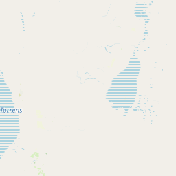
Map view of Ikara-Flinders Ranges National Park

Use this park location map to pinpoint Ikara-Flinders Ranges National Park in Australia, understand its exact geographic position, and read its mapped placement within the surrounding landscape more clearly.

Pigeon | © OpenStreetMap contributors

Location context for Ikara-Flinders Ranges National Park

South Australia
Park atlas

Connect with broader protected-area geography and compare similar landscapes in the Ikara-Flinders Ranges region.

Explore More National Parks and Protected Areas Near Ikara-Flinders Ranges National Park

After exploring Ikara-Flinders Ranges National Park's dramatic mountain landscapes and ancient geology, browse other significant national parks and protected areas across South Australia's vast outback. This expanded regional view allows you to compare diverse conservation landscapes, trace the geological heritage, and discover more Aboriginal cultural sites, enriching your atlas-style park exploration.
National parkSouth Australia
About 54 km away#1 closest

Northwest

Lake Torrens National Park: Explore South Australia's Remarkable Inland Salt Lake Geography

A unique protected landscape of arid plains and expansive salt flats.

Lake Torrens National Park offers an unparalleled exploration of Australia's remote outback, centered around a vast, ancient salt lake basin. This national park in South Australia provides a canvas of stark, minimalist terrain, featuring shimmering saltpans, arid gibber plains, and rocky outcrops. Understand the park's unique geographic identity, its ecological significance as a temporary wetland habitat, and its dramatic visual appeal for landscape photography and geological interest. It is a key protected area showcasing the extreme environment of Australia's interior.

Area
5,676.68 km²
Established
1991
IUCN
VI
Relief
Lowland
National parkSouth Australia
About 56 km away#2 closest

Northwest

Nilpena Ediacara National Park: South Australia National Park and Protected Landscape Identity

Mapped protected area within the regional geography of South Australia.

Nilpena Ediacara National Park represents a significant protected landscape within South Australia. This entry provides a detailed geographic context for the park, focusing on its role as a national park and its mapped boundaries. Delve into the specific atlas-driven understanding of this protected area, its landscape context, and its significance within the broader geographic framework of the Australian state.

Area
606.17 km²
Established
2021
IUCN
VI
Relief
Mountain
Nature reserveSouth Australia
About 92 km away#3 closest

Southwest

Buckaringa Sanctuary: Geographic Atlas and Protected Landscape Overview

Nature reserve terrain in the southern Flinders Ranges

Buckaringa Sanctuary serves as a key case study in arid landscape conservation within South Australia. This entry examines the reserve's unique geological features, including the deeply incised gorges and rocky ridges that define the Flinders Ranges. Through a focus on mapped boundaries and regional ecology, the content provides a clear understanding of the sanctuary's position in the Australian landscape, highlighting its role as a protected refuge of sandstone formations and native scrubland.

Area
20 km²
Established
1990
Relief
Mountain
Climate
Arid
National parkSouth Australia
About 93 km away#4 closest

Northeast

Vulkathunha-Gammon Ranges National Park: South Australia National Park Atlas Exploration

Mapped boundaries and regional geographic context.

Dive into the specifics of Vulkathunha-Gammon Ranges National Park, a designated national park situated in South Australia. This detailed resource focuses on its role as a protected landscape, providing users with critical geographic information. Understand the park's mapped boundaries and its relation to the broader regional geography, perfect for anyone engaged in atlas-based exploration of Australia's natural areas.

Area
1,257.23 km²
Established
1970
IUCN
II
Relief
Mountain
Nature reserveSouth Australia
About 123 km away#5 closest

Southwest

The Dutchmans Stern Conservation Park: Landscape Mapping and Regional Geography

Explore the ridgeline terrain of the southern Flinders Ranges

Discover the geographic identity of The Dutchmans Stern Conservation Park, a 3,695-hectare nature reserve in South Australia. This protected area centers on an elongated mountain ridge that supports distinct eucalypt habitats, including river red gum gullies and blue gum woodlands. The park boundary encompasses a vital topographic mosaic that provides a natural sanctuary within the broader, long-grazed pastoral plains of the southern Flinders Ranges.

Area
36.95 km²
Established
1987
IUCN
VI
Relief
Mountain
National parkSouth Australia
About 130 km away#6 closest

Northeast

Lake Frome National Park: Mapped Protected Area and Regional Geographic Identity in South Australia

Explore South Australia's unique landscape and park boundaries.

Lake Frome National Park offers a distinct focus for exploring the geography and protected landscape of South Australia. As a national park, it contributes to the mapped conservation network of the region, allowing for detailed study of its environmental context and geographic positioning. Discover the mapped terrain and regional park boundaries that define this significant protected area, crucial for a comprehensive atlas-based understanding of South Australia's natural heritage.

Area
2,582.4 km²
Established
1991
IUCN
VI
Relief
Lowland
Nature reserveSouth Australia
About 141 km away#7 closest

South

Black Rock Conservation Park: Protected Woodlands and Regional Geography in South Australia

Mapping ecological boundaries and outwash plain terrain

Black Rock Conservation Park provides a protected glimpse into the mid-north South Australian environment. This 119 hectare nature reserve preserves low woodland and chenopod understorey, serving as a significant bird habitat characterized by steep creek banks and outwash slopes originating from the surrounding rocky high points.

Area
1.19 km²
Established
1972
IUCN
III
Relief
Lowland
National parkSouth Australia
About 153 km away#8 closest

South

Mount Remarkable National Park: Protected Landscape Atlas and South Australia Geography

Explore mapped boundaries and natural terrain.

Mount Remarkable National Park serves as a vital protected area within South Australia's unique geographic setting. This MoriAtlas entry details the park's mapped boundaries and surrounding natural terrain, providing structured insight into its landscape character and regional geographic importance. Understand the park as a key element of Australia's protected lands atlas.

Area
166.18 km²
Established
1972
IUCN
VI
Visitors
50K annual

Common questions about visiting, size, designation, and location context for Ikara-Flinders Ranges National Park

Ikara-Flinders Ranges National Park FAQs for park facts, access, geography, and protected area context

Find quick answers about Ikara-Flinders Ranges National Park, including protected-area facts, park geography, trail and visitor context, and how the park fits into its surrounding country and regional landscape.
MoriAtlas Explorer

Continue Your Protected Areas Search Across the Global Atlas

Deepen your exploration by continuing the structured search for national parks and protected areas worldwide. Utilize the comprehensive filtering capabilities to compare different conservation landscapes and refine your understanding of global park geography. Discover more about the distribution and characteristics of protected natural areas.

Global natural geography