
Mori Atlas logo
Nature reserveIle-Balkhash Nature Reserve

Analyzing the ecological mosaic of river delta wetlands and steppe corridors in Almaty Region

Ile-Balkhash Nature Reserve: Mapped Protected Landscapes and Regional Geography in Kazakhstan

(State Nature Reserve "Ile-Balkhash")

The Ile-Balkhash Nature Reserve represents a critical protected area in southeastern Kazakhstan, encompassing the diverse delta of the Ili River where it meets Lake Balkhash. This landscape serves as a large-scale rewilding site, integrating riparian tugai forests, wetlands, and expansive semi-arid steppe. Through its unique terrain and active restoration of native wildlife, the reserve provides a vital case study in regional ecosystem connectivity and central Asian conservation geography.

river deltatugai forestwetlandsLake Balkhashsteppesemi-arid landscape
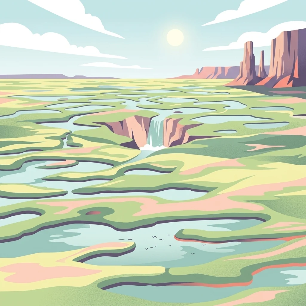
A stylized digital illustration of a wetland landscape with pools of water, a small waterfall, and rocky plateaus in the distance under a bright sun.

Ile-Balkhash Nature Reserve

Nature reserve

Park overview

Structured park overview, official facts, and landscape profile for Ile-Balkhash Nature Reserve

Ile-Balkhash Nature Reserve park facts, protected area profile, and essential visitor context

Review the core facts for Ile-Balkhash Nature Reserve, including designation, size, terrain, visitor scale, habitats, and operating context in one park-focused overview.

About Ile-Balkhash Nature Reserve

Ile-Balkhash Nature Reserve occupies a strategically important wedge of land along the southern and southeastern shores of Lake Balkhash, at the point where the Ili River disperses into the wetland systems that have shaped this end of the lake for thousands of years. The protected area sits in the Balkhash District of Almaty Region, and its boundaries are designed to encompass not just the river mouth but the broader transition from delta wetlands to the dry steppe that surrounds the lake.

The reserve is unusual in that it was created with a specific restoration target in mind: returning the Amur tiger to the wild landscapes of Kazakhstan. Tigers were extirpated here by the mid-twentieth century, and for decades the Ili delta and the surrounding tugai forests existed without an apex predator. By designating a large contiguous protected block, the Government of Kazakhstan aimed to create the conditions under which tigers, their prey, and the habitats on which both depend could all be rehabilitated at once.

What makes Ile-Balkhash particularly distinctive is that it is not only a habitat reserve but a working reintroduction site. Amur tigers from European zoo facilities and later from the Russian Far East have been brought in, while prey populations such as Bukhara deer and kulans are being actively restocked and monitored with satellite collars and camera traps. The reserve therefore combines traditional protected-area functions with intensive, hands-on wildlife management that is rare in this part of the world.

Quick facts and research context for Ile-Balkhash Nature Reserve

Ile-Balkhash Nature Reserve was formally established on 27 June 2018 by Resolution No. 381 of the Government of Kazakhstan. It covers roughly 415,000 hectares of land surrounding the Ili River delta where it flows into Lake Balkhash in the country's southeast.

The reserve is administered by the Forestry and Wildlife Committee under Kazakhstan's Ministry of Agriculture, while conservation delivery is led in partnership with the World Wildlife Fund and the Association for the Conservation of Biodiversity of Kazakhstan. Its IUCN category is VI, designating it as a protected area with sustainable use of natural resources rather than a strictly no-use zone.

Protection and recognition

Terrestrial conservation framework and formal recognition records

Ile-Balkhash Nature Reserve Protection Status and Governance

Terrestrial protection status and management scope define the baseline conservation framework for Ile-Balkhash Nature Reserve. Documented records outline the administrative parameters governing this protected area within the regional landscape.

Protection details

Protection scope
Terrestrial
Park context

Deeper park guide and search-rich context for Ile-Balkhash Nature Reserve

Ile-Balkhash Nature Reserve history, landscape, wildlife, and travel context

Explore Ile-Balkhash Nature Reserve through its history, landscape character, ecosystems, wildlife, conservation priorities, cultural context, and seasonal travel timing in a structured park guide built for atlas discovery and search intent.

Why Ile-Balkhash Nature Reserve stands out

The reserve is best known as the flagship site for the reintroduction of the Amur tiger to Kazakhstan and to Central Asia more broadly. After decades without wild tigers, the Pribalkhashye region was identified as a candidate landscape capable of supporting the species once again, and Ile-Balkhash was established as the dedicated recovery zone. Beyond tigers, the reserve has become known for its parallel reintroduction of Bukhara deer and kulans (Asiatic wild ass), a combination that effectively makes it a laboratory for restoring a complete mammalian community that once existed along the Ili and around Lake Balkhash.
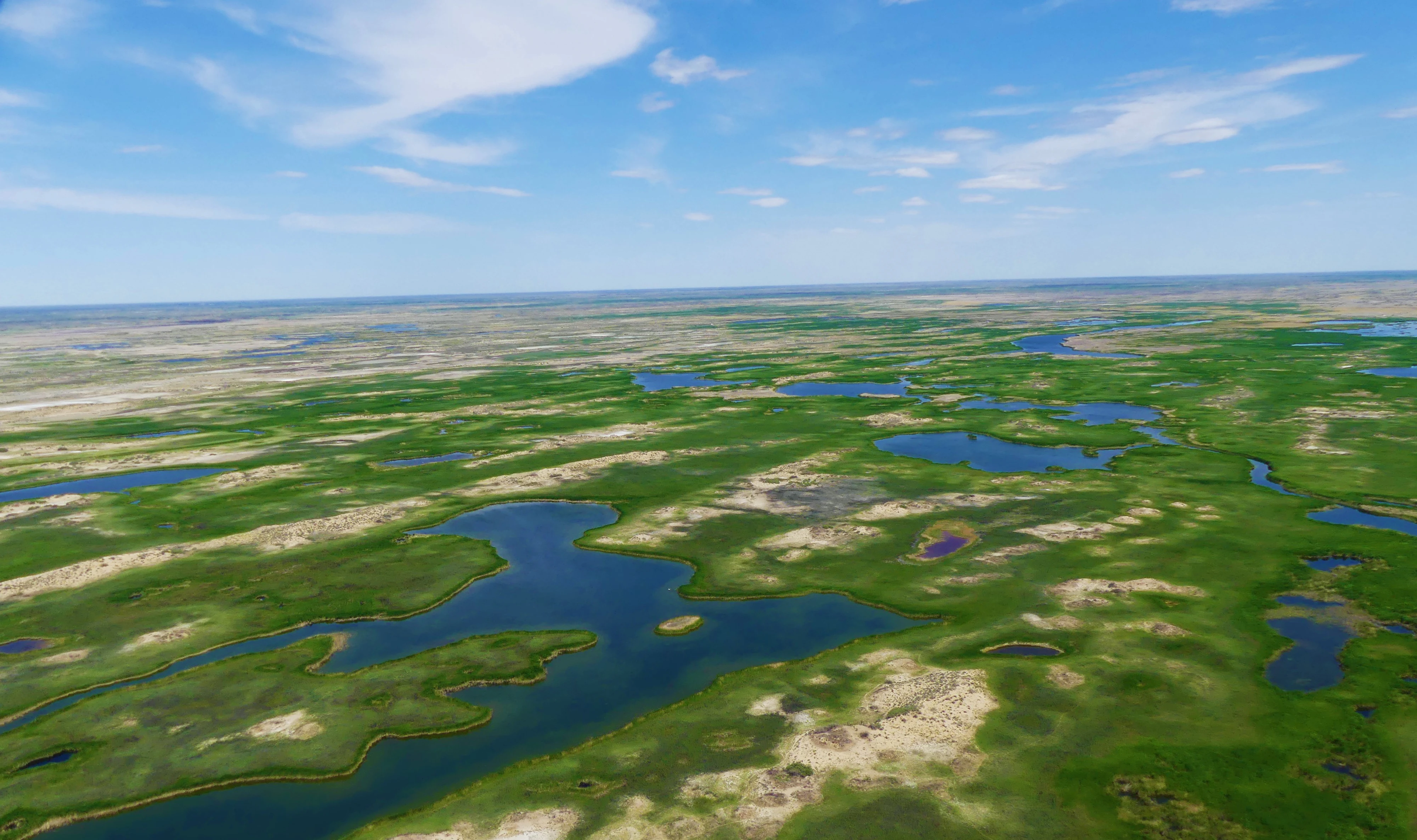
A wide aerial view of a vast, flat landscape featuring a mosaic of bright green marshland and meandering blue water bodies under a clear blue sky.
Aerial view of the sprawling wetland ecosystem at Ile-Balkhash Nature Reserve.

Ile-Balkhash Nature Reserve history and protected-area timeline

The reserve was created by Government of Kazakhstan Resolution No. 381, dated 27 June 2018, making it one of the youngest major protected areas in the country. Its establishment was closely tied to Kazakhstan's participation in the broader initiative to restore the Amur tiger to Central Asia, an effort organized in partnership with the World Wildlife Fund and supported by international donors including the government of the Netherlands and various philanthropic contributors.

The first major operational milestone came in December 2018, when a founding group of five Bukhara deer, bred in the Syrdarya-Turkestan regional park, arrived in the reserve and entered an acclimation enclosure. They were released into the wild in September 2019, with satellite collars fitted to two females to track their movements. In the following years, additional batches of deer were released, including large cohorts in 2021 and 2022 that pushed the reserve's population past 150 individuals, with the first fawns documented in the wild.

Parallel work began on kulans in 2021, when enclosures were built and the first animals were later translocated from the Altyn-Emel National Park. The most visible development came in 2024, when two Amur tigers were delivered from a Dutch predator center at Landgoed Hoenderdaell, and in 2025-2026 with further arrivals of tigers sourced from the Russian Far East. The reserve's history is therefore best understood not as a single founding moment but as a phased, ongoing restoration program that continues to evolve.

Ile-Balkhash Nature Reserve landscape and geographic character

The reserve's landscape is defined by the meeting of two very different systems: the Ili River and Lake Balkhash. The Ili is one of the major rivers of Central Asia, and as it approaches the lake it slows and spreads, forming a broad delta of channels, reedbeds, flood meadows, and silt islands. These deltaic wetlands, together with the surrounding tugai (riparian forest) corridors, are the ecological heart of the reserve.

Away from the river, the terrain transitions into the semi-arid plains and steppes that fringe the southern shore of Lake Balkhash. This is a region of strong continental climate, with hot summers and cold winters, low overall precipitation, and a vegetation pattern shaped by both river moisture and aridity. The combination of riparian habitats, steppe, and lake-edge environments gives the reserve a striking ecological mosaic within a comparatively compact area.

Ile-Balkhash Nature Reserve ecosystems, habitats, and plant life

Ile-Balkhash protects a transitional ecosystem where Central Asian desert, steppe, and riverine wetland overlap. The tugai forests of the Ili delta, dominated by dense thickets of poplar, willow, and tamarisk, represent one of the most biologically distinctive habitats in the country. They support a different suite of species than either the open steppe or the lake itself, and are the habitat type most closely associated with the reserve's ambitions for big-mammal restoration.

The reedbeds and open waters of the delta are rich in waterfowl, while the surrounding steppe and semi-desert landscapes carry their own characteristic flora and fauna adapted to drought, salinity, and seasonal temperature extremes. Ecologically, the reserve's importance lies in this interface: it is a place where moisture-dependent tugai species and dryland steppe species coexist within a single managed landscape.

Ile-Balkhash Nature Reserve wildlife and species highlights

The reserve's wildlife profile is shaped above all by its role as a reintroduction site. Amur tigers are the headline species, with founder animals brought in from European and Russian source populations and held initially in specialized enclosures, with the longer-term goal of establishing a free-ranging breeding population. Bukhara deer, a subspecies of red deer adapted to Central Asian riverine habitats, have been restocked in successive releases since 2018 and now form a growing breeding population monitored with satellite collars and camera traps.

Kulans, the Asiatic wild ass, form the third pillar of the reserve's mammal restoration effort. Although not a primary prey of tigers, their reintroduction helps reconstruct the broader herbivore community once present in the Pribalkhashye region. Beyond these flagship mammals, the Ili delta and Balkhash shoreline are rich in waterfowl and birdlife, and the surrounding steppe supports a range of typical Central Asian fauna adapted to semi-arid conditions.

Ile-Balkhash Nature Reserve conservation status and protection priorities

Ile-Balkhash is one of the most ambitious large-mammal restoration landscapes in post-Soviet Central Asia. Its IUCN Category VI designation reflects its dual role as a biodiversity reserve and a managed ecosystem in which natural resource use remains possible under controlled conditions, allowing traditional land uses to continue alongside active wildlife management.

From a conservation perspective, the reserve's significance is twofold. It anchors the recovery of the Amur tiger in a region where the species has been absent for generations, while simultaneously reviving prey populations such as Bukhara deer and kulans that had been reduced or eliminated across much of their former range. The whole program is supported by international partners including WWF, the government of the Netherlands, UNDP, and a coalition of donors, making it a rare long-term, externally backed rewilding initiative in this part of the world.

Ile-Balkhash Nature Reserve cultural meaning and human context

On the official name, the reserve is sometimes described as a national park in popular usage, but it is legally constituted as a Kazakhstani state nature reserve (rezervat / memlekettik tabigi rezervat), a designation that reflects a more protection-focused mandate than a typical recreational national park.

Top sights and standout views in Ile-Balkhash Nature Reserve

Ile-Balkhash Nature Reserve is distinctive for its combination of habitats: Ili River tugai forests, delta wetlands, and the steppe that surrounds them. The single rarest feature of the reserve today is the active breeding program for Amur tigers, with new founder animals still being translocated from Europe and Russia.

Equally important are the deer and kulan enclosures and extensive camera-trap and satellite-collar monitoring networks that document the wild-born offspring of reintroduced animals. A visit-oriented visitor should also note that the reserve is administered as a working conservation site with its own management committee, rather than as a mass-tourism destination, which gives the landscape a wild, undeveloped character typical of early-stage restoration projects.

Best time to visit Ile-Balkhash Nature Reserve

The region has a strongly continental climate, with hot, dry summers and cold winters. Spring and autumn tend to be the most comfortable periods for outdoor activity, when temperatures are milder and birdlife and large mammal movements are most visible. Winter brings harsh cold but produces a stark, quiet landscape across the delta and steppe.
Monthly climate preview

Trace long-term average temperature and precipitation rhythms across the protected landscape

Ile-Balkhash Nature Reserve Climate Normals and Monthly Weather Patterns

Representative coordinate records show wide annual temperature swings alongside steady monthly precipitation totals across the reserve. Reviewing the complete twelve-month climatology reveals detailed shifts in baseline conditions for the protected territory.
Annual mean8 °C
-13 °C27 °C
Jan-13°
Feb-10°
Mar
Apr11°
May18°
Jun25°
Jul27°
Aug24°
Sep17°
Oct
Nov-1°
Dec-9°
Warmest month
July

26.6 °C

Coolest month
January

-13.1 °C

Wettest month
November

0.6 mm/day

Driest month
September

0.2 mm/day

Park location guide

Geography guide, regional context, and park location map for Ile-Balkhash Nature Reserve

Ile-Balkhash Nature Reserve park geography, regions, and map view in Kazakhstan

Understand where Ile-Balkhash Nature Reserve sits in Kazakhstan through a broader geographic reading of the surrounding landscape, nearby location context, and its mapped position within the national park landscape.

How Ile-Balkhash Nature Reserve fits into Kazakhstan

Kazakhstan is a Central Asian country spanning vast steppes and plains, bordered by Russia, China, Kyrgyzstan, Uzbekistan, and Turkmenistan, with a coastline along the Caspian Sea. It gained independence from the Soviet Union in 1991 and has a population of approximately 20.5 million people. The country is officially secular but predominantly Muslim, with Kazakh and Russian as official languages.

Wider geography shaping Ile-Balkhash Nature Reserve in Kazakhstan

Kazakhstan occupies a vast territory in Central Asia, extending into Eastern Europe. Its terrain consists largely of hilly plateaus and plains, with lowlands covering about a third of the area. The southern and eastern regions are mountainous. The country borders Russia to the north and west, China to the east, Kyrgyzstan to the southeast, Uzbekistan to the south, and Turkmenistan to the southwest. It has a coastline along the Caspian Sea.

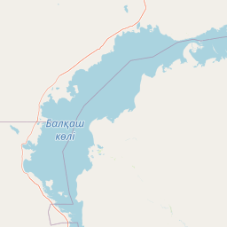
Map view of Ile-Balkhash Nature Reserve

Use this park location map to pinpoint Ile-Balkhash Nature Reserve in Kazakhstan, understand its exact geographic position, and read its mapped placement within the surrounding landscape more clearly.

Pigeon | © OpenStreetMap contributors

Location context for Ile-Balkhash Nature Reserve

Almaty Region

Visual reference guide to river delta wetlands, tugai forests, and steppe habitats

Ile-Balkhash Nature Reserve Landscape Photos and Protected Area Scenery

Visual documentation captures the defining geography of Ile-Balkhash Nature Reserve, showcasing the dynamic meeting of Ili River channels and Lake Balkhash shores. Photographic records provide clear insight into remote riparian corridors and semi-arid steppes that shape regional biodiversity.

A wide aerial view of a vast, flat landscape featuring a mosaic of bright green marshland and meandering blue water bodies under a clear blue sky.

An aerial shot of a vast, flat wetland ecosystem characterized by winding green grass islands separated by deep blue, irregular water channels.

Park atlas

Compare regional habitats, wetland networks, and connected conservation landscapes.

Explore Protected Areas and Parks Near Ile-Balkhash Nature Reserve

Browse other protected areas and national parks located within the surrounding regional geography. Comparing neighboring wildlife habitats and wetland terrains provides deeper context for regional conservation initiatives.
Watercolor illustration of a mountainous landscape with green hills, trees, and a river in the foreground
National parkKazakhstan
About 314 km away#1 closest

North

Karkaraly State National Nature Park: Kazakhstan's Mountain-Forest Protected Area

Discover unique geology, archaeology, and regional landscape context.

Delve into the distinctive protected landscape of Karkaraly State National Nature Park, situated in Kazakhstan's Karaganda Region. This park preserves a rare mountain-forest ecosystem with dramatic granite formations, ancient archaeological sites, and lakes, presenting a rich geographic contrast to the surrounding Kazakh Steppe. MoriAtlas provides structured insights into Karkaraly State National Nature Park's unique terrain, its conservation value, and its position within the broader regional geography of Central Asia.

Area
1,121.2 km²
Established
1998
IUCN
II
Relief
Mountain
Watercolor illustration showing rolling hills, distant mountains, and sparse vegetation
National parkAlmaty Region
About 328 km away#2 closest

Southeast

Altyn-Emel National Park: A Protected Landscape of Singing Dunes and Lunar Mountains

Explore unique geological wonders and ancient Saka history.

Discover Altyn-Emel National Park, a prominent national park located in Kazakhstan's Almaty Region. This protected area showcases an extraordinary diversity of landscapes, from the echoing Singing Dunes to the otherworldly Aktau mountains, often referred to as the 'lunar mountains' due to their vivid mineral hues. As a vital conservation zone, it safeguards Central Asian steppe ecosystems and significant Iron Age archaeological sites, offering a rich tapestry of natural beauty and historical depth for atlas exploration.

Area
4,600 km²
Established
1996
IUCN
II
Relief
Mixed relief
A pale, minimalist watercolor illustration of a soft, rolling landscape with light green and pink washes against a white background.
Wildlife reserveKaraganda Region
About 346 km away#3 closest

Northwest

Bugyly Sanctuary Wildlife Reserve and Protected Mountain Terrain in Karaganda Region

A protected zoological landscape in the heart of central Kazakhstan

Bugyly Sanctuary is a specialized wildlife reserve defined by its low mountain topography, rocky outcrops, and narrow stream-side groves. Situated in the Karaganda Region, the protected area functions as a vital refuge for argali sheep, roe deer, and various ground-nesting birds, standing as a testament to the diverse interior uplands of the Sarysu River basin.

Area
85 km²
Relief
Lowland
Water
Minor water
A watercolor illustration of a rolling, grassy landscape with gentle hills and light vegetation in pastel tones.
Natural monumentAlmaty Region
About 376 km away#4 closest

Southeast

Singing Dune (Поющий бархан) Natural Monument in the Almaty Region of Kazakhstan

A stationary desert landmark within the Dzungarian Alatau foothills.

Singing Dune (Поющий бархан) is a prominent geological landmark in the Altyn-Emel National Park of the Almaty Region. This massive sand barchan, anchored between two mountain ridges, is recognized for its unique ability to produce resonant organ-like sounds. The surrounding terrain blends arid desert dunes with the striking silhouettes of the Dzungarian Alatau foothills and the distant Ili River valley.

Relief
Upland
Scope
Terrestrial
Water
Minor water
Watercolor painting of a river, hills, and trees with pink and yellow sky tones
National parkAlmaty Region
About 381 km away#5 closest

Southeast

Ile-Alatau National Park: Protected Landscape Atlas and Almaty Region Geography

Mapped boundaries, diverse ecosystems, and mountain wilderness.

Ile-Alatau National Park is a key protected area in the Almaty Region of Kazakhstan, preserving a vast expanse of the Tian Shan mountain system. This national park showcases a dramatic vertical landscape, encompassing everything from lowland woodlands and relict spruce forests to expansive alpine meadows and glacial terrains. Its mapped boundaries define critical habitat for diverse wildlife and offer a profound insight into the complex ecological dynamics of high-altitude environments, making it an essential destination for atlas-based geographic discovery.

Area
2,000 km²
Established
1996
IUCN
II
Relief
Mixed relief
State or regional parkKyrgyzstan
About 392 km away#6 closest

South

Chong-Kemin Nature Park: Mapped Protected Landscape in Kyrgyzstan's Tian Shan Mountains

State or Regional Park with Alpine Valleys and Glacial Lakes

Chong-Kemin Nature Park offers a rich geographic exploration of Kyrgyzstan's Tian Shan mountain region. This state or regional park encompasses approximately 123,564 hectares, defined by the extensive Chong-Kemin River valley and seven glacial lakes. Its landscape provides crucial habitat within a protected area, showcasing alpine terrain and river ecosystems. Users interested in mapped protected areas and regional park geography will find Chong-Kemin Nature Park a key point for understanding Kyrgyzstan's natural heritage.

Area
1,235.64 km²
Established
1997
Relief
Mountain
Climate
Alpine
Watercolor illustration of a mountain lake with forests, distant mountains, and calm water reflecting the scenery
National parkAlmaty Region
About 400 km away#7 closest

Southeast

Kolsay Lakes National Park: Discover Protected Alpine Lakes in Almaty Region

Mapped Tian Shan mountain geography and glacial lake context.

Kolsay Lakes National Park is a significant protected area within the Almaty Region, celebrated for its breathtaking chain of three alpine lakes, often referred to as the 'Pearls of Tien Shan.' This national park showcases the rugged beauty of the Tian Shan mountains, with dramatic valleys, dense spruce forests, and pristine glacial waters. Understanding its geographic setting and mapped boundaries reveals the unique ecological and landscape value of this protected natural area.

Area
1,619 km²
Established
2007
IUCN
II
Relief
Mountain
Watercolor painting depicting a mountain range, lake, and grassy foreground under a pale sky
National parkAlmaty Region
About 403 km away#8 closest

East

Zhongar-Alatau National Park: Protected Mountain Landscape and Genetic Heritage Atlas

Almaty Region's critical wild apple forest and glaciated terrain.

Zhongar-Alatau National Park in Kazakhstan's Almaty Region is a significant protected landscape renowned for its role in conserving the genetic origins of cultivated apples. The park encompasses dramatic glaciated mountain ranges, deep canyons, and diverse ecosystems within the Dzungarian Alatau. Its mapped boundaries define an area vital for protecting unique wild fruit tree species, including the Sievers apple, and preserving the distinctive alpine terrain of southeastern Kazakhstan, offering rich context for geographic exploration.

Area
36 km²
Established
2010
IUCN
II
Relief
Mountain

Common questions about visiting, size, designation, and location context for Ile-Balkhash Nature Reserve

Ile-Balkhash Nature Reserve FAQs for park facts, access, geography, and protected area context

Find quick answers about Ile-Balkhash Nature Reserve, including protected-area facts, park geography, trail and visitor context, and how the park fits into its surrounding country and regional landscape.
MoriAtlas Explorer

Continue Your Protected Areas Search Across the Global Atlas

Deepen your exploration by continuing the structured search for national parks and protected areas worldwide. Utilize the comprehensive filtering capabilities to compare different conservation landscapes and refine your understanding of global park geography. Discover more about the distribution and characteristics of protected natural areas.

Global natural geography