Mori Atlas logo
Nearby park discovery

Regional mapped geography and protected area distribution surrounding the inland sand dunes

Protected Areas and Natural Landscapes Situated Near Im Dulbaum bei Alsbach in Hesse, Germany

Examine the geographic distribution of nature reserves and protected sites located in the vicinity of Im Dulbaum bei Alsbach. This spatial overview traces the regional landscape context across the Upper Rhine Plain and the Hessian Bergstraße. Users can visualize park boundaries and identify surrounding protected terrain to understand the broader conservation network within this specific German region.

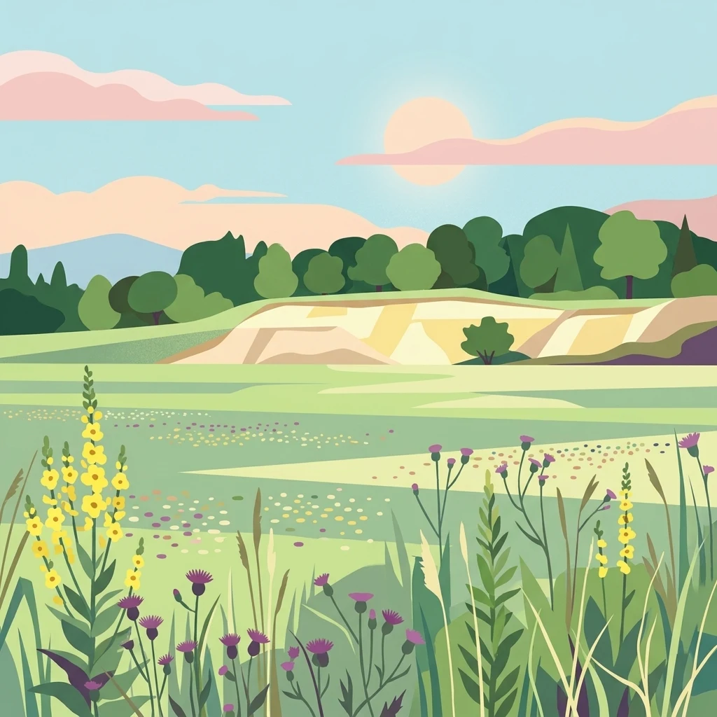
An illustration showing a semi-arid landscape with foreground wildflowers, a sandy dune, and a background of green trees under a soft sun.

A small but ecologically rich sandgrass reserve in the Hessian Upper Rhine Plain, anchored by relict inland dunes and recovery from former sand quarrying.

Im Dulbaum bei Alsbach

Im Dulbaum bei Alsbach is a small nature reserve in the municipality of Alsbach-Hähnlein in the Darmstadt-Dieburg district of southern Hesse, Germany. It lies within the Hessian section of the Upper Rhine Plain, near the foothills of the Bergstraße, and protects an unusually well preserved fragment of inland sand dune landscape that is otherwise rare in central Europe. The reserve belongs to the broad belt of aeolian sand deposits that stretches between Darmstadt and Rastatt along the Rhine graben. The area is most notable for its calcareous dry sand grasslands, known in German as Sandrasen, and for scattered patches of dry, warm-loving scrub and woodland edge habitats. Originally shaped by wind-deposited sands, the landscape was altered by centuries of agricultural use and by sand quarrying, and parts of it have since been restored through extensive sheep grazing. Its protection also reflects a larger ecological effort to connect remaining sandy grassland sites along the Hessian Bergstraße with similar habitats in the northern Upper Rhine Plain. Beyond its botanical importance, Im Dulbaum bei Alsbach has regional value as a refuge for heat-loving insects, reptiles, and rare plants that depend on open sandy ground. The site is designated both as a German Naturschutzgebiet under IUCN Category IV and as part of the European Natura 2000 network through its FFH designation, giving it both national and EU-level conservation recognition.

Location
Germany
Park type
Nature reserve
Established
1994
Area
0.1 km²
Im Dulbaum bei Alsbach Nature Reserve Atlas
Regional park map

See the ranked park cluster in its geographic setting

Nearby parks around Im Dulbaum bei Alsbach

This regional map shows the same 20 nearby parks ranked below around Im Dulbaum bei Alsbach. Select a ranked marker to highlight that park’s boundary where boundary data is available.
Reference park: Im Dulbaum bei AlsbachRanked nearby parkSelected boundary: Im Dulbaum bei Alsbach20 nearby parks shown
20 nearby parks

Ranked spatial distances and regional environmental comparisons across surrounding landscapes

Parks and Protected Areas Geographically Near Im Dulbaum bei Alsbach in Germany

Spatial proximity rankings establish geographic separation and direction metrics for protected areas surrounding Im Dulbaum bei Alsbach. Country context and recorded environmental characteristics provide structured comparison signals for analyzing regional park patterns.
A soft, delicate watercolor painting depicting a meandering river flowing through a lush, grassy wetland landscape with rolling hills in the background.
Nature reserveHessen
About 0.8 km away#1 closest

Northwest

Altneckarlachen von Alsbach, Hähnlein und Bickenbach: Protected Wetland and River Geography

A rare mosaic of prehistoric river loops in the Hessian Rhine plain

Altneckarlachen von Alsbach, Hähnlein und Bickenbach protects a unique sequence of prehistoric Neckar meanders featuring shallow water zones, reed belts, and black-alder swamp forest. This nature reserve in the Darmstadt-Dieburg district remains a critical wetland sanctuary, preserving a vital ecological cross-section of the ancient Rhine-Neckar landscape and its associated peatland soils.

Area
0.892 km²
Established
1990
IUCN
IV
Relief
Lowland
A watercolor landscape illustration showing a winding stream, marsh grasses, and trees with soft rolling hills in the background, set against a pale background.
Nature reserveHessen
About 2.5 km away#2 closest

North

Pfungstädter Moor Nature Reserve: Hessian Wetland and Ancient River Landscape

Protected wetland area in the Hessian Rhine plain

This nature reserve encompasses a rare silted-up segment of the ancient Neckar river, forming a complex of reed beds, alder carr, and peat bog habitats. Managed through creative restoration techniques that lift Rhine water into the moor, the landscape remains a vital ecological sanctuary in the heart of Hesse, standing in sharp contrast to the surrounding agricultural terrain.

Area
0.97 km²
Established
1955
IUCN
IV
Relief
Lowland
A soft watercolor painting of a rolling green hillside with trees, set against a pale, light-colored background.
Nature reserveHessen
About 3.1 km away#3 closest

Southeast

Orbishöhe von Auerbach und Zwingenberg: Geography, Landscape, and Protected Area Mapping

An examination of Hessian quarry-based ecological conservation sites.

The Orbishöhe von Auerbach und Zwingenberg nature reserve serves as a prime example of localized conservation within the Odenwald hills. Its landscape is defined by former quarry faces and open slope terraces, which provide a critical habitat for rare and threatened plant species. This resource offers a clear look at the reserve's topography, physical boundaries, and its broader role within the Natura 2000 network of protected German lands.

Area
0.064 km²
Established
1988
A horizontal watercolor painting showing a soft, impressionistic landscape with rolling hills, sparse trees, and pale green and pink tones on a white background.
Nature reserveHesse
About 4.8 km away#4 closest

Northeast

Kalksandkiefernwald bei Bickenbach, Pfungstadt und Seeheim-Jugenheim Protected Area Atlas

A rare calcareous sand pine forest in the Hessian Rhine plain

Located in the Darmstadt-Dieburg district, this reserve protects an airy, light-filled woodland on calcareous sandy ground. The terrain is defined by its gentle undulations and historical woodland grazing traces, offering a unique look at forest management in the Rhine plain. Explore the distribution of its two distinct sections, including the specialized sand grass vegetation found along its managed utility corridors.

Area
0.874 km²
Established
1996
IUCN
IV
Relief
Lowland
A horizontal watercolor illustration of a soft, hazy landscape featuring light pink blooming trees in a green field, with rolling, misty purple and brown hills in the background.
Nature reserveHesse
About 5.7 km away#5 closest

East

Fuchswiese bei Stettbach: Mapped Nature Reserve and Protected Meadow Landscape in Hesse

Exploring the ecological boundaries of a specialized wet meadow reserve in southern Hesse

Fuchswiese bei Stettbach is a dedicated nature reserve serving as a critical habitat for threatened meadow butterfly species. Located in the Darmstadt-Dieburg district of Hesse, this protected area preserves wet meadow vegetation amidst the northern Odenwald fringe. The site offers a focused view into how small, carefully managed landscapes contribute to the broader ecological health and regional geography of central Germany.

Area
0.03 km²
Established
2010
Watercolor painting showing a stylized, panoramic landscape of rolling hills and forest, depicted in soft green and earth tones against a white background.
Nature reserveHessen
6.4 km away#6 closest

East

Felsberg bei Reichenbach Nature Reserve: Geography and Granite Boulder Field Analysis

Protected forest and geological monument in the Odenwald range

Felsberg bei Reichenbach protects 168 hectares of Odenwald mountain slope in Southern Hessen. The site is centered on the Felsenmeer, a dramatic sea of granite boulders created by frost weathering, framed by mixed deciduous woodland. This area functions as an important Natura 2000 habitat, preserving both specialized rock ecosystems and montane forest, providing a clear geographic link between the Lautertal valley and the high slopes of the Felsberg summit.

Area
1.677 km²
Established
1972
IUCN
IV
Relief
Mountain
A watercolor painting of a pastoral landscape with soft green meadows, scattered trees, and distant purplish hills under a white sky.
Nature reserveHessen
6.4 km away#7 closest

Southeast

Magerrasen von Gronau mit angrenzenden Flächen Protected Landscape and Regional Geography

A network of calcareous meadows in the Odenwald foothills

Located in the Bergstraße district of Hessen, this protected area spans three distinct sub-areas characterized by nutrient-poor calcareous soils. These warm, sun-exposed meadows serve as an essential refugium for orchid diversity and specialized butterfly populations, standing as a representative example of successfully managed dry grassland ecosystems within the broader Geo-Naturpark Bergstraße-Odenwald.

Area
1.6 km²
Established
2004
A pale, soft-toned watercolor painting showing rolling green and golden dunes under a light, hazy sky.
Nature reserveHessen
7.4 km away#8 closest

Northeast

Düne am Ulvenberg von Darmstadt-Eberstadt: Inland Sand Dune Protected Area Geography

A rare Pleistocene dune ecosystem in the Hessen region.

Düne am Ulvenberg von Darmstadt-Eberstadt represents a critical inland dune fragment within the Upper Rhine Graben. This nature reserve provides essential habitat for sand-dwelling flora in a setting defined by its open, dry sandy flats, pine woodland, and specialized steppe-like turf that persists as a unique geological legacy.

Area
0.089 km²
Established
1991
IUCN
IV
A soft watercolor painting of a flat, open landscape with scattered trees, rolling grasses, and muted green and pink tones.
Nature reserveHessen
8.2 km away#9 closest

Northeast

Lerchenberg und Kernesbellen von Darmstadt-Eberstadt: Hessian Nature Reserve and Dune Atlas

Protected sand grassland and pine forest landscape mapping

Lerchenberg und Kernesbellen von Darmstadt-Eberstadt serves as a key inland dune reserve within the northern Upper Rhine Plain. This protected area features a unique, sun-warmed mosaic of sandy substrates, sparse calcareous forests, and historic orchard meadows. Analyze the site's ecological boundaries and its role as a critical habitat fragment within the broader network of regional protected landscapes.

Area
0.172 km²
Established
1995
IUCN
IV
A soft-focus watercolor painting of a wetland scene showing a calm body of water with reeds in the foreground and a tree-lined horizon under a pastel sky.
Nature reserveHessen
About 9.6 km away#10 closest

South

Erlache bei Bensheim: Exploring Protected Wetlands and Altneckar Landscapes in Hessen

A distinct nature reserve and bird sanctuary site

The Erlache bei Bensheim nature reserve serves as a critical wetland corridor in the Hessian Rhine plain. This area features a former loop of the River Neckar, now characterized by alder swamp forest, reedbeds, and open water, creating a highly specific ecological terrain surrounded by the regional infrastructure of the Bergstraße district.

Area
0.49 km²
Established
2000
IUCN
IV
Relief
Lowland
A soft watercolor painting of a winding river flowing through a lush green floodplain with distant hills under a pale sky.
Nature reserveHessen
11 km away#11 closest

Northwest

Kühkopf-Knoblochsaue Nature Reserve: A Detailed Look at Hessian Rhine Floodplain Geography

Protected river island terrain, alluvial forests, and floodplain dynamics

Examine the geographic characteristics of Kühkopf-Knoblochsaue, the premier nature reserve in the Hessian Ried. This site provides an in-depth atlas perspective on the Rhine floodplain, featuring the iconic inland island structure, softwood and hardwood forest transitions, and the ongoing influence of the Stockstadt-Erfelder Altrhein on the local terrain.

Area
24.4 km²
Established
1952
Relief
Lowland
Climate
Temperate
A horizontal watercolor illustration of a soft green landscape with meadows, scattered trees, and distant rolling hills under a pale pink sky.
Nature reserveHessen
About 11 km away#12 closest

Southeast

Schannenbacher Moor Nature Reserve: Geographic Overview and Protected Area Boundaries

Wetland and forest mosaic in the southern Hessian Odenwald

Schannenbacher Moor represents a significant protected area within Hessen, characterized by its combination of raised bog remnants, reedbeds, and near-natural floodplain woodlands. Framed by the Krehberg slopes and the Meerbach stream system, the reserve offers a rare example of low mountain bog ecology and biodiversity conservation. This mapped landscape provides essential data on the distribution of mire plant communities and bryophyte habitats in the region.

Area
0.162 km²
Established
1975
IUCN
IV
A horizontal watercolor painting depicting a calm lake with grassy banks, reeds, and a soft, hazy treeline in the background against a pale sky.
Nature reserveHessen
About 12 km away#13 closest

North

Bessunger Kiesgrube Nature Reserve: A Detailed Look at the Hessen Protected Landscape

Examining post-industrial geography and forest recovery

The Bessunger Kiesgrube is a designated nature reserve located in Hessen, Germany. Once a centuries-old gravel extraction site, the area now features a groundwater-fed lake bordered by steep rocky banks and dense, naturally regenerated woodland. This site provides a clear case study of ecological recovery on the edge of urban development, offering insight into the geological and environmental legacy of the region.

Area
0.118 km²
Established
1978
Relief
Lowland
Climate
Temperate
A horizontal watercolor painting showing a soft green landscape with meadows, low-lying trees, and distant hills under a light sky.
Nature reserveHesse
About 12 km away#14 closest

Southwest

Lochwiesen von Biblis Nature Reserve: Geographic Overview and Protected Landscape Mapping

Rhine valley meadow conservation in the Hessisches Ried of southern Hesse.

Lochwiesen von Biblis serves as a protected sanctuary for riverine ecosystems in the Upper Rhine lowlands. This nature reserve provides essential habitat for lowland meadows and wet grassland species, offering a window into the natural floodplain dynamics that once defined the entire Hessian Rhine corridor. Explore the structural boundaries of this conservation area and its place in the larger regional landscape.

Area
0.511 km²
Established
1992
IUCN
IV
A horizontal watercolor illustration showing soft, muted green trees and shrubs against a light pink and pale yellow sky, representing a wetland landscape.
Nature reserveHessen
About 13 km away#15 closest

North

Griesheimer Bruch Nature Reserve: Geographic Overview and Mapped Protected Landscapes

Wetland ecosystems and regional geography in southern Hesse

Griesheimer Bruch is a 35-hectare nature reserve that protects a rare mosaic of lowland bog remnants, mat-grass swards, and black alder carr forest. This mapped site is central to the Hessian Upper Rhine Plain, serving as a critical wetland refuge within the broader Natura 2000 network. Gain detailed insight into the hydrological features, field geography, and ecological boundaries of this protected landscape in southern Germany.

Area
0.35 km²
Established
2000
IUCN
IV
Soft watercolor illustration of a calm, marshy wetland scene with reeds, a lone bare tree on the left, and a soft forest line in the background.
Nature reserveHessen
About 16 km away#16 closest

North

Löserbecken von Weiterstadt Nature Reserve in Hessen: A Detailed Geographic Overview

Protected landscape within the Upper Rhine Plain

Löserbecken von Weiterstadt protects a distinct basin landscape characterized by the interaction between former sand extraction slopes and naturally forming rainwater wetlands. This reserve showcases the transformation of post-industrial ground into a high-value habitat for crested newts and other species. Explore the boundaries and topographic features of this compact, protected Hessen nature area.

Area
0.08 km²
Established
1983
IUCN
IV
A horizontal watercolor painting showing a soft, light-filled wetland scene with grassy banks, two small trees, and a calm waterway under a bright, hazy sky.
Nature reserveRhineland-Palatinate
About 17 km away#17 closest

West

Naturschutzgebiet Der Spieß An der Spießbrücke Nature Reserve and Wetland Atlas Geography

Protected floodplain habitat in the Rhineland-Palatinate region

This nature reserve protects a vital 9-hectare wetland mosaic near Worms, Germany, featuring an old Rhine arm known as the Altrhein. The site functions as a key resting area for rare bird species, characterized by its reedbeds, wet meadows, and ongoing integration into larger regional floodplain restoration initiatives throughout the Upper Rhine basin.

Area
0.093 km²
Established
1985
Relief
Lowland
Scope
Terrestrial
Watercolor painting of a rolling wetland landscape featuring green fields, soft hills in the background, and marshy foreground vegetation.
Nature reserveHessen
About 17 km away#18 closest

Northeast

Scheftheimer Wiesen Nature Reserve: Geographic Overview and Protected Landscape Mapping

Hessen wetland ecosystems and prehistoric heritage sites

Situated along the Ruthsenbach stream in Hessen, Scheftheimer Wiesen is a 166-hectare nature reserve known for its recovery of wet meadow habitats after decades of agricultural use. The area integrates natural terrain with cultural heritage, featuring reconstructed granite menhirs and historic burial mounds within a broader forest-framed environment near Darmstadt.

Area
1.661 km²
Established
1993
IUCN
IV
Relief
Lowland
Watercolor painting of a green wetland landscape with a winding stream and distant hills in soft pastel colors.
Nature reserveHesse
About 17 km away#19 closest

Southeast

Albersbacher Riedwiesen Nature Reserve: Mapped Geography and Protected Landscapes in Hesse

A detailed atlas view of the Albersbach stream valley conservation corridor.

Situated in the Weschnitz valley region of Hesse, the Albersbacher Riedwiesen nature reserve offers a concentrated look at traditional Odenwald landscapes. The area protects a unique combination of wet meadows, reedbeds, and dry grasslands that follow the natural meandering course of the Albersbach stream, providing a vital study in local geomorphology and conservation geography.

Area
0.124 km²
Established
1996
A horizontal watercolor painting depicting a soft, rolling meadow with patches of trees and distant hills.
Nature reserveHessen
About 18 km away#20 closest

North

Bruchwiesen bei Büttelborn Nature Reserve: Hessen Protected Wetland and River Meander

Mapped terrain and protected fen ecology in the Rhine Main region

Bruchwiesen bei Büttelborn represents a major protected lowland fen situated along a former course of the Neckar River. The site provides a mosaic of reedbeds, moist grasslands, and deciduous woodlands, creating a crucial habitat within the agricultural landscape of Hessen. This data highlights the park boundaries and the complex hydrological features that define this ecologically significant wetland.

Area
0.88 km²
Established
1997
IUCN
IV
Distance methodology

Geographic measurements, not driving distances

How nearby park distances are calculated

Distances use park boundaries whenever the available geometry allows it. When one or both boundaries are missing, the mapped park locations provide a clearly labelled estimate. Every value represents straight-line geographic separation and does not use roads or routing.

Boundary distance

Calculated between the nearest points of both park boundaries.

Location-to-boundary estimate

Estimated from one mapped park location to the nearest boundary of the other park.

Mapped-location estimate

Estimated between the mapped locations of both parks.

MoriAtlas Explorer

Explore the Protected Geography of Im Dulbaum bei Alsbach Nature Reserve

Examine the mapped boundaries and natural terrain features of Im Dulbaum bei Alsbach, a unique inland dune habitat in Hesse. Use MoriAtlas to trace the regional importance of these calcareous grasslands and their role within the broader Rhine Plain ecological network.