Mori Atlas logo
Biosphere reserveIsla Guadalupe

Tracing the volcanic landscape and diverse ecological boundaries of this remote Mexican biosphere reserve.

Isla Guadalupe Biosphere Reserve: Mapping the Protected Oceanic Geography and Island Terrain

(Reserva de la Biosfera Isla Guadalupe)

Isla Guadalupe stands as a significant oceanic landmass located within the Mexican Pacific, positioned far offshore from the Baja California peninsula. The biosphere reserve encompasses a rugged interior defined by the peak of Mount Augusta, transitioning through chaparral and pine habitats that mirror the ecological characteristics of the California Channel Islands. By examining the mapped boundaries and terrain, users can understand the conservation profile of this isolated volcanic island and its role within the broader regional geography of the Mexican Pacific.

oceanic islandbiosphere reservePacific OceanchaparralPinus radiata forestgreat white sharks

Isla Guadalupe

Biosphere reserve

Park overview

Structured park overview, official facts, and landscape profile for Isla Guadalupe Biosphere Reserve

Isla Guadalupe Biosphere Reserve park facts, protected area profile, and essential visitor context

Review the core facts for Isla Guadalupe Biosphere Reserve, including designation, size, terrain, visitor scale, habitats, and operating context in one park-focused overview.

About Isla Guadalupe Biosphere Reserve

Isla Guadalupe is a Mexican oceanic island in the Pacific Ocean, situated about 241 kilometers west of the Baja California peninsula. With an area of roughly 253 square kilometers, stretching some 35 kilometers in length and reaching Mount Augusta at over 1,300 meters in the north, it is one of the largest and most ecologically significant islands off mainland Mexico. Roca Elefante, at the island's southwest extremity, marks the westernmost point of Mexico and of Latin America.

Although politically and geographically Mexican, Guadalupe's natural character closely resembles the ecosystems of California's Channel Islands. The island shares the same ecoregional profile as the Santa Barbara Islands, supporting Mediterranean-type chaparral at lower elevations and pine-dominated forest in the higher northern reaches where fog and moisture are more frequent. This combination of isolation, varied topography, and a Mediterranean-influenced climate has long given Guadalupe a distinctly Californian ecological feel despite its political location on the Pacific side of Mexico.

The island's status changed dramatically in 2005 when it was declared the Reserva de la Biosfera Isla Guadalupe, formalizing protections that had existed informally since 1975 when the area was first recognized as a wildlife sanctuary. The biosphere designation came alongside other conservation milestones, including the completion of a multi-year feral goat eradication program that eliminated roughly 10,000 animals and removed one of the most damaging pressures on the island's native vegetation. Together, these steps transformed Guadalupe from a heavily exploited hunting ground into a flagship example of Mexican island conservation.

Quick facts and research context for Isla Guadalupe Biosphere Reserve

Isla Guadalupe lies in the Pacific Ocean off the Baja California peninsula and forms part of the Municipality of Ensenada in the Mexican state of Baja California. Its area covers roughly 253.8 square kilometers, with a maximum length of about 35 kilometers and a width of around 9.5 kilometers; the highest point, Mount Augusta, reaches 1,324 meters. Administratively a Mexican federal biosphere reserve since 2005, the island is also home to a small seasonal population, including fishermen, a military garrison safeguarding sovereignty, and weather station personnel at the southern Campamento Sur. Roca Elefante on the western tip is the westernmost point of Mexico and Latin America.

Protection and recognition

Documented protection history and official designation metrics for Isla Guadalupe

Isla Guadalupe Protection Status and Designated Area Recognition

Established with a mixed protection scope in 2005, Isla Guadalupe maintains official records detailing its designation history and management framework. Structured conservation facts outline the administrative parameters governing this protected natural landscape.

Protection details

Protection scope
Mixed
Designated year
2005
Park context

Deeper park guide and search-rich context for Isla Guadalupe Biosphere Reserve

Isla Guadalupe Biosphere Reserve history, landscape, wildlife, and travel context

Explore Isla Guadalupe Biosphere Reserve through its history, landscape character, ecosystems, wildlife, conservation priorities, cultural context, and seasonal travel timing in a structured park guide built for atlas discovery and search intent.

Why Isla Guadalupe Biosphere Reserve stands out

Isla Guadalupe is best known for two very different kinds of wildlife spectacle. Above the surface, it has become one of the world's leading destinations for observing great white sharks in clear offshore waters, with peak sightings running from August through October. On land, it stands out as a remote Mexican oceanic island where decades of ecological damage from feral goats have been reversed through a major eradication campaign, allowing native chaparral and pine habitat to begin recovering.
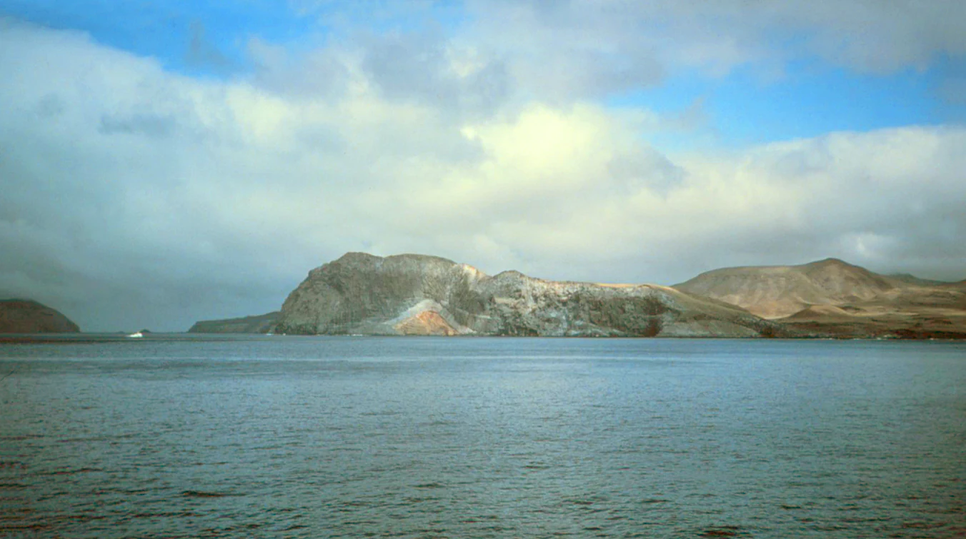
A wide coastal view of the rocky, barren Isla Guadalupe island with calm waters in the foreground and a cloudy blue sky above.
The rugged, volcanic coastline of Isla Guadalupe seen from the sea.

Isla Guadalupe Biosphere Reserve history and protected-area timeline

The earliest documented European sighting of Isla Guadalupe came in 1602, when a Spanish expedition under Sebastián Vizcaíno sailed past the island without landing. Throughout the late 18th and 19th centuries, the island was visited repeatedly by sealers and hunters who came for sea lions, sea otters, and elephant seals, profoundly disturbing the native ecosystem. Goats, likely introduced by sealers in the early 1800s, multiplied rapidly and almost eradicated the island's native vegetation, setting in motion the ecological degradation that would persist for nearly two centuries.

In 1975 the island was formally recognized as a wildlife sanctuary, marking the first official acknowledgment that Guadalupe's ecosystems required protection. Decades later, between 2002 and 2007, the Mexican government and the Grupo de Ecología y Conservación de Islas ran a large-scale feral goat eradication program that removed an estimated 10,000 goats and cleared the path for native vegetation to recover. On 25 April 2005 the island was formally declared the Reserva de la Biosfera Isla Guadalupe, a designation directed at the time by M. en C. Nadia Olivares Bañuelos, institutionalizing its protected status.

Isla Guadalupe Biosphere Reserve landscape and geographic character

Isla Guadalupe is a long, narrow oceanic landmass running roughly 35 kilometers along a north-south axis and reaching a maximum width of about 9.5 kilometers. The northern half of the island rises to Mount Augusta at 1,324 meters, the highest point on Guadalupe, creating a rugged interior of slopes and ravines that contrasts with the lower, gentler southern portion. Perched on the southwestern edge, Roca Elefante and its surrounding sea stacks are the visual and geographic signature of the island's far-western position relative to the Mexican mainland.

Isla Guadalupe Biosphere Reserve ecosystems, habitats, and plant life

Ecologically, Isla Guadalupe belongs to the same ecoregion as California's Santa Barbara Islands. Lower elevations are dominated by chaparral shrublands adapted to dry, Mediterranean-influenced conditions, while the wetter, higher northern slopes support pine forest, notably Pinus radiata where moisture levels rise with elevation and exposure to marine fog. Most precipitation falls in winter under the influence of northwesterly winds and Pacific cyclones, with annual rainfall averaging around 133 millimeters near sea level at the south end and significantly more in the elevated north. Three broad climate types coexist on the island: a dry Mediterranean climate, a cold arid climate, and a semi-arid temperate climate.

Isla Guadalupe Biosphere Reserve wildlife and species highlights

Guadalupe is internationally renowned for its marine wildlife, especially its seasonal aggregations of great white sharks (Carcharodon carcharias) that have made the surrounding waters one of the world's best locations for in-water encounters with the species. Many aquatic species found around Guadalupe also occur in California's Northern Channel Islands, linking the two ecoregions across the international maritime boundary. The southern end of the island holds a melipominene cove and the Campamento Sur weather station, while Roca Elefante and other pinnacles host seabird colonies and serve as haul-out and reference points for the surrounding marine fauna.

Isla Guadalupe Biosphere Reserve conservation status and protection priorities

Island conservation on Guadalupe formally began in 1975 when the area was declared a wildlife sanctuary, but the decisive conservation moment came in 2005 when it was established as the Reserva de la Biosfera Isla Guadalupe under Mexico's federal protected-area system. The biosphere designation was accompanied by the completion of a 2002-2007 feral goat eradication program, conducted by the Mexican government in partnership with the Grupo de Ecología y Conservación de Islas, which removed roughly 10,000 goats and halted one of the most severe herbivore impacts on the island's native vegetation. The reserve's overarching aim is to allow chaparral and pine ecosystems to regenerate while protecting the marine environment, including the great white shark habitat for which Guadalupe is now globally known.

Isla Guadalupe Biosphere Reserve cultural meaning and human context

Isla Guadalupe today carries a small human presence centered on three distinct communities: a military garrison at Campamento Este, a southern weather station and airstrip at Campamento Sur, and a 2005-registered civilian locality largely made up of regional fishermen. A mysterious set of linear and spiral markings resembling small Nazca-style geoglyphs has been reported in the southwestern part of the island, though these remain unconfirmed by Mexican authorities and scientific researchers. Access to the reserve requires a permit from the Mexican government, reflecting its status as a protected territory rather than a freely visited island.

Top sights and standout views in Isla Guadalupe Biosphere Reserve

Standout features of Isla Guadalupe include the world's-class viewing of great white sharks in clear offshore Pacific waters, especially from August to October; Mount Augusta as the island's commanding 1,324-meter northern peak; the chaparral-to-pine ecological gradient mirroring California's Channel Islands; Roca Elefante marking Mexico's and Latin America's westernmost point; and the legacy of the feral goat eradication effort that has allowed native vegetation recovery to begin. The reserve's combination of remote island setting, recovering terrestrial ecosystem, and thriving marine wildlife gives it an unusually layered conservation profile within the Mexican Pacific.

Best time to visit Isla Guadalupe Biosphere Reserve

For great white shark encounters around Guadalupe, the best window runs from August through October, when seasonal aggregations bring predictable, open-water sightings. Weather on the island is mildest and cleanest during the cooler dry months, while winter brings most of the annual rainfall, fed by northwesterly winds and Pacific cyclones. Calmer, drier conditions generally favor both surface visibility for marine viewing and easier working conditions for any on-island camping or expedition activity.
Monthly climate preview

Long-term temperature and precipitation records across representative coordinate data

Isla Guadalupe Climate Normals and Monthly Weather Patterns

Representative coordinate metrics outline annual temperature variations and monthly precipitation rhythms across Isla Guadalupe. Detailed twelve-month records provide complete climatological profiles for comparative regional analysis.
Annual mean17 °C
15 °C20 °C
Jan16°
Feb15°
Mar16°
Apr16°
May17°
Jun17°
Jul19°
Aug20°
Sep20°
Oct19°
Nov18°
Dec16°
Warmest month
September

20.2 °C

Coolest month
February

15.4 °C

Wettest month
February

0.6 mm/day

Driest month
May

0.1 mm/day

Park location guide

Geography guide, regional context, and park location map for Isla Guadalupe Biosphere Reserve

Isla Guadalupe Biosphere Reserve park geography, regions, and map view in Mexico

Understand where Isla Guadalupe Biosphere Reserve sits in Mexico through a broader geographic reading of the surrounding landscape, nearby location context, and its mapped position within the national park landscape.

How Isla Guadalupe Biosphere Reserve fits into Mexico

Mexico, officially the United Mexican States, is a country in North America spanning the Sierra Madre mountain ranges, coastal plains, and tropical regions. It borders the United States to the north, Guatemala and Belize to the southeast, and has coastlines along the Pacific Ocean, Gulf of Mexico, and Caribbean Sea. With a population exceeding 130 million, Mexico is home to one of the world's most significant concentrations of Indigenous languages alongside Spanish.

Wider geography shaping Isla Guadalupe Biosphere Reserve in Mexico

Mexico occupies a land area of 1,972,550 km2, making it the thirteenth-largest country in the world. The terrain is highly diverse, featuring the Sierra Madre Occidental and Sierra Madre Oriental mountain ranges, the Mexican Plateau, coastal lowlands along the Pacific and Gulf/Caribbean margins, and the Yucatan Peninsula. The country spans multiple climate zones from desert in the north to tropical rainforest in the south.

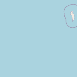
Map view of Isla Guadalupe Biosphere Reserve

Use this park location map to pinpoint Isla Guadalupe Biosphere Reserve in Mexico, understand its exact geographic position, and read its mapped placement within the surrounding landscape more clearly.

Pigeon | © OpenStreetMap contributors

Location context for Isla Guadalupe Biosphere Reserve

Baja California

Visualizing the rugged topography, pine habitats, and remote marine environment of this Mexican biosphere reserve.

Isla Guadalupe Photos, Volcanic Terrain, and Protected Ocean Scenery

Visual documentation of Isla Guadalupe reveals the dramatic topography of Mount Augusta, recovering pine habitats, and clear offshore waters inhabited by marine wildlife. Examining these protected area photographs provides direct insight into the isolated volcanic terrain and evolving conservation landscapes of the Pacific ecoregion.

A wide coastal view of the rocky, barren Isla Guadalupe island with calm waters in the foreground and a cloudy blue sky above.

Park atlas

Compare remote island ecosystems, volcanic terrain, and offshore Pacific reserves

Exploring Parks Near Isla Guadalupe and Surrounding Marine Protected Areas

Browsing other protected areas near Isla Guadalupe allows visitors to examine related marine reserves and rugged coastal island landscapes in the broader Pacific region. Comparing these remote environments provides valuable context on unique island conservation profiles and volcanic geography.
Wildlife reserveBaja California
About 320 km away#1 closest

East

Valle de los Cirios Wildlife Reserve: Mapped Geography and Protected Desert Landscapes

Exploring the diverse arid terrain of the Baja California peninsula

Valle de los Cirios represents a premier protected landscape in Mexico, characterized by its iconic cirio cactus woodlands and deep mountain sierras. The reserve connects vast stretches of desert habitat from the Pacific coast to the Gulf of California, creating a unique geographic corridor for endemic species and wide-ranging desert mammals.

Area
25,217.8 km²
Established
1980
Relief
Mountain
Climate
Arid
Watercolor painting of a mountainous landscape with pine trees, rolling hills, and a pastel sky
National parkBaja California
About 338 km away#2 closest

Northeast

Sierra de San Pedro Mártir National Park: Protected Landscape and Geographic Exploration

National park boundaries and natural terrain in Baja California.

Sierra de San Pedro Mártir National Park is a vital protected landscape situated in Baja California. This destination offers users a focused atlas exploration of its national park status, detailing its geographic setting and mapped protected area. Understand the park's specific place within the region, examining its natural terrain and boundaries for a clear geographic context, essential for any structured discovery of Mexico's conserved lands.

Area
729.09 km²
Established
1947
IUCN
II
Relief
Mountain
National parkEnsenada Municipality
About 391 km away#3 closest

Northeast

Constitution 1857 National Park National Park: Mapped Protected Landscape Discovery

Geographic context and park boundaries for Ensenada Municipality.

Delve into the protected landscape of Constitution 1857 National Park, a key national park entity located in the Ensenada Municipality. This resource highlights the park's distinct geographic features and mapped protected area, crucial for atlas exploration and understanding the regional natural terrain. Gain structured insight into the park's identity and its role within the wider geographic context.

Area
50.09 km²
Established
1962
IUCN
II
Relief
Mountain
A watercolor painting showing a coastal landscape with pale pink foreground, green vegetation, a light-colored bay, and soft-hued mountains in the background.
Biosphere reserveBaja California
About 460 km away#4 closest

East

Bahía de los Ángeles Biosphere Reserve: Geography and Protected Area Atlas

Coastal desert, volcanic islands, and Sea of Cortez marine channels

Spanning 1,500 square miles, this biosphere reserve preserves the dramatic transition from the arid Baja California desert to the deep, productive waters of the Gulf of California. The protected area encompasses a diverse chain of volcanic islands, including Isla Ángel de la Guarda, and supports high biological productivity driven by deep submarine canyons and marine currents.

Area
3,879.56 km²
Established
2007
Relief
Mixed relief
Climate
Arid
Wildlife reserveCalifornia
About 479 km away#5 closest

Northeast

Fish Creek Mountains Wilderness: Mapping the Rugged Colorado Desert Plateau in California

Exploring desert ridges and ancient shoreline remnants

Fish Creek Mountains Wilderness offers a study in desert geomorphology, rising as an abrupt plateau above the surrounding basin. This Bureau of Land Management protected area contains intricate erosional landforms, including twisting canyons and natural rock tanks sustained by limestone outcrops. These features create a critical desert wildlife habitat that maintains moisture long after seasonal storms, offering a quiet, undisturbed perspective on the broader Imperial County landscape.

Area
86.7 km²
Established
1994
IUCN
Ib
Relief
Mountain
Marine protected areaCalifornia
About 483 km away#6 closest

North

Channel Islands National Marine Sanctuary Marine Protected Area Map and Atlas

Southern California marine habitat and island topography

Channel Islands National Marine Sanctuary protects 1,470 square miles of diverse marine environment near the California coast. This sanctuary guards vital kelp forests and deep seafloor ecosystems while preserving deep water archaeological sites and the biological legacy of the Northern Channel Islands.

Area
3,807 km²
Established
1980
IUCN
V
Relief
Lowland
National parkCalifornia
About 493 km away#7 closest

North

Channel Islands National Park: A Protected Landscape within California's Geography

Explore its unique mapped terrain and protected area context.

Channel Islands National Park stands as a key protected area, providing critical insight into California's unique geographic features and natural landscapes. This entry focuses on the park's identity as a protected entity, detailing its mapped boundaries and the surrounding regional geography. It offers an atlas-level view, essential for understanding the park's contribution to the broader landscape context of the United States and its conservation importance.

Area
1,009.94 km²
Established
1980
IUCN
II
Visitors
323.2K annual
National parkBaja California
About 516 km away#8 closest

East

San Lorenzo Marine Archipelago National Park: Protected Area and Mapped Landscape Geography

Explore its national park status and regional context in Baja California.

Delve into San Lorenzo Marine Archipelago National Park, a key protected area contributing to Baja California's diverse geography. As a national park, its mapped boundaries and unique landscape characteristics provide essential data for atlas exploration and understanding regional conservation efforts. This entry focuses on the park's identity as a mapped protected entity, ideal for researchers and explorers seeking structured geographic insights into natural reserves.

Area
504.42 km²
Established
2005
IUCN
II
Relief
Upland

Common questions about visiting, size, designation, and location context for Isla Guadalupe Biosphere Reserve

Isla Guadalupe Biosphere Reserve FAQs for park facts, access, geography, and protected area context

Find quick answers about Isla Guadalupe Biosphere Reserve, including protected-area facts, park geography, trail and visitor context, and how the park fits into its surrounding country and regional landscape.
MoriAtlas Explorer

Continue Your Protected Areas Search Across the Global Atlas

Deepen your exploration by continuing the structured search for national parks and protected areas worldwide. Utilize the comprehensive filtering capabilities to compare different conservation landscapes and refine your understanding of global park geography. Discover more about the distribution and characteristics of protected natural areas.

Global natural geography