

Mori Atlas logo
National parkJaldapara National Park

Explore the savanna landscape, park boundaries, and regional geography of this key Indian national park.

Jaldapara National Park: Protected Grasslands and Rhino Conservation in Alipurduar District

Jaldapara National Park represents a significant protected landscape in India's Alipurduar district, characterized by its extensive rolling grasslands and vital role in Indian one-horned rhinoceros conservation. This national park, situated at the foothills of the Eastern Himalayas, offers a unique savanna-like terrain interspersed with riverine forests, providing essential habitat for diverse wildlife. Discover the mapped boundaries and geographic context of this remarkable protected area, contributing to a broader atlas of conservation landscapes.

Grassland EcosystemRhino ConservationEastern HimalayasWildlife SanctuaryMega HerbivoresSavanna

Jaldapara National Park

National park

Park overview

Structured park overview, official facts, and landscape profile for Jaldapara National Park

Jaldapara National Park park facts, protected area profile, and essential visitor context

Review the core facts for Jaldapara National Park, including designation, size, terrain, visitor scale, habitats, and operating context in one park-focused overview.

About Jaldapara National Park

Jaldapara National Park occupies a unique position in India's protected area network as one of the few significant grassland conservation areas in the eastern Himalayan region. The park's location at the transition zone between the Himalayan foothills and the alluvial plains of North Bengal creates a distinctive ecological character that supports species from both mountain and lowland ecosystems. The vast grassland savanna, dominated by tall elephant grasses, represents a rare habitat type in the Indian subcontinent and provides critical grazing grounds for large herbivores. The scattered riverine forest patches along watercourses add structural diversity and serve as refuge areas for different species during the monsoon season. The Torsa River, which flows adjacent to the park, not only provides essential water resources but also creates a natural boundary that influences the park's hydrology and vegetation patterns. Conservation efforts at Jaldapara focus on maintaining the delicate balance between protecting the grassland ecosystem and supporting viable populations of flagship species like the Indian rhinoceros.

Quick facts and research context for Jaldapara National Park

Jaldapara National Park is located in Alipurduar district of West Bengal, India, at the northern edge of the state near the border with Assam and Bhutan. The protected area covers 216.51 square kilometers of predominantly savanna grassland with scattered riverine forest patches. The park was originally declared a sanctuary in 1941 to protect its rich biodiversity and was redesignated as a national park in 2014. The Torsa River flows along the park's boundary, providing crucial water resources for the ecosystem. The park falls within the IUCN Category II protected area classification.

Protection and recognition

Analyzing the terrestrial management scope and official conservation history of the regional landscape

Jaldapara National Park Protection Status and Protected Area Designation

Documented terrestrial protection for Jaldapara National Park established official status in 2014, highlighting structured efforts to secure the regional ecological framework. Exploring official boundaries provides critical geographic context for understanding regional conservation networks and national park system frameworks.

Protection details

Protection scope
Terrestrial
Designated year
2014
Park context

Deeper park guide and search-rich context for Jaldapara National Park

Jaldapara National Park history, landscape, wildlife, and travel context

Explore Jaldapara National Park through its history, landscape character, ecosystems, wildlife, conservation priorities, cultural context, and seasonal travel timing in a structured park guide built for atlas discovery and search intent.

Why Jaldapara National Park stands out

Jaldapara National Park is most renowned for its population of Indian one-horned rhinoceros, which represents the largest concentration of this endangered species in the state of West Bengal and one of the largest in India after Kaziranga National Park. The park's extensive grasslands and riverine habitats create ideal conditions for this prehistoric-looking megaherbivore. Beyond rhinos, the park is noted for its diverse mammalian fauna including Indian elephants, leopards, sambar deer, gaur, and various species of smaller deer. The sweeping savanna landscape, characterized by tall elephant grasses that sway in the wind, offers a distinctive visual character that sets Jaldapara apart from the forested national parks more common in India.

Jaldapara National Park history and protected-area timeline

The area now known as Jaldapara has a long human history predating its formal protection status. Before the year 1800, the region was inhabited by the Toto and Mech tribes, both belonging to the broader Bodo-Kachari ethnic group. This pre-colonial period settlement gave the area its historical name of Totopara, reflecting the presence of the Toto people. The area remained relatively undisturbed until the colonial and post-colonial period when its ecological significance began to be recognized. In 1941, the British Indian administration declared Jaldapara a wildlife sanctuary, recognizing the need to protect the diverse flora and fauna that thrived in the grassland ecosystem. For over seven decades, the sanctuary functioned as a protected area, successfully maintaining populations of endangered species despite various pressures. In May 2014, the protected area was elevated to national park status, reflecting its increased conservation importance and the need for stronger legal protection. This elevation particularly aimed to strengthen conservation efforts for the Indian rhinoceros, whose population had become a priority for state wildlife managers.

Jaldapara National Park landscape and geographic character

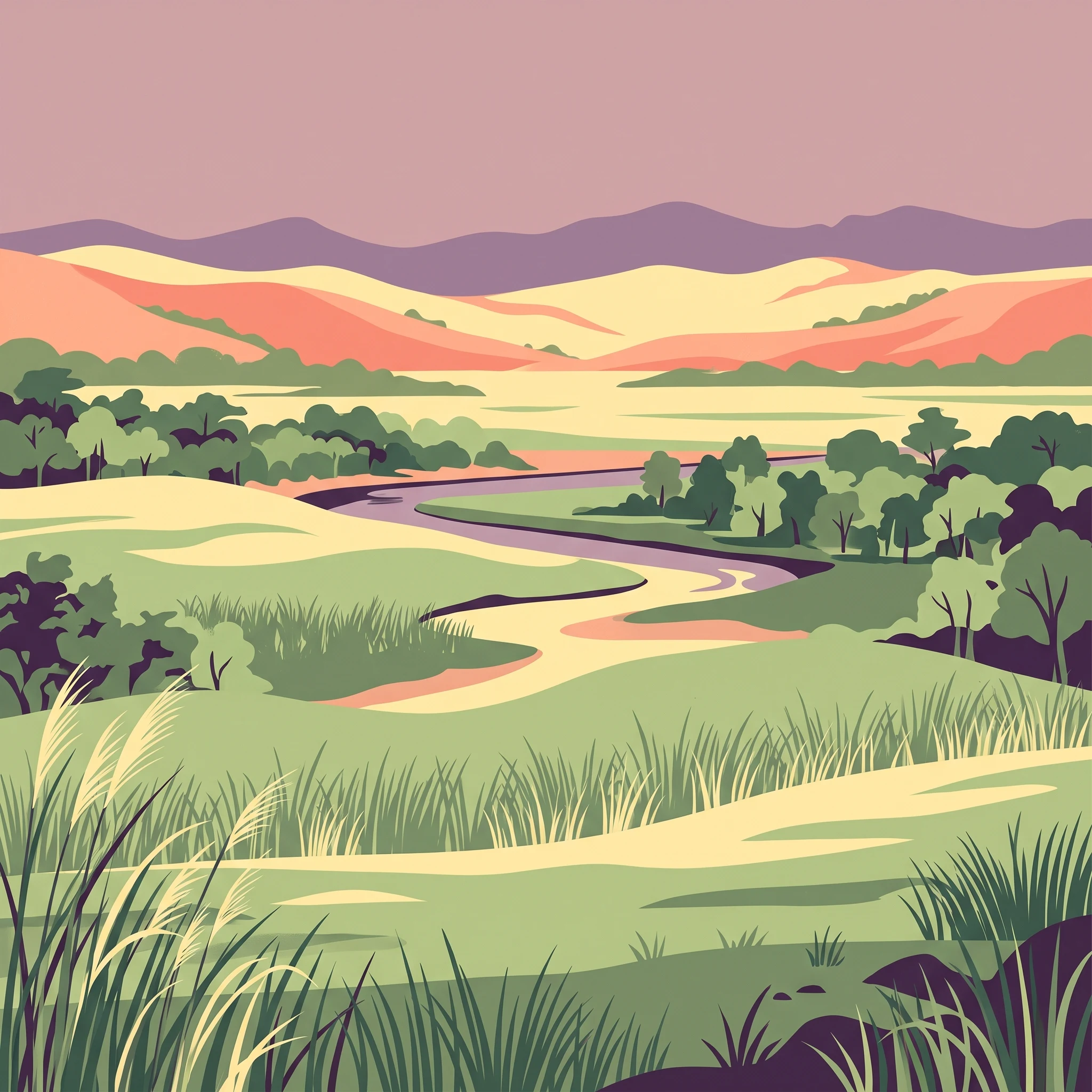
The physical landscape of Jaldapara National Park is characterized by its extensive rolling grasslands that dominate the terrain, creating a savanna environment unusual among Indian protected areas. The terrain is essentially flat to gently undulating, sitting at the base of the Himalayan foothills where the mountains give way to the alluvial plains. Tall elephant grasses, which can reach impressive heights, cover the majority of the park's surface, creating a sea of green that sways with the wind and provides cover for the park's wildlife. Interspersed throughout the grassland are patches of riverine forest, typically found along drainage lines and the banks of the Torsa River. These forest patches contain different tree species and provide vertical structure to the landscape. The park's elevation of 61 meters above sea level places it squarely in the subtropical zone, influencing both the vegetation types present and the climate patterns experienced throughout the year.

Jaldapara National Park ecosystems, habitats, and plant life

The ecological character of Jaldapara is defined by its grassland-dominated ecosystem, which represents a relatively rare habitat type in the Indian subcontinent. The savanna environment supports a distinctive suite of plant species adapted to periodic flooding and seasonal variation. Recent floristic surveys have documented 294 tree species belonging to 189 genera and 63 families, including four species of gymnosperms, demonstrating surprising botanical diversity within the grassland matrix. The riverine forests along watercourses contain different species assemblages suited to more moist conditions. The combination of open grassland and forest patches creates a heterogeneous landscape that supports diverse ecological communities. The park's position at the edge of the Himalayas means it receives species influences from both the mountain systems and the plains, contributing to its biological richness.

Jaldapara National Park wildlife and species highlights

Jaldapara National Park supports an impressive array of mammalian species, with the Indian one-horned rhinoceros standing as the flagship conservation priority. The park holds the largest population of this endangered species in West Bengal and is second only to Kaziranga in the entire country in terms of rhino numbers. The diverse ungulate community includes sambar deer, barking deer, chital, hog deer, and gaur, which together form the prey base for predator species. Indian elephants move through the park in substantial numbers, representing another megafauna species of conservation significance. Predators include the Indian leopard, which maintains populations in the forest patches. Wild boar are common throughout the grasslands. The combination of grassland and forest habitats creates conditions suitable for this rich mammal community, though detailed bird and reptile inventories are less prominently documented in available sources.

Jaldapara National Park conservation status and protection priorities

Jaldapara National Park represents an important conservation priority for India due to its population of Indian one-horned rhinoceros, a species that has historically faced severe poaching pressure across its range. The park's designation as a national park in 2014 reflected the government's commitment to stronger conservation measures for this endangered megaherbivore. The grassland ecosystem itself is of conservation significance, as such habitats are limited in extent across the Indian subcontinent. Management approaches focus on habitat maintenance through controlled burning and management of grass height to ensure suitable grazing conditions for rhinos and other herbivores. Anti-poaching efforts form a critical component of conservation strategy given the ongoing value of rhino horn in illegal markets. The park's location near international borders also creates challenges and opportunities for transboundary conservation considerations.

Jaldapara National Park cultural meaning and human context

The human heritage of the Jaldapara region predates its protected area status by several centuries. Before 1800, the area was home to the Toto and Mech tribal communities, ethnic groups belonging to the broader Bodo-Kachari people of the eastern Himalayan region. The historical name Totopara reflects this tribal presence and serves as a reminder of the long human history in this landscape. These communities traditionally practiced agriculture and maintained connections to the land that now falls within the park boundaries. The relationship between indigenous communities and the grassland ecosystem shaped the landscape through generations of land use. Following the establishment of the sanctuary, these communities' relationship with the area was modified by conservation policies, though the cultural dimension remains part of the park's regional identity.

Top sights and standout views in Jaldapara National Park

The defining highlight of Jaldapara National Park is its population of Indian one-horned rhinoceros, which represents one of the largest concentrations of this endangered species in India. The park's grassland landscape offers a safari experience distinct from the forest-based national parks more common in India, with elephant grass reaching impressive heights and creating an immersive wilderness atmosphere. The presence of multiple large mammal species including elephants, leopards, and various deer creates excellent wildlife viewing opportunities. The park's relative proximity to the Himalayan foothills gives it a geographic setting that combines plains accessibility with mountain-influenced ecology. The transformation from wildlife sanctuary to national park in 2014 reflects growing conservation recognition and provides enhanced protection for the ecosystem.

Best time to visit Jaldapara National Park

The optimal period to visit Jaldapara National Park falls during the winter months from November through March, when weather conditions are most comfortable for wildlife viewing and park activities. During this season, the grassland vegetation is less dense, making animal sightings more likely, and the mild temperatures allow for comfortable safari experiences. The monsoon season from June to September brings heavy rainfall to the region, which while creating lush green landscapes, can limit park accessibility and wildlife viewing opportunities. The summer months from April to June can be quite hot and may reduce animal activity during daytime hours. Visitors planning trips should check current access conditions and safari availability, as operational details may vary and should be verified through official park management channels.
Park guides

Targeted readings addressing specific planning questions and seasonal wildlife tracking windows

Jaldapara National Park Published Guides and Focused Research Material

Selected advisory resources provide structured answers to specific logistical questions concerning Jaldapara National Park. Detailed publications examine the ideal visitation months and seasonal trail conditions across the grassland ecosystem.
Monthly climate preview

Charting long-term temperature ranges and precipitation trends in Alipurduar

Jaldapara National Park Weather by Month and Climate Profile

Long-term averages for Jaldapara National Park reveal a highly seasonal precipitation cycle with temperatures rising from a mild 16.2 degrees Celsius to over 29 degrees in May. Examining the complete monthly climatology reveals detailed daily minimums, maximum temperature peaks, and historical rain patterns.
Annual mean24 °C
16 °C29 °C
Jan16°
Feb19°
Mar24°
Apr28°
May29°
Jun29°
Jul28°
Aug28°
Sep27°
Oct25°
Nov21°
Dec18°
Warmest month
May

29.3 °C

Coolest month
January

16.2 °C

Wettest month
July

13.3 mm/day

Driest month
December

0.1 mm/day

Park location guide

Geography guide, regional context, and park location map for Jaldapara National Park

Jaldapara National Park park geography, regions, and map view in India

Understand where Jaldapara National Park sits in India through a broader geographic reading of the surrounding landscape, nearby location context, and its mapped position within the national park landscape.

How Jaldapara National Park fits into India

India is a South Asian country bordered by the Indian Ocean, Arabian Sea, and Bay of Bengal. It shares land borders with Pakistan, China, Nepal, Bhutan, Bangladesh, and Myanmar. The country has a population of over 1.4 billion people and operates as a federal parliamentary republic with its capital in New Delhi.

Wider geography shaping Jaldapara National Park in India

India occupies the Indian subcontinent in South Asia, bordered by the Arabian Sea to the southwest, the Bay of Bengal to the southeast, and the Indian Ocean to the south. It shares land borders with Pakistan to the west, China, Nepal, and Bhutan to the north, and Bangladesh and Myanmar to the east. The territory also includes the Andaman and Nicobar Islands in the Indian Ocean.

Map view of Jaldapara National Park

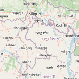
Use this park location map to pinpoint Jaldapara National Park in India, understand its exact geographic position, and read its mapped placement within the surrounding landscape more clearly.

Pigeon | © OpenStreetMap contributors

Location context for Jaldapara National Park

Alipurduar districtWest Bengal
Park atlas

Compare Jaldapara National Park's unique grassland ecosystems and riverine forests within the broader Eastern Himalayas foothills region.

Explore Other National Parks and Protected Areas Near Jaldapara National Park

Expand your exploration from Jaldapara National Park to discover other protected areas and national parks situated within the surrounding Eastern Himalayas foothills region. Compare diverse conservation landscapes, map regional protected zones, and trace the geographic spread of wildlife habitats and savanna ecosystems across the broader area.
National parkAlipurduar district
About 31 km away#1 closest

East

Buxa Tiger Reserve National Park: Protected Landscape Exploration in Alipurduar District

Mapped boundaries and diverse ecosystems within India's easternmost tiger reserve.

Buxa Tiger Reserve, a designated national park in India's Alipurduar district, offers a profound look into a protected landscape at the crossroads of major biogeographic zones. Its terrain ascends from the Gangetic Plains to the Himalayan foothills, showcasing a rich tapestry of forest types and supporting significant faunal diversity. This reserve functions as a crucial international elephant corridor, facilitating wildlife movement between India and Bhutan, and stands as a testament to the importance of mapped protected areas in transboundary conservation efforts.

Area
760 km²
Established
1983
IUCN
II
Relief
Mixed relief
National parkJalpaiguri district
About 47 km away#2 closest

West

Gorumara National Park: India National Park Atlas and Protected Landscape Geography

Discover the mapped boundaries and regional terrain.

Gorumara National Park stands as a vital protected natural area within India's Jalpaiguri district. This entry provides detailed atlas-focused information, detailing the park's geographic identity and its position within the regional landscape context. Understand the mapped protected boundaries and explore the unique terrain that characterizes Gorumara National Park as a key national park entity. It serves as a foundational point for geographic discovery within India's network of protected lands.

Area
79.99 km²
Established
1992
IUCN
II
Relief
Mixed relief
National parkKalimpong district
About 59 km away#3 closest

Northwest

Neora Valley National Park: India's Protected Landscape in Kalimpong District

Explore mapped boundaries and regional geography.

Neora Valley National Park is a significant protected area designated as a national park in India, located within the Kalimpong district. This dedicated page provides detailed geographic information, focusing on its mapped boundaries and its role as a natural landscape within the region. Understand the specific protected-area context of Neora Valley National Park for atlas-based discovery.

Area
88 km²
Established
1986
IUCN
II
Relief
Mountain
National parkKokrajhar District
About 70 km away#4 closest

East

Raimona National Park: National Park Protected Landscape and Geographic Atlas Exploration

Discover mapped terrain and regional geography within Raimona National Park.

Raimona National Park, designated as a national park within India's Kokrajhar District, offers rich opportunities for atlas-based geographic discovery. This page details the park's protected landscape, providing insights into its mapped boundaries and the surrounding natural terrain. Understanding Raimona National Park's placement within the regional geography allows for a deeper appreciation of its role as a significant protected area, perfect for detailed map exploration and landscape context.

Area
422 km²
Established
2021
IUCN
II
Relief
Mountain
Nature reserveBhutan
About 74 km away#5 closest

North

Torsa Strict Nature Reserve: Bhutan Nature Reserve Protected Landscape Discovery

Mapped geography and protected boundaries within the Eastern Himalayas.

Torsa Strict Nature Reserve represents a vital component of Bhutan's protected natural areas. This detail page offers a structured exploration of its identity as a nature reserve, focusing on its geographic placement within the country and the surrounding Himalayan terrain. Users can investigate the mapped outlines of this protected landscape, gaining a clearer understanding of its regional context and its significance for atlas-driven geographic discovery.

Area
609.51 km²
Established
1993
Relief
Mountain
Scope
Terrestrial
Wildlife reserveBhutan
About 77 km away#6 closest

East

Phibsoo Wildlife Sanctuary: Bhutan's Wildlife Reserve Atlas and Geographic Identity

Mapping the protected landscape and natural terrain of this Bhutanese sanctuary.

Delve into the specifics of Phibsoo Wildlife Sanctuary, a protected wildlife reserve situated within the geographic expanse of Bhutan. This park detail page focuses on its identity as a conservation landscape, offering insights into its mapped terrain and its significance within the broader regional geography of the Eastern Himalayas. Understand the protected boundaries and the unique natural context that Phibsoo Wildlife Sanctuary represents.

Area
268.93 km²
Established
2009
IUCN
IV
Relief
Mixed relief
Wildlife reserveBhutan
About 94 km away#7 closest

North

Motithang Takin Preserve: Bhutan Wildlife Reserve with Unique Protected Landscape Context

Explore the mapped geography and national animal sanctuary.

The Motithang Takin Preserve offers a unique glimpse into Bhutan's dedication to its national animal, the takin. This wildlife reserve, located near the capital city, provides a defined protected area where the distinctive goat-antelope thrives. By examining the preserve's mapped boundaries and its forested terrain, users gain insight into Bhutan's approach to conservation and the cultural significance of this iconic species within the Himalayan landscape.

Area
0.034 km²
IUCN
IV
Relief
Upland
Climate
Temperate
National parkBhutan
About 97 km away#8 closest

North

Jigme Dorji National Park: Bhutan's Vast Protected Landscape and Himalayan Geography

Explore mapped boundaries and diverse ecosystems within this national park.

Jigme Dorji National Park, located in the heart of Bhutan, is a testament to the country's commitment to conservation, covering over 4,300 square kilometers of pristine Himalayan terrain. This national park encompasses diverse ecosystems, from lush subtropical forests in its lower reaches to barren alpine meadows and permanent snowfields at its highest elevations. The park's extensive mapped boundaries showcase a landscape vital for unique wildlife and sacred cultural sites, offering a comprehensive view for atlas-based geographic discovery.

Area
4,316 km²
Established
1974
IUCN
II
Relief
Mountain

Common questions about visiting, size, designation, and location context for Jaldapara National Park

Jaldapara National Park FAQs for park facts, access, geography, and protected area context

Find quick answers about Jaldapara National Park, including protected-area facts, park geography, trail and visitor context, and how the park fits into its surrounding country and regional landscape.
MoriAtlas Explorer

Continue Your Protected Areas Search Across the Global Atlas

Deepen your exploration by continuing the structured search for national parks and protected areas worldwide. Utilize the comprehensive filtering capabilities to compare different conservation landscapes and refine your understanding of global park geography. Discover more about the distribution and characteristics of protected natural areas.

Global natural geography
