
Mori Atlas logo
Nature reserveKaiser Mountains

Tracing the distinct east-west ridges, steep limestone faces, and forest-covered slopes of this protected mountain landscape.

Kaiser Mountains Nature Reserve: Exploring the Limestone Massif and Alpine Geography of Tyrol, Austria

The Kaiser Mountains, or Kaisergebirge, represent a compact and visually powerful massif in the Northern Limestone Alps of Tyrol. This protected nature reserve displays a dramatic geological contrast between the vertical, bare rock walls of the southern Wilder Kaiser ridge and the gentler, forested flanks of the northern Zahmer Kaiser. The terrain provides a complex study of radial hydrography and alpine architecture, anchored by historic climbing peaks and diverse mountain ecosystems spanning across the Austrian landscape.

Northern Limestone Alpslimestone mountainsalpine climbingnature reserveTyrolEastern Alps
A graphic illustration of a dramatic limestone mountain range with coniferous forests in the foreground.

Kaiser Mountains

Nature reserve

Park overview

Structured park overview, official facts, and landscape profile for Kaiser Mountains

Kaiser Mountains park facts, protected area profile, and essential visitor context

Review the core facts for Kaiser Mountains, including designation, size, terrain, visitor scale, habitats, and operating context in one park-focused overview.

About Kaiser Mountains

The Kaiser Mountains are a compact alpine range that punches far above their footprint in terms of cultural and visual significance. Although they cover only about 280 square kilometres, the Kaisergebirge sits at a crossroads of geography, ecology, and alpine sport. Their position close to the Bavarian border, near Munich and Salzburg, has made them an easily accessible yet deeply authentic alpine landscape, both for travellers and for the climbing and hiking communities that have used them for over a century.

Ecologically, the range is defined by its strong vertical zonation. From forested submontane valleys filled with beech, fir, and spruce, the slopes rise through mountain pine thickets, alpine meadows, dwarf shrub heaths with rhododendron and alpenrose, and finally into bare limestone scree and summit rock. The variety of habitats is reflected in roughly 940 flowering plant species, dozens of fern and moss species, and a notable list of invertebrates, some of which are rare endemic forms linked to the ice-age history of the massif.

Culturally, the Kaiser Mountains occupy an unusual dual role. They are simultaneously a treasured protected natural landscape, shaped by the long-running Kaisergebirge nature reserve, and a cradle of European mountaineering. Many of the technical climbing innovations of the late nineteenth and twentieth centuries were tested on these walls, and the Kaiser continues to influence how difficult alpine routes are graded and understood. The result is a mountain range that is both a living ecosystem and a touchstone of Alpine heritage.

Quick facts and research context for Kaiser Mountains

The Kaiser Mountains occupy a position in the Austrian state of Tyrol between Kufstein and St. Johann in Tirol, very close to the German border. They form part of the Northern Limestone Alps, with the parent classification under the Alpine Club's Eastern Alps system labelled as group number 8. The range is dominated geologically by Wetterstein limestone and dolomite, sculpted by glaciation into deep valleys, sheer walls, and a small residual cirque glacier. At its core lies a long-established Austrian nature reserve covering most of the range's peaks and upper slopes. The Kaiser is one of the best-known mountaineering landscapes of the Eastern Alps, with a climbing tradition stretching back to the pioneers of the late nineteenth century.

Protection and recognition

Documented terrestrial protection scope, designation year, and management context

Kaiser Mountains Protection Status and Designated Conservation History

Kaiser Mountains maintains a recorded terrestrial protection status established in two thousand thirteen within international database tracking. Official conservation records outline the designated management scope and administrative framework governing the protected landscape.

Protection details

Protection scope
Terrestrial
Designated year
2013
Transboundary protection
No
WDPA ID
4343
Park context

Deeper park guide and search-rich context for Kaiser Mountains

Kaiser Mountains history, landscape, wildlife, and travel context

Explore Kaiser Mountains through its history, landscape character, ecosystems, wildlife, conservation priorities, cultural context, and seasonal travel timing in a structured park guide built for atlas discovery and search intent.

Why Kaiser Mountains stands out

The Kaiser Mountains are best known for their spectacular limestone walls and their place in the history of Alpine climbing. The Wilder Kaiser ridge, with its pale bare rock faces rising sharply above green valleys, has been a proving ground for generations of climbers, including legendary figures such as Hans Dülfer, Paul Preuss, Hermann Buhl, Reinhard Karl, and Stefan Glowacz. Famous routes on the Fleischbank, Totenkirchl, Predigtstuhl, and Maukspitze have shaped the development of climbing technique across the entire Eastern Alps.
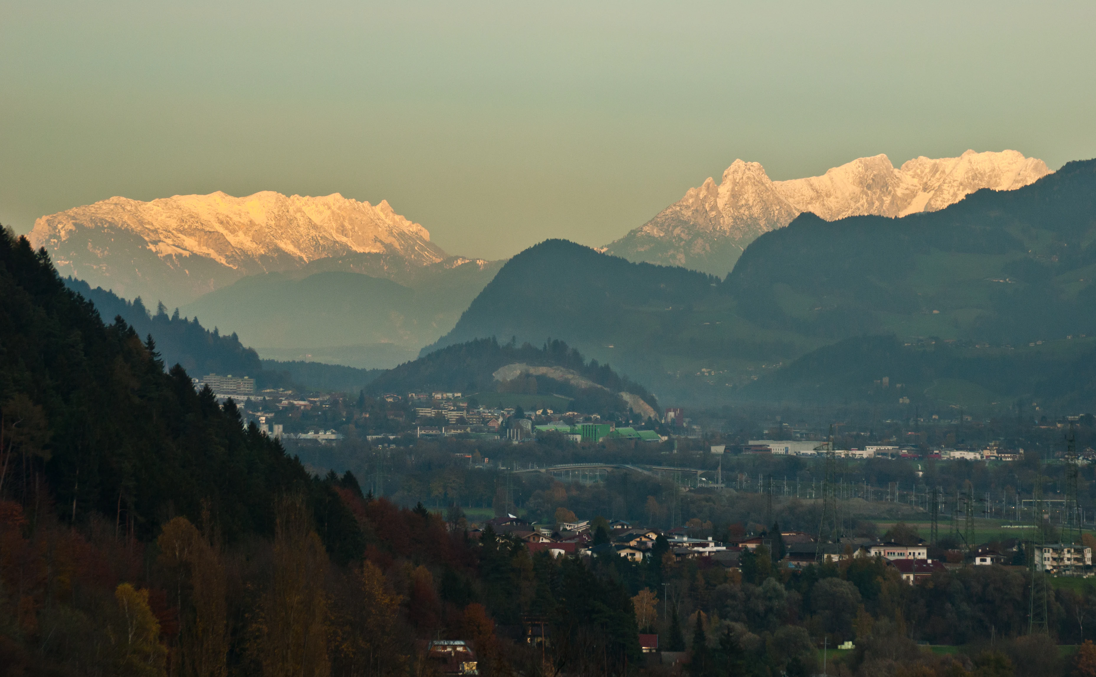
A wide mountain landscape view showing snow-capped limestone peaks of the Kaiser Mountains glowing in golden light above a valley with scattered buildings.
View of the Zahmer and Wilder Kaiser mountain ranges at sunrise, seen from the Inn Valley.

Kaiser Mountains history and protected-area timeline

The human story of the Kaiser Mountains reaches far back into prehistory. Stone Age hunters left evidence of their presence in the Tischofer Cave around 27,000 to 28,000 years ago, and Bronze Age pottery has also been recovered from the same site. In the medieval period, written records begin to appear, with a documented 1430 purchase of a farm called Hinterkaiser in the Kaisertal. The name Kaiser for the region itself is older, appearing in a 1240 Kitzbühel directory referring to a 'Gamsgiayt an dem Chaiser'. A 1611 annotation by Matthias Burgklehner already compared the silhouette of the range to an imperial crown, an image that has stayed attached to the mountains ever since.

Modern protection of the landscape began in earnest in the early twentieth century, when individuals such as Franz Nieberl, sometimes called the 'Emperor Pope' of the Kaiser, campaigned to keep cable cars and roads from overrunning the range. Their efforts eventually succeeded: following a 1961 referendum, a nature reserve covering 102 square kilometres of the Wilder and Zahmer Kaiser was officially established on 19 April 1963. A decade later, the reserve expanded its international profile when a wetland area of the Wilder Kaiser was designated under the Ramsar Convention in 2013.

The mountaineering history of the Kaiser Mountains is intertwined with the broader story of Alpine climbing. The late nineteenth and early twentieth centuries saw the first documented ascents of most major summits, while the years before the First World War turned the limestone walls of the Wilder Kaiser into the cradle of the Munich climbing scene, with pioneers like Hans Dülfer developing radically new techniques. Later climbers, including Paul Preuss, Hermann Buhl, Reinhard Karl, and Stefan Glowacz, continued to redefine difficulty on these walls, opening routes that shaped grading systems used across the Alps. The mountains remain a touchstone for technical alpine climbing to this day.

Kaiser Mountains landscape and geographic character

The Kaisergebirge is a small but visually powerful massif whose scenery changes character almost from one ridge to the next. The southern chain, the Wilder Kaiser, is built from pale Wetterstein limestone that rises in dramatic vertical faces, broken only by ledges, gullies, and scree fields. Its northern counterpart, the Zahmer Kaiser, shares the same rock foundations but wears a softer face, with extensive mats of mountain pine covering its flanks. Two main ridges run roughly east-west, linked centrally by the 1580-metre Stripsenjoch pass and divided to the west by the Kaisertal valley and to the east by the Kaiserbach valley.

The overall shape of the range is distinctive from any direction. From the south, the Wilder Kaiser presents a long, crowned wall of peaks above the green Sölllandl area; from the north, the same chain looks like a fortress of rock rising above the villages of Scheffau and Ellmau. The Zahmer Kaiser, by contrast, offers a gentler skyline of forested ridges and broad alpine pastures. Between Fleischbank and the Totenkirchl, a small cirque glacier known as the Schneeloch still clings to the high rock, though climate warming is steadily reducing it. At the western edge of the range, Lake Hinterstein offers a quieter, almost pastoral counterpoint to the alpine severity above it.

The hydrography of the range radiates outward in all directions. Western slopes drain via the Sparchenbach into the Inn, while eastern slopes feed the Kaiserbach, which eventually reaches the Chiemsee via the Großache. Northern slopes contribute to the Weissenbach, and southern slopes either run into the Inn through the Weißache or, east of the Ellmauer Tor watershed, into the Großache and onward toward the Chiemsee. This radial drainage pattern reinforces the sense of the Kaiser as a self-contained landscape, surrounded by valleys and viewsheds that frame it on every side.
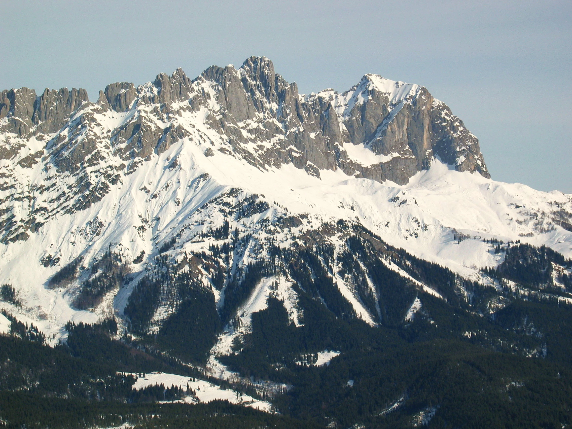
A wide, high-angle shot of rugged, snow-covered mountain peaks with steep rocky faces and dense evergreen forests at the base.
A view of the jagged, snow-covered Ackerlspitze and Maukspitze peaks in the Kaiser Mountains.

Kaiser Mountains ecosystems, habitats, and plant life

Ecologically, the Kaiser Mountains are a textbook example of Northern Limestone Alps biodiversity. Their elevation range, from around 480 metres in the valley floors to 2344 metres at the Ellmauer Halt, supports an unusually rich vertical sequence of habitats. Below the tree line, mixed forests of beech, silver fir, and Norway spruce dominate, with ash and sycamore maple appearing in the warmer submontane zones and alder in sunny clearings. Above the forests, traditional land use has produced hay meadows, nutrient-poor grasslands, and pastures that are themselves valuable semi-natural habitats.

In the subalpine zone, the vegetation shifts toward classic alpine heath communities, including extensive mountain pine stands on the slopes of the Zahmer Kaiser and a mix of alpenrose and rare dwarf alpenrose on exposed ground. Higher still, alpine polsterrasen, or cushion grasslands, cling to thin soils right up to the summit ridges, while various sedge communities occupy wetter pockets and small wetlands. The result is a landscape where small changes in altitude, slope, and aspect produce sharply different plant communities, all within a few hundred metres of each other.

The Kaiser is also notable for the ice-age legacy embedded in its invertebrate fauna. Some of its rare snails, earthworms, spiders, and butterflies are partly endemic, shaped by the glacial refuges and post-glacial isolation of the limestone valleys. This blend of typical Central European limestone forest and unusual relict species gives the range both a familiar and a distinctive identity in terms of nature conservation, especially within the long-standing Kaisergebirge nature reserve framework.

Panoramic view of the jagged limestone peaks of the Wilder Kaiser mountains, with snow on the summits and dark coniferous forests at the base, viewed from a green valley in Ellmau, Austria.
A panoramic view of the snow-capped Wilder Kaiser mountain range in the Tyrolean Alps.

Kaiser Mountains wildlife and species highlights

The wildlife profile of the Kaiser Mountains spans the full elevation range of the massif, from valley forests to bare summit rock. In the woodlands, typical European forest mammals are present, including the edible dormouse, the hazel dormouse, and the bank vole. Amphibians such as the alpine salamander and the fire salamander thrive in damp habitats, while reptiles include the smooth snake and unusually coloured variants of the common European viper. These species benefit from the mosaic of forest, meadow, and rocky terrain across the lower slopes.

In the higher elevations, mammals shift toward species adapted to alpine terrain. Chamois are characteristic of the rocky upper slopes, while smaller specialists such as the stoat, the European snow vole, and the mountain hare occupy harsher ground above the tree line. The range of habitats supports a sharp gradient of mammal communities that mirrors the broader vegetation gradient from forest to alpine.

Birdlife is one of the strongest elements of the Kaiser's natural profile. The mixed and coniferous forests host woodland species like the wood warbler and the willow tit, and the range is important for a North Tyrol endemic population of the red-breasted flycatcher. Alpine cliffs and rocky terrain support charismatic species such as the alpine chough, the common raven, the Eurasian crag martin, the alpine accentor, and the wallcreeper, a bird closely associated with steep limestone. Gamebirds are well represented, with black grouse, western capercaillie, and rock ptarmigan all present. Raptors circle the mountains year-round, including the northern goshawk, the Eurasian sparrowhawk, the golden eagle, and several owl species such as the tawny owl, the Eurasian pygmy owl, and Tengmalm's owl.
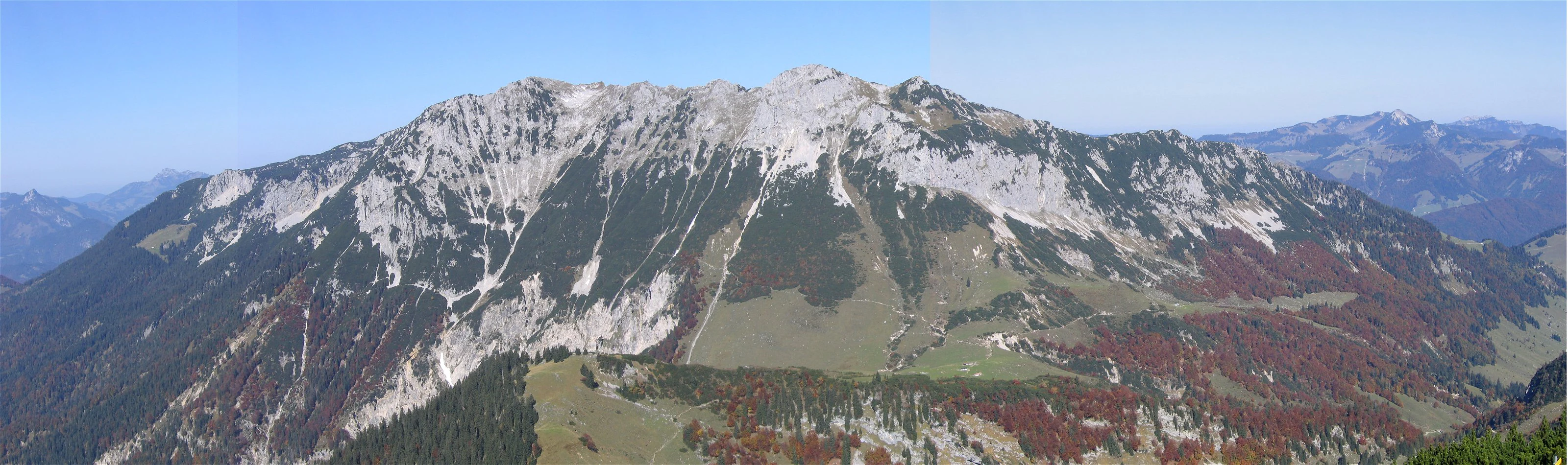
A wide, panoramic shot showing the rugged limestone peaks of the Zahmer Kaiser mountain range, characterized by rocky slopes, coniferous forests, and autumn-colored foliage.
A panoramic view of the Zahmer Kaiser mountain range.

Kaiser Mountains conservation status and protection priorities

Conservation is central to the identity of the Kaiser Mountains. The Kaisergebirge nature reserve, established in 1963 after a public referendum, covers the majority of the range's peaks and high ground, including all the summits of both the Wilder Kaiser and the Zahmer Kaiser. Its primary purpose, set out by the early twentieth-century advocates of protection, was to keep the range from being overrun by cable car projects and new roads. That original aim is still visible today: the only mechanised lift in the protected area is the chair lift to the Brentenjoch saddle, and other lift proposals have been kept out by the reserve.

The reserve also plays a role in protecting the Kaisertal, which for many decades was the only permanently inhabited valley in Austria without road access. Eventually, in 2008, the Kaisertal road was opened, but only as a private road restricted to residents, farmers, and emergency services. This compromise, unusual for an inhabited alpine valley, reflects the ongoing balance that conservation efforts in the range seek to maintain.

Internationally, the importance of the Kaisergebirge was reinforced in 2013 when part of the Wilder Kaiser was designated as a Ramsar wetland site, recognising its ecological value at a global level. Beyond protections, the reserve is supported by an unusually rich set of ecological data: around 940 flowering plant species, hundreds of mosses, lichens, and fungi, and a notable set of endemic and relict invertebrates. The combination of formal protection, biodiversity, and ongoing scientific attention makes the Kaiser one of the more carefully conserved alpine landscapes in Austria.

Kaiser Mountains cultural meaning and human context

The Kaiser Mountains hold a distinctive place in Tyrol's cultural geography. Their silhouette is visible from major population centres of the region, and the name 'Kaiser', traditionally linked to the appearance of an imperial crown, has shaped the way locals and visitors describe the landscape for centuries. The 1611 reference by Matthias Burgklehner, describing the range as 'a very high mountain range, which is just like an imperial crown', is still often quoted as part of the cultural identity of the mountains.

Although the Kaisergebirge does not carry the same weight of folk legend as some other alpine ranges, the area is closely tied to Tyrol's mountaineering culture. The villages around the range, including Kufstein, Ellmau, Going, Scheffau, St. Johann in Tirol, Ebbs, and Kirchdorf, have long been gateways for climbers, hikers, and later winter sports enthusiasts. The Wilder Kaiser area is now an internationally recognised ski and tourism region, while the older traditions of alpine farming, herding, and valley settlement continue in the lower elevations. A museum in St. Johann in Tirol is dedicated in part to the climbing history of the range, connecting the Kaisergebirge's natural and cultural heritage into a single narrative.
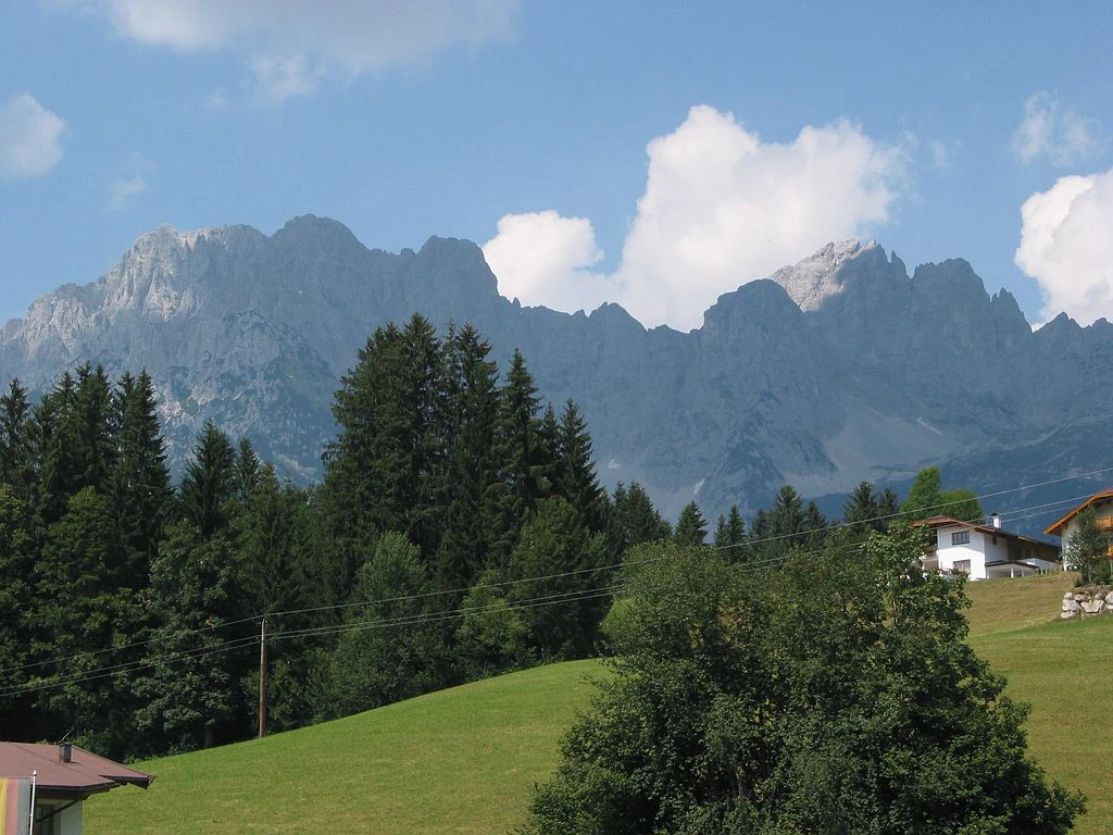
A wide view of the jagged Wilder Kaiser mountain peaks looming behind a green alpine meadow, coniferous forest, and small traditional residential buildings.
The dramatic limestone ridges of the Wilder Kaiser mountain range in the Austrian Tyrol.

Top sights and standout views in Kaiser Mountains

The Kaiser Mountains are a small alpine range with a remarkable concentration of distinctive features. Within a few kilometres, the landscape shifts from steep, world-famous limestone walls to gentle forested ridges, from alpine meadows and traditional alpine pastures to small cirque glaciers and clear mountain lakes. Its two main ridges, the Wilder Kaiser and the Zahmer Kaiser, express this contrast directly in their names, the Wild and the Tame, and offer completely different experiences to climbers, hikers, and nature enthusiasts.

Equally notable is the range's layered identity. It is simultaneously a protected nature reserve of over 100 square kilometres, a Ramsar-recognised wetland area, a UNESCO-listed climbing venue in terms of historical importance, and a major winter sports region. Few alpine ranges of comparable size combine such a strong ecological story with such a deep cultural and sporting heritage. The Kaisergebirge is essentially a complete alpine experience compressed into a compact and accessible East Alpine massif.
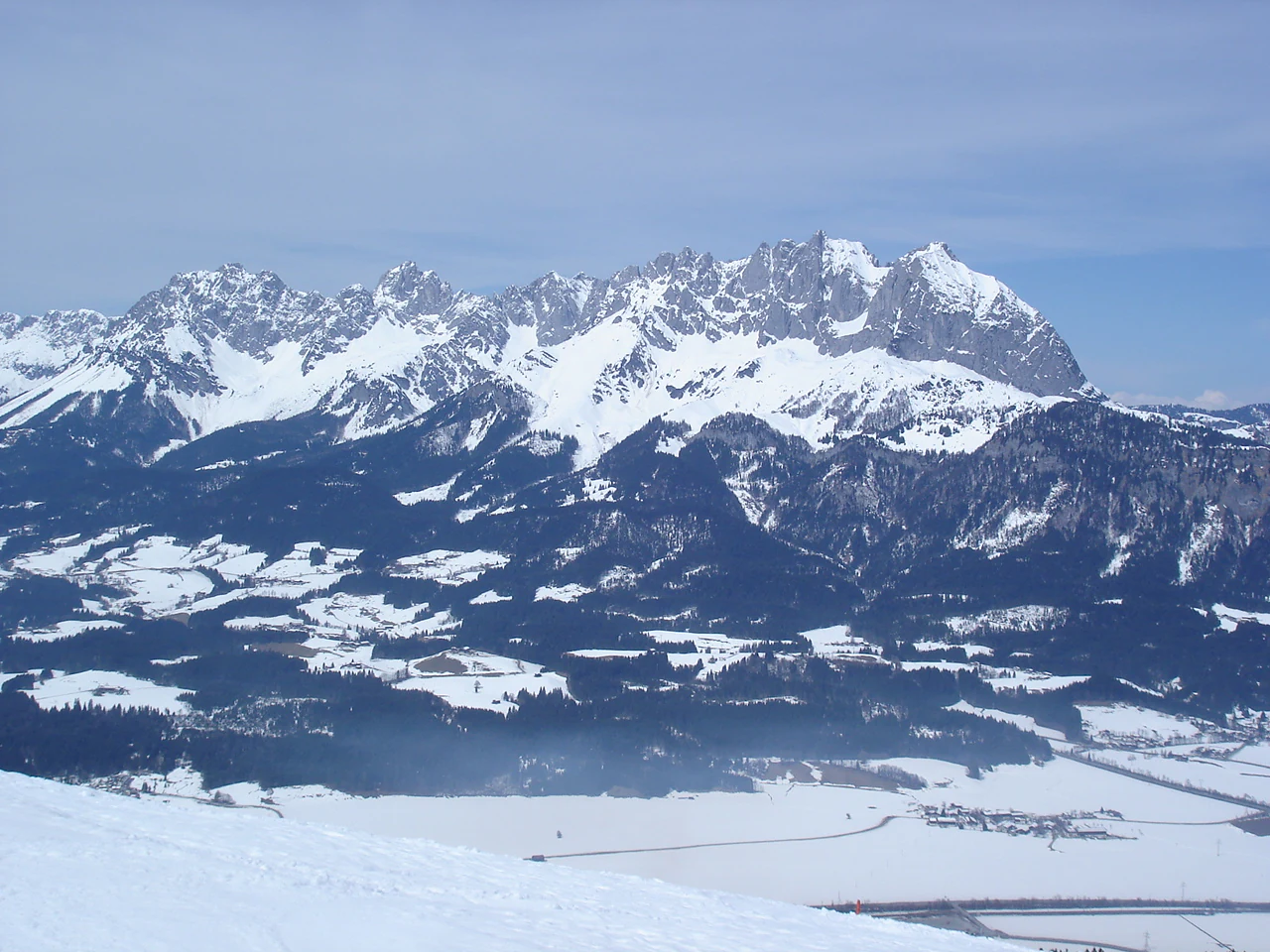
A wide, eye-level landscape shot of a rugged, snow-dusted mountain range rising above a snowy valley floor under a clear sky.
A panoramic view of the snow-covered Kaiser Mountains range, seen from the south.

Best time to visit Kaiser Mountains

The Kaiser Mountains offer very different experiences depending on the season. Summer is the most versatile period, with temperatures in nearby Kufstein typically reaching the mid-twenties Celsius in July and August, long daylight hours, and stable alpine weather that opens up the full range of hiking and climbing routes. Wildflower meadows, alpenrose blooms, and active alpine wildlife make this the most rewarding time for general exploration of the Zahmer Kaiser and the lower parts of the Wilder Kaiser.

Late spring and early autumn can be quieter and visually striking, with milder temperatures, fewer crowds on the popular routes, and good visibility for photography, though weather can become more changeable, particularly in the shoulder months. Winter transforms the landscape into a snowy playground, with the Wilder Kaiser-Brixental ski region operating on the southern flanks, the Kaisertal offering quieter winter walking, and snow-covered ridges providing dramatic scenery for those prepared for winter conditions. High winter use of the range means some huts and routes are busy, while others, particularly in the Zahmer Kaiser, remain peaceful.

Monthly climate preview

Long-term temperature ranges and monthly precipitation averages across the representative coordinate

Kaiser Mountains Climate Normals and Representative Annual Weather Patterns

Representative coordinate records show measured multi-year temperature variations and monthly precipitation amounts across the sampled terrain. Opening the full twelve-month profile provides complete weather statistics for detailed analysis.
Annual mean5 °C
-5 °C15 °C
Jan-5°
Feb-4°
Mar
Apr
May
Jun13°
Jul15°
Aug14°
Sep10°
Oct
Nov
Dec-4°
Warmest month
July

14.5 °C

Coolest month
January

-4.8 °C

Wettest month
July

6.2 mm/day

Driest month
February

2.6 mm/day

Park location guide

Geography guide, regional context, and park location map for Kaiser Mountains

Kaiser Mountains park geography, regions, and map view in Austria

Understand where Kaiser Mountains sits in Austria through a broader geographic reading of the surrounding landscape, nearby location context, and its mapped position within the national park landscape.

How Kaiser Mountains fits into Austria

Austria is a landlocked country in Central Europe, bordered by Germany, Czech Republic, Slovakia, Hungary, Slovenia, Italy, Switzerland, and Liechtenstein. The country is a federal semi-presessional republic composed of nine states, with Vienna as its capital and largest city. It has a population of approximately 9.1 million people.

Wider geography shaping Kaiser Mountains in Austria

Austria is located in Central Europe, lying in the Eastern Alps. It is bordered by Germany and Czech Republic to the north, Slovakia to the northeast, Hungary to the east, Slovenia and Italy to the south, and Switzerland and Liechtenstein to the west.

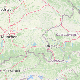
Map view of Kaiser Mountains

Use this park location map to pinpoint Kaiser Mountains in Austria, understand its exact geographic position, and read its mapped placement within the surrounding landscape more clearly.

Pigeon | © OpenStreetMap contributors

Location context for Kaiser Mountains

Tyrol

Visualizing limestone walls, alpine ridges, and protected mountain habitats

Kaiser Mountains Photos and Landscape Scenery Exploration

Browse detailed photographs of Kaiser Mountains to examine steep limestone walls, forested ridges, and protected alpine habitats across the massif. Visual records help clarify the dramatic terrain, stark geological contrasts, and characteristic scenery defining the region.

A wide mountain landscape view showing snow-capped limestone peaks of the Kaiser Mountains glowing in golden light above a valley with scattered buildings.

A jagged limestone mountain peak illuminated by the warm, golden light of sunset, set against a blue sky with soft, peach-colored clouds.

A wide, high-angle shot of rugged, snow-covered mountain peaks with steep rocky faces and dense evergreen forests at the base.

Panoramic view of the jagged limestone peaks of the Wilder Kaiser mountains, with snow on the summits and dark coniferous forests at the base, viewed from a green valley in Ellmau, Austria.

A wide, panoramic shot showing the rugged limestone peaks of the Zahmer Kaiser mountain range, characterized by rocky slopes, coniferous forests, and autumn-colored foliage.

A wide panoramic photograph showing a series of rugged, snow-covered mountain peaks in the Kaiser Mountains, with various summits identified by small labels and vertical indicator lines.

A wide view of the jagged Wilder Kaiser mountain peaks looming behind a green alpine meadow, coniferous forest, and small traditional residential buildings.

A wide, eye-level landscape shot of a rugged, snow-dusted mountain range rising above a snowy valley floor under a clear sky.

A massive limestone mountain face with rugged peaks and rocky slopes, viewed from below with green trees in the foreground against a clear blue sky.

A wide scenic view of the jagged limestone peaks of the Wilder Kaiser mountains, with a green alpine meadow and coniferous forest in the foreground and a few houses on the right.

A wide, panoramic view of snow-dusted limestone mountain peaks under a cloudy, bright sky, seen from a higher elevation with a coniferous tree in the foreground.

A wide, high-angle view looking down into a valley containing a town and a winding river, flanked by large, rugged mountains under a clear blue sky.

A wide landscape view of the Kaiser Mountains featuring craggy limestone peaks above a green valley and evergreen forest.

Panoramic view of the snow-covered Kaiser Mountains with various peaks labeled with text overlays.

Panoramic sunset view of the Wilder Kaiser mountain range featuring rocky ridges and overlaid vertical yellow lines pointing to specific peaks.

A wide panoramic photograph showing a rugged limestone mountain range under a partly cloudy sky, with many peaks identified by thin vertical lines and text labels above them.

Park atlas

Compare adjacent limestone ranges and regional protected areas across Tyrol

Explore Parks Near Kaiser Mountains and Surrounding Protected Landscapes

Browse other parks near Kaiser Mountains to examine connected alpine terrain, limestone massifs, and regional protected-area geography. Expanding your search beyond the Kaisergebirge reveals broader ecological patterns and comparative mountain landscapes across the Eastern Alps.
Nature reserveGermany
About 33 km away#1 closest

Northeast

Naturwald Kraxenbach: Protected Montane Forest and Alpine Landscape Geography in Bavaria

A comprehensive look at a protected Bavarian mountain reserve

Naturwald Kraxenbach offers a deep dive into the montane ecosystems of the German-Austrian border. This nature reserve protects over 200-year-old forest stands and distinct holly habitats within the steep valleys of the Chiemgauer Alps, providing an essential study of natural forest development in a historical forestry region.

Area
18.01 km²
Established
2020
Relief
Mountain
Climate
Alpine
National parkAustria
About 35 km away#2 closest

Southeast

Hohe Tauern National Park: Regional Geography and Protected Alpine Mountain Terrain

Major protected area in the heart of the Austrian Alps

Hohe Tauern National Park protects a grand scale of alpine terrain, including towering summits above 3,000 meters and the longest glacial systems in the country. This atlas record provides insights into the park's vertical landscape, encompassing glacial valleys, waterfalls, and diverse ecological zones that define the High Tauern mountain range in Austria.

Watercolor illustration showing mountain ranges, forests, and a river under a light sky.
National parkBavaria
About 36 km away#3 closest

East

Berchtesgaden National Park: Protected Landscape and Regional Geographic Context in Bavaria

Mapped natural terrain and protected area exploration.

Berchtesgaden National Park represents a crucial protected landscape situated in Bavaria, Germany. This entry provides detailed information focused on its protected area status, unique geographic setting, and mapped natural terrain. It serves as a gateway to understanding the park's specific identity within the regional atlas of Germany, offering insights into its boundaries and its significance as a curated natural landscape for discovery.

Area
210 km²
Established
1978
IUCN
II
Relief
Mountain
Watercolor painting showing mountain ranges with green, yellow, and pink hues, depicting layered peaks and cloud formations
National parkAustria
About 63 km away#4 closest

Southeast

Hohe Tauern National Park: Alpine Geography and Protected Landscape Atlas

High-altitude mountain terrain and glacial systems in Austria

Hohe Tauern serves as a primary protected area within the Austrian Alps, showcasing a vast sequence of glacial valleys, sharp mountain massifs, and high-alpine tundra. This exploration details the park's physical boundaries and its significance in preserving diverse ecological gradients and wilderness core zones across the Central Eastern Alps.

Area
1,806 km²
Established
1981
IUCN
II
Relief
Mountain
A horizontal watercolor illustration of a landscape with green pine trees in the foreground, a pale yellow meadow, and soft purple and green rolling mountains in the background against a white background.
Nature reserveBavaria
About 77 km away#5 closest

Northwest

Schellenbergmoor Nature Reserve: Geographic Mapping of Bavarian Pre-Alpine Wetland Landscapes

Protected peatland terrain in the Tölzer Moorachse corridor

Schellenbergmoor functions as a protected nature reserve situated in the pre-Alpine hill and moorland zone of Upper Bavaria. This site preserves rare raised and transitional bog habitats, serving as a critical node for hydrology and ecosystem connectivity between Lake Starnberg and the Loisach river basin.

Established
1987
A horizontal watercolor painting showing a range of light-colored, jagged mountain peaks in the background with a green coniferous forest and a small body of water in the foreground.
Nature reserveTyrol
About 83 km away#6 closest

West

Arnspitze Group Nature Reserve: Mapped Limestone Ridge and Alpine Geography

A historic protected massif in the Austrian Tyrol.

The Arnspitze Group represents a vital limestone ridge ecosystem within the Northern Limestone Alps. This nature reserve, spanning the border region, displays significant karst formations and forested slopes. Gain insight into the ridge layout, summit heights, and the protected status that defines this essential Tyrolean mountain chain through detailed map-based discovery.

Area
12.5 km²
Established
1942
Relief
Mountain
Climate
Alpine
A watercolor painting showing a panoramic view of soft mountain ridges and evergreen forests flanking a winding valley stream.
Nature reserveOberbayern
About 84 km away#7 closest

West

Schachen und Reintal: A Protected Alpine Landscape in the Wetterstein Mountains

Geographic atlas and nature reserve mapping for Oberbayern

Spanning from the Zugspitzplatt to the rugged Jubiläumsgrat, Schachen und Reintal serves as a vital nature reserve in the Bavarian Alps. The area preserves a wide topographical gradient of limestone terrain, river-carved gorges, and pristine forests, providing an essential look at the protected high alpine geography of the Wetterstein range.

Area
39.636 km²
Established
1970
IUCN
IV
Nature reserveOberbayern
About 87 km away#8 closest

West

Naturwaldreservat Wettersteinwald: Protected Nature Reserve and Alpine Forest Geography

Oberbayern, Germany; subalpine forest conservation and limestone mountain terrain

Uncover the ecological structure of Naturwaldreservat Wettersteinwald, one of the oldest nature forest reserves in the Bavarian Alps. Located on steep Wetterstein limestone, the area encompasses a compact mosaic of spruce and stone pine, protecting essential habitat for rare saproxylic beetle species within its defined 42 hectare boundaries.

Area
0.426 km²
Established
1978
Relief
Mountain
Climate
Alpine

Common questions about visiting, size, designation, and location context for Kaiser Mountains

Kaiser Mountains FAQs for park facts, access, geography, and protected area context

Find quick answers about Kaiser Mountains, including protected-area facts, park geography, trail and visitor context, and how the park fits into its surrounding country and regional landscape.
MoriAtlas Explorer

Continue Your Protected Areas Search Across the Global Atlas

Deepen your exploration by continuing the structured search for national parks and protected areas worldwide. Utilize the comprehensive filtering capabilities to compare different conservation landscapes and refine your understanding of global park geography. Discover more about the distribution and characteristics of protected natural areas.

Global natural geography