
Mori Atlas logo
National parkKalkalpen National Park

Discover the mapped protected boundaries and unique geology of this Austrian National Park.

Kalkalpen National Park: Central Europe's Premier Ancient Beech Forests and Karst Landscape

(Nationalpark Kalkalpen)

Kalkalpen National Park represents a vast expanse of protected natural heritage in Upper Austria, showcasing Central Europe's largest contiguous ancient beech forests and a remarkable karst landscape. Established to preserve these vital ecosystems, the park's rugged terrain spans the Northern Limestone Alps, featuring dramatic peaks, pristine waterways, and geological formations shaped over millennia. As a key site for atlas exploration, Kalkalpen offers deep insights into old-growth forest ecology, complex karst systems, and the mapped geographic context of Austria's wilder regions.

national parklimestone alpsold-growth forestsbeech forestskarst landscapecaves
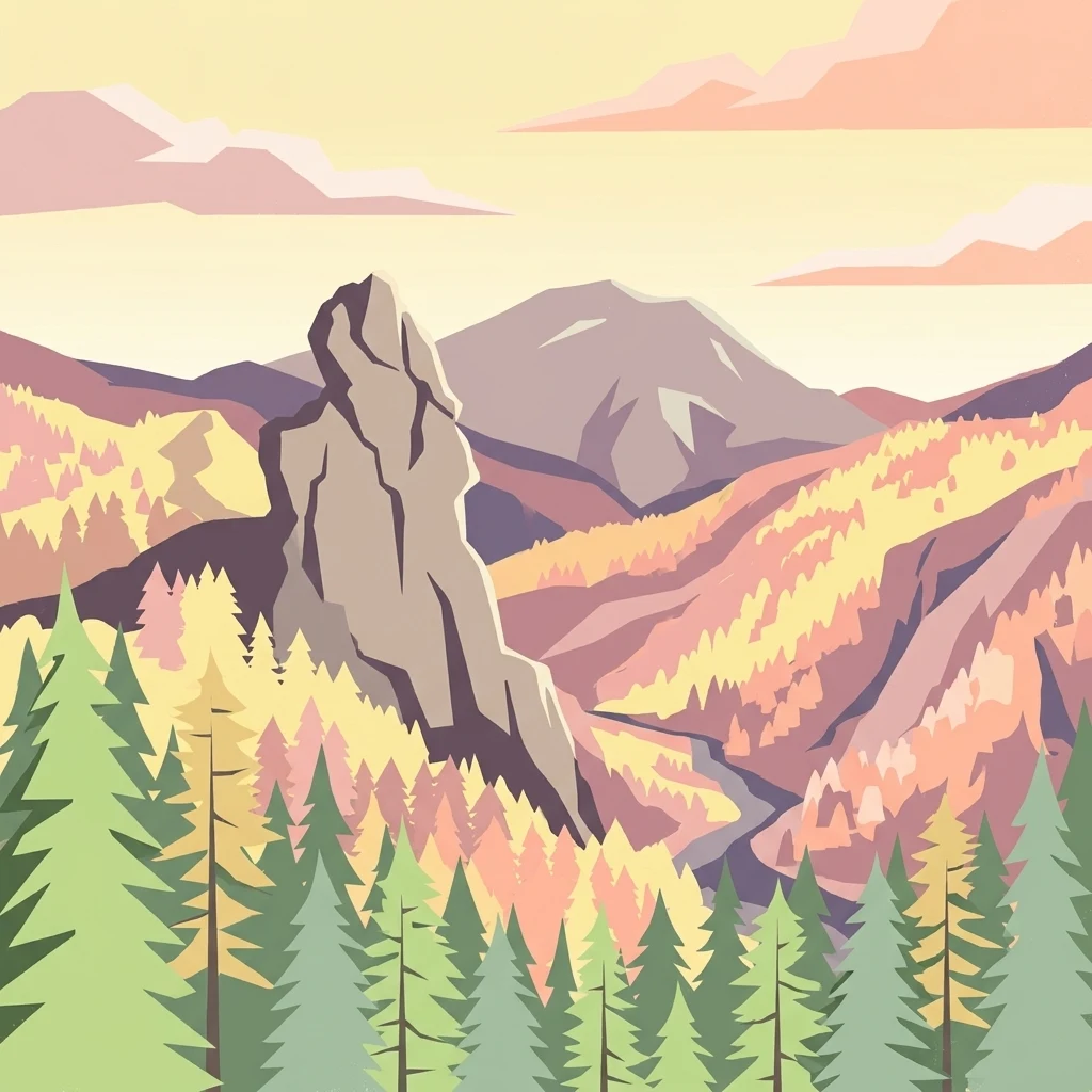
Stylized illustration showing forested valleys, a large rock formation, and layered mountains under a pastel sky

Kalkalpen National Park

National park

Park overview

Structured park overview, official facts, and landscape profile for Kalkalpen National Park

Kalkalpen National Park park facts, protected area profile, and essential visitor context

Review the core facts for Kalkalpen National Park, including designation, size, terrain, visitor scale, habitats, and operating context in one park-focused overview.

About Kalkalpen National Park

Kalkalpen National Park occupies a remarkable position in Austria's conservation landscape as the nation's largest forested protected area and the most significant karst region in the country. The park encompasses two principal mountain areas: the Sengsengebirge in the west and the Reichraminger Hintergebirge in the east, both forming part of the Northern Limestone Alps. This limestone-dominated terrain has produced an extraordinary underground landscape with more than 70 documented caves, including the Klarahöhle cave system and notable ice caves such as the Eiskapelle in the Sengsengebirge, where ice can persist until autumn in some years.

The park's ecological significance is rooted in its extensive old-growth forests. Beech forests in the Urlachtal, Bodinggraben, Wilder Graben, and Hintergebirge regions were inscribed on the UNESCO World Heritage List in 2017 as part of the transboundary Ancient and Primeval Beech Forests of the Carpathians and Other Regions of Europe. These forests represent unbroken ecological lineages tracing back to the post-glacial period, making them living laboratories for understanding European forest dynamics.

visitor centers in Molln, Reichraming, and Windischgarsten provide educational access to the park's natural and cultural heritage. The historic Villa Sonnwend in Roßleithen serves as the park's lodge and seminar center, a building dating to 1907. The park supports sustainable tourism through an extensive network of hiking trails, mountain biking routes, and the Hintergebirgsradweg cycling path that follows the former route of the Waldbahn Reichraming railway.

Quick facts and research context for Kalkalpen National Park

Kalkalpen National Park spans roughly 20,825 hectares in Upper Austria, making it Austria's largest forested national park. The highest peak within the park is Hohe Nock at 1,963 meters. The landscape is approximately 80% forested, dominated by mixed forests of spruce, fir, and beech. The park contains over 200 kilometers of unbuilt stream courses and more than 800 springs. Over 70 caves have been discovered within the park boundaries, including the Klarahöhle cave system discovered in 2004. The park is owned primarily by Österreichische Bundesforste (88%), with the remainder in private and municipal ownership.

Protection and recognition

Verifying the terrestrial boundaries, management scope, and official designation history.

Kalkalpen National Park Protection Status and Conservation Profile

Map-based explorer records compile the documented terrestrial boundaries and official protection status established for Kalkalpen National Park. Understanding verified conservation profiles helps researchers and geography enthusiasts trace global wilderness frameworks with accurate environmental dataset details.

Protection details

Protection scope
Terrestrial
Transboundary protection
No
Park context

Deeper park guide and search-rich context for Kalkalpen National Park

Kalkalpen National Park history, landscape, wildlife, and travel context

Explore Kalkalpen National Park through its history, landscape character, ecosystems, wildlife, conservation priorities, cultural context, and seasonal travel timing in a structured park guide built for atlas discovery and search intent.

Why Kalkalpen National Park stands out

Kalkalpen is best known for protecting Central Europe's largest remaining ancient beech forests, which represent some of the last old-growth forest ecosystems in the continent. The park's karst geology, with its extensive cave systems, sinkholes, and underground water networks, is equally distinctive. In 2019, the oldest dated beech tree in Europe, estimated to be over 500 years old with rings dating to 1474, was discovered within the park, providing extraordinary evidence of the forests' ecological continuity. The Reichraminger Hintergebirge region offers dramatic alpine scenery with peaks exceeding 2,000 meters visible from the Wurbauerkogel panorama tower.
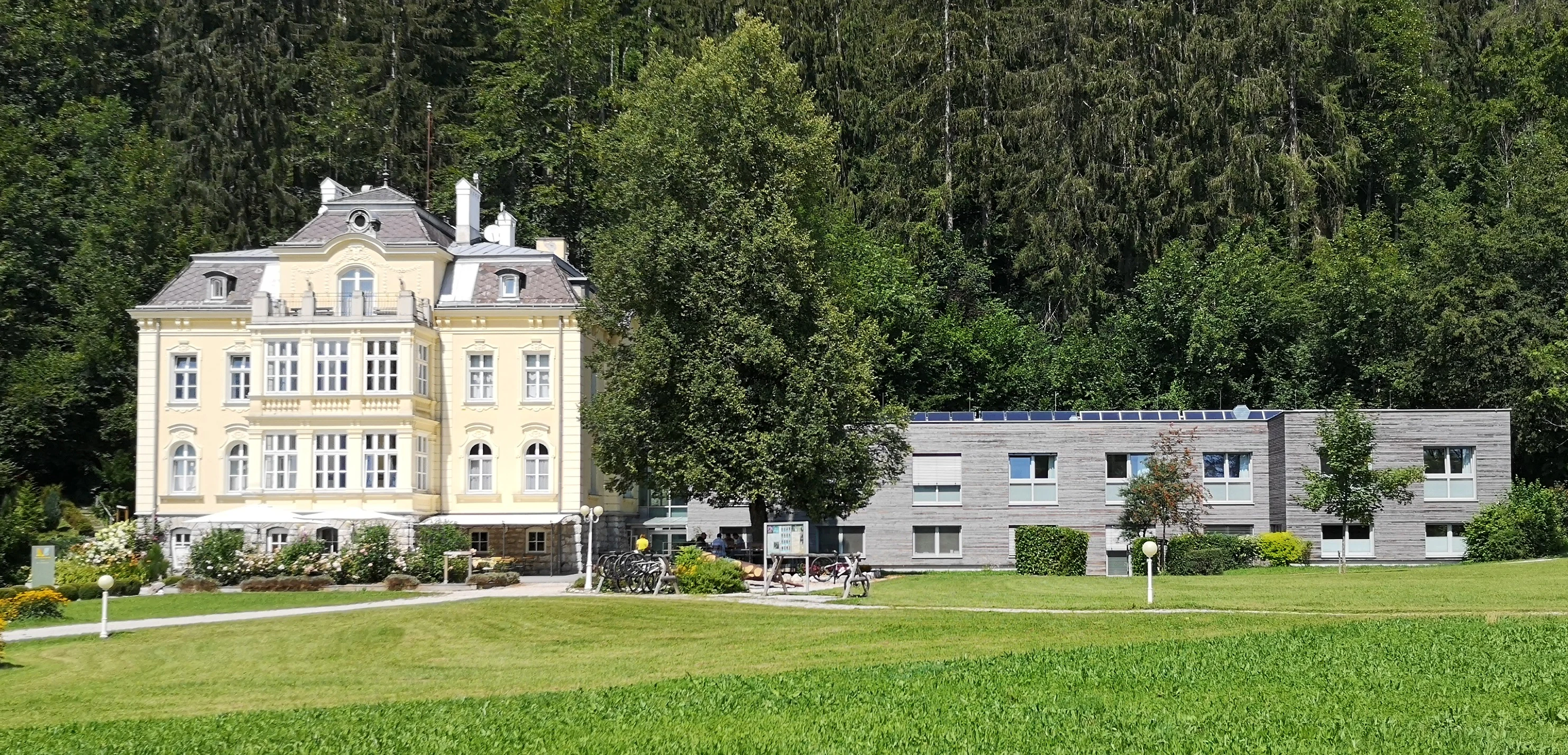
Historic yellow building with white trim and gray roof surrounded by green fields and trees
Villa Sonnwend, a historic building managed by Kalkalpen National Park as a lodge and seminar hotel

Kalkalpen National Park history and protected-area timeline

The history of Kalkalpen National Park reflects decades of conservation advocacy in Upper Austria. Human presence in the region extends to the Stone Age, with stone artifacts from hunting communities dating to between 18,000 and 10,000 BCE discovered in the Nixloch cave near Ternberg. Bronze Age artifacts including axes and a spear point found near Windischgarsten indicate continued human activity through the first millennium BCE.

The modern conservation movement gained momentum in the 1970s and 1980s. The Sengsengebirge nature reserve was established in 1976, providing initial protection. Beginning in the 1980s, local conservation groups and the Austrian Nature Union (Naturschutzbund ÖNB) mounted successful campaigns against proposed industrial developments, including a military training area proposed by the steel company VÖEST and hydroelectric reservoir projects by Ennskraftwerke AG in the Hintergebirge.

Formal planning for a national park began in 1990, culminating in the Nationalpark Law passed by the Upper Austrian Parliament in 1996. The park was initially established by ordinance on July 21, 1997, covering 16,509 hectares and formally opened on July 25, 1997. International IUCN recognition as a Category II protected area followed in the same year. Subsequent expansions brought the park to its current size: 18,400 hectares in 2001 and 20,856 hectares in 2003, with a further adjustment in 2009. The park gained Ramsar designation in 2004 and Natura 2000 status the same year, fulfilling both European Union FFH and Birds Directive requirements.

Kalkalpen National Park landscape and geographic character

The landscape of Kalkalpen National Park is defined by its location within the Northern Limestone Alps, characterized by dramatic alpine terrain carved from limestone and dolomite bedrock. The primary rock types are Wettersteinkalk and Hauptdolomit, which have produced an extensive karst system of caves, sinkholes, and underground drainage networks. The terrain is approximately 80% forested, with the remaining areas comprising alpine meadows, rocky summits, and water features.

The Reichraminger Hintergebirge forms the eastern portion of the park, offering a remote wilderness character with steep-sided valleys descending from ridgelines exceeding 1,900 meters. The highest peak in the park, Hohe Nock at 1,963 meters, rises from this eastern section. From the Wurbauerkogel panorama tower near Windischgarsten, visitors can see 21 peaks exceeding 2,000 meters on clear days. The Sengsengebirge in the western portion contains the famous Eiskapelle, an ice cave with a 60-meter-long, 30-meter-wide chamber where ice can persist year-round in its deepest section. The park contains over 200 kilometers of unbuilt stream courses and more than 800 documented springs, feeding clean water systems that remain largely unmodified.
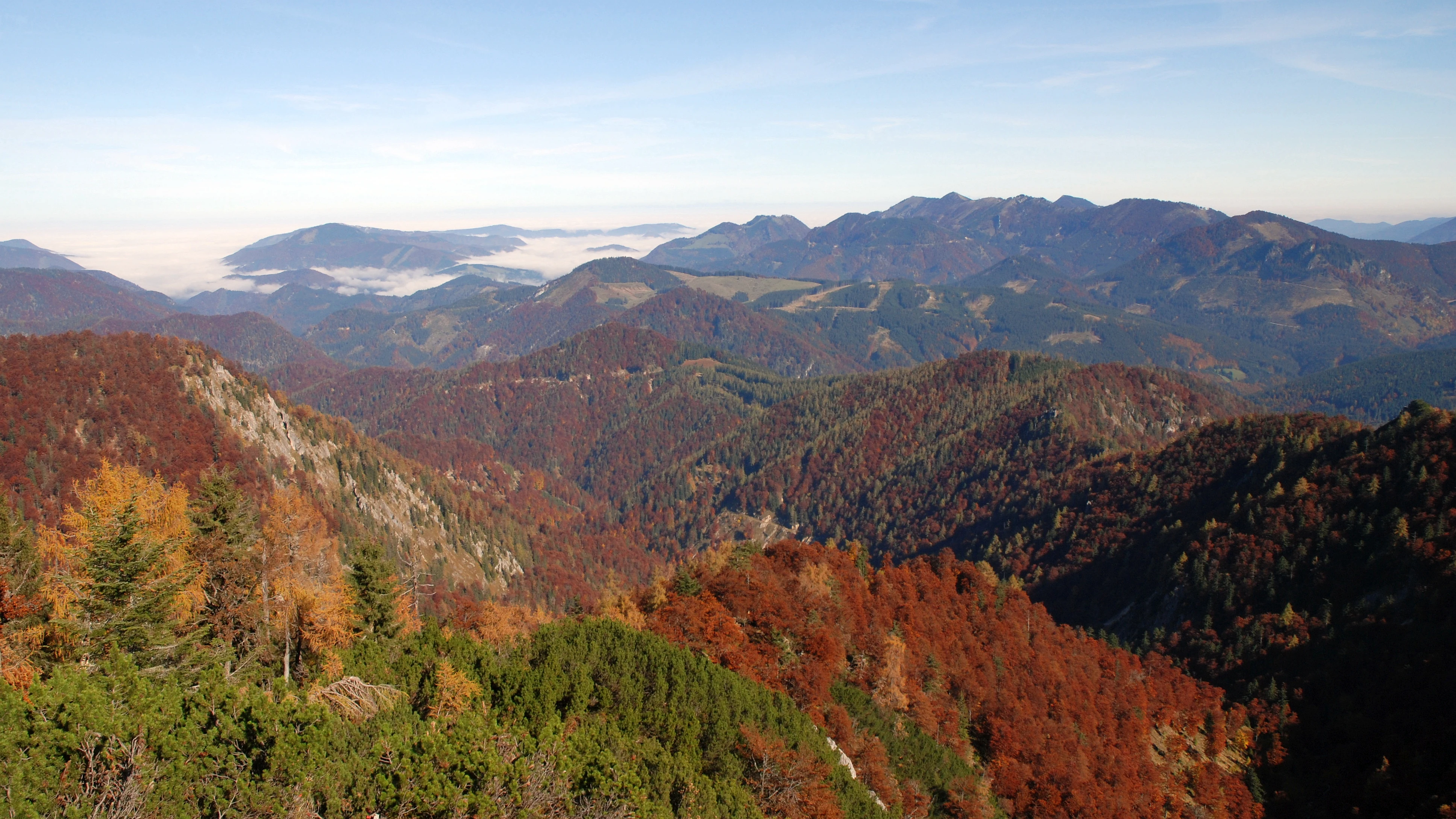
Panoramic view of mountainous terrain with autumn-colored trees, green conifers, and distant mountain ranges under a clear sky
Autumnal mountain landscape in Kalkalpen National Park with colorful foliage and distant peaks

Kalkalpen National Park ecosystems, habitats, and plant life

The nature of Kalkalpen reflects the ecological richness of Central Europe's most extensive forest protected area. The park's old-growth beech forests are its most internationally significant ecological feature, representing post-glacial forest continuity across Europe. These forests, particularly in the Urlachtal, Bodinggraben, and Reichraminger Hintergebirge areas, were selected for UNESCO World Heritage inscription because they preserve ecological processes unbroken for millennia.

The vegetation includes over 850 documented plant species, with more than 100 species of flowering plants, ferns, and mosses. The mixed forests combine Norway spruce, silver fir, and European beech in varying proportions across elevation zones. The aquatic environment is equally significant, with the park containing Ramsar-designated wetland areas recognizing the importance of its streams, springs, and groundwater systems. The more than 200 kilometers of unbuilt watercourses and 800 springs form an interconnected hydrological network that supports diverse riparian and groundwater-dependent ecosystems.
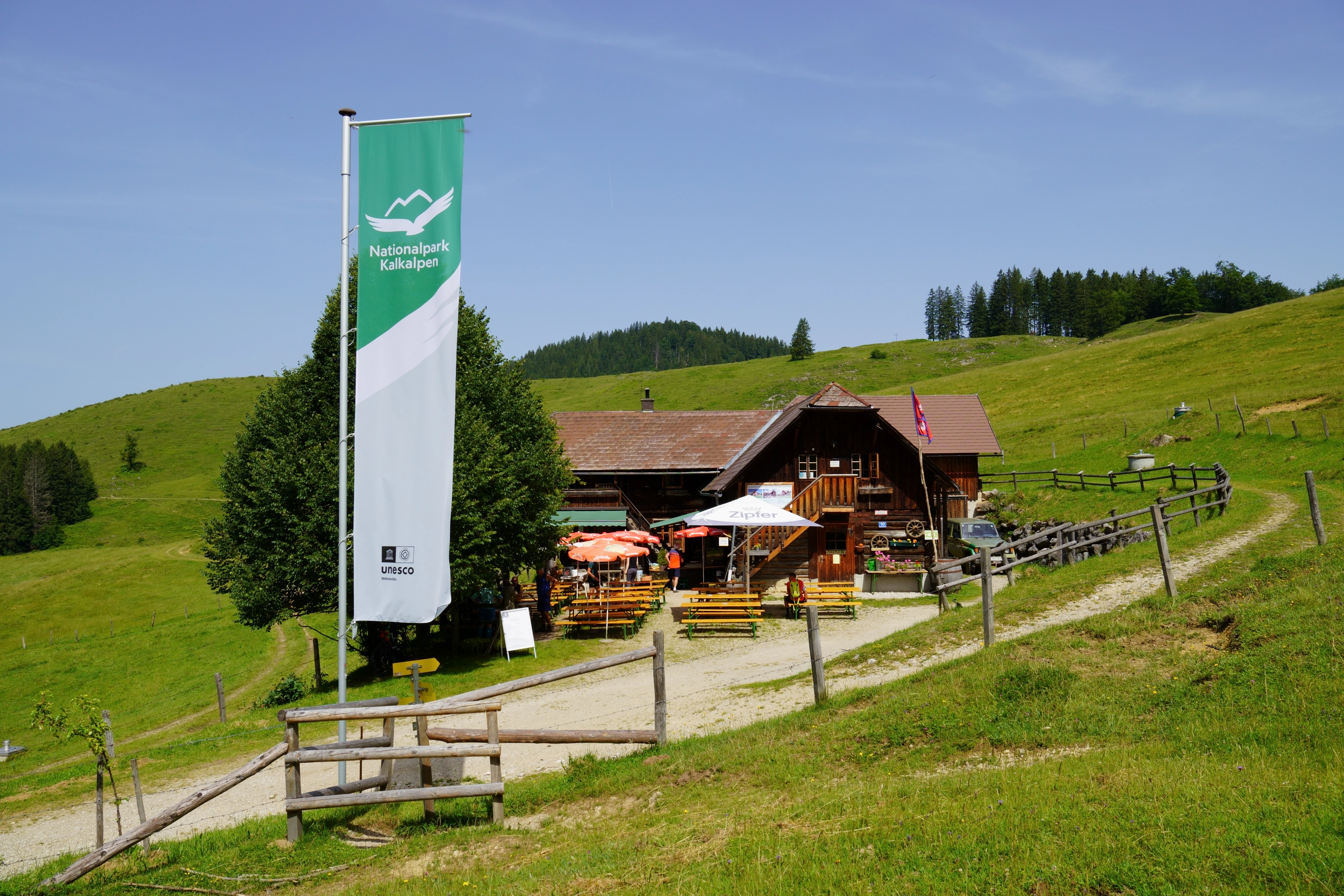
A wooden lodge with outdoor seating, a tall green and white Nationalpark Kalkalpen banner, and a grassy landscape with hills in the background
Visitor center with Nationalpark Kalkalpen banner at Anlaufalm in Reichraminger Hintergebirge

Kalkalpen National Park wildlife and species highlights

Kalkalpen supports a remarkable diversity of wildlife despite its relatively compact size, with approximately 30 mammal species, 80 breeding bird species, and 1,500 butterfly species documented within the park boundaries. The large mammal community includes species such as the Eurasian lynx, brown bear, and European beaver, all of which have been recorded in the park though at low population densities. The European otter, common dormouse, and numerous bat species represent the smaller mammals that thrive in the park's diverse habitats.

The bird community includes several species of conservation concern in Austria, among them the capercaillie, black grouse, golden eagle, and black stork. The diversity of forest types, from old-growth beech forests to mixed coniferous stands, provides habitat for both forest-dwelling species and open-country birds. The park also supports a rich invertebrate community, with the 1,500 butterfly species representing particularly notable diversity. Among the reptiles, the Aesculapian snake, smooth snake, and common adder occur in the karst and forest habitats.

Kalkalpen National Park conservation status and protection priorities

Kalkalpen National Park represents one of Austria's most significant conservation achievements, protecting the country's largest forested area and its most extensive karst landscape within a single protected area. The inclusion of the park's ancient beech forest components in the UNESCO World Heritage Site for Ancient and Primeval Beech Forests of the Carpathians and Other Regions of Europe in 2017 provides international recognition of these ecosystems as irreplaceable heritage requiring the highest level of protection.

The park's management approach divides the territory into distinct zones, with 89% designated as nature zone and 11% as preservation zone, ensuring that core ecological processes receive strict protection while allowing for sustainable visitor access. The Ramsar designation in 2004 recognizes the wetland values of the park's streams and groundwater systems, while Natura 2000 status under both the EU Habitats Directive and Birds Directive integrates the park into Europe's protected area network. The discovery of Europe's oldest known beech tree in 2019 underscores the park's role as a repository of ecological history and genetic continuity.

Kalkalpen National Park cultural meaning and human context

The cultural context of Kalkalpen extends beyond the modern protected area to encompass centuries of human interaction with the landscape. The region's position at the crossroads of Upper Austria, Lower Austria, and Styria made it a historic transit corridor, as evidenced by Bronze Age artifacts found near Windischgarsten. The traditional iron-processing industry of the Eisenwurzen region, centered on the Steyr valley, depended on the forests for charcoal production, and the Graf Lamberg noble family's hunting preserves maintained relatively undisturbed forest conditions into the early twentieth century.

The former Waldbahn Reichraming railway, which operated from the late nineteenth century until the early 1970s, carved a transportation corridor through the park that has been converted into the Hintergebirgsradweg recreational trail. This industrial heritage coexists with older traditions of alpine agriculture, as evidenced by the approximately 20 almen (alpine pastures) within the park's preservation zone. The surrounding communities of Molln, Reichraming, Windischgarsten, Roßleithen, and other villages maintain connections to the park through tourism and stewardship activities.

Top sights and standout views in Kalkalpen National Park

Kalkalpen's most exceptional highlights include the ancient beech forests recognized as UNESCO World Heritage, the dramatic karst landscape with over 70 caves including the Klarahöhle and the Eiskapelle ice cave, and the opportunity to experience one of Central Europe's largest wilderness areas within relatively easy reach of Austria's population centers. The Wurbauerkogel panorama tower provides sweeping views across 21 peaks exceeding 2,000 meters, while the network of hiking, cycling, and winter trails offers diverse ways to explore the terrain. The discovery of Europe's oldest dated beech tree in 2019 adds extraordinary historical depth to the forest experience, connecting visitors to ecological processes spanning more than five centuries.

Best time to visit Kalkalpen National Park

The best time to visit Kalkalpen depends on the experience sought. Summer months from June through September offer the most extensive trail accessibility and warm conditions suitable for hiking, cycling, and exploring the visitor centers. The autumn season brings vibrant forest coloration and the opportunity to observe wildlife as animals prepare for winter. Winter transforms the park into a snowshoeing and skiing destination, with the quiet of the snow-covered forest offering a different character entirely. Spring and early summer coincide with peak wildflower displays in the alpine meadows and provide excellent conditions for birdwatching as migratory species return to breed.

Monthly climate preview

Analyze long-term temperature ranges and precipitation patterns in Upper Austria

Climate Profile and Monthly Weather Normals for Kalkalpen National Park

Long-term observations at a representative elevation of 600.24 meters show average monthly temperatures spanning from a mean of minus 2.21 degrees Celsius in Month 1 up to 18.48 degrees Celsius in Month 7. Accessing the complete monthly profile reveals detailed minimum and maximum ranges alongside precise daily precipitation trends for Kalkalpen National Park.
Annual mean8 °C
-2 °C18 °C
Jan-2°
Feb-1°
Mar
Apr
May13°
Jun17°
Jul18°
Aug18°
Sep13°
Oct
Nov
Dec-1°
Warmest month
July

18.5 °C

Coolest month
January

-2.2 °C

Wettest month
July

4.5 mm/day

Driest month
February

2 mm/day

Park location guide

Geography guide, regional context, and park location map for Kalkalpen National Park

Kalkalpen National Park park geography, regions, and map view in Austria

Understand where Kalkalpen National Park sits in Austria through a broader geographic reading of the surrounding landscape, nearby location context, and its mapped position within the national park landscape.

How Kalkalpen National Park fits into Austria

Austria is a landlocked country in Central Europe, bordered by Germany, Czech Republic, Slovakia, Hungary, Slovenia, Italy, Switzerland, and Liechtenstein. The country is a federal semi-presessional republic composed of nine states, with Vienna as its capital and largest city. It has a population of approximately 9.1 million people.

Wider geography shaping Kalkalpen National Park in Austria

Austria is located in Central Europe, lying in the Eastern Alps. It is bordered by Germany and Czech Republic to the north, Slovakia to the northeast, Hungary to the east, Slovenia and Italy to the south, and Switzerland and Liechtenstein to the west.

Map view of Kalkalpen National Park

Use this park location map to pinpoint Kalkalpen National Park in Austria, understand its exact geographic position, and read its mapped placement within the surrounding landscape more clearly.

Pigeon | © OpenStreetMap contributors

Location context for Kalkalpen National Park

Upper Austria
Natural feature types

Browse the Natural Feature Collection for Kalkalpen National Park

Dive into the comprehensive geography of Kalkalpen National Park by reviewing our structured collection of named natural features. From ancient primeval forests to complex limestone cave systems, these entries provide essential spatial context for understanding the varied terrain of the Northern Limestone Alps within the MoriAtlas framework.
Recorded earthquake history

View the Historical Earthquake Record for Kalkalpen National Park

Explore the documented seismic history associated with the mountain landscape of Kalkalpen National Park. This MoriAtlas catalogue provides an organized view of historical earthquake records identified within the vicinity of this protected forest and karst region.

Kalkalpen National Park Earthquake History

Catalogued events

40 events

Strongest magnitude

Magnitude 4.5

Most recent event

Jan 20, 2021

This history includes earthquakes recorded inside the park or within 50 km of its borders

A Photographic Journey through Kalkalpen National Park's Ancient Beech Forests, Dramatic Alpine Scenery, and Extensive Karst Landscapes.

Visual Guide to Kalkalpen National Park: Explore Alpine Landscapes, Ancient Beech Forests, and Karst Scenery

Visually explore Kalkalpen National Park through a curated gallery of its diverse landscapes, featuring ancient beech forests, dramatic limestone alps, and intricate karst formations. These images provide essential context for understanding the park's unique protected-area character, illustrating its rich forest ecosystems, alpine habitats, and the distinct natural beauty of Central Europe's largest wilderness.

Historic yellow building with white trim and gray roof surrounded by green fields and trees

Mountain landscape with rocky outcrop, forested hills, and distant peak under partly cloudy sky

Panoramic view of mountainous terrain with autumn-colored trees, green conifers, and distant mountain ranges under a clear sky

A wooden lodge with outdoor seating, a tall green and white Nationalpark Kalkalpen banner, and a grassy landscape with hills in the background

Park atlas

Explore additional protected areas and regional landscapes across Upper Austria and beyond after tracing Kalkalpen's unique karst features.

Discover Other National Parks Near Kalkalpen National Park, Upper Austria

Expand your exploration beyond Kalkalpen National Park to compare its ancient beech forests and extensive karst landscapes with other protected areas across the Northern Limestone Alps. Trace the regional spread of national parks and reserves, gaining a broader understanding of Central European mountain ecosystems and conservation efforts.
National parkAustria
Mapped location lies within the park boundary#1 closest

Limestone Alps National Park: A National Park in Austria's Mapped Protected Landscapes

Explore protected area boundaries and regional geography.

Limestone Alps National Park represents a vital component of Austria's protected lands, contributing to the nation's atlas of natural landscapes. This page details the park's identity as a national park, focusing on its geographic scope and mapped boundaries. Users can delve into the regional context and understand the protected-area significance of Limestone Alps National Park, enriching their exploration of Austria's diverse geography.

National parkStyria
8.7 km away#2 closest

Southeast

Gesäuse National Park: Detailed Protected Landscape and Alpine Geography in Styria

Explore Austria's dramatic river gorge and rugged peaks.

Gesäuse National Park in Styria represents a significant alpine protected area, characterized by the striking Enns river gorge cutting through the Gesäuseberge. This national park offers a unique geographic context, showcasing steep limestone peaks, dramatic rock faces, and a rich hydrological network. Discover the mapped boundaries and protected landscape of one of Austria's most visually striking natural passages, ideal for detailed atlas exploration and understanding alpine conservation.

Area
110 km²
Established
2002
IUCN
II
Relief
Mountain
A soft watercolor illustration showing a panoramic view of mountain ridgelines in muted green, blue, and faint pink tones against a white background.
Nature reserveSalzkammergut
About 33 km away#3 closest

West

Loser Plateau Nature Reserve: Alpine Karst Geography in the Salzkammergut Mountain Range

Protected high alpine plateau and extensive karst systems

The Loser Plateau is a distinctive high-altitude nature reserve in the Salzkammergut region of Austria. This protected area features expansive limestone pavements, complex karst sinkholes, and massive mountain crags that dominate the skyline above Lake Altaussee. It provides a unique window into high alpine geology, showcasing fossil-rich layers and an intricate network of documented cave systems that rank among the most significant in the Eastern Alps.

Area
12 km²
Relief
Mountain
Climate
Alpine
Access
Easy access
Protected areaStyria
65 km away#4 closest

South

Zirbitzkogel Protected Area: Mapping the Alpine Landscapes and Glacial Terrain of the Seetal Alps

High mountain geography and protected terrain in Styria, Austria

Zirbitzkogel represents the highest point of the Seetal Alps, characterized by crystalline geology, slate, and gneiss. The landscape features a clear progression from subalpine spruce and larch forests to broad, level summit plateaus covered in ragged sedge grasslands. Beyond its alpine vegetation and glacial tarns, the area serves as a critical protected habitat for diverse alpine fauna, offering an ideal setting for understanding regional alpine ecology and complex mountain landforms.

Established
2006
Relief
Mountain
Climate
Alpine
Access
Easy access
Nature reserveJihočeský kraj
84 km away#5 closest

North

Rašeliniště Kapličky Nature Reserve: Mapped Protected Landscapes in South Bohemia

High-altitude peatland and bog pine forest geography

Rašeliniště Kapličky encompasses 73 hectares of transitional peatland in the Bohemian Forest foothills. The reserve is defined by its deep granite-based peat deposits, rare bog-pine hybrid populations, and the drainage patterns of the Lipový potok stream. This protected area serves as an essential reference for understanding upland wetland ecology and the post-industrial landscape history of the South Bohemian borderlands.

Area
1.27 km²
Established
1992
IUCN
IV
Relief
Upland
Natural monumentJihočeský kraj
About 85 km away#6 closest

North

Uhlířský vrch Natural Monument: Regional Geography and Protected Forest Terrain Mapping

Mountain forest and scree woodland in the Jihočeský kraj region.

Spanning 16 hectares of northern-facing slopes near Loučovice, Uhlířský vrch stands as a vital natural monument within the Trojmezenská hornatina highlands. This record provides geographic insight into its montane habitat, elevation range, and integration into the layered conservation network of South Bohemia. Trace the boundaries and terrain features of this significant protected area in the heart of the Czech mountain landscape.

Area
0.165 km²
Established
1992
IUCN
IV
Relief
Mountain
Watercolor illustration showing mountain ranges, forests, and a river under a light sky.
National parkBavaria
85 km away#7 closest

West

Berchtesgaden National Park: Protected Landscape and Regional Geographic Context in Bavaria

Mapped natural terrain and protected area exploration.

Berchtesgaden National Park represents a crucial protected landscape situated in Bavaria, Germany. This entry provides detailed information focused on its protected area status, unique geographic setting, and mapped natural terrain. It serves as a gateway to understanding the park's specific identity within the regional atlas of Germany, offering insights into its boundaries and its significance as a curated natural landscape for discovery.

Area
210 km²
Established
1978
IUCN
II
Relief
Mountain
Nature reserveJihočeský kraj
94 km away#8 closest

North

Velký Hodonický rybník Nature Reserve: Regional Geography and Protected Wetland Atlas

Mapped aquatic habitats in the South Bohemian foothills

Situated in the Novohradské podhůří, Velký Hodonický rybník is a protected nature reserve defined by its shallow fishpond basin and specialized wetland flora. This site acts as a key element of the Natura 2000 network, preserving rare aquatic vegetation and amphibian populations within a characteristic South Bohemian landscape. The area offers a detailed view into the intersection of historical agricultural land use and contemporary environmental preservation.

Area
0.027 km²
Established
2023
IUCN
III

Common questions about visiting, size, designation, and location context for Kalkalpen National Park

Kalkalpen National Park FAQs for park facts, access, geography, and protected area context

Find quick answers about Kalkalpen National Park, including protected-area facts, park geography, trail and visitor context, and how the park fits into its surrounding country and regional landscape.
MoriAtlas Explorer

Continue Your Protected Areas Search Across the Global Atlas

Deepen your exploration by continuing the structured search for national parks and protected areas worldwide. Utilize the comprehensive filtering capabilities to compare different conservation landscapes and refine your understanding of global park geography. Discover more about the distribution and characteristics of protected natural areas.

Global natural geography