
Mori Atlas logo
Nature reserveKalktriften Willebadessen

Mapped limestone slopes, diverse butterfly habitats, and open ridge terrain in the Nethe valley

Kalktriften Willebadessen Nature Reserve and Protected Calcareous Grassland Landscapes in Nordrhein-Westfalen

(Naturschutzgebiet Kalktriften Willebadessen)

Kalktriften Willebadessen is a significant nature reserve situated on the steep, southwest-facing limestone slopes above the Nethe river in Nordrhein-Westfalen. This protected area preserves a rare semi-dry calcareous grassland environment, shaped by centuries of traditional grazing. The landscape features stony rendzina soils and a distinctive microclimate that supports an extraordinary concentration of wild orchids, gentians, and over fifty documented butterfly species, including the rare Kreuzenzian-Ameisenbläuling.

calcareous grasslandKalkhalbtrockenrasenlimestone slopesbutterfly reserveorchidsgentians
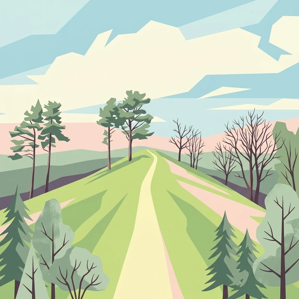
A stylized digital illustration showing a light-colored walking path winding uphill through green, rolling grasslands with scattered trees and a soft, pastel-colored sky.

Kalktriften Willebadessen

Nature reserve

Park overview

Structured park overview, official facts, and landscape profile for Kalktriften Willebadessen

Kalktriften Willebadessen park facts, protected area profile, and essential visitor context

Review the core facts for Kalktriften Willebadessen, including designation, size, terrain, visitor scale, habitats, and operating context in one park-focused overview.

About Kalktriften Willebadessen

Kalktriften Willebadessen is a compact but unusually rich nature reserve in the eastern Weser Uplands of North Rhine-Westphalia, Germany. It occupies the steep, sun-warmed eastern slopes of the Nethe valley above the town of Willebadessen, directly across the river from the wooded ridge of the Eggegebirge. The combination of Muschelkalk limestone bedrock, thin rendzina soils, karst drainage, and a southwest exposure gives the slopes a strikingly dry, almost Mediterranean microclimate in an otherwise temperate German landscape.

The defining habitat of the reserve is a semi-dry calcareous grassland, the so-called Kalkhalbtrockenrasen, which is maintained through ongoing sheep and goat grazing. Originally forested, these slopes were cleared and used as communal pasture for centuries because their steepness and stoniness made them unsuitable for cultivation or haymaking. Deforestation, livestock trampling along traditional drove paths, continuous grazing pressure, and the deliberate nightly penning of animals on cropland to transfer nutrients gradually created the shallow, nutrient-poor turf that now defines the site.

Ecologically, the reserve is most famous for its butterflies. More than fifty species of day-flying butterflies have been recorded, including burnet moths, fritillaries, blues, and skippers, with the Kreuzenzian-Ameisenbläuling acting as a flagship species whose biology is tightly linked to the gentians growing in the open sward. The same flower-rich conditions support a remarkable array of orchids and gentians, such as the Bienen-Ragwurz, Männliches Knabenkraut, Mücken-Händelwurz, Grünliche Waldhyazinthe, Kreuz-Enzian, and Deutscher Fransenenzian.

Beyond the flora and butterflies, the reserve also provides habitat for reptiles such as the Schlingnatter and Zauneidechse, ground-nesting and shrub-loving birds including Neuntöter and Rebhuhn, and a variety of grasshoppers and snails typical of warm dry grasslands. The visitor experience is structured around the Schmetterlingspfad, a 3.5-kilometer trail that climbs the characteristic V-shaped ridge at the southern end of the reserve, opens up to wide views across the Nethe valley, and uses eight information panels to explain how grazing, erosion, and species-richness are interconnected in this particular landscape.

Quick facts and research context for Kalktriften Willebadessen

Kalktriften Willebadessen is a designated Naturschutzgebiet of about 112 hectares in the Kreis Höxter district of North Rhine-Westphalia, Germany. It overlaps with the Natura 2000 site Kalkmagerrasen bei Willebadessen (DE-4320-303), an EU Habitats Directive area of roughly 46 hectares. The reserve sits on the steep, sun-exposed eastern slopes of the Nethe valley, opposite the Eggegebirge, on Muschelkalk limestone bedrock.

The site's defining feature is a culturally maintained Kalkhalbtrockenrasen, a semi-dry calcareous grassland that depends on continuous low-intensity sheep and goat grazing. The reserve is recognized as an IUCN Category IV Habitat/Species Management Area and is administrated by the Untere Landschaftsbehörde of Kreis Höxter. It has been a formally protected nature reserve since 2003, and the visitor trail Schmetterlingspfad, opened in July 2010, runs through its most scenic ridge.

Protection and recognition

Examine official terrestrial conservation status and management frameworks.

Kalktriften Willebadessen Protection Status and Designation Records

Kalktriften Willebadessen maintains documented terrestrial protection metrics within global conservation databases. Official records detail the established management scope and administrative designation framework without external recognition sources.

Protection details

Protection scope
Terrestrial
Transboundary protection
No
WDPA ID
318624
Park context

Deeper park guide and search-rich context for Kalktriften Willebadessen

Kalktriften Willebadessen history, landscape, wildlife, and travel context

Explore Kalktriften Willebadessen through its history, landscape character, ecosystems, wildlife, conservation priorities, cultural context, and seasonal travel timing in a structured park guide built for atlas discovery and search intent.

Why Kalktriften Willebadessen stands out

Kalktriften Willebadessen is best known for its flower-rich Kalkhalbtrockenrasen and the exceptionally diverse butterfly fauna that it supports. More than fifty day-flying butterfly species have been documented here, anchored by the very rare Kreuzenzian-Ameisenbläuling, a blue butterfly whose life cycle is bound to specific gentian species growing in the open limestone turf. Gentians and a striking concentration of wild orchids, including bee orchids and various man orchids, are equally central to the reserve's identity. These plants and insects coexist only because the slopes have been kept open by traditional grazing, and the reserve is widely seen as a model of how centuries-old pastoral use, when carefully maintained, can produce one of the most species-rich habitats in modern central Europe.
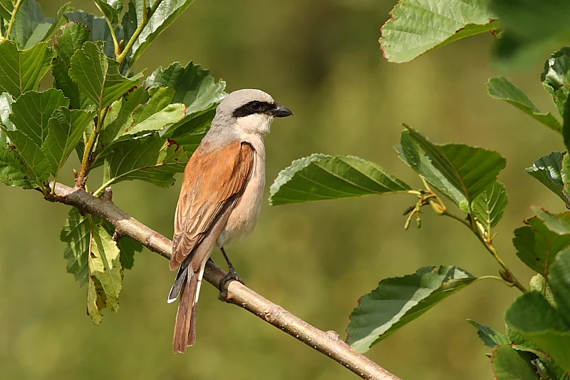
A male red-backed shrike bird with its distinctive black eye mask and rusty-brown back perched on a tree branch.
A male red-backed shrike perched on a branch, a characteristic bird species found in the calcareous grasslands of the nature reserve.

Kalktriften Willebadessen history and protected-area timeline

The history of the Kalktriften is essentially a story of long-term pastoral use followed by modern conservation restoration. Because the steep, stony limestone slopes above the Nethe were unsuitable for arable farming or mowing, they were used for centuries as communal grazing land for sheep and goats. Over time, this use transformed originally forested slopes into open Hutweiden, with shallow rendzina soils, sparse vegetation, and a savanna-like openness that, according to local memory, was so bare through the late 1950s that every white goat could be spotted from a distance.

When grazing ceased in the second half of the twentieth century, the open character of the slopes quickly began to disappear. Scrub encroached, hedges expanded, paths grew over, and parts of the area were afforested. By the year 2000, the once-distinctive grassland had become difficult even to walk through, and its characteristic species were increasingly threatened.

The modern protection effort began in 2000, when the Nordrhein-Westfalen-Stiftung Naturschutz, Heimat- und Kulturpflege acquired roughly 45 hectares, with the remaining areas made available by the town of Willebadessen. Supported financially by the European Union, the Bezirksregierung Detmold, the Kreis Höxter, and Deutsche Bahn as a compensatory measure for the ICE high-speed line crossing of the Egge, the reserve was officially designated in 2003. Scrub was progressively cleared and the open slopes were once again grazed by sheep, allowing the Kalkhalbtrockenrasen and its associated flora and fauna to recover. The Schmetterlingspfad interpretive trail, themed around the blue butterflies of the reserve, was opened on 10 July 2010 and has since become the main route through the area.

Kalktriften Willebadessen landscape and geographic character

The reserve occupies the steep, west-southwest-facing eastern slopes of the Nethe valley, where the river bends from a south-southeasterly course, along the Eggegebirge, to a more easterly direction at Willebadessen. The slopes themselves are part of the Oberwälder Land natural region and rise directly opposite the forested Eggegebirge on the far side of the valley, giving the landscape an unusually open, sweeping character.

A distinctive feature is the prominent, steep ridge at the southern end of the reserve, whose profile resembles an inverted V. This rocky, sun-baked spur descends sharply toward the Nethe and represents the driest and most exposed part of the Kalktriften, with a microclimate that local descriptions compare to a high alpine alm or even a Mediterranean hillside. Its very top forms the highest part of the protected slopes, while the gentler ridge crests above the valley are cultivated as grain fields, leaving a sharp contrast between open farmland above, dry grassland in the middle, and the river corridor below.

Geologically, the slopes are underlain by Muschelkalk limestone belonging to the Brakeler Muschelkalkschwelle, and the combination of karst weathering, steep gradient, and southwest exposure is what makes the area so dry. Soils are stony rendzinas, originally rich in humus but progressively thinned by centuries of deforestation, livestock trampling, and erosion. The resulting thin, stony, drought-prone turf is the foundation of the open landscape and the reason the area looks more like a sunlit alpine pasture than a typical German forest valley.
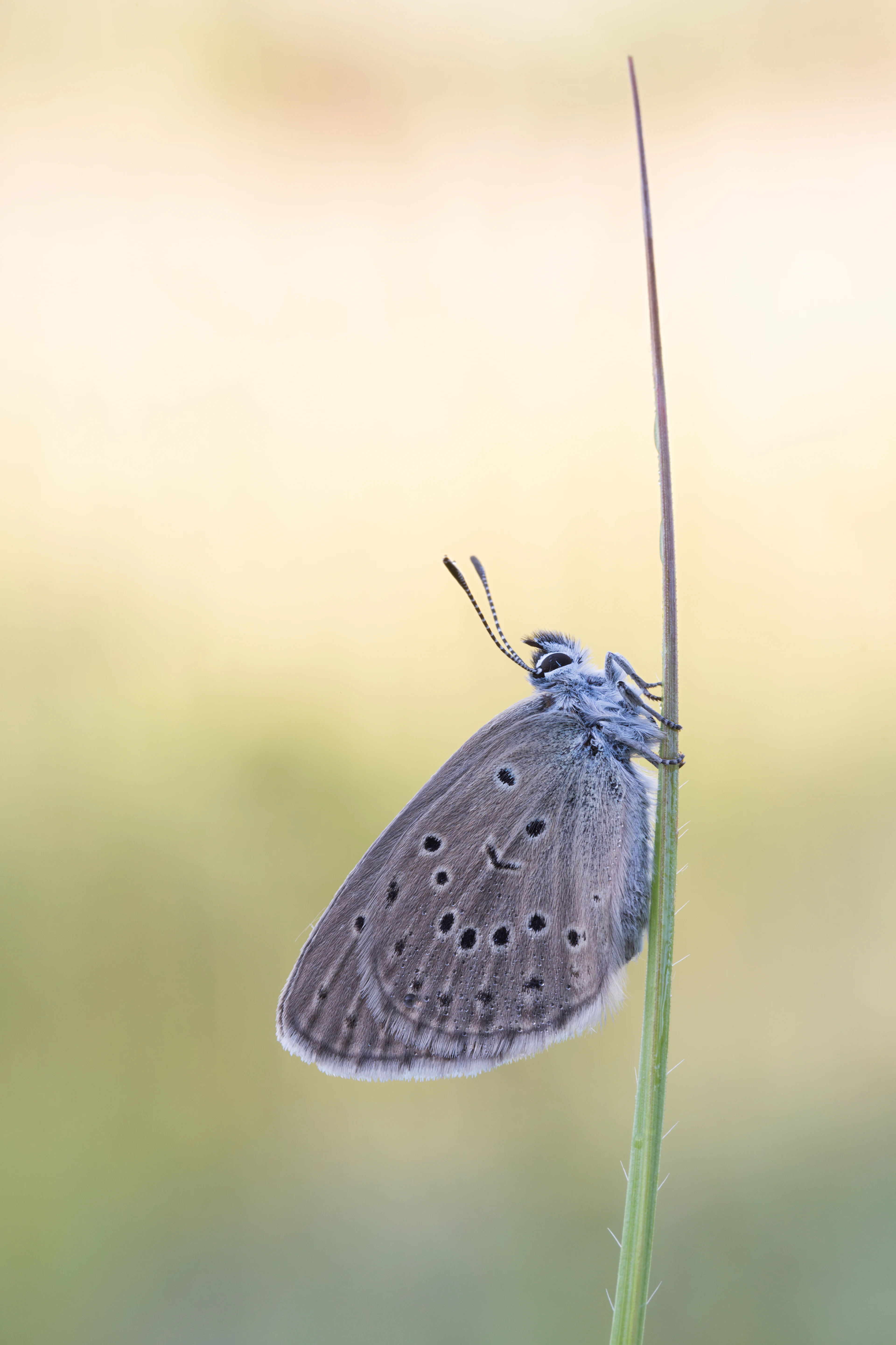
A close up profile view of a greyish blue butterfly with dark spots on its closed wings resting vertically on a thin green stalk against a soft blurred background.
A Phengaris rebeli butterfly resting on a blade of grass.

Kalktriften Willebadessen ecosystems, habitats, and plant life

The ecological identity of the Kalktriften is built around a single, distinctive habitat type: the managed semi-dry calcareous grassland, the Kalkhalbtrockenrasen. Although the original rendzina soils were relatively nutrient-rich and the local climate brings substantial rainfall, the karstic bedrock, steep slope, and sun-baked exposure cause rapid drying during dry spells. Grazing animals, especially sheep and goats, then maintain the open structure through selective browsing, trampling, and continued erosion along traditional drove paths.

These conditions have produced a remarkably species-rich sward, where legumes, low herbs, grasses, thistles, and gentians grow together in a flower-rich mosaic punctuated by small rock outcrops, animal tracks, and patchy scrub. The mosaic is deliberately maintained in a patchwork of open turf, scattered shrubs, and warmer microhabitats, because research has shown that butterflies and other grassland insects depend not on uniform grassland but on this kind of fine-grained landscape texture.

At the broader landscape scale, the reserve fits into the regional network of calcareous grasslands of the Weser-Egge uplands, which include other protected dry-grassland and rocky sites in the Kreis Höxter area. Together, these sites form one of the northernmost strongholds in central Europe where orchids, gentians, and warm-loving butterflies can persist in a continuous cultural landscape maintained by grazing.
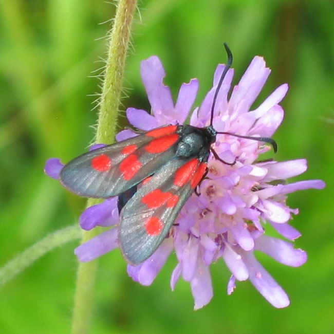
A close-up view of a small five-spot burnet moth with dark wings and red spots perched on a purple pincushion-like flower.
A five-spot burnet moth resting on a purple wildflower.

Kalktriften Willebadessen wildlife and species highlights

The reserve's wildlife profile is dominated by day-flying butterflies and moths. More than fifty species of butterflies have been documented, including the flagship Kreuzenzian-Ameisenbläuling, whose caterpillars depend on the gentians of the reserve. Fritillaries such as Feuriger Perlmuttfalter, Kaisermantel, and Großer Perlmuttfalter are joined by blues like Silbergrüne Bläuling and Zwerg-Bläuling, skippers including Kronwicken-Dickkopffalter, Komma-Dickkopffalter, and Malven-Würfelfleck, and a notable guild of burnet moths such as Esparsetten-Widderchen, Thymianwidderchen, and Kleine Fünffleck-Widderchen, whose bright colors advertise their toxicity on the same flower-rich slopes.

Grassland birds also use the mosaic of low scrub, open turf, and taller hedges. The Neuntöter uses the area as a breeding territory, while the Rebhuhn finds refuge in the mix of open ground and adjacent field margins. Reptile presence is notable, with both Schlingnatter and Zauneidechse recorded, and the warm microclimate supports distinctive grasshopper species such as Kurzflügelige Beißschrecke, Heidegrashüpfer, and Langfühler-Dornschrecke, plus the dry-grassland snail Helicella itala. Even the seemingly barren stony ridge contributes to this diversity by providing basking sites, pupation spots, and cool refuges that are essential to many of these species.
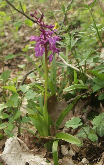
A purple flowering plant with lance-shaped leaves growing from the ground, surrounded by low forest floor vegetation.
An early purple orchid (Orchis mascula) in the Kalktriften Willebadessen nature reserve.

Kalktriften Willebadessen conservation status and protection priorities

Kalktriften Willebadessen is protected on several overlapping levels. It is a formal Naturschutzgebiet under North Rhine-Westphalian nature conservation law, designated in 2003, and at the same time forms the core of an EU Natura 2000 site under the Habitats Directive, listed as Kalkmagerrasen bei Willebadessen (DE-4320-303) with about 46 hectares. The reserve is classified internationally as an IUCN Category IV Habitat and Species Management Area, managed by the Untere Landschaftsbehörde of the Kreis Höxter.

The reason the site matters from a conservation perspective is that it is a culturally created refuge for species that have lost most of their habitat elsewhere. Because much of the surrounding agricultural landscape has become either intensively used or abandoned, the flower-rich, grazing-dependent calcareous grassland and the specialist butterflies, orchids, and gentians tied to it have become regionally rare. The reserve therefore acts as an anchor for the conservation of calcareous dry grasslands in the Weser-Egge uplands and as a model of how targeted grazing and scrub control can keep an entire community of rare species viable on a relatively small area. Natura 2000 management plans emphasize the maintenance of open turf, the connection of isolated parcels by continued sheep grazing, and the avoidance of fertilization and trampling damage.

Kalktriften Willebadessen cultural meaning and human context

The Kalktriften are an unusually clear example of a centuries-old cultural landscape that has been preserved as a nature reserve. The word Trift itself is a Middle High German term for a communal grazing area or drove, related to treiben (to drive), and it reflects the historical role of the slopes as shared pasture for the people of Willebadessen. The original transformation from forest to open grassland was driven entirely by local pastoral practice: sheep and especially goats kept woody plants in check, while the nightly penning of animals on cropland slowly shifted nutrients from the slopes to the valley fields.

Local memory, including the saying that in the 1950s one could spot every white goat on the hillside from far away, captures the historical openness of the area. The modern reserve is essentially a deliberate continuation of that older land-use system, now supported by public funding and organized through the NRW-Stiftung. The Schmetterlingspfad, with its information panels, mosaic artwork, and bench at sunny viewpoints, links this pastoral background to the ecological story visitors see today and frames the reserve not just as a biological site but as a piece of regional cultural heritage.
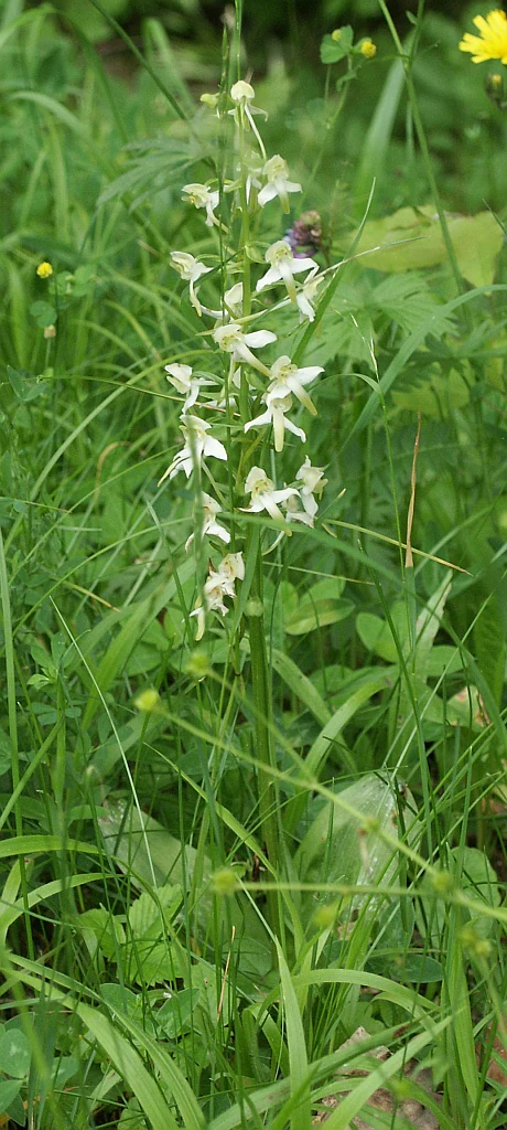
A close-up of a Greater butterfly orchid plant with pale greenish-white flowers growing in tall grass.
Greater butterfly orchid, Platanthera chlorantha, blooming in the calcareous grassland of Kalktriften Willebadessen.

Top sights and standout views in Kalktriften Willebadessen

Kalktriften Willebadessen stands out as one of the most botanically and entomologically rich dry-grassland sites in North Rhine-Westphalia, anchored by its semi-dry calcareous grassland on Muschelkalk slopes and its extraordinary concentration of rare day-flying butterflies. The reserve is also distinctive among German nature areas for the clarity with which its biodiversity is tied to a single, ongoing cultural practice: low-intensity sheep and goat grazing, supported by active scrub control and Natura 2000 management planning.

For visitors, the main attractions are the panoramic Schmetterlingspfad along the sunny southern ridge, the chance to see flagship species like the Kreuzenzian-Ameisenbläuling and a wide range of orchids and gentians in a small area, and the surprisingly open, almost alpine views across the Nethe valley toward the Eggegebirge.
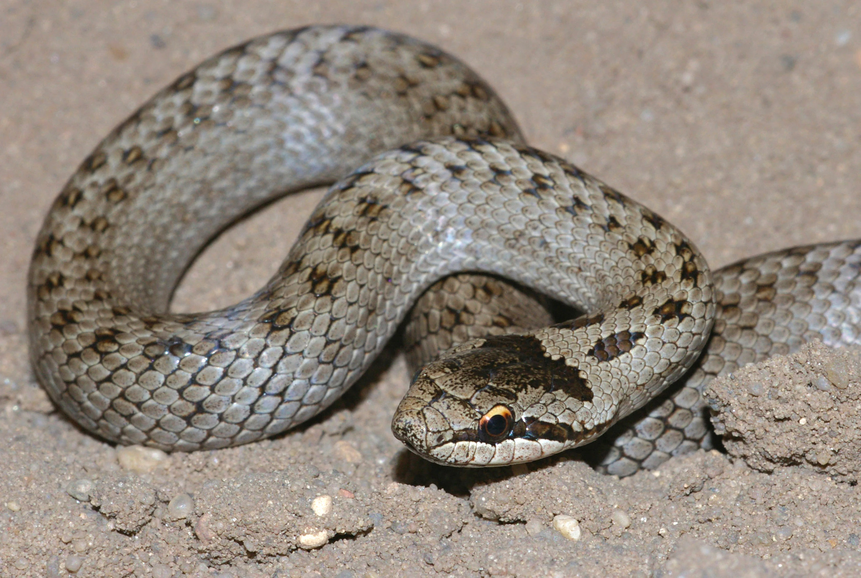
A close-up of a brown and grey patterned smooth snake resting on light-colored sandy soil.
A smooth snake (Coronella austriaca) coiled on the ground in the Kalktriften Willebadessen nature reserve.

Best time to visit Kalktriften Willebadessen

Late spring through early summer is the most rewarding season, when the orchids, gentians, and other chalk-grassland flowers reach their peak and the dry slopes are alive with butterflies, burnet moths, and grasshoppers. Warm, dry days in this period offer the best chance of seeing the emblematic Kreuzenzian-Ameisenbläuling and other blue butterflies along the Schmetterlingspfad, as well as reptiles basking on the rocky southern ridge.

High summer can be very hot and dry on these southwest-facing slopes, but butterflies remain active and the open views across the Nethe valley are at their most striking. Autumn brings softer light, ripening grasses, and the return of migratory and feeding bird activity, while winter visits are quieter but still showcase the bare, almost alpine structure of the landscape. Because the trail is unshaded and exposed, comfortable weather and good footwear are particularly important for enjoying the full 3.5-kilometer route.

Monthly climate preview

Long-term representative coordinate measurements for monthly temperature and precipitation patterns

Kalktriften Willebadessen Climate Normals, Annual Temperature and Precipitation Rhythm

Kalktriften Willebadessen records measured annual temperature and precipitation rhythms based on representative coordinate climatology from 1991 through 2020. Examining the full monthly climate profile reveals detailed twelve-month variations in average minimums, maximums, and daily precipitation rates.
Annual mean9 °C
0 °C18 °C
Jan
Feb
Mar
Apr
May12°
Jun15°
Jul18°
Aug18°
Sep14°
Oct
Nov
Dec
Warmest month
July

18 °C

Coolest month
January

-0.2 °C

Wettest month
July

2.6 mm/day

Driest month
April

1.7 mm/day

Park location guide

Geography guide, regional context, and park location map for Kalktriften Willebadessen

Kalktriften Willebadessen park geography, regions, and map view in Germany

Understand where Kalktriften Willebadessen sits in Germany through a broader geographic reading of the surrounding landscape, nearby location context, and its mapped position within the national park landscape.

How Kalktriften Willebadessen fits into Germany

Germany is a federal republic in Western and Central Europe with a population of over 83 million across sixteen constituent states. It is Europe's largest economy by nominal GDP and a major global exporter and importer. The capital is Berlin, and the country borders Denmark, Poland, Czech Republic, Austria, Switzerland, France, Luxembourg, Belgium, and the Netherlands.

Wider geography shaping Kalktriften Willebadessen in Germany

Germany is located in Western and Central Europe, spanning 357,022 km². It borders Denmark to the north, Poland and the Czech Republic to the east, Austria and Switzerland to the south, and France, Luxembourg, Belgium, and the Netherlands to the west. The country has coastlines on the Baltic Sea and North Sea to the north, with the Alps located in the southern region.

Map view of Kalktriften Willebadessen

Use this park location map to pinpoint Kalktriften Willebadessen in Germany, understand its exact geographic position, and read its mapped placement within the surrounding landscape more clearly.

Pigeon | © OpenStreetMap contributors

Location context for Kalktriften Willebadessen

Nordrhein-Westfalen

Visualizing calcareous grassland habitats and limestone terrain

Kalktriften Willebadessen Photos and Landscape Scenery

Photographs reveal the steep limestone slopes, sunlit limestone turf, and diverse wildflower habitats that define Kalktriften Willebadessen. Visual documentation provides clear insight into the protected calcareous grasslands and dramatic valley terrain of the Weser Uplands.

A male red-backed shrike bird with its distinctive black eye mask and rusty-brown back perched on a tree branch.

A close-up view of a male sand lizard resting on a textured concrete surface with a vibrant green body and a brown, patterned dorsal stripe.

A close up profile view of a greyish blue butterfly with dark spots on its closed wings resting vertically on a thin green stalk against a soft blurred background.

A close-up view of a small five-spot burnet moth with dark wings and red spots perched on a purple pincushion-like flower.

A purple flowering plant with lance-shaped leaves growing from the ground, surrounded by low forest floor vegetation.

A close-up vertical shot of a Mountain Everlasting flower, showing clusters of small, pinkish-purple, fuzzy blossoms on a hairy, light green stem.

A close-up of a Greater butterfly orchid plant with pale greenish-white flowers growing in tall grass.

A close-up of a brown and grey patterned smooth snake resting on light-colored sandy soil.

A close up view of a bright yellow Berger's Clouded Yellow butterfly perched on a thin green plant stem with small buds.

A close-up view of several white, spherical flower heads of mountain clover (Trifolium montanum) with green stems and leaves in a grassy field.

A narrow dirt trail leads up a grassy, sloped hill ridge with scattered trees against a bright, partly cloudy blue sky.

A detailed close up photograph of a yellow Anthyllis vulneraria pseudovulneraria flower blooming against a blurred green background.

Close up of a green and brown grasshopper positioned on top of dry, straw-like vegetation.

A brown ground grasshopper, identified as Tetrix tenuicornis, is perched on a green, serrated leaf in a macro-style photograph.

A single tall purple orchid flower stands in the foreground of a green meadow, with rolling grassy hills in the background.

A close-up view of exposed stony soil with light-colored limestone rocks and fine roots from surface vegetation.

Park atlas

Compare regional protected areas and connected limestone habitats across the Weser Uplands.

Explore Parks Near Kalktriften Willebadessen and Surrounding Protected Landscapes

Browsing other parks near Kalktriften Willebadessen reveals the broader ecological character of the Weser Uplands and surrounding river valleys. Comparing these protected landscapes highlights regional terrain patterns, limestone geology, and connected conservation corridors.
A soft, horizontal watercolor painting showing a winding stream flowing through a green valley with gentle hills and trees in the background.
Nature reserveNordrhein-Westfalen
About 10 km away#1 closest

Northwest

Naturschutzgebiet Schmittwassertal: A Protected Nature Reserve in the Paderborn District

Mapping brook corridors and calcareous grassland landscapes in Westphalia.

Naturschutzgebiet Schmittwassertal represents a fragmented yet ecologically vital nature reserve in Nordrhein-Westfalen. The area encompasses 53.6 hectares of stream-cut valleys and limestone-influenced slopes. This atlas entry details the mosaic of habitats ranging from alder-lined brook corridors to nutrient-poor Borstgrasrasen and semi-dry calcareous grasslands, highlighting its function as a connected biological corridor.

Area
0.536 km²
Established
2014
Relief
Upland
Climate
Temperate
A soft watercolor painting depicting a meandering stream through a grassy valley with rolling, tree-covered hills in the background.
Nature reserveNorth Rhine-Westphalia
About 11 km away#2 closest

Southwest

Schwarzbachtal (PB): A Protected Stream Valley Landscape in North Rhine-Westphalia

Mapped nature reserve and valley habitat geography

Spanning over 200 hectares in the Paderborn district, Schwarzbachtal (PB) is a core nature reserve that protects the delicate stream valley landscape of the Schwarzbach. This area serves as a significant example of long-term conservation management in North Rhine-Westphalia, offering structured insight into regional habitat patterns and valley topography.

Area
2.206 km²
Established
2014
IUCN
IV
A horizontal watercolor painting showing a soft landscape with a winding stream, grassy meadows, and distant forested hills under a pale sky.
Nature reserveGermany
About 13 km away#3 closest

Southwest

Marschallshagen und Nonnenholz mit oberem Altenautal Protected Nature Reserve Map

Ecological landscape and forest geography in the Paderborn district

Covering approximately 1,943 hectares, this nature reserve is a major component of the regional conservation framework. The landscape creates a layered mosaic of closed beech forest, near-natural running water, and floodplain woodland, serving as a significant site for European bird protection programs.

Area
19.43 km²
Established
2002
A soft watercolor painting showing a panoramic view of rolling hills and undulating green and pink landscape features against a pale sky.
Nature reserveWaldeck-Frankenberg
About 18 km away#4 closest

Southwest

Naturschutzgebiet Büchenberg und Platzberg bei Hesperinghausen: Geography and Protected Landscapes

A study of limestone slopes and calcareous grassland habitats

This protected area in Waldeck-Frankenberg serves as a key site for calcareous dry grasslands and rare orchid species. The terrain features a striking mosaic of steep Zechstein limestone slopes, rock outcrops, and moisture-rich meadow patches. Analyzing the area reveals how small, traditionally managed reserves can maintain high biodiversity and provide essential connectivity within the Diemeltal regional landscape.

Area
0.418 km²
Established
1993
Relief
Upland
Climate
Temperate
A soft watercolor painting of a serene landscape featuring a small pond in the foreground with gentle hills and trees in the background.
Protected landscapeKreis Paderborn
About 19 km away#5 closest

West

Landschaftsschutzgebiet Büren: A Detailed Look at the Protected Rural Mosaic of Kreis Paderborn

Mapped protected landscapes in the German Westphalian countryside

Landschaftsschutzgebiet Büren spans a wide, undulating terrain in the Kreis Paderborn district, characterized by its durable structure of woodland patches, hedgerows, and headwater springs. The area serves as a key case study in maintaining semi-natural ecological features within an active, working agricultural landscape. Access detailed geographic context on the patterns of this regional protected area and its role in the Westphalian landscape.

Area
142.95 km²
Established
1974
Relief
Mixed relief
Scope
Terrestrial
A horizontal watercolor painting depicting a gentle landscape with rolling green hills, a small stream winding through fields, and a light sky.
Nature reserveNordrhein-Westfalen
About 21 km away#6 closest

Northeast

Kalkmagerrasen bei Ottbergen und Bruchhausen: Protected Limestone Nature Reserve

Regional geography and protected landscape boundaries in Nordrhein-Westfalen

The Kalkmagerrasen bei Ottbergen und Bruchhausen reserve protects a high-value mosaic of calcareous grassland and juniper heath across the rolling limestone hills of the upper Weser valley. This significant site integrates open grazing lands with patches of orchid-rich beech forest, preserving the ecological heritage of the German countryside through traditional land use patterns.

Area
1.13 km²
Established
1988
IUCN
IV
Relief
Upland
A soft watercolor illustration showing rolling green hills, small groups of conifer trees, and a pale pink and peach sky in the background.
Natural monumentEberschütz
About 22 km away#7 closest

Southeast

Der Bunte Berg bei Eberschütz: Natural Monument and Landscape Geography

Limestone ridge and calcareous grassland habitat in Germany

Examine the topography and protected land features of Der Bunte Berg bei Eberschütz. This compact reserve provides a critical study of limestone-influenced terrain, transitioning from mature pine and beech woodland to specialized juniper heath and dry grassland habitats essential for regional biodiversity.

A soft watercolor painting showing a winding river flowing through a green meadow with rolling hills and distant forested ridges under a pale, warm sky.
Nature reserveLandkreis Kassel
About 23 km away#8 closest

Southeast

Kalkmagerrasen und Diemelaltwasser bei Lamerden Nature Reserve and Landscape Overview

A rare protected mosaic in the Landkreis Kassel district

Investigate the distinctive geography of Kalkmagerrasen und Diemelaltwasser bei Lamerden, where shell limestone slopes rise above the Diemel river oxbow. This protected habitat complex serves as an important ecological anchor in northern Germany, preserving the delicate balance between riparian flood zones and orchid-rich calcareous grasslands that define this regional landscape.

Area
0.175 km²
Established
1989
Relief
Upland
Climate
Temperate

Common questions about visiting, size, designation, and location context for Kalktriften Willebadessen

Kalktriften Willebadessen FAQs for park facts, access, geography, and protected area context

Find quick answers about Kalktriften Willebadessen, including protected-area facts, park geography, trail and visitor context, and how the park fits into its surrounding country and regional landscape.
MoriAtlas Explorer

Continue Your Protected Areas Search Across the Global Atlas

Deepen your exploration by continuing the structured search for national parks and protected areas worldwide. Utilize the comprehensive filtering capabilities to compare different conservation landscapes and refine your understanding of global park geography. Discover more about the distribution and characteristics of protected natural areas.

Global natural geography