Mori Atlas logo
Nearby park discovery

Mapping surrounding natural landscapes and protected geographic boundaries

Regional Protected Areas and Nature Reserves Near Kalktriften Willebadessen

Trace the distribution of protected lands in the vicinity of Kalktriften Willebadessen to better understand the regional geography of the Weser Uplands. This map-based perspective highlights the relationship between distinct nature reserves, helping to identify how varied calcareous grasslands and river valley habitats are situated throughout the broader North Rhine-Westphalia area.

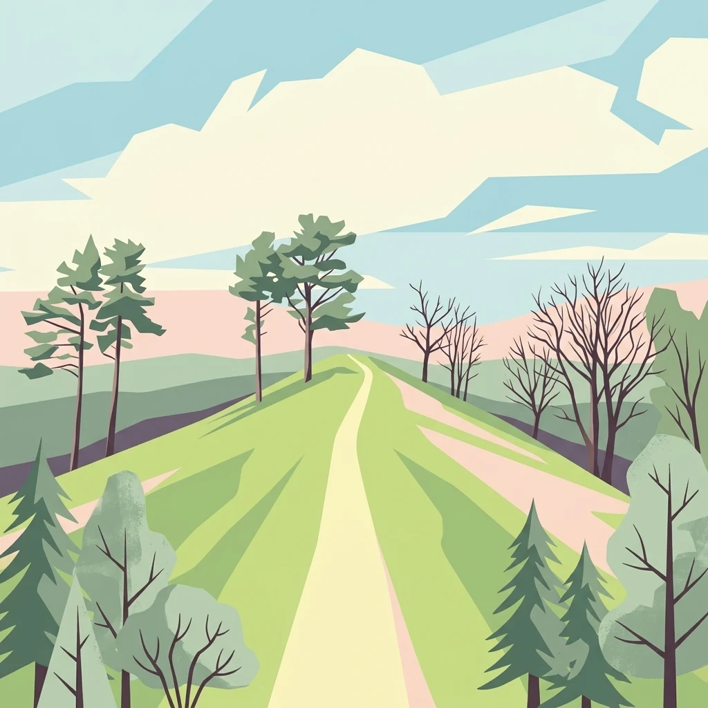
A stylized digital illustration showing a light-colored walking path winding uphill through green, rolling grasslands with scattered trees and a soft, pastel-colored sky.

A limestone half-dry grassland reserve in the Nethe valley, shaped by centuries of sheep and goat grazing and famous for rare butterflies and orchids.

Kalktriften Willebadessen

Kalktriften Willebadessen is a nature reserve in North Rhine-Westphalia, Germany, located just northeast of the small town of Willebadessen in the eastern part of the Weser Uplands. The protected area lies on the steep, southwest-facing slopes above the Nethe river, opposite the wooded ridge of the Eggegebirge. Its elevated, stony terrain is built on Muschelkalk limestone and supports a classic Kalkhalbtrockenrasen, a semi-dry calcareous grassland that developed through centuries of sheep and goat grazing and is now actively maintained by conservation management. The reserve is designated under the EU Habitats Directive as part of the Natura 2000 network, and it is most celebrated for its exceptional butterfly fauna. More than fifty species of day-flying butterflies have been recorded here, including the rare Kreuzenzian-Ameisenbläuling (a gentian-dependent blue butterfly) that has become an emblem of the site. The same open, flower-rich conditions also harbor threatened gentians and a surprising variety of wild orchids. A 3.5-kilometer themed trail known as the Schmetterlingspfad introduces visitors to this unusual landscape, with information panels that link the traditional use of the slopes as pasture to the biodiversity that depends on it today. Combining a sweeping view across the Nethe valley with a near-alpine atmosphere, the Kalktriften stand out as one of the most distinctive semi-dry grassland habitats in the region.

Location
Germany
Park type
Nature reserve
Established
2003
Area
1.1 km²
Kalktriften Willebadessen Nature Reserve Atlas
Regional park map

See the ranked park cluster in its geographic setting

Nearby parks around Kalktriften Willebadessen

This regional map shows the same 20 nearby parks ranked below around Kalktriften Willebadessen. Select a ranked marker to highlight that park’s boundary where boundary data is available.
Reference park: Kalktriften WillebadessenRanked nearby park20 nearby parks shown
20 nearby parks

Geographic proximity and regional environment comparisons across surrounding protected landscapes

Ranked Protected Areas and Parks Near Kalktriften Willebadessen

Examine the ranked collection of protected areas situated closest to Kalktriften Willebadessen based on direct geographic measurements and spatial orientation. Compare surrounding park environments, regional terrain patterns, and broader conservation contexts without assuming uniform ecological characteristics.
A soft, horizontal watercolor painting showing a winding stream flowing through a green valley with gentle hills and trees in the background.
Nature reserveNordrhein-Westfalen
About 10 km away#1 closest

Northwest

Naturschutzgebiet Schmittwassertal: A Protected Nature Reserve in the Paderborn District

Mapping brook corridors and calcareous grassland landscapes in Westphalia.

Naturschutzgebiet Schmittwassertal represents a fragmented yet ecologically vital nature reserve in Nordrhein-Westfalen. The area encompasses 53.6 hectares of stream-cut valleys and limestone-influenced slopes. This atlas entry details the mosaic of habitats ranging from alder-lined brook corridors to nutrient-poor Borstgrasrasen and semi-dry calcareous grasslands, highlighting its function as a connected biological corridor.

Area
0.536 km²
Established
2014
Relief
Upland
Climate
Temperate
A soft watercolor painting depicting a meandering stream through a grassy valley with rolling, tree-covered hills in the background.
Nature reserveNorth Rhine-Westphalia
About 11 km away#2 closest

Southwest

Schwarzbachtal (PB): A Protected Stream Valley Landscape in North Rhine-Westphalia

Mapped nature reserve and valley habitat geography

Spanning over 200 hectares in the Paderborn district, Schwarzbachtal (PB) is a core nature reserve that protects the delicate stream valley landscape of the Schwarzbach. This area serves as a significant example of long-term conservation management in North Rhine-Westphalia, offering structured insight into regional habitat patterns and valley topography.

Area
2.206 km²
Established
2014
IUCN
IV
A horizontal watercolor painting showing a soft landscape with a winding stream, grassy meadows, and distant forested hills under a pale sky.
Nature reserveGermany
About 13 km away#3 closest

Southwest

Marschallshagen und Nonnenholz mit oberem Altenautal Protected Nature Reserve Map

Ecological landscape and forest geography in the Paderborn district

Covering approximately 1,943 hectares, this nature reserve is a major component of the regional conservation framework. The landscape creates a layered mosaic of closed beech forest, near-natural running water, and floodplain woodland, serving as a significant site for European bird protection programs.

Area
19.43 km²
Established
2002
A soft watercolor painting showing a panoramic view of rolling hills and undulating green and pink landscape features against a pale sky.
Nature reserveWaldeck-Frankenberg
About 18 km away#4 closest

Southwest

Naturschutzgebiet Büchenberg und Platzberg bei Hesperinghausen: Geography and Protected Landscapes

A study of limestone slopes and calcareous grassland habitats

This protected area in Waldeck-Frankenberg serves as a key site for calcareous dry grasslands and rare orchid species. The terrain features a striking mosaic of steep Zechstein limestone slopes, rock outcrops, and moisture-rich meadow patches. Analyzing the area reveals how small, traditionally managed reserves can maintain high biodiversity and provide essential connectivity within the Diemeltal regional landscape.

Area
0.418 km²
Established
1993
Relief
Upland
Climate
Temperate
A soft watercolor painting of a serene landscape featuring a small pond in the foreground with gentle hills and trees in the background.
Protected landscapeKreis Paderborn
About 19 km away#5 closest

West

Landschaftsschutzgebiet Büren: A Detailed Look at the Protected Rural Mosaic of Kreis Paderborn

Mapped protected landscapes in the German Westphalian countryside

Landschaftsschutzgebiet Büren spans a wide, undulating terrain in the Kreis Paderborn district, characterized by its durable structure of woodland patches, hedgerows, and headwater springs. The area serves as a key case study in maintaining semi-natural ecological features within an active, working agricultural landscape. Access detailed geographic context on the patterns of this regional protected area and its role in the Westphalian landscape.

Area
142.95 km²
Established
1974
Relief
Mixed relief
Scope
Terrestrial
A horizontal watercolor painting depicting a gentle landscape with rolling green hills, a small stream winding through fields, and a light sky.
Nature reserveNordrhein-Westfalen
About 21 km away#6 closest

Northeast

Kalkmagerrasen bei Ottbergen und Bruchhausen: Protected Limestone Nature Reserve

Regional geography and protected landscape boundaries in Nordrhein-Westfalen

The Kalkmagerrasen bei Ottbergen und Bruchhausen reserve protects a high-value mosaic of calcareous grassland and juniper heath across the rolling limestone hills of the upper Weser valley. This significant site integrates open grazing lands with patches of orchid-rich beech forest, preserving the ecological heritage of the German countryside through traditional land use patterns.

Area
1.13 km²
Established
1988
IUCN
IV
Relief
Upland
A soft watercolor illustration showing rolling green hills, small groups of conifer trees, and a pale pink and peach sky in the background.
Natural monumentEberschütz
About 22 km away#7 closest

Southeast

Der Bunte Berg bei Eberschütz: Natural Monument and Landscape Geography

Limestone ridge and calcareous grassland habitat in Germany

Examine the topography and protected land features of Der Bunte Berg bei Eberschütz. This compact reserve provides a critical study of limestone-influenced terrain, transitioning from mature pine and beech woodland to specialized juniper heath and dry grassland habitats essential for regional biodiversity.

A soft watercolor painting showing a winding river flowing through a green meadow with rolling hills and distant forested ridges under a pale, warm sky.
Nature reserveLandkreis Kassel
About 23 km away#8 closest

Southeast

Kalkmagerrasen und Diemelaltwasser bei Lamerden Nature Reserve and Landscape Overview

A rare protected mosaic in the Landkreis Kassel district

Investigate the distinctive geography of Kalkmagerrasen und Diemelaltwasser bei Lamerden, where shell limestone slopes rise above the Diemel river oxbow. This protected habitat complex serves as an important ecological anchor in northern Germany, preserving the delicate balance between riparian flood zones and orchid-rich calcareous grasslands that define this regional landscape.

Area
0.175 km²
Established
1989
Relief
Upland
Climate
Temperate
A watercolor painting showing a rolling landscape with sparse trees on the left, a grassy slope rising to a small forest on the right, and distant hills under a pale, soft sky.
Nature reserveLandkreis Kassel
About 23 km away#9 closest

Southeast

Ostheimer Hute Nature Reserve: Protected Calcareous Grassland Landscapes in Landkreis Kassel

A preserved limestone slope habitat in northern Hesse

Ostheimer Hute is a protected nature reserve characterized by species-rich calcareous dry grasslands on Triassic Muschelkalk limestone. Located within the Diemel Valley, this site preserves a traditional open landscape through managed grazing, supporting diverse invertebrate fauna and specialized flora across its distinct hill-slope parcels.

Area
0.162 km²
Established
1989
Relief
Upland
Climate
Temperate
A soft watercolor illustration of rolling green hills, a cluster of trees, and distant low mountains in muted pastel tones.
Protected landscapeHochsauerlandkreis
About 23 km away#10 closest

Southwest

Landschaftsschutzgebiet Freiflächen um Erlinghausen / Auf der Sandkuhle: Protected Area Map

A regional landscape conservation zone in Hochsauerlandkreis

This protected landscape encompasses 548 hectares of rural terrain surrounding Erlinghausen. It is defined by its traditional agricultural matrix, orchard meadows, and cultural heritage features that maintain the historic character of the eastern Sauerland foothills.

Area
5.487 km²
Established
2008
Relief
Upland
Scope
Terrestrial
A soft watercolor illustration showing rolling green hills, distant mountains, and forested slopes on a white background.
Nature reserveHesse
About 24 km away#11 closest

Southeast

Dingel und Eberschützer Klippen: Protected Landscapes and Geography in Hesse, Germany

A dense mosaic of limestone slopes, juniper scrub, and beech forest communities.

Discover the geographic identity of Dingel und Eberschützer Klippen, a combined nature reserve and Natura 2000 site in northern Hesse. The protected area features a unique concentration of orchid-rich habitats, south-facing limestone slopes, and broadleaf forest blocks that define this essential part of the Reinhardswald region.

Area
1.123 km²
Established
1987
Relief
Upland
Climate
Temperate
A soft watercolor painting of gentle green rolling hills and meadows under a faint pink sky.
Nature reserveHesse
About 24 km away#12 closest

East

Flohrberg und Ohmsberg bei Deisel Nature Reserve; Calcareous Landscape and Park Boundaries

A protected Hessian site near Trendelburg

Situated in the Landkreis Kassel, Flohrberg und Ohmsberg bei Deisel encompasses 107 hectares of calcareous ground, disused quarries, and sheep-grazed grasslands. The area provides a critical landscape context for orchid-rich flora and rare butterfly fauna within the northern Hessian hill country, acting as a protected link between open farmland and the Reinhardswald forest edge.

Area
0.418 km²
Established
1990
Nature reserveNorth Rhine-Westphalia
About 24 km away#13 closest

West

Ziegenberg Nature Reserve: Geographic Overview and Protected Area Boundaries

Riparian landscapes and calcareous slopes in the Paderborn region

Ziegenberg offers a distinct look at the intersection of calcareous hillside forests and moist stream environments in Germany. The reserve protects a concentrated diversity of habitats ranging from orchid-rich woodland to alluvial streamside corridors, serving as an important ecological link within the Paderborn district's natural geography.

Area
0.028 km²
Established
1984
IUCN
IV
Nature reserveNordrhein-Westfalen
About 24 km away#14 closest

Northwest

Lippeniederung zwischen Bad Lippspringe und Mastbruch: A Protected Floodplain Landscape

Nature reserve geography and river valley conservation in Paderborn, Germany.

Lippeniederung zwischen Bad Lippspringe und Mastbruch encompasses a specialized floodplain corridor along the Lippe river. This site highlights the importance of managing small-scale riverine meadows and aquatic transition zones within the broader, heavily used agricultural geography of North Rhine-Westphalia.

Area
1.59 km²
Established
1966
IUCN
IV
Relief
Lowland
Nature reservePaderborn
About 24 km away#15 closest

West

Ziegenberg Nature Reserve: Protected Landscape Geography and Paderborn River Corridors

Mapping the forest ridges and floodplains of Paderborn district.

Discover the geographic composition of Ziegenberg, a nature reserve in Paderborn that blends riparian meadows with stony forest ridges. This protected site demonstrates the complex relationship between municipal expansion, river hydrology, and conservation within the German landscape.

Area
0.81 km²
Established
1980
Relief
Upland
Climate
Temperate
A watercolor painting showing a green landscape with a winding river and distant hills under a light pink sky.
Protected landscapeKreis Paderborn
About 24 km away#16 closest

Northwest

Landschaftsschutzgebiet Fließgewässer und Auen: Regional Protected Landscape Overview

Riverine floodplain corridors and valley habitats in Paderborn

This protected landscape in Kreis Paderborn sustains essential habitat connectivity along river valleys including the Lippe and Beke. Its design features a fragmented network of sixteen sub-areas, showcasing how floodplain vegetation, wet meadows, and riparian corridors function within an urban-adjacent environment.

Area
9.583 km²
Established
1999
Relief
Lowland
Scope
Terrestrial
Nature reserveNorth Rhine-Westphalia
About 25 km away#17 closest

North

Hohlsteinhöhle Nature Reserve: Karst Geography and Subterranean Habitat Maps in North Rhine-Westphalia

Protected limestone fissure caves in the Eggegebirge range

Hohlsteinhöhle stands as a significant protected site within the northern Eggegebirge uplands. Known for its distinct Upper Cretaceous marl-limestone fissures and role as a crucial winter refuge for sensitive bat species, this nature reserve offers a detailed look at the karst-driven geological character of the region, emphasizing the conservation of restricted subterranean environments.

Relief
Mountain
Climate
Temperate
Access
Highly restricted
Scope
Terrestrial
A horizontal watercolor painting of a calm lake surrounded by a pine forest and rolling hills under a soft light.
Protected landscapeKreis Paderborn
About 25 km away#18 closest

Southwest

Landschaftsschutzgebiet FFH-Gebiet Fürstenberger Wald: Protected Area and Forest Geography

A woodland conservation landscape in the Kreis Paderborn foothills

This protected area features a cohesive block of old-growth beech forest, enriched by significant deadwood habitats and a dense internal network of brooks. Located within the Kreis Paderborn administrative district, the landscape serves as a key ecological connector in the eastern Sauerland, balancing moist valley meadows with upland forest ridges and ongoing deciduous forest restoration efforts.

Area
14.925 km²
Established
2007
Relief
Upland
Climate
Temperate
A soft watercolor painting of rolling green and yellow hills under a clear sky, featuring sparse shrubbery and a gentle, layered horizon.
Nature reserveHessen
About 26 km away#19 closest

Southeast

Mittelberg bei Hofgeismar: Nature Reserve and Protected Calcareous Grassland Site

A high-quality conservation landscape located in northern Hessen, Germany.

This nature reserve protects an ecologically rich slope habitat west of Hofgeismar. Defined by its sun-exposed calcareous soil and dry grassland, the site supports ten orchid species and a diverse assemblage of Red List butterflies. It stands as a textbook example of a small, high-density biodiversity hotspot embedded within the broader agricultural geography of the Kassel district.

Area
0.432 km²
Established
1991
Relief
Upland
Climate
Temperate
Nature reserveNiedersachsen
About 27 km away#20 closest

East

Wälder im südlichen Solling Nature Reserve: A Detailed Atlas of German Protected Woodlands

Ecological mapping of Niedersachsen's southern Solling forest complexes.

Navigate the protected boundaries and landscape character of Wälder im südlichen Solling. This nature reserve provides an essential study in forest conservation, highlighting the intersection of traditional wood-pasture management and steep, near-natural slope forest ecosystems within the Solling-Vogler upland.

Area
10.16 km²
Established
2020
Relief
Upland
Climate
Temperate
Distance methodology

Geographic measurements, not driving distances

How nearby park distances are calculated

Distances use park boundaries whenever the available geometry allows it. When one or both boundaries are missing, the mapped park locations provide a clearly labelled estimate. Every value represents straight-line geographic separation and does not use roads or routing.

Boundary distance

Calculated between the nearest points of both park boundaries.

Location-to-boundary estimate

Estimated from one mapped park location to the nearest boundary of the other park.

Mapped-location estimate

Estimated between the mapped locations of both parks.

MoriAtlas Explorer

Explore the Protected Geography and Biodiversity of Kalktriften Willebadessen

Navigate the complex landscape of Kalktriften Willebadessen to understand its role within the Natura 2000 network. Gain insight into the karst topography and pastoral history that sustain this rare limestone environment through the MoriAtlas collection of protected areas.