

Mori Atlas logo
Nature reserveKarlu Karlu / Devils Marbles Conservation Reserve

Mapping the desert valleys and balanced granite formations of Australia's iconic interior heritage.

Karlu Karlu / Devils Marbles Conservation Reserve: A Geological and Cultural Landscape Atlas

Karlu Karlu / Devils Marbles Conservation Reserve represents a unique convergence of geological wonder and deep Aboriginal cultural significance within the Northern Territory. This protected area features vast desert valleys punctuated by precariously balanced, spherically weathered granite boulders that rise from the arid plain. The reserve serves as a crucial case study in joint management of Indigenous protected lands, offering clear geographic context for the complex natural and spiritual terrain of the Australian outback.

granite bouldersdesert valleyoutbackAboriginal sacred siteIndigenous Protected Areajoint management
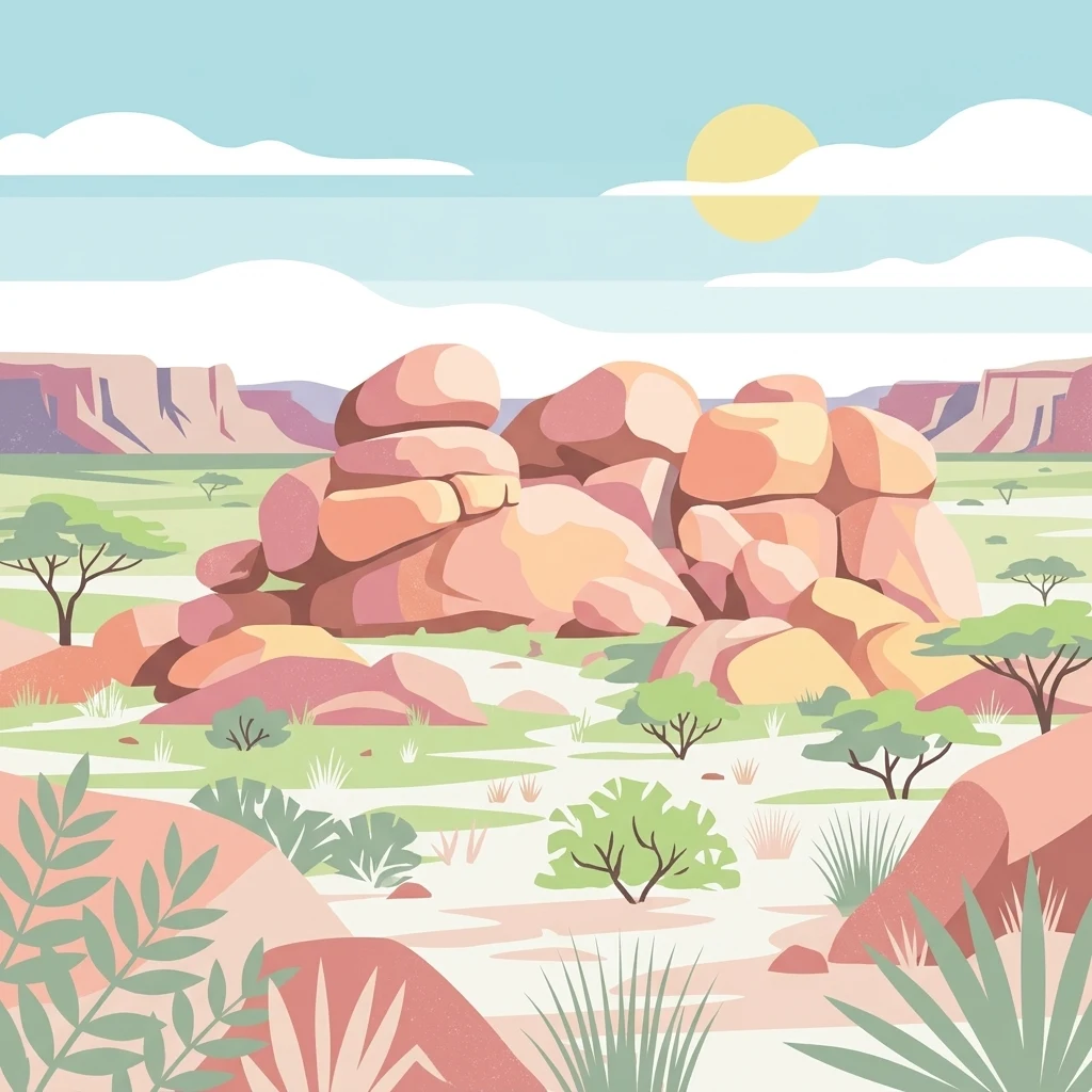
A flat vector illustration of a desert landscape featuring large, rounded pink and orange boulders in the center, sparse green acacia-like trees, and low shrubs under a sunny sky.

Karlu Karlu / Devils Marbles Conservation Reserve

Nature reserve

Park overview

Structured park overview, official facts, and landscape profile for Karlu Karlu / Devils Marbles Conservation Reserve

Karlu Karlu / Devils Marbles Conservation Reserve park facts, protected area profile, and essential visitor context

Review the core facts for Karlu Karlu / Devils Marbles Conservation Reserve, including designation, size, terrain, visitor scale, habitats, and operating context in one park-focused overview.

About Karlu Karlu / Devils Marbles Conservation Reserve

Karlu Karlu / Devils Marbles Conservation Reserve sits in the heart of Australia's arid interior, in the locality of Warumungu in the Northern Territory. The reserve lies 105 kilometres south of Tennant Creek and 393 kilometres north of Alice Springs, with the small roadstop settlement of Wauchope just nine kilometres to the south and the hamlet of Wycliffe Well 25 kilometres to the south. A short access road leads directly from the Stuart Highway into the boulder fields, which is one reason the site draws so many visitors despite its remote location.

Geologically, the reserve protects an unusual exposure of granite that has been raised through overlying sandstone and then shaped by millions of years of weathering into the rounded, often balanced or split boulders that give the place its name. The boulders are concentrated mainly on the western side of the reserve, sitting like small geological islands in a wide desert valley surrounded by sandstone country. Their size, their often precarious-looking shapes, and the sheer variety of forms make the site both scientifically interesting and visually striking.

Culturally, Karlu Karlu is far more than a geological curiosity. Almost the entire reserve is a Registered Sacred Site under Northern Territory law, and multiple Aboriginal groups, including the Alyawarre, Kaytetye, Warumungu and Warlpiri peoples, hold spiritual connections and custodial responsibilities for the area. Traditional Dreaming stories with the boulders as their setting are still actively transmitted today, and only a handful of those stories are considered suitable to share with uninitiated visitors. The site's contemporary significance comes from the fact that it is simultaneously a celebrated natural landmark of the Australian outback and a living, protected cultural landscape.

Quick facts and research context for Karlu Karlu / Devils Marbles Conservation Reserve

Karlu Karlu / Devils Marbles Conservation Reserve is an IUCN Category V protected landscape in the Northern Territory of Australia, located in Warumungu country about 105 kilometres south of Tennant Creek and just off the Stuart Highway. The reserve covers roughly 18 square kilometres of arid desert valley, with boulder clusters concentrated mainly on its western side.

Originally gazetted as the Devils Marbles Reserve in October 1961 and renamed under the Territory Parks and Wildlife Conservation Act in 1979, the area was listed on the former Register of the National Estate in 1980 and almost entirely registered as a Sacred Site in 1982. In October 2008 ownership was formally returned to the traditional Aboriginal owners and the park is now jointly managed under a 99-year lease, making it an Indigenous Protected Area.

Protection and recognition

Documented terrestrial protection history and conservation designation metrics

Karlu Karlu / Devils Marbles Conservation Reserve Protection Status

Karlu Karlu / Devils Marbles Conservation Reserve maintains a documented terrestrial protection status established in 1979. Designated records outline official management scope and conservation history without external international recognition sources.

Protection details

Protection scope
Terrestrial
Designated year
1979
Transboundary protection
No
Park context

Deeper park guide and search-rich context for Karlu Karlu / Devils Marbles Conservation Reserve

Karlu Karlu / Devils Marbles Conservation Reserve history, landscape, wildlife, and travel context

Explore Karlu Karlu / Devils Marbles Conservation Reserve through its history, landscape character, ecosystems, wildlife, conservation priorities, cultural context, and seasonal travel timing in a structured park guide built for atlas discovery and search intent.

Why Karlu Karlu / Devils Marbles Conservation Reserve stands out

Karlu Karlu is best known for its extraordinary collection of large, rounded granite boulders scattered across a sparse desert valley, including many that appear balanced or split in half by natural forces. The reserve is recognised as one of the most iconic natural landmarks of the Australian outback and as a place of profound cultural and spiritual significance to Aboriginal traditional owners. It is also known as one of the oldest religious sites in the world that remains actively cared for by its traditional custodians, with multiple Aboriginal Dreaming stories having the boulders as their setting. The site's status as an Indigenous Protected Area, jointly managed between traditional owners and the Parks and Wildlife Commission, is a defining part of its modern identity.
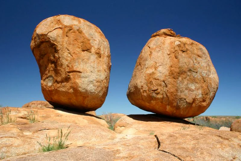
Two large rounded orange granite boulders balanced on top of a rocky outcrop against a clear blue sky.
Iconic balanced granite boulders at Karlu Karlu, Devils Marbles Conservation Reserve.

Karlu Karlu / Devils Marbles Conservation Reserve history and protected-area timeline

The boulders themselves have been part of Aboriginal cultural life for countless generations and form the setting for living Dreaming stories that continue to be passed on by traditional owners today. In the European exploration era, the site became known by its English name through John Ross, who during the 1870 Australian Overland Telegraph Line expedition wrote that the landscape looked like the Devil had emptied his bag of marbles around the place, giving rise to the enduring name Devils Marbles.

The reserve was formally gazetted as the Devils Marbles Reserve in October 1961, then renamed the Devil's Marbles Conservation Reserve on 21 September 1979 under the Territory Parks and Wildlife Conservation Act. In 1980 the area was listed on the now-defunct Register of the National Estate, and in 1982 almost the entire reserve was registered as a sacred site by the Aboriginal Areas Protection Authority. A piece of the reserve's later history involves the removal of one of the boulders in 1952 to serve as part of a memorial to John Flynn in Alice Springs; the boulder later proved to have come from a women's sacred site and, after more than 45 years of negotiation, was returned and replaced in 1999.

A defining moment in the reserve's modern history came in October 2008, when ownership of Karlu Karlu/Devils Marbles was officially handed back to the traditional Aboriginal owners at a ceremony on site. The reserve was then leased back to the Parks Service for 99 years, establishing a joint management arrangement between rangers and traditional owners that continues today and led, on 6 July 2011, to the current dual name Karlu Karlu / Devils Marbles Conservation Reserve.

Karlu Karlu / Devils Marbles Conservation Reserve landscape and geographic character

The landscape of Karlu Karlu is defined by a wide, shallow desert valley in the arid interior of the Northern Territory, in country traditionally associated with Warumungu, Alyawarre, Kaytetye and Warlpiri people. The valley floor is sparsely vegetated and largely flat, allowing the boulder clusters to read clearly against the surrounding plain. The nearest significant towns are Tennant Creek to the north and Alice Springs further south, and the reserve is hemmed in visually by a generally featureless horizon broken only by occasional low ranges.

The most distinctive landscape feature of the reserve is the scattered grouping of large granite boulders, found mostly on the western side of the protected area. These boulders vary enormously in size and form: some sit balanced precariously on top of other boulders or larger rock platforms, while others have been split cleanly down the middle by natural forces. The scale and arrangement of the boulders give the landscape an almost otherworldly quality, with the rocks appearing as isolated outcrops rising out of the desert floor rather than as a continuous range.

Beyond the boulder fields themselves, the surrounding landscape is dominated by arid sandplain and sandstone country typical of central Australia. Scratchy low vegetation, dry seasonal creek lines, and the broad open sky of the Barkly region form the backdrop to the rocks. The Stuart Highway runs near the reserve, and travellers approaching from the highway see the boulders rising gradually out of the plain before reaching the formal access road that leads directly into the heart of the formation.
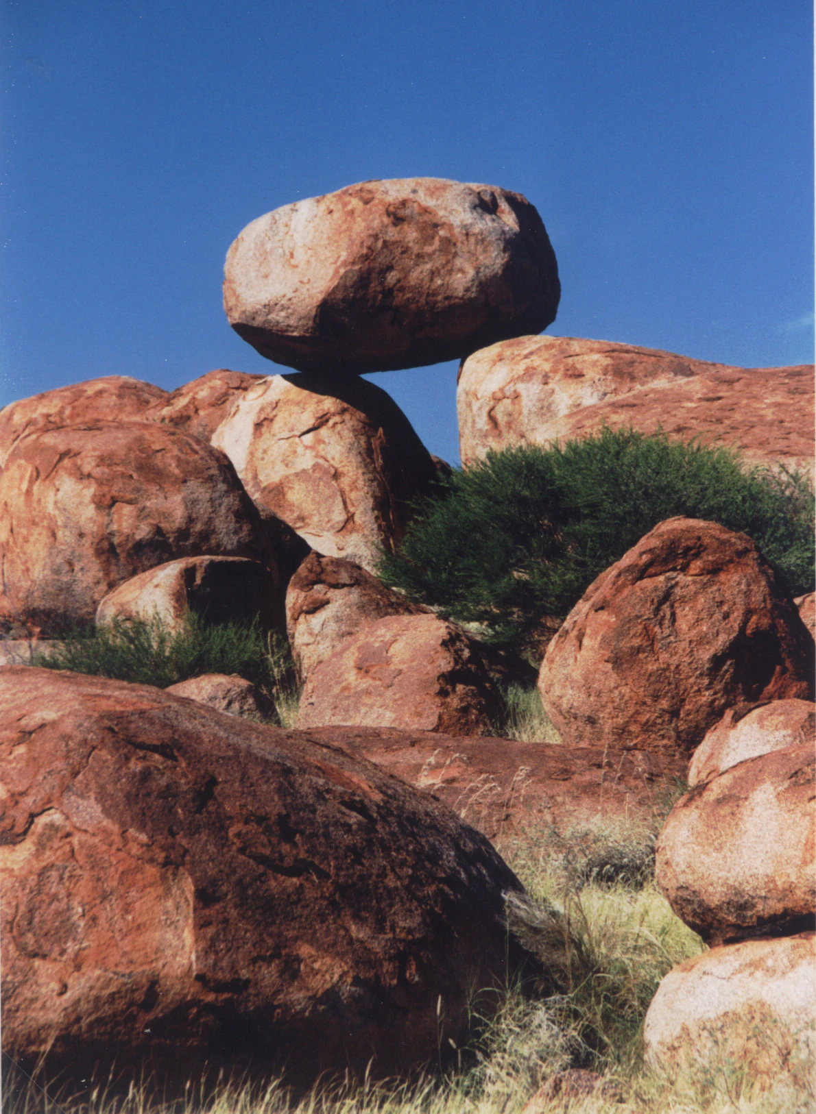
A large, rounded granitic boulder perfectly balanced atop another rock formation at Karlu Karlu, set against a clear blue sky.
Balanced granitic boulders at Karlu Karlu / Devils Marbles Conservation Reserve.

Karlu Karlu / Devils Marbles Conservation Reserve ecosystems, habitats, and plant life

Ecologically, the reserve sits within the dry desert and semi-arid woodland environments characteristic of the Barkly region of the Northern Territory. The boulder-strewn valley supports a sparse but hardy cover of plants adapted to low rainfall, high daytime temperatures, and cool nights. Vegetation in and around the reserve is typical of central Australian sandplain and sandstone country, including drought-tolerant shrubs, scattered low trees, and seasonal grasses that respond to infrequent rains.

The granite outcrops themselves create localised microhabitats within the otherwise open desert. Crevices between and beneath the boulders provide shelter for reptiles, small mammals, and insects, while the rock surfaces themselves absorb heat during the day and release it at night, creating thermal refuges. The surrounding sandy soils support plants that are part of the broader arid-zone flora of the region, linking Karlu Karlu ecologically with the wider desert landscapes traversed by the Stuart Highway between Alice Springs and Darwin.

The contrast between the harsh open desert and the shaded spaces among the boulders helps explain why such a small reserve can support a recognisable ecological community. Although the reserve is small in area, its combination of exposed granite, accumulated sand, and rock shelter gives it an ecological identity distinct from the surrounding sandplains, and contributes to its importance as both a natural and cultural refuge in the central Australian arid zone.
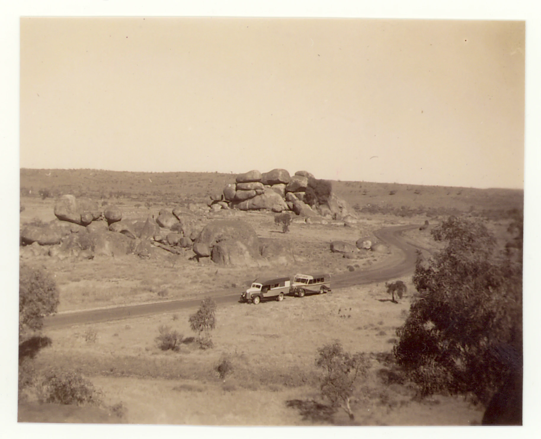
A sepia-toned vintage photograph showing a vehicle driving along a road past large, stacked granite boulders in an arid Australian landscape.
Historical photograph of granite boulders at Karlu Karlu, 1946.

Karlu Karlu / Devils Marbles Conservation Reserve wildlife and species highlights

Wildlife at Karlu Karlu is typical of the arid interior of central Australia, with species adapted to extreme heat, low rainfall, and the rocky shelters provided by the boulder formations. Reptiles are among the most visible inhabitants, using the crevices and shaded surfaces of the granite boulders for thermoregulation and refuge. Small desert mammals and a range of insect life occupy the spaces between and beneath the rocks, taking advantage of the microclimate differences between sun-warmed stone and shaded crevices.

Birds typical of the Barkly region and surrounding arid woodlands are also present in and around the reserve, including species that move through the broader sandplain environment of central Australia. Vegetation around the boulder fields and along seasonal drainage lines provides habitat for these birds, as well as for the small mammals and reptiles that form part of the arid-zone food web.

Although the reserve is not primarily established as a wildlife sanctuary, its combination of rock shelter, sparse vegetation, and connection to surrounding desert country gives it ecological value beyond its small area. Visitors may encounter typical central Australian arid-zone fauna while exploring the walking tracks through the boulder fields, particularly in the cooler months when wildlife activity is generally higher.
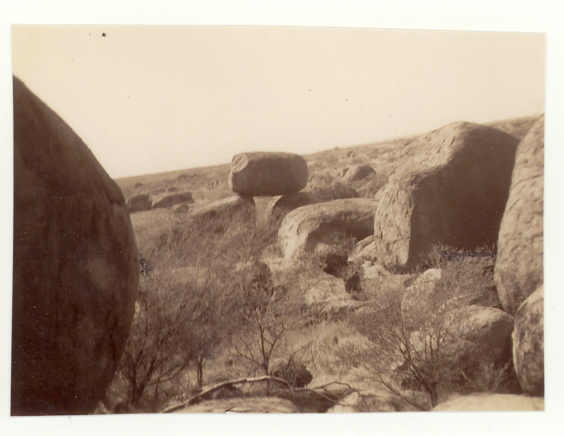
A black and white historic photograph showing large, rounded granite boulders scattered across a dry, arid landscape with sparse low-lying scrub brush.
A historic photograph of the granite boulders at Karlu Karlu, Devils Marbles, taken in 1946.

Karlu Karlu / Devils Marbles Conservation Reserve conservation status and protection priorities

Karlu Karlu is significant from a conservation perspective on multiple, overlapping levels. Geologically, it protects a rare exposure of granite that has been shaped into an unusual collection of rounded, balanced and split boulder formations, representing a stage in the long-term weathering of an extensive underground granite mass. The reserve safeguards both the boulders themselves and the broader desert valley context in which they sit, ensuring that the formation continues to be visible and intact for future generations.

Culturally, almost the entire reserve is protected as a Registered Sacred Site under the Northern Territory Aboriginal Sacred Sites Act 1989, which gives the landscape legal protection beyond its status as a conservation reserve. The reserve was listed on the former Register of the National Estate in 1980 and was registered as a sacred site by the Aboriginal Areas Protection Authority in 1982, well before the formal return of ownership to the traditional owners in 2008.

Since 2008, the conservation of Karlu Karlu has been carried out under a joint management arrangement in which the land is owned by the traditional Aboriginal owners and leased back to the Parks and Wildlife Commission of the Northern Territory under a 99-year lease, making it an Indigenous Protected Area. This model integrates the protection of the geological values of the site with the protection of its continuing cultural and spiritual significance, and the current dual name Karlu Karlu / Devils Marbles Conservation Reserve reflects that joint custodianship.

Karlu Karlu / Devils Marbles Conservation Reserve cultural meaning and human context

Karlu Karlu is fundamentally a cultural landscape before it is a tourist site. The boulders and the surrounding country form the setting for multiple Aboriginal Dreaming stories that remain alive and are actively transmitted from generation to generation among the traditional owners. Although the reserve sits within country originally associated with the Alyawarre people, the Kaytetye, Warumungu and Warlpiri peoples also hold spiritual connections and responsibilities for the area, and only a small selection of the relevant Dreaming narratives are considered appropriate to share with uninitiated visitors.

One public Dreaming story tells of Arrange, the Devil Man, who travelled through the area from a nearby hill. As he walked, he made a hair-string belt by twirling hair, and the clusters he dropped turned into the large red boulders found at Karlu Karlu. On his return journey he spat on the ground, which became the granite boulders in the central part of the reserve, before finally returning to his place of origin at a hill called Ayleparrarntenhe, where he remains today. Such stories are not folklore decoration but central elements of the spiritual and custodial responsibilities attached to the landscape.

The cultural significance of the site has also shaped its modern administrative history, in particular the long-running controversy over a boulder removed from the reserve in 1952 to mark John Flynn's grave in Alice Springs. The boulder was later found to have come from a women's sacred site, and after decades of negotiation a swap was arranged in 1999, returning the original boulder to Karlu Karlu and replacing it with a non-sacred boulder donated by the Arrernte people. The episode is an important reminder that every part of the reserve carries cultural meaning that continues to be respected today.
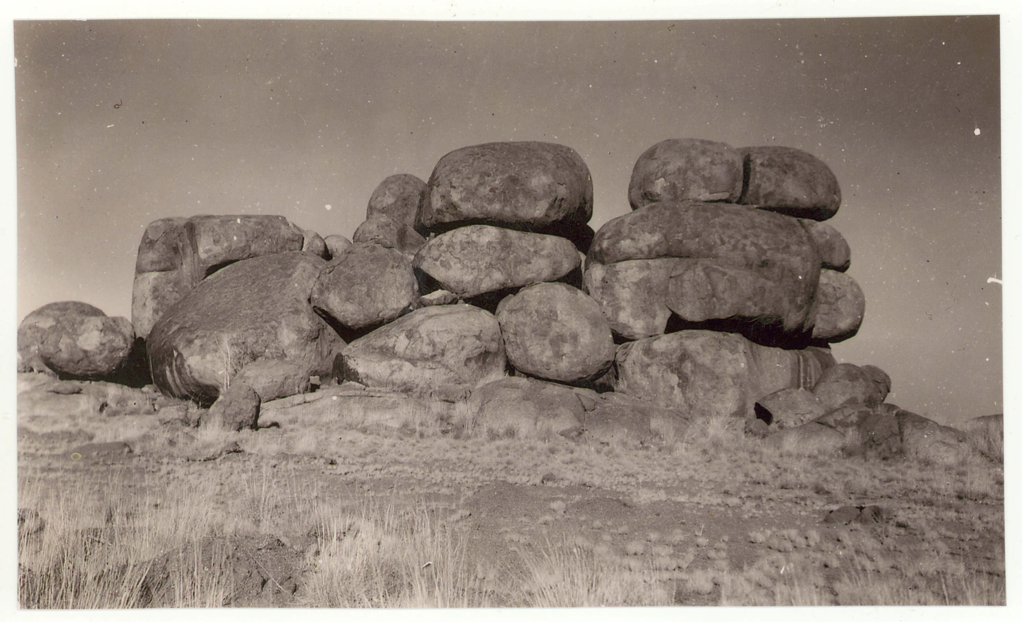
A black and white archival photograph of large, rounded granite boulders stacked naturally in a dry, sparse landscape.
A historical black and white photograph of the iconic balanced granitic boulders at Karlu Karlu, 1946.

Top sights and standout views in Karlu Karlu / Devils Marbles Conservation Reserve

Karlu Karlu is unusual among Australian protected areas in that it combines striking geological scenery with deep and continuing Aboriginal cultural significance on a very small footprint. Its compact area of around 18 square kilometres contains a globally distinctive collection of rounded, balanced and split granite boulders, while also protecting one of the oldest continuously significant sacred landscapes in the world. The dual name Karlu Karlu / Devils Marbles and the reserve's status as an Indigenous Protected Area jointly managed by traditional owners and the Parks and Wildlife Commission make it an important example of how cultural and natural heritage can be protected together.

For visitors, the highlight of the reserve is the visual impact of the boulder fields themselves, easily reached on foot from the Stuart Highway via a short access road and a network of walking tracks. The dramatic natural shapes of the boulders, the openness of the surrounding desert valley, and the interpretive information on site together communicate both the geological story of the formation and the cultural frameworks that give it meaning.
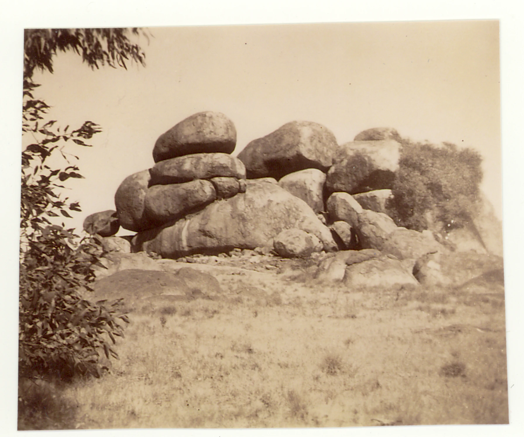
A sepia-toned vintage photograph showing a cluster of large, weathered, rounded granite boulders in an arid landscape with a small shrub in the foreground left.
Historical photograph of granite boulders at Karlu Karlu / Devils Marbles, taken in 1946.

Best time to visit Karlu Karlu / Devils Marbles Conservation Reserve

The cooler months between May and August are widely considered the most comfortable period to visit Karlu Karlu, when daytime temperatures in the Barkly region are milder and the conditions for walking among the boulder fields are generally more pleasant. This period coincides with the reserve's main visitor season and with the Territory Parks Alive program of ranger-led events that runs from May to September each year, offering visitors a chance to engage more directly with both the natural and cultural stories of the site.

Outside of these months, the reserve remains accessible throughout the year and the boulder formations are unchanged by season, but summer conditions in central Australia can be very hot during the day. Travellers who arrive in the warmer months typically plan shorter visits during the cooler parts of the day and rely on the on-site information boards and walking paths rather than extended time among the boulders.

Monthly climate preview

Long term temperature and precipitation normals sampled at a representative coordinate

Karlu Karlu / Devils Marbles Conservation Reserve Climate and Weather by Month

Karlu Karlu / Devils Marbles Conservation Reserve experiences substantial temperature variations alongside low monthly precipitation levels across the representative coordinate. Reviewing the complete twelve month profile provides deeper insight into measured baseline patterns and long term climate normals.
Annual mean25 °C
17 °C31 °C
Jan31°
Feb30°
Mar28°
Apr25°
May20°
Jun17°
Jul17°
Aug19°
Sep25°
Oct28°
Nov31°
Dec31°
Warmest month
December

31.2 °C

Coolest month
July

16.7 °C

Wettest month
February

3.7 mm/day

Driest month
August

0.1 mm/day

Park location guide

Geography guide, regional context, and park location map for Karlu Karlu / Devils Marbles Conservation Reserve

Karlu Karlu / Devils Marbles Conservation Reserve park geography, regions, and map view in Australia

Understand where Karlu Karlu / Devils Marbles Conservation Reserve sits in Australia through a broader geographic reading of the surrounding landscape, nearby location context, and its mapped position within the national park landscape.

How Karlu Karlu / Devils Marbles Conservation Reserve fits into Australia

Australia is a constitutional monarchy and federal parliamentary democracy comprising six states and ten territories. With a population of nearly 28 million, it is one of the world's most urbanised countries, with most people concentrated on the eastern seaboard. The country has a high Human Development Index and is known for its cultural diversity, ancient Aboriginal heritage, and unique wildlife.

Wider geography shaping Karlu Karlu / Devils Marbles Conservation Reserve in Australia

Australia occupies the entire Australian continent, the island of Tasmania, and numerous smaller islands. It is the world's flattest and driest inhabited continent, featuring vast deserts in the interior (the Outback), tropical rainforests along the eastern coast, and a coastline bordering the Indian and Pacific Oceans.

Map view of Karlu Karlu / Devils Marbles Conservation Reserve

Use this park location map to pinpoint Karlu Karlu / Devils Marbles Conservation Reserve in Australia, understand its exact geographic position, and read its mapped placement within the surrounding landscape more clearly.

Pigeon | © OpenStreetMap contributors

Location context for Karlu Karlu / Devils Marbles Conservation Reserve

Northern Territory

Visual reference of granite boulder fields and arid desert valley scenery

Karlu Karlu / Devils Marbles Conservation Reserve Photos and Landscapes

Visual documentation captures the scattered granite boulder clusters and arid desert valley floor defining the protected area. Photographic records illustrate the geological formations and open horizon characteristic of central Australia.

Two large rounded orange granite boulders balanced on top of a rocky outcrop against a clear blue sky.

A close-up perspective of two massive granite boulders leaning against each other, creating a V-shaped gap that reveals green shrubbery and a clear blue sky in the background.

A large, rounded granitic boulder perfectly balanced atop another rock formation at Karlu Karlu, set against a clear blue sky.

A sepia-toned vintage photograph showing a vehicle driving along a road past large, stacked granite boulders in an arid Australian landscape.

A black and white historic photograph showing large, rounded granite boulders scattered across a dry, arid landscape with sparse low-lying scrub brush.

A black and white historical photograph shows large rounded granite boulders scattered across a dry, scrubby landscape, with a road curving through the foreground and text at the bottom reading The Devil's Marbles, Central Australia.

A black and white archival photograph of large, rounded granite boulders stacked naturally in a dry, sparse landscape.

A sepia-toned vintage photograph showing a cluster of large, weathered, rounded granite boulders in an arid landscape with a small shrub in the foreground left.

A sepia-toned archival photograph from 1946 showing a vast, dry desert landscape scattered with large, rounded granite boulders and a dirt path with a few small figures walking.

A black and white vintage photograph showing a truck parked in front of large, rounded granite boulder formations under a cloudy sky.

Park atlas

Compare regional desert landscapes and connected natural landmarks across central Australia

Parks Near Karlu Karlu / Devils Marbles Conservation Reserve and Surrounding Protected Areas

Browse other parks near Karlu Karlu / Devils Marbles Conservation Reserve to examine related arid terrain and protected granite landscapes. Continuing the geographic comparison reveals broader patterns across regional desert reserves and surrounding conservation areas.
National parkNorthern Territory
About 77 km away#1 closest

Southeast

Iytwelepenty / Davenport Range National Park: Protected National Park Landscape Atlas

Explore Northern Territory's mapped protected area and regional geography.

Iytwelepenty / Davenport Range National Park is a designated national park offering crucial insights into Australia's protected landscapes. This resource provides a detailed view of its geographic position within the Northern Territory, emphasizing its mapped boundaries and the surrounding regional context. Users seeking to understand the distribution and geographical characteristics of protected areas will find this park's atlas-style data invaluable for discovery.

Area
1,278.47 km²
Established
1993
IUCN
II
Relief
Mountain
National parkNorthern Territory
About 243 km away#2 closest

Southeast

Dulcie Range National Park National Park: Mapped Protected Landscape in Northern Territory

Explore its geographic boundaries and regional terrain.

Dulcie Range National Park, a protected national park in Australia's Northern Territory, offers a focus for structured geographic discovery. This page details its mapped protected area, contributing to an understanding of the regional landscape and terrain. It serves as a vital entry point for exploring the park's specific natural and geographic identity within the vast context of Northern Australia.

Area
191.12 km²
Established
1991
IUCN
II
Relief
Upland
Nature reserveNorthern Territory
About 259 km away#3 closest

Southwest

Anna's Reservoir Conservation Reserve: Protected Landscapes and Geography in the Northern Territory

Natural rock-hole terrain and arid catchment heritage

Located north of Alice Springs on Aileron Station, Anna's Reservoir Conservation Reserve is a protected area centered on a critical natural water source. The site offers a window into the intersection of Indigenous custodianship and inland exploration, protecting 85 hectares of arid environment characteristic of the central Australian interior.

Area
0.85 km²
Established
1971
Scope
Terrestrial
Watercolor painting of an arid landscape featuring red sandstone rock formations, green scrub, and grasses against pale mountains.
Protected landscapeNorthern Territory
About 265 km away#4 closest

South

Native Gap Conservation Reserve: Protected Landscape and Central Australian Geography

Mapped sandstone terrain within the Northern Territory Hann Range

Spanning just 11 hectares, this protected area is defined by its dramatic sandstone ridge and deep historical ties to the Arrente and Anmatyerr peoples. The reserve provides a distinct geographic reference point along the Stuart Highway, where desert flora and historic telegraph routes converge within the unique terrain of central Australia.

Area
0.11 km²
Established
1980
IUCN
V
Relief
Upland
Wildlife reserveNorthern Territory
About 300 km away#5 closest

Northeast

Connells Lagoon Conservation Reserve: Northern Territory Protected Landscape Atlas

Examining the ecological significance of Barkly Tableland grasslands

Connells Lagoon Conservation Reserve, also known as Dalgajini, encompasses a vital protected sample of the Barkly Tableland's Mitchell grassland and black soil plains. This wildlife reserve functions as a sanctuary for native grassland systems, maintaining a rare, cattle-free landscape that allows for the study of regional vegetation, rare avian species, and ancestral Wambaya cultural land patterns within the Northern Territory.

Area
258.9 km²
Established
1994
IUCN
Ia
Relief
Lowland
Protected areaNorthern Territory
About 313 km away#6 closest

North

Lake Woods Protected Area: Northern Territory Wetland Geography and Atlas Data

Ephemeral floodplain and waterbird habitat mapping

Lake Woods is a distinct freshwater system in the Northern Territory, defined by its cycle of flooding and recession. The basin hosts an important mosaic of coolibah woodland, river red gums, and lignum shrubland. As a recognized wetland for migratory and breeding waterbirds, the area offers a significant example of inland Australian floodplain geography and dynamic aquatic ecosystems.

Area
1,240 km²
Water
Water-dominated
Protected areaNorthern Territory
About 324 km away#7 closest

South

Arltunga Historical Reserve: A Heritage Protected Area in Northern Territory Australia

Mapping nineteenth century mining ruins and arid terrain

Arltunga Historical Reserve offers a distinct window into the outback mining era through its well-preserved stone structures and desolate desert setting. This protected area within the Northern Territory highlights the intersection of European settlement history and the traditional cultural heritage of the Eastern Arrernte people.

Area
50 km²
Established
1975
Relief
Upland
Climate
Arid
Protected landscapeNorthern Territory
About 331 km away#8 closest

South

Trephina Gorge Nature Park: Mapped Geography and Protected Landscape Context

East MacDonnell Ranges, Northern Territory Australia

Trephina Gorge Nature Park represents a central feature of the arid MacDonnell Ranges, characterized by its deep gorge, white ghost gums against red rock, and expansive spinifex ridges. This record outlines the park boundaries, its role as a jointly managed conservation area, and its position within the broader geography of central Australia.

Established
1965
Relief
Mountain
Climate
Arid
Access
Access unknown

Common questions about visiting, size, designation, and location context for Karlu Karlu / Devils Marbles Conservation Reserve

Karlu Karlu / Devils Marbles Conservation Reserve FAQs for park facts, access, geography, and protected area context

Find quick answers about Karlu Karlu / Devils Marbles Conservation Reserve, including protected-area facts, park geography, trail and visitor context, and how the park fits into its surrounding country and regional landscape.
MoriAtlas Explorer

Continue Your Protected Areas Search Across the Global Atlas

Deepen your exploration by continuing the structured search for national parks and protected areas worldwide. Utilize the comprehensive filtering capabilities to compare different conservation landscapes and refine your understanding of global park geography. Discover more about the distribution and characteristics of protected natural areas.

Global natural geography