

Mori Atlas logo
Nature reserveKarte Conservation Park

Explore the distinct topography and dense mallee vegetation within this protected nature reserve.

Karte Conservation Park: Mapping the Protected Mallee Sand Dunes of South Australia

Karte Conservation Park forms a vital protected landscape of irregular, steep sand dunes located within the southern mallee region of South Australia. This nature reserve preserves an unusually undisturbed mosaic of ridge-fruited mallee eucalypt stands and native cypress, serving as a critical refuge for mallee-dependent wildlife like the mallee fowl. The park boundary encompasses a rare, unbroken vegetative cover that stands in stark contrast to the surrounding agricultural plains of the Murray-Mallee zone.

conservation parksouth australiamallee vegetationsand dunessemi-arid landscapenative flora

Karte Conservation Park

Nature reserve

Park overview

Structured park overview, official facts, and landscape profile for Karte Conservation Park

Karte Conservation Park park facts, protected area profile, and essential visitor context

Review the core facts for Karte Conservation Park, including designation, size, terrain, visitor scale, habitats, and operating context in one park-focused overview.

About Karte Conservation Park

Karte Conservation Park is a compact South Australian reserve in the south-eastern part of the state, occupying part of the localities of Karte and Parilla on crown land in the Hundreds of Kingsford and Parilla. It lies roughly halfway between Adelaide and the Victorian border, in the low-rainfall country that surrounds the agricultural town of Pinnaroo. Although small in size, it is ecologically significant because it sits on a self-contained system of steep, irregular sand dunes that have escaped the broad-scale land clearance typical of the surrounding Murray-Mallee landscape.

The defining ecological identity of the park is the very mature mallee vegetation that clothes these dunes. Rather than a forest of tall single-trunked eucalypts, the park's tree layer consists of multi-stemmed mallee eucalyptus, dominated by a tall, dense form of Eucalyptus incrassata. Beneath and between these mallees grow Melaleuca lanceolata, Melaleuca uncinata, and Callitris verrucosa, producing the kind of dense, layered shrub-and-tree cover that characterises undisturbed southern mallee. The result is a continuous canopy of low trees and woody shrubs over deep sand, with relatively little open ground.

What makes Karte particularly valuable in a regional context is how little it has been disturbed. Although the surrounding natural and cultural landscape has been heavily modified by pastoral and agricultural use, the dunes within the park have seen minimal intervention, and the vegetation has remained unburnt for long periods. This combination of intact mallee structure, sandy substrate, and limited recent fire history is precisely what the threatened mallee fowl requires, and the park is recognised as habitat for this and other mallee-dependent species.

The park's protected status reflects this ecological importance. It was first proclaimed as Karte National Park on 4 September 1969 under the National Parks Act 1966, and was reconstituted as Karte Conservation Park on 27 April 1972 when the National Parks and Wildlife Act 1972 came into force. Additional land in the Hundred of Kingsford and the Hundred of Parilla was added to the park in December 1972 and June 1976 respectively, building the reserve up to about 35.90 square kilometres. The reserve is now classified as an IUCN Category Ia protected area, or strict nature reserve, recognising its role as a refuge for natural ecological processes rather than as a site oriented primarily to public recreation.

Quick facts and research context for Karte Conservation Park

Karte Conservation Park lies in the localities of Karte and Parilla in South Australia, about 193 kilometres east of Adelaide and 26 kilometres north-west of Pinnaroo. It is a small protected area of roughly 36 square kilometres, situated in the southern Australian mallee belt on a system of steep, irregular sand dunes.

The park comprises crown land in several cadastral sections of the Hundreds of Kingsford and Parilla. It was first proclaimed as Karte National Park in 1969 under the National Parks Act 1966 and reconstituted as a conservation park in 1972 under the National Parks and Wildlife Act 1972, with additional land added in the 1970s. It is classified as an IUCN Category Ia protected area (strict nature reserve) and is managed by the South Australian Department for Environment and Water.

Protection and recognition

Explore the documented terrestrial conservation scope and established designation history.

Karte Conservation Park Protection Status and Designation History

Karte Conservation Park maintains a documented terrestrial protection scope established in 1972. Structured conservation records compile official designation history and management parameters for this protected area.

Protection details

Protection scope
Terrestrial
Designated year
1972
Transboundary protection
No
Park context

Deeper park guide and search-rich context for Karte Conservation Park

Karte Conservation Park history, landscape, wildlife, and travel context

Explore Karte Conservation Park through its history, landscape character, ecosystems, wildlife, conservation priorities, cultural context, and seasonal travel timing in a structured park guide built for atlas discovery and search intent.

Why Karte Conservation Park stands out

Karte Conservation Park is best known for protecting a discrete block of steep, irregular sand dunes in South Australia's southern mallee country that still supports very mature, largely undisturbed mallee vegetation. The park's dominant vegetation is a tall, dense stand of ridge-fruited mallee eucalyptus, mixed with melaleuca species and native cypress, giving the dunes a continuous cover of low trees and shrubs typical of the southern Australian semi-arid zone. The reserve is also recognised as an important refuge for mallee-dependent fauna, most notably the threatened mallee fowl, which relies on the kind of dense mallee shrubland and undisturbed sandy substrate that Karte still preserves around its dune system.

Karte Conservation Park history and protected-area timeline

Karte Conservation Park has its origins in the late 1960s, when the South Australian government began formally identifying areas of mallee country for protection under the state's emerging national parks framework. On 4 September 1969, crown land in the Hundred of Kingsford was proclaimed as Karte National Park under the National Parks Act 1966, giving the dune country its first formal protected-area status.

The park's legal character changed on 27 April 1972, when the new National Parks and Wildlife Act 1972 came into force. Under this legislation, the reserve was reconstituted as Karte Conservation Park, a designation that reflected a broader reorganisation of South Australian reserves into categories suited to different management objectives. The change of title did not signal any weakening of protection; rather, it placed the park within the new conservation-park framework that was intended for areas of significant natural value that did not necessarily require the higher level of intervention associated with full national parks.

After this reconstitution, the park was expanded twice. On 7 December 1972, additional land in section 10 of the Hundred of Kingsford was added, extending the reserve on its existing cadastral base. A further addition followed on 17 June 1976, when land in section 135 of the Hundred of Parilla was included, broadening the park into the adjoining hundred. Together, these additions built the conservation park up to its current area of approximately 35.90 square kilometres. The reserve was also listed on the now-defunct Register of the National Estate in 1980, and today is managed by the South Australian Department for Environment and Water as a strict nature reserve under international guidelines.

Karte Conservation Park landscape and geographic character

The landscape of Karte Conservation Park is defined by a localised system of steep, irregular sand dunes in South Australia's southern mallee zone. The dunes rise sharply from the surrounding plain in an uneven, broken pattern, giving the park a distinctive undulating topography set apart from the flatter agricultural and pastoral land that surrounds it. The sand is deep and free-draining, typical of the aeolian deposits that build up the dune systems across the Murray-Mallee region.

The terrain is dissected rather than uniform, with closely spaced dune crests and swales producing a mosaic of microhabitats across a relatively small area. This irregular dune structure is important ecologically: it creates variation in slope, exposure, and sand depth, which in turn supports subtle differences in vegetation density and shelter. The result is a textured, layered landscape of dunes, hollows, and dense woody cover, rather than an open plain or uniform woodland.

Across this dune country, the ground is essentially continuous mallee shrubland, with no major breaks into non-vegetated sand or cleared land within the park boundaries. This unbroken vegetative cover, combined with the steep dune topography, gives Karte a strongly enclosed, ecologically self-contained character compared with the heavily modified surrounding landscape.

Karte Conservation Park ecosystems, habitats, and plant life

Karte Conservation Park protects an unusually intact example of mature southern mallee vegetation on sandy soils. The dominant tree layer is a tall, dense form of the ridge-fruited mallee Eucalyptus incrassata, whose multi-stemmed growth form gives rise to the characteristic mallee structure of low, spreading trees rather than tall single-trunked forest. This Eucalyptus incrassata mallee is the ecological backbone of the reserve and shapes the appearance and functioning of nearly the entire park.

Within and beneath this mallee canopy grow a number of important shrub and small-tree species. Melaleuca lanceolata and Melaleuca uncinata contribute to the dense woody shrub layer, while Callitris verrucosa, a native cypress, adds a coniferous element to the otherwise broad-leaved mallee community. Together, these species produce a thick, multi-layered cover of trees and shrubs over deep sand, with very little bare ground visible within the dunes.

A key feature of the park's nature is the maturity and continuity of this vegetation. The mallee community is described as very mature, suggesting that individual plants and the community as a whole are well developed and structurally complex, rather than consisting of even-aged regrowth. Importantly, the park has remained largely undisturbed and unburnt for a considerable time, allowing these mature vegetation patterns to persist in a landscape where surrounding areas have been cleared or altered. This combination of mature age, structural diversity, and limited disturbance is what gives Karte its distinct value among South Australian mallee reserves.

Karte Conservation Park wildlife and species highlights

Karte Conservation Park is recognised primarily as habitat for wildlife associated with mature southern mallee vegetation. Its most notable resident is the mallee fowl, a ground-dwelling bird listed as threatened, which depends on the dense mallee shrubland and undisturbed sandy substrate that the park still provides. The mallee fowl's presence is one of the main reasons the reserve has drawn conservation attention, because suitable habitat for the species has become increasingly fragmented elsewhere in the Murray-Mallee region.

The park is also described as providing habitat for numerous other mallee-associated species beyond the mallee fowl, suggesting that the dense, structurally diverse mallee shrubland supports a broader community of birds and small fauna typical of the southern Australian semi-arid zone. The unbroken canopy cover, the mature age of the vegetation, and the long unburnt history all contribute to habitat conditions that favour fauna reliant on stable, well-developed mallee rather than on recently regenerating stands.

Pest mammals are also recorded within the park. Foxes, rabbits, and house mice are present, reflecting the fact that the reserve sits within a broader agricultural and pastoral landscape from which these species readily move into native vegetation. The presence of these introduced mammals is a recognised pressure on the park's wildlife values, particularly for ground-nesting birds such as the mallee fowl, and is one of the management challenges associated with maintaining the reserve's habitat quality.

Karte Conservation Park conservation status and protection priorities

Karte Conservation Park is a small but ecologically important reserve, valued mainly for its unusually intact and mature mallee vegetation in a region where similar habitat has been heavily cleared for agriculture. Its conservation significance rests on the fact that, although the surrounding natural and cultural landscape has been extensively disturbed, the steep sand dunes within the park have remained minimally altered, preserving a continuous block of very mature mallee that is rare in the contemporary Murray-Mallee landscape.

The reserve plays a particular role in conserving habitat for the threatened mallee fowl, whose dependence on dense mallee shrubland and undisturbed sandy ground makes reserves like Karte increasingly important as the species' range contracts. The park's long unburnt history and structurally diverse, mature vegetation support not only the mallee fowl but a broader community of mallee-dependent fauna, making it a refuge for ecological processes rather than simply a tract of protected land.

Formal recognition of the park's conservation value is reflected in several layers of protection. It has been reserved under South Australian legislation since 1969, was listed on the Register of the National Estate in 1980, and is classified as an IUCN Category Ia protected area (strict nature reserve), placing it among the most strictly protected categories of natural area internationally. The reserve is managed by the South Australian Department for Environment and Water, with control of introduced mammals such as foxes, rabbits, and house mice representing a continuing management priority for maintaining habitat condition.

Karte Conservation Park cultural meaning and human context

Karte Conservation Park does not have a strongly documented cultural or Indigenous heritage profile in the available source material beyond the general observation that, while the surrounding cultural landscape has been disturbed by pastoral and agricultural development, the park itself has remained minimally altered. The reserve is best understood as a fragment of the broader southern Australian mallee country that was historically shaped by the land-use patterns of European settlement, rather than as a site defined primarily by cultural or traditional associations.

Top sights and standout views in Karte Conservation Park

Karte Conservation Park's standout features are concentrated and distinctive: a discrete block of steep, irregular sand dunes carrying very mature, largely undisturbed mallee vegetation, dominated by a tall, dense form of Eucalyptus incrassata with Melaleuca lanceolata, Melaleuca uncinata, and Callitris verrucosa in the understorey. The park's long unburnt history and minimal disturbance set it apart from the surrounding cleared agricultural landscape, giving it value as a reference site for southern mallee vegetation.

Equally important is the reserve's role as habitat for the threatened mallee fowl and other mallee-dependent fauna, supported by the park's formal status as an IUCN Category Ia strict nature reserve, its inclusion on the former Register of the National Estate, and its management within South Australia's conservation park system.

Best time to visit Karte Conservation Park

Karte Conservation Park sits in South Australia's southern mallee zone, a low-rainfall region where the character of the landscape varies mainly with temperature and seasonal dryness rather than with dramatic seasonal transformation. Cooler months of the southern hemisphere autumn, winter and spring typically offer more comfortable conditions for being outdoors in the semi-arid countryside, when daytime temperatures are milder and the dune country is more accessible on foot.

Summer in this part of South Australia can be very hot and dry, with high temperatures and sparse shade across the dune vegetation, conditions which can make extended time in the park difficult. Wildlife observations and the experience of the mallee shrubland are generally easier during the cooler and milder parts of the year, when fauna such as the mallee fowl are also more typically active around the dune country.
Monthly climate preview

Long term annual temperature ranges and monthly precipitation patterns across South Australia

Karte Conservation Park Climate Normals, Average Temperature and Precipitation

Historical coordinate records for Karte Conservation Park document a measured annual cycle of shifting monthly temperatures alongside consistent baseline precipitation rates. Detailed monthly climate normals expand these long term averages into comprehensive temperature and rainfall breakdowns.
Annual mean17 °C
10 °C25 °C
Jan25°
Feb24°
Mar21°
Apr17°
May13°
Jun10°
Jul10°
Aug11°
Sep13°
Oct17°
Nov20°
Dec22°
Warmest month
January

24.7 °C

Coolest month
July

9.6 °C

Wettest month
September

1.1 mm/day

Driest month
January

0.6 mm/day

Park location guide

Geography guide, regional context, and park location map for Karte Conservation Park

Karte Conservation Park park geography, regions, and map view in Australia

Understand where Karte Conservation Park sits in Australia through a broader geographic reading of the surrounding landscape, nearby location context, and its mapped position within the national park landscape.

How Karte Conservation Park fits into Australia

Australia is a constitutional monarchy and federal parliamentary democracy comprising six states and ten territories. With a population of nearly 28 million, it is one of the world's most urbanised countries, with most people concentrated on the eastern seaboard. The country has a high Human Development Index and is known for its cultural diversity, ancient Aboriginal heritage, and unique wildlife.

Wider geography shaping Karte Conservation Park in Australia

Australia occupies the entire Australian continent, the island of Tasmania, and numerous smaller islands. It is the world's flattest and driest inhabited continent, featuring vast deserts in the interior (the Outback), tropical rainforests along the eastern coast, and a coastline bordering the Indian and Pacific Oceans.

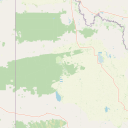
Map view of Karte Conservation Park

Use this park location map to pinpoint Karte Conservation Park in Australia, understand its exact geographic position, and read its mapped placement within the surrounding landscape more clearly.

Pigeon | © OpenStreetMap contributors

Location context for Karte Conservation Park

South Australia
Park atlas

Compare regional mallee reserves and connected sand dune ecosystems in South Australia

Explore Parks Near Karte Conservation Park and Surrounding Protected Landscapes

Browse protected areas near Karte Conservation Park to examine similar semi-arid mallee vegetation and undulating dune terrain. Comparing these adjacent regional reserves reveals broader ecological patterns across the southern Australian landscape.
National parkAustralia
About 34 km away#1 closest

East

Murray-Sunset National Park: Iconic Pink Lakes and Mallee Wilderness in Victoria's Semi-Arid Interior

Explore its unique landscape, mapped boundaries, and regional geography.

Murray-Sunset National Park offers a compelling glimpse into Australia's semi-arid heart, featuring a dramatic landscape of salt lakes, gypsum plains, extensive sand dunes, and dense mallee woodlands. This vast protected area is renowned for the vibrant pink hue of its salt lakes, a phenomenon created by microscopic algae that flourishes in the hypersaline conditions during warmer months. The park's rich biodiversity and unique ecosystem make it a significant conservation asset, providing crucial habitat for numerous species adapted to this challenging yet beautiful environment.

Area
6,330 km²
Established
1991
IUCN
II
Relief
Lowland
Nature reserveSouth Australia
About 43 km away#2 closest

Northwest

Billiatt Conservation Park: Mapping Dune Topography and Mallee Woodland in South Australia

Protecting semi-arid scrubland and Important Bird Area habitats

Billiatt Conservation Park covers an extensive system of sand dunes across the semi-arid interior of South Australia. This nature reserve offers a look at the mosaic of open mallee scrubland and dune topography that supports rare bird species and a complex reptile community. Explore the geographic boundaries and landscape characteristics that define this protected territory.

Area
8.02 km²
Established
1940
IUCN
VI
Relief
Lowland
National parkSouth Australia
About 72 km away#3 closest

North

Murray River National Park: Protected Wetland Ecosystems in South Australia

Explore South Australia's unique river red gum floodplains.

Murray River National Park is a significant protected area in South Australia, renowned for its expansive wetland and floodplain environments situated along the Murray River. This national park preserves crucial habitats within the Murray-Darling Basin, characterized by river red gum woodlands, permanent water bodies, and dynamic seasonal floodplains. Its detailed maps and geographic context offer deep insights into one of Australia's most important riverine conservation landscapes.

Area
148.79 km²
Established
1991
IUCN
VI
Relief
Lowland
Protected areaSouth Australia
About 72 km away#4 closest

North

Kapunda Island Conservation Park: Atlas and Geographic Context of a Murray River Reserve

A protected sand-bar island in the South Australian Riverland

Located in the Murray River near Loxton, Kapunda Island Conservation Park serves as an important example of a riverine island environment. This protected area provides essential habitat, featuring river red gum woodland and lignum understorey that support local waterbird populations and regional biodiversity patterns.

Area
0.01 km²
Established
1968
IUCN
III
Relief
Lowland
National parkAustralia
About 78 km away#5 closest

East

Wyperfeld National Park: Mapping Victoria's Vast Mallee Semi-Arid Wilderness and Sandhill Landscapes

Discover the unique geography and protected terrain of this significant Australian national park.

Wyperfeld National Park in Victoria, Australia, is a prime example of a vast semi-arid wilderness landscape. It is best known for its extensive sandhill formations, referred to as 'snowdrifts,' which punctuate the otherwise flat terrain. The park also protects a significant ephemeral lake system and is a stronghold for the mallee ecosystem, offering a unique context for understanding dryland conservation and mapped natural areas. Its protected status highlights its importance within the broader geographic context of Australia's protected landscapes.

Area
3,570 km²
Established
1921
IUCN
II
Relief
Lowland
Nature reserveSouth Australia
About 82 km away#6 closest

Southwest

Carcuma Conservation Park: Protected Mallee Heath and Sand Ridge Geography

A vital nature reserve within the upper south-east of South Australia.

Carcuma Conservation Park protects an intact expanse of mallee heath and open forest within the South Australian landscape. The park is defined by its undulating sand ridge topography and stabilised dunes, offering significant insight into the native plant communities that historically characterized the region's semi-arid environment.

Area
35.9 km²
Established
1969
IUCN
Ia
Relief
Lowland
State or regional parkSouth Australia
About 96 km away#7 closest

North

Cooltong Conservation Park: Geography and Protected Mallee Woodland in South Australia

A regional conservation area defined by dune and shale flat topography

Cooltong Conservation Park is a protected state area in South Australia's Riverland. It features 37 square kilometres of mallee shrubland shaped by undulating dunes and shale flats. This conservation landscape is a recognized stronghold for birdlife, particularly the iconic Malleefowl, offering an authentic look at Australia's inland semi-arid terrain and its ecological connectivity.

Area
37.1 km²
Established
1993
IUCN
VI
Relief
Lowland
Nature reserveSouth Australia
About 112 km away#8 closest

West

Ettrick Conservation Park: Protected Mallee Woodlands and Grassland Remnants

A vital conservation landscape in the South Australian Murray-Darling Basin.

Ettrick Conservation Park acts as an ecological sanctuary within South Australia by protecting rare tussock grasslands and open mallee eucalypt woodland. This protected area offers insight into the original vegetation patterns of the region, supporting ground-dwelling bird species and showcasing a critical fragment of semi-arid terrain amidst a largely cleared agricultural landscape.

Area
4.79 km²
Established
2013
IUCN
VI
Relief
Lowland

Common questions about visiting, size, designation, and location context for Karte Conservation Park

Karte Conservation Park FAQs for park facts, access, geography, and protected area context

Find quick answers about Karte Conservation Park, including protected-area facts, park geography, trail and visitor context, and how the park fits into its surrounding country and regional landscape.
MoriAtlas Explorer

Continue Your Protected Areas Search Across the Global Atlas

Deepen your exploration by continuing the structured search for national parks and protected areas worldwide. Utilize the comprehensive filtering capabilities to compare different conservation landscapes and refine your understanding of global park geography. Discover more about the distribution and characteristics of protected natural areas.

Global natural geography