

Mori Atlas logo
National parkKaziranga National Park

Discover the mapped geography and protected area identity of this key Assam natural landscape.

Kaziranga National Park: Assam's Premier National Park and Protected Landscape

Kaziranga National Park stands as a significant protected landscape within the Indian state of Assam, recognized as a National Park. This page offers an atlas-focused exploration of its geographic scope and mapped boundaries, situating it within the rich natural terrain of northeastern India. Understand the distinct protected area character and regional landscape context that defines Kaziranga National Park.

World Heritage SiteTiger ReserveRhinoceros ConservationFloodplain EcosystemAssamImportant Bird Area
Stylized illustration of a waterfall surrounded by dense forests and mountains under a bright sky

Kaziranga National Park

National park

Park overview

Structured park overview, official facts, and landscape profile for Kaziranga National Park

Kaziranga National Park park facts, protected area profile, and essential visitor context

Review the core facts for Kaziranga National Park, including designation, size, terrain, visitor scale, habitats, and operating context in one park-focused overview.

About Kaziranga National Park

Kaziranga National Park represents one of the most significant conservation achievements in modern India. Located in the northeastern state of Assam, the park spans the floodplain of the Brahmaputra River, creating a dynamic ecosystem where seasonal flooding shapes both the landscape and the wildlife that depends upon it. The park's flat terrain, characterized by tall elephant grass and interspersed with riverine forests and marshy beels (wetland lakes), provides ideal habitat for large herbivores and their predators. The management of Kaziranga involves a complex system of ranges, beats, and anti-poaching infrastructure, coordinated by the Assam Forest Department with support from the Government of India. The park has expanded beyond its original boundaries to include additional habitat corridors connecting to the Karbi Anglong Hills, providing essential migration routes for animals during the annual flooding that submerges much of the park. This expansion reflects the park's commitment to maintaining ecological connectivity in the face of environmental challenges and human development pressures.

Quick facts and research context for Kaziranga National Park

Kaziranga National Park covers approximately 1,090 square kilometers in Assam, India, situated along the Brahmaputra River floodplain. The park was established as a reserve forest in 1905 and achieved national park status in 1974, later becoming a UNESCO World Heritage Site in 1985 and a Tiger Reserve in 2006. The park's landscape consists of alluvial inundated grasslands, tropical moist deciduous forests, and semi-evergreen vegetation, criss-crossed by major rivers including the Brahmaputra, Diphlu, and Mora Diphlu. The monsoon climate brings annual rainfall of around 2,220 millimeters, with seasonal flooding that shapes both the ecosystem and wildlife distribution patterns.

Protection and recognition

Verifying the official conservation status, designation history, and international significance

Kaziranga National Park Protection Status and UNESCO World Heritage Designation

Exploring the official boundaries of Kaziranga National Park reveals its established legal protection framework and documented 1974 designation history. Map-based researchers can trace verified administrative scopes alongside official UNESCO World Heritage status to understand regional conservation boundaries.

International recognition

Protection details

Protection scope
Mixed
Designated year
1974
Transboundary protection
No
Core area
378 km²
Park context

Deeper park guide and search-rich context for Kaziranga National Park

Kaziranga National Park history, landscape, wildlife, and travel context

Explore Kaziranga National Park through its history, landscape character, ecosystems, wildlife, conservation priorities, cultural context, and seasonal travel timing in a structured park guide built for atlas discovery and search intent.

Why Kaziranga National Park stands out

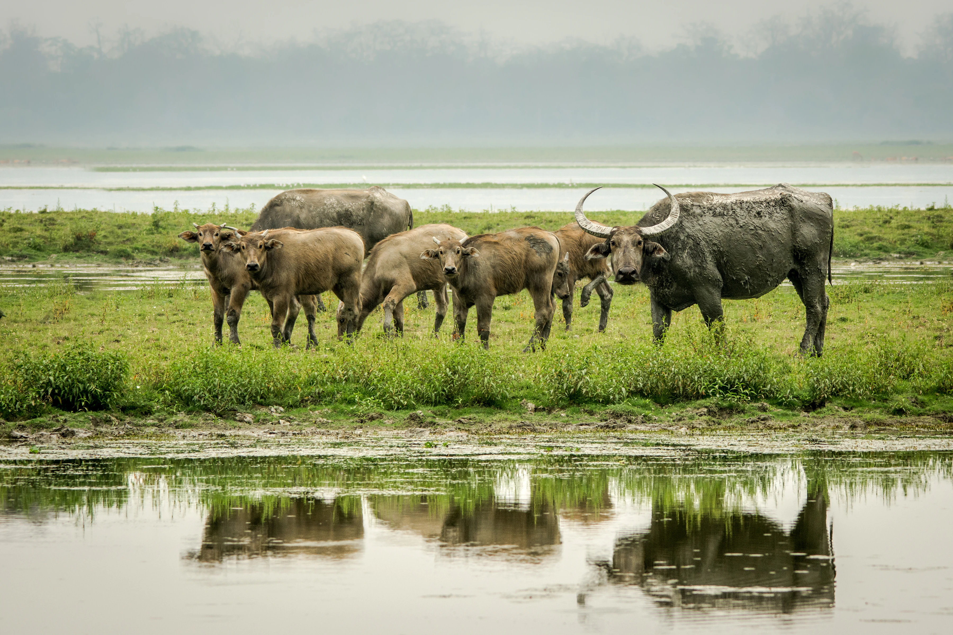
Kaziranga is best known for being the stronghold of the Indian rhinoceros, containing approximately two-thirds of the world's population of this endangered species. The park is also celebrated for its population of wild water buffalo, which represents about 57 percent of the global population, and its eastern swamp deer, known locally as barasingha. The park's designation as a Tiger Reserve and its status as an Important Bird Area by BirdLife International further enhance its conservation significance. The 'Big Five' of Kaziranga, the Indian rhinoceros, royal Bengal tiger, Asian elephant, wild water buffalo, and swamp deer, represent the park's most iconic megafauna species.
Group of water buffalo standing in a grassy field near a body of water with reflections
Wild water buffalo family grazing near a water body in Kaziranga National Park

Kaziranga National Park history and protected-area timeline

The conservation history of Kaziranga began in 1904 when Lady Mary Curzon, wife of the British Viceroy Lord Curzon, visited the area and failed to see a single-horned rhinoceros. Alarmed by the depletion of this iconic species, she persuaded her husband to initiate protective measures, leading to the creation of the Kaziranga Proposed Reserve Forest on June 1, 1905, covering 232 square kilometers. The area was initially designated as a game sanctuary before being renamed the Kaziranga Wildlife Sanctuary in 1950 to eliminate hunting connotations. The park achieved national park status in 1974 under the new legal framework for wildlife protection. In 1985, Kaziranga was inscribed as a UNESCO World Heritage Site, recognizing its outstanding universal value. The park was declared a Tiger Reserve in 2006, further elevating its conservation mandate. Throughout its history, Kaziranga has faced numerous challenges including severe flooding, poaching pressures, and more recently, controversies surrounding its conservation enforcement methods.

Kaziranga National Park landscape and geographic character

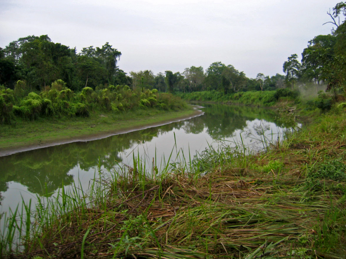
Kaziranga occupies a distinctive position within the sub-Himalayan belt, presenting a landscape shaped by the dynamic forces of the Brahmaputra River. The terrain is predominantly flat, ranging in elevation from approximately 40 to 80 meters above sea level. The park's boundaries are defined by the Brahmaputra River to the north and east, while the Mora Diphlu River forms the southern boundary. Within the park, the landscape features a complex network of beels (riverine flood-formed lakes), sandbars exposed during the dry season, and elevated chapories that provide crucial refuge for wildlife during floods. The vegetation follows this topography, with tall elephant grass dominating the flood-prone areas, transitioning to denser forests on slightly higher ground. The annual monsoon brings significant flooding, submerging 70 to 80 percent of the park for several days at a time, creating both challenges for wildlife and maintaining the productive grasslands that support the park's herbivore populations.
A river flows through grassy banks with dense green trees in the background
A river flows through lush vegetation in Kaziranga National Park

Kaziranga National Park ecosystems, habitats, and plant life

The ecological character of Kaziranga reflects its position within the Eastern Himalaya biodiversity hotspot, combining high species richness with the distinctive floodplain environment. Four primary vegetation types characterize the park: alluvial inundated grasslands, alluvial savanna woodlands, tropical moist mixed deciduous forests, and tropical semi-evergreen forests. Tall grasses cover approximately 41 percent of the park's area, while open jungle and short grasses account for significant portions. The seasonal flooding regime creates a dynamic habitat mosaic, with shallow beels and water channels providing critical wetland habitat during the monsoon, then drying to expose fresh grazing areas during the winter. The forests near the park's eastern blocks contain valuable timber species, while the semi-evergreen areas support diverse tree and shrub communities. Aquatic flora in the numerous beels and along river margins contributes to the park's ecological complexity, though invasive species such as water hyacinth pose ongoing management challenges.
Several elephants and a rhinoceros in a grassy field with trees in the background
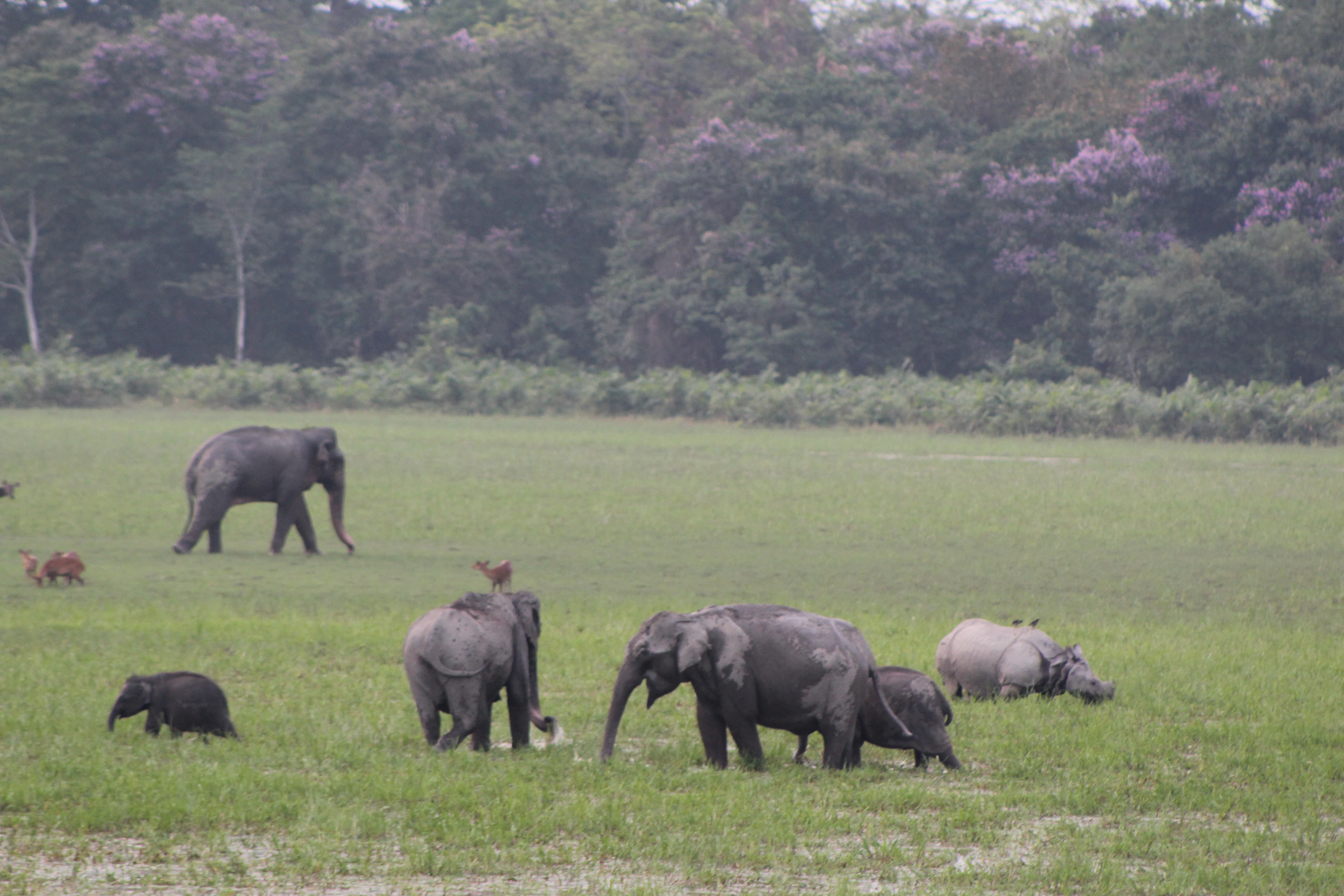
Elephants and a rhinoceros walking in the grasslands of Kaziranga National Park

Kaziranga National Park wildlife and species highlights

Kaziranga supports an extraordinary concentration of megafauna, led by its global significance for the Indian rhinoceros. The 2018 census recorded approximately 2,613 rhinos in the park, representing the vast majority of the world's population of this species. The park also holds the world's largest population of wild water buffalo, with around 1,666 individuals, and maintains a significant population of eastern swamp deer. Large herbivores include approximately 1,940 Indian elephants and sambar deer, while smaller species such as Indian muntjac, hog deer, and Indian boar are also present. Kaziranga supports a viable population of Bengal tigers and was declared a Tiger Reserve in 2006, with the park providing one of the few wild breeding areas outside Africa for large felids. The birdlife is equally diverse, with the park designated as an Important Bird Area, supporting migratory waterfowl from Central Asia, riverine birds, and numerous resident species including the great pied hornbill and various babblers. The reptile population includes two of the world's largest snakes, the reticulated python and Indian rock python, as well as the king cobra, while multiple turtle species including the endemic Assam roofed turtle inhabit the wetland areas.
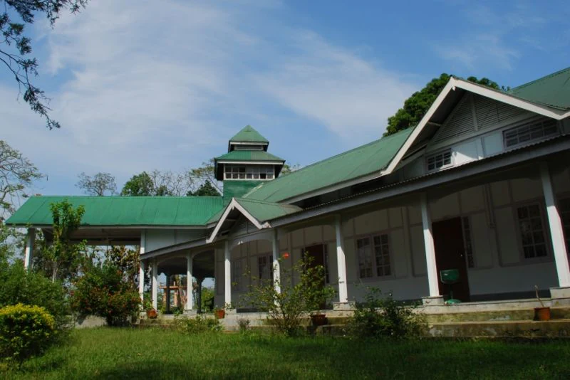
Green-roofed building with white columns and covered porch surrounded by grass and trees under a blue sky
Bonoshree Lodge, a state-run tourist facility within Kaziranga National Park

Kaziranga National Park conservation status and protection priorities

Kaziranga represents one of India's most successful conservation stories, having prevented the extinction of the Indian rhinoceros from its historic range. The park operates under a comprehensive legal framework, with maximum protection status under Indian wildlife law. Anti-poaching efforts have included the construction and maintenance of anti-poaching camps, intensive patrolling, intelligence networks in surrounding villages, and since 2013, drone surveillance to combat armed poaching. The park has faced ongoing challenges from flooding, with significant animal losses during major flood events, leading to the creation of artificial chapories and wildlife corridors. Habitat management includes controlled burning of grasslands to maintain optimal grazing conditions and invasive species removal. The park receives funding from both the Assam Government and the Indian Ministry of Environment, Forest and Climate Change, with additional support under Project Elephant. Economic valuation studies estimate the park's annual ecosystem services at approximately 9.8 billion rupees, highlighting its significant contribution to both biodiversity conservation and local livelihoods.

Kaziranga National Park cultural meaning and human context

Kaziranga lies within a region rich with cultural heritage, situated among communities that have historical connections to the landscape. The park's name derives from local legend, possibly connected to a love story between characters named Rawnga and Kazi from nearby villages, or alternatively from the Karbi language where 'kazi' means goat and 'rangai' means red. The broader region has historical links to the Ahom dynasty, which ruled Assam for centuries, and the park's landscape has been shaped by the river systems that have long supported agricultural communities. The park's establishment as a protected area in the early 20th century reflected the colonial conservation priorities, though it has evolved to incorporate local community engagement in recent decades. Tourism provides employment opportunities for surrounding communities, while the park's interpretation center and orchid biodiversity park offer cultural and educational dimensions to the visitor experience.
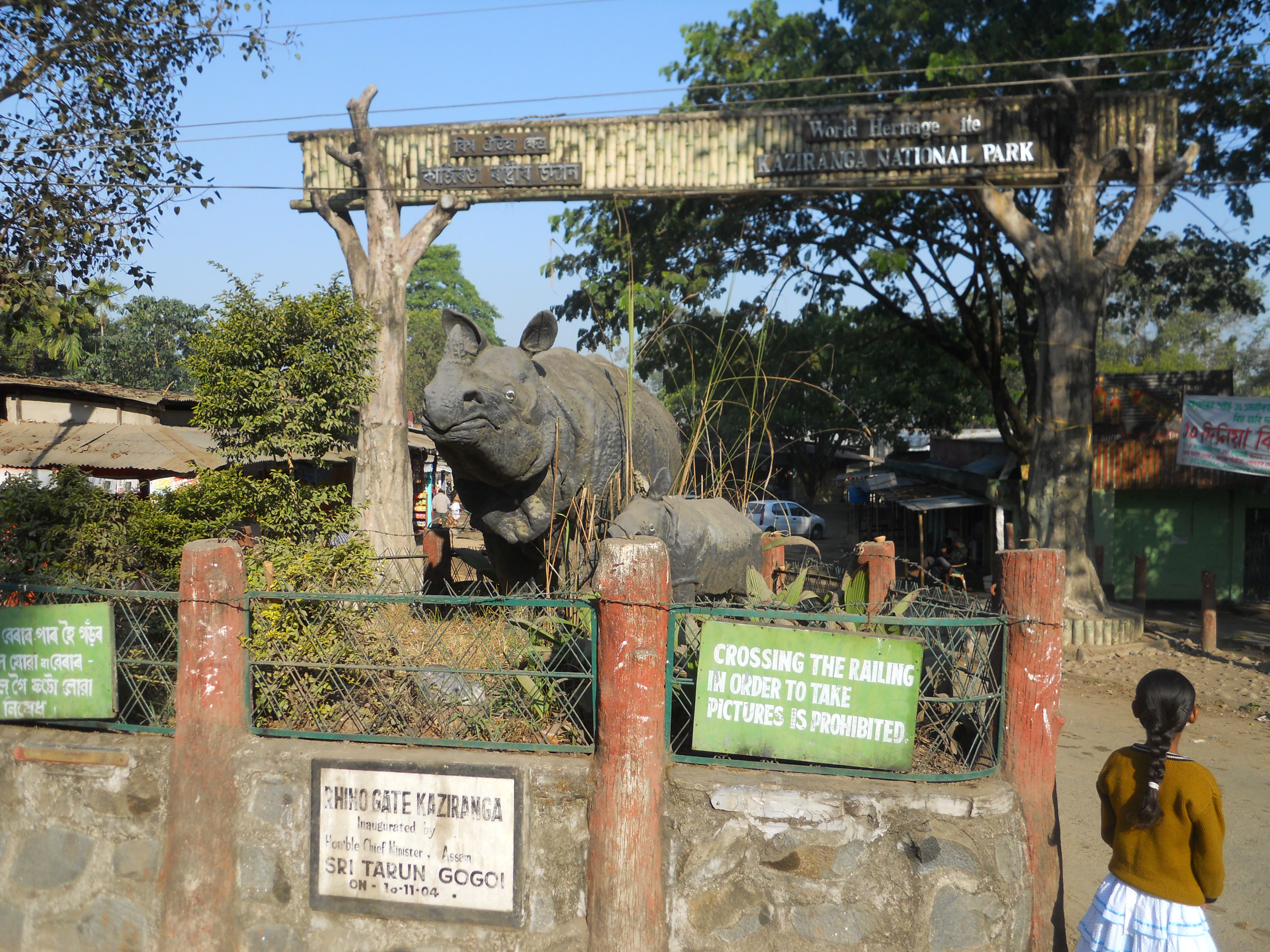
Stone wall entrance gate with red pillars, green signs, and a large rhinoceros statue at Kaziranga National Park. A person stands near the gate.
Entrance gate of Kaziranga National Park featuring a rhinoceros statue and warning signs

Top sights and standout views in Kaziranga National Park

Kaziranga offers one of the most iconic wildlife viewing experiences in Asia, with the opportunity to observe Indian rhinoceroses in their natural floodplain habitat. Elephant-back and jeep safaris provide access to the park's grasslands and forests, while observation towers at multiple locations offer elevated viewpoints for wildlife observation. The park's bird diversity attracts ornithologists, particularly during the winter migration season when Central Asian species arrive. The landscape itself, framed by the snow-covered Lower Himalayas in the distance, provides a striking backdrop. The park's expansion to include corridors connecting to the Karbi Anglong Hills demonstrates ongoing efforts to maintain ecological connectivity. The new Orchid and Biodiversity Park at Durgapur adds a botanical dimension to the visitor experience, showcasing over 500 orchid species.

Close-up of a white tiger with black stripes lying on the ground
White tiger with distinctive black stripes resting in a natural setting

Best time to visit Kaziranga National Park

The best time to visit Kaziranga is during the winter months from November to April, when the weather is pleasant and wildlife visibility is at its highest. The dry season sees the shallow beels and water channels recede, concentrating animals around remaining water sources and making them easier to observe. The controlled burning of grasslands in December and January attracts wildlife to the fresh growth in burnt patches. The summer months from March to May offer excellent wildlife viewing as animals congregate near water bodies, though temperatures can be high. The monsoon season from June to September brings heavy rainfall and significant flooding, which, while ecologically important, limits park access and can result in animal migration to higher ground outside the park. The timing of visits should consider that the park experiences seasonal variations in accessibility and wildlife behavior throughout the year.
Park guides

Essential questions and seasonal visit timing for the Brahmaputra floodplain.

Kaziranga National Park Focused Guides and Expert Planning Resources

Targeted published guides provide structured answers for navigating the conservation landscape of Kaziranga National Park. Consult specific planning resources regarding the best time to visit and seasonal park closures.
Monthly climate preview

Explore long term temperature trends and precipitation patterns in Assam

Kaziranga National Park Climate Profile and Monthly Weather Averages

Long term climate data for the Assam region reveals a substantial annual shift from dry periods averaging under one millimeter of daily precipitation to intense wet months peaking above nine millimeters. Reviewing the complete twelve month profile exposes precise historical temperature variations and monthly averages across the entire seasonal cycle.
Annual mean24 °C
15 °C28 °C
Jan15°
Feb18°
Mar23°
Apr26°
May28°
Jun28°
Jul28°
Aug28°
Sep27°
Oct24°
Nov20°
Dec17°
Warmest month
June

28.3 °C

Coolest month
January

15.4 °C

Wettest month
June

9.6 mm/day

Driest month
December

0.3 mm/day

Park location guide

Geography guide, regional context, and park location map for Kaziranga National Park

Kaziranga National Park park geography, regions, and map view in India

Understand where Kaziranga National Park sits in India through a broader geographic reading of the surrounding landscape, nearby location context, and its mapped position within the national park landscape.

How Kaziranga National Park fits into India

India is a South Asian country bordered by the Indian Ocean, Arabian Sea, and Bay of Bengal. It shares land borders with Pakistan, China, Nepal, Bhutan, Bangladesh, and Myanmar. The country has a population of over 1.4 billion people and operates as a federal parliamentary republic with its capital in New Delhi.

Wider geography shaping Kaziranga National Park in India

India occupies the Indian subcontinent in South Asia, bordered by the Arabian Sea to the southwest, the Bay of Bengal to the southeast, and the Indian Ocean to the south. It shares land borders with Pakistan to the west, China, Nepal, and Bhutan to the north, and Bangladesh and Myanmar to the east. The territory also includes the Andaman and Nicobar Islands in the Indian Ocean.

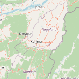
Map view of Kaziranga National Park

Use this park location map to pinpoint Kaziranga National Park in India, understand its exact geographic position, and read its mapped placement within the surrounding landscape more clearly.

Pigeon | © OpenStreetMap contributors

Location context for Kaziranga National Park

AssamGolaghat districtNagaon district
Recorded earthquake history

Review the Historical Earthquake Catalogue for Kaziranga National Park

Explore the recorded history of seismic activity associated with the unique floodplain landscape of Kaziranga National Park. MoriAtlas provides a transparent view of historical event data, mapping recorded epicentres in relation to the park boundaries to support informed geographic and regional analysis.

Kaziranga National Park Earthquake History

Catalogued events

79 events

Strongest magnitude

Magnitude 5.5

Most recent event

Aug 18, 2025

This history includes earthquakes recorded inside the park or within 50 km of its borders

Visualizing Kaziranga's dynamic floodplain ecosystem, diverse habitats, and protected-area character through a curated gallery of its unique terrain.

Kaziranga National Park Imagery: Explore its Landscapes, Habitats, and Iconic Wildlife Scenery

Explore a visual atlas of Kaziranga National Park through high-quality images showcasing its iconic floodplain landscapes, dense grasslands, and diverse wetland habitats critical for megafauna. Understand the unique geographic context and conservation efforts that define this UNESCO World Heritage Site, gaining insight into its environment and the animals it protects.

Group of water buffalo standing in a grassy field near a body of water with reflections

One-horned rhinoceros standing on grassy riverbank with water in foreground, large tree, and distant hills under overcast sky

A river flows through grassy banks with dense green trees in the background

Several elephants and a rhinoceros in a grassy field with trees in the background

Green-roofed building with white columns and covered porch surrounded by grass and trees under a blue sky

A blue and brown bird perched on a rock with tall grass and green foliage in the background

Stone wall entrance gate with red pillars, green signs, and a large rhinoceros statue at Kaziranga National Park. A person stands near the gate.

Close-up of a white tiger with black stripes lying on the ground

Five sambar deer standing in shallow water with a bird nearby under a golden sunset sky

Tiger lying on grass with dense green foliage behind it

Green open-top vehicle on a dirt road with a person standing in the vehicle, surrounded by vegetation

A grassland scene with two trees and a fire with black smoke in the background

Flooded grasslands with a dirt jeep trail, green vegetation, and scattered trees under an overcast sky

A leafless tree stands in a grassy field with other trees and a forested area in the background under a clear sky.

Several otters swimming in greenish water with dense vegetation along the shore

Swamp deer with large antlers walking through tall brown and green grass alongside a small white bird

Park atlas

Browse the Mapped Geography of Protected Landscapes Surrounding Kaziranga's Floodplain Ecosystem

Discover Other National Parks and Protected Areas Near Kaziranga National Park

Explore diverse national parks and protected landscapes sharing the regional geography and ecological context of Kaziranga National Park, India's renowned World Heritage Site. Compare their riverine environments, conservation efforts, and unique features to understand the broader spread of protected areas across the Brahmaputra floodplain and sub-Himalayan belt.
Wildlife reserveAssam
About 32 km away#1 closest

West

Bura Chapori Wildlife Sanctuary: Protected Grassland Geography in the Brahmaputra Valley

A vital wildlife reserve and buffer area within Assam's floodplain ecosystem.

Located in the Sonitpur district of Assam, Bura Chapori Wildlife Sanctuary offers a focused look at the Brahmaputra valley's dynamic floodplain environment. This protected area supports an essential mosaic of open grasslands and riverine woodlands, serving as a critical corridor for large mammals and endangered grassland birds. Its geography is deeply influenced by the seasonal rhythms of the Brahmaputra River, shaping the sanctuary as both a wetland habitat and a key conservation link.

Area
44.06 km²
Established
1974
IUCN
IV
Relief
Lowland
Wildlife reserveArunachal Pradesh
About 37 km away#2 closest

Northeast

Itanagar Wildlife Sanctuary: Hill Forest Reserve and Protected Landscape in Arunachal Pradesh

Exploring the dense evergreen geography of a key Indian wildlife reserve

Spanning 140 square kilometres, Itanagar Wildlife Sanctuary preserves a vital mosaic of tropical semi-evergreen and wet evergreen forest within the foothills of Arunachal Pradesh. Bounded by the Pachin, Pam, Neorochi, and Chingke streams, this protected area offers a unique juxtaposition of dense hill forest and urban edges, functioning as a significant biodiversity habitat in northeastern India.

Area
140.3 km²
Established
1978
IUCN
IV
Relief
Upland
National parkSonitpur
About 53 km away#3 closest

Northwest

Nameri National Park: A Protected Landscape within Sonitpur's Geography

Explore the mapped terrain and national park boundaries.

Nameri National Park represents a significant protected natural area, contributing to the regional geography of Sonitpur, India. This page offers an atlas-oriented perspective, detailing the park's mapped landscape and its designation as a national park. Understand the geographic context and the protected land's specific identity within this mapped region.

Area
200 km²
Established
1978
IUCN
II
Relief
Mountain
National parkAssam
About 68 km away#4 closest

West

Orang National Park: Assam's Key Floodplain Protected Landscape

Explore mapped boundaries and terrain context of this national park.

Orang National Park, located in Assam, India, is a significant protected area celebrated for its unique alluvial floodplain terrain and critical role in conservation. This national park provides a focused atlas-style view of grassland and wetland ecosystems, essential habitats for iconic species like the great Indian one-horned rhinoceros and Bengal tiger. Its geographical setting along the Brahmaputra River contributes to a dynamic landscape, offering rich context for understanding protected area distribution and regional natural features. Discover the mapped boundaries and ecological significance of this important protected land.

Area
78.81 km²
Established
1985
IUCN
II
Relief
Lowland
Wildlife reserveAssam
About 73 km away#5 closest

South

East Karbi-Anglong Wildlife Sanctuary: Geographic Overview and Hill Forest Map

Protected wildlife reserve within the Karbi Anglong district of Assam.

The East Karbi-Anglong Wildlife Sanctuary occupies a significant portion of the Karbi Anglong plateau, encompassing 222 square kilometers of rolling hills and narrow valleys. This protected area supports a mosaic of forest habitats, ranging from moist evergreen patches to drier deciduous ridges. It functions as an essential refuge for tigers, elephants, and primates, while maintaining a rich avian community of approximately 250 recorded species.

Area
221.81 km²
Established
2000
IUCN
IV
Relief
Upland
Wildlife reserveWest Kameng
About 84 km away#6 closest

Northwest

Eaglenest Wildlife Sanctuary: Geography and Protected Forest Atlas

Mapping the Eastern Himalayan foothills in West Kameng

Eaglenest Wildlife Sanctuary stands as a landmark of Indo-Burmese biodiversity conservation, spanning a dramatic altitudinal range that anchors the West Kameng forest complex. This wildlife reserve features dense bamboo stands, temperate ridges, and foothill forest corridors that provide a crucial environment for diverse mammal and bird species. The sanctuary remains a primary site for understanding the interaction between mountain topography and ecological connectivity in the Eastern Himalayas.

Area
218 km²
Established
1989
IUCN
IV
Visitors
75 annual
Wildlife reserveArunachal Pradesh
About 86 km away#7 closest

Northwest

Sessa Orchid Sanctuary: Himalayan Foothills Wildlife Reserve and Mapped Protected Landscape

High-altitude forest geography in Arunachal Pradesh

Sessa Orchid Sanctuary is a pivotal wildlife reserve spanning the rugged Himalayan foothills of West Kameng, Arunachal Pradesh. Defined by deep gorges and high ridges, the sanctuary protects one of the most significant orchid habitats in India, featuring over 200 distinct species within its closed-canopy monsoon forests. This protected area stands as a central link in the Kameng Protected Area Complex, representing a critical region for scientific research, endemic flora, and continuous forest conservation.

Area
100 km²
Established
1989
IUCN
IV
Relief
Mountain
Wildlife reserveArunachal Pradesh
About 98 km away#8 closest

Northeast

Talle Valley Wildlife Sanctuary, Arunachal Pradesh: Protected Area and Forest Map

A vital Himalayan sanctuary of vertical forest gradients

Spanning from 1,200 to 3,000 meters in elevation, Talle Valley Wildlife Sanctuary contains a dense mosaic of broadleaf and conifer forests. This reserve in the Subansiri basin provides essential habitat for clouded leopards, hornbills, and various rare Himalayan plants, representing a significant study in biogeographic transition zones.

Area
337 km²
Established
1995
IUCN
IV
Relief
Mountain

Common questions about visiting, size, designation, and location context for Kaziranga National Park

Kaziranga National Park FAQs for park facts, access, geography, and protected area context

Find quick answers about Kaziranga National Park, including protected-area facts, park geography, trail and visitor context, and how the park fits into its surrounding country and regional landscape.
MoriAtlas Explorer

Continue Your Protected Areas Search Across the Global Atlas

Deepen your exploration by continuing the structured search for national parks and protected areas worldwide. Utilize the comprehensive filtering capabilities to compare different conservation landscapes and refine your understanding of global park geography. Discover more about the distribution and characteristics of protected natural areas.

Global natural geography