Mori Atlas logo
National parkKgalagadi Transfrontier Park

Discover the sweeping red dunes and arid terrain of this southern Kalahari Desert wilderness.

Kgalagadi Transfrontier Park National Park: Map of Protected Landscape and Desert Geography

The Kgalagadi Transfrontier Park represents a significant protected landscape in the southern Kalahari Desert, spanning across Botswana and South Africa. This national park offers a unique atlas perspective on vast arid environments, characterized by its iconic red sand dunes and the dry riverbeds of the Nossob and Auob Rivers. Its immense scale and harsh beauty define a landscape that supports remarkable biodiversity and offers unparalleled opportunities for mapped exploration of its protected boundaries and desert terrain.

Transfrontier ParkKalahari DesertPeace ParkBig Five TerritoryLion Conservation UnitDark Sky Sanctuary

Kgalagadi Transfrontier Park

National park

Park overview

Structured park overview, official facts, and landscape profile for Kgalagadi Transfrontier Park

Kgalagadi Transfrontier Park park facts, protected area profile, and essential visitor context

Review the core facts for Kgalagadi Transfrontier Park, including designation, size, terrain, visitor scale, habitats, and operating context in one park-focused overview.

About Kgalagadi Transfrontier Park

Kgalagadi Transfrontier Park represents one of the most significant conservation achievements in southern Africa, creating a unified protected area that transcends national boundaries. The park's creation in 2000 marked the first peace park established in the region, born from decades of cooperation between Botswana and South Africa. The concept of a shared conservation area emerged informally as early as 1948 when the Bechuanaland Protectorate and the Union of South Africa agreed to protect the contiguous desert lands. This vision became concrete in 1992 when officials established a joint management committee, leading to the formal bilateral agreement signed in 1999 and the official launch in 2000 under the leadership of Presidents Festus Mogae and Thabo Mbeki. The park's vast expanse encompasses dramatically different terrain within the southern Kalahari, where ancient dune systems have been shaped by wind over millennia. The dry river valleys of the Nossob and Auob, though they rarely carry surface water, support delicate strips of greenery including the distinctive camelthorn trees that provide vital shade and forage for wildlife. This harsh environment has shaped uniquely adapted species that have evolved remarkable strategies for surviving the extremes of desert life.

Quick facts and research context for Kgalagadi Transfrontier Park

Kgalagadi Transfrontier Park covers roughly 38,000 square kilometers across Botswana and South Africa, making it one of the largest protected areas in southern Africa. The park was formally established as a transfrontier park in May 2000 through a bilateral agreement between the two countries, though the individual national parks have longer histories, with Kalahari Gemsbok National Park established in 1931. The Kalahari Desert environment features extreme temperatures ranging from below freezing in winter to over 40 degrees Celsius in summer, with very low annual precipitation. The park contains three tourist rest camps with amenities and six basic wilderness camps for more adventurous visitors.

Protection and recognition

Documented terrestrial boundaries and cross-border protection frameworks of the desert landscape.

Kgalagadi Transfrontier Park Protection Status and Transboundary Designation

Map the official terrestrial conservation boundaries and transboundary protection frameworks that define Kgalagadi Transfrontier Park. Verifiable geographical records outline the designated land scope and joint administrative structures across regional borders, providing a factual atlas of official protection status.

Protection details

Protection scope
Terrestrial
Transboundary protection
Yes
Park context

Deeper park guide and search-rich context for Kgalagadi Transfrontier Park

Kgalagadi Transfrontier Park history, landscape, wildlife, and travel context

Explore Kgalagadi Transfrontier Park through its history, landscape character, ecosystems, wildlife, conservation priorities, cultural context, and seasonal travel timing in a structured park guide built for atlas discovery and search intent.

Why Kgalagadi Transfrontier Park stands out

Kgalagadi Transfrontier Park is best known for its pristine Kalahari ecosystem and exceptional predator populations. The park supports a significant lion population and has been designated a Lion Conservation Unit since 2005, serving as a stronghold for these big cats in southern Africa. The iconic gemsbok, or oryx, for which the original South African park was named, remains a defining symbol of the landscape. The park is also notable for its dark sky designation, with the !Ae!Hai Heritage Park within the transfrontier area becoming Africa's first International Dark Sky Sanctuary. The absence of physical barriers along the international border allows wildlife to move freely across the entire ecosystem, maintaining natural migration patterns and ecological connectivity.

Kgalagadi Transfrontier Park history and protected-area timeline

The formal protection of the Kalahari region began with the establishment of Kalahari Gemsbok National Park on July 31, 1931, primarily to protect migratory wildlife, especially the gemsbok, from poaching. For decades, the park existed as a single-country protected area, but the ecological reality of the Kalahari landscape, which does not respect international boundaries, drove the desire for cross-border cooperation. A verbal agreement between the Bechuanaland Protectorate and the Union of South Africa in 1948 laid the groundwork for future collaboration. The formal joint management committee was established in June 1992 between South African National Parks and Botswana's Department of Wildlife and National Parks, with a comprehensive management plan approved in 1997. The historic bilateral agreement signed on April 7, 1999 committed both nations to managing their adjacent parks as a single ecological unit, and the official launch followed on May 12, 2000. In 2002, the governments set aside over 580 square kilometers for the Khomani San and Mier indigenous communities, creating the !Ae!Hai Heritage Park and facilitating the construction of !Xaus Lodge, which maintains cultural practices while providing economic benefits to these communities.

Kgalagadi Transfrontier Park landscape and geographic character

The terrain of Kgalagadi Transfrontier Park is defined by the southern Kalahari Desert, one of the most expansive semi-arid environments in Africa. Rolling red sand dunes stretch to the horizon, their shapes constantly reshaped by persistent winds, creating a landscape of remarkable beauty and solitude. The dunes are interspersed with interdune valleys and occasional hard-packed pans that provide different ecological niches. Two major dry river systems, the Nossob and Auob Rivers, traverse the park from north to south, their beds visible as lighter ribbons cutting through the reddish landscape. These riverbeds typically carry no surface water but contain underground aquifers that sustain stands of Vachellia erioloba trees and patches of grass that provide critical dry-season forage. After the rare but dramatic thunderstorms that occur in the Kalahari, these riverbeds may briefly flow with flash floods that rapidly transform the landscape, temporarily creating pools of water that attract wildlife from across the region. The vegetation is sparse but diverse enough to support the park's remarkable wildlife, with scattered shrubs, grasses, and the distinctive camelthorn trees forming the foundation of the desert ecosystem.

Kgalagadi Transfrontier Park ecosystems, habitats, and plant life

The Kalahari ecosystem represented by Kgalagadi Transfrontier Park supports a surprising diversity of life despite its harsh conditions. The desert environment creates specialized habitats including sand dunes, dry riverbeds, savanna plains, and sparsely vegetated hardpan areas, each supporting different communities of plants and animals. The underground water systems in the dry riverbeds sustain vegetation corridors that act as critical wildlife corridors, particularly during the dry season when surface water becomes scarce. The park's position in the southern Kalahari places it at the transition between arid desert and more mesic savanna environments, creating a unique ecological character. Soils are predominantly sandy and nutrient-poor, selecting for drought-adapted plant species that have evolved strategies such as deep root systems, water-storing tissues, and seasonal leaf drop to survive the extreme conditions.

Kgalagadi Transfrontier Park wildlife and species highlights

Kgalagadi Transfrontier Park supports exceptional wildlife diversity with over 470 documented species. The park is particularly known for its predator populations, including lion, cheetah, African leopard, spotted hyena, and brown hyena. Large ungulates include migratory herds of blue wildebeest, gemsbok, springbok, southern giraffe, common eland, greater kudu, warthog, and red hartebeest, whose seasonal movements provide spectacle and sustain predator populations. Smaller mammals are numerous and diverse, including African wildcat, bat-eared fox, Cape fox, black-backed jackal, caracal, genets, honey badger, meerkats, and various mongoose species. Over 200 bird species inhabit the park, including ostriches, various bustards, waterfowl, storks, passerines, and approximately 30 raptor species. Reptiles are well represented with over 30 species including venomous snakes such as Cape cobra, horned adder, puff adder, and black mamba, as well as terrapins, tortoises, agamas, geckos, and skinks. Amphibians include the sand frog and African bullfrog.

Kgalagadi Transfrontier Park conservation status and protection priorities

Kgalagadi Transfrontier Park holds significant conservation importance as a Lion Conservation Unit and a regional stronghold for these apex predators. The park's designation as a lion conservation unit since 2005 reflects its critical role in maintaining viable populations of Panthera leo melanochaita in southern Africa. Conservation efforts extend beyond the park's boundaries through the Western Kgalagadi Conservation Corridor project, which aims to maintain and restore wildlife movement corridors linking the transfrontier park to the Central Kalahari Game Reserve in Botswana. This corridor work supports both ecological connectivity and community development in the region. The presence of the !Ae!Hai Heritage Park, managed for the Khomani San and Mier communities, represents an innovative model of integrating indigenous community land rights with conservation objectives.

Kgalagadi Transfrontier Park cultural meaning and human context

The Kgalagadi region has been home to indigenous peoples for thousands of years, particularly the Khomani San (Bushmen) and Mier communities. The establishment of the !Ae!Hai Heritage Park in 2002 recognized these communities' historical connection to the land, allocating approximately 580 square kilometers of San Heritage Land and Mier Heritage Land within the broader transfrontier area. The !Xaus Lodge, managed on behalf of these communities, serves as both a tourism facility and a center for cultural preservation, with a cultural village where local people create and sell traditional crafts. This arrangement allows the Khomani San to maintain aspects of their traditional lifestyle while participating in the modern economy. The region's cultural significance is further highlighted by the designation of the !Ae!Hai Heritage Park as Africa's first International Dark Sky Sanctuary, recognizing the exceptional clarity of the desert night skies that have fascinated humans for millennia.

Top sights and standout views in Kgalagadi Transfrontier Park

The Kgalagadi Transfrontier Park offers visitors the opportunity to experience one of Africa's last great wilderness areas where wildlife moves freely across an international border. The red dunes and sparse vegetation create a photographer's paradise, while the predator populations provide exceptional game viewing opportunities. The network of waterholes attracts wildlife during the dry season, offering reliable viewing of lion, cheetah, and other species. The three rest camps provide comfortable base for exploration, while the remote wilderness camps offer a more challenging and intimate connection with the desert environment. The dark night skies, recognized by the International Dark Sky Association, provide extraordinary stargazing opportunities unmatched in Africa. The cultural dimension of visiting alongside the Khomani San and Mier communities adds a meaningful human element to the wilderness experience.

Best time to visit Kgalagadi Transfrontier Park

The optimal time to visit Kgalagadi Transfrontier Park depends on what visitors hope to experience. The dry winter months from May to September offer cooler daytime temperatures, often pleasant for game viewing, though nights can be cold. This period typically provides the best wildlife viewing as animals congregate around remaining water sources. However, the harsh summer months from October to April bring extreme heat, with temperatures regularly exceeding 40 degrees Celsius, making midday activities difficult. The summer rains, when they occur, briefly transform the landscape, creating temporary pools that attract wildlife and producing dramatic thunderstorm displays. For those interested in birdwatching, the wetter months support more bird activity. The park can be visited year-round, but most visitors prefer the dryer winter months for more comfortable conditions and reliable wildlife sightings.
Park guides

Targeted research questions and seasonal timing for the southern Kalahari

Kgalagadi Transfrontier Park Focused Guides and Desert Ecosystem Insights

Selected published guides provide structured answers for navigating the harsh desert environment and vast conservation area. Analytical reference materials examine optimal seasonal timing for wildlife observation across the border landscape.
Monthly climate preview

Explore long term temperature cycles and monthly precipitation averages within Kgalagadi District.

Kgalagadi Transfrontier Park Monthly Climate and Weather Patterns

Long term climatology for Kgalagadi Transfrontier Park reveals a strong contrast between summer heat exceeding 40 degrees Celsius and freezing winter nights at 939 meters elevation. Accessing the complete twelve month profile charts historical precipitation and temperature shifts to support accurate geographic analysis of the protected wilderness.
Annual mean22 °C
13 °C29 °C
Jan29°
Feb28°
Mar27°
Apr22°
May17°
Jun13°
Jul13°
Aug15°
Sep20°
Oct24°
Nov26°
Dec28°
Warmest month
January

28.9 °C

Coolest month
July

12.6 °C

Wettest month
January

1.3 mm/day

Driest month
August

0 mm/day

Park location guide

Geography guide, regional context, and park location map for Kgalagadi Transfrontier Park

Kgalagadi Transfrontier Park park geography, regions, and map view in Botswana

Understand where Kgalagadi Transfrontier Park sits in Botswana through a broader geographic reading of the surrounding landscape, nearby location context, and its mapped position within the national park landscape.

How Kgalagadi Transfrontier Park fits into Botswana

Botswana is a landlocked nation in Southern Africa with approximately 2.4 million residents across 581,730 km² of territory. About 70% of the country lies within the Kalahari Desert. Botswana gained independence in 1966 and operates as a parliamentary republic with President Duma Boko as head of state. The economy is driven by diamond mining and tourism, with the country maintaining one of Africa's higher human development indices.

Wider geography shaping Kgalagadi Transfrontier Park in Botswana

Botswana is a landlocked country in Southern Africa, bordered by South Africa to the south and southeast, Namibia to the west and north, Zambia to the north, and Zimbabwe to the northeast. The terrain is predominantly flat, with approximately 70% of the territory comprising the Kalahari Desert. The country lies at roughly 24°39.5′S 25°54.5′E.

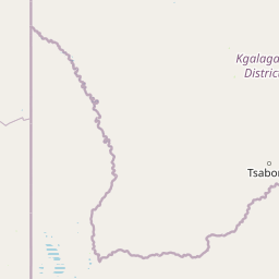
Map view of Kgalagadi Transfrontier Park

Use this park location map to pinpoint Kgalagadi Transfrontier Park in Botswana, understand its exact geographic position, and read its mapped placement within the surrounding landscape more clearly.

Pigeon | © OpenStreetMap contributors

Location context for Kgalagadi Transfrontier Park

Kgalagadi DistrictNorthern Cape
Natural feature types

Explore Geographic Features and Natural Landmarks of Kgalagadi Transfrontier Park

Investigate the specific landforms and environmental zones that define the Kalahari ecosystem. MoriAtlas provides a structured view of the dunes, riverbeds, and terrain within the Kgalagadi Transfrontier Park to support detailed geographic research and regional map exploration.
Park atlas

Trace the vast protected landscapes surrounding Kgalagadi Transfrontier Park, mapping cross-border conservation areas.

Explore Nearby National Parks and Protected Areas Beyond Kgalagadi Transfrontier Park

Explore additional national parks and protected areas that share geographic context or protected-landscape characteristics with Kgalagadi Transfrontier Park. Compare their unique desert ecosystems, predator populations, and conservation strategies to deepen your atlas-based understanding of the region's wilderness.
National parkNorthern Cape
216 km away#1 closest

South

Augrabies Falls National Park: A South African National Park Defined by Granite Gorge and Semi-Desert Terrain

Explore the mapped natural landscape and protected boundaries.

Augrabies Falls National Park in South Africa's Northern Cape Province is a key protected area known for its thundering waterfall on the Orange River and the profound granite gorge carved over millennia. The park's semi-desert environment showcases the distinctive quiver trees and geological landmarks like Moon Rock, offering a unique landscape context. Understand its protected status and geographic significance within the arid Nama-Karoo biome through detailed mapping and landscape information.

Area
820 km²
Established
1966
IUCN
II
Relief
Upland
Nature reserveNorthern Cape
About 278 km away#2 closest

Southeast

Witsand Nature Reserve: Protected Sand Dunes and Northern Cape Regional Geography

A remote arid plateau and singing sand landscape

Witsand Nature Reserve encompasses a 3,500 hectare protected area set atop a rocky plateau in the Northern Cape. Known for its distinctive red Kalahari-style dunes that produce acoustic booming sounds, the reserve offers a unique look at the arid interior of South Africa through a lens of quiet, expansive geography and remote terrain.

Area
31.7 km²
Established
1994
Relief
Upland
Climate
Arid
Nature reserveWindhoek
About 342 km away#3 closest

Northwest

Südwest-Naturreservat: A Protected Botanical Nature Reserve in Central Windhoek

Conservation landscapes and native flora in the Khomas Highland

Located in central Windhoek, Südwest-Naturreservat functions as a key protected area and botanical site. It showcases a diverse collection of Namibian plants across both landscaped and natural terrain, offering a focused look at arid and semi-arid flora within an accessible urban environment that highlights the region's unique biodiversity.

Area
0.12 km²
Established
1970
IUCN
V
Relief
Upland
Nature reserveNamibia
About 351 km away#4 closest

West

Tirasberge Nature Reserve: Geography and Protected Landscapes of Southern Namibia

A compact wilderness spanning mountain massifs and desert frontiers.

The Tirasberge region serves as a vital protected area in southern Namibia, showcasing a diverse intersection of mountain ridges, red sand dunes, and arid savanna plains. This reserve provides a unique look into a stratified landscape where high elevation terrain meets the lower reaches of the Namib dune sea, creating a complex corridor for ecology and history. Understanding the reserve reveals how mountain-to-savanna transitions define the rugged character of this southern African conservation zone.

Area
1,250 km²
Established
1998
Relief
Mountain
Climate
Arid
National parkNamibia
361 km away#5 closest

West

Namib-Naukluft National Park: Namibia's Iconic Desert Landscape and Protected Terrain

Explore its ancient dunes, Naukluft mountains, and coastal geography.

Namib-Naukluft National Park is a colossal protected area in Namibia, holding the distinction of being Africa's largest national park. This park is renowned for its iconic sand dunes, particularly at Sossusvlei, which are among the highest in the world and display dramatic colors due to iron oxidation. The landscape also features the rugged Naukluft Mountains and vital coastal fog zones, creating a diverse arid environment. Delve into the mapped geography and unique terrain of this ancient desert setting, understanding its protected landscape significance within Namibia's atlas.

Area
49,768 km²
Established
1907
IUCN
II
Relief
Mixed relief
National parkNorthern Cape
363 km away#6 closest

Southwest

Richtersveld National Park: Geographic and Protected Area Map Context

Exploring arid volcanic landscapes in Northern Cape

Richtersveld National Park represents a vast, complex protected area defined by its rugged mountain ridges and arid desert ecology. Centered in South Africa's Northern Cape, the landscape is shaped by the Orange River and high-altitude volcanic formations. This profile offers detailed insight into the park's natural boundaries, endemic plant habitats, and its role as a living cultural landscape within the wider regional geography.

Area
1,624.45 km²
Established
1991
Relief
Mountain
Climate
Arid
Wildlife reserveNamibia
About 374 km away#7 closest

Southwest

ǀAi-ǀAis Hot Springs Game Park: A Namibian Wildlife Reserve Bridging Desert and Geothermal Landscapes

Explore mapped boundaries and regional park geography.

ǀAi-ǀAis Hot Springs Game Park represents a vital protected area within Namibia's arid southern reaches. This wildlife reserve is characterized by its namesake hot springs, which foster unique riparian ecosystems against a backdrop of rugged desert mountains and the impressive Fish River canyon. Its inclusion in a transfrontier conservation effort underscores its significance for regional landscape mapping and the preservation of stark desert beauty and geothermal features.

IUCN
II
Relief
Mixed relief
Climate
Arid
Access
Remote access
Protected areaNamibia
About 374 km away#8 closest

Southwest

Ai-Ais/Richtersveld Transfrontier Park: Mapped Boundaries of a Southern African Protected Area

Exploring its desert terrain and cross-border conservation geography.

Ai-Ais/Richtersveld Transfrontier Park is a significant protected area that spans across Namibia and South Africa, embodying a vital component of Southern Africa's conservation efforts. This page focuses on the park's geographic identity, detailing its arid landscape characteristics and the mapped extent of its protected boundaries. Understanding this transfrontier park offers insight into cross-border ecological cooperation and the unique desert terrain it encompasses, providing a foundation for structured geographic discovery.

Area
6,045 km²
Established
2003
IUCN
II
Relief
Mountain

Common questions about visiting, size, designation, and location context for Kgalagadi Transfrontier Park

Kgalagadi Transfrontier Park FAQs for park facts, access, geography, and protected area context

Find quick answers about Kgalagadi Transfrontier Park, including protected-area facts, park geography, trail and visitor context, and how the park fits into its surrounding country and regional landscape.
MoriAtlas Explorer

Continue Your Protected Areas Search Across the Global Atlas

Deepen your exploration by continuing the structured search for national parks and protected areas worldwide. Utilize the comprehensive filtering capabilities to compare different conservation landscapes and refine your understanding of global park geography. Discover more about the distribution and characteristics of protected natural areas.

Global natural geography