

Mori Atlas logo
National parkKhlong Lan National Park

Discover the geographic boundaries and natural terrain of this Thai national park.

Khlong Lan National Park: Mapped Protected Landscape in Kamphaeng Phet Province

Khlong Lan National Park represents a key protected area within the natural geography of Kamphaeng Phet Province, Thailand. This atlas-focused page offers a detailed exploration of its mapped boundaries and the surrounding landscape context. Understand its designation as a national park and its significance as a protected natural territory.

National ParksThailandMountain ForestsWaterfallsDawna RangeKamphaeng Phet

Khlong Lan National Park

National park

Park overview

Structured park overview, official facts, and landscape profile for Khlong Lan National Park

Khlong Lan National Park park facts, protected area profile, and essential visitor context
Review the core facts for Khlong Lan National Park, including designation, size, terrain, visitor scale, habitats, and operating context in one park-focused overview.

About Khlong Lan National Park

Khlong Lan National Park occupies a significant position in Thailand's protected area network as a representative example of mountain forest ecosystems in the country's Lower North region. The park lies within the Dawna Range, an extension of the Himalayan mountain system that traverses northwestern Thailand before continuing into Myanmar. This geological setting has created a landscape of considerable topographic diversity, with steep ridges, narrow valleys, and a pronounced elevation gradient that supports distinct ecological communities across different altitudes. The park's establishment in 1985 reflected Thailand's growing commitment in the latter decades of the twentieth century to preserving representative samples of the nation's natural landscapes beyond the more famous parks of the central and southern regions. Today, the park continues to serve as an important watershed area, with its forest cover helping to regulate water flow into the Khlong Khlung and Khlong Suan Mak tributaries that eventually join the Ping River. Visitors to the park typically access the waterfall areas and trail systems that traverse the lower and mid-elevation forests, though the mountainous interior remains relatively remote and less frequently visited than the more accessible attractions near the park boundary.

Quick facts and research context for Khlong Lan National Park

Khlong Lan National Park spans 300 square kilometers in the Lower North region of Thailand, occupying parts of Khlong Lan and Mueang Kamphaeng Phet districts. The park is situated along the Dawna Range, with elevations ranging from valley floors to the summit of Khun Khlong Lan at 1,439 meters. The protected area was established in 1985 and is managed by Thailand's Department of National Park, Wildlife and Plant Conservation. Khlong Lan and Khlong Nam Lai waterfalls are the park's most visited features, and the area receives approximately 206,000 annual visitors.

Park context

Deeper park guide and search-rich context for Khlong Lan National Park

Khlong Lan National Park history, landscape, wildlife, and travel context
Explore Khlong Lan National Park through its history, landscape character, ecosystems, wildlife, conservation priorities, cultural context, and seasonal travel timing in a structured park guide built for atlas discovery and search intent.

Why Khlong Lan National Park stands out

Khlong Lan National Park is best known for its dramatic mountain scenery within the Dawna Range and its pair of prominent waterfalls that draw visitors from across Thailand. The park's namesake Khlong Lan Waterfall cascades through dense forest in a setting that has become emblematic of the protected area, while Khlong Nam Lai offers additional waterfall appreciation opportunities. The area is also recognized for its role in protecting headwater forests that feed tributaries of the Ping River, one of Thailand's major river systems. The combination of accessible waterfalls, mountainous terrain, and the highest peak in the province makes this park a notable destination for both recreation and ecological understanding of Thailand's northern forest landscapes.

Khlong Lan National Park history and protected-area timeline

Khlong Lan National Park was officially designated as a protected area on December 25, 1985, becoming the 44th national park in Thailand's park system. The establishment of the park occurred during a period when Thailand was systematically expanding its network of protected areas to encompass the diverse ecological regions of the country. Prior to national park designation, the area's forests and mountain landscapes had been subject to varying degrees of human use, and the creation of the protected area provided formal legal framework for conservation management. The park was created specifically to preserve the mountain forest ecosystems of the Dawna Range in Kamphaeng Phet Province, an area that had previously lacked formal protection despite its ecological and watershed significance. Management responsibility was assigned to Thailand's Department of National Park, Wildlife and Plant Conservation, which continues to oversee the park's operations, visitor services, and conservation programs.

Khlong Lan National Park landscape and geographic character

The landscape of Khlong Lan National Park is defined by its position within the Dawna Mountain Range, a north-south trending chain of rugged peaks that forms part of the boundary between Thailand and Myanmar. The terrain is predominantly steep and hilly, with narrow valleys carved by streams that descend from the higher elevations toward the surrounding lowlands. Khun Khlong Lan, the park's highest peak at 1,439 meters, rises prominently above the surrounding ridges and provides a sense of vertical drama to the landscape. The mountain slopes are mantled with dense forest cover that transitions with elevation from mixed deciduous and evergreen forest in the lower reaches to evergreen broadleaf forest and montane vegetation at higher elevations. The waterfall areas, particularly Khlong Lan, represent points where streams descend over rock faces in the mountainous terrain, creating the scenic features that constitute the park's primary visitor attractions.

Khlong Lan National Park ecosystems, habitats, and plant life

The forest ecosystems of Khlong Lan National Park reflect the moist tropical conditions of the Dawna Range, supporting vegetation communities adapted to the monsoon climate and varied topography. The park's fertile forests cover the hillsides and valley floors, creating a green landscape that changes with the seasons as deciduous species respond to the dry and wet periods characteristic of the region. The elevation range within the park supports different forest types, with moist evergreen forests predominating in areas of higher rainfall and more stable moisture conditions, while mixed deciduous formations occur on drier slopes and at lower elevations. These forest communities provide habitat for diverse plant and animal species, though the park is not as well-documented for biodiversity as some of Thailand's more famous protected areas in the central and western mountain ranges.

Khlong Lan National Park wildlife and species highlights

While detailed wildlife documentation for Khlong Lan National Park is limited in the available sources, the forest and mountainous environment supports representative species of Thailand's Lower North fauna. The protected forest areas provide habitat for various bird species, small mammals, and reptiles that characterize moist forest communities in this part of the country. The watershed areas and streams also support aquatic species adapted to the flowing water environments of the mountain tributaries. Like many Thai national parks established primarily for landscape and watershed protection rather than specific endangered species, detailed species inventories are less prominent in public documentation compared to parks with more famous wildlife populations.

Khlong Lan National Park conservation status and protection priorities

Khlong Lan National Park contributes to Thailand's protected area network by preserving a representative sample of Dawna Range mountain forest ecosystems that would otherwise face pressures from logging, agriculture, and development. The park's watershed function is particularly significant, as the forests help regulate water flow into tributaries of the Ping River, a major watercourse supporting agriculture and communities in central Thailand. The establishment of the protected area provided legal framework for preventing forest conversion and managing visitor impact in sensitive areas. As a Category II protected area under IUCN classification, the park balances conservation objectives with public recreation, allowing visitors to experience the natural landscape while maintaining protection for the underlying ecosystems.

Khlong Lan National Park cultural meaning and human context

Khlong Lan National Park is located in an area of Thailand that has historical connections to older settlement patterns and land use traditions in Kamphaeng Phet Province. The province itself has significance in Thai history as a former boundary area between the Sukhothai Kingdom and neighboring polities, and the mountainous terrain has long been associated with forest resource use and transitional communities. The park area falls within administrative districts that include both lowland agricultural areas and communities with traditional relationships to the surrounding forests. While the park itself does not contain major archaeological sites or explicit indigenous protected designations, the broader region reflects the historical interaction between Thai communities and the mountain environments of the northern frontier.

Top sights and standout views in Khlong Lan National Park

Khlong Lan Waterfall stands as the park's signature attraction, where water descends through forested surroundings in a setting that exemplifies the mountain landscapes of the Dawna Range. The trail to the waterfall provides visitors with access to experience the forest environment directly. Khlong Nam Lai offers a secondary waterfall destination within the park, expanding options for visitors seeking scenic natural attractions. The summit of Khun Khlong Lan at 1,439 meters represents a challenge for hikers interested in reaching the highest point in the park and gaining views across the mountainous terrain. The stream systems originating in the park and flowing toward the Ping River illustrate the watershed importance of these protected mountain forests.

Best time to visit Khlong Lan National Park

The optimal period for visiting Khlong Lan National Park coincides with Thailand's cooler dry season, typically from November through February, when temperatures are more comfortable for hiking and the landscape remains green from the preceding monsoon. The monsoon season from May through October brings higher rainfall that can affect trail conditions and visibility, though the waterfall flow may be more impressive during and immediately after wet periods. March and April represent the hot dry season, when high temperatures can make outdoor activities uncomfortable, particularly on exposed ridgelines and trails without significant shade cover. Visitors planning waterfall visits should consider that dry season flow may be reduced compared to the wet season, while the cooler months offer more pleasant conditions for exploring the park's trail network.
Park location guide

Geography guide, regional context, and park location map for Khlong Lan National Park

Khlong Lan National Park park geography, regions, and map view in Thailand
Understand where Khlong Lan National Park sits in Thailand through a broader geographic reading of the surrounding landscape, nearby location context, and its mapped position within the national park landscape.

How Khlong Lan National Park fits into Thailand

Thailand is a Southeast Asian nation formerly called Siam, located in mainland Southeast Asia. It operates as a unitary parliamentary constitutional monarchy under King Vajiralongkorn. The country borders Myanmar, Laos, Cambodia, and Malaysia, with maritime boundaries involving Vietnam, Indonesia, and India. Thailand has a population of nearly 66 million and covers approximately 513,120 km². Historically, the Sukhothai Kingdom marks the beginning of Thai history, followed by the powerful Ayutthaya Kingdom.

Wider geography shaping Khlong Lan National Park in Thailand

Thailand occupies mainland Southeast Asia with borders to Myanmar (west/northwest), Laos (east/northeast), Cambodia (southeast), and Malaysia (south). The country has coastline along the Gulf of Thailand to the southeast and the Andaman Sea to the southwest. The territory covers approximately 513,120 km².

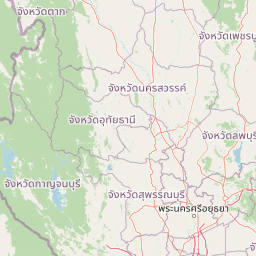
Map view of Khlong Lan National Park

Use this park location map to pinpoint Khlong Lan National Park in Thailand, understand its exact geographic position, and read its mapped placement within the surrounding landscape more clearly.

Pigeon | © OpenStreetMap contributors

Location context for Khlong Lan National Park

Kamphaeng Phet Province
Park atlas

Browse connected protected landscapes, tracing mountain forests and waterfall terrain in the surrounding region.

Explore National Parks and Protected Areas Near Khlong Lan National Park, Thailand
Continue your atlas exploration from Khlong Lan National Park by discovering additional national parks and protected areas within Thailand, focusing on nearby mountain forests and waterfall regions. This view allows you to compare similar protected landscapes, trace the regional spread of conservation efforts, and understand the broader geographic context of the Dawna Mountain Range's headwater catchments.
National parkNakhon Sawan Province

Mae Wong National Park: National Park Protected Area and Geographic Setting

Mapped boundaries and regional landscape of Mae Wong.

Investigate Mae Wong National Park, a designated national park offering insights into its protected landscape identity. This entry provides structured geographic data, focusing on the park's mapped boundaries and its position within the broader regional context of Nakhon Sawan Province. Examine its role as a significant protected area for atlas-based discovery and geographic understanding.

Area
894 km²
Established
1987
IUCN
II
Visitors
51.8K annual
National parkKamphaeng Phet Province

Khlong Wang Chao National Park: Thailand's Distinct Mountainous Protected Landscape in Kamphaeng Phet

Explore mapped boundaries and terrain of this significant national park.

Khlong Wang Chao National Park is a key protected area in western Thailand, recognized for its impressive mountainous geography within the Thanon Thong Chai Range. Spanning 747 square kilometers, the park features complex ridges, valleys, and Yen Mountain, its highest peak. Its designation as a national park highlights the importance of its dense teak forests and unique central valley formations, offering a rich subject for geographic and landscape exploration.

Area
747 km²
Established
1990
IUCN
II
Visitors
33.4K annual
National parkTak Province

Namtok Pha Charoen National Park: Protected Landscape and Regional Geography of Tak Province

Explore its mapped boundaries and natural terrain.

Namtok Pha Charoen National Park serves as a vital protected area within Thailand's Tak Province, a region characterized by extensive forests and mountain ranges. This page offers an in-depth view of the park's geography, detailing its specific location and its importance as a mapped natural landscape. Understanding the park's boundaries and its place within the broader context of Western Thailand's geography is central to exploring its unique identity.

Area
770 km²
IUCN
II
Visitors
152.5K annual
Relief
Mountain
National parkTak Province

Lan Sang National Park: Mapped Protected Landscape and Waterfall Atlas

Discover the geography and natural features of this national park.

Lan Sang National Park presents a rich protected landscape within Tak Province, Thailand, renowned for its striking tiered waterfalls cascading through the mountainous Dawna Range. This national park offers a detailed look at its mapped terrain, including multiple named waterfalls like Namtok Pha Lat and Namtok Tha Le, alongside scenic viewpoints. Its diverse forest environments contribute to a unique natural setting, making it a significant area for understanding regional geography and protected natural land patterns.

Area
104 km²
Established
1979
IUCN
II
Visitors
38.9K annual
National parkTak Province

Taksin Maharat National Park: National Park with Mapped Boundaries in Tak Province

Discover its protected landscape and regional geography.

Taksin Maharat National Park is a designated national park offering a focused point for geographic discovery. Located within Tak Province, a region characterized by significant forest cover and mountainous geography in western Thailand, this park contributes to the understanding of protected land distribution. Exploring its mapped terrain and landscape identity provides insight into the natural features that define this specific Thai protected area.

Area
149 km²
Established
1981
IUCN
II
Visitors
30.2K annual
National parkSukhothai Province

Ramkhamhaeng National Park: National Park Atlas and Protected Landscape Geography

Mapped boundaries and regional context within Sukhothai Province.

Ramkhamhaeng National Park serves as a vital national park, offering a unique perspective on Thailand's natural protected areas. Explore its mapped boundaries and understand its integration into the regional geography of Sukhothai Province. This page provides detailed atlas-style insights into the park's landscape, facilitating a deeper appreciation of its protected status and geographic significance.

Area
341 km²
Established
1980
IUCN
II
Visitors
23.4K annual
National parkTak Province

Khun Phawo National Park: Protected National Park in Tak Province, Thailand

Mapped geography and protected area context for Khun Phawo.

Khun Phawo National Park stands as a designated national park within Tak Province, western Thailand. This page facilitates a deeper atlas-driven understanding of the park's protected landscape, its mapped terrain, and its regional geographic significance. It is an essential entry point for exploring the park's boundaries and its place within the broader conservation atlas.

Area
397 km²
Established
2009
IUCN
II
Visitors
10.3K annual
National parkTak Province

Mae Wa National Park: Protected Landscape and Geographic Context in Tak Province, Thailand

Explore the park's mapped boundaries and regional landscape identity.

Mae Wa National Park represents a vital protected natural landscape within Tak Province, Thailand. This entry facilitates a deeper understanding of its geographic placement and its role as a national park. Users can explore the park's specific terrain, its boundaries as mapped within the region, and its contribution to the broader atlas of protected areas in western Thailand, offering a factual basis for landscape discovery.

Area
582 km²
Established
2000
IUCN
II
Visitors
5.9K annual

Common questions about visiting, size, designation, and location context for Khlong Lan National Park

Khlong Lan National Park FAQs for park facts, access, geography, and protected area context
Find quick answers about Khlong Lan National Park, including protected-area facts, park geography, trail and visitor context, and how the park fits into its surrounding country and regional landscape.
MoriAtlas Explorer

Continue Your Protected Areas Search Across the Global Atlas

Deepen your exploration by continuing the structured search for national parks and protected areas worldwide. Utilize the comprehensive filtering capabilities to compare different conservation landscapes and refine your understanding of global park geography. Discover more about the distribution and characteristics of protected natural areas.

Global natural geography