

Mori Atlas logo
National parkKhlong Phanom National Park

Navigate the mapped boundaries and natural terrain of this key national park in Southern Thailand.

Khlong Phanom National Park: Protected Landscape and Geographic Context in Surat Thani Province

Khlong Phanom National Park represents a significant protected area within Surat Thani Province, offering a detailed view of its unique geographic setting. As part of a broader atlas of protected lands, this page details the park's landscape context and mapped boundaries, allowing for structured discovery of Southern Thailand's natural terrain. Understanding Khlong Phanom National Park through its geography provides essential context for exploring the region's diverse protected areas.

National ParkTropical ForestLimestone MountainsSouthern ThailandPhuket Mountain RangeSurat Thani Province

Khlong Phanom National Park

National park

Park overview

Structured park overview, official facts, and landscape profile for Khlong Phanom National Park

Khlong Phanom National Park park facts, protected area profile, and essential visitor context

Review the core facts for Khlong Phanom National Park, including designation, size, terrain, visitor scale, habitats, and operating context in one park-focused overview.

About Khlong Phanom National Park

Khlong Phanom National Park represents a significant conservation area in southern Thailand's protected estate, established in 2000 to preserve the forests and wildlife of the Phuket mountain range. The park occupies a strategic position within a larger network of protected areas that includes Khao Sok National Park to the north and Tonpariwat Wildlife Sanctuary to the southwest, together forming an important ecological corridor. The terrain is dominated by steep limestone mountains that rise sharply from narrow valley floors, creating a dramatic landscape of ridges and cliffs. The forest cover remains largely intact, supporting a complex ecosystem that includes both lowland tropical rainforest and montane vegetation zones. The park is administered by Thailand's Department of National Parks, Wildlife and Plant Conservation and receives relatively low visitation compared to more famous Thai parks, contributing to its wilderness character.

Quick facts and research context for Khlong Phanom National Park

Located in Phanom District, Surat Thani Province, southern Thailand. The park covers roughly 410 square kilometers of mountainous terrain within the Phuket mountain range. Elevation ranges from around 200 meters in valley floors to approximately 870 meters at the highest peak in the central area. The landscape consists primarily of steep limestone ridges running east to west, with about 80% of the area being mountainous and 20% flat valley terrain. The region experiences a tropical monsoon climate with year-round rainfall, featuring a rainy season from May through December and a warmer dry period from January to April.

Protection and recognition

Tracing terrestrial conservation frameworks and designation history in global registries

Official Protection Status and Geographic Designation of Khlong Phanom National Park

Established in 2000 as a terrestrial protected area, Khlong Phanom National Park maintains a documented conservation status within global registries. Geographic datasets compile official records and designation history to assist researchers mapping global conservation networks.

Protection details

Protection scope
Terrestrial
Designated year
2000
WDPA ID
7638337
Park context

Deeper park guide and search-rich context for Khlong Phanom National Park

Khlong Phanom National Park history, landscape, wildlife, and travel context

Explore Khlong Phanom National Park through its history, landscape character, ecosystems, wildlife, conservation priorities, cultural context, and seasonal travel timing in a structured park guide built for atlas discovery and search intent.

Why Khlong Phanom National Park stands out

Khlong Phanom is best known for its pristine tropical evergreen forest and dramatic limestone mountain scenery within the Phuket mountain range. The park protects one of the most extensive contiguous forest areas in southern Thailand, with towering trees, dense vegetation, and steep cliff faces creating a rugged landscape. Its relative remoteness and lower visitor numbers compared to neighboring Khao Sok make it notable for those seeking a less commercialized wilderness experience.

Khlong Phanom National Park history and protected-area timeline

Khlong Phanom was designated as Thailand's 72nd national park on November 17, 2000, formalizing protection for the forests of the Phuket mountain range in Surat Thani Province. The establishment came as part of Thailand's broader efforts to conserve remaining pristine forest areas in the southern peninsula, a region that had experienced significant deforestation in preceding decades. The park was created to protect the watersheds, biodiversity, and forest ecosystems of the mountainous terrain, which had remained relatively intact due to the ruggedness of the terrain and limited development pressure in the area. Prior to national park status, the area existed within Thailand's forest reserve system. The 2000 designation brought formal national park protection with associated visitor management and conservation enforcement frameworks.

Khlong Phanom National Park landscape and geographic character

The physical landscape of Khlong Phanom National Park is defined by the Phuket mountain range, which runs as a series of steep limestone ridges from west to east across the park's extent. Approximately 80% of the park consists of mountainous terrain, with the northern portions featuring particularly dramatic limestone formations and some spectacular cliff faces. The highest point reaches approximately 870 meters above sea level in the central portion of the park, while valley floors sit at around 200 meters elevation. The remaining 20% of the area comprises valley floors and lower terrain between the mountain ridges. The terrain creates a complex pattern of ridges, valleys, and steep slopes that support the park's diverse forest ecosystems.

Khlong Phanom National Park ecosystems, habitats, and plant life

The park supports lush tropical evergreen forest covering the mountainous terrain in dense, unbroken stands. The forest ecosystem is classified as virgin tropical rainforest, characterized by large emergent trees, a complex canopy structure, and dense understory vegetation. Tree species found in the park include valuable timber species such as takian, along with po daem, rubber trees, champa, and numerous other tropical hardwoods. The forest maintains high humidity year-round due to the consistent rainfall and the mountainous terrain's ability to trap moisture. Bamboo, rattan, and various climbing vines are common in the understory, while ferns and other shade-tolerant plants thrive in the lower forest layers. The continuous forest cover and relative lack of human disturbance have allowed the ecosystem to develop with minimal fragmentation.

Khlong Phanom National Park wildlife and species highlights

Khlong Phanom supports a diverse array of wildlife typical of southern Thailand's tropical forests. Notable mammalian species include elephants, deer species including barking deer and mouse deer, gaurs, tigers, bears, and serows. Primates present include gibbons and langurs, while smaller mammals include wild boars and various squirrel species. The bird population includes pheasants and numerous other bird species, while the reptile and amphibian communities include frogs and various reptile species. The forest ecosystem supports this wildlife through its structure of continuous canopy, diverse food sources, and protected corridors connecting to adjacent protected areas. The combination of forest types from valley floors to ridgelines provides varied habitats supporting different species requirements.

Khlong Phanom National Park conservation status and protection priorities

The park plays an important role in protecting the watersheds of the Phuket mountain range and maintaining ecological connectivity within southern Thailand's protected area network. As part of the larger contiguous protected landscape including Khao Sok and Tonpariwat, Khlong Phanom contributes to wildlife movement corridors that allow species to range across larger areas than isolated parks would permit. The relatively low visitation levels and established protection status help maintain the forest ecosystem in relatively undisturbed condition, supporting biodiversity conservation in a region where forest conversion has affected many areas. The national park designation provides legal protection for both the forest and the wildlife within its boundaries.

Khlong Phanom National Park cultural meaning and human context

The park lies within the administrative boundaries of Phanom District and includes areas within Khlong Sak, Phanom, and Plu Tua subdistricts. The region has historical connections to local communities that have utilized the forest resources traditionally, though the national park status now restricts certain uses. The area forms part of the broader Surat Thani Province landscape, which includes both coastal areas and mountainous interior. The Thai name 'คลองพนม' reflects local naming traditions, with 'Khlong' meaning canal or waterway and 'Phanom' referring to the mountain or highland character of the area.

Top sights and standout views in Khlong Phanom National Park

The park's primary appeal lies in its dramatic limestone mountain landscapes, pristine tropical forest, and wilderness character that distinguishes it from more visited Thai parks. The steep ridges and cliff faces create scenic vistas, while the intact forest supports active wildlife populations. The connection to adjacent protected areas creates one of the largest forest complexes in southern Thailand, offering potential for experiencing a relatively undeveloped protected landscape.

Best time to visit Khlong Phanom National Park

The park can be visited throughout the year, though the optimal period falls during the cooler dry season from November through April when conditions are more comfortable for outdoor exploration. The rainy season from May through December brings regular rainfall and higher humidity, though the forest remains green and the landscapes can be particularly lush during and after wet periods. August through October typically sees the highest rainfall, while the hottest conditions occur in early April. The relatively low visitor numbers mean that the park retains its tranquility outside of major holiday periods, though facilities and access may be more limited compared to better-developed parks.
Monthly climate preview

Long-term representative point measurements for temperature and precipitation rhythms

Khlong Phanom National Park Climate Normals and Measured Annual Weather Patterns

Representative coordinate records show measured monthly temperature variations and precipitation amounts across the landscape at an elevation of 219 meters. Reviewing the complete twelve-month climatology profile provides deeper insight into long-term averages for this protected area.
Annual mean25 °C
24 °C27 °C
Jan24°
Feb25°
Mar26°
Apr27°
May26°
Jun25°
Jul25°
Aug25°
Sep25°
Oct25°
Nov25°
Dec24°
Warmest month
April

27.1 °C

Coolest month
January

23.9 °C

Wettest month
September

11.7 mm/day

Driest month
February

1.1 mm/day

Park location guide

Geography guide, regional context, and park location map for Khlong Phanom National Park

Khlong Phanom National Park park geography, regions, and map view in Thailand

Understand where Khlong Phanom National Park sits in Thailand through a broader geographic reading of the surrounding landscape, nearby location context, and its mapped position within the national park landscape.

How Khlong Phanom National Park fits into Thailand

Thailand is a Southeast Asian nation formerly called Siam, located in mainland Southeast Asia. It operates as a unitary parliamentary constitutional monarchy under King Vajiralongkorn. The country borders Myanmar, Laos, Cambodia, and Malaysia, with maritime boundaries involving Vietnam, Indonesia, and India. Thailand has a population of nearly 66 million and covers approximately 513,120 km². Historically, the Sukhothai Kingdom marks the beginning of Thai history, followed by the powerful Ayutthaya Kingdom.

Wider geography shaping Khlong Phanom National Park in Thailand

Thailand occupies mainland Southeast Asia with borders to Myanmar (west/northwest), Laos (east/northeast), Cambodia (southeast), and Malaysia (south). The country has coastline along the Gulf of Thailand to the southeast and the Andaman Sea to the southwest. The territory covers approximately 513,120 km².

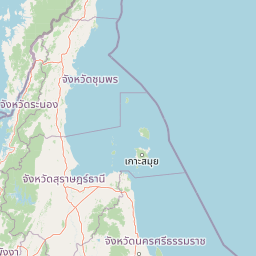
Map view of Khlong Phanom National Park

Use this park location map to pinpoint Khlong Phanom National Park in Thailand, understand its exact geographic position, and read its mapped placement within the surrounding landscape more clearly.

Pigeon | © OpenStreetMap contributors

Location context for Khlong Phanom National Park

Surat Thani Province
Park atlas

Compare surrounding protected landscapes and mapped geography in Southern Thailand's diverse park region

Explore Other National Parks and Protected Areas Near Khlong Phanom National Park

After exploring Khlong Phanom National Park, delve into nearby national parks and adjacent protected areas across Southern Thailand's unique limestone mountain range. Broaden your geographic understanding of conservation landscapes and compare diverse protected areas, tracing their spread and regional context on the atlas.
National parkSurat Thani Province
About 20 km away#1 closest

Northwest

Khao Sok National Park: Protected Landscape Atlas and Geographic Detail

Explore mapped boundaries and regional terrain in Surat Thani Province.

Khao Sok National Park represents a crucial protected landscape within the expansive geography of Surat Thani Province, Thailand. This detailed entry focuses on the park's identity as a national park, emphasizing its mapped boundaries and the surrounding natural terrain. Through structured information and geographic context, users can gain a clear understanding of Khao Sok National Park's place in the atlas, contributing to a more informed approach to landscape discovery.

Area
739 km²
Established
1980
IUCN
II
Visitors
419.5K annual
National parkPhang Nga Province
About 40 km away#2 closest

Northwest

Si Phang-nga National Park: Protected Landscape Identity and Geographic Context in Phang Nga

Explore the park's mapped boundaries and unique karst landscape.

Si Phang-nga National Park stands as a key protected area, distinguished by its extraordinary limestone karst formations that dominate the coastal geography of Phang Nga Province, Thailand. The park's protected landscape features include dramatic pinnacles rising from mangrove-lined waters and intricate cave systems with archaeological significance. Delve into the unique natural terrain and map context that define this vital national park, offering a deep dive into its geological history and ecological importance.

Area
246 km²
Established
1988
IUCN
II
Visitors
21.3K annual
National parkPhang Nga Province
About 50 km away#3 closest

West

Khao Lak, Lam Ru National Park: Protected National Park Landscape and Geography

Explore its mapped boundaries and regional context in Phang Nga Province.

This entry focuses on Khao Lak, Lam Ru National Park, a designated national park offering a distinct protected landscape within Phang Nga Province, Thailand. It provides structured data and map context crucial for understanding its geographic scope and regional significance. Explore the park's mapped boundaries, its role as a protected area, and its contribution to the broader landscape of southern Thailand, fostering a deeper appreciation for its natural geography and atlas-derived insights.

Area
125 km²
Established
1991
IUCN
II
Visitors
72.2K annual
National parkSurat Thani Province
About 51 km away#4 closest

North

Kaeng Krung National Park: Exploring Protected Area Boundaries and Regional Geography

A National Park within Surat Thani Province's diverse landscapes.

Kaeng Krung National Park is a distinct protected area situated in Surat Thani Province, Thailand. This page provides essential context for understanding the park's geographic significance, its mapped boundaries, and its contribution to the regional protected landscape atlas. Explore the fundamental geographic characteristics that define this important natural reserve and its surrounding terrain.

Area
541 km²
Established
1991
IUCN
II
Visitors
909 annual
National parkThailand
About 55 km away#5 closest

Southwest

Ao Phang Nga National Park: A Protected National Park in Thailand's Geographic Atlas

Explore the mapped landscape and protected area identity.

Ao Phang Nga National Park offers a distinct protected landscape within Thailand, serving as a key entry in the national park atlas. This page focuses on delineating its geographic boundaries and understanding its specific characteristics as a national park. Users can discover the mapped context and regional setting, providing valuable insights into Thailand's protected natural areas and their conservation significance.

Area
400 km²
Established
1981
IUCN
II
Visitors
999K annual
National parkKrabi Province
About 65 km away#6 closest

South

Khao Phanom Bencha National Park: Protected Mountainous Rainforest and Waterfall Landscapes

Explore Krabi Province's unique protected area and its dramatic geographic features.

Khao Phanom Bencha National Park represents a core protected landscape within Krabi Province, Thailand. Dominated by the imposing Khao Phanom Bencha mountain range, its terrain includes steep, forested slopes and intricate valley systems that give rise to impressive waterfalls. This national park is an essential component of the region's protected natural areas, offering a detailed look at its unique ecosystem and geographic character through mapped landscape context and atlas exploration.

Area
50 km²
Established
1981
IUCN
II
Visitors
17.3K annual
National parkPhang Nga Province
About 70 km away#7 closest

Southwest

Khao Lampi, Hat Thai Mueang National Park: Mountain Rainforest and Andaman Coast Atlas

Explore the mapped geography and protected boundaries.

Delve into Khao Lampi, Hat Thai Mueang National Park, a key protected area within Phang Nga Province, Thailand. This unique national park showcases a striking dichotomy: the lush, waterfall-adorned slopes of the Khao Lampi mountains contrast with the pristine Andaman Sea coastline of Hat Thai Mueang beach, a critical site for sea turtle nesting. The park's mapped landscape encompasses dense tropical rainforest, significant mangrove ecosystems, and important natural terrain, offering a comprehensive view of diverse protected environments for atlas exploration.

Area
72 km²
Established
1986
IUCN
II
Visitors
50.5K annual
National parkThailand
About 82 km away#8 closest

East

Tai Rom Yen National Park: Thailand's Protected Landscape and Geographic Context

Explore the mapped boundaries of this national park.

Tai Rom Yen National Park is a protected area contributing to Thailand's significant natural landscape. This page focuses on its identity as a national park, detailing its geographic placement and the importance of its mapped boundaries. Users exploring the atlas of Southeast Asia will find this park a valuable point of reference for understanding regional protected territories and their landscape characteristics, free from any operational or visitor information.

Common questions about visiting, size, designation, and location context for Khlong Phanom National Park

Khlong Phanom National Park FAQs for park facts, access, geography, and protected area context

Find quick answers about Khlong Phanom National Park, including protected-area facts, park geography, trail and visitor context, and how the park fits into its surrounding country and regional landscape.
MoriAtlas Explorer

Continue Your Protected Areas Search Across the Global Atlas

Deepen your exploration by continuing the structured search for national parks and protected areas worldwide. Utilize the comprehensive filtering capabilities to compare different conservation landscapes and refine your understanding of global park geography. Discover more about the distribution and characteristics of protected natural areas.

Global natural geography