
Islands
Park geography
Structured landscape analysis including elevation ranges and key natural landmarks
Geographic Profile and Mapped Terrain Boundaries of Killarney National Park in County Kerry, Ireland
Analyze the physical geography of Killarney National Park across its 102.89 square kilometer area. This structured profile maps terrain features ranging from 22 to 842 meters in elevation, including peaks such as Purple Mountain and Torc Mountain, alongside diverse wetlands, forests, and glacial lakes within the Irish landscape.
Ireland's first national park, protecting ancient oak and yew woodlands, wild red deer herds, and the iconic Lakes of Killarney
Killarney National Park
Killarney National Park occupies a remarkable position in southwest Ireland as the nation's inaugural national park, established in 1932 when the Muckross Estate was gifted to the Irish Free State. The park encompasses over 100 square kilometers of diverse landscapes centered around the three Lakes of Killarney, with elevations ranging from lake level up to 842 meters at Mangerton Mountain. Its ecological significance stems from the extensive old-growth oak and yew woodlands, some of Europe's finest, alongside blanket bogs, mountain terrain, and wetlands that support exceptional biodiversity. The park was designated a UNESCO Biosphere Reserve in 1981, recognizing its importance as a refuge for rare species and distinctive Atlantic biogeographic flora. The park is particularly distinguished by hosting Ireland's only remaining wild herd of native red deer, a population descending from animals present since the post-glacial period approximately 4,000 years ago. The ancient woodlands represent the most extensive native forest remaining in Ireland, with the oak woods internationally recognized for their rich bryophyte communities and the yew woodland at Reenadinna constituting one of just three pure yew woodlands in Europe. The park's location near Ireland's western coast, influenced by Gulf Stream currents, creates a mild oceanic climate that supports species with hiberno-lusitanean distributions found nowhere else in Ireland, a biogeographic pattern more typical of northern Spain and Portugal.
- Location
- Ireland
- Park type
- National park
- Established
- 1932
- Area
- 102.9 km²
Location overview
Mapped territory and regional status within County Kerry and Ireland
Killarney National Park Geographic Setting and Regional Placement
Killarney National Park is situated within the regional borders of County Kerry in Ireland. The protected area operates entirely within a single national jurisdiction without transboundary, marine, or coastal boundaries.
- Countries
- Ireland
- Regions
- County Kerry
- Primary location
- Ireland
- Geographic setting
- Inland
Boundary and coordinates
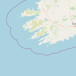
Interactive protected-area geometry covering 102.89 square kilometers
Killarney National Park Boundary Map and Spatial Extent
Mapped park geometry establishes clear spatial context across the protected landscape. Recorded measurements outline the total surface area, coordinate limits, and geographic span for geographic analysis.
- Boundary area
- 104.1 km²
- Boundary perimeter
- 83.1 km
- Northernmost point
- 52.0688° N
- Southernmost point
- 51.9388° N
- Easternmost point
- 9.4746° W
- Westernmost point
- 9.6363° W
- Geographic centre
- 52.0019° N, 9.5546° W
- North–south span
- 14.5 km
- East–west span
- 11.1 km
Elevation and terrain
Mountain relief span, peaks, and recorded interior natural features
Killarney National Park Terrain and Elevation Profile
Elevation summary metrics outline the vertical range from twenty two to eight hundred forty two meters across mountain terrain. Recorded natural features provide names, types, and spatial relationships within the protected landscape.
- Minimum elevation
- 22 m
- Maximum elevation
- 842 m
Selected named natural features
Viewpoints
Ladies View
Peaks
Purple Mountain
832 m
Bays
Bog Bay
Peaks
Purple Mountain NE Top
757 m
Forests
Lamb Island
Environmental setting
Temperate climate zones, mountain relief, and major water features across the protected landscape
Killarney National Park Environmental Classifications and Physical Setting
Recorded landscape features, broad habitat types, and forest cover classifications offer complementary ways to read the physical setting of Killarney National Park. Linked categories connect directly to relevant atlas destinations for deeper regional comparison.
- Relief
- Mountain
- Climate
- Temperate
- Water
- Major water bodies
- Forest cover
- Mostly forested
- Seasonality
- Year-round
Landscape features
Mountains · Valleys · Cliffs · Forest · Woodland · Grassland · Wetland · Bog · Lakes · Rivers · Waterfalls · Islands · Cave · Karst
Habitat types
Temperate broadleaf forest · Montane forest · Alpine meadow · Grassland · Wetland · Peatland · Riverine habitat · Lacustrine habitat
Park atlas
Trace the geographic spread of Ireland's protected landscapes and compare their unique conservation features.
Explore Other National Parks and Protected Areas Near Killarney National Park, Ireland
Continue your exploration of Ireland's conservation areas by comparing national parks and protected landscapes adjacent to Killarney National Park. Trace the regional spread of diverse Atlantic ecosystems, ancient woodlands, and mountain-lake terrain, understanding their geographic context and conservation value.
National parkIreland
106 km away#1 closest
North

Burren National Park: A Distinctive Karst Protected Landscape in County Clare
Explore its unique limestone pavement and geological formations.
Burren National Park offers a profound exploration of karst geology, featuring Ireland's most extensive and visually striking limestone pavement. The park's terrain displays a unique mosaic of exposed rock, swallow holes, and surprising pockets of vegetation, including rare Arctic-alpine and Mediterranean flora. As a protected national park, it preserves this scientifically significant landscape and offers a window into the dynamic interplay of geological forces and ecological adaptation within Western Ireland's regional geography.
- Area
- 15 km²
- Established
- 1991
- IUCN
- II
- Relief
- Mountain
National parkCounty Galway
About 164 km away#2 closest
North
Connemara National Park: A Mapped Protected Landscape in County Galway
Explore national park geography and protected terrain details.
Delve into Connemara National Park, a distinct national park located in the western region of County Galway, Ireland. This entry serves as a gateway to understanding its protected landscape, mapped boundaries, and its role within the broader geographic context of Connacht. Explore how this protected area contributes to the diverse natural terrain of Ireland, viewed through an atlas-driven discovery lens.
- Area
- 20 km²
- Established
- 1980
- IUCN
- II
- Relief
- Mountain
National parkCounty Kerry
About 164 km away#3 closest
North
Páirc Náisiúnta na Mara National Park: Protected Landscape Atlas for County Kerry
Explore mapped protected areas and regional geography.
This entry details Páirc Náisiúnta na Mara National Park, offering insights into its protected landscape character and geographic setting within County Kerry. As a significant protected area, it contributes to the atlas of Southwest Ireland, providing context for its natural terrain and mapped boundaries. Discover the park's unique identity and its position within the broader regional geography for structured exploration.
- Area
- 280 km²
- Established
- 2024
- IUCN
- II
- Relief
- Mixed relief
National parkCounty Mayo
209 km away#4 closest
North
Wild Nephin National Park: Ireland's Protected Landscape in County Mayo
National Park with regional geographic context.
Explore Wild Nephin National Park, a significant protected area situated in County Mayo, Ireland. This entry focuses on the park's mapped boundaries and its unique natural terrain, offering a clear geographic perspective. Understand how this national park contributes to the diverse landscapes of western Ireland and serves as a key point for atlas-based discovery of protected lands.
- Area
- 150 km²
- Established
- 1998
- IUCN
- II
- Climate
- Temperate
National parkCounty Wicklow
225 km away#5 closest
Northeast
Wicklow Mountains National Park: Protected Landscape and Geographic Atlas Mapping
Explore County Wicklow's mapped natural terrain and park boundaries.
Understand the geographic scope and protected landscape identity of Wicklow Mountains National Park. This page offers detailed information on its mapped boundaries and its context within County Wicklow, providing a foundation for atlas-based discovery of Ireland's natural areas. Explore how this national park contributes to the region's mapped geography and conservation landscapes.
- Area
- 205 km²
- Established
- 1991
- IUCN
- II
- Relief
- Mountain
Nature reserveCounty Fermanagh
About 272 km away#6 closest
Northeast

Crom Estate Nature Reserve and Upper Lough Erne Geographic Landscape Overview
Riparian forest and island geography in County Fermanagh
Deeply connected to the shores of Upper Lough Erne, Crom Estate is a sprawling nature reserve defined by its ancient riparian woodlands and intricate maze of bays and islands. The terrain preserves a distinct mix of old-growth forest, open grassland, and historic castle ruins, providing a valuable case study in the regional geography of County Fermanagh and the conservation of water-influenced ecosystems.
- Area
- 5.5 km²
- Established
- 1987
- Relief
- Lowland
- Climate
- Temperate
National parkCounty Meath
About 276 km away#7 closest
Northeast
Boyne Valley National Park: Protected River Floodplains and Neolithic Landscapes
Geographic atlas overview for County Meath, Ireland
Boyne Valley National Park encompasses a significant riparian corridor along the River Boyne, serving as a sanctuary for diverse freshwater species and a guardian of major megalithic monuments. This protected area offers insight into the confluence of Irish ecological preservation and prehistoric archaeological heritage within a managed, low-lying floodplain setting.
- Area
- 2.23 km²
- Established
- 2023
- IUCN
- II
- Relief
- Lowland
National parkPembrokeshire
284 km away#8 closest
East
Pembrokeshire Coast National Park: Mapped Coastal Boundaries and Protected Landscape Atlas
Explore unique seaside terrain and regional geography.
Delve into the Pembrokeshire Coast National Park, a premier protected landscape recognized for its extraordinary coastal formations and diverse natural terrain. This atlas entry details the park's distinct mapped boundaries, from its iconic limestone cliffs and sea stacks to its sheltered estuaries and inland Preseli Hills. Understand how this significant national park contributes to the protected area map of Pembrokeshire and offers unparalleled opportunities for geographic discovery along the Welsh coast.
- Area
- 629 km²
- Established
- 1952
- IUCN
- V
- Relief
- Mixed relief
MoriAtlas Explorer
Continue Your Atlas Exploration of Killarney National Park's Geography
To deepen your understanding of Killarney National Park's protected landscape, delve into its specific geographic features and mapped context. MoriAtlas offers the tools to trace its park boundaries and compare its regional setting, providing a structured approach to exploring Ireland's significant natural areas and enhancing your atlas-based knowledge.
Browse next
Global natural geography
Explore related park routes
Explore MoriAtlas Global ParksBrowse All MoriAtlas ParksGlobal Park Map DiscoveryMoriAtlas: Browse All CountriesBrowse All MoriAtlas ContinentsNational Park Environment AtlasGrand Canyon National Park AtlasYellowstone National Park AtlasYosemite National Park Atlas and GeographySerengeti National Park AtlasGalápagos National Park Protected LandscapeBanff National Park Geography and AtlasKruger National Park Atlas EntryUluṟu-Kata Tjuṯa National Park AtlasExplore Uluru-Kata Tjuta National Park GeographyPlitvice Lakes National Park AtlasFiordland National Park Protected LandscapeGreat Smoky Mountains National Park AtlasAfghanistan National Parks and Protected AreasAlbania National Parks and Protected AreasAlgeria National Parks and Protected AreasAmerican Samoa National Parks and Protected AreasAndorra National Parks and Protected AreasAngola National Parks and Protected AreasAntarctica National Parks and Protected AreasAntigua and Barbuda Park List