Mori Atlas logo
National parkKillarney National Park

Discover the geographic context and atlas significance of this Irish national park.

Killarney National Park: Protected Landscape Identity and Mapped Boundaries

Killarney National Park stands as a key protected area within Ireland's natural heritage, offering a unique lens for geographic discovery. As a designated national park, its mapped boundaries provide crucial context for understanding the local terrain and protected landscape. MoriAtlas enables detailed map exploration and analysis, allowing users to grasp the park's place within the broader regional geography and its specific environmental characteristics.

National ParksWoodlandsLakesWildlife ReservesMountain LandscapesUNESCO Biosphere Reserves

Killarney National Park

National park

Park overview

Structured park overview, official facts, and landscape profile for Killarney National Park

Killarney National Park park facts, protected area profile, and essential visitor context
Review the core facts for Killarney National Park, including designation, size, terrain, visitor scale, habitats, and operating context in one park-focused overview.

About Killarney National Park

Killarney National Park stands as Ireland's premier protected area, a landscape of extraordinary ecological and cultural significance in the southwest of the country near the town of Killarney in County Kerry. The park's creation began when the Muckross Estate was donated to the Irish state in 1932, forming the Bourn Vincent Memorial Park that became Ireland's first national park. Since then, the park has expanded to more than double its original size, now encompassing over 102 square kilometers of mountain, lake, woodland, and bog habitats.

The park's ecological diversity stems from its complex geology, where a major boundary between Devonian Old Red Sandstone and Carboniferous limestone runs through the area. This geological junction, combined with the park's elevation range and the moderating influence of the Gulf Stream, creates varied microhabitats supporting an exceptional range of species. The Lakes of Killarney form the park's aquatic heart, three interconnected lakes covering nearly a quarter of the total area, each with distinct ecological characteristics. Lough Leane is the largest and most nutrient-rich, Muckross Lake is the deepest at 73.5 meters, and the Upper Lake lies in rugged mountain scenery.

The park's significance extends beyond Ireland's borders. Its designation as a UNESCO Biosphere Reserve in 1981 recognizes the international importance of its habitats and species. The extensive native woodlands, particularly the sessile oak forests and the rare yew woodland at Reenadinna, are of European importance and receive protection under the EU Habitats Directive. The park's position at the edge of Europe, influenced by Atlantic climate patterns, supports species found nowhere else in Ireland, including several with hiberno-lusitanean distributions more typical of northern Spain and Portugal.

Quick facts and research context for Killarney National Park

Killarney National Park is located in County Kerry, southwest Ireland, near the town of Killarney. The park covers 102.89 square kilometers and was established in 1932 as Ireland's first national park, created when the Muckross Estate was donated to the Irish state. The park centers on the three Lakes of Killarney, which together comprise nearly a quarter of the total area: Lough Leane, Muckross Lake, and the Upper Lake. Elevation ranges from 22 meters along the lake shores to 842 meters at the mountain peaks. The underlying geology features a major boundary between Devonian Old Red Sandstone and Carboniferous limestone. The park is managed by the National Parks and Wildlife Service and holds UNESCO Biosphere Reserve status since 1981, additionally forming part of a Special Area of Conservation and Special Protection Area under European environmental directives.

Park context

Deeper park guide and search-rich context for Killarney National Park

Killarney National Park history, landscape, wildlife, and travel context
Explore Killarney National Park through its history, landscape character, ecosystems, wildlife, conservation priorities, cultural context, and seasonal travel timing in a structured park guide built for atlas discovery and search intent.

Why Killarney National Park stands out

Killarney National Park is especially known for its ancient oak and yew woodlands of international importance, which represent the largest remaining native forest in Ireland. The park hosts Ireland's only wild herd of native red deer, a population of approximately 900 individuals representing a 4,000-year-old lineage. The three interconnected Lakes of Killarney, particularly Lough Leane with its thirty islands, create a distinctive aquatic landscape. The yew woodland at Reenadinna is among only three pure yew woodlands in Europe, while the bryophyte communities in the oak woods are considered the most developed Atlantic bryophyte community on the continent.

Killarney National Park history and protected-area timeline

The land that now forms Killarney National Park has been inhabited since the Bronze Age, with archaeological evidence of copper mining on Ross Island approximately 4,000 years ago. The area contains significant early Christian sites, most notably Inisfallen Abbey founded in the 7th century on an island in Lough Leane, where the Annals of Inisfallen were composed between the 11th and 13th centuries. This monastic settlement is thought to have given rise to the name Lough Leane, meaning Lake of Learning. Muckross Abbey, founded in 1448 by Observantine Franciscans, remains a striking ruin within the park, featuring a central courtyard with a famed yew tree traditionally said to be as old as the abbey itself.

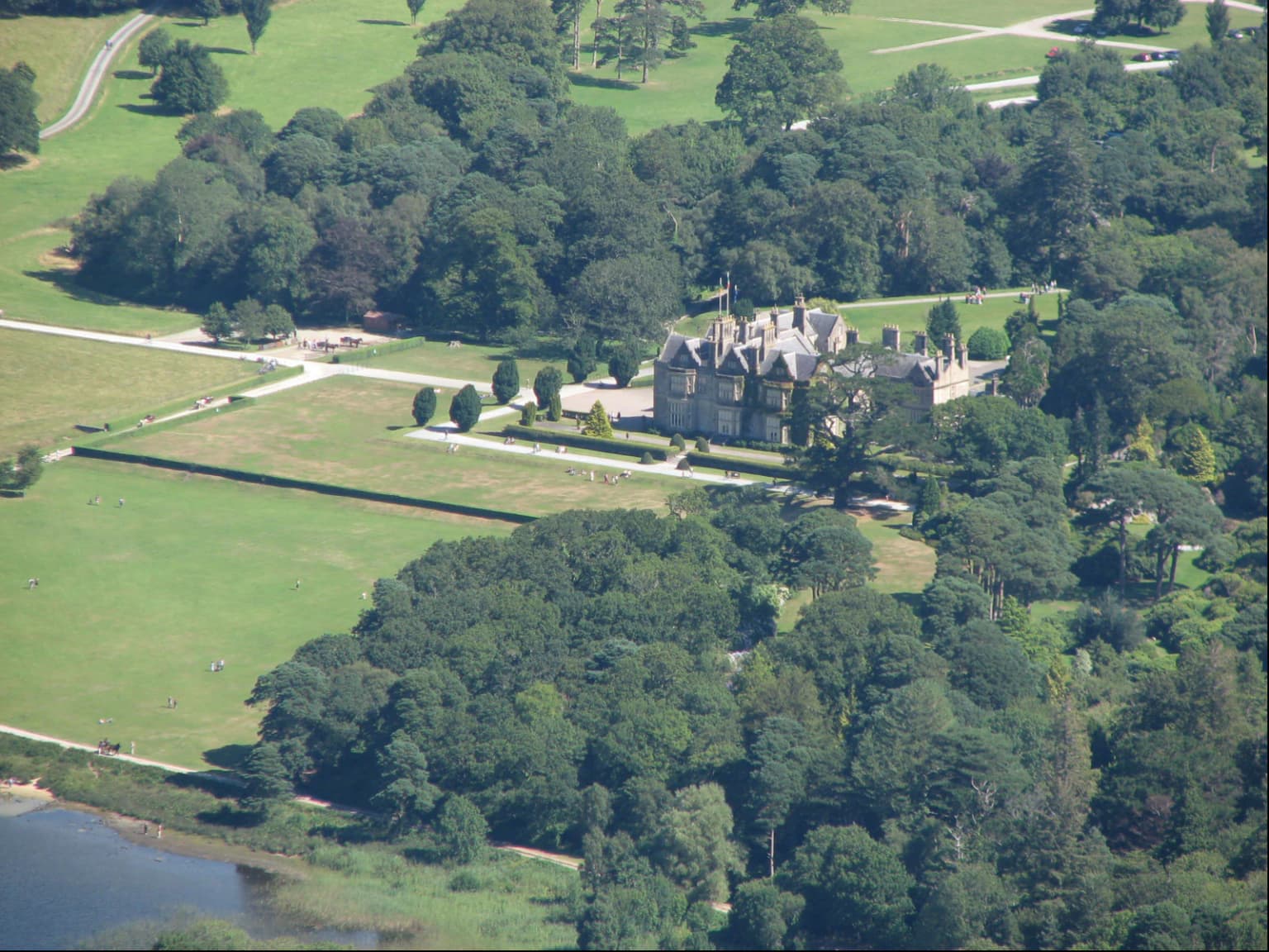
Following the Norman invasion, the land around the lakes passed to the McCarthys and O'Donoghues, with Ross Castle, a 15th-century tower house on Lough Leane's shore, remaining as a significant historical structure. During the 17th and 18th centuries, the woodlands suffered extensive exploitation for local industries including charcoal production, cooperage, and tanning. The iron industry's demand for charcoal caused significant oakwood destruction in the 18th century. The Herbert family acquired the Muckross Peninsula in 1770 and constructed Muckross House, completed in 1843, which remains a major visitor attraction today.

In 1910, American William Bowers Bourn purchased the Muckross Estate as a wedding gift for his daughter Maud. Following her death in 1929, her husband Arthur Vincent and her parents donated the estate to the Irish state in 1932. The Bourn Vincent Memorial Park Act established the national park, initially operating primarily as a working farm. Major expansion occurred around 1970 when the park was re-designated to correspond with IUCN Category II standards, adding approximately 60 square kilometers including the three lakes, Knockreer Estate, Ross Island, and additional townlands, more than doubling the park's original size.

Killarney National Park landscape and geographic character

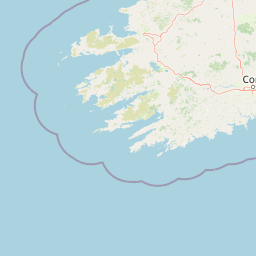
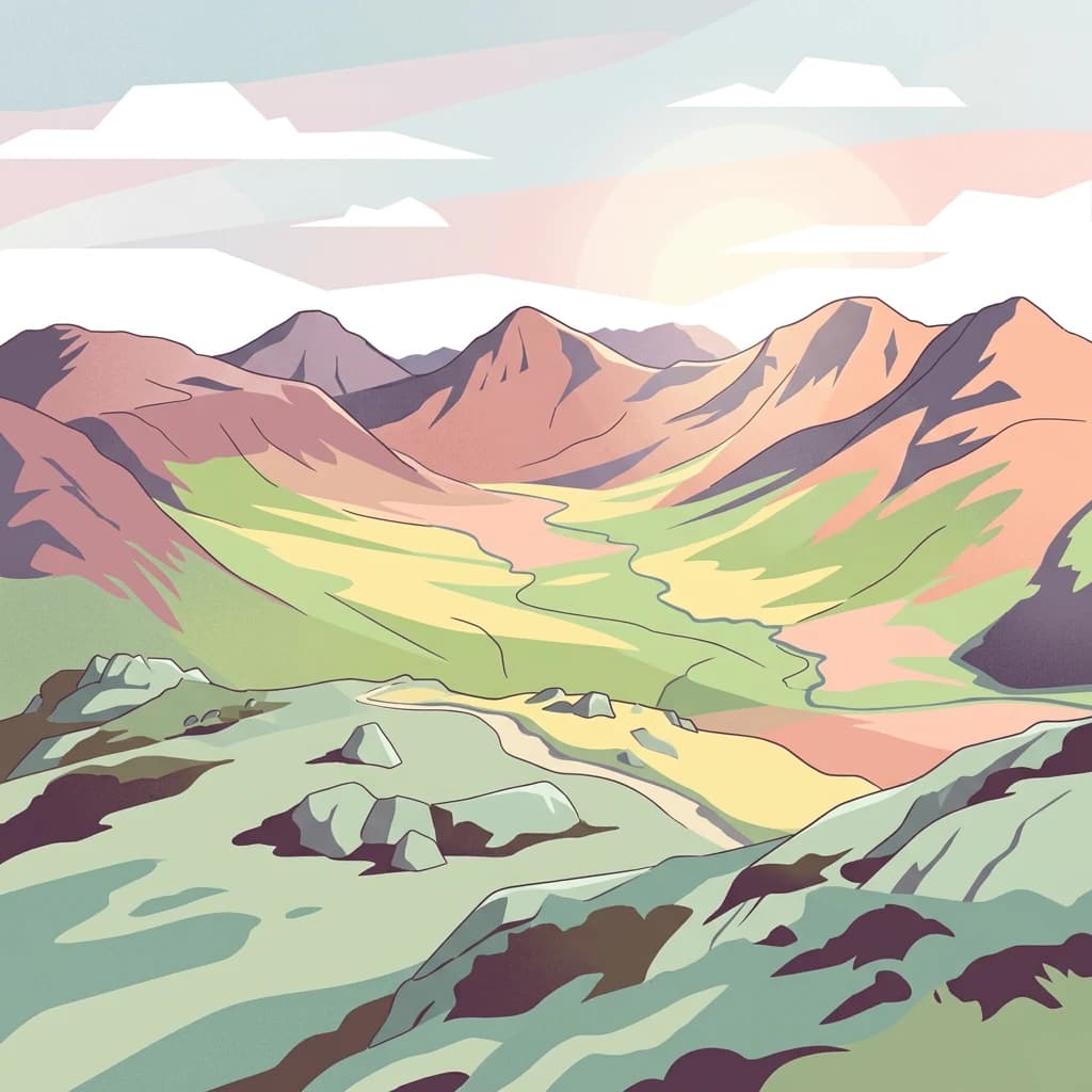
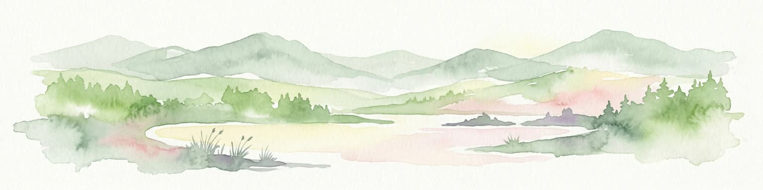
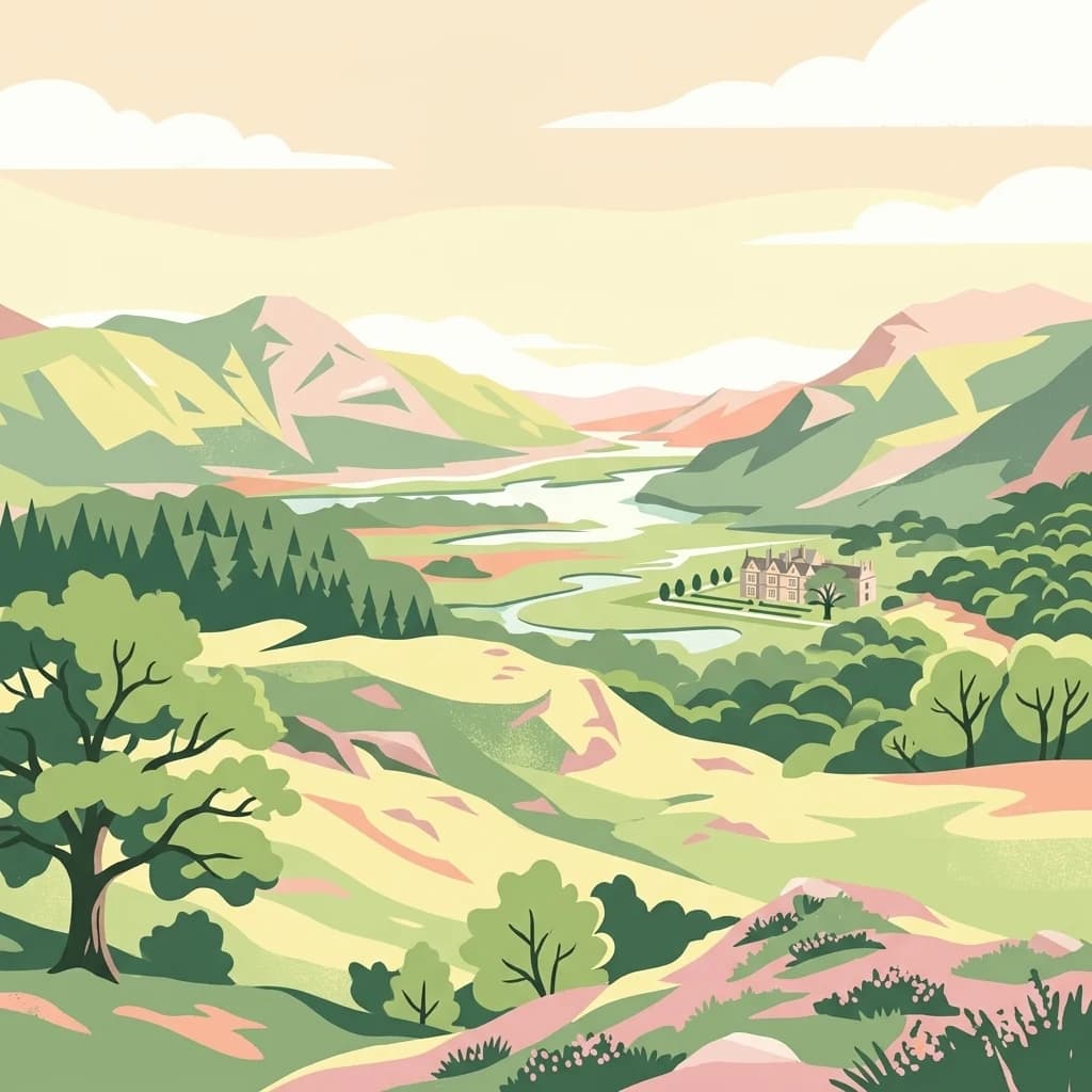
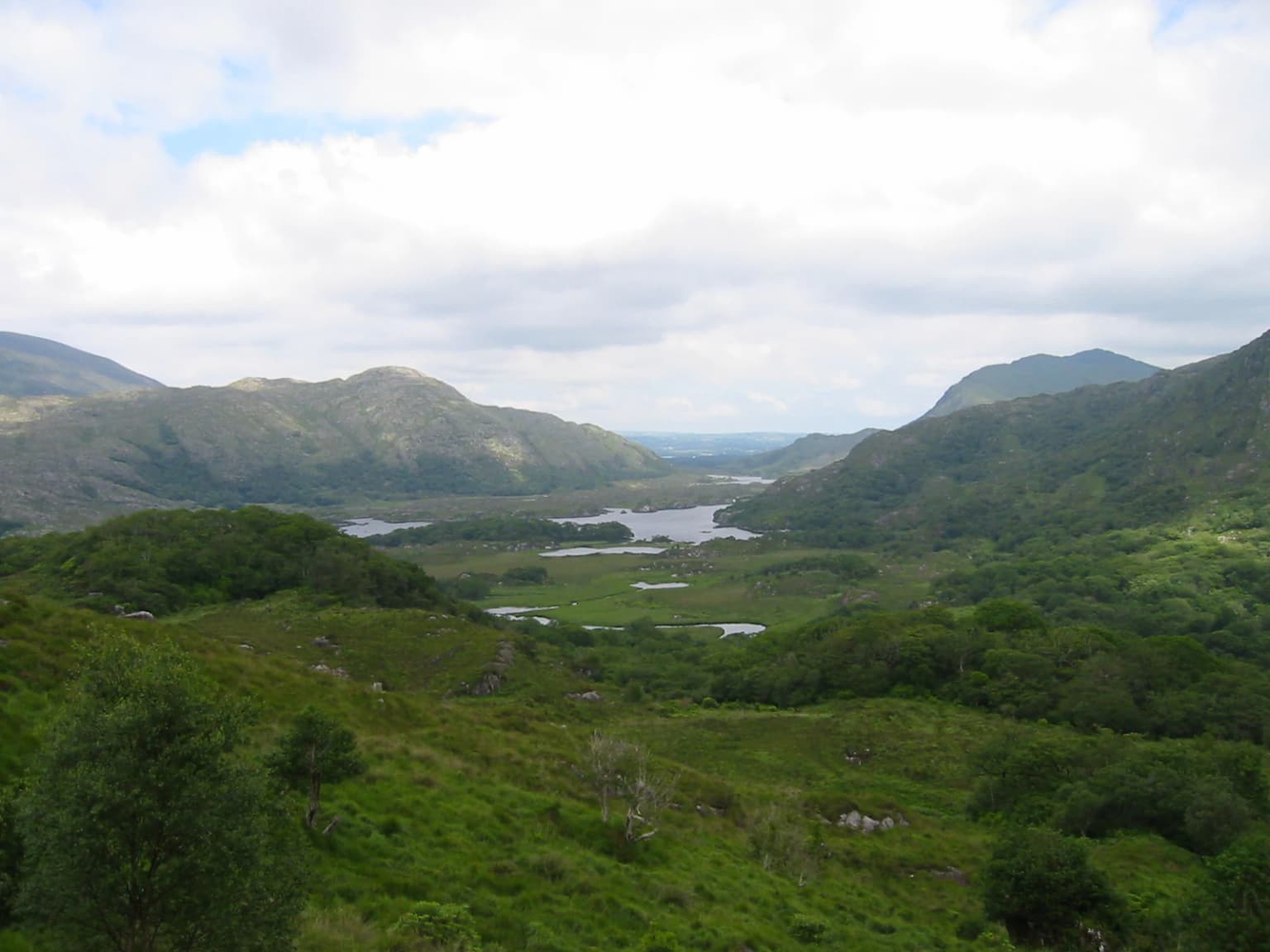
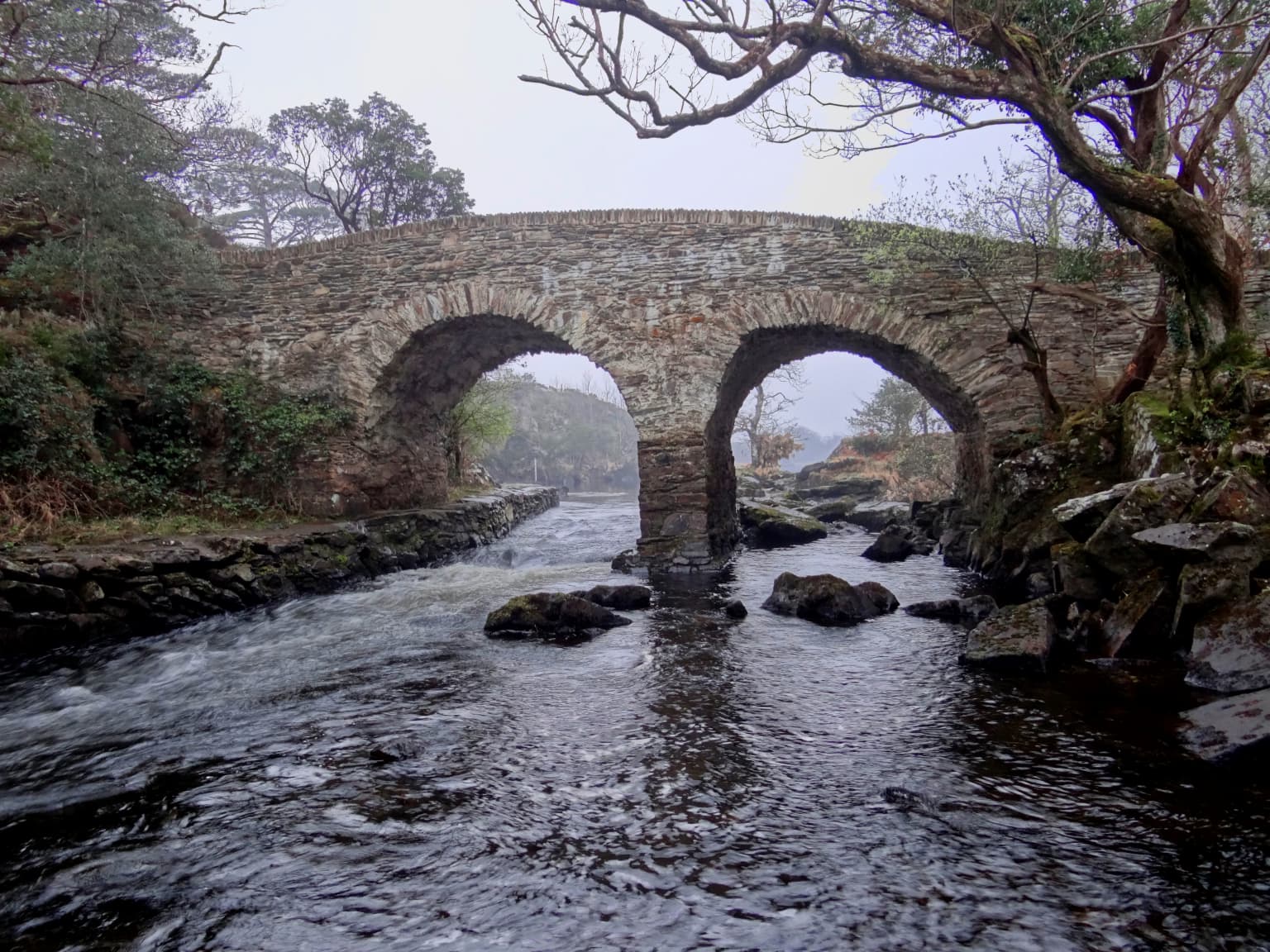
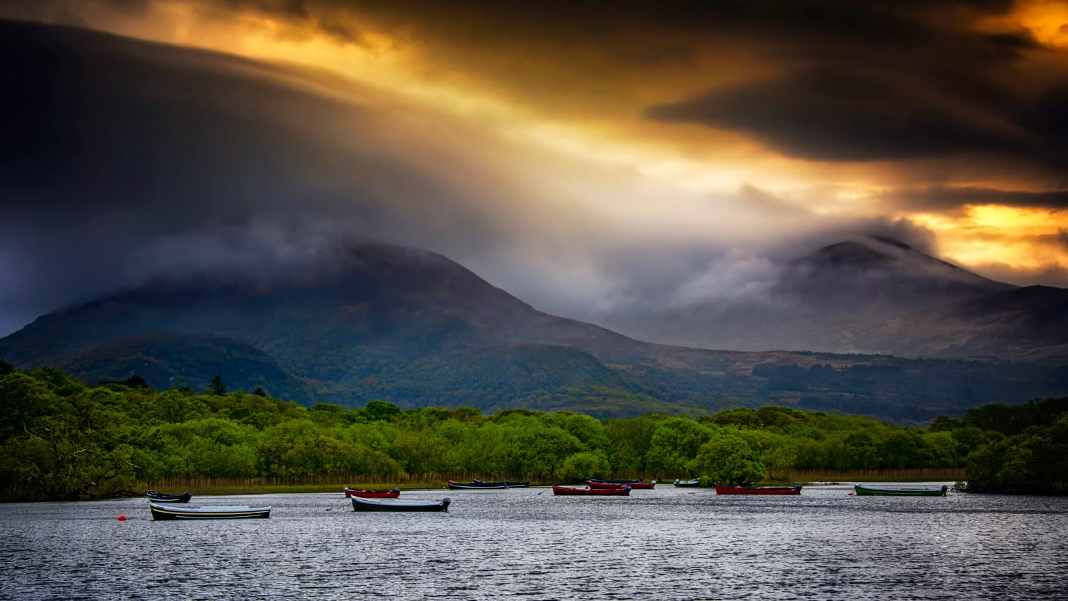
The park's dramatic landscape centers on the three Lakes of Killarney, the interconnected aquatic system that forms nearly a quarter of the park's area. Lough Leane is the largest at approximately 19 square kilometers and contains over thirty islands, including the historically significant Inisfallen. Muckross Lake is the deepest of the three, reaching 73.5 meters where Torc Mountain descends steeply into the water. The Upper Lake, the smallest, lies in rugged mountain scenery accessed through the narrow Long Range channel at the Meeting of the Waters.

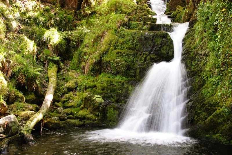
The surrounding terrain rises through the Shehy, Purple, Torc, and Mangerton mountains, with altitudes ranging from 22 meters along the lake shores to 842 meters at the peaks. A significant geological boundary between Devonian Old Red Sandstone and Carboniferous limestone traverses the park, with sandstone dominating most areas while limestone pavements occur on the low eastern shore of Lough Leane. Above 200 meters, the sandstone mountains are virtually treeless, covered in blanket bog and wet heath with characteristic outcropping rock, cliffs, and crags. Wet woodlands border the lake floodplains, particularly along Lough Leane's edges.

Killarney National Park ecosystems, habitats, and plant life

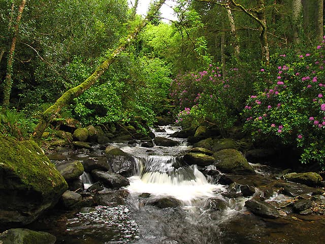
The park supports Ireland's most extensive area of semi-natural native woodland, approximately 120 square kilometers, with three principal woodland types of different ecological character. The acidophilous oak woodland grows on Devonian sandstone slopes, the moss-rich yew woodland occupies Carboniferous limestone outcrops, and wet woodland dominated by alder occurs on low-lying swampy limestone soils along the lake edges. The oak and yew woodlands are of international importance and hold Annex I status under the EU Habitats Directive.

The oak woodlands, approximately 12.2 square kilometers in extent, are Ireland's largest remaining native oak forest and a remnant of the woodland that once covered much of the country. Located on the lower slopes of the Shehy and Purple mountains adjacent to Lough Leane, these woods are dominated by sessile oak and support exceptional bryophyte communities considered the finest Atlantic example in Europe. Rare mosses, liverworts, and filmy ferns thrive in the humid oceanic climate, with many species growing as epiphytes on tree trunks and branches. The yew woodland at Reenadinna, approximately 0.25 square kilometers, is one of just three pure yew woodlands in Europe and the only significant area in Ireland or Britain.

The yew woodland developed 3,000-5,000 years ago on karst limestone pavement between Muckross Lake and Lough Leane on the Muckross Peninsula. The yew has created a dense canopy 6-14 meters high that excludes most other plant life, allowing only bryophytes to thrive in the humid conditions. Above 200 meters, blanket bog and wet heath dominate with characteristic vegetation including heather, bell heather, western gorse, and bilberry. The lakes represent distinct ecosystems, with Lough Leane being eutrophic and nutrient-rich while Muckross Lake and the Upper Lake are oligotrophic with acidic, nutrient-poor waters supporting specialized aquatic vegetation including quillwort, shoreweed, and water lobelia.

Killarney National Park wildlife and species highlights

Killarney National Park supports exceptional wildlife populations, most notably Ireland's only remaining wild herd of native red deer, approximately 900 individuals descended from animals present since the post-glacial period around 4,000 years ago. These deer inhabit the upland areas, particularly on Mangerton and Torc mountains, and receive full legal protection. Sika deer, introduced from Japan in 1865, now number around 1,000 and roam both upland and woodland areas, posing potential threats to native red deer genetics through possible interbreeding.

The park contains most of Ireland's native mammal species, including pine marten, red fox, badger, red squirrel, and hedgehog, as well as the introduced bank vole and American mink. The avian population is exceptionally diverse with 141 bird species recorded, including several rare in Ireland such as redstart, wood warbler, and garden warbler in the woodlands. Upland areas support red grouse and ring ouzel, both on the IUCN Red List of species of high conservation concern, while the chough, nightjar, and osprey are regularly observed. The park hosts wintering birds including Greenland white-fronted geese, with a small flock migrating to the boglands each year.

The Lakes of Killarney support brown trout and salmon, with rare species including Arctic char, a relict species left behind after the last Ice Age now at the southern edge of its range, and the unique Killarney shad, a land-locked subspecies found nowhere else in the world. Invertebrates of note include the Kerry slug, a hiberno-lusitanean species that reputedly can roll into a ball, and the northern emerald dragonfly, Ireland's rarest, confined to the park's bogs. A white-tailed eagle reintroduction program began in 2007, with birds now tracking to other parts of Ireland.

Killarney National Park conservation status and protection priorities

Killarney National Park holds significant conservation designations at both national and European levels. Its UNESCO Biosphere Reserve status since 1981 recognizes the international importance of its habitats and species. The park forms part of a Special Area of Conservation and Special Protection Area under European environmental directives, with the oak and yew woodlands holding Annex I habitat protection. The native red deer herd receives high priority for genetic purity maintenance, and several species including the Killarney shad and Kerry slug are listed under the EU Habitats Directive.

The park faces several significant conservation challenges. The common rhododendron, introduced during the 19th century, has become the greatest threat, now infesting over 6.5 square kilometers and preventing native woodland regeneration through ground shading. A rhododendron removal program is underway, though reinvasion continues. Sika deer overgrazing damages woodland floors and hinders tree regeneration while posing potential genetic threats to the native red deer. Eutrophication from agricultural and domestic pollution has affected Lough Leane, though water quality has improved since phosphates were removed from sewage in 1985. Fire remains a risk despite the wet climate, with significant damage occurring in April 2021.

Killarney National Park cultural meaning and human context

The Killarney area has been inhabited since the Bronze Age, with archaeological evidence of copper mining on Ross Island approximately 4,000 years ago indicating the area's importance to early peoples. The early Christian period left a rich legacy, most notably Inisfallen Abbey founded in the 7th century by St. Finian the Leper. The monastery was occupied until the 14th century and is renowned for the Annals of Inisfallen, a critical source for early Irish history composed there between the 11th and 13th centuries. The monks are thought to have given rise to the name Lough Leane, meaning Lake of Learning.

Muckross Abbey, founded in 1448, became the burial place of local chieftains, and in the 17th and 18th centuries it was the final resting place of notable Kerry poets including Aogán Ó Rathaille and Eoghan Rua Ó Súilleabháin. Ross Castle, a 15th-century tower house on Lough Leane's shore, was once the residence of the O'Donoghue Mór chieftain. The park contains a well-preserved stone circle at Lissivigeen and other archaeological features dating from various periods of human occupation.

Top sights and standout views in Killarney National Park

Killarney National Park offers exceptional diversity of landscapes and attractions within a relatively compact area. The three Lakes of Killarney, with their islands, mountain backdrops, and interconnected channels, provide the park's iconic scenery. Visitors can explore Muckross House, a Victorian mansion drawing over 250,000 visitors annually, with its famous gardens featuring extensive rhododendron collections. The ancient woodlands, particularly Derrycunihy Wood and the Reenadinna yew woodland, offer atmospheric walks through Ireland's finest remaining forests. Historical sites including Muckross Abbey, Ross Castle, and Inisfallen Island connect visitors to centuries of Irish history. The native red deer herd provides opportunities for wildlife observation in their natural mountain habitat.

Best time to visit Killarney National Park

Killarney National Park is open year-round and offers distinct experiences across seasons. The oceanic climate ensures the landscape remains green throughout the year, though visitors should be prepared for changeable weather and regular rainfall regardless of season. Spring and early summer bring active wildlife behavior, with deer calving in June and migrant birds arriving. The summer months, while popular, offer longer daylight hours for exploring the extensive trail network. Autumn provides colored foliage in the woodlands and the annual salmon run on the lakes. Winter, though quieter, offers the chance to see red deer more easily in the uplands as they move to lower elevations, though conditions on higher ground may be challenging. The park's popularity means peak seasons can be busy, particularly around the Lakes of Killarney and at major attractions like Muckross House.

Park location guide

Geography guide, regional context, and park location map for Killarney National Park

Killarney National Park park geography, regions, and map view in Ireland
Understand where Killarney National Park sits in Ireland through a broader geographic reading of the surrounding landscape, nearby location context, and its mapped position within the national park landscape.

How Killarney National Park fits into Ireland

Ireland is an island in the North Atlantic, geologically part of the British Isles. Politically, the island is split between the Republic of Ireland (a sovereign state and EU member) and Northern Ireland (part of the UK). The island has a population of approximately 7.2 million people and is known for its lush landscape, Celtic heritage, and literary culture.

Wider geography shaping Killarney National Park in Ireland

Ireland is an island in the North Atlantic Ocean, separated from Great Britain to the east by the North Channel, Irish Sea, and St George's Channel. The island forms part of the British Isles archipelago. The terrain consists of low-lying mountains surrounding a central plain, with the highest point being Carrauntoohil at 1,041 metres. The coastline stretches approximately 7,527 kilometres with numerous inlets and bays.

Map view of Killarney National Park

Use this park location map to pinpoint Killarney National Park in Ireland, understand its exact geographic position, and read its mapped placement within the surrounding landscape more clearly.

Pigeon | © OpenStreetMap contributors

Location context for Killarney National Park

County Kerry
Park atlas

Trace the geographic spread of Ireland's protected landscapes and compare their unique conservation features.

Explore Other National Parks and Protected Areas Near Killarney National Park, Ireland
Continue your exploration of Ireland's conservation areas by comparing national parks and protected landscapes adjacent to Killarney National Park. Trace the regional spread of diverse Atlantic ecosystems, ancient woodlands, and mountain-lake terrain, understanding their geographic context and conservation value.
National parkCounty Clare

Burren National Park: National Park in County Clare, Ireland

Explore protected landscape and mapped geography.

Burren National Park is a designated national park located in County Clare, Ireland. This MoriAtlas page provides detailed insights into its protected landscape character, its unique karst terrain, and its specific geographic boundaries. Understand how this protected area fits within the broader context of County Clare's Atlantic coast geography, enabling structured atlas-style exploration of its natural significance.

Area
15 km²
Established
1991
IUCN
II
Relief
Mountain
Stylized illustration of mountainous landscape with colorful terrain, valley, and winding path under a partly cloudy sky
National parkCounty Galway

Connemara National Park: A Mapped Protected Landscape in County Galway

Explore national park geography and protected terrain details.

Delve into Connemara National Park, a distinct national park located in the western region of County Galway, Ireland. This entry serves as a gateway to understanding its protected landscape, mapped boundaries, and its role within the broader geographic context of Connacht. Explore how this protected area contributes to the diverse natural terrain of Ireland, viewed through an atlas-driven discovery lens.

Area
20 km²
Established
1980
IUCN
II
Relief
Mountain
Watercolor illustration of a coastal landscape with green fields and distant mountains.
National parkCounty Kerry

Páirc Náisiúnta na Mara National Park: Protected Landscape Atlas for County Kerry

Explore mapped protected areas and regional geography.

This entry details Páirc Náisiúnta na Mara National Park, offering insights into its protected landscape character and geographic setting within County Kerry. As a significant protected area, it contributes to the atlas of Southwest Ireland, providing context for its natural terrain and mapped boundaries. Discover the park's unique identity and its position within the broader regional geography for structured exploration.

Area
280 km²
Established
2024
Relief
Mixed relief
Climate
Temperate
National parkCounty Mayo

Wild Nephin National Park: Ireland's Protected Landscape in County Mayo

National Park with regional geographic context.

Explore Wild Nephin National Park, a significant protected area situated in County Mayo, Ireland. This entry focuses on the park's mapped boundaries and its unique natural terrain, offering a clear geographic perspective. Understand how this national park contributes to the diverse landscapes of western Ireland and serves as a key point for atlas-based discovery of protected lands.

Area
150 km²
Established
1998
IUCN
II
Climate
Temperate
Watercolor illustration of a landscape with mountains, a lake, and trees
National parkCounty Wicklow

Wicklow Mountains National Park: Protected Landscape and Geographic Atlas Mapping

Explore County Wicklow's mapped natural terrain and park boundaries.

Understand the geographic scope and protected landscape identity of Wicklow Mountains National Park. This page offers detailed information on its mapped boundaries and its context within County Wicklow, providing a foundation for atlas-based discovery of Ireland's natural areas. Explore how this national park contributes to the region's mapped geography and conservation landscapes.

Area
205 km²
Established
1991
IUCN
II
Relief
Mountain
National parkPembrokeshire

Pembrokeshire Coast National Park: Mapped Coastal Boundaries and Protected Landscape Atlas

Explore unique seaside terrain and regional geography.

Delve into the Pembrokeshire Coast National Park, a premier protected landscape recognized for its extraordinary coastal formations and diverse natural terrain. This atlas entry details the park's distinct mapped boundaries, from its iconic limestone cliffs and sea stacks to its sheltered estuaries and inland Preseli Hills. Understand how this significant national park contributes to the protected area map of Pembrokeshire and offers unparalleled opportunities for geographic discovery along the Welsh coast.

Area
629 km²
Established
1952
IUCN
V
Relief
Mixed relief
National parkCounty Donegal

Glenveagh National Park: A Protected Landscape in the Heart of County Donegal

Mapped geography and natural terrain for Ireland's national park.

Delve into the geographic specifics of Glenveagh National Park, a protected area situated in County Donegal. This section provides detailed information on its mapped boundaries and regional landscape context. Understand how this national park fits within the natural geography of Ulster, offering a structured atlas view for detailed exploration of its unique terrain and protected status.

Area
169.58 km²
Established
1986
IUCN
II
Relief
Mixed relief
National parkWales

Snowdonia National Park: Protected Landscape and Map Exploration in North Wales

Mountain terrain, glacial lakes, and regional geography.

Snowdonia National Park offers a profound exploration of mountainous protected landscapes in North Wales. This page details the park's mapped boundaries, revealing a terrain shaped by glaciation, featuring dramatic peaks like Snowdon, steep valleys, and pristine glacial lakes. Understand its geographic identity within the United Kingdom and how its protected status contributes to the regional landscape context, providing a unique focus for atlas-based discovery.

Area
2,142 km²
Established
1951
Relief
Mountain
Climate
Temperate

Common questions about visiting, size, designation, and location context for Killarney National Park

Killarney National Park FAQs for park facts, access, geography, and protected area context
Find quick answers about Killarney National Park, including protected-area facts, park geography, trail and visitor context, and how the park fits into its surrounding country and regional landscape.
MoriAtlas Explorer

Continue Your Protected Areas Search Across the Global Atlas

Deepen your exploration by continuing the structured search for national parks and protected areas worldwide. Utilize the comprehensive filtering capabilities to compare different conservation landscapes and refine your understanding of global park geography. Discover more about the distribution and characteristics of protected natural areas.

Global natural geography
Killarney National Park: Protected Area Atlas & Map Exploration | MoriAtlas