Mori Atlas logo
National parkKoygorodskiy National Park

Mapping the boreal forests and river corridors of this essential Russian protected area

Koygorodskiy National Park: A Protected Taiga and River Landscape in the Southern Komi Republic

(National Park "Koygorodskiy")

Koygorodskiy National Park spans 56,700 hectares of the southern Komi Republic, serving as a critical conservation site for the transition zone where dense taiga meets mixed forest. The terrain features rolling lowland woodlands and intricate river valley systems, including the Letka River, which define the park's biological character. This territory is recognized for high vascular plant diversity and its role in protecting essential habitat for rare species within the East European boreal forest zone.

taiga forestsouthern Komiboreal forestmixed woodlandriver valleysprotected forest

Koygorodskiy National Park

National park

Park overview

Structured park overview, official facts, and landscape profile for Koygorodskiy National Park

Koygorodskiy National Park park facts, protected area profile, and essential visitor context

Review the core facts for Koygorodskiy National Park, including designation, size, terrain, visitor scale, habitats, and operating context in one park-focused overview.

About Koygorodskiy National Park

Koygorodskiy National Park occupies a substantial forested territory in the southern Republic of Komi, a Russian region usually associated more broadly with the great boreal wilderness of the European North. The park stretches across the Koygorodsky and Priluzsky administrative districts, an area shaped by long stands of coniferous and mixed taiga forest traversed by river valleys that mark out the region's hydrology. As a category II protected area under IUCN classification, it is part of Russia's national system of nature reserves, with its existence oriented toward preserving the natural character of the region against the pressures of forestry, land conversion, and local resource use.

The territory falls within a part of Komi where climate, soils, and forest composition differ from the harsher northern expanses further inside the republic. This southern position gives the park a transitional character: classic taiga elements such as spruce, pine, and birch mingle with patches of broadleaf vegetation, and the river systems that cross the landscape create a network of riparian habitats. The Letka River, visible in images from the Slobodskoy district of the neighboring Kirov Oblast and referenced in relation to the broader watershed mosaic, hints at the kind of hydrological networks the park's ecosystems depend upon.

Compared to more famous and longer-established Komi protected areas, Koygorodskiy is a young reserve, having been formally created in late 2019. Its youth is offset by the fact that it protects a region whose biodiversity had not previously been guaranteed under national park status. The combination of dense plant species records, including several Red Book species, and a varied fauna, gives the park tangible ecological weight despite its recent designation. For visitors, researchers, and conservation planners, the park adds a southern anchor to Komi's network of protected landscapes, balancing the more remote northern reserves with a more accessible, populated southern setting.

Quick facts and research context for Koygorodskiy National Park

Koygorodskiy National Park lies in the southern Republic of Komi in northwestern Russia and was officially established in December 2019 as a category II nationally protected area under the IUCN framework. It occupies approximately 56,700 hectares across the Koygorodsky and Priluzsky administrative districts, covering a substantial block of taiga and transitional forest terrain.

The park protects around 420 vascular plant species, of which a notable share are rare or endangered and listed in the Red Books of Russia and the Republic of Komi. Its animal life includes around 51 mammal species, 118 bird species, 13 fish species, and more than 300 insect species, with over 20 of these classified as Red Book entries of conservation concern.

Protection and recognition

Documented terrestrial protection scope and international recognition data

Koygorodskiy National Park Protection Status and Designation History

Koygorodskiy National Park holds a documented terrestrial protection status established in the year 2019. Structured administrative records outline the official designation history and management scope for this conservation area.

Protection details

Protection scope
Terrestrial
Designated year
2019
Transboundary protection
No
Park context

Deeper park guide and search-rich context for Koygorodskiy National Park

Koygorodskiy National Park history, landscape, wildlife, and travel context

Explore Koygorodskiy National Park through its history, landscape character, ecosystems, wildlife, conservation priorities, cultural context, and seasonal travel timing in a structured park guide built for atlas discovery and search intent.

Why Koygorodskiy National Park stands out

Koygorodskiy National Park is especially known for its rich vascular plant diversity in the southern Komi taiga, including the presence of several rare orchid and grass species listed in Russian and regional Red Books. It is also increasingly recognized for the combination of taiga forest habitats and river valley ecosystems that support a varied mammal, bird, and invertebrate assemblage in the southern part of the republic. The reserve's relatively recent creation in 2019 highlights its role as a strategic conservation addition aimed at protecting taiga biodiversity in a transitional boreal zone, where southern forest communities meet the broader northern Komi wilderness.

Koygorodskiy National Park history and protected-area timeline

Koygorodskiy National Park was established relatively recently, on December 7, 2019, as part of the Russian Federation's ongoing expansion of its national park network. Its creation was driven by the goal of conserving the unique biological diversity of the southern Republic of Komi, an area that had historically been shaped by forestry and rural land use rather than formal conservation protection.

The park's founding reflects a federal decision to anchor biodiversity conservation in this particular part of Komi, which had not previously been covered by a national park designation. By setting the territory apart as a category II protected area under the IUCN classification, the establishment formalized safeguards over woodland, river, and wetland habitats, as well as the rare plant and animal communities they support.

Because the park is still in its first years of operation, its institutional history is closely tied to early-stage management planning, ecological monitoring, and the gradual development of visitor infrastructure under the park's official portal. Its youth means that much of its longer historical significance lies ahead, but its already documented species richness underscores the conservation rationale behind its creation.

Koygorodskiy National Park landscape and geographic character

The landscape of Koygorodskiy National Park is dominated by the forested terrain typical of the southern Komi Republic, where vast tracts of taiga and mixed woodland stretch across gently undulating terrain. Coniferous species such as spruce and pine, alongside birch and other broadleaf trees, define the canopy, creating a dense, continuous forest cover that extends across much of the park's expanse. The terrain belongs to the broader East European taiga zone and lacks dramatic alpine features, instead offering rolling lowland and hill landscapes defined by forest types and hydrology.

River valleys are among the most defining elements of the park's physical geography. The Letka River and related tributaries form part of the regional drainage mosaic the park connects with, carving lowland corridors through the forest and shaping floodplain habitats along their banks. These valleys introduce micro-relief into the otherwise uniform forested topography, supporting distinctive wet forest, meadow, and riverbank vegetation communities.

The setting is also shaped by its proximity to the Kirov Oblast border, with areas like the Slobodskoy district across the regional boundary forming part of the wider geographic context. This continuous forest and river landscape, interrupted by small human settlements and traditional rural land, defines the broader scenic context of Koygorodskiy National Park and gives the territory its characteristic southern Komi character.

Koygorodskiy National Park ecosystems, habitats, and plant life

Koygorodskiy National Park protects a rich complex of taiga and mixed-forest habitats characteristic of the southern Republic of Komi. The dominant vegetation is boreal forest, with coniferous cover of spruce and pine interwoven with stands of birch and patches of broadleaf species, including small-leaved linden. This mix creates a structural and ecological gradient in the forest, ranging from dense coniferous stands to lighter mixed woodlands and forest edges that host a richer understory of herbs, mosses, and grasses.

Koygorodskiy National Park conservation status and protection priorities

Koygorodskiy National Park was created in 2019 specifically to safeguard the unique biological diversity of the southern Komi Republic, which had previously lacked formal national-level protection. The park's overarching conservation role is to preserve intact taiga and mixed-forest habitats together with their associated species assemblages in a region otherwise subject to forestry and rural land use. Its IUCN category II designation situates it within Russia's system of strictly protected landscapes aimed at maintaining natural ecological processes and species populations.

A central element of the park's conservation significance lies in its botanical richness, particularly the presence of rare and endangered vascular plant species that appear in the Red Books of Russia and the Republic of Komi. Species such as the Baltic orchid, Traunsteiner's orchid, small-leaved linden, broad-leaved cinna, and scattered meadow grass provide concrete evidence of the park's role in maintaining regionally important plant genetic resources and relict habitats at the southern edge of Komi.

The park also contributes to animal conservation by protecting habitats for more than twenty Red Book species, including the European honey buzzard, Siberian salamander, great grey shrike, Ural owl, and the common bullhead. Its combination of forest, river, and transitional ecosystems gives it a meaningful role in the broader network of Russian protected areas, ensuring that an ecologically significant southern Komi landscape remains available for long-term biodiversity maintenance and ecological research.

Top sights and standout views in Koygorodskiy National Park

Koygorodskiy National Park stands out as a young but ecologically substantial protected area in the southern Komi Republic, notable for its convergence of taiga forest, river valleys, and rare plant species. Its record of roughly 420 vascular plant species, including several Red Book entries, places the park among the botanically rich reserves of the region. The presence of more than twenty protected animal species adds a strong faunal dimension to its profile.

The park's geographic setting in the Koygorodsky and Priluzsky districts links it to an active rural and forest landscape, contrasting with more remote Komi reserves further north. This combination of accessibility, transitional southern taiga, and formal protection since 2019 gives the park a distinctive role as both a conservation site and a regional natural landmark.

Monthly climate preview

Long term temperature and precipitation records across representative park coordinates

Koygorodskiy National Park Climate Normals and Monthly Weather Statistics

Historical averages for Koygorodskiy National Park document a broad annual temperature spread alongside measured monthly precipitation variations from representative coordinate sampling. Detailed analysis of the complete twelve month climatology reveals precise thermal shifts and precipitation rhythms across the protected landscape.
Annual mean1 °C
-15 °C17 °C
Jan-15°
Feb-14°
Mar-7°
Apr
May
Jun14°
Jul17°
Aug14°
Sep
Oct
Nov-8°
Dec-13°
Warmest month
July

17.1 °C

Coolest month
January

-15.3 °C

Wettest month
June

3.5 mm/day

Driest month
February

1.4 mm/day

Park location guide

Geography guide, regional context, and park location map for Koygorodskiy National Park

Koygorodskiy National Park park geography, regions, and map view in Russia

Understand where Koygorodskiy National Park sits in Russia through a broader geographic reading of the surrounding landscape, nearby location context, and its mapped position within the national park landscape.

How Koygorodskiy National Park fits into Russia

Russia is a transcontinental nation spanning eleven time zones, bordered by fourteen countries. It is the world's largest country by area, covering 17,098,246 km². Moscow is the capital and largest city, while Saint Petersburg is the second-largest and a major cultural centre.

Wider geography shaping Koygorodskiy National Park in Russia

Russia spans Eastern Europe and North Asia, covering 17,098,246 km². It shares land borders with fourteen countries, more than any other nation, and spans eleven time zones. The landscape includes vast plains, mountain ranges such as the Urals and Caucasus, and extensive coastlines along the Arctic Ocean, Pacific Ocean, Baltic Sea, Black Sea, and Caspian Sea.

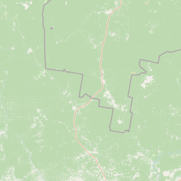
Map view of Koygorodskiy National Park

Use this park location map to pinpoint Koygorodskiy National Park in Russia, understand its exact geographic position, and read its mapped placement within the surrounding landscape more clearly.

Pigeon | © OpenStreetMap contributors

Location context for Koygorodskiy National Park

Komi Republic
Park atlas

Compare boreal taiga reserves and regional forest landscapes across the surrounding region

Other Parks Near Koygorodskiy National Park and Surrounding Protected Areas

Visitors exploring Koygorodskiy National Park can browse nearby national parks and protected areas sharing similar boreal taiga and river valley terrain. Expanding the geographic comparison reveals broader conservation patterns across the southern Republic of Komi and adjacent forest zones.
National parkKomi Republic
About 20 km away#1 closest

Southwest

Koygorodsky National Park: Protected Landscape Exploration and Regional Geography

Mapped boundaries and natural landscape context.

Gain a structured understanding of Koygorodsky National Park, a designated national park within the Komi Republic. This entry facilitates exploration of its protected landscape, mapped geographic features, and its role within the broader regional atlas. Focus on the park's identity as a distinct protected area and its contribution to understanding Russian natural geography through detailed, map-centric data.

Area
567 km²
Established
2019
IUCN
II
Relief
Lowland
A soft watercolor painting of a serene river landscape with green hills, purple trees, and a lone bare tree by the water's edge.
National parkUdmurtia
About 400 km away#2 closest

Southeast

Nechkinsky National Park: Protected Kama River Valley Geography and Landscape Atlas

Kama River valley protected areas and floodplain topography

Spanning the middle course of the Kama River and the Votkinsk Reservoir, Nechkinsky National Park protects a diverse mosaic of forest, wetland, and riverine habitats. The terrain features a sharp contrast between elevated forest slopes and flat alluvial floodplains, serving as a primary conservation landscape for the regional biodiversity of Udmurtia.

Area
207.52 km²
Established
1997
IUCN
II
Relief
Upland
A watercolor illustration showing a winding river flowing through a lush green landscape with rolling hills in the background.
National parkMari El
About 413 km away#3 closest

South

Mariy Chodra National Park: Regional Geography and Protected Forest Atlas

Mapped terrain, karst lake systems, and woodland corridors in Mari El

Deepen your understanding of Mariy Chodra National Park through its distinct geological and forest features. This overview examines the intersection of rolling upland blocks, sandy terrain, and the varied hydrology of the Ilet River drainage basin within the Volga region.

Area
366 km²
Established
1985
IUCN
II
Relief
Upland
Watercolor illustration of a winding river through a valley with rolling hills and sparse vegetation under a soft sky
National parkUdmurt Republic
About 418 km away#4 closest

Southeast

Nechkinsky National Park: Protected River Valleys and Wetlands in the Udmurt Republic of Russia

Geographic analysis of Kama River floodplains and forest-steppe terrain.

Nechkinsky National Park provides a critical study of river valley geography and protected ecosystems. Its unique terrain includes steep slopes; extensive floodplain terraces; and the coastal zones of the Votkinsk reservoir. This area serves as both a natural biological habitat for rare species and an important archaeological site preserving history from the Ananyino culture.

Area
208 km²
Established
1997
IUCN
II
Relief
Mixed relief
Watercolor illustration showing a lake, forested hills, and mountains in the background
National parkRussia
About 432 km away#5 closest

South

Mariy Chodra National Park: Geographic and Protected Area Mapping for Russian Forests

Regional forest landscapes and protected Russian terrain

Mariy Chodra National Park is an essential protected natural area located in Russia, distinguished by its forest-dominated ecosystems. This entry provides detailed geographic context and boundary information for those studying the distribution of protected landscapes across the Russian Federation.

IUCN
II
National parkNizhny Novgorod Oblast
About 473 km away#6 closest

Southwest

Nizhegorodskoe Povolzhie National Park: Geographic Boundaries and Protected Area Identity

Regional Russian park network spanning five distinct ecological clusters.

Spanning across nine districts in Nizhny Novgorod Oblast, this federal national park protects a vast array of natural environments within a single designation. From the dark coniferous stands of the Kilemarsky Taiga to the limestone sinkholes of Ichalkovsky Bor and the Volga river floodplains, the park offers a detailed look at the intersection of boreal and central Russian ecosystems.

Area
658.02 km²
Established
2024
Relief
Mixed relief
Climate
Temperate
Watercolor illustration showing a river flowing through a valley with trees and distant mountains
National parkTatarstan
About 475 km away#7 closest

South

Nizhnyaya Kama National Park: An Atlas of Protected Forests and Riverine Geography in Tatarstan

Examining boreal forest ecosystems along the Kama River corridor

Discover the geographic structure of Nizhnyaya Kama National Park, a protected region in Tatarstan featuring significant pine-dominated forests. This assessment details the park's isolated clusters, riverbank topography, and the ecological transition between elevated ravine systems and lowland wetlands within the Volga river basin.

Area
265.87 km²
Established
1991
IUCN
II
Relief
Lowland
Watercolor painting of a winding river flowing through a lush, green valley with forested hills in the distance.
National parkTatarstan
About 475 km away#8 closest

South

Nizhnyaya Kama National Park: Atlas of Tatarstan River Valley Landscapes

Examining protected forest and floodplain ecology

Nizhnyaya Kama National Park protects a significant portion of the lower Kama River valley, creating a sanctuary for diverse plant communities and wildlife. The landscape is marked by the interplay between aquatic habitats, expansive meadows, and dense upland forests, serving as a critical refuge within the industrial context of Tatarstan.

Area
266.01 km²
Established
1991
IUCN
II
Relief
Lowland

Common questions about visiting, size, designation, and location context for Koygorodskiy National Park

Koygorodskiy National Park FAQs for park facts, access, geography, and protected area context

Find quick answers about Koygorodskiy National Park, including protected-area facts, park geography, trail and visitor context, and how the park fits into its surrounding country and regional landscape.
MoriAtlas Explorer

Continue Your Protected Areas Search Across the Global Atlas

Deepen your exploration by continuing the structured search for national parks and protected areas worldwide. Utilize the comprehensive filtering capabilities to compare different conservation landscapes and refine your understanding of global park geography. Discover more about the distribution and characteristics of protected natural areas.

Global natural geography