
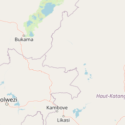
Streams
Park geography
Technical data on regional location, physical features, and landscape composition
Comprehensive Geographic Profile and Mapped Boundaries of Kundelungu National Park
The geographic profile of Kundelungu National Park covers an area of 7600 square kilometers within the Haut-Katanga Province. This dataset includes recorded perimeter measurements and a detailed look at the upland relief, savanna habitats, and river systems such as the Lufira and Lofoyi that shape the natural environment.
Related tags
savanna ecosystemwaterfallImportant Bird AreaCentral AfricaKatanga region
Central African savanna park protecting the region's highest waterfall
Kundelungu National Park
Kundelungu National Park is a vast protected area in the southeastern Democratic Republic of the Congo, situated in Haut-Katanga Province near the border with Zambia. Covering approximately 7,600 square kilometers, the park encompasses a sweeping landscape of grassy savanna and open steppes dotted with forest galleries along watercourses. Established in 1970, the park is managed by the Institut Congolais pour la Conservation de la Nature and holds IUCN Category II designation as a national park. The park's most remarkable feature is Lofoi Falls, a 340-meter waterfall ranking among the highest in Central Africa. This combination of dramatic terrain, diverse wildlife, and significant ecological designation makes Kundelungu an important conservation area within the Congo's protected area network.
- Location
- Democratic Republic of the Congo
- Park type
- National park
- Established
- 1970
- Area
- 7,600 km²
Location overview
Regional and national placement in the Democratic Republic of the Congo
Geographic Context and Location of Kundelungu National Park
Kundelungu National Park is located within Haut-Katanga Province in the Democratic Republic of the Congo. The protected reserve operates as a non-transboundary area within sovereign national borders.
- Countries
- Democratic Republic of the Congo
- Regions
- Haut-Katanga Province
- Primary location
- Haut-Katanga Province
Boundary and coordinates
Kundelungu National Park’s boundary spans 7,600 km²
Kundelungu National Park mapped boundary and 7,600 km² area
Kundelungu National Park’s mapped geometry spans a substantial recorded 7,600 km². It provides an atlas-level view of the park’s reach and placement without asserting legal-survey precision.
- Boundary area
- 8,420.7 km²
- Boundary perimeter
- 789.3 km
- Northernmost point
- 9.2479° S
- Southernmost point
- 11.098° S
- Easternmost point
- 28.0467° E
- Westernmost point
- 26.9555° E
- Geographic centre
- 10.1586° S, 27.437° E
- North–south span
- 204.6 km
- East–west span
- 119.6 km
Terrain and natural features
Upland terrain classifications and recorded within-boundary natural features
Kundelungu National Park Terrain and Named Natural Features
Upland terrain classifications define the regional landscape and upland character of the protected area. Linked feature cards supply names, types, measurements, and spatial relationships for recorded streams, rivers, waterfalls, and cliffs located within boundaries.
Selected named natural features
Rivers
Sangwe
Streams
Lutshipuka
Rivers
Disubwe
Waterfalls
Lofoi Falls
347 m high
Streams
Sangwe
Environmental setting
Interpreting tropical relief, seasonal water systems, and habitat types
Kundelungu National Park Environmental Classifications and Physical Setting
Recorded landscape features, tropical climate zones, and sparse forest covers combine to form complementary interpretations of the physical setting. Linked categories connect stored environmental data directly to relevant atlas destinations across the protected area.
- Relief
- Upland
- Climate
- Tropical
- Water
- Major water bodies
- Forest cover
- Sparse forest
- Seasonality
- Seasonal
Landscape features
Grassland · Steppe · Forest · Waterfalls
Habitat types
Savanna · Tropical forest
Park atlas
Trace the regional spread of diverse protected landscapes surrounding Kundelungu National Park.
Explore Nearby National Parks and Protected Areas Beyond Kundelungu National Park
Continue your exploration of Central African conservation by browsing national parks and protected areas geographically linked to Kundelungu National Park's unique savanna and waterfall landscapes. Gain a deeper understanding of the broader Katanga region's protected-area network, comparing diverse terrains and ecological significance within the Democratic Republic of the Congo.
National parkDemocratic Republic of the Congo
16 km away#1 closest
Northwest

Upemba National Park: Protected Landscape and Geographic Atlas within the Democratic Republic of the Congo
Explore its mapped boundaries and diverse ecosystems.
Upemba National Park, located in the Democratic Republic of the Congo, is a premier destination for understanding protected landscapes and regional geography. This national park is characterized by its extensive wetlands, lake ecosystems, and mountainous terrain, providing a rich environment for atlas-driven discovery. Its unique geographic context and diverse habitats make it a pivotal site for exploring central African protected areas and their ecological significance.
- Area
- 11,730 km²
- Established
- 1939
- IUCN
- II
- Relief
- Mixed relief
National parkLuapula Province
About 173 km away#2 closest
Northeast

Lusenga Plain National Park: Zambia National Park Geographic Atlas
Mapped park boundaries and regional landscape context.
Gain a structured understanding of Lusenga Plain National Park, a dedicated national park situated in Zambia's Luapula Province. This resource details the park's geographic dimensions and its placement within the regional landscape, providing essential context for atlas exploration and a mapped view of protected lands.
- Area
- 800 km²
- Established
- 1972
- IUCN
- II
- Relief
- Lowland
National parkNorthern Province
206 km away#3 closest
Northeast
Mweru Wantipa National Park: National Park in Northern Province, Zambia
Discover mapped boundaries and regional geography
Delve into Mweru Wantipa National Park, a protected national park located in Zambia's Northern Province. This entry provides detailed geographic context, focusing on the park's mapped boundaries and its role as a protected landscape. Understand its position within regional geography and explore its contribution to the broader atlas of natural areas.
- IUCN
- II
- Relief
- Lowland
- Climate
- Tropical
- Access
- Highly restricted
National parkNorthern Province
About 288 km away#4 closest
East
Isangano National Park: Exploring Its Protected Landscape and Geographic Identity in Northern Province
Discover the mapped boundaries and regional context of this national park.
Isangano National Park stands as a protected national park within the vast geographic expanse of Zambia's Northern Province. This dedicated entry provides critical context for understanding the park's role as a conservation landscape, detailing its physical geography and its position within regional atlas data. Explore the mapped outlines and natural terrain features that define Isangano National Park, offering a foundational view for broader geographic exploration and protected-area research.
- Area
- 840 km²
- Established
- 1972
- Relief
- Lowland
- Climate
- Tropical
National parkCentral Province
About 290 km away#5 closest
Southeast
Kasanka National Park: National Park, Central Province, Zambia - Atlas and Geography
Explore protected landscape boundaries and regional context
Kasanka National Park is a vital protected area situated in Zambia's Central Province. This entry provides detailed geographic context, focusing on its mapped boundaries and its significance as a national park within the larger atlas of protected lands. Users can explore the terrain and natural landscape characteristics that define this specific conservation area and its regional setting.
- Area
- 390 km²
- IUCN
- II
- Relief
- Lowland
- Scope
- Terrestrial
National parkZambia
296 km away#6 closest
Northeast
Nsumbu National Park: Zambia's Lakeside Protected Landscape, Map Atlas, and Geographic Context
Mapped terrain and unique shoreline geography.
Nsumbu National Park stands as a vital protected landscape in Zambia, defined by its prominent position on Lake Tanganyika. The park's approximately 2,026 square kilometers showcase a dramatic geographic interplay between terrestrial environments, including miombo woodlands and rare Itigi-Sumbu thicket, and the vast aquatic expanse of the lake. Users exploring this atlas entry will find detailed information on the park's mapped boundaries, distinctive shoreline features like rocky cliffs and sandy beaches, and its overall role in the regional geography of Southern Africa.
- Area
- 2,026 km²
- Established
- 1985
- IUCN
- II
- Relief
- Lowland
National parkMuchinga Province
About 339 km away#7 closest
Southeast
Lavushi Manda National Park: Zambian National Park with Mapped Protected Boundaries
Discover its regional geography and landscape context.
Lavushi Manda National Park represents a distinct protected landscape within Muchinga Province, Zambia. This page provides detailed insights into its geographic identity, mapped park boundaries, and its placement within the broader regional terrain. Utilize this resource for structured atlas exploration of the park's natural context and its significance as a conservation area, offering a foundation for understanding its environmental setting.
- Area
- 1,500 km²
- Established
- 1972
- IUCN
- II
- Relief
- Mixed relief
National parkZambia
About 376 km away#8 closest
Southwest
West Lunga National Park: Exploring Zambia's Sole Evergreen Forest Protected Area
Discover rare Cryptosepalum dry forests and unique mapped geography.
West Lunga National Park offers a distinct atlas exploration opportunity as Zambia's only national park primarily defined by its forest cover. This remote protected area safeguards the largest evergreen forest in Africa outside the equatorial zone, characterized by dense Cryptosepalum trees forming a closed canopy over sandy terrain. Understand the park's unique landscape, its geographic position within the region, and its importance as a conservation area with mapped protected boundaries.
- Area
- 1,700 km²
- IUCN
- II
- Relief
- Lowland
- Access
- Remote access
MoriAtlas Explorer
Continue Exploring Kundelungu National Park's Mapped Landscape and Regional Geography
Deepen your understanding of Kundelungu National Park by tracing its protected boundaries and examining its savanna terrain within Haut-Katanga Province. Discover how this significant national park fits into the broader geographic atlas of Central Africa and its conservation importance. MoriAtlas provides detailed geographic context for key protected areas, enabling a richer exploration of natural landscapes worldwide.
Browse next
Global natural geography
Explore related park routes
Explore MoriAtlas Global ParksBrowse All MoriAtlas ParksGlobal Park Map DiscoveryMoriAtlas: Browse All CountriesBrowse All MoriAtlas ContinentsNational Park Environment AtlasGrand Canyon National Park AtlasYellowstone National Park AtlasYosemite National Park Atlas and GeographySerengeti National Park AtlasGalápagos National Park Protected LandscapeBanff National Park Geography and AtlasKruger National Park Atlas EntryUluṟu-Kata Tjuṯa National Park AtlasExplore Uluru-Kata Tjuta National Park GeographyPlitvice Lakes National Park AtlasFiordland National Park Protected LandscapeGreat Smoky Mountains National Park AtlasAfghanistan National Parks and Protected AreasAlbania National Parks and Protected AreasAlgeria National Parks and Protected AreasAmerican Samoa National Parks and Protected AreasAndorra National Parks and Protected AreasAngola National Parks and Protected AreasAntarctica National Parks and Protected AreasAntigua and Barbuda Park List