
Mori Atlas logo
Wildlife reserveRéserve nationale de faune du lac-Saint-François

Explore this vital freshwater wetland complex; a protected wildlife reserve featuring riparian forests and St. Lawrence shoreline geography.

Mapping the Protected Landscapes of Réserve nationale de faune du lac-Saint-François in Southwestern Quebec

(Réserve nationale de faune du lac Saint-François)

The Réserve nationale de faune du lac-Saint-François protects a rare and critical freshwater wetland complex in southwestern Quebec. This wildlife reserve serves as an essential ecological refuge for migratory birds and waterfowl, set against a backdrop of cedar swamps, sugar maple forests, and St. Lawrence River shoreline. The mapped terrain reveals a mosaic of marshland and low ridges that provide high biodiversity in a region largely transformed by agriculture.

wetlandsmarshlandSt. Lawrence RiverRamsar sitemigratory birdswaterfowl refuge
A flat-style digital illustration of a marshy wetland with tall grasses, shrubs, and a winding waterway under a soft, sunset-colored sky.

Réserve nationale de faune du lac-Saint-François

Wildlife reserve

Park overview

Structured park overview, official facts, and landscape profile for Lac Saint-François National Wildlife Area

Lac Saint-François National Wildlife Area park facts, protected area profile, and essential visitor context

Review the core facts for Lac Saint-François National Wildlife Area, including designation, size, terrain, visitor scale, habitats, and operating context in one park-focused overview.

About Lac Saint-François National Wildlife Area

Lac Saint-François National Wildlife Area is a federally protected natural area in southwestern Quebec, established to conserve one of the most important wetland complexes remaining along the St. Lawrence River. It lies within the Le Haut-Saint-Laurent regional county municipality, entirely contained in the township of Dundee, and is positioned at the meeting point of Quebec, Ontario, and the United States, where Lac Saint-François, a widening of the St. Lawrence, provides the reserve's northern boundary.

The reserve safeguards a mosaic of aquatic and terrestrial habitats: open marshes, swamps, cedar swamps, sugar maple woodlands, streams, and stretches of shoreline along one of the great navigable rivers of North America. Despite the broader region having lost significant wetland area to drainage and agriculture over the past century, this protected tract retains an exceptional level of biodiversity, with hundreds of plant species and dozens of breeding, migrating, and resident animal species documented within its boundaries.

Lac Saint-François NWA holds recognition at national and international levels. It was designated as a National Wildlife Area in 1978 by Environment Canada's Canadian Wildlife Service, received Migratory Bird Sanctuary status, was classified as an Important Bird Area, and was inscribed as a Ramsar Wetland of International Importance in 1987. Together these designations reflect the reserve's significance for waterfowl conservation, migratory bird stewardship, and the long-term protection of riparian and wetland ecosystems in the heavily impacted St. Lawrence lowlands.

In addition to its conservation role, the reserve is a place of public engagement. Walking trails extend through many of its habitat types, and water-based activities such as canoeing and kayaking allow visitors to experience the wetland landscape from within. On-site services and programming are delivered by a local friends-of-the-reserve association, which has managed visitor activities and trail upkeep since 1993.

Quick facts and research context for Lac Saint-François National Wildlife Area

Lac Saint-François National Wildlife Area is located in the Le Haut-Saint-Laurent regional county municipality, entirely within the township of Dundee, Quebec. It lies roughly 50 kilometers southwest of Salaberry-de-Valleyfield and is bordered to the north by Lac Saint-François, a broadening of the St. Lawrence River.

Established in 1978 under the administration of the Canadian Wildlife Service, the reserve covers approximately 15 square kilometers of wetland, forest, and shoreline habitat. It has been recognized internationally as a Ramsar site since 1987, designated a Migratory Bird Sanctuary, and identified as an Important Bird Area for the concentration of waterfowl and other birdlife it supports. Adjacent to the reserve are additional federally administered wetlands, and the Mohawk territory of Akwesasne lies to the west, including islands north of the reserve.

Protection and recognition

Review documented terrestrial protection scope and official designation records for this protected landscape.

Protection Status and International Recognition for Réserve nationale de faune du lac-Saint-François

Terrestrial protection status records for Réserve nationale de faune du lac-Saint-François establish the baseline administrative framework and conservation boundary data. Documented recognition metrics outline the official protected area classification and international database references.

Protection details

Protection scope
Terrestrial
Transboundary protection
No
WDPA ID
555637804
Park context

Deeper park guide and search-rich context for Lac Saint-François National Wildlife Area

Lac Saint-François National Wildlife Area history, landscape, wildlife, and travel context

Explore Lac Saint-François National Wildlife Area through its history, landscape character, ecosystems, wildlife, conservation priorities, cultural context, and seasonal travel timing in a structured park guide built for atlas discovery and search intent.

Why Lac Saint-François National Wildlife Area stands out

Lac Saint-François NWA is best known for its exceptional freshwater wetland complex, making it one of the most important wetland protected areas in Quebec. The reserve is a critical refuge for migratory waterfowl, hosting thousands of ducks during spring and fall migrations and supporting nesting populations of thirteen waterfowl species, including Canada goose, mallard, American black duck, wood duck, and lesser scaup. The site is equally distinguished by its formal international recognition: it is a Ramsar Wetland of International Importance, a Migratory Bird Sanctuary, and an Important Bird Area. These layered designations underscore the reserve's role not only as a local conservation site but as a component of broader hemispheric flyway conservation. Its mosaic of marshes, swamp forests, cedar stands, sugar maple forests, streams, and St. Lawrence shoreline gives it an unusually high concentration of biodiversity within a comparatively small footprint.
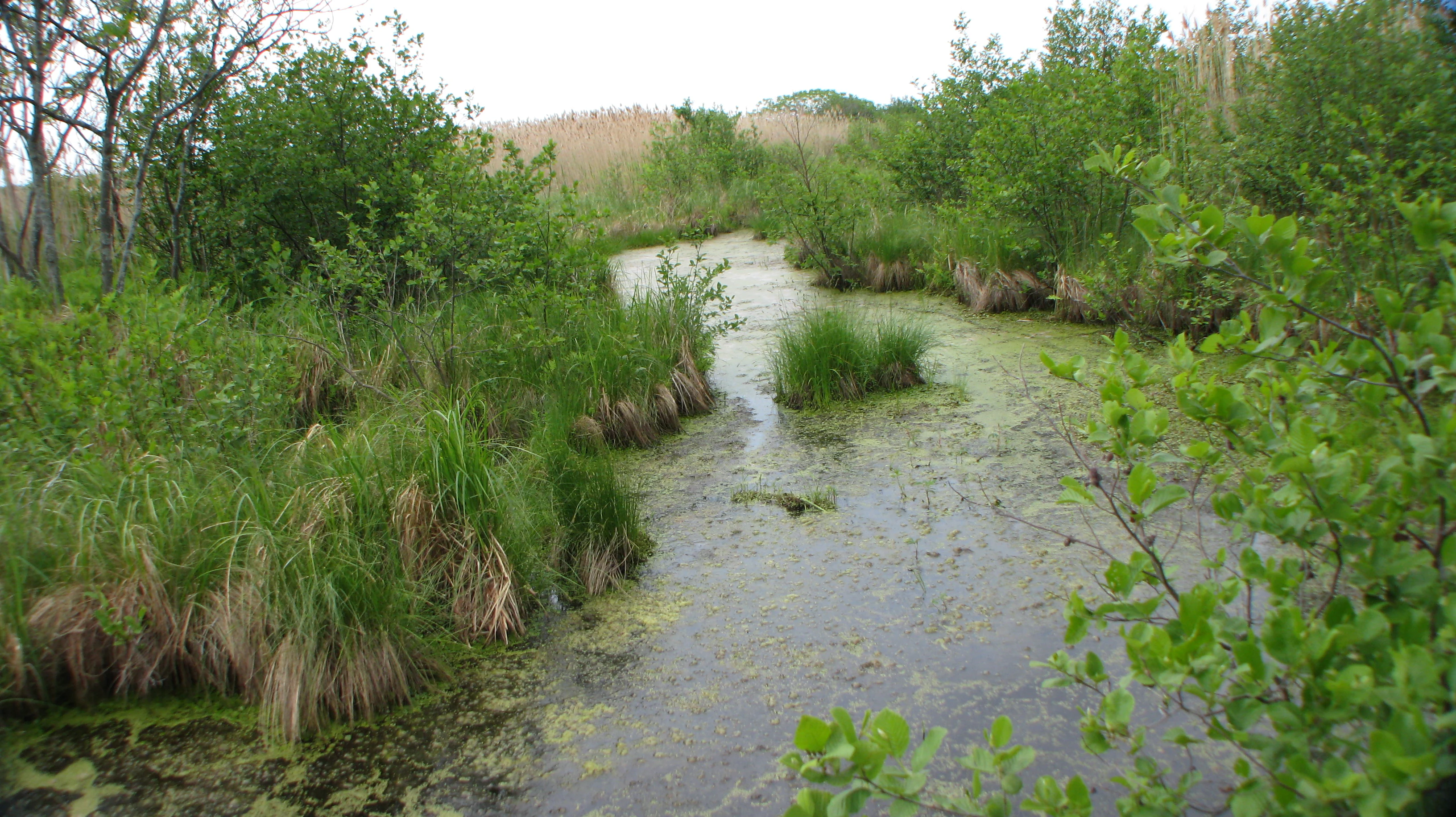
A narrow, shallow channel of water covered with algae winding through a wetland, flanked by grasses, shrubs, and trees.
A marshy waterway surrounded by lush green vegetation in the Lac Saint-Francois National Wildlife Area.

Lac Saint-François National Wildlife Area history and protected-area timeline

The region around Lac Saint-François has been inhabited for nearly eight thousand years. Early human presence in the area belongs to nomadic hunter groups that exploited large game such as caribou. Over the following millennia, the local population transitioned through the Archaic period into more settled hunter-fisher-gatherer communities, and eventually, beginning around one thousand years ago, into the Iroquoian Saint Lawrence culture, which adopted agriculture, cultivated crops such as corn, squash, beans, tobacco, and sunflower, and built semi-permanent, sometimes palisaded villages in nearby areas.

European contact came in the early seventeenth century, when Samuel de Champlain used the region as a stopping point while exploring the St. Lawrence valley. Throughout the colonial period, the area served as a passage for travelers heading toward the Great Lakes and beyond. The first European settlers arrived between 1782 and 1784, mostly Loyalists who established farms in what would become Huntingdon County, now the Le Haut-Saint-Laurent regional county municipality. Between 1800 and 1840, important pine and oak stands in the surrounding region were exploited. From 1931 onward, extensive drainage work caused the loss of thousands of hectares of marshland, with only partial offset from the construction of the Beauharnois generating station in 1933, which raised the water level of the lake and modestly increased wetland area along the shore.

Formal ecological recognition of the area emerged through a series of studies between 1968 and 1976, which highlighted the exceptional importance of the marshes south of Lac Saint-François. Beginning in 1971, the Canadian Wildlife Service began acquiring lands through negotiated purchases, a process that continued until 1990. The reserve itself was officially established on April 27, 1978. In the 1980s, Ducks Unlimited Canada undertook habitat improvements to favor waterfowl nesting, and on May 27, 1987, the site was inscribed as a Ramsar Wetland of International Importance. In 1993, management of activities and services was delegated to a local friends-of-the-reserve association, which continues to operate visitor services and trail maintenance.

Lac Saint-François National Wildlife Area landscape and geographic character

The landscape of Lac Saint-François NWA is shaped by its position along a broad, slow-moving section of the St. Lawrence River. The terrain is a gently undulating plain crossed by low ridges oriented southwest to northeast, interrupted by isolated knolls that rise no more than about eight meters above the surrounding ground. This subtle topography frames the mosaic of wetlands, channels, and forested patches that define the reserve.

The north side of the reserve opens onto Lac Saint-François, a widening of the St. Lawrence that has been significantly altered by upstream dams and dikes constructed downstream of Salaberry-de-Valleyfield. Water levels are drawn down at the beginning of spring and gradually raised through September, with only modest variation during the summer months, a pattern that distinguishes Lac Saint-François from other unremediated fluvial lakes in the St. Lawrence system, such as Lac Saint-Pierre and Lac des Deux Montagnes. Overall, the lake is shallow, averaging only about six meters in depth.

Within the reserve, the wetland landscape includes dikes, marshes, swamps, cedar stands, sugar maple woodlands, and small streams. Together, these features form the transition between open water and the agricultural lands to the south, which lie beyond Route 132.

Lac Saint-François National Wildlife Area ecosystems, habitats, and plant life

The Lac Saint François National Wildlife Area harbors one of the most concentrated levels of biodiversity found in Quebec. Surveys of the reserve have documented hundreds of plant and animal species, an unusually high figure for a protected area of its size, reflecting the convergence of aquatic, wetland, and forest habitats within a short distance.

Vegetation in the reserve reflects both its wetland character and its position in the St. Lawrence lowlands. Forested areas are dominated by species typical of southern Quebec, including sugar maple, silver maple, Manitoba maple, American basswood, American beech, white ash, eastern hemlock, black ash, and rock elm. In wetter zones, cedar stands and silver maple swamps create distinctive structural elements within the broader forest cover.

The mosaic of marshes, swamps, and riparian corridors supports an exceptionally rich community of birds, fish, reptiles, amphibians, and mammals. Because much of the surrounding region has been converted to farmland, the reserve now functions as a critical refuge for wetland-dependent species and as one of the most ecologically productive natural areas remaining in this heavily altered landscape.

Lac Saint-François National Wildlife Area wildlife and species highlights

Wildlife is the defining feature of Lac Saint-François NWA. The reserve is a crucial staging area for migratory waterfowl, with roughly five thousand ducks recorded during spring migration and around eight thousand during fall migration. Thirteen waterfowl species nest within the reserve, including Canada goose, mallard, American black duck, wood duck, and lesser scaup.

Beyond waterfowl, the reserve supports a remarkable richness of landbirds and wading birds. Northern waterthrush, veery, and sandhill crane are among the nesting species, and the population of sedge wren found here is believed to be the most important in all of Canada, underscoring the area's significance for bird conservation well beyond its immediate region.

Reptiles and amphibians add to the reserve's biological richness. Four-toed salamander, Blanding's turtle, and common snapping turtle are documented within its boundaries. Mammals are also well represented, with muskrat, meadow jumping mouse, big brown bat, North American beaver, white-tailed deer, and coyote among the species that use the reserve's varied habitats. Together, this assemblage highlights the role of the reserve as a refuge for wetland-associated wildlife in a landscape where such habitats have become increasingly rare.

Lac Saint-François National Wildlife Area conservation status and protection priorities

The reserve's conservation profile is unusually strong. It carries multiple overlapping designations: National Wildlife Area, Migratory Bird Sanctuary, Important Bird Area, and Ramsar Wetland of International Importance. Each of these formal recognitions reflects a different dimension of the reserve's ecological value, from waterfowl habitat and migratory bird protection to international wetland significance.

Equally important is the reserve's role as a refuge in a heavily modified landscape. The wider region has lost the majority of its original wetlands due to drainage and conversion to agriculture, and the loss of marshlands recorded since the early twentieth century has been severe. In this context, the protected marsh, swamp, and forest habitats of Lac Saint-François NWA serve as a critical reservoir of wetland biodiversity that would otherwise have no counterpart in the area.

Management and stewardship are shared between the Canadian Wildlife Service and the local friends-of-the-reserve association. Land acquisition began in 1971 and continued for nearly two decades, while habitat improvement projects, including those carried out by Ducks Unlimited Canada in the 1980s, have helped to maintain the waterfowl nesting value of the area. The reserve's internationally recognized status continues to anchor its conservation importance today.

Lac Saint-François National Wildlife Area cultural meaning and human context

The area has deep human history. Indigenous presence in the region stretches back approximately eight thousand years, evolving from nomadic hunting groups to settled Iroquoian farming communities that cultivated corn, squash, beans, tobacco, and sunflower and built semi-permanent villages in nearby locations. These communities shaped the landscape long before European contact.

European arrival in the early seventeenth century, beginning with Samuel de Champlain's use of the region as a waypoint along the St. Lawrence, marked the beginning of sustained colonial activity. The earliest European settlers were Loyalists who arrived in the 1780s, followed by waves of agricultural development that ultimately transformed the surrounding region. Today, the Mohawk territory of Akwesasne lies adjacent to the reserve and includes some of the islands to its north, giving the protected area an enduring connection to Indigenous presence in the valley.

Top sights and standout views in Lac Saint-François National Wildlife Area

Lac Saint-François National Wildlife Area stands out for the layered strength of its protected-area designations. Its status as a Ramsar site, Migratory Bird Sanctuary, Important Bird Area, and National Wildlife Area places it among the most comprehensively recognized wetland reserves in Quebec.

The reserve is also notable for its unusually high biodiversity within a small footprint, a direct consequence of the convergence of marshland, swamp forest, cedar stands, mixed hardwood forest, streams, and St. Lawrence shoreline. This habitat diversity supports nesting waterfowl, large spring and fall migrations, an exceptional sedge wren population, reptiles such as Blanding's turtle, and mammals ranging from beaver to white-tailed deer.

Best time to visit Lac Saint-François National Wildlife Area

The reserve is shaped strongly by seasonal hydrology and bird movements. Spring is one of the most dynamic periods, when waterfowl numbers peak during northward migration and rising water levels gradually transform open marsh into breeding habitat. Many of the most active bird observation opportunities occur during this season.

Summer offers stable water levels and lush vegetation, with marshes, cedar stands, and mixed forests at their most vivid. Trails and water routes are typically accessible, and wildlife observation shifts toward nesting species and resident animals. Autumn brings the second major waterfowl migration, adding thousands of ducks staging on the wetlands before they move further south, while fall foliage enriches the forested areas of the reserve.
Monthly climate preview

Long-term representative temperature and precipitation averages across twelve monthly cycles

Réserve nationale de faune du lac-Saint-François Climate Normals and Annual Weather Patterns

Representative coordinate measurements reveal significant annual temperature shifts alongside steady precipitation distribution throughout the year at Réserve nationale de faune du lac-Saint-François. Examining the complete monthly climate dataset provides deeper insight into long-term meteorological normals and regional environmental conditions.
Annual mean7 °C
-10 °C21 °C
Jan-10°
Feb-8°
Mar-2°
Apr
May13°
Jun18°
Jul21°
Aug20°
Sep16°
Oct
Nov
Dec-5°
Warmest month
July

21 °C

Coolest month
January

-9.7 °C

Wettest month
June

3.6 mm/day

Driest month
February

1.9 mm/day

Park location guide

Geography guide, regional context, and park location map for Lac Saint-François National Wildlife Area

Lac Saint-François National Wildlife Area park geography, regions, and map view in Canada

Understand where Lac Saint-François National Wildlife Area sits in Canada through a broader geographic reading of the surrounding landscape, nearby location context, and its mapped position within the national park landscape.

How Lac Saint-François National Wildlife Area fits into Canada

Canada is a federal parliamentary constitutional monarchy spanning North America from the Atlantic to the Pacific and Arctic Oceans. With a population of over 41 million, it is officially bilingual in English and French at the federal level. The country gained independence from the United Kingdom through a gradual process culminating in 1982.

Wider geography shaping Lac Saint-François National Wildlife Area in Canada

Canada occupies the northern portion of North America, sharing its longest international border with the United States. The country extends from the Atlantic Ocean to the Pacific Ocean and northward into the Arctic Ocean, giving it the longest coastline of any nation.

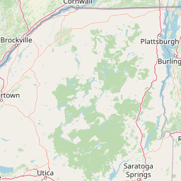
Map view of Lac Saint-François National Wildlife Area

Use this park location map to pinpoint Lac Saint-François National Wildlife Area in Canada, understand its exact geographic position, and read its mapped placement within the surrounding landscape more clearly.

Pigeon | © OpenStreetMap contributors

Location context for Lac Saint-François National Wildlife Area

Quebec

Visual reference collection highlighting wetland habitats and St. Lawrence shoreline environments

Réserve nationale de faune du lac-Saint-François Photos and Landscape Scenery

Visual documentation captures the freshwater wetland complex, marshlands, and forested shorelines that define Réserve nationale de faune du lac-Saint-François. Examining these protected landscapes reveals the terrain, habitat mosaics, and environmental character of the wildlife reserve.

A narrow, shallow channel of water covered with algae winding through a wetland, flanked by grasses, shrubs, and trees.

Park atlas

Compare adjacent wetland reserves and surrounding St. Lawrence River conservation lands.

Parks Near Réserve nationale de faune du lac-Saint-François and Regional Protected Areas

Visitors exploring Réserve nationale de faune du lac-Saint-François can browse adjacent protected areas and nearby regional wildlife reserves along the St. Lawrence River. Examining these connected wetland habitats provides deeper context for regional waterfowl flyways and floodplain conservation.
A soft, painterly watercolor illustration showing a shallow waterway, green grassy islands, and soft rolling hills in the distance.
Nature reserveQuebec
About 59 km away#1 closest

Northeast

Îles de la Paix Migratory Bird Sanctuary: Protected Island Geography and Wetland Maps

A vital riverine habitat within the St. Lawrence River basin

Examine the unique river-island topography of the Îles de la Paix Migratory Bird Sanctuary in Quebec. This protected area offers a rare glimpse into a dynamic landscape of marshes and flooded forests, serving as a critical node in the St. Lawrence River migratory flyway near the Montreal metropolitan region.

Area
10.92 km²
Established
1972
IUCN
III
Relief
Lowland
A soft, watercolor painting of a calm river winding through a green landscape with trees and rolling hills in the background.
Wildlife reserveQuebec
About 61 km away#2 closest

Northeast

Réserve nationale de faune des îles de la Paix: Geography of an Island Wetland Refuge

A protected wildlife corridor in southwestern Quebec

The Réserve nationale de faune des îles de la Paix comprises a cluster of islands and protected wetlands in the St. Lawrence River. This site provides critical nesting and staging grounds within a managed habitat system, connecting forested terrestrial areas with expansive aquatic zones essential for migratory bird species.

Area
1.87 km²
Established
1977
IUCN
Ia
Relief
Lowland
Wildlife reserveOntario
About 109 km away#3 closest

West

Rideau Migratory Bird Sanctuary: Protected Wildlife Reserve and Regional Waterfowl Habitat

Riparian conservation zones along the Rideau River in Ontario

The Rideau Migratory Bird Sanctuary protects a strategically important riparian corridor within Ontario. This federal wildlife reserve provides essential refuge for migratory birds along the Rideau River system, offering a specialized look at the region's diverse wetland margins and floodplain geography.

Area
7.52 km²
Established
1957
Watercolor painting of green hills, islands, and a body of water under a pale yellow sky
National parkOntario
About 109 km away#4 closest

Southwest

Thousand Islands National Park: Exploring Ontario's Protected Landscape Geography

Discover the mapped terrain and regional context of this national park.

Uncover the protected landscape identity of Thousand Islands National Park, a key national park located in Ontario. This resource focuses on its geographic setting, mapped boundaries, and overall atlas context, providing a clear understanding of its role as a protected area. Explore how its unique terrain contributes to the regional geography and the broader national park network, offering valuable insight for landscape-focused discovery.

Area
24.4 km²
Established
1904
IUCN
II
Visitors
109.3K annual
Wildlife reserveQuebec
About 135 km away#5 closest

Northeast

Réserve nationale de faune des îles de Contrecœur: Mapped Wildlife Reserve and Wetland Habitat

Protected freshwater ecosystems in the St. Lawrence River, Quebec

Discover the geographic footprint of the Réserve nationale de faune des îles de Contrecœur, a protected network of islands and channels in the St. Lawrence River. This entry provides context on the reserve's role in conserving emergent aquatic vegetation and waterfowl nesting sites within the broader southern Quebec landscape.

Area
3.12 km²
Established
1981
IUCN
Ia
Relief
Lowland
Wildlife reserveOntario
About 136 km away#6 closest

West

Zugvogelschutzgebiet Mississippi Lake Protected Landscape and Wildlife Reserve Atlas

Waterfowl habitat and wetland geography in Ontario

Zugvogelschutzgebiet Mississippi Lake serves as a designated wildlife reserve providing essential staging grounds for migratory waterfowl. Located at the river-mouth interface on Mississippi Lake, the area encompasses provincially significant wetlands within Ewan Bay. This protected footprint offers a distinct look at the quiet, low-relief hydrology and marsh ecology characteristic of the broader southern Ontario basin.

Area
2.84 km²
Established
1959
IUCN
IV
Relief
Lowland
Watercolor painting of a lush green landscape featuring rolling hills in the distance, a meandering stream in the midground, and wetlands with cattails in the foreground.
Protected landscapeVermont
About 151 km away#7 closest

Southeast

Green Mountain National Forest: Mapped Geography and Protected Landscape Analysis

Examining the wilderness backbone of Vermont's mountainous terrain

Gain insight into the expansive boundaries of Green Mountain National Forest, an essential protected area spanning the Green Mountains of Vermont. This profile details the forest's composition, ranging from high-elevation spruce-fir zones to mixed hardwood slopes and extensive federal wilderness corridors, providing a foundational geographic understanding of this vital northeastern landscape.

Area
1,615.31 km²
Established
1932
Relief
Mountain
Climate
Temperate
Protected areaAddison County
About 175 km away#8 closest

Southeast

Joseph Battell Wilderness: Mapping Protected Ridges in the Green Mountain National Forest

A high-elevation Appalachian landscape in Addison County, Vermont.

Spanning over twelve thousand acres, the Joseph Battell Wilderness preserves a critical core of the Green Mountains. This protected area features dramatic cliff faces like Mount Horrid and a continuous sequence of summits exceeding three thousand feet. The region provides a deep look at northern hardwood habitats and the geographic influence of the Long Trail within the broader Vermont mountain landscape.

Area
49.92 km²
Established
2006
Relief
Mountain
Climate
Temperate

Common questions about visiting, size, designation, and location context for Lac Saint-François National Wildlife Area

Lac Saint-François National Wildlife Area FAQs for park facts, access, geography, and protected area context

Find quick answers about Lac Saint-François National Wildlife Area, including protected-area facts, park geography, trail and visitor context, and how the park fits into its surrounding country and regional landscape.
MoriAtlas Explorer

Continue Your Protected Areas Search Across the Global Atlas

Deepen your exploration by continuing the structured search for national parks and protected areas worldwide. Utilize the comprehensive filtering capabilities to compare different conservation landscapes and refine your understanding of global park geography. Discover more about the distribution and characteristics of protected natural areas.

Global natural geography