
Mori Atlas logo
Protected landscapeLaguna de Rocha

Investigating the dynamic hydrology and shifting salinity patterns of this internationally significant coastal lagoon.

Laguna de Rocha Protected Landscape: Mapping the Coastal Wetlands and Barrier Systems of Rocha Department, Uruguay

Laguna de Rocha serves as a critical protected landscape within Uruguay, characterized by its shallow waters and intermittent connection to the Atlantic Ocean. This coastal lagoon environment provides a mosaic of habitats ranging from reedbeds and mudflats to sandy barriers and coastal dunes. The surrounding geography of Rocha Department encompasses these diverse wetland systems, which function as essential nodes for migratory waterbirds and fragile shorebird populations. Through structured analysis of its terrain and regional water connectivity, this record highlights the unique ecological function of the area as a Ramsar site and biosphere reserve.

coastal lagoonwetlandbirdsbirdwatchingshorebirdsmigratory birds
A flat-style digital illustration of a mountain valley at sunset, featuring tall pine trees in the foreground, steep cliffs, a winding river, and a waterfall cascading into a lake.

Laguna de Rocha

Protected landscape

Park overview

Structured park overview, official facts, and landscape profile for Laguna de Rocha

Laguna de Rocha park facts, protected area profile, and essential visitor context

Review the core facts for Laguna de Rocha, including designation, size, terrain, visitor scale, habitats, and operating context in one park-focused overview.

About Laguna de Rocha

Laguna de Rocha is one of the most significant coastal wetlands of Uruguay, an expansive shallow lagoon bordered by the Atlantic Ocean and shaped by the constantly shifting relationship between freshwater inflows and marine influence. It lies within the department of Rocha, along a stretch of the southeastern Uruguayan coast where barrier beaches, dune systems, wetlands, and agricultural plains come together. The lagoon itself is a defining geographic feature of the region, occupying a broad surface of around 72 square kilometers but only reaching depths of around one and a half meters at its deepest points. This very shallow character, combined with a sandy cord that separates it from the open Atlantic, makes it a textbook example of a coastal lagoon ecosystem.

The lagoon was formed over the past six to eight thousand years as sea levels rose, leaving a depressed coastal landscape where freshwater streams collected behind emergent sand barriers. Several streams feed the basin, with the Rocha and Las Conchas creeks being the most important, and the smaller Laguna de las Nutrias sits to its west. Because the barrier opens periodically, often after storms or natural erosion, salt water from the Atlantic mixes with the lagoon's freshwater, producing significant and irregular fluctuations in salinity. These changes are a defining ecological trait of the site, supporting different species communities over time and granting the lagoon exceptional biological diversity.

Laguna de Rocha sits within a broader landscape dominated by wetlands, agricultural fields of rice and maize, cattle and sheep pastures, and small patches of native woodland that together make up only a small share of the catchment area. Around it, beach ridges, dune vegetation, and coastal grasslands create transitional habitats between marine, freshwater, and terrestrial systems. This mix of environments explains why the lagoon is such a magnet for wildlife, particularly migratory and shore-dependent birds, and why its conservation status has been reinforced through national and international designations over several decades.

Quick facts and research context for Laguna de Rocha

Laguna de Rocha lies in the Rocha department of southeastern Uruguay, on the country's Atlantic-facing coast. Its surface area is about 72 square kilometers, with average depths of roughly 0.6 meters and a maximum of around 1.4 meters, classifying it as a shallow coastal lagoon. The lagoon drains a basin of about 1,400 square kilometers and receives freshwater from streams such as the Rocha and Las Conchas, while a sandy barrier isolates it from the sea.

Its protected area spans roughly 22,000 hectares, and it has been a UNESCO Biosphere Reserve, a Ramsar site (since 2015), and part of Uruguay's National System of Protected Areas (SNAP) under the Protected Landscape category since 2010. Annual rainfall in the region is about 1,285 millimeters, and the surrounding watershed is largely agricultural land used for rice, maize, and livestock.

Protection and recognition

Documented protection history and official Ramsar wetland designation details

Laguna de Rocha Protection Status and International Recognition Records

Laguna de Rocha holds a mixed protection scope established in 2015 alongside documented Ramsar wetland recognition sources. Structured records outline the official designation history and international conservation framework for the protected area.

International recognition

Protection details

Protection scope
Mixed
Designated year
2015
Transboundary protection
No
Park context

Deeper park guide and search-rich context for Laguna de Rocha

Laguna de Rocha history, landscape, wildlife, and travel context

Explore Laguna de Rocha through its history, landscape character, ecosystems, wildlife, conservation priorities, cultural context, and seasonal travel timing in a structured park guide built for atlas discovery and search intent.

Why Laguna de Rocha stands out

Laguna de Rocha is best known for its extraordinary birdlife, which has earned it recognition as an Important Bird Area (IBA) and inclusion in the Western Hemisphere Shorebird Reserve Network. More than 200 species of breeding and migratory birds have been recorded here, including black-necked swans, coscoroba swans, Chilean flamingos, and threatened species such as the Olrog's gull-like species referred to in the region and the Dominican monkbird (yet another name used regionally for distinct rare passerines tied to Uruguayan grasslands adjoining the lagoon). It is equally known for its dynamic barrier-and-lagoon system, where the sandbar separating the lagoon from the Atlantic periodically opens to the sea. This natural exchange drives salinity shifts that sustain high biological diversity, supporting fish, crabs, shrimp, and mollusks alongside coastal amphibians such as Darwin's frogs and mammals including giant otters, foxes, capybaras, and tuco-tucos.
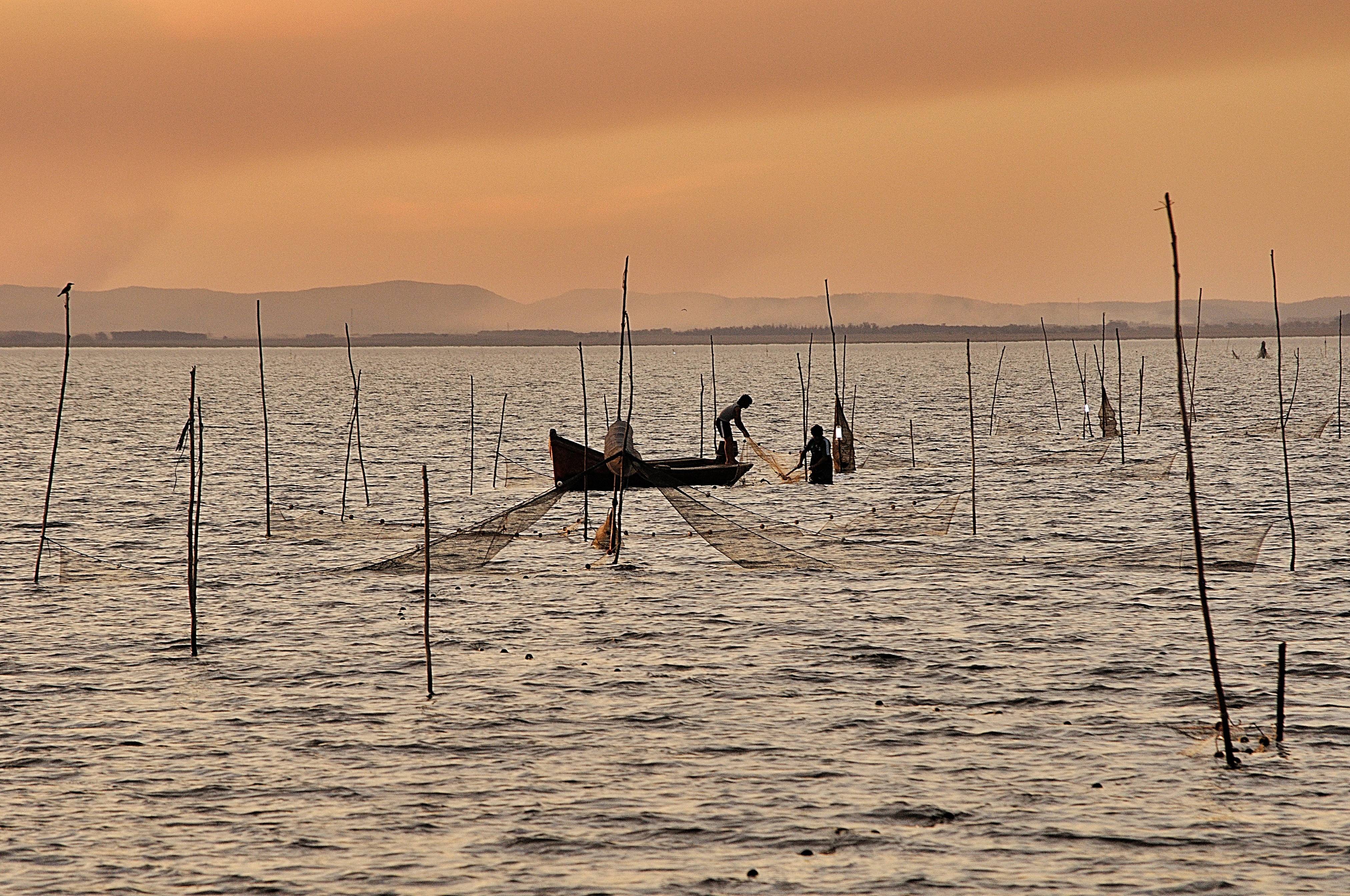
Two people in a small wooden boat on a calm, expansive lagoon at sunset, surrounded by multiple thin wooden poles sticking out of the water, with traditional fishing nets deployed.
Local fishermen at work on Laguna de Rocha at sunset.

Laguna de Rocha history and protected-area timeline

Laguna de Rocha's modern conservation history is tied closely to Uruguay's evolving framework for protected natural areas. In 1977, it was declared a 'parque nacional lacustre,' or lacustrine national park, by decree 260/77, marking a first formal recognition of its ecological and scenic value. Like other lagoons along Uruguay's southeastern and eastern coastline, it was later recognized as a UNESCO Man and the Biosphere (MaB) Biosphere Reserve, embedding it within a global network of sites considered important for both conservation and sustainable human relationships with the environment.

In 2010, the area surrounding Laguna de Rocha formally entered Uruguay's National System of Protected Areas (SNAP) as a Protected Landscape, following the framework established by laws 17.234 (2000) and 17.930 (2005) and decree 52/2005. This inclusion came after an extended consultation process involving local communities, conservation organizations, and government authorities. In 2015, the lagoon itself was listed as a Ramsar Wetland of International Importance, underscoring its value as a wetland habitat of global significance, and slightly earlier it had been formally recognized as an Important Bird Area (IBA) for its ornithological importance.

More recently, decree 457/016 expanded the originally designated protected area, reflecting a continued commitment to strengthening the lagoon's protection in the face of growing pressures from agricultural expansion, water demand, and contamination. Throughout this history, the foundation 'Amigos de las Lagunas Costeras de Rocha' and other local actors have played a central role in advocating for the lagoon's protection, monitoring, and public awareness.

Laguna de Rocha landscape and geographic character

The landscape of Laguna de Rocha is defined by the interplay between water, sand, and low coastal plains typical of Uruguay's southeastern Atlantic shore. The lagoon itself is a broad, shallow body of water, averaging less than a meter deep, separated from the sea by a long sandy cord, or barrier beach. This barrier is not permanent: it forms, erodes, and periodically breaks, allowing exchanges between the lagoon and the Atlantic Ocean that shape the lagoon's character over time. The result is a constantly shifting environment, where the size of the lagoon, the salinity of its water, and the configuration of its shoreline can change notably across months and years.

Beyond the lagoon, the surrounding terrain is mostly flat to gently undulating. Coastal dunes and sandy ridges line parts of the barrier, while the western side of the lagoon dissolves into low-lying marshlands and grasslands. The watershed feeding the lagoon is dominated by agricultural land, including rice paddies, maize fields, and pastures for cattle and sheep, with only a small fraction of the catchment covered by native woodland. To the west of the main lagoon lies a smaller companion body of water known as Laguna de las Nutrias, which adds further complexity to the local hydrology. The lagoon's shoreline thus presents a mosaic of habitats, including open water, mudflats, reedbeds, sandy beaches, dune vegetation, and pasture.
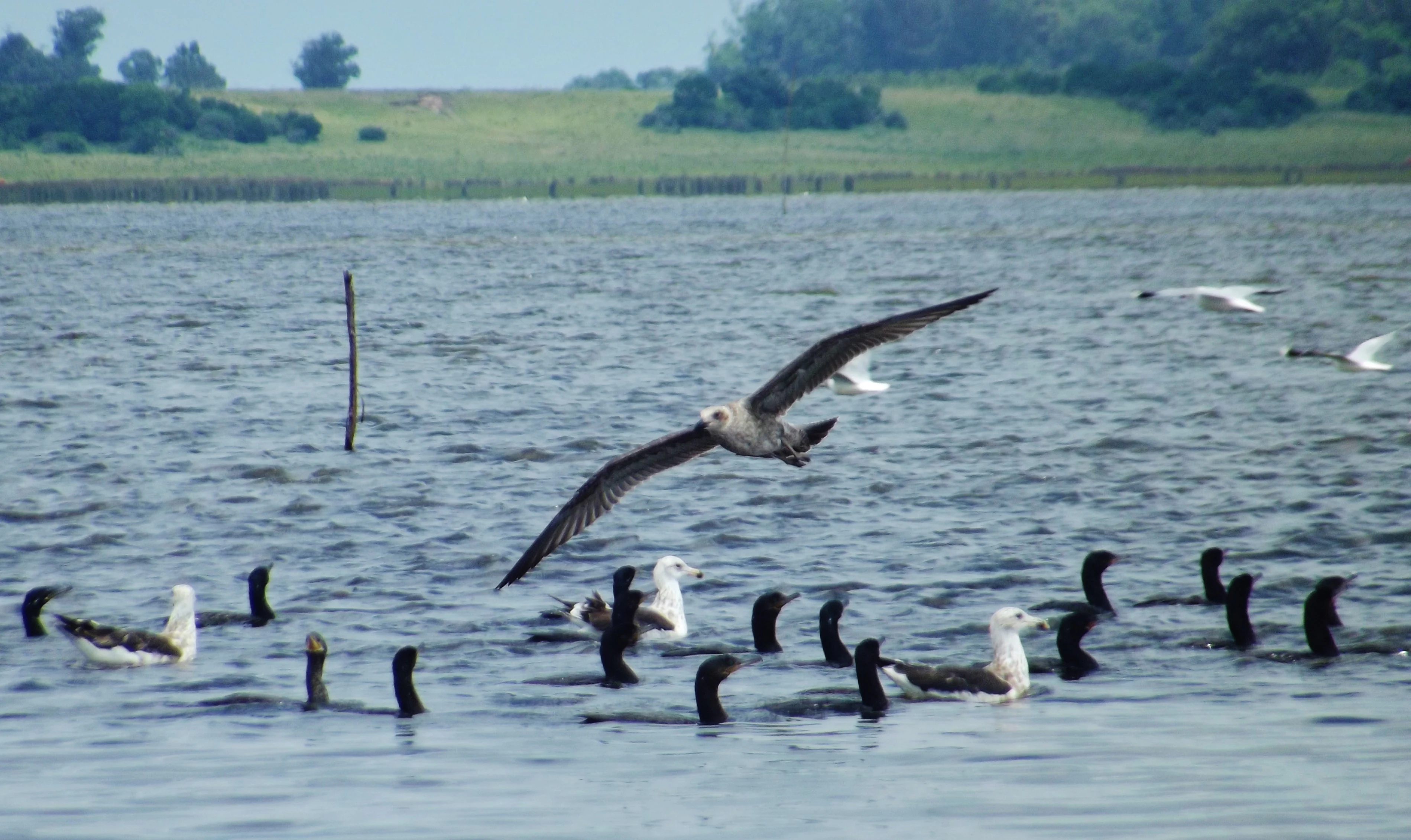
A large flock of dark and white birds swimming on a calm lagoon with one bird in flight in the center, a grassy shoreline visible in the background.
A group of birds swimming and flying over the waters of Laguna de Rocha.

Laguna de Rocha ecosystems, habitats, and plant life

Ecologically, Laguna de Rocha is best understood as a transitional system where freshwater and marine influences meet. Because the barrier beach opens and closes intermittently, the lagoon experiences significant natural fluctuations in salinity, and this dynamic character drives much of its biological richness. The relatively shallow waters, abundant nutrients, and shifting chemical conditions support dense populations of fish, crabs, shrimp, and mollusks, which in turn sustain a wide range of predators and waterbirds.

The lagoon and its margins also include reedbeds, coastal marshlands, sandy shores, low dunes, and small patches of woodland. Together, these habitats create a continuum of environments that links aquatic systems with terrestrial ones. The native forest cover in the catchment is limited, around six percent of the area, but the wetland habitats themselves are highly productive and act as ecological anchors for the surrounding countryside. The dynamic, partially saline conditions have created a distinctive ecological community that distinguishes Laguna de Rocha from purely freshwater inland wetlands or strictly marine coastal environments.

Laguna de Rocha wildlife and species highlights

Laguna de Rocha is one of Uruguay's most important sites for waterbirds and shorebirds, with more than two hundred species recorded, including both resident breeders and long-distance migrants. Black-necked swans and coscoroba swans are among the most iconic and frequently observed waterbirds, often visible on open waters and along the lagoon margins. The lagoon's importance for migratory and threatened species has earned it designation as an Important Bird Area (IBA) and inclusion in the Western Hemisphere Shorebird Reserve Network as a site of regional significance.

Beyond waterbirds, threatened and emblematic species also use the lagoon and its surroundings. Chilean flamingos occur here, as do regionally significant threatened species such as certain gulls and the Dominican monkbird associated with nearby grasslands. The sandy coastal strip still hosts Darwin's frogs, a small amphibian characteristic of Uruguay's coastal dune habitats and increasingly restricted to natural areas. Mammals documented in and around the lagoon include giant otters, native foxes, capybaras, and tuco-tucos, while the waters themselves are rich in fish, crabs, shrimp, and mollusks that support many of the bird populations.

Laguna de Rocha conservation status and protection priorities

Laguna de Rocha is a globally recognized wetland and one of the most important conservation sites in Uruguay. Its designations now include UNESCO Biosphere Reserve status under the Man and the Biosphere (MaB) program, Ramsar Wetland of International Importance status since 2015, Important Bird Area (IBA) recognition for its ornithological value, and membership in the Western Hemisphere Shorebird Reserve Network at the regional level. At the national level, the area surrounding the lagoon was incorporated into Uruguay's National System of Protected Areas (SNAP) in 2010 under the Protected Landscape category, and the protected area was later expanded by decree 457/016.

The conservation significance of Laguna de Rocha lies in its dynamic coastal lagoon system, its role for migratory waterbirds, and its support for threatened species ranging from flamingos to Darwin's frogs and giant otters. However, the site also faces serious pressures. Its catchment is dominated by agricultural land, with rice, maize, and livestock as the primary land uses, and water demand in the region has been rising. As a result, the lagoon is affected by water pollution, runoff of fertilizers, and water scarcity. Its ongoing protection depends on continued monitoring, integrated watershed management, and balancing agricultural use with the ecological needs of one of Uruguay's most valuable wetlands.

Laguna de Rocha cultural meaning and human context

Laguna de Rocha is closely tied to the identity of the Rocha department and of Uruguay's southeastern coastal culture. The wetland, its barrier beaches, and the surrounding agricultural countryside have long shaped local livelihoods, which historically combined fishing, small-scale farming, and livestock raising. Local organizations, notably the foundation Amigos de las Lagunas Costeras de Rocha, have played a sustained role in advocating for the lagoon's protection, participating in the long consultation process that led to the area's inclusion in the national protected areas system, and fostering community awareness about its ecological value. The lagoon is also inseparable from the regional identity of Rocha as a gateway to Uruguay's coastal landscapes, including the nearby beaches, dunes, and small coastal towns.

Top sights and standout views in Laguna de Rocha

Laguna de Rocha's most distinctive quality is the way a shallow freshwater lagoon coexists with a sandy barrier that intermittently opens to the Atlantic, producing constant ecological change. Within this dynamic setting, the lagoon supports more than 200 bird species, including black-necked and coscoroba swans, Chilean flamingos, and threatened regional specialties. Its layered international recognitions, from UNESCO Biosphere Reserve and Ramsar site to Important Bird Area and Western Hemisphere Shorebird Reserve Network membership, place it among the most internationally distinguished wetlands in South America's Atlantic coast. Accompanying habitats, ranging from reedbeds and mudflats to coastal dunes and Darwin's frog habitat, ensure that the protected area functions as a complete coastal ecosystem rather than a single-species refuge.

Best time to visit Laguna de Rocha

The character of Laguna de Rocha changes significantly with the seasons and with the state of its barrier beach. Southern Hemisphere spring and summer (roughly October through March) tend to bring warmer conditions, more active birdlife, and heightened migratory bird activity, including the presence of seasonal shorebird visitors. Wetland bird observation is generally rewarding throughout much of the year because the lagoon hosts both resident and migratory species. Weather patterns influence water levels and barrier dynamics, and visiting after periods of rainfall or storms can mean observing a lagoon that has recently exchanged water with the Atlantic, with visible ecological change along its shoreline. Cooler months (autumn and winter) offer quieter conditions and a different set of migratory visitors, making the lagoon a year-round wildlife destination rather than a strictly seasonal one.
Monthly climate preview

Monthly temperature and precipitation averages derived from representative station climatology

Laguna de Rocha Climate Normals and Annual Temperature Patterns

Long-term records reveal measured monthly temperature and precipitation rhythms across the representative coordinate for Laguna de Rocha. Reviewing the complete twelve-month climatology dataset clarifies multi-season variations in average minimum and maximum temperatures.
Annual mean16 °C
10 °C23 °C
Jan23°
Feb22°
Mar20°
Apr17°
May14°
Jun11°
Jul10°
Aug11°
Sep12°
Oct15°
Nov18°
Dec21°
Warmest month
January

22.6 °C

Coolest month
July

9.6 °C

Wettest month
April

4.2 mm/day

Driest month
November

2.9 mm/day

Park location guide

Geography guide, regional context, and park location map for Laguna de Rocha

Laguna de Rocha park geography, regions, and map view in Uruguay

Understand where Laguna de Rocha sits in Uruguay through a broader geographic reading of the surrounding landscape, nearby location context, and its mapped position within the national park landscape.

How Laguna de Rocha fits into Uruguay

Uruguay is a unitary presidential republic located in southeastern South America. It covers approximately 176,215 km² and has a population of nearly 3.5 million people. The capital and largest city is Montevideo, where roughly 2 million people live in the metropolitan area. Uruguay gained independence between 1825 and 1828 following territorial disputes involving Portugal, Spain, Brazil, and the United Provinces of the Río de la Plata.

Wider geography shaping Laguna de Rocha in Uruguay

Uruguay is situated in the southeastern part of South America, bordering Argentina to its west and southwest, Brazil to its north and northeast, the Río de la Plata estuary to the south, and the Atlantic Ocean to the southeast. The terrain consists primarily of rolling plains and low hills, with the highest point being Cerro Catedral at approximately 514 meters. The country has several rivers including the Uruguay River, Paraná River, and Negro River.

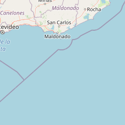
Map view of Laguna de Rocha

Use this park location map to pinpoint Laguna de Rocha in Uruguay, understand its exact geographic position, and read its mapped placement within the surrounding landscape more clearly.

Pigeon | © OpenStreetMap contributors

Location context for Laguna de Rocha

Rocha Department

Explore visual records of coastal lagoons, sandy barriers, and wetland habitats.

Laguna de Rocha Photos and Landscape Scenery: Visualizing Uruguay Protected Areas

Photographic collections reveal the dynamic interplay between shallow lagoon waters, shifting sandbars, and Atlantic coastal plains. Visual documentation highlights fragile wetland habitats, diverse bird populations, and protected ecosystems across the region.

Two people in a small wooden boat on a calm, expansive lagoon at sunset, surrounded by multiple thin wooden poles sticking out of the water, with traditional fishing nets deployed.

An aerial view of a coastal lagoon with marshy shorelines, sandy patches, and open water under a soft, overcast sky.

A large flock of dark and white birds swimming on a calm lagoon with one bird in flight in the center, a grassy shoreline visible in the background.

Park atlas

Compare regional wetland habitats and connected coastal ecosystems across southeastern Uruguay

Exploring Parks Near Laguna de Rocha and Surrounding Protected Landscapes

Browsing other protected areas near Laguna de Rocha reveals broader patterns in regional wetland geography and coastal terrain. Examining these adjacent reserves provides valuable context for understanding the wider ecological connectivity of the Atlantic shore.
Wildlife reserveMaldonado
About 21 km away#1 closest

Southwest

Area de manejo de habitats y/o especies Laguna Garzon: Wildlife Reserve and Coastal Atlas

Mapped wetlands and Atlantic coastal landscapes in Maldonado, Uruguay.

The Area de manejo de habitats y/o especies Laguna Garzon protected area features a unique mosaic of interconnected lagoons and dune-backed shorelines. This coastal wildlife reserve offers a significant geographic study of wetland habitats and their interaction with the Atlantic maritime zone, providing essential context for understanding Uruguay's southeastern coastal terrain.

Established
2014
Water
Water-dominated
Protected landscapeRocha
About 41 km away#2 closest

Northeast

Paisaje protegido Laguna de Castillos: Mapped Geography and Protected Landscape Features

Coastal lagoon and native woodland terrain in Rocha, Uruguay

Investigate the geographic profile of Paisaje protegido Laguna de Castillos, an essential protected area in Rocha. This terrain features the largest continuous ombú forest in the country alongside shallow coastal lagoon waters and complex wetland habitats that support a high diversity of native waterfowl.

Area
82.64 km²
Established
2020
Relief
Lowland
Climate
Subtropical
A stylized digital illustration of yellow and peach-toned sand dunes under a soft blue sky, with small patches of green grass in the foreground.
National parkRocha
About 45 km away#3 closest

Northeast

Parque nacional Cabo Polonio: Coastal Geography and Marine Protected Area Atlas

Examining dune systems, coastal lagoons, and marine habitats

Analyze the geography of Parque nacional Cabo Polonio, a protected area in Uruguay's Rocha region. This atlas entry details the mosaic of transverse dunes, interdunal wetlands, rocky outcrops, and oceanic islands that define this significant coastal-marine protected landscape.

Area
258.2 km²
Established
2009
Relief
Lowland
Climate
Subtropical
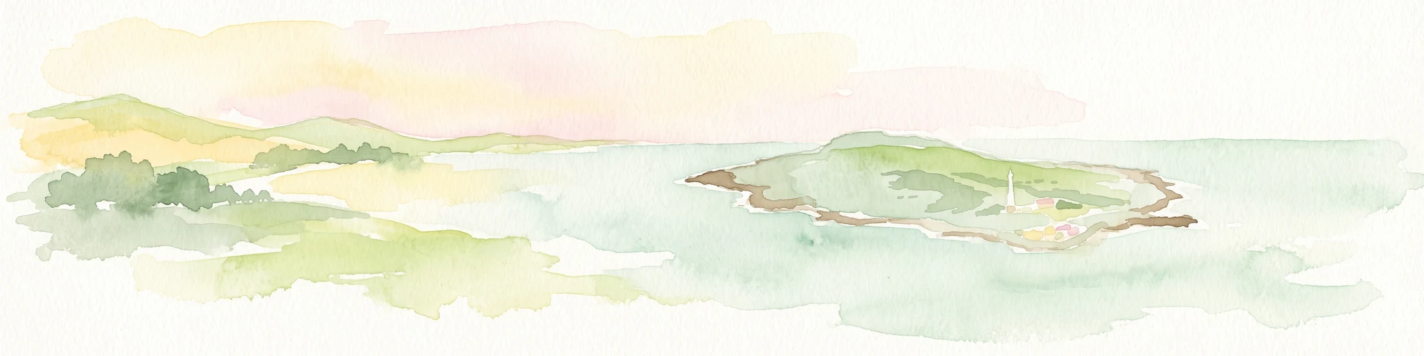
A soft watercolor painting showing an island surrounded by water, with distant green hills on the horizon under a light-colored sky.
National parkMaldonado
About 61 km away#4 closest

Southwest

Parque nacional Isla e islote de Lobos y su entorno sumergido: Protected Area Atlas

Mapping the oceanic terrain and rocky coastal landscapes of Uruguay

This resource provides a detailed geographic overview of Parque nacional Isla e islote de Lobos y su entorno sumergido. Explore the composition of this protected marine environment, which spans both rugged island terrain and extensive submerged rocky formations within the Atlantic waters of Maldonado.

Area
40 km²
Established
2024
Relief
Lowland
Climate
Temperate
National parkRocha Department
85 km away#5 closest

Northeast

Santa Teresa National Park: Mapped Coastal Forest and Beach Protected Landscape

Explore Rocha Department's unique protected Atlantic coast geography.

Santa Teresa National Park, a designated national park in Uruguay's Rocha Department, offers a compelling example of a protected coastal environment. Its landscape is characterized by a distinctive blend of dense forests that reach down to the sandy shores of the Atlantic Ocean, a rare feature in the region's protected areas. This page provides detailed geographic context and map-based exploration for understanding this unique seaside national park and its place within Uruguay's conservation atlas.

IUCN
II
Relief
Lowland
Climate
Subtropical
Access
Easy access
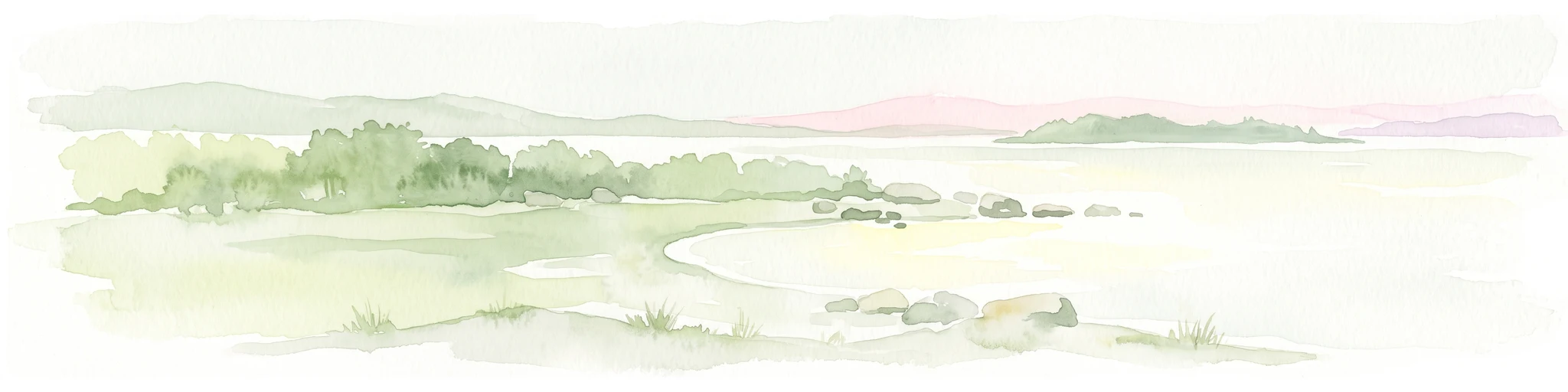
Watercolor painting of a wide, calm lake landscape with a sandy shoreline, sparse vegetation, and gentle hills in the background.
National parkRocha Department
About 86 km away#6 closest

Northeast

Parque Nacional Laguna Negra: Geographic Map and Protected Area Overview

Wetland and Savanna Landscapes in Rocha Department

Parque Nacional Laguna Negra protects a compressed mosaic of coastal environments in eastern Uruguay. The area integrates dense marshlands with native grasslands and patches of indigenous forest, providing a essential habitat corridor along the Atlantic coast. Use this atlas resource to understand its terrain and internal environmental distribution.

Area
7.15 km²
Established
2025
Relief
Lowland
Climate
Temperate
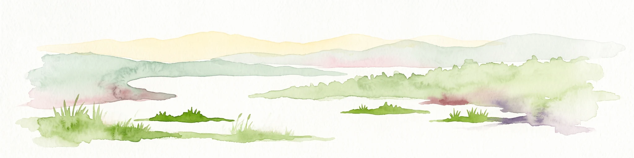
Watercolor painting of a soft landscape with rolling hills in the background and grassy plains in the foreground on a white background.
National parkLavalleja Department
About 90 km away#7 closest

West

Parque nacional Arequita: Protected Landscape and Volcanic Geography in Lavalleja

Mapped natural terrain and protected ecosystems of southeastern Uruguay.

Parque nacional Arequita preserves a unique volcanic landscape in the Lavalleja Department, centered on the ancient basalt hill of Cerro Arequita. The area protects diverse environments ranging from rocky cave systems and native forests to critical freshwater watersheds. This record offers a deep look into the geographical character, internal boundaries, and ecological importance of one of Uruguay's most prominent natural sites.

Area
5.6 km²
Established
2024
Relief
Upland
Climate
Temperate
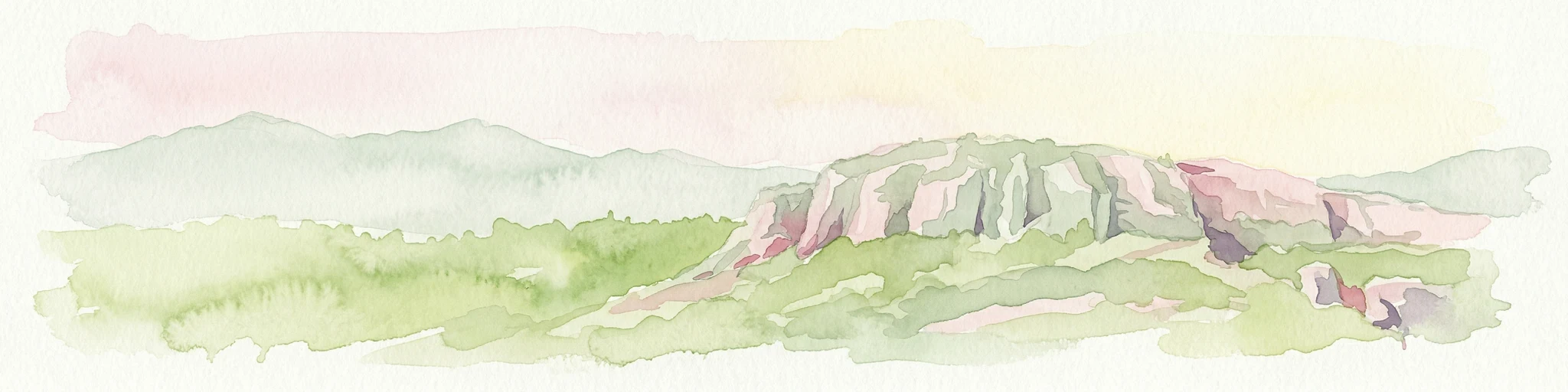
Watercolor painting showing a hill with green landscape and distant mountains
National parkUruguay
About 90 km away#8 closest

West

Arequita National Park: Uruguay's National Park Protected Landscape and Geography

Mapped boundaries and regional natural terrain context for a key protected area.

Delve into Arequita National Park, a designated national park contributing to Uruguay's protected land inventory. This resource explores the park's unique geographic setting, its mapped boundaries, and its significance within the natural landscape of the Southern Cone. Gain structured insight into its role as a protected area and its contribution to the regional geography of South America.

Scope
Terrestrial
Water
No major water

Common questions about visiting, size, designation, and location context for Laguna de Rocha

Laguna de Rocha FAQs for park facts, access, geography, and protected area context

Find quick answers about Laguna de Rocha, including protected-area facts, park geography, trail and visitor context, and how the park fits into its surrounding country and regional landscape.
MoriAtlas Explorer

Continue Your Protected Areas Search Across the Global Atlas

Deepen your exploration by continuing the structured search for national parks and protected areas worldwide. Utilize the comprehensive filtering capabilities to compare different conservation landscapes and refine your understanding of global park geography. Discover more about the distribution and characteristics of protected natural areas.

Global natural geography