Mori Atlas logo
Protected areaLake Gabou

A rare oasis wetland sustaining biodiversity across the sandstone topography of the Tagant Plateau

Lake Gabou: Mapped Protected Area and Wetland Landscapes within the Tagant Region of Mauritania

(Lac Gabou et le réseau hydrographique du Plateau du Tagant)

Lake Gabou represents a significant protected area situated within the arid expanse of central Mauritania. This wetland landscape, embedded in the Tagant Plateau, captures seasonal runoff to support a critical refuge for West African crocodiles and migrating birds. The area features a distinct contrast between rocky sandstone outcrops and fertile groves of date and doum palms, forming an essential node in the hydrographic network of the Sahelian transition zone.

wetlandsSahelTagant Plateaulakepalm grovesmigratory birds

Lake Gabou

Protected area

Park overview

Structured park overview, official facts, and landscape profile for Lake Gabou

Lake Gabou park facts, protected area profile, and essential visitor context

Review the core facts for Lake Gabou, including designation, size, terrain, visitor scale, habitats, and operating context in one park-focused overview.

About Lake Gabou

Lake Gabou lies in the Tagant Region of central Mauritania, an area defined by the elevated sandstone formations of the Tagant Plateau. The plateau is part of the geological backbone of the country, rising above the surrounding sandy plains and acting as a catchment that channels seasonal rainfall into a network of basins, gueltas, and lakes. Lake Gabou is one of the most prominent features in this hydrographic system, capturing runoff from the plateau's surface and concentrating water, soil moisture, and vegetation in a localized zone.

In climatic terms, the lake sits in the transition between the true Sahara and the Sahelian zone to the south. Average rainfall is low and irregular, but the runoff captured by the plateau's rocky surface and rocky valleys can sustain open water and surrounding wetlands long enough to support notable ecological communities. The lake and its fringing vegetation create a green island within a broader arid landscape, which is why sites like Lake Gabou have such disproportionate ecological value in Mauritania.

The wetland zone around Lake Gabou is characterized by date palms and doum palms, both of which are economically and culturally important to local communities. African baobabs and desert roses are also present, contributing to a mixed flora that includes species from Sahelian woodland, dryland savanna, and wetland habitats. The combination of open water, palm groves, and surrounding plateaus creates a layered environment that supports an unusual diversity of life for an arid Saharan-edge region.

Lake Gabou's importance is reflected in its international designations. It was listed as a Ramsar Wetland of International Importance in February 2009, recognizing its role in the global network of wetlands of significance for waterbirds, hydrology, and ecological function. It has also been identified by BirdLife International as an Important Bird Area, particularly because of the wintering populations of ruffs that rely on the site. Together, these designations place Lake Gabou among the most ecologically important wetland sites in Mauritania.

Quick facts and research context for Lake Gabou

Lake Gabou is a lake and wetland system situated in the Tagant Region of Mauritania, on the Tagant Plateau. It collects runoff from the surrounding plateau and supports a mosaic of wetland, palm, and savanna vegetation in an arid Saharan environment. The site covers roughly 9,500 hectares and includes the nearby settlement of Ksar el Barka.

Lake Gabou was listed as a Ramsar Wetland of International Importance in 2009 under the official designation 'Lac Gabou et le réseau hydrographique du Plateau du Tagant'. It has also been recognized by BirdLife International as an Important Bird Area, notably for the populations of wintering ruffs that use the wetland.

Protection and recognition

Examine documented terrestrial protection scope and Ramsar wetland listings

Lake Gabou Protection Status and International Recognition Records

Lake Gabou maintains documented terrestrial protection status alongside formal international recognition from the Ramsar Convention for Lac Gabou et le réseau hydrographique du Plateau du Tagant. Structured records summarize known management scope and official designation sources without projecting conservation outcomes.

International recognition

Protection details

Protection scope
Terrestrial
Park context

Deeper park guide and search-rich context for Lake Gabou

Lake Gabou history, landscape, wildlife, and travel context

Explore Lake Gabou through its history, landscape character, ecosystems, wildlife, conservation priorities, cultural context, and seasonal travel timing in a structured park guide built for atlas discovery and search intent.

Why Lake Gabou stands out

Lake Gabou is best known for being one of the rare permanent wetland sites on the otherwise arid Tagant Plateau. Its combination of seasonal lake habitat, indigenous palm groves, and Sahelian woodland vegetation gives it strong ecological significance within Mauritania's desert landscape. The lake is also recognized for its role as a refuge for West African crocodiles and as a staging or wintering site for migratory birds, including significant numbers of ruffs. These qualities have brought it both Ramsar and Important Bird Area recognition.

Lake Gabou history and protected-area timeline

The lake and its basin have a documented history that extends back into traditional and colonial-era accounts of the region. The lake and surrounding area were historically known by the names Tammourt en Naaj and Hoorewendu, the latter meaning 'head of the swamp' in Pulaar.

In earlier centuries, the lake's waters and wetlands sheltered a population of hippopotami, an indicator of how much more extensive and water-rich the wetland once was. This historic presence of large aquatic mammals underlines the long-term importance of Lake Gabou as a refuge within an otherwise arid Saharan-margin landscape. In the modern era, the lake was designated a Ramsar Wetland of International Importance in 2009, formalizing its protection status at the international level.

Lake Gabou landscape and geographic character

Lake Gabou is set within the rugged topography of the Tagant Plateau, an elevated sandstone landscape that dominates central Mauritania. The plateau is characterized by flat-topped mesas, rocky scarps, deep sandy valleys, and dry channels that fill briefly during the rainy season. Lake Gabou occupies a basin in this terrain, taking advantage of natural low points where seasonal runoff collects.

The surrounding terrain is highly contrasted: barren sandstone outcrops and dunes meet patches of green vegetation around the lake and along the valleys that feed it. The fringing palm groves of date and doum palms create a distinct inner landscape, sheltering the wetland and giving the site a characteristic oasis-like character that contrasts sharply with the wider arid plateau.

Lake Gabou ecosystems, habitats, and plant life

The ecological identity of Lake Gabou rests on the juxtaposition of wetland and arid Saharan-edge environments. Where water is present, the wetland supports aquatic and semi-aquatic vegetation, while the banks and surrounding basin host a Sahelian and Saharan-margin flora. Date palms and doum palms form the most visible structural vegetation, while African baobabs and desert roses contribute to the site's drier woodland flora.

This mix of wetland, palm grove, and dryland vegetation in a single location makes the lake ecologically unusual in Mauritania. Its habitat mosaic supports diverse groups of fauna, including waterbirds, reptiles, and species adapted to arid surroundings, and it functions as a focal point for life on an otherwise dry plateau.

Lake Gabou wildlife and species highlights

Lake Gabou provides habitat for a notable range of fauna within an arid region. It has historically supported populations of hippopotami, reflecting the size and ecological richness the wetland once held. Currently, the lake is recognized as a refuge for West African crocodiles, a species of significant conservation concern across West Africa.

The site also holds strong importance for birds. Lake Gabou has been recognized as an Important Bird Area by BirdLife International and supports populations of wintering ruffs. More broadly, it functions as a site for migrating birds moving across the Sahara-Sahel boundary, and as a seasonal refuge for waterbirds that depend on the few reliable wetland sites in the region.

Lake Gabou conservation status and protection priorities

Lake Gabou's conservation significance lies in its role as one of the key wetland sites on the Tagant Plateau, a region where permanent water and wetland habitat are scarce. By holding seasonal water and supporting key species, the lake sustains ecological functions that are otherwise difficult to maintain in this arid landscape.

In 2009, the site was formally designated a Ramsar Wetland of International Importance under the name 'Lac Gabou et le réseau hydrographique du Plateau du Tagant', acknowledging its role within the broad hydrographic network of the plateau rather than as an isolated lake. Its recognition as a BirdLife International Important Bird Area adds another layer of international conservation attention, particularly because the site supports significant wintering populations of ruffs.

The lake's importance for West African crocodiles further strengthens its conservation profile, as these reptiles depend on very few remaining suitable wetland habitats across West Africa. Together, these values make Lake Gabou a high-priority site for wetland and biodiversity conservation in Mauritania.

Lake Gabou cultural meaning and human context

The wetland has long been embedded in the cultural geography of the region. The historical name Hoorewendu, meaning 'head of the swamp' in Pulaar, reflects the importance of the lake to local Fulani communities and their linguistic heritage. The presence of date and doum palms has also supported traditional livelihoods, linking the ecological and cultural value of the site.

The settlement of Ksar el Barka is associated with the lake, suggesting that human communities have historically drawn on the wetland for water, vegetation, and resources. This long-standing relationship between people and the wetland is part of why Lake Gabou continues to carry cultural as well as ecological significance.

Top sights and standout views in Lake Gabou

Lake Gabou's standout features include its position as a major wetland within the Tagant Plateau, its mix of Sahelian palm groves with Saharan-margin desert vegetation, and its role as a refuge for West African crocodiles and migratory birds. Its Ramsar designation and Important Bird Area status underline its place in international conservation networks.

Another defining highlight is the lake's setting within the broader Tagant Plateau hydrographic system, which gives it significance beyond its own shoreline. The combination of palm-rich fringing vegetation, open water, and rocky plateau surroundings creates a distinctive landscape profile that stands apart from typical Saharan scenery.

Best time to visit Lake Gabou

The character of Lake Gabou shifts with the seasons, in line with the rainfall and water regimes of the Tagant Plateau. During and shortly after the rainy season, water levels in the lake are likely to be at their highest, supporting the greatest concentrations of waterbirds and the most visibly active wetland habitat. The surrounding vegetation, including date and doum palms, is also at its most lush during these months.

In the dry season, water recedes and the landscape takes on a more arid appearance, although palm groves and baobabs remain visible and wildlife still concentrates around the remaining water. The cooler months tend to be more comfortable for travel in the region, while the period when water and bird concentrations peak offers the richest experience for visitors interested in the wetland and its fauna.
Monthly climate preview

Long-term representative records tracking monthly averages across the Tagant Region coordinate

Lake Gabou Climate Normals: Annual Temperature and Precipitation Rhythm

Representative coordinate records outline sustained annual temperature swings and distinct precipitation variations across the protected landscape. Examining the full twelve-month profile provides complete historical averages for evaluating long-term environmental patterns.
Annual mean28 °C
20 °C34 °C
Jan20°
Feb23°
Mar26°
Apr30°
May33°
Jun34°
Jul32°
Aug30°
Sep30°
Oct29°
Nov26°
Dec21°
Warmest month
June

34.5 °C

Coolest month
January

20.1 °C

Wettest month
August

2.8 mm/day

Driest month
November

0 mm/day

Park location guide

Geography guide, regional context, and park location map for Lake Gabou

Lake Gabou park geography, regions, and map view in Mauritania

Understand where Lake Gabou sits in Mauritania through a broader geographic reading of the surrounding landscape, nearby location context, and its mapped position within the national park landscape.

How Lake Gabou fits into Mauritania

Mauritania is a Northwest African country covering approximately 1,030,000 km², making it the 11th-largest in Africa and 28th-largest globally. About 90% of its territory lies in the Sahara desert, with most of its population of roughly 5.5 million living in the southern region. The country achieved independence from France in 1960 and is officially an Islamic republic with Arabic as the official language.

Wider geography shaping Lake Gabou in Mauritania

Mauritania is located in Northwest Africa along the Atlantic Ocean coast to the west. It borders Western Sahara to the north and northwest, Algeria to the northeast, Mali to the east and southeast, and Senegal to the southwest. The landscape is predominantly desert, with the Sahara covering about 90% of the territory. The southern region is more temperate and supports most of the population.

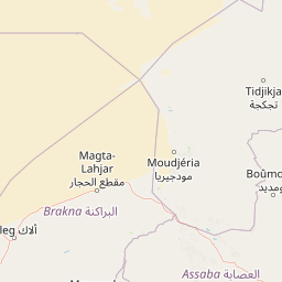
Map view of Lake Gabou

Use this park location map to pinpoint Lake Gabou in Mauritania, understand its exact geographic position, and read its mapped placement within the surrounding landscape more clearly.

Pigeon | © OpenStreetMap contributors

Location context for Lake Gabou

Tagant Region
Park atlas

Discover related wetland reserves and regional conservation landscapes

Explore Protected Areas and Parks Near Lake Gabou in Mauritania

Compare Lake Gabou with other protected areas across the Tagant Plateau and surrounding arid terrain. Broader park discovery reveals connected hydrographic networks and desert wetland habitats throughout the region.
National parkMali
About 470 km away#1 closest

South

Bafing National Park: Mali National Park Atlas and Protected Woodland Landscape

Explore the unique chimpanzee habitat and bird conservation within this West African savanna.

Bafing National Park is a cornerstone of conservation in Mali, recognized for its exclusive role in protecting chimpanzee populations within the Manding Plateau region. This extensive national park features a predominant woodland ecosystem interspersed with savanna areas, providing critical habitat for numerous bird species as designated by BirdLife International. Understanding Bafing National Park's mapped geography and protected landscape offers insight into vital primate and avian conservation efforts in West Africa.

Area
5,000 km²
Established
2000
IUCN
II
Relief
Upland
National parkMauritania
About 471 km away#2 closest

Northwest

Banc d'Arguin National Park: Mauritania's National Park Geography and Mapped Boundaries

Explore the geographic identity and protected landscape.

Investigate Banc d'Arguin National Park, a significant national park located in Mauritania. This detailed page offers insights into its protected landscape, mapped geographic features, and its regional context. Understand the specific park boundaries and how the area contributes to the atlas of protected lands in Northwest Africa.

Area
12,000 km²
Established
1976
IUCN
II
Relief
Lowland
National parkMauritania
About 497 km away#3 closest

West

Diawling National Park: National Park Protected Landscape in Mauritania

Explore mapped boundaries and regional geographic context.

Diawling National Park represents a significant protected area within the vast geographic scope of Mauritania, a nation characterized by its extensive Sahara Desert territory. As a designated national park, it provides crucial context for understanding the distribution of conservation landscapes and their specific mapped boundaries in arid Northwest Africa. This entry supports detailed atlas exploration by highlighting the park's unique role and regional geographic setting.

Area
156 km²
Established
1991
IUCN
II
Relief
Lowland
National parkSenegal
About 512 km away#4 closest

South

Niokolo-Koba National Park: Exploring Senegal's Protected Landscape Identity

Mapped boundaries and regional geography context.

Niokolo-Koba National Park offers a distinct focus on Senegal's protected landscapes, providing valuable insights for atlas and map-based exploration. This national park serves as a key geographic anchor, highlighting the natural terrain and the extent of its protected boundaries within the country. Users can delve into the specific characteristics of this area to understand its role within Senegal's diverse natural heritage and regional geography.

Area
9,130 km²
Established
1954
IUCN
II
Relief
Upland
National parkKayes Region
About 532 km away#5 closest

Southeast

Boucle du Baoulé National Park: National Park Geographic Context and Atlas Discovery

Explore mapped boundaries and regional landscape.

Boucle du Baoulé National Park is a designated national park situated in the Kayes Region, offering a focal point for geographic exploration within Mali. This entry provides critical atlas-level details on its protected landscape, enabling users to trace its mapped boundaries and understand its position within the surrounding natural terrain. Dive into the specific geography of Boucle du Baoulé National Park to enhance your understanding of protected areas and their regional significance.

Area
25,330 km²
Established
1982
IUCN
II
Climate
Arid
National parkSenegal
About 542 km away#6 closest

Southwest

Langue de Barbarie National Park: A Protected National Park in Senegal's Geography

Explore its mapped boundaries and regional landscape context.

Langue de Barbarie National Park is a protected national park located in Senegal, offering a distinct geographic focus for atlas exploration. Understanding this protected area involves examining its mapped boundaries and its place within the broader coastal geography of West Africa. This entry provides structured information to comprehend the park's identity as a conservation landscape and its contribution to Senegal's natural territory.

Area
20 km²
Relief
Lowland
Scope
Mixed
Water
Major water bodies
National parkMali
About 568 km away#7 closest

South

Wongo National Park: Discover Its Protected Landscape and Geographic Atlas Context in Mali

Explore Mali's Wongo National Park mapped boundaries and regional natural landscapes.

Wongo National Park represents a significant protected area within Mali, offering a distinct entry point for exploring national park geography and mapped landscapes. This designation within the West African region provides valuable insight into protected land distribution and the surrounding natural terrain. The park's context within the broader atlas framework allows for detailed investigation of its boundaries and its place within the country's ecological and geographic framework, supporting structured discovery.

Area
534 km²
Established
2002
IUCN
II
Climate
Temperate
Watercolor illustration of a river flowing through a landscape with trees, grassy areas, and distant hills under a soft sky
National parkCentral River Division
About 577 km away#8 closest

Southwest

River Gambia National Park: National Park Geography and Protected Landscape Atlas

Discover mapped boundaries within Central River Division.

River Gambia National Park represents a key protected area within the Central River Division, offering specific geographic insights for atlas exploration. This page details the park's mapped boundaries and its role as a national park, providing a factual basis for understanding its landscape context and regional importance. Explore the geographic features that define this protected natural area.

Area
5.85 km²
Established
1978
IUCN
II
Relief
Lowland

Common questions about visiting, size, designation, and location context for Lake Gabou

Lake Gabou FAQs for park facts, access, geography, and protected area context

Find quick answers about Lake Gabou, including protected-area facts, park geography, trail and visitor context, and how the park fits into its surrounding country and regional landscape.
MoriAtlas Explorer

Continue Your Protected Areas Search Across the Global Atlas

Deepen your exploration by continuing the structured search for national parks and protected areas worldwide. Utilize the comprehensive filtering capabilities to compare different conservation landscapes and refine your understanding of global park geography. Discover more about the distribution and characteristics of protected natural areas.

Global natural geography