

Mori Atlas logo
National parkLake Nakuru National Park

Analyzing the volcanic terrain and soda lake ecosystems within this iconic Kenyan conservation site

Lake Nakuru National Park in the Great Rift Valley: A Mapped Protected Area and Landscape Profile

Lake Nakuru National Park represents a significant protected area centered around the alkaline waters of a shallow soda lake on the floor of the Great Rift Valley. This atlas entry examines the park's distinct mosaic of grassland, acacia woodland, and rocky escarpments that support substantial rhinoceros populations and vast bird concentrations. By mapping the boundaries of this fenced sanctuary against the backdrop of the Menengai volcanic crater, researchers and geography enthusiasts can better understand the unique ecological functions of this concentrated Rift Valley habitat.

soda lakeRift Valleyflamingo sanctuaryrhino conservationbirdwatchingalkaline lake

Lake Nakuru National Park

National park

Park overview

Structured park overview, official facts, and landscape profile for Lake Nakuru National Park

Lake Nakuru National Park park facts, protected area profile, and essential visitor context

Review the core facts for Lake Nakuru National Park, including designation, size, terrain, visitor scale, habitats, and operating context in one park-focused overview.

About Lake Nakuru National Park

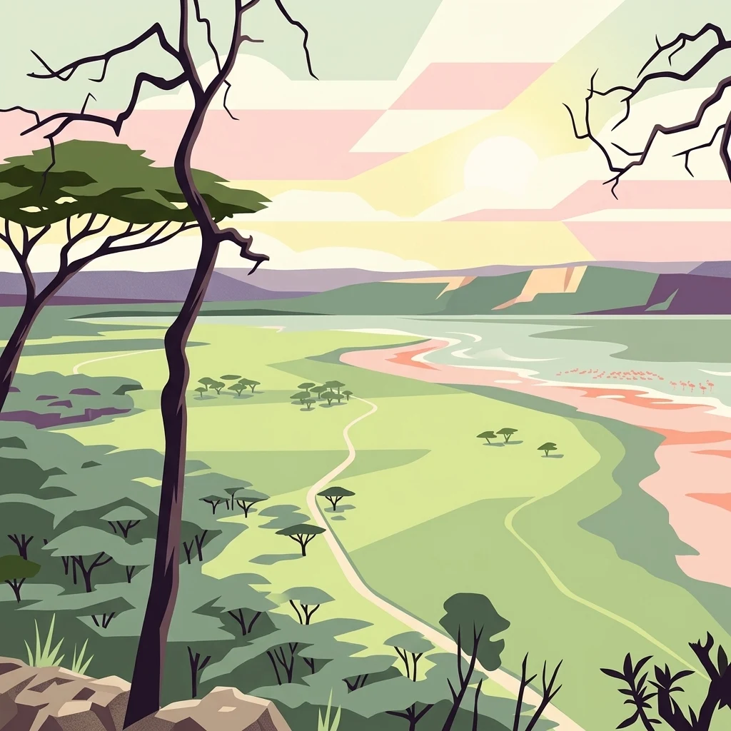
Lake Nakuru National Park sits on the floor of the Great Rift Valley in central Kenya, encircling a shallow soda lake whose chemistry has shaped both its landscape and its fame. The lake is highly alkaline and supports dense blooms of cyanobacteria, the foundation of an extraordinary food web that draws vast numbers of waterbirds. Surrounding the lake are bands of grassland, acacia woodland, and rocky escarpment that climb toward the rift walls, creating a compact mosaic of habitats within a relatively small protected footprint.

The park was first gazetted as a bird sanctuary in 1960 and upgraded to national park status in 1968. Since then its role has expanded considerably. While the flamingos continue to define its broader identity, the reserve has been progressively reshaped into a flagship rhino conservation area. Both black and white rhinoceros are maintained here, and a perimeter fence has been erected specifically to protect these animals from poaching, rather than to contain them.

Its location, about 140 kilometers northwest of Nairobi and close to the town of Nakuru, makes it one of the most easily accessed major parks in Kenya. The combination of Rift Valley scenery, an iconic alkaline lake, dense concentrations of large mammals, and rich birdlife has secured Lake Nakuru a lasting place among East Africa's signature protected landscapes.

Quick facts and research context for Lake Nakuru National Park

Lake Nakuru National Park is a small but high-profile protected area in Kenya's Rift Valley Province, encircling Lake Nakuru south of the town of Nakuru. It covers roughly 188 square kilometers and sits at an elevation of about 1,754 meters above sea level on the floor of the Great Rift Valley.

The park is managed by the Kenya Wildlife Service and holds IUCN Category II national park status. It originally began as a bird sanctuary in 1960 and was elevated to national park status in 1968, with later boundary expansions to strengthen rhino conservation. Beyond its flamingo-rich lake, it has been progressively fenced to create a secure sanctuary for both black and white rhinoceros.

Protection and recognition

Examine documented terrestrial conservation frameworks and official designation parameters.

Lake Nakuru National Park Protection Status and Global Recognition Records

Lake Nakuru National Park maintains a defined terrestrial protection status governed by recorded conservation frameworks and administrative parameters. Comprehensive factual records outline international recognition sources and management scope for this protected landscape.

Protection details

Protection scope
Terrestrial
Transboundary protection
No
WDPA ID
762
Park context

Deeper park guide and search-rich context for Lake Nakuru National Park

Lake Nakuru National Park history, landscape, wildlife, and travel context

Explore Lake Nakuru National Park through its history, landscape character, ecosystems, wildlife, conservation priorities, cultural context, and seasonal travel timing in a structured park guide built for atlas discovery and search intent.

Why Lake Nakuru National Park stands out

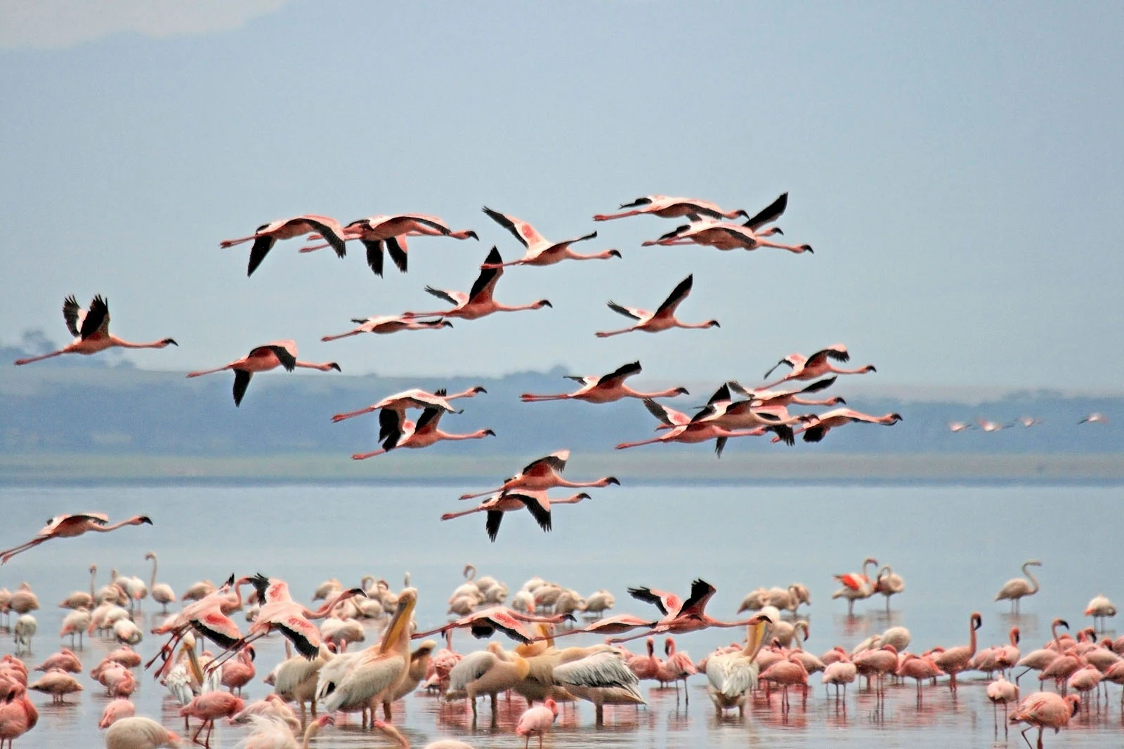
Lake Nakuru is internationally recognized for the spectacular congregations of lesser flamingos that feed on the algae of its alkaline waters, often accompanied by large numbers of pelicans. At peak times the lake's surface has appeared almost solid pink, an image that helped define the park's global reputation. It is equally known as one of Kenya's most important rhino sanctuaries. Concentrated populations of both black and white rhinoceros live within a fenced perimeter designed specifically to deter poaching rather than to restrict animal movement. The combination of a Rift Valley soda lake, iconic birdlife, and a serious large-mammal conservation role gives the park a profile that is both scenic and ecologically strategic.
Lake Nakuru National Park history and protected-area timeline

Lake Nakuru's protected status began in 1960, when the area around the lake was designated as a bird sanctuary in recognition of the lake's importance for waterbirds, particularly flamingos. In 1968 the area was elevated to national park status, formalizing its role as a flagship reserve within Kenya's protected-area system.

Over the following decades the park's purpose expanded beyond bird conservation. The reserve was enlarged to accommodate growing populations of rhinoceros, especially black rhinos, whose survival in the wild was under increasing pressure. A perimeter fence was constructed around the expanded area; its explicit purpose was anti-poaching protection rather than restriction of animal movement, a design intention that has shaped the park's identity as a secure sanctuary.

In 2009 the park supported a substantial rhino population, including around 25 black rhinos, one of the largest concentrations in Kenya, alongside a much larger group of white rhinos. These developments established the park as a key node in Kenya's broader rhino conservation strategy, complementing its earlier role as a flamingo sanctuary.

Lake Nakuru National Park landscape and geographic character

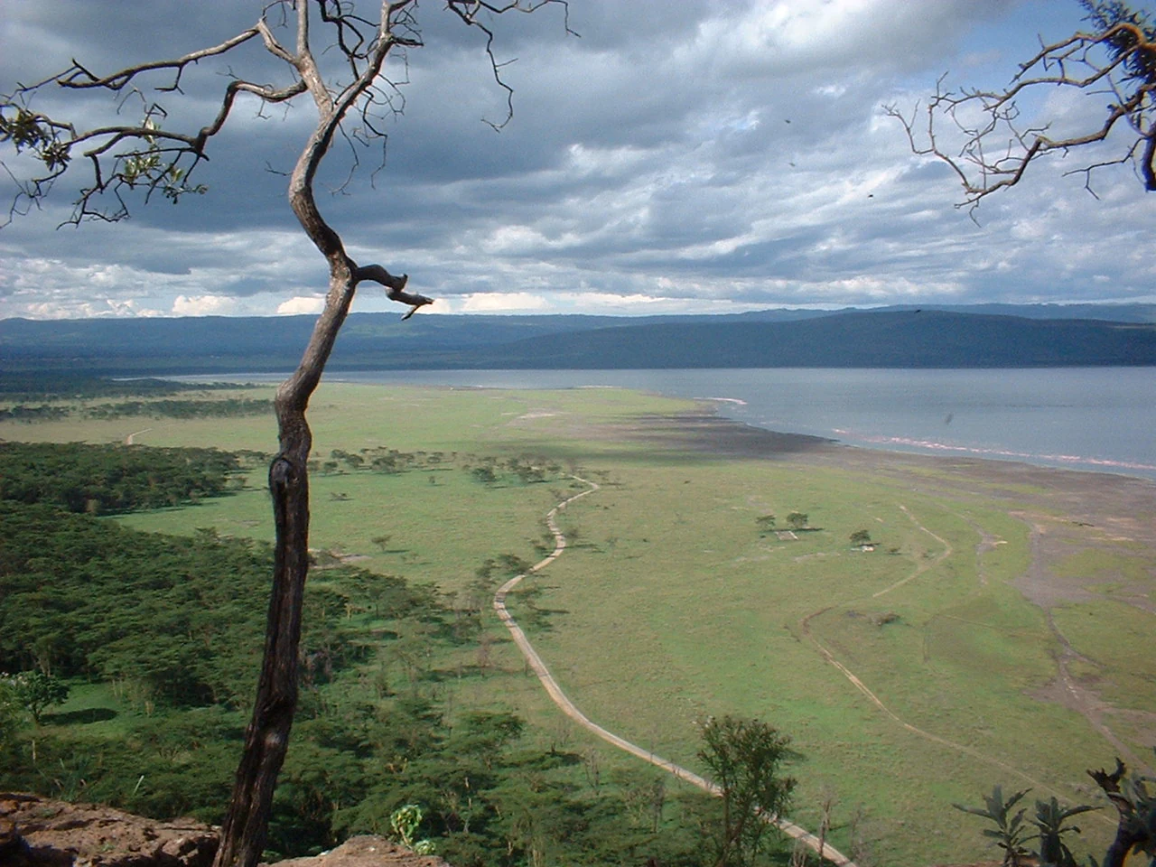
The defining landscape element is Lake Nakuru itself, a shallow, highly alkaline soda lake on the floor of the Great Rift Valley. The lake's shoreline shifts with water levels, exposing broad flats of pale mud and salt-tinged sediment that contribute to the park's bright, open character. The waters are typically shallow enough that massive flocks of flamingos can wade far from the shore.

Surrounding the lake is a ring of habitats typical of the Rift Valley. Open grasslands alternate with denser belts of acacia woodland and Euphorbia forest, particularly on the steeper slopes. Rocky outcrops and the wooded valleys leading down toward the lake break up the terrain and create shaded pockets where wildlife concentrates. Toward the southeast the park borders the Soysambu Conservancy, an important wildlife corridor and a potential future expansion zone.

Dominating the skyline above the park is the dormant volcano Menengai, a massive cratered feature rising roughly 2,300 meters above sea level. Its crater rim and forested flanks form an unmistakable backdrop and give the park a strongly volcanic, Rift Valley character.
Lake Nakuru National Park ecosystems, habitats, and plant life

The lake's chemical composition is the single most important ecological driver in the park. Its alkalinity fuels blooms of cyanobacteria, which in turn support the enormous populations of lesser flamingos and other waterbirds that define the lake's ecology. The food web is unusually simple at its base but supports a remarkable density of birdlife.

Around the lake, vegetation shifts from open shorelines to grasslands and into denser acacia and Euphorbia woodland on the slopes. This gradient creates transitional habitats that support a broad mix of grazers and browsers. The park's relatively small size is offset by the concentration of ecological niches compressed into a short distance between alkaline shoreline and wooded escarpment.

The terrain includes volcanic soils and rocky areas that favor hardy, drought-resistant vegetation. Combined with the lake's chemical regime, this gives the park a distinct ecological signature within the Rift Valley network of protected areas, with a stronger bird-and-lake emphasis than many of its neighbors.
Lake Nakuru National Park wildlife and species highlights

Wildlife viewing at Lake Nakuru centers on two parallel attractions. The first is the waterbird spectacle of the lake, where lesser flamingos gather in the hundreds of thousands to feed on cyanobacteria, joined by pelicans and a wide supporting cast of herons, kingfishers, fish eagles, and other species. The second is the terrestrial fauna of the surrounding grasslands and woodlands.

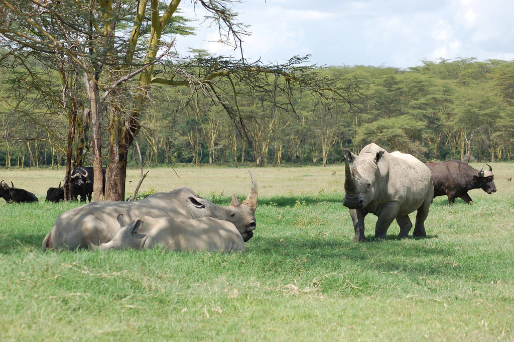
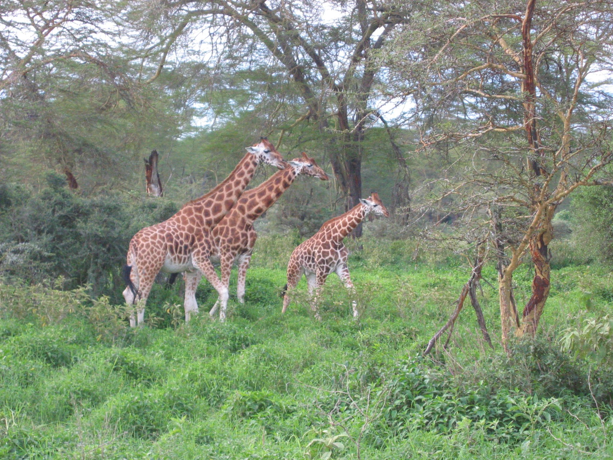
Rhinoceros are the park's most important large mammals and the reason for its late-twentieth-century expansion. Both white and black rhinos are present, with white rhinos being the more numerous of the two. Rothschild's giraffes, originally moved here for safety from western Kenya in 1977, are a regular sight, and waterbuck are extremely common throughout the park.

Predators include lions and leopards, with leopards increasingly reported in recent years. Large pythons occur in the denser forest patches, occasionally crossing roads or draped across branches. Beyond these headliners, the park supports around 56 mammal species overall and roughly 450 recorded bird species, making it a compact but unusually rich wildlife area.
Lake Nakuru National Park conservation status and protection priorities

Conservation significance at Lake Nakuru operates on two levels. Historically, the park was established to protect one of Africa's most important flamingo feeding sites and remains a reference point for soda-lake bird conservation in the Rift Valley.

In more recent decades the park has become a cornerstone of Kenya's rhino conservation strategy. Expansion of the park's boundaries and construction of a perimeter fence were undertaken specifically to safeguard black and white rhinos from poaching, creating a secure sanctuary rather than a confined enclosure. The southeast border adjoins the Soysambu Conservancy, which represents both the remaining wildlife corridor toward Lake Naivasha and a likely future extension of rhino habitat.

The park's combination of an intensively managed single-species sanctuary with a broader landscape-scale conservation role gives it an outsized importance relative to its modest area.

Lake Nakuru National Park cultural meaning and human context

Lake Nakuru's cultural footprint is modest but distinctive, shaped primarily by its proximity to the town of Nakuru and its visibility from one of Kenya's busiest travel corridors. The town of Nakuru, Kenya's fourth-largest city for much of its history, takes its name from the Maasai word for the dusty, swirling local conditions, and the lake has long been part of the regional identity of the central Rift Valley.

Historically the lake's flamingo flocks drew attention from very early in Kenya's tourism era, and the park helped popularize the image of pink-flooded Rift Valley lakes that still shapes visitor expectations of the region. While indigenous land-use traditions around the lake are less prominently preserved than in some other Kenyan protected areas, the park's role as a regional landmark is firmly established.

Top sights and standout views in Lake Nakuru National Park

Lake Nakuru's most arresting highlight is the flamingo-fringed shoreline of the alkaline lake itself, where lesser flamingos have historically carpeted the water in shifting pink masses. The visual scale of these gatherings, and their pairing with pelicans, fish eagles, and other Rift Valley waterbirds, gives the park one of Africa's most distinctive wildlife scenes.

Equally important is the rhino sanctuary role defined by the expanded, fenced park. White and black rhinos, Rothschild's giraffes, waterbuck, and an increasing leopard presence combine with the Rift Valley backdrop, including the cratered Menengai volcano, to give the park an unusually compact but layered set of standout features.

Best time to visit Lake Nakuru National Park

Lake Nakuru can be visited year-round, but conditions vary meaningfully with rainfall and lake levels. The dry seasons typically offer clearer viewing, firmer roads, and more concentrated wildlife around the lake and remaining water sources, while the wetter periods can transform the shoreline and influence how many flamingos choose to feed on the lake.

The number of flamingos visible fluctuates with the lake's water chemistry and food availability, so the exact character of the bird spectacle can shift from season to season. For the broader mammal viewing, including rhinos and Rothschild's giraffes, the dry periods are generally considered the more reliable window across the Rift Valley ecosystems.

Monthly climate preview

Long-term monthly temperature and precipitation patterns across representative Rift Valley elevation coordinates

Lake Nakuru National Park Climate Normals, Temperature and Precipitation

Lake Nakuru National Park exhibits measured annual temperature variations and monthly precipitation rhythms spanning a 1991 to 2020 climatology period. Detailed monthly climate normals provide deeper statistical context regarding long-term temperature ranges and precipitation rates.
Annual mean16 °C
14 °C17 °C
Jan16°
Feb17°
Mar17°
Apr16°
May15°
Jun15°
Jul14°
Aug14°
Sep15°
Oct16°
Nov16°
Dec16°
Warmest month
March

17.3 °C

Coolest month
July

14 °C

Wettest month
April

6.1 mm/day

Driest month
February

1.5 mm/day

Park location guide

Geography guide, regional context, and park location map for Lake Nakuru National Park

Lake Nakuru National Park park geography, regions, and map view in Kenya

Understand where Lake Nakuru National Park sits in Kenya through a broader geographic reading of the surrounding landscape, nearby location context, and its mapped position within the national park landscape.

How Lake Nakuru National Park fits into Kenya

Kenya is a presidential republic in East Africa and the seventh-most populous country on the continent. Its capital is Nairobi, and it borders five countries and the Indian Ocean. The country features significant geographic diversity including Mount Kenya, the Rift Valley, and coastal regions.

Wider geography shaping Lake Nakuru National Park in Kenya

Kenya is located in East Africa, bordering South Sudan to the northwest, Ethiopia to the north, Somalia to the east, Tanzania to the southwest, and Uganda and Lake Victoria to the west. The southeastern border meets the Indian Ocean. The geography includes the Rift Valley highlands with Mount Kenya, coastal plains, and northern arid regions.

Map view of Lake Nakuru National Park

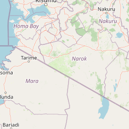
Use this park location map to pinpoint Lake Nakuru National Park in Kenya, understand its exact geographic position, and read its mapped placement within the surrounding landscape more clearly.

Pigeon | © OpenStreetMap contributors

Location context for Lake Nakuru National Park

Rift Valley
Park atlas

Compare nearby national parks and protected areas across the Great Rift Valley region

Explore Other Parks Near Lake Nakuru National Park and Surrounding Protected Landscapes

Browse other protected areas and national parks located near Lake Nakuru National Park in the surrounding Rift Valley region. Comparing these neighboring habitats provides a broader geographic perspective on regional conservation landscapes and wildlife distribution.
National parkKenya
Mapped location lies within the park boundary#1 closest

Southwest

Lake Nakuru National Park: An Atlas of Kenyan Rift Valley Protected Landscapes

Geographic boundaries, terrain analysis, and ecosystem context.

Investigate the physical layout and protected status of Lake Nakuru National Park, a critical habitat located within Kenya's Great Rift Valley. This record details the park's alkaline lake basin, surrounding woodland transitions, and its broader role in regional conservation, providing a clear atlas perspective on one of the country's most significant natural protected areas.

Area
188 km²
Established
1961
Relief
Lowland
Climate
Subtropical
National parkNakuru County
About 66 km away#2 closest

Southeast

Hell's Gate National Park: National Park Atlas and Mapped Landscape Exploration

Discover Nakuru County's protected terrain and geographic context.

Explore the mapped boundaries and unique geographic identity of Hell's Gate National Park, a protected national park within Kenya's Nakuru County. This detailed atlas view focuses on the park's natural landscape and its place within the regional geography, offering structured discovery of its protected terrain and surrounding context. Understand the visual and geographic essence of this significant conservation area.

Area
68.25 km²
Established
1984
IUCN
II
Relief
Mountain
National parkNyeri County
About 73 km away#3 closest

East

Aberdare National Park: Mapped Protected Landscape in Nyeri County

National Park Geography and Atlas Context

Aberdare National Park is a protected national park located within Nyeri County, Kenya. This entry offers detailed geographic information and map context, highlighting its protected boundaries and landscape characteristics. Users can explore its regional setting, understand its specific terrain features, and discover its significance as a conservation area within the Kenyan geography. Access structured data that clarifies the park's identity as a vital protected landscape.

Area
767 km²
Established
1950
IUCN
II
Relief
Mountain
National parkKenya
About 74 km away#4 closest

Southeast

Mount Longonot National Park: Kenya's Mapped Protected Landscape for Atlas Exploration

Discover the natural terrain and park boundaries.

Mount Longonot National Park serves as a vital protected area within Kenya, offering a focused lens for geographical exploration. This national park's defined landscape and mapped boundaries provide essential context for understanding its place in the broader regional geography. Ideal for users seeking detailed information on protected territories, Mount Longonot National Park offers insights into Kenya's natural heritage through an atlas-centric approach.

Scope
Terrestrial
National parkKenya
About 132 km away#5 closest

Southeast

Nairobi National Park: Detailed Geographic Overview and Protected Landscape Atlas

Explore the mapped boundaries and regional context of this Kenyan national park.

Nairobi National Park represents a significant protected national park entity within Kenya. This MoriAtlas entry provides detailed insight into its geographic placement and mapped landscape characteristics. Users can delve into the park's specific location, its protected boundaries, and its contribution to the regional geography of East Africa, facilitating structured map-based exploration and understanding of this vital conservation area.

Area
117 km²
Established
1946
IUCN
II
Relief
Mixed relief
National parkKenya
About 142 km away#6 closest

East

Mount Kenya National Park: Mapped Volcanic Landscape & Protected Area Geography

Kenya's high-altitude Afro-alpine ecosystems and mapped park boundaries.

Mount Kenya National Park safeguards a globally significant volcanic landscape and vital water resources for Kenya. This protected area above 3,000 meters features dramatic peaks, glaciers, and distinctive Afro-alpine flora. Explore its comprehensive mapped boundaries, understand its regional geographic importance, and discover the unique ecosystems that define this exceptional national park through detailed atlas context.

Area
715 km²
Established
1949
IUCN
II
Relief
Mountain
National parkKenya
About 152 km away#7 closest

Southeast

Ol Donyo Sabuk National Park: Kenya's Prominent Highland Volcanic Protected Landscape

Mapped National Park boundaries and montane forest geography.

Ol Donyo Sabuk National Park represents a vital protected natural area situated in Kenya's central highlands. Its landscape is dominated by a striking volcanic peak, offering a unique montane forest environment and significant primate habitat. This entry provides essential details for atlas exploration, focusing on the park's geographic placement, its protected landscape features, and the ecological context it represents within Kenya's protected areas system.

IUCN
II
Relief
Mountain
Scope
Terrestrial
Water
Minor water
National parkMara Region
About 172 km away#8 closest

Southwest

Serengeti National Park: National Park Atlas and Protected Landscape Discovery

Explore savanna grasslands, regional geography, and mapped park boundaries.

Serengeti National Park, a significant national park within Tanzania's Mara Region, offers an unparalleled view into a vast protected landscape. This page provides access to the park's geographic identity, its defining savanna ecosystem, and its role as a critical component of the regional atlas. Understand the mapped extent of its protected boundaries and the unique natural context that supports its renowned wildlife.

Area
14,763 km²
Established
1940
IUCN
II
Visitors
350K annual

Common questions about visiting, size, designation, and location context for Lake Nakuru National Park

Lake Nakuru National Park FAQs for park facts, access, geography, and protected area context

Find quick answers about Lake Nakuru National Park, including protected-area facts, park geography, trail and visitor context, and how the park fits into its surrounding country and regional landscape.
MoriAtlas Explorer

Continue Your Protected Areas Search Across the Global Atlas

Deepen your exploration by continuing the structured search for national parks and protected areas worldwide. Utilize the comprehensive filtering capabilities to compare different conservation landscapes and refine your understanding of global park geography. Discover more about the distribution and characteristics of protected natural areas.

Global natural geography