Mori Atlas logo
Nearby park discovery

Map and explore the geographic distribution of protected landscapes surrounding this volcanic region.

Regional Protected Areas and National Parks Near Lassen Volcanic National Park in California

Analyze the geographic context and distribution of protected areas situated near Lassen Volcanic National Park. This regional overview provides a mapped perspective on surrounding wilderness and conservation lands within the Cascade Range and Northern California, illustrating the spatial relationship between diverse volcanic and alpine landscapes.

Related tags

Volcanic LandscapeNational ParkCascade RangeGeothermal FeaturesPlug Dome Volcano

Active volcanic landscapes at the southern end of the Cascade Range

Lassen Volcanic National Park

Lassen Volcanic National Park is a national park in northeastern California that protects a remarkable volcanic landscape at the southern end of the Cascade Range. The park's dominant feature is Lassen Peak, the largest plug dome volcano in the world and the southernmost active volcano in the Cascades. The park is one of the few places on Earth where all four types of volcanoes can be found: plug dome, shield, cinder cone, and stratovolcano. The area remains geologically active with boiling mud pots, fumaroles, and hot springs demonstrating ongoing volcanic processes beneath the surface. Established in 1916 following a period of significant eruptive activity, the park preserves approximately 106,000 acres of diverse terrain ranging from glaciated canyons and alpine lakes on the western side to a vast lava plateau dotted with cinder cones on the eastern side. The landscape tells a compelling geological story of volcanic construction, collapse, and ongoing thermal activity.

Location
United States of America
Park type
National park
Established
1916
Area
430.8 km²
Highest point
3,187 m
Lassen Volcanic National Park protected area
Regional park map

See the ranked park cluster in its geographic setting

Nearby parks around Lassen Volcanic National Park

This regional map shows the same 20 nearby parks ranked below around Lassen Volcanic National Park. Select a ranked marker to highlight that park’s boundary where boundary data is available.
Reference park: Lassen Volcanic National ParkRanked nearby parkSelected boundary: Lassen Volcanic National Park20 nearby parks shown
20 nearby parks

Distance-ranked regional park geography and surrounding protected landscapes

Parks and Protected Areas Geographically Near Lassen Volcanic National Park

Examine the ranked collection of nearby protected areas surrounding Lassen Volcanic National Park through precise geographic separation metrics. Compare regional park geography and recorded environmental traits to understand broader conservation patterns across the surrounding terrain.
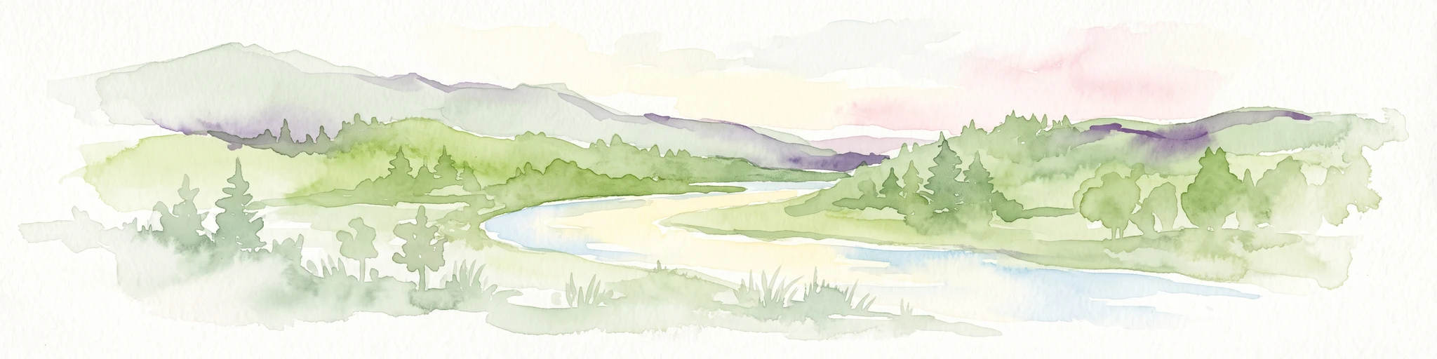
A wide watercolor illustration showing a calm body of water surrounded by green hills, conifer trees, and reeds in the foreground.
Protected landscapeCalifornia
Park boundaries overlap#1 closest

East

Lassen National Forest: Mapped Geography and Protected Landscapes of Northern California

Volcanic terrain and expansive old growth ecosystems

Lassen National Forest represents a vast protected landscape in Northern California, defined by its severe volcanic geology and resilient conifer forests. This atlas entry provides essential geographic context regarding the forest boundaries, the volcanic rim of Mount Tehama, and the intricate river systems shaping the region. Explore the terrain, from accessible lava tubes to the wilderness areas preserved within this significant mountain corridor.

Area
4,331.53 km²
Established
1905
Relief
Mountain
Climate
Temperate
Protected landscapeCalifornia
27 km away#2 closest

Southeast

Plumas National Forest: Mapped Geography and Protected Landscape Features in California

Exploring the Sierra Nevada watershed and wilderness terrain

Plumas National Forest serves as a critical protected landscape in northern California, anchoring the headwaters of the Feather River system. This atlas entry details the forest's rugged canyons, high elevation mountain lakes, and significant old growth conifer stands that define its role within the northern Sierra Nevada ecosystem.

Area
4,640 km²
Established
1907
Relief
Mountain
Climate
Mediterranean
Wildlife reserveCalifornia
29 km away#3 closest

Southwest

Ishi Wilderness Wildlife Reserve: Mapping the Volcanic Canyons of the Cascade Foothills

Geographic atlas of protected northern California wilderness and cultural landscapes.

Ishi Wilderness represents a crucial protected area in northern California, where volcanic geology meets a deep-rooted cultural history. Explore the mapped ridgelines, river canyons, and diverse oak woodland habitats that define this unique wildlife reserve and its role within the Cascade foothills.

Area
167.29 km²
Established
1984
IUCN
Ib
Relief
Mountain
Protected landscapeCalifornia
39 km away#4 closest

North

Modoc National Forest: Protected Landscape and Warner Mountains Geography

High desert volcanic terrain in northeastern California

Modoc National Forest encompasses a massive expanse of volcanic plateaus and rugged mountain ridges in the northeastern corner of California. This protected area offers significant geographic variety, transitioning from arid sagebrush basins to lush, high-elevation conifer forests. It serves as a vital natural landscape, home to the South Warner Wilderness and large stands of old-growth timber, reflecting the unique geologic history of the regional lava flows.

Area
6,695.09 km²
Established
1904
Relief
Mountain
Access
Moderate access
A soft watercolor painting depicting a serene landscape with gentle green hills, a small forest, and a calm lake at sunrise or sunset.
Protected landscapeCalifornia
43 km away#5 closest

West

Shasta, Trinity National Forest: Mapping the Protected Landscapes of Northern California

Volcanic peaks, expansive reservoirs, and rugged mountain wilderness

Spanning over two million acres, Shasta, Trinity National Forest represents a major protected landscape in Northern California. The geography includes the iconic Mount Shasta volcano and the complex shoreline of Shasta Lake, while hosting expansive wilderness areas and diverse terrain ranging from oak-forested foothills to alpine meadows.

Area
8,942.87 km²
Established
1954
Relief
Mountain
Climate
Temperate
Protected landscapeCalifornia
79 km away#6 closest

West

Whiskeytown, Shasta, Trinity National Recreation Area: Geographic and Protected Landscape Overview

Mapped terrain across northern California reservoir units

Investigate the environmental character of Whiskeytown, Shasta, Trinity National Recreation Area, spanning from the expansive waters of Shasta Lake to the forested ridges of the Whiskeytown unit. This atlas entry details the interplay between large-scale reservoir management, riparian habitats, and the transition from Mediterranean chaparral to high-elevation conifer forests in California.

Area
99,588 km²
Established
1965
IUCN
V
Visitors
1.5M annual
Protected landscapeCalifornia
87 km away#7 closest

Southeast

Tahoe National Forest: Exploring Protected Mountain Landscapes in the California Sierra Nevada

An atlas of granite river canyons and alpine ridge terrain

Tahoe National Forest defines a critical segment of the western Sierra Nevada, containing granite river canyons, numerous reservoirs, and summits reaching above 9,000 feet. This protected landscape acts as a vital headwater for California foothill communities and Nevada, hosting significant natural features like the Placer County Big Trees Grove and segments of the Pacific Crest Trail.

Area
3,526.82 km²
Established
1899
Relief
Mountain
Climate
Mediterranean
A soft watercolor illustration depicting a series of distant mountain ranges behind a line of evergreen trees against a white background.
Wildlife reserveCalifornia
99 km away#8 closest

Northwest

Mount Shasta Wilderness: A Geographic Profile of California Volcanic and Alpine Landscapes

Mapping protected volcanic peaks and glacial ecosystems

Deeply explore the protected geography of Mount Shasta Wilderness, a 38,200-acre reserve in Northern California. This record details the park's stratovolcano foundations, glacial terrain, and forested corridors, offering a clear view of the complex landforms and boundary systems that define this significant high-elevation protected area.

Area
155 km²
Established
1984
IUCN
Ib
Relief
Mountain
A watercolor illustration showing a soft, panoramic view of green trees and rolling hills against pale, pinkish-yellow mountains in the background.
Protected landscapeCalifornia
102 km away#9 closest

Southwest

Mendocino National Forest: Mapping California's Remote Protected Mountain Landscape

Examining wilderness boundaries and rugged coastal terrain

Mendocino National Forest serves as a significant protected area in California, known for being the only national forest in the state without major paved access. Its terrain spans 913,000 acres of mountain peaks, deep river canyons, and old-growth conifer forests. Home to the unique tule elk population at Lake Pillsbury, this landscape provides a rare example of wilderness isolation, complex geothermal features, and rugged, largely untouched northern coastal topography.

Area
3,696.02 km²
Established
1907
Relief
Mountain
Climate
Mediterranean
A watercolor painting showing soft green hills, distant pink-hued mountains, and a pale blue lake in a serene, stylized landscape.
Protected landscapeNevada
121 km away#10 closest

East

Humboldt, Toiyabe National Forest: Protected Landscape and Regional Mountain Geography

A vast network of Nevada mountain ranges and alpine wilderness

Humboldt, Toiyabe National Forest serves as a defining public land entity across Nevada and eastern California. As the largest national forest in the contiguous United States, it preserves a striking collection of isolated mountain ranges, including the Ruby Mountains and the rugged Jarbidge wilderness, within a broader basin-and-range landscape. Examine the boundaries and terrain that characterize this complex, high-desert ecosystem.

Area
25,454 km²
Established
1908
Relief
Mountain
Access
Easy access
Watercolor painting of a peaceful river landscape, featuring rolling green hills, dense trees, and distant soft-toned mountains.
Protected areaCalifornia
136 km away#11 closest

Northwest

Six Rivers National Forest: Exploring Protected River Valleys and Mountain Terrain in California

A regional protected area spanning California river systems

Six Rivers National Forest defines much of the rugged landscape in northwestern California. Named for the six major river drainages within its borders, the area features a unique combination of coastal forests, deep river canyons, and high-country ridges that offer significant insight into the region's broader geographic and ecological character.

Area
3,875.2 km²
Established
1947
Relief
Mountain
Climate
Mediterranean
Protected landscapeCalifornia
144 km away#12 closest

North

Butte Valley National Grassland: Geographic Overview and Protected Landscape Mapping

High-desert sagebrush steppe in Northern California

Butte Valley National Grassland is a singular protected landscape in northern California, known for its expansive sagebrush steppe and dry lakebed terrain. Centered in the Klamath River basin, the grassland provides an essential high-desert habitat framed by the dramatic volcanic presence of the Cascade Range and Mount Shasta. This atlas entry details the geography, soil composition, and mountain-framed boundaries of this unique protected area.

Area
74.56 km²
Established
1991
Relief
Upland
Climate
Temperate
Protected landscapeCalifornia
153 km away#13 closest

Northwest

Marble Mountain Wilderness: Exploring Protected Mountain Landscapes in Northern California

Klamath Mountains Wilderness and Alpine Geography

Spanning hundreds of thousands of acres, Marble Mountain Wilderness offers a dense concentration of subalpine fir, deep glacial lakes, and steep drainage basins. This northern California protected landscape provides an atlas of rugged ridges and marble-toned peaks that represent one of the most ecologically diverse backcountry areas in the region.

Area
978.3 km²
Established
1964
IUCN
Ib
Relief
Mountain
Protected areaNevada
About 165 km away#14 closest

Southeast

Mount Rose Wilderness: Protected Landscape and Regional Geography in Northwestern Nevada

Carson Range alpine terrain and ecological transition mapping

Mount Rose Wilderness represents a significant protected area in the Carson Range, where 31,223 acres of terrain transition from the forested, subalpine slopes of the Sierra Nevada to the drier, sage-dominated Great Basin. The mapped landscape includes high granite peaks and meadows, offering a clear view of the complex environmental gradients that define this unique section of the American West.

Area
126.35 km²
Established
1989
Relief
Mountain
Climate
Temperate
Protected areaNevada
167 km away#15 closest

Northeast

Little High Rock Canyon Wilderness: Mapping the High Desert Protected Landscapes of Nevada

A rugged canyon environment within the expansive Great Basin desert

Explore the distinct geography of Little High Rock Canyon Wilderness, where sharp basalt walls and sheltered canyons break the wide sagebrush expanse of northern Nevada. This protected area serves as a vital component of the High Rock country, offering a compact yet significant look at the high desert terrain and historic landscape features defining this remote portion of the Great Basin.

Established
2000
Relief
Upland
Climate
Arid
Access
Remote access
Wildlife reserveNevada
181 km away#16 closest

Northeast

East Fork High Rock Canyon Wilderness: Protected Basin and Canyon Geography

Remote Nevada high desert and basalt canyon landscapes

Managed as a federal wilderness area, this reserve protects the rugged northeast rim of High Rock Canyon in northern Nevada. The landscape is defined by steep volcanic edges, dry drainage systems, and vast, open horizons characteristic of the Great Basin high desert. This area serves as a quiet contrast to the surrounding multi-use terrain, offering an unbroken view of one of the most desolate and striking geographic corridors in the American West.

Established
2000
IUCN
Ib
Relief
Highland
Climate
Arid
A watercolor painting of soft, layered mountain ridges and forests in muted green, yellow, and red tones, presented in a wide, horizontal format against a white background.
Protected landscapeCalifornia
About 181 km away#17 closest

Northwest

Klamath National Forest; Protected Landscape Geography and Mapped Wilderness Boundaries

Diverse mountain terrain in Northern California

Klamath National Forest represents a significant protected area in Northern California, encompassing a vast, rugged landscape that bridges the Klamath Mountains and the Cascade Range. Its terrain is characterized by deeply incised river valleys, exposed rocky summits, and an intricate mosaic of coniferous forests. This geographic detail provides essential context on the forest's role as a major site for wilderness protection and ecological study in the Pacific Northwest.

Area
7,033 km²
Established
1905
Relief
Mountain
Climate
Temperate
An artistic watercolor illustration showing a line of green evergreen trees in the foreground with hazy, distant mountains in the background against a light, neutral sky.
Protected landscapeOregon
192 km away#18 closest

Northwest

Rogue River, Siskiyou National Forest: Mapped Geography and Protected Area Overview

Tracing volcanic peaks and river-carved mountain terrain in Oregon

Spanning nearly 7,300 square kilometers, the Rogue River, Siskiyou National Forest acts as a crucial ecological anchor in the Pacific Northwest. This overview details its unique mountain geography, the extensive wilderness tracts within its boundaries, and the river systems that define its mountainous character.

Area
6,973.46 km²
Established
2004
Visitors
915K annual
Relief
Mountain
Wildlife reserveOregon
197 km away#19 closest

North

Mountain Lakes Wilderness: Geographic Atlas of Oregon's Glacial Volcanic Reserve

Mapping the volcanic cirques and square boundaries of the southern Cascades.

Mountain Lakes Wilderness serves as a primary geographic anchor in the southern Cascades, where shield volcanoes meet glacially carved basins. This protected area contains over twenty lakes situated in high-altitude cirques near the summits of volcanic peaks like Aspen Butte. The area is defined by its distinctive square survey-township boundary, providing a clear footprint of wilderness conservation within the larger Fremont-Winema National Forest terrain.

Area
93 km²
Established
1964
IUCN
Ib
Relief
Mountain
National parkCalifornia
202 km away#20 closest

Northwest

Redwood National and State Parks: Protected Landscape Geography and Mapped Boundaries

Explore California's protected area atlas.

Gain a structured understanding of Redwood National and State Parks as a protected national park within the geographic context of California. This dedicated page focuses on its mapped boundaries and protected landscape identity, offering critical atlas-level insights for regional geography exploration and conservation land context. Discover how this protected area fits into the larger mapped terrain.

Area
562.88 km²
Established
1968
IUCN
V
Visitors
458.4K annual
Distance methodology

Geographic measurements, not driving distances

How nearby park distances are calculated

Distances use park boundaries whenever the available geometry allows it. When one or both boundaries are missing, the mapped park locations provide a clearly labelled estimate. Every value represents straight-line geographic separation and does not use roads or routing.

Boundary distance

Calculated between the nearest points of both park boundaries.

Location-to-boundary estimate

Estimated from one mapped park location to the nearest boundary of the other park.

Mapped-location estimate

Estimated between the mapped locations of both parks.

MoriAtlas Explorer

Continue exploring Lassen Volcanic National Park's protected landscape and geography

Deepen your understanding of Lassen Volcanic National Park by examining its precise geographic boundaries and the unique natural terrain it preserves. This destination offers key insights into the park's protected status and its role within California's geographic tapestry. Continuing your exploration here provides valuable data for appreciating its mapped landscape and context within the comprehensive atlas of protected areas.