Mori Atlas logo
Nature reserveLepelaarplassen

A detailed look at the polder terrain, wetland ecology, and mapped marshland boundaries

Lepelaarplassen Nature Reserve: Understanding the Protected Wetland Landscapes of Flevoland

Lepelaarplassen represents a significant wetland nature reserve on the southern shore of the Markermeer in the Netherlands. This protected area within the young landscape of the Flevoland polder showcases an intricate network of open water, reed beds, willow marshes, and wet meadows. By examining the mapped boundaries and natural terrain, it becomes clear how these managed habitats support dense breeding bird colonies and serve as a crucial migration corridor for waterfowl.

wetland reservemarshlandbirdwatchingbreeding bird coloniescormorant colonygreat egret

Lepelaarplassen

Nature reserve

Park overview

Structured park overview, official facts, and landscape profile for Lepelaarplassen

Lepelaarplassen park facts, protected area profile, and essential visitor context

Review the core facts for Lepelaarplassen, including designation, size, terrain, visitor scale, habitats, and operating context in one park-focused overview.

About Lepelaarplassen

The Lepelaarplassen form a relatively young but ecologically rich nature reserve on the southern shore of the Markermeer, between Almere and the dike that protects the Flevopolder from the lake. Covering about 500 hectares, the area sits in a landscape that was, geologically speaking, only created when the former Zuiderzee seabed was drained in the second half of the twentieth century. What began as a byproduct of sand extraction during the construction of the Oostvaardersdijk has matured into one of the most important wetland reserves in the Netherlands for breeding and migratory waterbirds.

The reserve's core is a clay marsh with three lakes that emerged from sand-winning operations, together with a fourth seepage lake along the dike where birds concentrate at the edge between open water and terraced polder. Around the lakes, the landscape is a patchwork of willow marsh, broad reed fringes, open water, wet meadows studded with shallow pools, and a small sand mound provided for sand martins. A low dike has been built to raise water levels, gradually enlarging the share of marsh and wet grassland within the area.

Ecologically, the Lepelaarplassen sit at the centre of a wetland corridor that includes the adjacent Wilgenbos and the more famous Oostvaardersplassen. While these areas are only partially connected, and fish and large grazers cannot easily move between them, the chain as a whole plays a vital role for bird migration along the Oostvaardersdijk. The Dutch society Vogelbescherming has classified the Lepelaarplassen area as a wetland of international importance, reflecting its role in supporting both breeding colonies and large numbers of staging and wintering waterbirds.

Spontaneous nature development has been important here. The willow marsh covering part of the reserve established itself naturally after the drainage of southern Flevoland, with no active planting. Over time, however, active management by Het Flevo-landschap has increasingly shaped the reserve. Shallow channels and pools were introduced from 2007 onward to benefit marsh birds such as bitterns and marsh harriers. In 2021, two bird islands in the central lake were enlarged so that spoonbills, avocets, common terns, and little ringed plovers could once again find secure nesting sites out of reach of terrestrial predators. The successful breeding of white-tailed eagles from 2019 onward has underlined that the reserve now offers conditions for top predators as well as for wetland species at the base of the food web.

Quick facts and research context for Lepelaarplassen

Lepelaarplassen is a wetland nature reserve of about 500 hectares on the edge of the Markermeer, near Almere in Flevoland, Netherlands. It has been protected as a nature reserve since 1971, was designated as a Natura 2000 site in 2009, and became a core area of Nationaal Park Nieuw Land in 2018. The reserve is managed by Het Flevo-landschap and is internationally recognized as an important wetland for migratory and breeding birds.

Protection and recognition

Terrestrial protected area designation history and Natura 2000 records

Lepelaarplassen Protection Status and International Recognition Data

Terrestrial protected area records for Lepelaarplassen outline a 2009 designation alongside documented Natura 2000 recognition sources. Official conservation status details provide a reliable baseline for examining international recognition and territorial management scope.

International recognition

Protection details

Protection scope
Terrestrial
Designated year
2009
Transboundary protection
No
Park context

Deeper park guide and search-rich context for Lepelaarplassen

Lepelaarplassen history, landscape, wildlife, and travel context

Explore Lepelaarplassen through its history, landscape character, ecosystems, wildlife, conservation priorities, cultural context, and seasonal travel timing in a structured park guide built for atlas discovery and search intent.

Why Lepelaarplassen stands out

The reserve is best known for its major breeding bird colonies in the heart of a young polder landscape. It hosts one of the largest cormorant colonies in the Netherlands and a sizeable great egret colony, alongside seasonal concentrations of marsh and waterbirds. Together with the adjoining Wilgenbos and Oostvaardersplassen, the area forms a key link in a migration route along the Oostvaardersdijk dike.
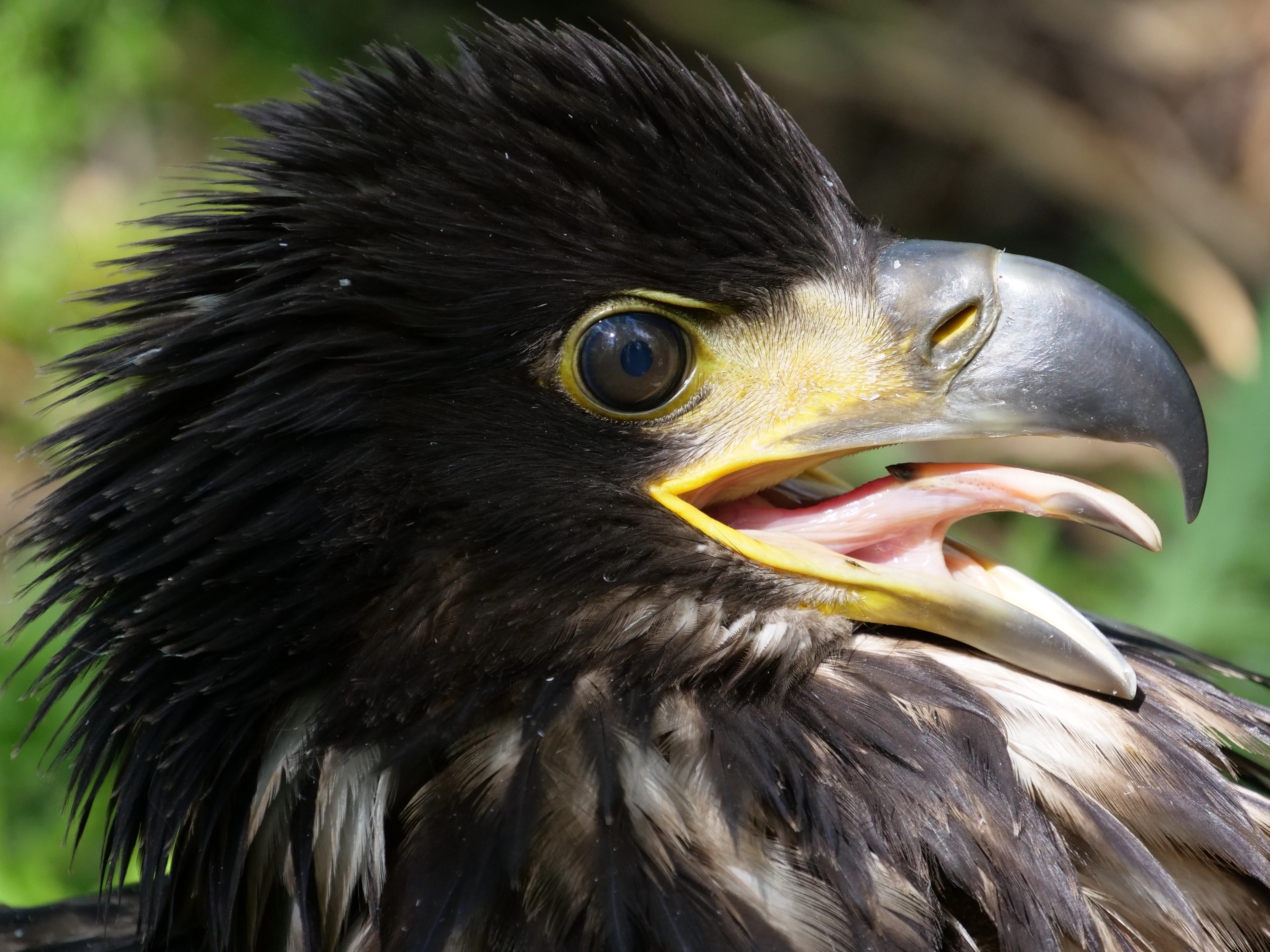
A close up profile of a white-tailed eagle with dark feathers and a yellow beak, captured with its beak slightly open.
A close up view of a white-tailed eagle at the Lepelaarplassen nature reserve.

Lepelaarplassen history and protected-area timeline

The Lepelaarplassen have been protected as a nature reserve since 1971, only a few years after the surrounding southern Flevoland polder was reclaimed from the former Zuiderzee. The lakes that define the reserve were not planned from a conservation perspective, but were created as a side effect of sand extraction during the construction of the Oostvaardersdijk, the dike that separates the polder from the Markermeer.

Since 1994 the area has been managed by the foundation Het Flevo-landschap, which has gradually shaped the reserve through habitat restoration: raising water levels with low dikes, digging shallow channels and pools, and creating or enlarging bird islands. In 2009 the area was formally designated as a Natura 2000 site, placing it within the European network of protected nature areas, and in 2018 it became a core zone of the larger Nationaal Park Nieuw Land. A visitor centre called De Trekvogel, located near the De Blocq van Kuffeler pumping station on the Oostvaardersdijk, served the area until 2023.

Lepelaarplassen landscape and geographic character

The landscape of the Lepelaarplassen is shaped by its position on the edge of a young polder. The reserve's core is a flat clay marsh containing four lakes, three of which were excavated for sand during the building of the Oostvaardersdijk and a fourth seepage lake that runs along the foot of the dike. The lakes are framed by wide reed fringes and by stretches of willow marsh that established themselves spontaneously after the drainage of southern Flevoland, making it one of the few places in the Netherlands where willow woodland came about entirely through natural colonisation.

Beyond the marsh, the reserve includes open water surfaces, wet meadows dotted with shallow pools that attract geese and meadow birds, and a deliberately constructed sand mound provided for sand martins. A low encircling dike has raised water levels within the reserve, gradually increasing the share of marsh and wet grassland. The result is a layered, wetland-dominated landscape in which water levels, vegetation structure, and human-engineered landforms all interact to support dense birdlife.
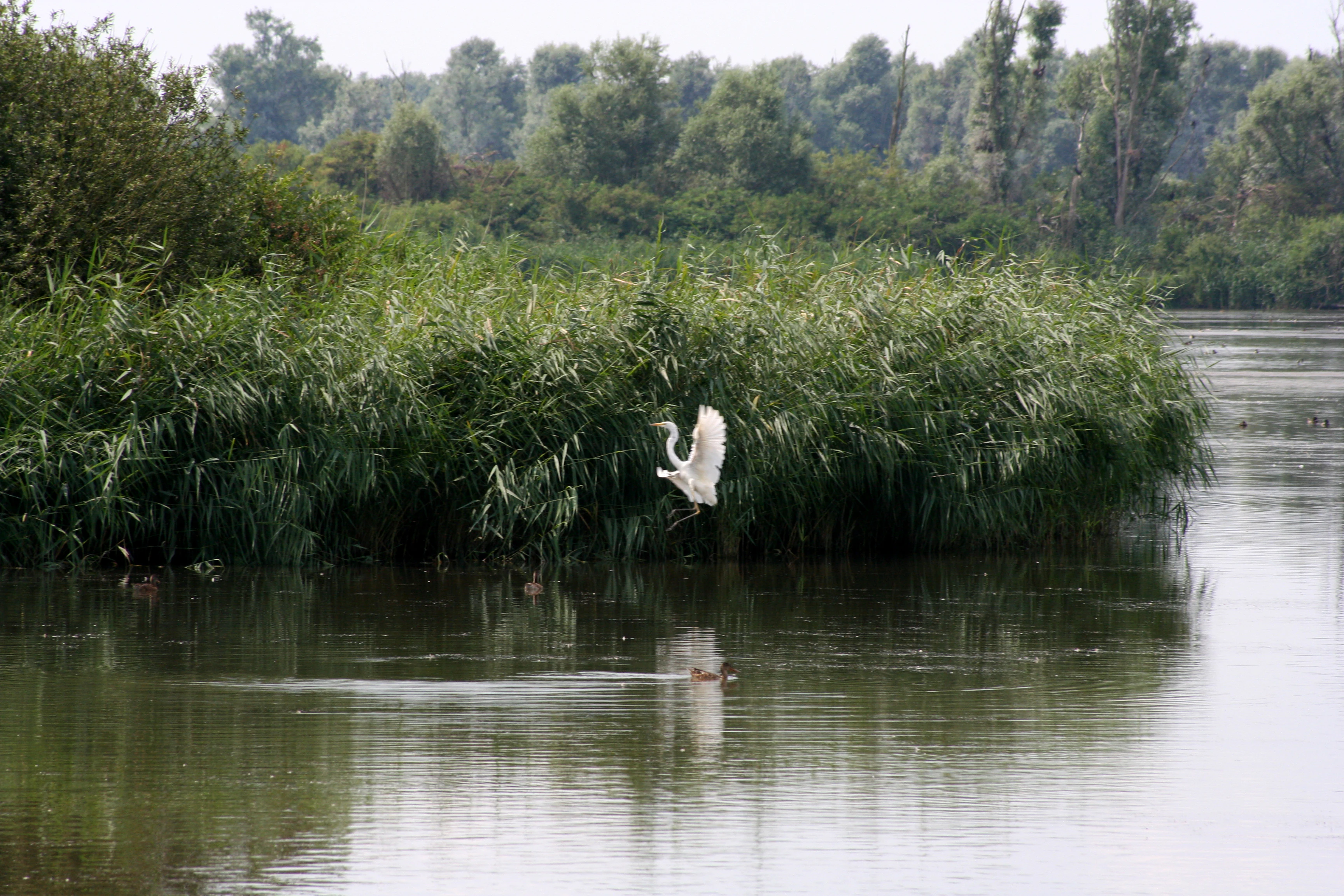
A great egret with white plumage in flight, preparing to land in a lush green marshland with dense reeds and a calm body of water.
A great egret landing in the marshy habitat of Lepelaarplassen.

Lepelaarplassen ecosystems, habitats, and plant life

Ecologically, the reserve sits within the reclaimed Zuiderzee seabed of the Flevopolder, where nature has had to develop on land that existed only as lake bottom a few decades earlier. The Lepelaarplassen illustrates how new polder landscapes can become ecologically significant relatively quickly when water levels are managed for wetland habitats and where natural colonisation by willow is allowed to proceed.

The area combines several complementary habitat types: open freshwater lakes, reed beds, willow marsh, wet meadows, and small islands of bare sand. These habitats together support a wide range of invertebrates, fish, amphibians, and mammals, including beaver and otter, while also providing breeding, foraging, and roosting conditions for a large suite of birds. Because most of the reserve was never intensively farmed or built upon, it has retained relatively natural hydrological conditions for a polder setting, and its connection to the broader Markermeer shore gives it an additional lakeside character.

Lepelaarplassen wildlife and species highlights

Birdlife is the heart of the reserve's identity. A cormorant colony became established here in 1985 with about 240 pairs and at its peak numbered around 5,000 breeding pairs. Diminished fish stocks in the Markermeer have since reduced that colony to roughly 1,100 pairs, but it remains one of the more significant cormorant colonies in the Netherlands. In the heart of the reserve, a large colony of great egrets breeds, with around 150 pairs, and spoonbills, the species after which the reserve is named, still visit the area in small numbers even though they no longer breed here, having moved to the Wadden Islands from 2010 onward.

Roughly 94 bird species breed in the reserve, including little grebe, spotted crake, kingfisher, purple heron, common tern, little ringed plover, bittern, and marsh harrier. The enlargement of two bird islands in 2021 was aimed at expanding suitable nesting habitat for spoonbills, avocets, terns, and plovers that need predator-free islands. The reserve's white-tailed eagle story has become a symbol of its ecological development: a chick named Jannie hatched in the reserve in 2019 and became the first Dutch white-tailed eagle to be fitted with a transmitter, allowing researchers to track her movements.

Mammals also feature prominently. Both beaver and otter are active in the area, which is notable given that otters returned to large parts of the Netherlands only in recent decades. The combination of marsh, open water, and quiet edges makes the reserve one of the more reliable places in the Flevopolder to encounter these semi-aquatic mammals alongside the reserve's abundant birdlife.

Lepelaarplassen conservation status and protection priorities

The Lepelaarplassen carry substantial conservation weight for a relatively small Dutch reserve. They have been formally protected as a nature reserve since 1971 and were designated as a Natura 2000 area in 2009, placing them within the European Union's network of protected sites for threatened habitats and species. Their recognition by Vogelbescherming as a wetland of international importance reflects both their role as breeding habitat for colonial waterbirds and their function as a staging area along the Oostvaardersdijk migration corridor.

The reserve also illustrates how active management can shape a young polder landscape to support conservation goals. Raising water levels through low encircling dikes, digging shallow channels, and creating reed fringes have all been used to expand marsh habitat, while the enlargement of bird islands in 2021 addresses the loss of secure nesting sites for ground-nesting waterbirds. Successful white-tailed eagle breeding from 2019 onward shows that the reserve has reached a level of ecological maturity sufficient to sustain apex predators, a significant development for a polder landscape only decades old.

Lepelaarplassen cultural meaning and human context

The cultural context of the Lepelaarplassen is inseparable from the larger story of the Zuiderzee works. The lakes exist because of the construction of the Oostvaardersdijk, and the surrounding landscape was created when southern Flevoland was drained from the former seabed. The reserve's spontaneous willow woodland is a landmark example of unplanned nature development within an engineered landscape. The reserve also has practical significance for local communities near Almere, providing walking, cycling, and birdwatching opportunities at the boundary between city and lake.

Top sights and standout views in Lepelaarplassen

A polder wetland reserve with major cormorant and great egret breeding colonies, an internationally recognised wetland for migratory waterbirds, and one of the first Dutch sites where white-tailed eagles have bred. The reserve forms a key link with the Oostvaardersplassen and Wilgenbos along the Oostvaardersdijk, and showcases how a young man-made landscape can develop into a major bird sanctuary within only a few decades.

Best time to visit Lepelaarplassen

Outside the breeding season, roughly from August to early March, guided walks are offered into the inner parts of the reserve, which is the most rewarding period for general nature visitors. Spring and early summer, between March and July, are the breeding season, when access is restricted to a bird hide and a limited number of peripheral paths, but this is also when the breeding colonies of cormorants, great egrets, and other marsh birds are most active. A roughly 12 kilometre walking and cycling route around the reserve is accessible year round, with several viewing screens providing wide views across the lakes and marshes.
Monthly climate preview

Long-term average temperature and monthly precipitation patterns across representative coordinates

Lepelaarplassen Climate Normals and Annual Weather by Month Profile

Historical data records mean monthly temperatures ranging from 3.33 degrees Celsius to 17.86 degrees Celsius alongside steady precipitation rates throughout the year. Examining the full twelve-month profile reveals complete thermal and moisture trends across the coordinate point.
Annual mean10 °C
3 °C18 °C
Jan
Feb
Mar
Apr
May13°
Jun15°
Jul18°
Aug18°
Sep15°
Oct11°
Nov
Dec
Warmest month
August

17.9 °C

Coolest month
January

3.3 °C

Wettest month
November

2.7 mm/day

Driest month
April

1.4 mm/day

Park location guide

Geography guide, regional context, and park location map for Lepelaarplassen

Lepelaarplassen park geography, regions, and map view in Netherlands

Understand where Lepelaarplassen sits in Netherlands through a broader geographic reading of the surrounding landscape, nearby location context, and its mapped position within the national park landscape.

How Lepelaarplassen fits into Netherlands

The Netherlands is a low-lying coastal country in Northwestern Europe, famous for its extensive dike and canal systems that reclaim land from the sea. It consists of twelve provinces and is known for tulips, windmills, and cycling culture. The country is a founding member of the European Union with Amsterdam as its capital and The Hague as the seat of government.

Wider geography shaping Lepelaarplassen in Netherlands

The Netherlands is located in Northwestern Europe along the North Sea coastline to the north and west. It borders Germany to the east and Belgium to the south. The country is notably flat, with a significant portion of its territory lying below sea level, protected by dikes and dune systems. It consists of twelve provinces and also includes overseas municipalities in the Caribbean.

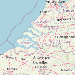
Map view of Lepelaarplassen

Use this park location map to pinpoint Lepelaarplassen in Netherlands, understand its exact geographic position, and read its mapped placement within the surrounding landscape more clearly.

Pigeon | © OpenStreetMap contributors

Location context for Lepelaarplassen

Flevoland
Recorded earthquake history

Browse the Historical Earthquake Catalogue for Lepelaarplassen

Access a detailed record of seismic events historically associated with the geography of Lepelaarplassen. This MoriAtlas archive allows you to review specific event data, including magnitude and distance metrics, to better understand the seismic background of this Flevoland nature reserve.

Lepelaarplassen Earthquake History

Catalogued events

2 events

Strongest magnitude

Magnitude 3.1

Most recent event

Aug 6, 1994

This history includes earthquakes recorded inside the park or within 50 km of its borders

Explore protected area views, marsh habitats, and reclaimed polder terrain

Lepelaarplassen Photos and Scenery: Visualizing Wetland Landscapes

Visual documentation reveals the distinctive wetland terrain, open water surfaces, and willow marsh habitats defining the Lepelaarplassen protected area. Examining park photography offers clear insight into the ecological structure, reed fringes, and complex landscape character of this young polder reserve.

A close up profile of a white-tailed eagle with dark feathers and a yellow beak, captured with its beak slightly open.

A small, low-lying island in a calm lake, covered with many dark birds, likely cormorants, perched in trees and on the rocky shoreline, with a background of dense green forest.

A great egret with white plumage in flight, preparing to land in a lush green marshland with dense reeds and a calm body of water.

Park atlas

Compare regional wetland reserves and connected polder habitats across the province

Explore Parks Near Lepelaarplassen and Surrounding Protected Wetland Landscapes

Browse protected areas near Lepelaarplassen to discover related marshlands and wetland reserves sharing the same regional polder geography. Comparing these adjacent natural areas provides a broader view of wetland conservation and bird migration corridors across the surrounding landscape.
National parkFlevoland
Park boundaries overlap#1 closest

Northeast

Nieuw Land National Park: Mapped Wetland Landscape on Flevoland's Reclaimed Land

Protected area geography and ecological discovery in the Netherlands

Nieuw Land National Park offers a distinctive protected landscape forged on land recently reclaimed from the sea in the Dutch province of Flevoland. This national park is characterized by its vast expanse of wetlands, artificial islands like the Marker Wadden, and critical importance for migratory bird populations. Delve into the park's geographic context and mapped features to understand its unique conservation value and role within the wider European atlas of protected areas.

Area
289 km²
Established
2018
IUCN
II
Relief
Lowland
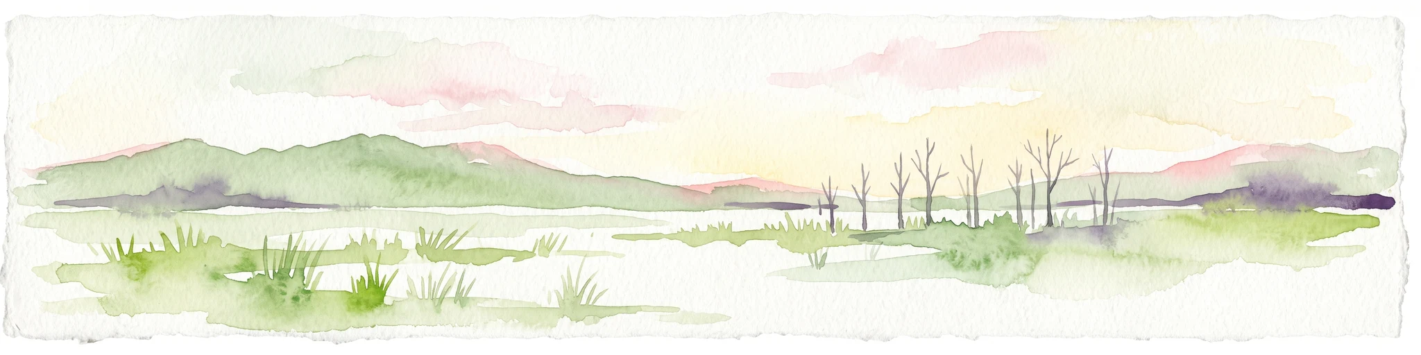
A horizontal watercolor painting depicting a wetland landscape with grassy foreground, bare skeletal trees, and rolling green hills under a soft, pale sky.
Nature reserveFlevoland
3.2 km away#2 closest

Northeast

Oostvaardersplassen Nature Reserve: Mapped Geography and Protected Area Context

Explore the marshland and polder terrain in Flevoland, Netherlands

Oostvaardersplassen represents a landmark in modern Dutch conservation, covering a 5,600-hectare mosaic of mudflats, reed beds, and willow thickets. This nature reserve, located between Almere and Lelystad, demonstrates the evolution of a young reclaimed landscape. It provides an essential habitat for marsh birds and large herbivores within the Nationaal Park Nieuw Land region, offering a distinct study in polder-based ecological management and wetland geography.

Area
56 km²
Established
1974
Relief
Lowland
Climate
Temperate
Nature reserveFlevoland
8.6 km away#3 closest

Northeast

Markermeer & IJmeer Nature Reserve: Mapping Dutch Freshwater and Polder Landscapes

A vast protected lake system shaped by historic water engineering

Spanning the distance between Flevoland and North Holland, Markermeer & IJmeer represents a significant freshwater protected area. The landscape features large lake basins framed by dike systems and recent island developments, offering a prime example of Dutch wetland geography and managed water ecosystems.

Area
79.553 km²
Established
2009
Relief
Lowland
Climate
Temperate
Nature reserveFlevoland
About 14 km away#4 closest

Southeast

Eemmeer & Gooimeer Zuidoever: Mapped Geography and Protected Lake-Fringe Landscape

A Natura 2000 wetland reserve within the Flevoland region

The Eemmeer & Gooimeer Zuidoever nature reserve consists of two distinct yet interconnected lake basins that represent the evolving landscape of the central Netherlands. The area is defined by its shallow water fringes and marshy shorelines, which provide essential sanctuary for waterbirds. By tracing the boundary between engineered polders and older mainland provinces, this reserve provides a unique look at the ecological significance of the former Zuiderzee remnants.

Area
15.84 km²
Established
2009
Relief
Lowland
Climate
Temperate
A watercolor landscape painting of a calm, shallow body of water surrounded by grassy, low-lying shores and soft, distant hills under a pale, white sky.
Protected areaNetherlands
19 km away#5 closest

North

IJsselmeer: Geography and Protected Wetland Mapping of the Netherlands

Engineered freshwater landscapes and polder geography

The IJsselmeer acts as the central freshwater reservoir for the Netherlands, providing a expansive, horizon-dominated landscape shaped by the Afsluitdijk. As an internationally recognized wetland, it supports diverse waterbird populations within its intricate system of dikes, former tidal channels, and emerging nature islands. This protected area stands as a definitive example of large-scale, adaptive hydraulic management in a low-lying coastal nation.

Area
1,133 km²
Established
1932
Relief
Lowland
Climate
Temperate
Nature reserveNetherlands
21 km away#6 closest

Southeast

Arkemheen Nature Reserve: Geography and Protected Landscape Context in the Netherlands

Mapping medieval polder patterns and wetland bird habitats.

Arkemheen is a significant nature reserve in the Netherlands characterized by a flat, open polder landscape and historic fourteenth-century agricultural patterns. The area offers a distinct ecological profile, integrating freshwater border lakes with saline-influenced grasslands that support an internationally recognized population of meadow and wetland birds.

Area
14.3 km²
Established
1356
Relief
Lowland
Climate
Temperate
Protected areaNetherlands
29 km away#7 closest

Southeast

Veluwe: A Comprehensive Geographic Atlas of the Central Netherlands Protected Area

Glacial moraines, heathlands, and inland sand systems

Investigate the Veluwe, a premier protected area in the Gelderland province characterized by its historic push moraines and extensive ecological zones. The region encompasses significant sand drift complexes, dense woodlands, and vital spring-fed streams, offering a clear view of the diverse natural terrain found throughout the central Netherlands.

Area
1,000 km²
Relief
Upland
Climate
Temperate
Access
Easy access
Protected areaFlevoland
35 km away#8 closest

Northeast

Ketelmeer & Vossemeer: Protected Area Geography, Boundaries, and Landscape Context

Mapping freshwater lake dynamics in the Flevoland and Overijssel border region.

Ketelmeer & Vossemeer constitutes a significant Natura 2000 wetland complex where riverine floodplains meet engineered polder landscapes. This analysis provides insights into the site's role as a critical Important Bird Area and its position within the broader IJssel delta network of lakes and water channels.

Area
38.43 km²
Established
2013
Relief
Lowland
Climate
Temperate

Common questions about visiting, size, designation, and location context for Lepelaarplassen

Lepelaarplassen FAQs for park facts, access, geography, and protected area context

Find quick answers about Lepelaarplassen, including protected-area facts, park geography, trail and visitor context, and how the park fits into its surrounding country and regional landscape.
MoriAtlas Explorer

Continue Your Protected Areas Search Across the Global Atlas

Deepen your exploration by continuing the structured search for national parks and protected areas worldwide. Utilize the comprehensive filtering capabilities to compare different conservation landscapes and refine your understanding of global park geography. Discover more about the distribution and characteristics of protected natural areas.

Global natural geography