Mori Atlas logo
Nearby park discovery

Map and explore regional geography within the southern Blue Ridge Mountains context

Protected Landscapes and National Parks Near Little Dry Run Wilderness in Virginia

Examine the geographic distribution of protected areas surrounding Little Dry Run Wilderness in southwestern Virginia. This regional view clarifies the spatial relationships between nearby natural landscapes and the surrounding Blue Ridge Mountain terrain. Analyze the park network within Wythe County to understand the broader context of these congressionally designated wilderness lands.

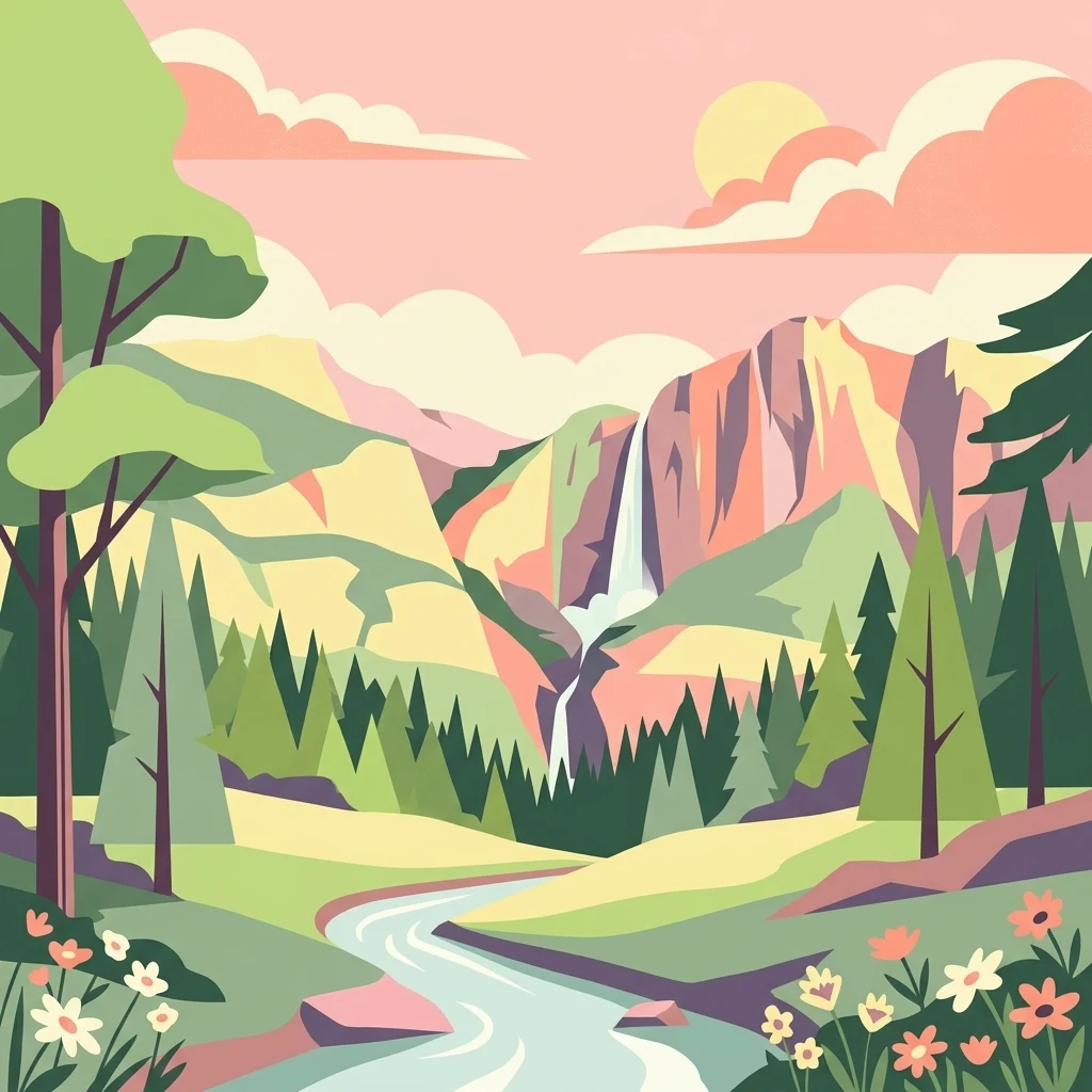
A flat vector illustration of a mountain landscape with a waterfall cascading down a cliff into a river, surrounded by pine forests and wildflowers under a pastel sky.

A quiet Blue Ridge wilderness anchored by a native trout stream and old-growth remnants within Virginia's Mount Rogers National Recreation Area.

Little Dry Run Wilderness

Little Dry Run Wilderness is a small, roadless protected area in the southern Blue Ridge Mountains of southwestern Virginia. Located in Wythe County near the community of Speedwell, it forms the eastern end of the Mount Rogers National Recreation Area and is part of the broader Mount Rogers Cluster of congressionally designated wildernesses in the George Washington and Jefferson National Forests. The wilderness takes its name from Little Dry Run, a stream lined with eastern hemlock and white pine that runs through the heart of the area and joins Dry Run to the north. With elevations rising from roughly 2,400 feet along the stream to more than 3,600 feet on an unnamed peak, the landscape combines forested coves, a small bog, rocky knobs, and ridges characteristic of the Blue Ridge Province. Designated by Congress in 1984 under the Eastern Wilderness Act, the area was set aside to keep its natural conditions intact and to contribute to the diversity of plant and animal gene pools protected across the National Wilderness Preservation System. It is administered by the U.S. Forest Service and is recognized for its cove forests, rare plant occurrences, and habitat for nesting songbirds.

Location
United States of America
Park type
Wildlife reserve
Established
1984
Area
11.6 km²
Highest point
1,101 m
Little Dry Run Wilderness Map and Geography
Regional park map

See the ranked park cluster in its geographic setting

Nearby parks around Little Dry Run Wilderness

This regional map shows the same 20 nearby parks ranked below around Little Dry Run Wilderness. Select a ranked marker to highlight that park’s boundary where boundary data is available.
Reference park: Little Dry Run WildernessRanked nearby parkSelected boundary: Little Dry Run Wilderness20 nearby parks shown
20 nearby parks

Geographic proximity and regional environment comparisons for surrounding protected landscapes

Ranked Nearby Parks and Protected Areas Surrounding Little Dry Run Wilderness

Examine the ranked collection of protected areas situated geographically near Little Dry Run Wilderness to evaluate surrounding regional park geography. Measured boundary separation and recorded environmental attributes provide structured comparison signals for neighboring conservation terrain.
Wildlife reserveVirginia
16 km away#1 closest

West

Raccoon Branch Wilderness: Mapping Protected Wildlife Reserves in Southwest Virginia

Rugged quartzite ridges and Appalachian stream corridors

The Raccoon Branch Wilderness represents a significant protected area within the Southern Blue Ridge mountains. Its geography is characterized by parallel ridgelines and deeply cut drainage channels that support rare plant communities and endangered aquatic life. This wilderness serves as a vital component of the regional Mount Rogers cluster, preserving a representative segment of Appalachian highland terrain.

Area
17.1 km²
Established
2009
IUCN
Ib
Relief
Mountain
Wildlife reserveGrayson County
21 km away#2 closest

Southwest

Little Wilson Creek Wilderness: Protected Appalachian Forest and High Elevation Geography

Mapping the ridges, stream systems, and balds of Grayson County

Little Wilson Creek Wilderness is a significant protected area in southwestern Virginia, featuring elevations exceeding 4,800 feet. The region spans a diverse ecological landscape of rare high country bogs, northern hardwood forests, and old growth remnants that drain into the New River system. Gain insights into the terrain and boundaries of this prominent Blue Ridge Mountain wilderness.

Area
22.1 km²
Established
1984
IUCN
Ib
Relief
Mountain
Protected areaVirginia
25 km away#3 closest

Southwest

Lewis Fork Wilderness: Geography and Protected Land Profile in Southwestern Virginia

High-elevation Appalachian backcountry and ridgeline mapping

Spanning the ridgelines near the summit of Mount Rogers, Lewis Fork Wilderness serves as a key ecological anchor for Virginia. This protected backcountry offers a dense mosaic of forest types, ranging from oak-hickory stands to rare spruce-fir habitats. The landscape features steep terrain and pristine mountain streams, providing a concentrated look at the environmental complexity of the southern Appalachian Mountains.

Area
24.59 km²
Established
1984
IUCN
Ib
Relief
Mountain
A watercolor painting showing a soft, stylized landscape with rolling green hills, a winding stream, and trees under a pale sky.
Protected areaVirginia
29 km away#4 closest

North

Garden Mountain Wilderness: Appalachian Protected Area and Regional Landscape Geography

Old-growth forest and ridge-bound Appalachian terrain in Virginia

Garden Mountain Wilderness encompasses a significant Appalachian ridge and the deep Lick Creek valley within western Virginia. This protected area harbors diverse hardwood forests, old-growth remnants, and critical habitat for rare species. The topography is defined by parallel ridges and enclosed valleys, showcasing the geological complexity of the central Appalachians and the importance of localized conservation efforts.

Area
13.48 km²
Established
2009
IUCN
Ib
Relief
Mountain
Wildlife reserveBland County
30 km away#5 closest

North

Hunting Camp Creek Wilderness: Mapped Protected Landscapes in Bland County

Wildlife reserve terrain and Appalachian mountain geography

Hunting Camp Creek Wilderness encompasses an 8,471-acre protected area in Virginia, defined by the Garden Mountain and Brushy Mountain ridges. This wildlife reserve features deep valleys, dense forests, and a core section of the Appalachian Trail, serving as a critical refuge for local mountain biodiversity and wild backcountry exploration.

Area
34.28 km²
Established
2009
IUCN
Ib
Relief
Mountain
A soft, horizontal watercolor painting depicting layers of rolling mountain ridges and evergreen forests in shades of green, yellow, and light pink.
Protected landscapeVirginia
About 34 km away#6 closest

Southwest

Mount Rogers National Recreation Area: Virginia Appalachian Highlands Protected Landscape

Mapping high-elevation ridgelines and wilderness corridors.

Located in southwestern Virginia, Mount Rogers National Recreation Area preserves a vast expanse of southern Appalachian mountain terrain. The landscape features spruce-fir forests, alpine-style balds, and deep valley watersheds. This protected area serves as a primary geographic anchor for hikers and conservationists, housing the highest peak in the state and extensive federally designated wilderness segments within its borders.

Area
626.52 km²
Established
1966
Relief
Mountain
Climate
Temperate
A soft, light-toned watercolor illustration of a winding creek flowing through a lush, green landscape with distant rolling hills and scattered trees.
Wildlife reserveBland County
41 km away#7 closest

North

Kimberling Creek Wilderness: Geography and Protected Land Boundaries in Bland County

A trail-free Appalachian wilderness reserve in Jefferson National Forest

Kimberling Creek Wilderness represents a significant protected enclave in the central Appalachians of Virginia. This detail covers the steep topography extending from Kimberling Creek to the ridgeline of Hogback Mountain, characterized by sheltered cove forests and diverse oak-hickory stands. The area offers a rare glimpse into recovering eastern old-growth forest ecosystems within an entirely trail-free wilderness environment.

Area
23.99 km²
Established
1984
IUCN
Ib
Relief
Mountain
Watercolor painting of a winding trail through grassy hills with mountains in the background, using a soft pastel color palette of greens, purples, and yellows.
Protected landscapeNorth Carolina
82 km away#8 closest

Southwest

Pisgah National Forest: Protected Appalachian Mountain Geography and Regional Mapping

An extensive mountain forest in western North Carolina

Pisgah National Forest represents a major protected landscape in the southern Appalachian Mountains of North Carolina. Its diverse terrain includes high peaks above 6,000 feet, dense hardwood forests, and deep river gorges. Recognized as a historic center for professional forestry, the area protects extensive watersheds and wilderness zones, offering a detailed case study in Appalachian geography, conservation science, and rugged mountain topography.

Area
2,075.06 km²
Established
1916
Relief
Mountain
Climate
Temperate
Wildlife reserveVirginia
85 km away#9 closest

Northeast

Mountain Lake Wilderness: Protected Appalachian Geography and Mountain Landscapes

High-elevation wetlands and ridge-line geography in Virginia

Mountain Lake Wilderness protects a compact yet biologically diverse landscape where cool, moist conditions support rare mountain bogs and red spruce forests. This protected area along the Eastern Continental Divide features rocky outcrops like White Rocks and War Spur Overlook, providing panoramic views of the surrounding Ridge and Valley terrain within the Jefferson National Forest.

Area
44.66 km²
Established
1984
IUCN
Ib
Relief
Mountain
National parkWest Virginia
101 km away#10 closest

North

New River Gorge National Park and Preserve: Appalachian River Gorge Protected Landscape Atlas

Mapped terrain and geographic context within West Virginia.

Delve into the protected landscape identity of New River Gorge National Park and Preserve, a significant national park in West Virginia. This page details its role as a protected area, highlighting the dramatic river gorge geography, mapped terrain, and its place within the Appalachian Mountains. Understand the park's boundaries and the natural context that makes it a key destination for geographic discovery and conservation appreciation.

Area
294.64 km²
Established
2020
IUCN
V
Visitors
1.6M annual
A soft watercolor painting of a river flowing through a lush green valley with rolling mountains in the hazy background.
Wildlife reserveNorth Carolina
109 km away#11 closest

Southwest

Linville Gorge Wilderness: Rugged Canyon Geography and Protected Appalachian Forest

Historic wildlife reserve in North Carolina

Spanning over 10,000 acres, Linville Gorge Wilderness is defined by its steep cliff walls, vertical elevation drops, and an absence of road infrastructure. As one of the original areas designated under the Wilderness Act, this North Carolina landmark offers a unique look at undisturbed old-growth hardwoods and pine communities nestled within the dramatic peaks of the Blue Ridge Mountains.

Area
47.7 km²
Established
1964
IUCN
Ib
Relief
Mountain
Watercolor painting showing layers of soft green hills and mountain ridges fading into a light hazy background.
Protected landscapeWest Virginia
138 km away#12 closest

Northeast

Monongahela National Forest: Protected Appalachian Landscapes and Regional Geography

Mapping West Virginia wilderness and mountain terrain

Monongahela National Forest protects nearly one million acres of the central Appalachian Mountains. This massive federally managed landscape is defined by the Allegheny Front, the highest peak in the Allegheny range at Spruce Knob, and iconic geological formations like Seneca Rocks. The region represents a vital intersection of climate, hydrology, and biodiversity in the eastern United States, housing eight distinct wilderness areas and complex high-altitude ecosystems.

Area
3,727.8 km²
Established
1920
Visitors
3M annual
Relief
Mountain
Protected landscapeWest Virginia
About 160 km away#13 closest

North

Gauley River National Recreation Area: Appalachian Gorge and Protected River Landscape

Mapped terrain, remote forest corridors, and river-centered geography in West Virginia.

Gauley River National Recreation Area protects a rugged corridor defined by high-volume river channels, sheer rock outcrops, and dense Appalachian hardwood forests. This documentation covers the park's distinct river-centered geography, the interplay of tributary hollows with main river flows, and its status as a critical piece of the broader southern West Virginia mountain landscape.

Area
46.57 km²
Established
1988
IUCN
V
Visitors
213.6K annual
A wide watercolor illustration showing rolling mountains in pastel shades of pink, purple, and green, with a line of trees and a reflective body of water in the foreground, framed by bare tree branches on the sides.
Protected areaVirginia
174 km away#14 closest

Northeast

James River Face Wilderness: Mapping the Topography of Virginia's Blue Ridge Protected Landscapes

Geographic overview of mountain wildlands and boulder fields

Spanning over 8,900 acres, James River Face Wilderness serves as a vital protected area within the Appalachian mountain chain. The landscape contains steep creek drainages, vertical ridgelines, and significant geological formations such as the Devils Marbleyard, offering a comprehensive study of central Virginia's complex forest ecosystems and rugged mountain terrain.

Area
36.05 km²
Established
1975
IUCN
Ib
Relief
Mountain
Wildlife reserveVirginia
176 km away#15 closest

Northeast

Rough Mountain Wilderness: Mapping Appalachian Ridges and Protected Terrain

Remote wildlife reserve in western Virginia

Spanning over 9,000 acres, Rough Mountain Wilderness provides a rare example of undisturbed Appalachian forest. The area is characterized by consistently steep slopes, sharp ridgeline topography, and a deep sense of isolation within the George Washington and Jefferson National Forests of western Virginia.

Area
38 km²
Established
1987
IUCN
Ib
Relief
Mountain
Wildlife reserveVirginia
176 km away#16 closest

Northeast

Rich Hole Wilderness: Appalachian Wildlife Reserve and Forest Geography

Protected cove hardwood forest in western Virginia

Rich Hole Wilderness represents a protected high quality forest landscape located within the James River Ranger District. This area spans steep, narrow hollows and high ridge crests, providing critical habitat and showcasing old growth timber specimens. Use this resource to understand the park terrain, drainage patterns, and its position within the broader Appalachian forest network of western Virginia.

Area
26.1 km²
Established
1988
IUCN
Ib
Relief
Mountain
National parkTennessee
201 km away#17 closest

Southwest

Great Smoky Mountains National Park: Exploring Its Protected Landscape and Regional Geography

Tennessee's premier national park, mapped for landscape discovery.

Delve into the protected area identity of Great Smoky Mountains National Park, a significant natural landmark within Tennessee. This page provides detailed context on its mountainous terrain, mapped ecological zones, and its foundational role in the broader geography of eastern North America. Understanding the park's specific protected landscape features and its geographic setting is essential for appreciating its unique conservation value.

Area
2,114.15 km²
Established
1934
IUCN
II
Visitors
12.2M annual
Wildlife reserveNelson County
216 km away#18 closest

Northeast

Priest Wilderness: A Deep Dive Into Appalachian Mountain Geography and Protected Forest Boundaries

High elevation ridge terrain in Nelson County, Virginia.

Priest Wilderness stands as a signature protected area in the Blue Ridge Mountains, defined by a dramatic 3,000 foot vertical gain and dense, mature hardwood forests. This documentation maps the rugged ridge and hollow topography that characterizes one of the most significant wilderness sections along the central Appalachian trail corridor.

Area
23.17 km²
Established
2000
IUCN
Ib
Relief
Mountain
A pale, abstract watercolor painting depicting gentle, tree-covered mountain ridges against a white background.
Wildlife reserveNorth Carolina
219 km away#19 closest

Southwest

Middle Prong Wilderness: High-Elevation Appalachian Forest and Watershed Geography

Rugged ridges and headwaters in the Pisgah National Forest

Middle Prong Wilderness encompasses nearly 7,900 acres of protected southern Appalachian terrain. This rugged landscape, ranging from deep valley floors to wind-swept high-elevation ridges, serves as a vital protected corridor adjacent to Shining Rock Wilderness, showcasing a complex mosaic of hardwood and spruce-fir forest ecosystems within the Blue Ridge Mountains.

Area
32 km²
Established
1984
IUCN
Ib
Relief
Mountain
A horizontal watercolor painting depicting a soft green landscape with rolling hills, a meandering stream, and foreground grasses against a light white background.
Protected landscapeNorth Carolina
223 km away#20 closest

Southwest

Nantahala National Forest: Geographic Overview of Protected Appalachian Mountain Landscapes

Mapping deep river gorges and temperate rainforests in North Carolina

The Nantahala National Forest represents a significant conservation achievement, encompassing diverse southern Appalachian mountain terrain. The landscape features deep river gorges, ancient old-growth forests, and extensive networks of waterfalls. This overview provides mapped context on its vast wilderness areas, including Joyce Kilmer-Slickrock, and the long-distance trail corridors that traverse this temperate rainforest region.

Area
2,150 km²
Established
1920
Relief
Mountain
Climate
Temperate
Distance methodology

Geographic measurements, not driving distances

How nearby park distances are calculated

Distances use park boundaries whenever the available geometry allows it. When one or both boundaries are missing, the mapped park locations provide a clearly labelled estimate. Every value represents straight-line geographic separation and does not use roads or routing.

Boundary distance

Calculated between the nearest points of both park boundaries.

Location-to-boundary estimate

Estimated from one mapped park location to the nearest boundary of the other park.

Mapped-location estimate

Estimated between the mapped locations of both parks.

MoriAtlas Explorer

Explore the Protected Geography of Little Dry Run Wilderness

Deepen your understanding of Little Dry Run Wilderness through MoriAtlas. Examine the specific watershed boundaries, forest composition, and ridge-line terrain that define this protected wildlife reserve within the southern Blue Ridge mountain system.