
Mori Atlas logo
Nature reserveLobau

Mapping the extensive oxbow lakes, riparian forests, and historic wetlands of the Vienna floodplain.

Lobau Nature Reserve: Protected Danube Floodplain Geography and Riparian Landscape Atlas

(National Reserve Lobau)

The Lobau nature reserve represents a rare, large-scale floodplain ecosystem integrated into the eastern cityscape of Vienna. This protected area preserves a dynamic mosaic of groundwater-fed oxbow lakes, softwood riparian forests, and open gravel terraces that mirror the pre-regulation character of the Danube corridor. Through this detailed atlas, examine the complex hydrological terrain that defines this critical ecological corridor.

Dubane floodplainwetland ecosystemRamsar siteDanube-Auen National Parkriparian forestoxbow lakes
A flat-style digital illustration of a mountain valley with waterfalls flowing into a river, surrounded by trees and cliffs, under a pale sun.

Lobau

Nature reserve

Park overview

Structured park overview, official facts, and landscape profile for Lobau

Lobau park facts, protected area profile, and essential visitor context

Review the core facts for Lobau, including designation, size, terrain, visitor scale, habitats, and operating context in one park-focused overview.

About Lobau

The Lobau is a substantial floodplain area on the left bank of the Danube, occupying the southeastern margin of Vienna and extending eastward toward Groß-Enzersdorf. It belongs to the broader system of Danube floodplains that historically stretched through the Marchfeld, and today forms the Viennese segment of the larger Austrian floodplain network. Within the city, it lies in Donaustadt (the 22nd district) and is administratively and ecologically managed as a core nature protection area.

Ecologically, the Lobau is defined by the interplay between the Danube, its former side arms, and a sustained groundwater table. Before 1875, when the Vienna Danube regulation forced the river into a single bed, much of today's Lobau was shifted regularly through flooding, with meanders reshaping the terrain and oxbow formations appearing and disappearing over time. Modern regulation cut off direct flooding, but a network of now-stagnant oxbow lakes, ponds, and side arms still shapes the area's hydrology and supports an exceptional mix of wetland, riparian forest, and dry gravel habitats.

The protection status of the Lobau has evolved in stages, beginning with its 1905 designation as a protected area, continued through nature reserve status from 1978, Ramsar recognition in 1983 for the Lower Lobau, and integration into the Danube-Auen National Park in 1996. Since 2004 it has also been designated as a European protected area (FFH site), linking Viennese habitats to the broader transboundary Ramsar site that reaches into Slovakia and the Czech Republic.

For residents and visitors, the Lobau functions as a quiet green escape inside Vienna's urban region. A network of marked trails, including parts of the European long-distance paths E4 and E8, connects the Lobau to wider walking routes. Traditional swimming ponds such as the Dechantlacke and Panozzalacke, as well as long-standing naturist areas along old river arms, underline the area's role as a recreational landscape with deep local cultural roots.

Human intervention, however, has not been limited to conservation. The unfinished Danube-Oder Canal, begun in 1939, physically divides the Lobau into the more developed Upper Lobau and the more natural Lower Lobau, while the Lobau Oil Harbor and associated infrastructure remain visible reminders of wartime and industrial use of the area.

Quick facts and research context for Lobau

The Lobau is a Danube floodplain of about 22 square kilometers in Vienna and adjacent parts of Lower Austria, administered by the city of Vienna's forestry office. It sits in the district of Donaustadt and is divided by a partially completed canal into the Upper Lobau and the largely natural Lower Lobau.

The area has been a protected landscape since 1905, became a nature reserve in 1978, and was designated a UNESCO Biosphere Reserve from 1977 until Austria's withdrawal in 2016. Since 1996 it has formed the Viennese section of the Danube-Auen National Park, and its Lower Lobau has been recognized as a Ramsar Wetland since 1983.

Protection and recognition

Documented terrestrial protection metrics and management scope for Lobau

Lobau Protection Status and Designation History in the Protected Area Atlas

Examine the documented protection status and designation history established for Lobau since nineteen eighty two. Review official terrestrial conservation metrics and management scope parameters structured within the global park database.

Protection details

Protection scope
Terrestrial
Designated year
1982
Transboundary protection
No
WDPA ID
900001
Park context

Deeper park guide and search-rich context for Lobau

Lobau history, landscape, wildlife, and travel context

Explore Lobau through its history, landscape character, ecosystems, wildlife, conservation priorities, cultural context, and seasonal travel timing in a structured park guide built for atlas discovery and search intent.

Why Lobau stands out

The Lobau is best known for being a rare large-scale floodplain ecosystem embedded within a major European capital, preserving the ecological memory of the Danube's pre-regulation landscape. It combines oxbow lakes, softwood willow and poplar flood forests, hardwood oak-elm stands, and open steppe-like gravel terraces known as Heißländen. Recognition as a Ramsar site and as part of the Danube-Auen National Park underpins its identity as a stronghold for wetland and migratory bird species. Its role in the 1809 battles of Aspern and Wagram also gives the area a strong historical dimension that complements its natural character.
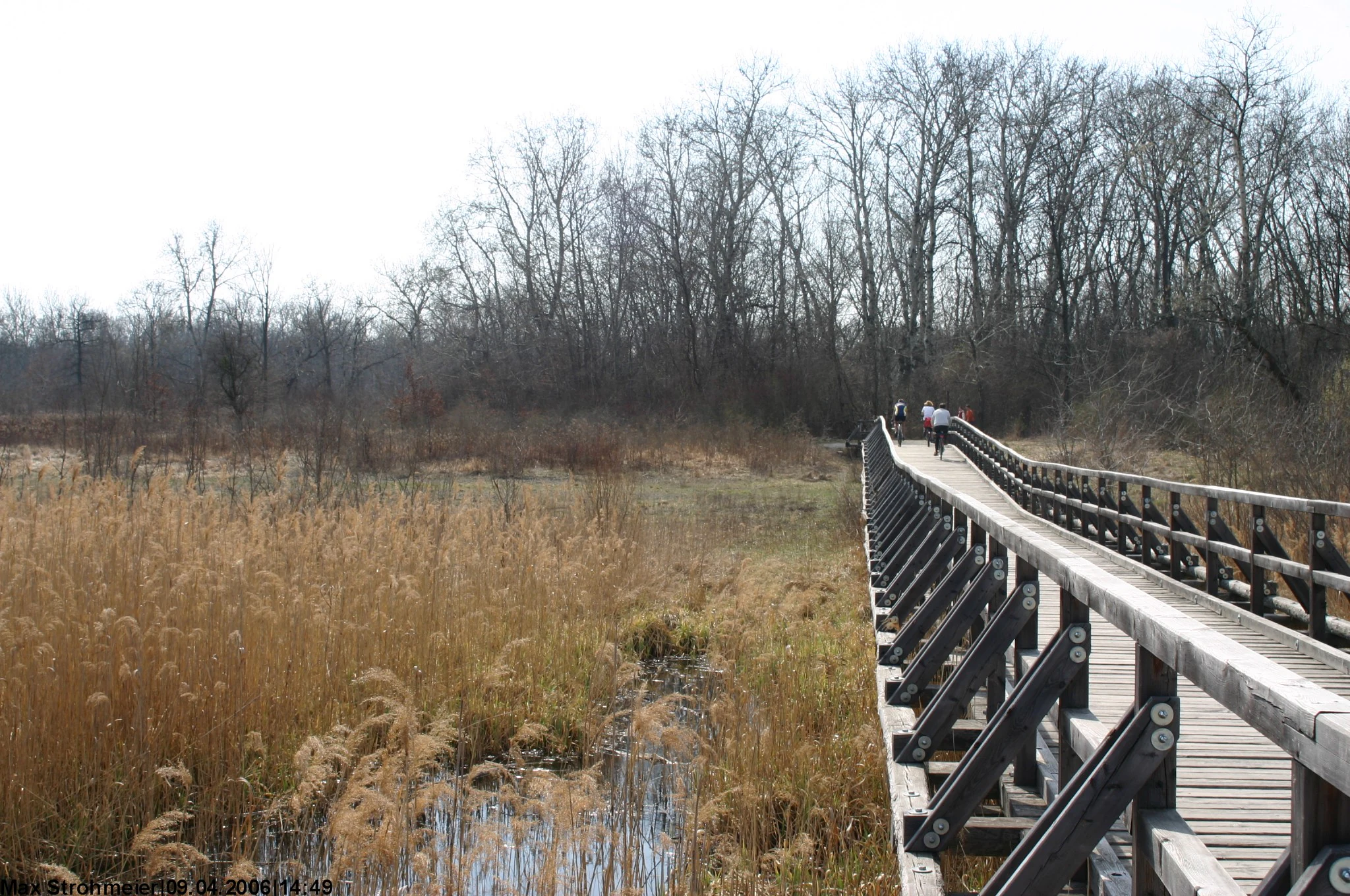
Josefssteg in the Lobau
View of the Lobau park area from the Josefssteg bridge.

Lobau history and protected-area timeline

For centuries the Lobau was shaped less by design than by the behavior of the Danube itself. Before the 1870s, the river meandered freely across the Marchfeld, repeatedly reshaping the floodplain through seasonal floods, and the area's role was largely tied to water-driven landscape dynamics and imperial use. By the nineteenth century, the Lobau had become a hunting reserve attached to the Habsburg court, with Crown Prince Rudolf among its frequent visitors. In September 1903, Emperor Franz Joseph I and King Edward VII of Britain met there for a hunting trip, an event that underscored the area's status as a royal retreat.

The year 1905 brought formal recognition of the Lobau as a protected area, and after the collapse of the monarchy, Emperor Charles I transferred what is now the Upper Lobau to the city of Vienna in 1918. The 1920s expanded the Lobau's role in everyday Viennese life: tram 317 from Kagran brought visitors into the floodplain for hiking and swimming, and, whether permitted or not, naturist groups established gathering spots along the old river arms that still exist today. In 1927, an organized march of the unemployed to assigned garden plots in the Lobau created a short-lived but symbolically important episode of urban social history.

The area's most dramatic historical moment came in 1809, when Napoleon used the Lobau as the bridgehead for crossing the Danube during the War of the Fifth Coalition. Between 21 and 22 May 1809, French forces moved across the river's multiple branches in the Lobau area to engage Austrian troops north of the Danube, fighting the Battle of Aspern, Napoleon's first major defeat. After the battle, he retreated into the Lobau and used it as his headquarters for weeks, until the night of 5 July 1809, when engineers under Henri-Gatien Bertrand built bridges that enabled the French army of about 150,000 men to cross to the left bank, leading to the decisive Austrian defeat at the Battle of Wagram. Today, monuments, the French cemetery, the Napoleonstraße, and other memorial sites preserve this Napoleonic chapter in the local landscape.

In the twentieth century, the Lobau experienced substantial landscape alteration. A planned Danube-Oder Canal, an idea dating back to 1719, was begun under National Socialist rule in 1939 and partly constructed using forced labor before being halted, leaving the canal as a partial waterway that still divides the area. The Lobau Oil Harbor, with its refinery and tank storage, was developed alongside it. After World War II, conservation interests gradually strengthened: 1977 brought UNESCO Biosphere Reserve status, followed by nature reserve designation in 1978, Ramsar Wetland listing in 1983, and integration into the Danube-Auen National Park in 1996.

Lobau landscape and geographic character

The Lobau's landscape is shaped by water, both flowing and still. Although the Danube no longer freely enters the floodplain after the regulation of the river, a mosaic of old river arms, oxbow lakes, and ponds gives the area a strongly aquatic character. The Hubertusdamm separates the floodplain from the active river bed, while inside, former branches of the Danube form standing or slow-moving waters that gradually silt up over time.

Topographically, the Lobau includes broader gravel deposits that have produced the conspicuous dry terraces known as Heißländen. These steppe-like terraces form savanna-like openings within the broader forest matrix, with sparse tree cover limited to spots where deeper soils hold enough moisture. Between these drier ridges and the wetter water bodies, the landscape shifts through groundwater-influenced meadows, reed belts, and increasingly dense forest stands.

The unfinished Danube-Oder Canal has left its mark on the topography by physically dividing the floodplain into the Upper Lobau and the Lower Lobau. The Lower Lobau is the more natural and contiguous section, while the Upper Lobau shows more agricultural and infrastructural influence. Ponds such as the Dechantlacke and the Panozzalacke function as both landscape focal points and historic swimming sites, surrounded by reed beds, willows, and poplars.
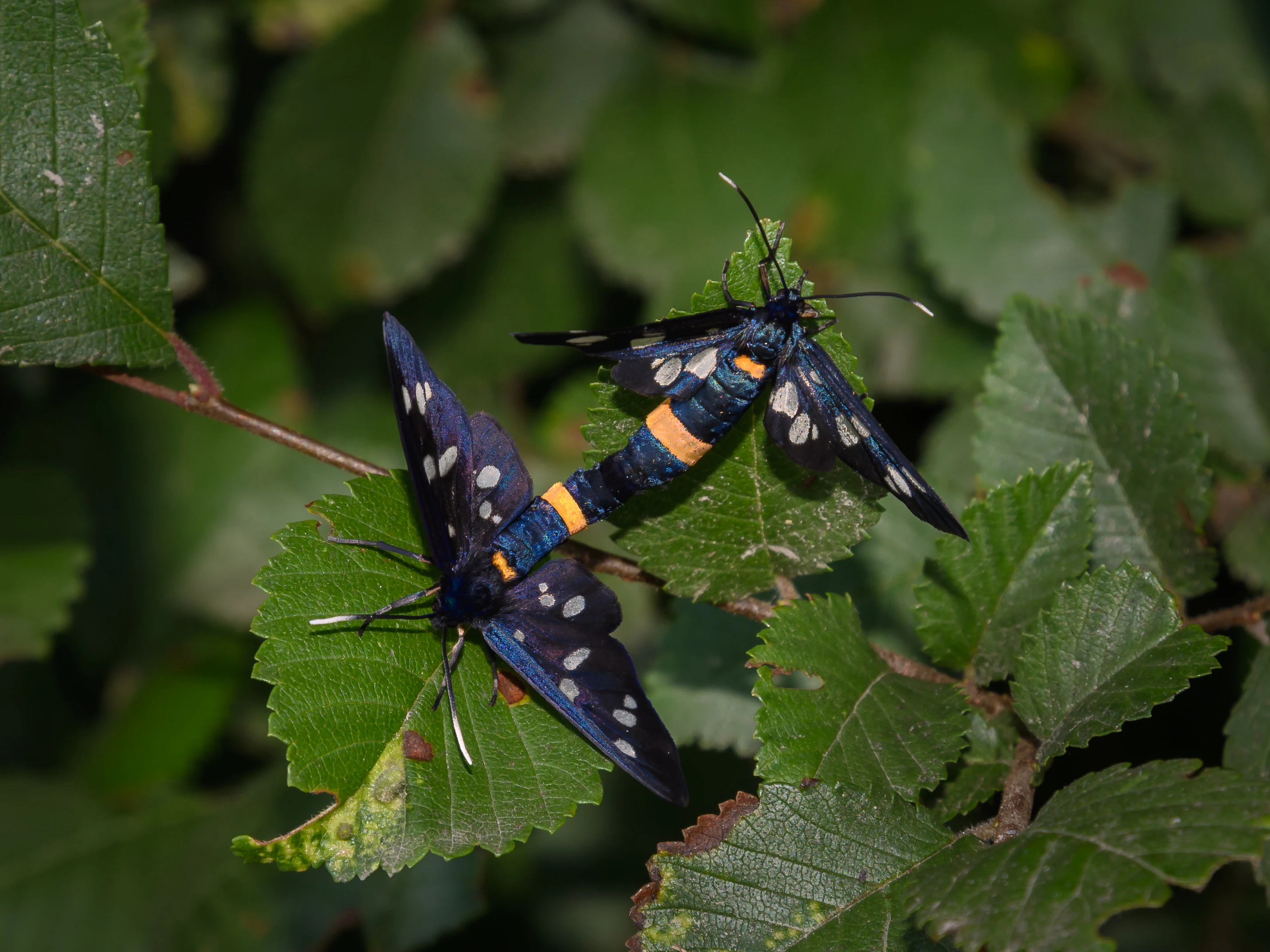
Two dark Amata phegea moths with orange abdominal bands mating on vibrant green serrated leaves.
Two Amata phegea moths mating on green foliage in the Lobau floodplain.

Lobau ecosystems, habitats, and plant life

The Lobau is a textbook example of a Central European floodplain ecosystem that has partly survived human regulation of its parent river. Its ecosystems include still-water oxbow systems, softwood riparian forests dominated by willows and poplars, mature hardwood stands with oak and elm, and the open, dry gravel terraces of the Heißländen. Together they form a compact landscape where reed beds, wet meadows, and drier steppe-like openings are all within short distances of one another.

Hydroecology is central to the area's character. Many oxbow lakes and ponds occasionally dry out completely, generating temporary mudflats that support specialized plant and animal communities. Common reed forms extensive stands, while a community of aquatic plants such as water violet, pondweed species, water chestnut, water crowfoot, and bladderwort occupies the open water. On temporarily exposed shorelines, drought-adapted species including spikerush, mudwort, beggarticks, and club-rush become established.

The dry gravel terraces support drought-tolerant vegetation, including hawthorn, sea buckthorn, orchids, barberry, feather grass, and a notable cover of lichens and mosses. Together, the wetland and dry communities give the Lobau a remarkable ecological richness within a small geographic footprint, and that combination of wet and dry habitats is at the heart of its conservation value.
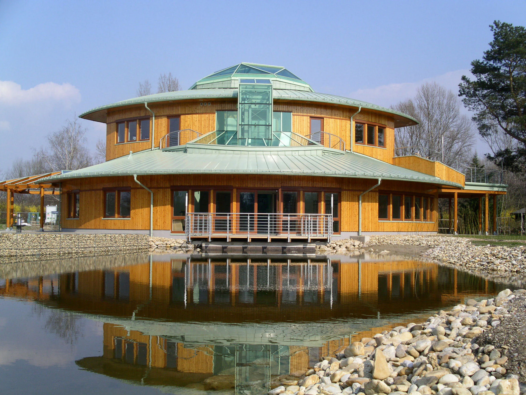
A modern, two-story, circular wooden visitor center building with a green metal roof, reflecting in a calm pond in the foreground.
The Nationalparkhaus, the main visitor center for the Lobau section of Danube-Auen National Park.

Lobau wildlife and species highlights

The wildlife profile of the Lobau reflects both its wetland focus and its forest cover. The area sustains over thirty mammal species, including the Eurasian beaver, which was reintroduced in the 1970s after being extirpated from Austria. Wild boar, European otter, roe deer, Eurasian water shrew, red fox, and European hare are typical residents, and several bat species, including common noctule, Natterer's bat, and Daubenton's bat, use the area.

Herpetological diversity is high given the small area. Reptiles include the European pond turtle, slow worm, Aesculapian snake, dice snake, grass snake, and smooth snake. Amphibians are represented by the European tree frog, agile frog, fire-bellied toad, and the Danube crested newt, a species closely tied to large floodplain river systems.

Avifauna is one of the Lobau's strongest identity markers. The area serves as a wintering site and stopover for migratory birds on the Danube corridor. Fish-eating species such as great cormorant, grey heron, and common kingfisher use the water bodies, while birds of prey including red kite, white-tailed eagle, and European honey buzzard range across the forest canopy. Other characteristic species include middle spotted woodpecker and sand martin.

Fish such as European bitterling, common carp, pigo, and European mudminnow inhabit the waterways, and invertebrates are highly diverse. Notable invertebrates include the noble crayfish, dragonflies such as green snaketail and Eurasian baskettail, the southern festoon butterfly, the European mantis, water striders, and stag beetles, all of which benefit from the mix of aquatic and terrestrial habitat types.
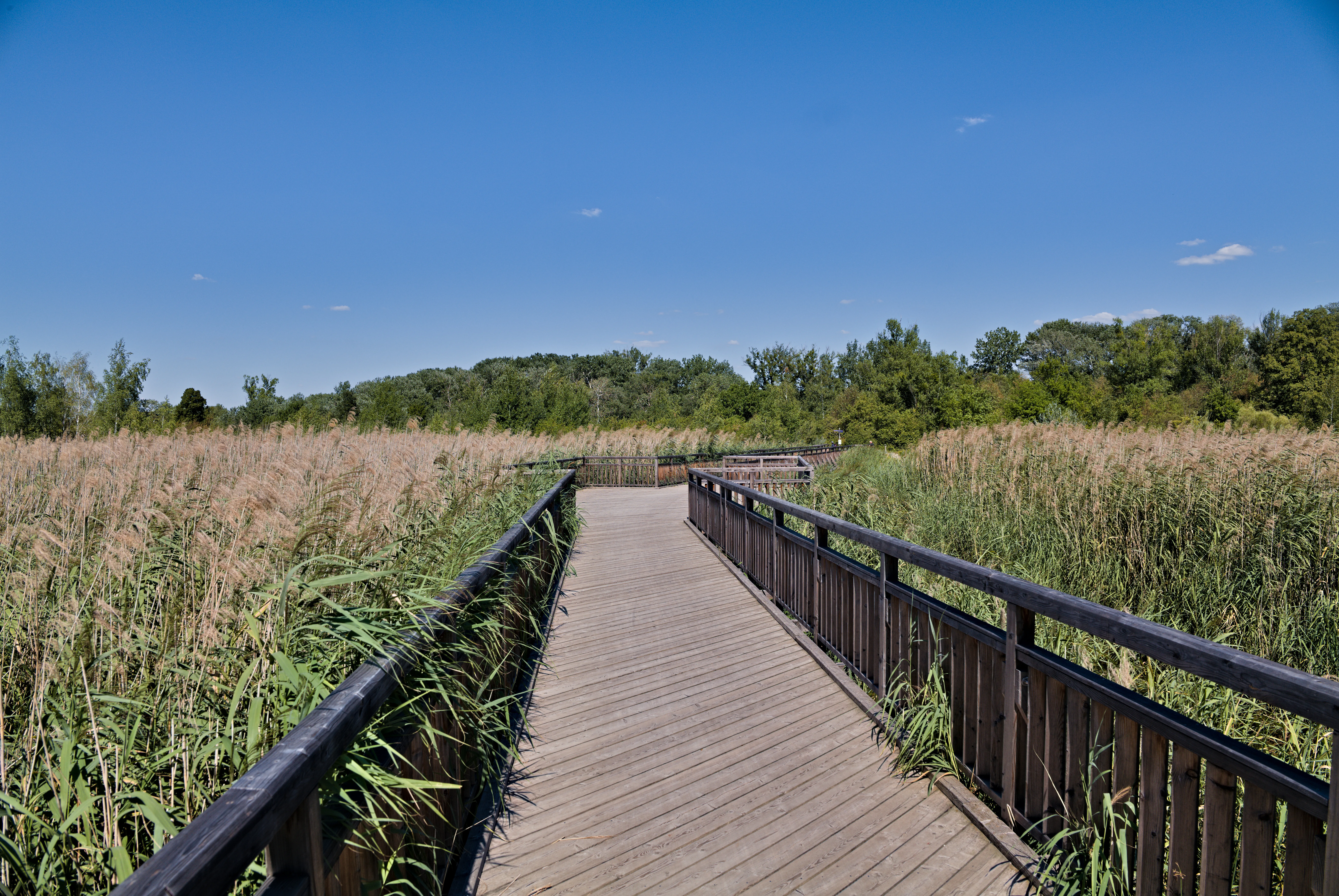
A wooden boardwalk bridge with railings crosses a dense area of tall reeds under a clear blue sky in the Lobau wetlands.
The Josefsteg footbridge winds through the dense reed beds of the Lobau wetlands.

Lobau conservation status and protection priorities

The Lobau is ecologically significant because it preserves an unusually complete sequence of Danube floodplain habitats inside an intensively used metropolitan area. Its protected status has accumulated over more than a century: protected area from 1905, nature reserve from 1978, Ramsar Wetland designation (Untere Lobau) from 1983, and UNESCO Biosphere Reserve recognition from 1977 to 2016, when Austria withdrew the area because it could not meet the revised Sevilla Strategy requirements for a functioning biosphere reserve.

Since 1996 the Lobau has been an integral part of the Danube-Auen National Park, providing a continuous ecological corridor between Vienna and the more downstream floodplain areas of Lower Austria. The Lower Lobau continues to be a Ramsar site and forms, with sites in Slovakia and the Czech Republic, one of the few trilateral transboundary Ramsar wetlands in Central Europe, connecting it to the broader Morava-March floodplain network.

Conservation concerns in the Lobau focus strongly on hydrology. The reduction of natural flooding after Danube regulation, combined with hydropower-driven deepening of the riverbed and intensive management elsewhere in the watershed, has caused ongoing declines in groundwater and surface water levels. The Lower Lobau, in particular, shows rapid desiccation and sedimentation, with oxbow lakes increasingly prone to drying up and shrinking populations of water-dependent species. These dynamics drive current debates about future water management in the Vienna section of the Danube-Auen National Park.

Lobau cultural meaning and human context

The cultural imprint of the Lobau reaches back to Napoleonic Europe and continues through to Viennese popular culture of the twentieth century. The 1809 battles fought from and around the Lobau, Napoleon's use of it as a headquarters, and the visible French cemetery and monuments make it a layered commemoration landscape, with memorial sites tied to the broader narrative of the Napoleonic Wars.

In the early twentieth century the Lobau acquired a new role as a signature recreational landscape for Vienna. Tram 317 brought generations of city dwellers into its quiet floodplain forest and ponds, and a 1927 Viennese song, "Drunt' in der Lobau", written with contributions from Fritz Löhner-Beda and Heinrich Strecker, made the area a cultural reference point in its own right. The Lobau's informal naturist culture along its old river arms dates to the 1920s and continues today.

The Lobau has also been a site of grassroots politics and protest, including a 1927 march by the unemployed to assigned garden plots, and a 2006 environmental encampment opposing the planned Lobautunnel, an element of the S1 expressway extension. The protection of the area is therefore not only an ecological question but also a recurring theme in Viennese identity and public discourse around its urban edges.
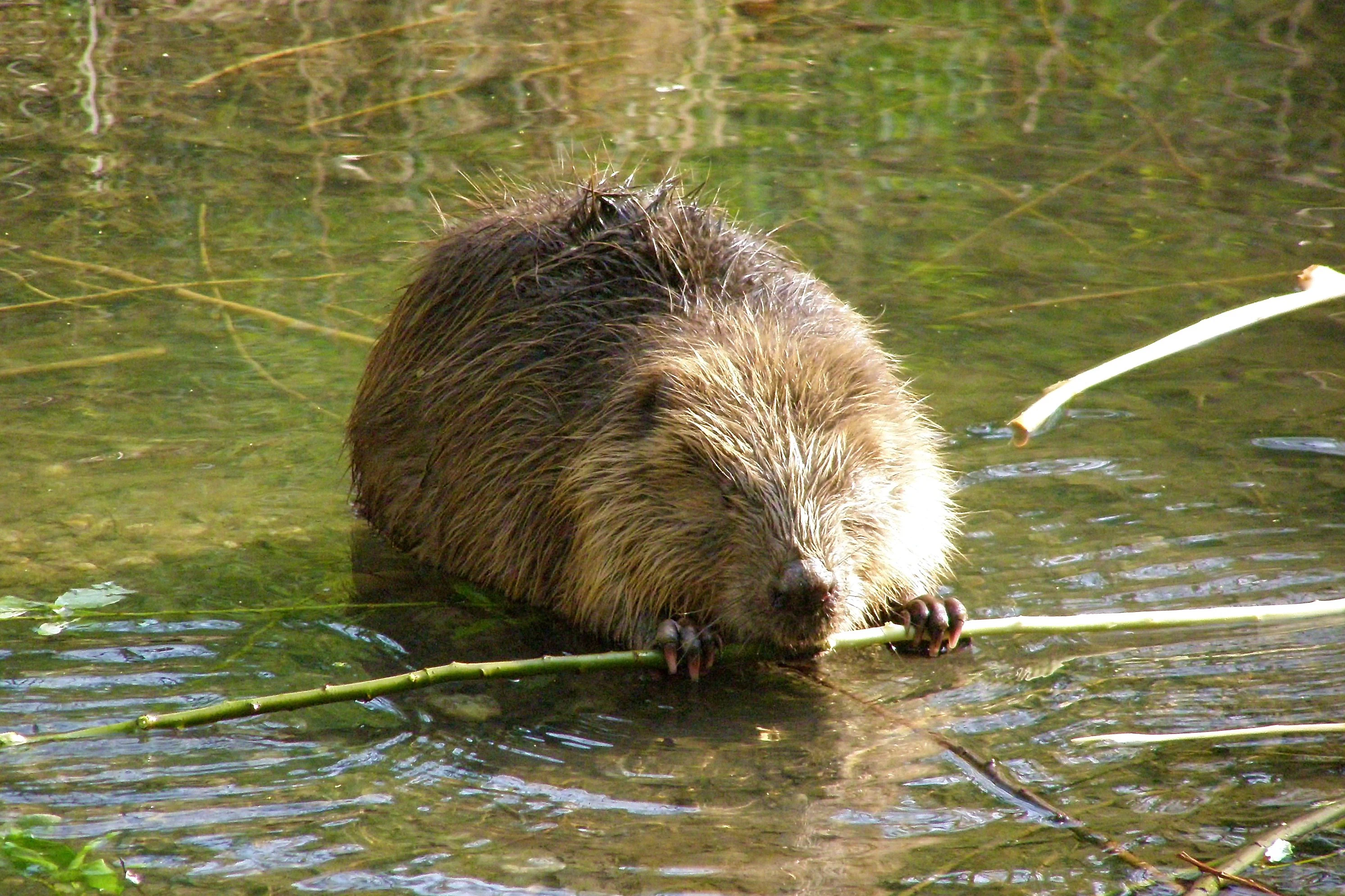
A brown Eurasian beaver sitting in shallow water holding a thin branch with its front paws.
A Eurasian beaver resting in the shallow waters of the Lobau wetlands.

Top sights and standout views in Lobau

A dynamic Danube floodplain within Vienna, encompassing oxbow lakes, reedy ponds, and extensive riparian forests, the Lobau is among the most ecologically rich urban-edge protected areas in Austria. Its global recognition comes from Ramsar Wetland status, its role in the Danube-Auen National Park, and its place in a trilateral Ramsar network with Slovakia and the Czech Republic.

Its long trail network, including sections of the European long-distance paths E4 and E8, makes it accessible to walkers, and its historical memorial sites, including Napoleon's former headquarters, the French cemetery, and the Napoleonic monuments near Aspern, give it a cultural dimension that extends well beyond its natural features.
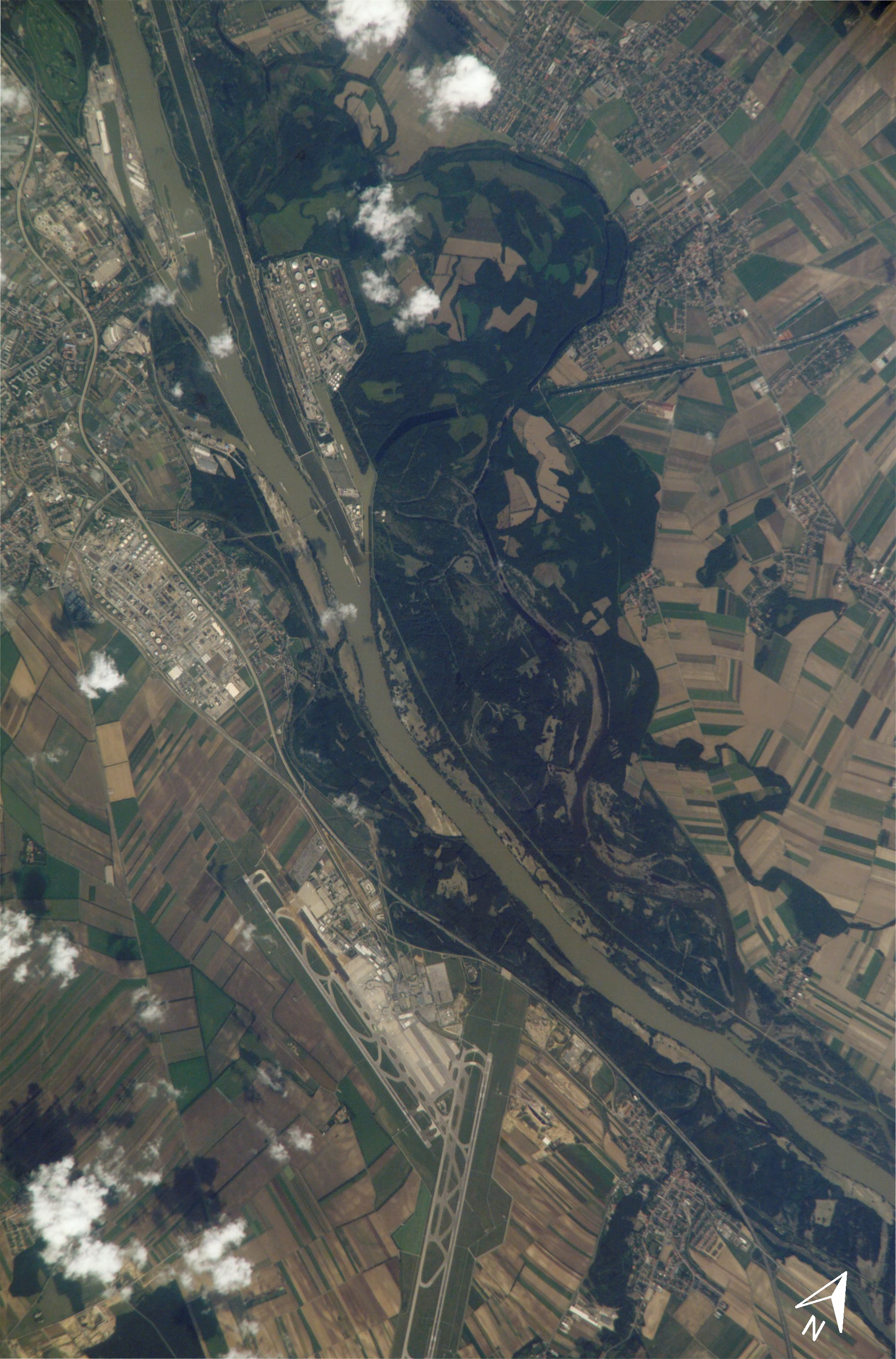
Top-down satellite imagery showing the Danube river, the forested Lobau floodplain, and a large airport complex surrounded by agricultural fields.
Satellite view of the Lobau wetland area and the adjacent Vienna International Airport.

Best time to visit Lobau

The Lobau's seasonal character is tied strongly to water levels and the behavior of its wetland and riparian habitats. Spring brings rising water tables and active bird migration, with the area serving as a stopover for many waterfowl and waders; this is a particularly rewarding time for birdwatching along the ponds and reed beds.

Summer offers a different experience: warm-weather swimming at the Dechantlacke and Panozzalacke, quiet walks through the softwood floodplain forests, and the dry gravel terraces of the Heißländen at their most open and sunlit. The shaded trails remain usable in modest summer heat thanks to the canopy of willows, poplars, and hardwoods.

Autumn and winter shift the mood again, with fallen water levels in some oxbow lakes exposing mudflats and wintering bird species becoming more prominent. Crisp, frosty days are also a traditional seasonal experience locally, and frozen standing waters occasionally indicate the area's quieter, more contemplative character.

Monthly climate preview

Measured monthly weather patterns and precipitation averages across the park coordinate

Lobau Climate Normals and Long Term Temperature Records

Historical records from NASA POWER outline the long term temperature progression and daily precipitation rates recorded at representative points within Lobau. Examining these monthly climate normals provides a clear baseline for tracking average atmospheric conditions throughout the year.
Annual mean9 °C
-2 °C21 °C
Jan-2°
Feb
Mar
Apr
May14°
Jun19°
Jul21°
Aug20°
Sep15°
Oct
Nov
Dec-1°
Warmest month
July

20.6 °C

Coolest month
January

-1.8 °C

Wettest month
June

2.9 mm/day

Driest month
January

1.2 mm/day

Park location guide

Geography guide, regional context, and park location map for Lobau

Lobau park geography, regions, and map view in Austria

Understand where Lobau sits in Austria through a broader geographic reading of the surrounding landscape, nearby location context, and its mapped position within the national park landscape.

How Lobau fits into Austria

Austria is a landlocked country in Central Europe, bordered by Germany, Czech Republic, Slovakia, Hungary, Slovenia, Italy, Switzerland, and Liechtenstein. The country is a federal semi-presessional republic composed of nine states, with Vienna as its capital and largest city. It has a population of approximately 9.1 million people.

Wider geography shaping Lobau in Austria

Austria is located in Central Europe, lying in the Eastern Alps. It is bordered by Germany and Czech Republic to the north, Slovakia to the northeast, Hungary to the east, Slovenia and Italy to the south, and Switzerland and Liechtenstein to the west.

Map view of Lobau

Use this park location map to pinpoint Lobau in Austria, understand its exact geographic position, and read its mapped placement within the surrounding landscape more clearly.

Pigeon | © OpenStreetMap contributors

Location context for Lobau

Vienna

Explore protected area views, riparian forests, and oxbow lake terrain across the Danube corridor.

Lobau Photos and Landscape Scenery: Visualizing Danube Floodplain Habitats

Visual documentation captures the complex wetland habitats, oxbow lakes, and gravel terraces defining the Lobau floodplain ecosystem. Examining these protected area views reveals the distinct terrain and riparian forest character preserved along the Danube river corridor.

Josefssteg in the Lobau

A large, solitary deciduous tree with a wide, dense green canopy stands in the center of a grassy field against a blue sky.

Two dark Amata phegea moths with orange abdominal bands mating on vibrant green serrated leaves.

A modern, two-story, circular wooden visitor center building with a green metal roof, reflecting in a calm pond in the foreground.

A wooden boardwalk bridge with railings crosses a dense area of tall reeds under a clear blue sky in the Lobau wetlands.

A narrow dirt trail leads into a dense, green deciduous forest with dappled sunlight filtering through the canopy.

A brown Eurasian beaver sitting in shallow water holding a thin branch with its front paws.

Top-down satellite imagery showing the Danube river, the forested Lobau floodplain, and a large airport complex surrounded by agricultural fields.

A view of a quiet, green wetland pond at the Lobau nature reserve, surrounded by dense trees and shrubs, with water lilies floating on the surface.

A rectangular wooden information sign mounted on a rustic wooden railing, displaying text about the Josefsteg bridge and its construction history against a blurred background of green foliage.

Aerial view looking over a wide river, a narrow canal with a pedestrian bridge, and a forested area containing large industrial storage tanks.

A wooden pier extends into a calm lake lined with dense trees, with several small flat-bottomed boats moored alongside.

An aerial satellite photograph showing the Lobau wetland area bordering the Danube river, with the Vienna Airport visible in the lower section.

A modern, circular building with wooden siding and a green metal roof reflected in a calm foreground pond.

A panoramic view of a calm pond surrounded by dense deciduous forest and reeds, with water lily pads floating on the surface.

A wide view of a grassy field with patches of shrubs and mature trees in the background under an overcast sky.

Park atlas

Compare regional wetland habitats and connected riverine conservation areas

Exploring Parks Near Lobau and Surrounding Protected Natural Landscapes

Continue geographic discovery by comparing protected areas and riverine reserves located near Lobau. Examining surrounding riparian landscapes reveals broader ecological corridors across the regional terrain.
National parkLower Austria
Mapped location lies within the park boundary#1 closest

East

Danube-Auen National Park: Protected Floodplain Ecosystem and Regional Geography

Mapped boundaries and vital riparian landscape in Lower Austria.

Delve into the unique protected landscape of Danube-Auen National Park, a cornerstone of Central European riparian conservation. This page offers detailed insights into its mapped boundaries, the dynamic interplay of river channels, lowland forests, and wetlands, and its significant role within the geographic context of Lower Austria. Understand the atlas value of this protected area, ideal for discovering rich natural terrain and ecosystem context.

Area
93 km²
Established
1996
IUCN
II
Relief
Lowland
Watercolor painting of a rolling hilly landscape with green slopes, sparse trees, and a winding path in the foreground.
Nature reserveLower Austria
About 32 km away#2 closest

East

Hundsheimer Berg Nature Reserve: Protected Landscapes of the Lower Austrian Carpathians

Mapped dry steppe, karst topography, and pannonian forest habitats

Rising abruptly from the Danube lowlands, Hundsheimer Berg preserves a compact range of crystalline and limestone hills. This nature reserve provides vital insights into the pannonian biogeographic region, featuring a diverse mosaic of rocky slopes and dry grasslands that support a high concentration of rare insects and plants.

Area
1.66 km²
Established
1965
IUCN
IV
Relief
Mountain
Nature reserveLower Austria
About 32 km away#3 closest

East

Spitzerberg Nature Reserve: Geography and Protected Landscapes of Lower Austria

A vital conservation site featuring arid rock steppes and limestone slopes.

Located in the province of Lower Austria, Spitzerberg serves as a essential nature reserve protecting a rare concentration of Pannonian dry habitats. The site is defined by its steep-sided hill structure, rocky limestone outcrops, and thin soils that support a variety of specialized plant and animal species adapted to this arid environment.

Area
226 km²
Established
1981
IUCN
IV
Relief
Upland
Watercolor painting showing a landscape with rolling terrain, water features, and distant mountains
National parkBurgenland
About 39 km away#4 closest

South

Neusiedler See-Seewinkel National Park: Protected Steppe Lake Landscape in Burgenland

Explore mapped wetland geography and birdwatching significance.

Neusiedler See-Seewinkel National Park showcases a rare steppe lake environment and extensive wetland habitats at the eastern edge of Austria, within the Burgenland region. This protected area is globally recognized for its exceptional avian diversity and the unique ecological mosaic formed by reed beds, salt marshes, and seasonal pools. Explore its mapped boundaries and distinctive Pannonian geography for a deep understanding of this vital European protected landscape.

Area
97 km²
Established
1993
IUCN
II
Relief
Lowland
Watercolor painting of a shallow lake scene with green reeds in the foreground, small trees on the shoreline, and rolling hills in the soft, hazy background.
Nature reserveAustria
About 43 km away#5 closest

Southeast

Lake Neusiedl: Protected Nature Reserve and Pannonian Steppe Geography in Austria

An endorheic lake system and critical wetland sanctuary.

Lake Neusiedl is a distinct nature reserve representing a rare European steppe lake environment. Its geography includes a vast ring of Phragmites reed beds, saline wetlands, and surrounding lowlands that form a vital migratory corridor. The lake serves as a cornerstone for protected landscapes in Austria, blending natural marshland dynamics with a deeply storied cultural history.

Area
315 km²
Established
1993
Relief
Lowland
Climate
Temperate
Protected landscapeLower Austria
About 46 km away#6 closest

West

Vienna Woods: Protected Landscape, Forested Highlands, and Alpine Foothill Geography

Natural terrain and protected boundaries in Lower Austria

The Vienna Woods encompass a distinct geographic region where sandstone ridges meet limestone formations. This protected landscape provides a dense network of forest habitats, river gorges, and significant peaks overlooking the Danube. Its structure traces the edge of the Alps, offering a rich study in regional geology, elevation gradients, and the intersection of natural wilderness with the surrounding basin environment.

Area
1,056.45 km²
Established
1987
Relief
Mountain
Climate
Temperate
Watercolor illustration of a landscape with green hills, a body of water, and trees under a soft sky
National parkGyőr-Moson-Sopron
About 50 km away#7 closest

South

Fertő-Hanság National Park: Central European Wetland and Salt Lake Protected Area

Mapped Geographic Boundaries and Landscape Context

Fertő-Hanság National Park, situated in Győr-Moson-Sopron, Hungary, is a vital protected landscape renowned for its shallow salt lake and expansive marshlands. This page provides an atlas-focused discovery of its protected area, highlighting the unique interplay of reed beds and alkaline grasslands. Understand the park's geographic setting and its role as a significant wetland ecosystem for bird populations and specialized flora.

Area
235.88 km²
Established
1991
IUCN
II
Relief
Lowland
A stylized digital illustration of a mountainous landscape at sunset, featuring prominent steep limestone cliffs in the foreground and a vast valley extending into the distance under a warm-toned sky.
Nature reserveLower Austria
About 52 km away#8 closest

Southwest

Hohe Wand Nature Park: Mapped Geography and Protected Landscapes in Lower Austria

A limestone plateau mountain at the Alpine-Pannonian transition

Located in Lower Austria, Hohe Wand Nature Park encompasses a distinct limestone plateau and dramatic southeastern cliffs. Its protected status reflects the convergence of Alpine and Pannonian geography, offering a unique opportunity to study karst geology, exposed cliff habitats, and the transition zone between high mountain ranges and the Vienna Basin lowlands.

Relief
Mountain
Climate
Temperate
Access
Easy access
Scope
Terrestrial

Common questions about visiting, size, designation, and location context for Lobau

Lobau FAQs for park facts, access, geography, and protected area context

Find quick answers about Lobau, including protected-area facts, park geography, trail and visitor context, and how the park fits into its surrounding country and regional landscape.
MoriAtlas Explorer

Continue Your Protected Areas Search Across the Global Atlas

Deepen your exploration by continuing the structured search for national parks and protected areas worldwide. Utilize the comprehensive filtering capabilities to compare different conservation landscapes and refine your understanding of global park geography. Discover more about the distribution and characteristics of protected natural areas.

Global natural geography