
Mori Atlas logo
National parkLosiny Ostrov National Park

Analyzing the protected boundaries, diverse forest terrain, and riverine wetlands of this historic conservation area.

Losiny Ostrov National Park: Mapping the Largest Urban Forest Ecosystem in Moscow, Russia

(National Park "Losiny Ostrov")

Losiny Ostrov National Park serves as a crucial ecological refuge, stretching across the eastern edge of Moscow and into the surrounding Moscow Oblast. This expansive protected area functions as a complex mosaic of broadleaf forests, coniferous stands, and significant wetland systems that act as headwaters for local river networks. By safeguarding these natural corridors, the park maintains a rare wildlife habitat for moose, sika deer, and wild boar while providing a unique window into the intersection of urban development and wild landscapes.

urban forestnational parkbroadleaf forestconiferous forestpeat bogwetlands

Losiny Ostrov National Park

National park

Park overview

Structured park overview, official facts, and landscape profile for Losiny Ostrov National Park

Losiny Ostrov National Park park facts, protected area profile, and essential visitor context

Review the core facts for Losiny Ostrov National Park, including designation, size, terrain, visitor scale, habitats, and operating context in one park-focused overview.

About Losiny Ostrov National Park

Losiny Ostrov National Park is a substantial protected forest that forms the green eastern fringe of Moscow and extends into the Moscow Oblast. The ensemble of forest parks under its protection, including Yauzsky, Losinoostrovsky, Mytishchinsky, Losinopogonny, Alekseevsky, and Shchyolkovsky, makes up not only the largest forest inside Moscow's city limits but also a nationally significant refuge for wildlife in an otherwise heavily urbanized region.

The park is organized into functional zones that range from strictly protected reserves with no access, through special protection zones and heritage protection areas, to broader recreational and administrative zones where Muscovites come for walking, cycling, and outdoor activities. This zoning reflects the park's hybrid identity: it is simultaneously a conservation site of federal importance and a beloved everyday green space for a megacity.

Ecosystems within the park include broadleaf and coniferous forest, peat bogs, river floodplains at the headwaters of the Yauza and Pekhorka, and small streams that feed these rivers. The park hosts more than five hundred species of vascular plants, rare orchids and other protected flora, and a vertebrate fauna of more than 280 species, among them moose, sika deer, wild boar, foxes, raccoon dogs, and a wide variety of forest birds including several Red Book species.

Alongside its ecological role, Losiny Ostrov carries notable cultural and educational value. A moose bio-station allows visitors to see and feed moose, an arboretum opened in 2014 displays the diversity of Russia's forests, and the "Russian Everyday Life" museum presents rural and early Slavic heritage of the region. These features, combined with its deeply layered history, make Losiny Ostrov a park where nature protection, public recreation, and urban life converge in unusual ways.

Quick facts and research context for Losiny Ostrov National Park

Losiny Ostrov is a large protected forest complex spanning parts of Moscow and the Moscow Oblast, including districts such as Metrogorodok, Golyanovo, and Bogorodskoye in the city, and the urban districts of Balashikha, Korolyov, Mytishchi, and Shchyolkovo beyond it.

It has held national park status since 24 August 1983 and is classified as an IUCN Category II protected area of federal significance. The park includes several large forest park territories (Yauzsky, Losinoostrovsky, Mytishchinsky, Losinopogonny, Alekseevsky, and Shchyolkovsky) and is bordered by the Yauza and Pekhorka river headwaters and the upper Yauza wetlands. Management is handled by a dedicated federal budgetary institution.

Protection and recognition

Examine terrestrial protection scope and recorded international designation data

Losiny Ostrov National Park Protection Status and Mapped Designation Records

Losiny Ostrov National Park maintains a documented terrestrial protection scope within its regional landscape. Structured records detail available conservation classifications and designation parameters without additional international recognition sources.

Protection details

Protection scope
Terrestrial
Transboundary protection
No
Park context

Deeper park guide and search-rich context for Losiny Ostrov National Park

Losiny Ostrov National Park history, landscape, wildlife, and travel context

Explore Losiny Ostrov National Park through its history, landscape character, ecosystems, wildlife, conservation priorities, cultural context, and seasonal travel timing in a structured park guide built for atlas discovery and search intent.

Why Losiny Ostrov National Park stands out

Losiny Ostrov is best known as the largest forest within the boundaries of a major capital city and one of the largest urban forests in the world, with free-ranging moose, sika deer, and wild boar living alongside millions of city residents. It is also recognized for its layered cultural and natural history: royal and princely hunting grounds shaped its identity for centuries, and nineteenth-century forestry experiments produced pine stands that still resist urban pressures today. The park combines ecological protection with active public recreation, including a working moose bio-station, an arboretum opened in 2014, and a museum of traditional Russian rural life.
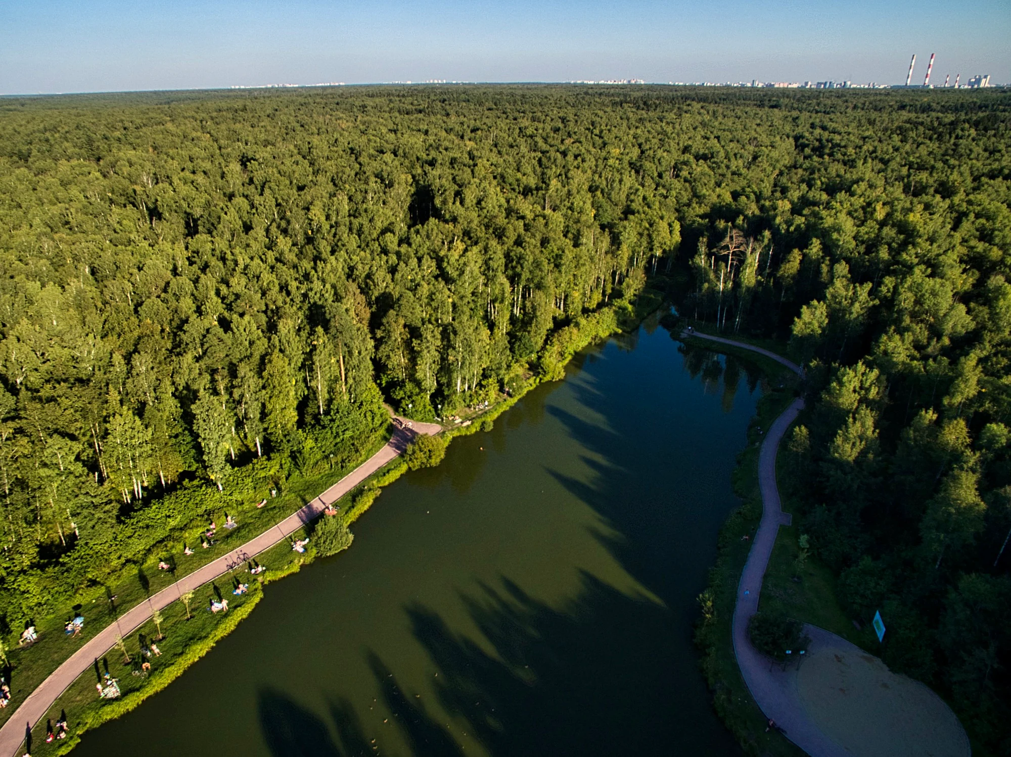
An aerial photograph showing a long, dark green pond winding through a dense forest. Paths run along both banks, with people visible on the left bank. In the far distance, city buildings and industrial smokestacks are visible against a blue sky.
Aerial view of Los Pond winding through the dense forest of Losiny Ostrov National Park.

Losiny Ostrov National Park history and protected-area timeline

Losiny Ostrov has been known as a distinct forested territory since 1406, when these woodlands entered the Taininskaya palace estate and served as hunting grounds for Russian princes and later tsars. Records indicate that Ivan IV hunted bears here in 1564, and through the following centuries the forest enjoyed a partially reserved status that limited large-scale exploitation.

In 1799 the forests passed to state administration and the first topographic survey was conducted, dividing the territory into regular square-mile quarters. A formal forest district was established in 1842, when foresters Egor Grimme and Nikolai Shelgunov completed the initial forest management plan, which documented spruce as dominant at the time. From 1844 onward, foresters under Vasiliy Greshner began extensive artificial reforestation, planting primarily pine, a program that continued for 115 years; these planted pine stands remain notably resilient against urban pressure today.

During the late nineteenth century the area, then known as Pogonny Losiny Ostrov, became a popular destination for dacha culture as Moscow expanded and a sorting station at the tenth verst opened in 1898. In 1903 to 1908 the Moscow Ring Railway was cut through the forest, and in the 1910s scientists documented its pine, spruce, and linden composition and rich bird and mammal fauna.

The twentieth century brought both severe destruction and renewed protection. Much of the forest was cut during World War II, with restoration efforts beginning in 1944. The territory was declared a nature park in 1979 by the joint decision of Moscow city and regional soviets, and on 24 August 1983 it was formally established as a full national park alongside Sochi. Since then it has faced ongoing pressure from urban encroachment, with notable conflicts over proposed boundary reductions, road construction, and contested land use within and around the park during the 2000s and 2010s.

Losiny Ostrov National Park landscape and geographic character

The park occupies a gently hilly plain at the meeting point of the Meshchera lowland and the southern spurs of the Klinsko-Dmitrovskaya ridge, which forms the watershed between the Moscow River and the Klyazma. Elevations range roughly from the floodplain of the Yauza at around 146 meters to higher points near 175 meters, with the most varied relief in the southwestern part of the park, where terraces rise sharply above the Yauza floodplain.

The forest cover dominates the protected area, with water bodies and peat bogs occupying smaller but ecologically significant portions. Water plays a defining role in the landscape: the park contains the headwaters of the Yauza and the Pekhorka, and several small streams, including Ichka and Budayka, flow into the Yauza within the park. The upper Yauza wetlands, a system of peat bogs, are among the more distinctive wet landscape features within the territory.

Human imprint is visible too. Historical peat extraction in the 1950s to 1970s significantly altered the natural bed of the Yauza, and the construction of the Akulovsky hydroelectric complex reshaped the Pekhorka channel. Despite these modifications, the park retains a mosaic of mixed forest, coniferous stands, riverine corridors, and open bog landscapes that define its visual identity.
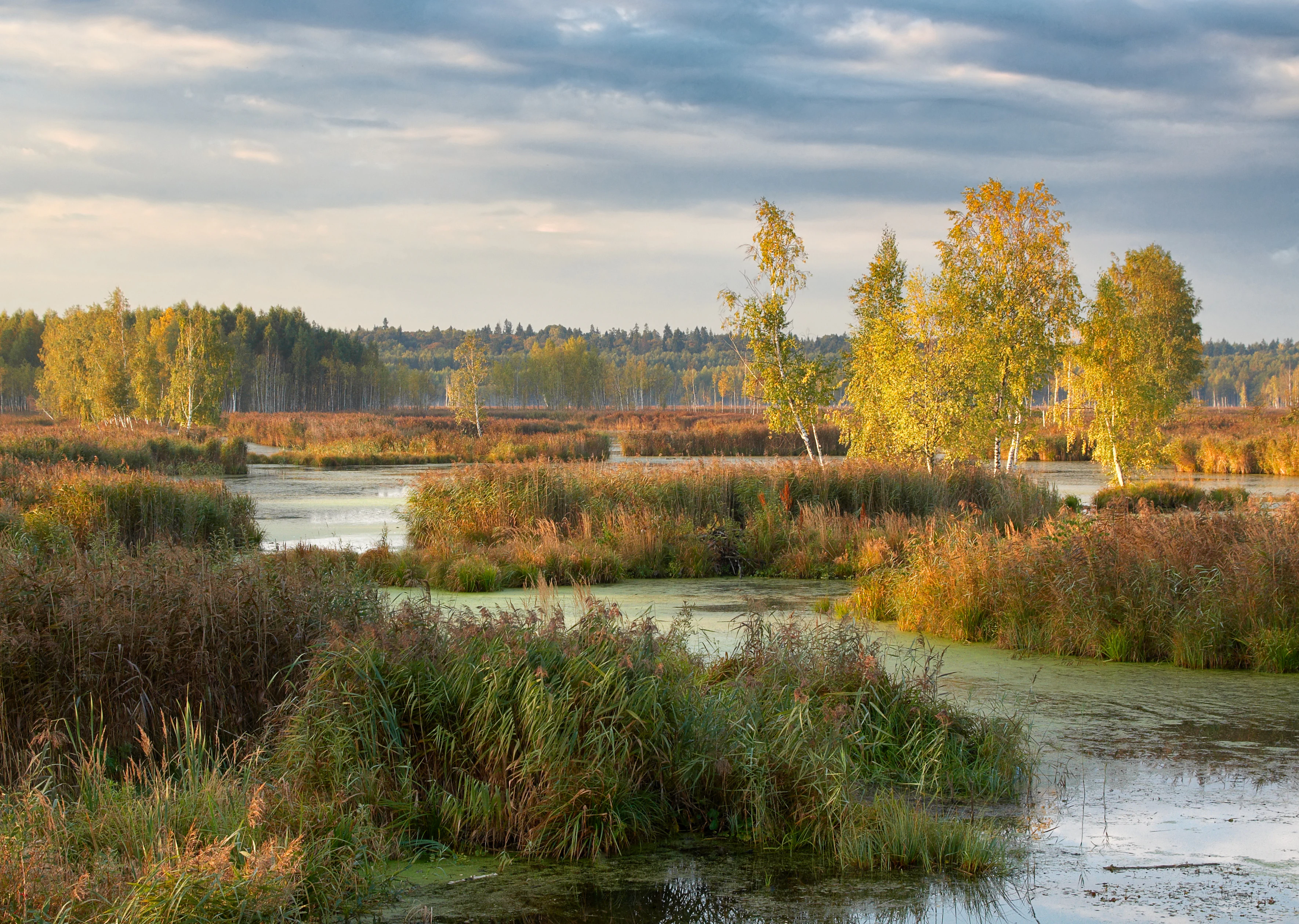
A landscape view of a marshy wetland with tall grasses and reeds in the foreground, calm water, and a line of trees with yellow autumn foliage in the background under a cloudy sky.
Autumn view of the wetlands and birch trees in Losiny Ostrov National Park.

Losiny Ostrov National Park ecosystems, habitats, and plant life

Losiny Ostrov lies in the subzone of broadleaf and spruce forests of the Valdai-Onega subprovince of the North European taiga province, within the larger Eurasian taiga region. This places it at an ecological crossroads where southern broadleaf species and northern coniferous types coexist.

The flora includes more than five hundred species of vascular plants, with thirty-two tree species and thirty-seven shrub species documented. Forest-forming species are dominated by birch, followed by pine, spruce, linden, and a small share of oak. Among herbaceous plants, several rare and protected species occur, including common daphne, lily of the valley, European globeflower, peach-leaved and nettle-leaved bellflowers, two species of Platanthera orchids, and common bird's-nest orchid. The park also hosts the only nearby natural Moscow-region population of Hepatica nobilis.

The mosaic of forest, bog, and river habitats supports high biodiversity within an urban context. Wetlands, particularly along the upper Yauza, sustain specialized plant communities, while older planted and natural pine and linden stands create distinctive forest microhabitats. The combination of relatively undisturbed forest interior and edge habitats near the city makes the park ecologically unusual for a national park located within a megacity.
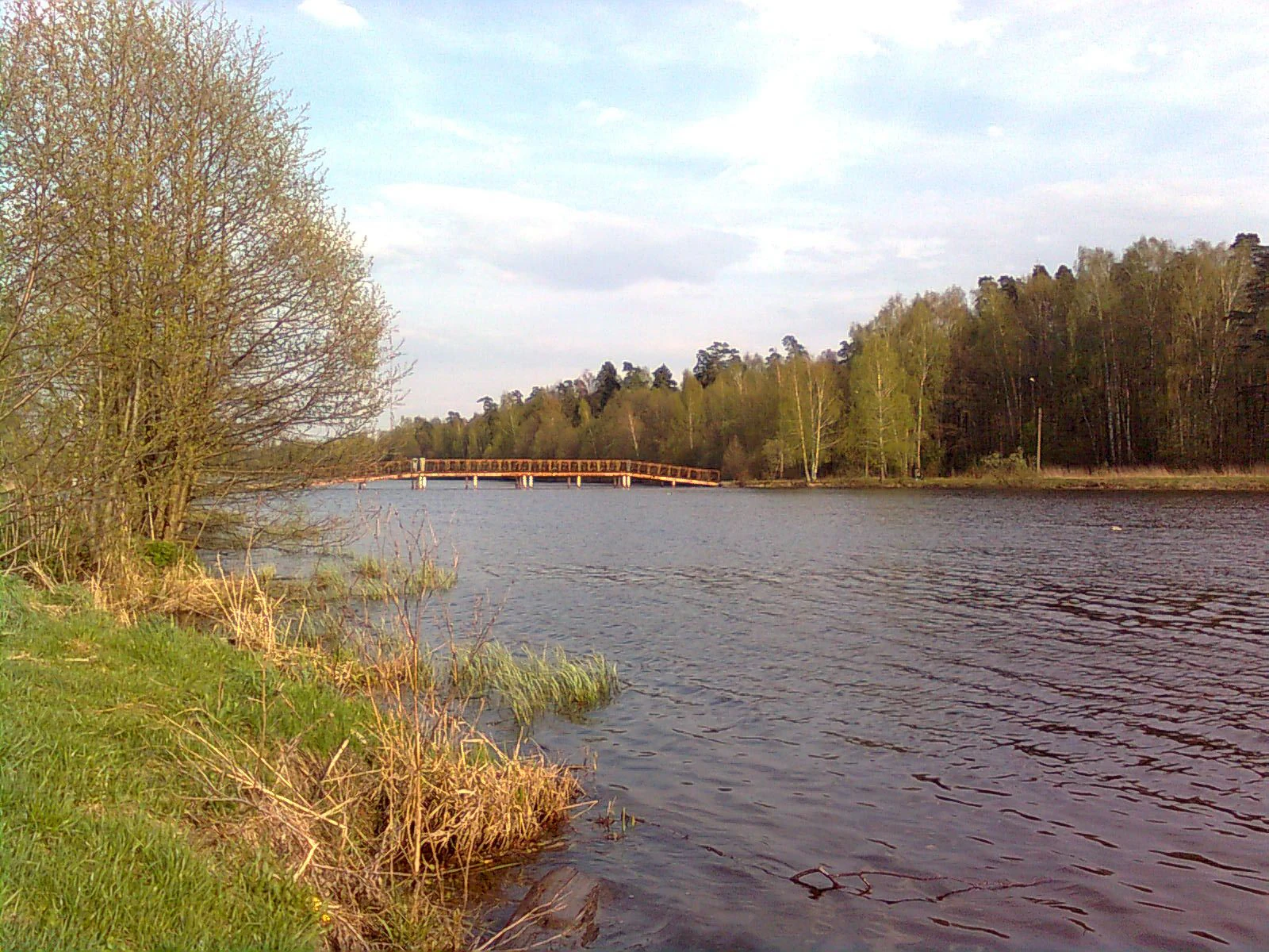
A wide landscape view of a pond with a grassy bank and reeds in the foreground, leading to a wooden bridge in the distance under a cloudy sky.
Alekseyevsky Pond with a wooden footbridge crossing the water, surrounded by forest within Losiny Ostrov National Park.

Losiny Ostrov National Park wildlife and species highlights

The park's fauna includes more than 280 species of vertebrates, with birds making up the largest group at over 160 species, followed by 38 mammal species, fifteen fish species, ten nominal amphibian species (six confirmed by recent monitoring), and two reptile species. Mammal populations reported by park staff in the early 2010s included around 70 moose, 300 sika deer, 200 wild boar, and 300 hares, alongside red foxes, American mink, raccoon dogs, red squirrels, hazel dormice, beavers, muskrats, and various small rodents.

Birds of prey and larger forest birds are particularly notable. Northern goshawks, white-tailed eagles, and ospreys have all been recorded in the park, and several species are included in the Russian Red Book, including the great grey shrike, white-tailed eagle, osprey, and the white azure tit (a subspecies of the Eurasian blue tit). The wetland areas, especially the upper Yauza bogs, provide important habitat for birdwatching, including migratory species visible from observation points such as the birdwatching tower near the Chugunny Bridge in Mytishchi.

The park's wildlife faces significant pressures despite its protected status. Stray dog packs living within and around the park have been documented preying on young wild boar, sika deer fawns, ground-nesting birds, and small mammals, with serious impacts on deer populations. Bark beetle infestations have also required targeted sanitary felling. These challenges illustrate the unusual pressures placed on fauna when a large protected forest is embedded in a dense urban region.
A landscape painting showing a dense pine forest edge bordering a marshy clearing with puddles and several elk grazing in the distance under a cloudy sky.
Painting titled Elk Island by Alexei Savrasov, depicting a forest clearing with elk.

Losiny Ostrov National Park conservation status and protection priorities

Losiny Ostrov is designated as a federal-level specially protected natural territory and holds IUCN Category II status, placing it among the most strictly protected national parks in Russia. Its core conservation value lies in preserving a large and relatively continuous forest ecosystem, including peat bogs and river headwaters, immediately adjacent to one of Europe's largest capital cities.

The park's conservation framework is built on a system of differentiated functional zones, including a strictly protected zapovednaya zone, an especially protected zone for limited research and guided visits, a historical and cultural protection zone, a recreational zone, and a хозяйственная zone for infrastructure supporting both the park and surrounding neighborhoods. A legally defined охранная зона (buffer zone) further restricts polluting and harmful developments around the park's borders.

Beyond legal protection, Losiny Ostrov serves conservation at a broader regional scale by maintaining habitat connectivity inside a heavily urbanized region, supporting Red Book species, and functioning as a reference site for understanding how forest ecosystems respond to long-term urban pressure. It is also a site of active ecological research, with multiple scientific collections and forestry studies published on its vegetation, soils, and forest dynamics over several decades.

Losiny Ostrov National Park cultural meaning and human context

The cultural identity of Losiny Ostrov is closely tied to centuries of royal and princely hunting traditions, beginning with its role as part of the Taininskaya palace estate and including documented tsarist hunts such as Ivan IV's bear hunt in 1564. The very name, originally Pogonny Losiny Ostrov, literally refers to coursing hunts for elk, embedding the area in Russia's aristocratic hunting heritage.

The nineteenth and early twentieth centuries brought a contrasting cultural layer, as Moscow's expansion turned the forest's edges into a zone of dachas, dairymen huts, and railway-linked leisure. By 1910 the forest was being explored by botanists and entomologists; the painter Alexei Savrasov depicted it at Sokolniki in 1869, and the area appears in later cultural references including the forest park being used as a filming location in 2021.

Today the park hosts cultural institutions that interpret this layered past. The museum "Russian Everyday Life," opened in 1998 and reconstructed in 2015, presents rural domestic life from the late nineteenth and early twentieth centuries and reconstructs aspects of the early Vyatichi Slavic settlement along the Moscow River. Together with the dendrological arboretum and the moose bio-station, these features frame the park as a place where ecological and cultural heritage are actively presented to urban visitors.
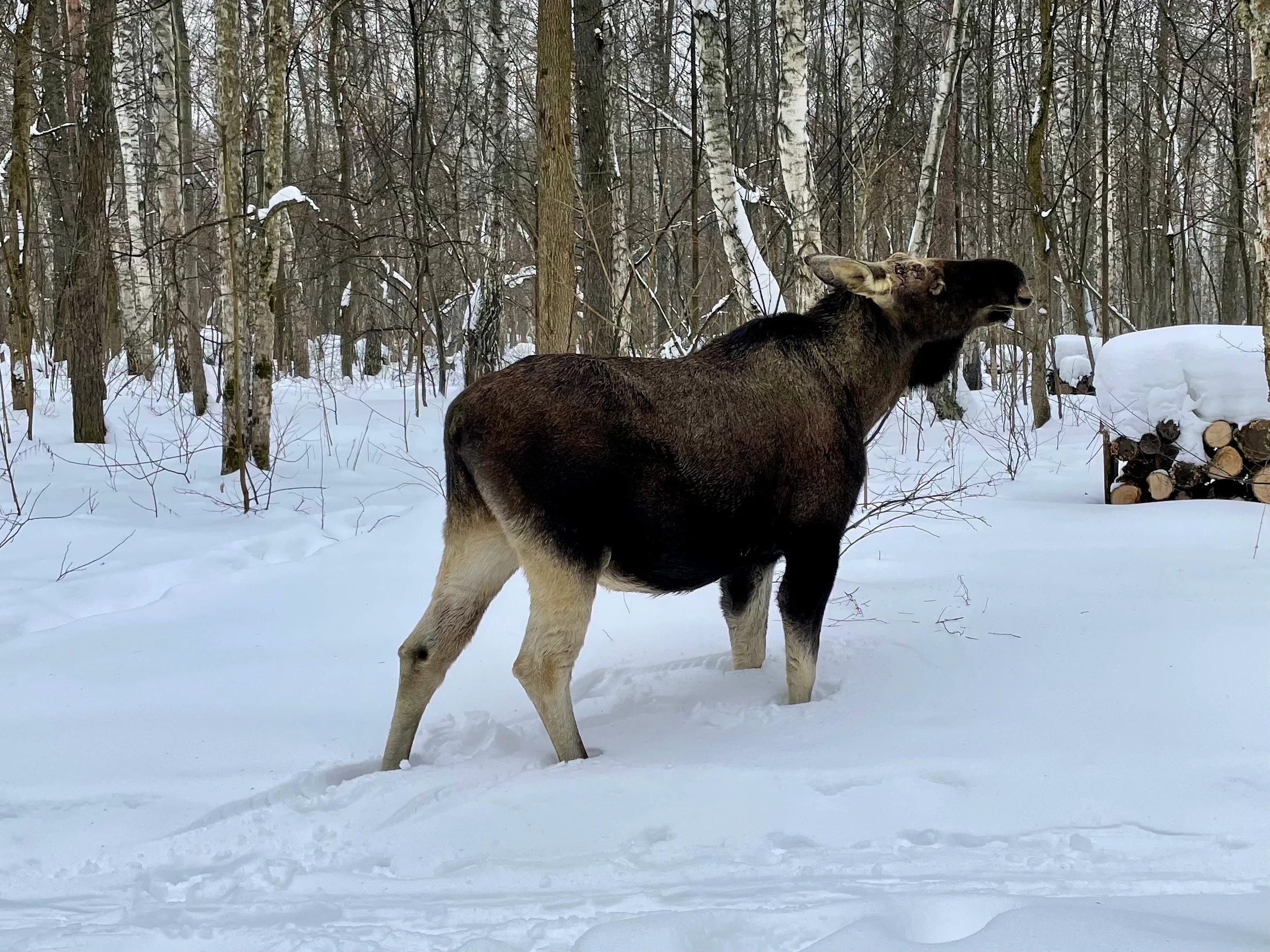
A large moose stands in profile in a snowy forest with birch trees and a stack of firewood in the background.
A moose standing in a snowy forest within Losiny Ostrov National Park.

Top sights and standout views in Losiny Ostrov National Park

Losiny Ostrov stands out for its unique status as one of the largest forests within a major capital city, its century-spanning history of use by Russian rulers and ordinary Muscovites, and its ongoing ability to host large mammals such as moose, sika deer, and wild boar within sight of dense urban neighborhoods.

Equally distinctive is the park's layered visitor experience. Educational sites such as the moose bio-station, the Forest of Russia arboretum, and the museum of Russian everyday life allow visitors to engage with the park's ecology and cultural history together, while natural areas such as the upper Yauza wetlands offer quieter, more traditional forest and bog landscapes accessible from nearby Moscow districts.
A view inside a dense forest with tall straight tree trunks rising toward a green canopy, with sunlight filtering through and illuminating the vegetation-covered forest floor.
Sunlit forest interior within Losiny Ostrov National Park in August, showing tall tree trunks and a green forest floor.

Best time to visit Losiny Ostrov National Park

The park rewards visits across much of the year because its mixed forest and wetland character offer different seasonal experiences. Spring and autumn are particularly notable for birdwatching, when migratory species pass through the upper Yauza wetlands and observation points like the tower near the Chugunny Bridge in Mytishchi offer good viewing conditions; spring also brings a brief but striking display of early flowering herbs and protected species in the herb layer.

Summer highlights the dense green canopy of broadleaf and coniferous forest and is the most comfortable season for longer walking and cycling routes through the recreational zones. Winter transforms the park into a quieter cross-country skiing and walking landscape, though visitors should be aware that wildlife viewing becomes more difficult and access to some interpretive facilities may be more limited.

Monthly climate preview

Long-term temperature and precipitation averages recorded at representative coordinates

Losiny Ostrov National Park Climate Normals and Annual Weather Patterns

Historical measurements from NASA Power reveal a wide annual temperature range and steady precipitation distribution across Losiny Ostrov National Park. Examining the full twelve-month dataset clarifies long-term thermal rhythms and monthly precipitation trends.
Annual mean4 °C
-11 °C19 °C
Jan-11°
Feb-10°
Mar-4°
Apr
May12°
Jun16°
Jul19°
Aug17°
Sep11°
Oct
Nov-3°
Dec-8°
Warmest month
July

18.6 °C

Coolest month
January

-10.6 °C

Wettest month
July

2.8 mm/day

Driest month
March

1.3 mm/day

Park location guide

Geography guide, regional context, and park location map for Losiny Ostrov National Park

Losiny Ostrov National Park park geography, regions, and map view in Russia

Understand where Losiny Ostrov National Park sits in Russia through a broader geographic reading of the surrounding landscape, nearby location context, and its mapped position within the national park landscape.

How Losiny Ostrov National Park fits into Russia

Russia is a transcontinental nation spanning eleven time zones, bordered by fourteen countries. It is the world's largest country by area, covering 17,098,246 km². Moscow is the capital and largest city, while Saint Petersburg is the second-largest and a major cultural centre.

Wider geography shaping Losiny Ostrov National Park in Russia

Russia spans Eastern Europe and North Asia, covering 17,098,246 km². It shares land borders with fourteen countries, more than any other nation, and spans eleven time zones. The landscape includes vast plains, mountain ranges such as the Urals and Caucasus, and extensive coastlines along the Arctic Ocean, Pacific Ocean, Baltic Sea, Black Sea, and Caspian Sea.

Map view of Losiny Ostrov National Park

Use this park location map to pinpoint Losiny Ostrov National Park in Russia, understand its exact geographic position, and read its mapped placement within the surrounding landscape more clearly.

Pigeon | © OpenStreetMap contributors

Location context for Losiny Ostrov National Park

MoscowMoscow Oblast
Natural feature types

Explore the Natural Landmark Index for Losiny Ostrov National Park

Dive into the geographic structure of Losiny Ostrov National Park by browsing its mapped natural features. This collection helps clarify the park's physical diversity, from peat bog systems to river corridors, using the MoriAtlas framework to contextualize the landscape within its urban setting.

Visual reference guide to urban forest habitats, riverine terrain, and wildlife environments

Losiny Ostrov National Park Photos and Protected Landscape Scenery

Visual documentation captures the diverse terrain, mixed woodlands, and wetland habitats that define Losiny Ostrov National Park. Examining detailed park photography reveals the unique ecological character of protected forest environments situated directly beside major metropolitan boundaries.

An aerial photograph showing a long, dark green pond winding through a dense forest. Paths run along both banks, with people visible on the left bank. In the far distance, city buildings and industrial smokestacks are visible against a blue sky.

A large wooden entrance gate with vertical slats spans a paved road leading into a forest. The left pillar displays a white elk head logo and the text 'ЛОСИНЫЙ ОСТРОВ'. Large white letters are partially visible on the ground on both sides of the gate.

A landscape view of a marshy wetland with tall grasses and reeds in the foreground, calm water, and a line of trees with yellow autumn foliage in the background under a cloudy sky.

A wide landscape view of a pond with a grassy bank and reeds in the foreground, leading to a wooden bridge in the distance under a cloudy sky.

A landscape painting showing a dense pine forest edge bordering a marshy clearing with puddles and several elk grazing in the distance under a cloudy sky.

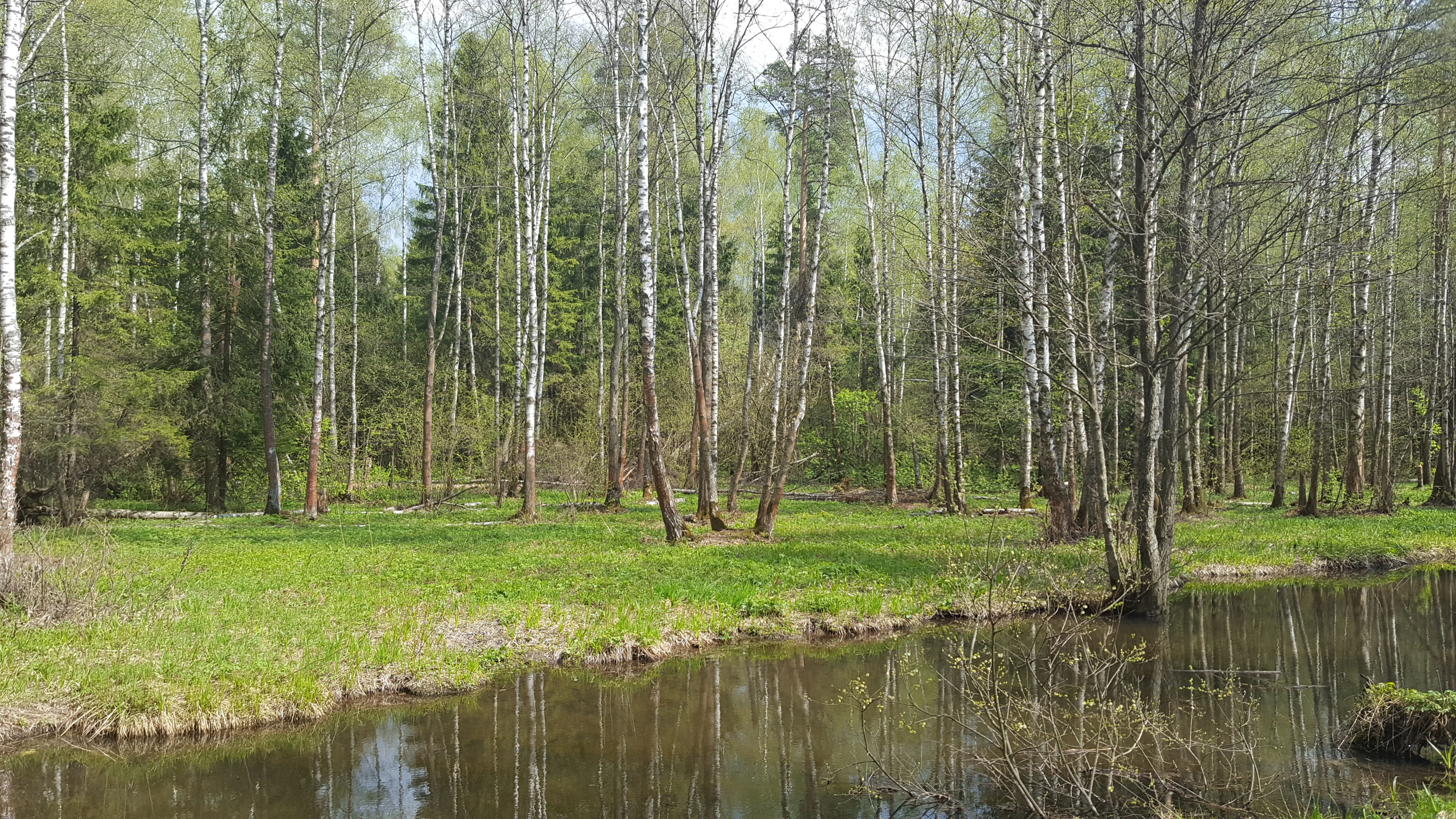
A river flows past a grassy bank lined with white birch trees in a forest.

A large moose stands in profile in a snowy forest with birch trees and a stack of firewood in the background.

A view inside a dense forest with tall straight tree trunks rising toward a green canopy, with sunlight filtering through and illuminating the vegetation-covered forest floor.

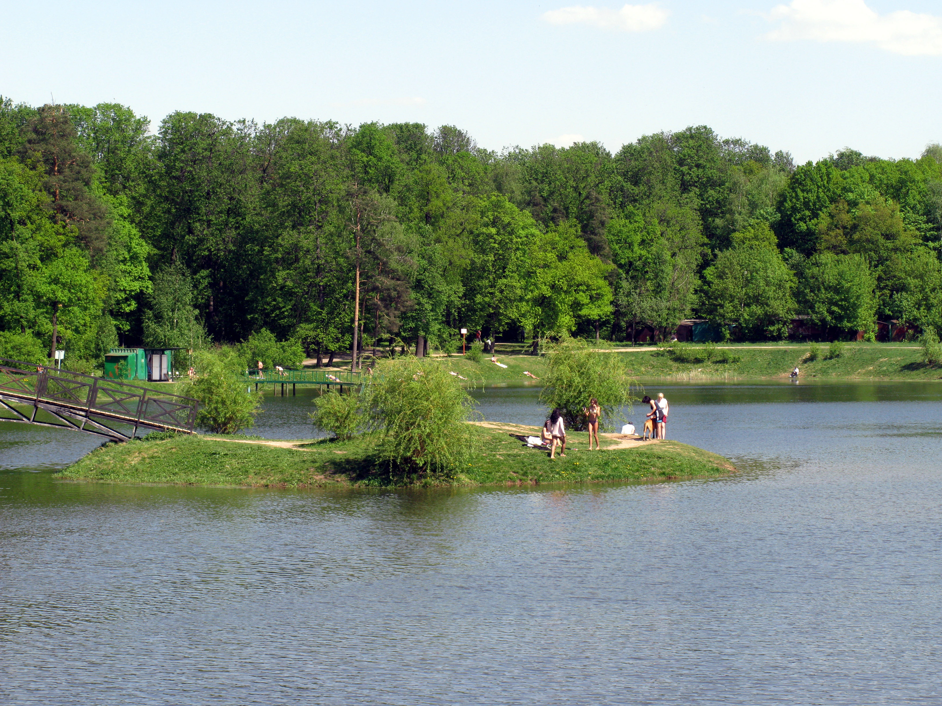
A pond with a small grassy island in the center where several people are standing, a wooden bridge on the left side, and dense green forest in the background under a partly cloudy sky.

A wide shot of a swampy wetland with green water covered in algae, surrounded by reeds and trees in the background under an overcast sky.

Park atlas

Compare nearby protected landscapes and forest ecosystems across the surrounding region

Other Parks Near Losiny Ostrov National Park and Regional Protected Areas

Browse other parks near Losiny Ostrov National Park to examine similar urban forest reserves, wetland habitats, and protected landscapes. Expanding the geographic comparison reveals broader ecological patterns and regional conservation areas across the surrounding territory.
Watercolor illustration of a winding river, trees, and hills in the background
National parkMoscow Oblast
Park boundaries overlap#1 closest

West

Losiny Ostrov National Park: Mapping the Boundaries of a Unique Urban Wilderness

Protected forest and wetland geography in Moscow Oblast.

Spanning over 116 square kilometers, Losiny Ostrov National Park represents a significant conservation effort as Europe's largest urban national park. Its geography encompasses dense mixed forests, the Upper Yauza Swamps, and a convergence of regional watersheds, providing a rare study of wilderness persistence within a densely populated metropolitan environment.

Area
116 km²
Established
1983
IUCN
II
Relief
Lowland
National parkЯмало-Ненецкий автономный округ
About 106 km away#2 closest

Northeast

Плещеево озеро National Park: Glacial Lake Geography and Protected Area Atlas

Mapped terrain, forest mosaic, and Upper Volga basin protected landscapes.

Плещеево озеро National Park centers on a significant glacial lake, framed by an ecological mosaic of boreal and broadleaf forests, extensive peat bogs, and coastal wetlands. This protected area within the Upper Volga basin offers a look at a layered natural environment where diverse bird populations, endemic fish, and historical landmarks meet across the East European Plain.

Area
237.9 km²
Established
1988
IUCN
II
Relief
Lowland
Watercolor painting showing a lake with grasses in the foreground and distant shoreline
National parkYaroslavl Oblast
About 107 km away#3 closest

Northeast

Pleshcheyevo Ozero National Park: National Park Mapping and Regional Protected Area Atlas

Discover its protected landscape and geographic setting.

Pleshcheyevo Ozero National Park is a key protected area within the geography of Yaroslavl Oblast, Russia. This page offers detailed insights into the park's specific landscape character, its mapped boundaries, and its significance as a national park. It serves as an entry point for understanding the protected lands of the region and exploring its natural terrain within a broader atlas context.

Area
238 km²
Established
1997
IUCN
II
Relief
Lowland
National parkMoscow Oblast
About 115 km away#4 closest

Northwest

Zavidovo National Park: Mapping the Protected Landscapes of the Upper Volga Lowland

A study of glacial plains, forest mosaics, and riverine habitats.

Zavidovo National Park occupies a sprawling area of the Upper Volga Lowland, characterized by gentle relief and an exceptional concentration of water-based habitats. The park serves as a prime example of a managed conservation territory that integrates river valleys, lowland forests, and marshlands. Its geographic identity remains deeply rooted in the glacial history of central Russia, supporting a continuous protected block within the Moscow Oblast.

Area
1,250 km²
Established
1972
IUCN
II
Relief
Lowland
Watercolor illustration of a lake surrounded by forests and mountains under a light sky
National parkTver Oblast
About 116 km away#5 closest

Northwest

Zavidovo National Park: Geographic and Protected Landscape Atlas of Tver Oblast

Exploring river floodplains and mixed forest terrain.

Zavidovo National Park represents a distinctive protected landscape within Russia, characterized by its flat glacial moraine terrain and complex water systems. The park protects critical wetlands, peat bogs, and river corridors that sustain diverse game and avian populations. Explore the geographic boundaries and ecological features that define this notable natural zone situated in the heart of Tver Oblast.

Area
1,329 km²
Established
2015
IUCN
II
Relief
Lowland
Watercolor painting of a lake surrounded by trees and distant hills
National parkVladimir Oblast
About 145 km away#6 closest

East

Meshchyora National Park: A Premier Wetland Protected Area in Vladimir Oblast

Explore its mapped boundaries and intricate floodplain geography.

Meshchyora National Park is a key protected landscape in central Russia, renowned for its expansive wetland ecosystems across the Meshchera Lowlands of Vladimir Oblast. Covering nearly 119,000 hectares, the park preserves a unique glacial terrain of peatlands, lakes, and meandering rivers, supporting remarkable biodiversity. Its role as a vital component of the Oka River basin and its conservation focus on restoring degraded peatlands make it a significant site for atlas-based geographic discovery and understanding protected area landscapes.

Area
1,189 km²
Established
1992
IUCN
II
Relief
Lowland
National parkVladimir Oblast
About 145 km away#7 closest

East

Мещёра National Park: A Study of Glacial Lowland Geography and Protected Forest Landscapes

A diverse protected mosaic in Vladimir Oblast, Russia.

Focusing on the flat, sandy expanses of the Meshchera Plain, this national park showcases a unique transition zone between taiga and nemoral forests. The area is characterized by its slow meandering rivers, numerous glacial lakes, and extensive peat bog systems that provide a benchmark for regional ecological preservation.

Area
2,239 km²
Established
1992
IUCN
II
Relief
Lowland
National parkЯмало-Ненецкий автономный округ
About 160 km away#8 closest

Southeast

Мещёрский национальный парк: Geographic Atlas and Protected Area Boundaries

Detailed mapping of the Meshchera Lowland wetland mosaic

Understand the protected geography of Мещёрский национальный парк, an essential conservation area containing complex peat bogs, expansive mixed forests, and the vital floodplain of the Pra River. This record provides a clear perspective on the park's terrain, hydrological features, and its status as a significant natural landmark within the broader Meshchera region.

Area
1,050.14 km²
Established
1992
IUCN
II
Visitors
5K annual

Common questions about visiting, size, designation, and location context for Losiny Ostrov National Park

Losiny Ostrov National Park FAQs for park facts, access, geography, and protected area context

Find quick answers about Losiny Ostrov National Park, including protected-area facts, park geography, trail and visitor context, and how the park fits into its surrounding country and regional landscape.
MoriAtlas Explorer

Continue Your Protected Areas Search Across the Global Atlas

Deepen your exploration by continuing the structured search for national parks and protected areas worldwide. Utilize the comprehensive filtering capabilities to compare different conservation landscapes and refine your understanding of global park geography. Discover more about the distribution and characteristics of protected natural areas.

Global natural geography