Mori Atlas logo
National parkLosiny Ostrov National Park

Discover the mapped boundaries and regional geography of this key protected landscape.

Losiny Ostrov National Park: A Protected National Park in Moscow Oblast

(National Park Losiny Ostrov)

Losiny Ostrov National Park stands as a vital national park, offering a unique perspective on the protected landscapes within Moscow Oblast. This page provides a detailed atlas-oriented exploration of the park's geographic identity, focusing on its mapped boundaries and its contribution to the regional natural context. Users can delve into the specifics of this protected area, understanding its place within Russia's broader network of natural reserves and geographic features.

urban national parkold-growth forestwetland ecosystemmoose habitaturban wildlifegreenbelt
Illustration of a landscape with a waterfall, birch trees, grassy fields, and mountains under a sun and clouds

Losiny Ostrov National Park

National park

Park overview

Structured park overview, official facts, and landscape profile for Losiny Ostrov National Park

Losiny Ostrov National Park park facts, protected area profile, and essential visitor context
Review the core facts for Losiny Ostrov National Park, including designation, size, terrain, visitor scale, habitats, and operating context in one park-focused overview.

About Losiny Ostrov National Park

Losiny Ostrov National Park represents one of the most unusual conservation achievements in Europe, maintaining a substantial wilderness area within the boundaries of a major world city. The park straddles the boundary between Moscow city and Moscow Oblast, with the Moscow Ring Road and the Moscow Little Ring Railway physically dividing its territory into inner and outer sectors. This urban nature reserve protects a complex mosaic of forests, wetlands, and river valleys that form a critical ecological corridor through the Moscow metropolitan region. The park's forest ecosystem is predominantly composed of mixed woodlands with pine and spruce stands interspersed with deciduous species, while the wetland areas include the notable Upper Yauza Swamps and numerous small ponds and streams. The park's location at the intersection of the Meshchera Lowlands and the Klin-Dmitrov ridge creates diverse microhabitats that support the surprising biodiversity found within its boundaries. Beyond its ecological value, Losiny Ostrov serves as an essential recreational resource for Moscow's residents, offering opportunities for hiking, wildlife observation, and environmental education while maintaining the natural character that distinguishes it from conventional city parks.

Quick facts and research context for Losiny Ostrov National Park

Losiny Ostrov National Park covers approximately 116 square kilometers, with roughly 83 percent covered by forest, making it one of the most heavily forested urban areas in Europe. The park is administratively divided into three functional zones: an especially protected core zone comprising about 47 percent of the total area and closed to public access, a training and excursion zone accounting for roughly 27 percent where visitors may explore along established routes, and a recreational zone making up the remaining 26 percent open for general entry. The terrain is gently undulating, with elevations ranging from 146 meters in the floodlands of the Yauza River to 175 meters above sea level. The park contains the headwaters of both the Yauza and Pekhorka rivers and supports remarkable biodiversity, including 44 mammal species, 170 bird species, nine amphibian species, five reptile species, and 19 fish species.

Park context

Deeper park guide and search-rich context for Losiny Ostrov National Park

Losiny Ostrov National Park history, landscape, wildlife, and travel context
Explore Losiny Ostrov National Park through its history, landscape character, ecosystems, wildlife, conservation priorities, cultural context, and seasonal travel timing in a structured park guide built for atlas discovery and search intent.

Why Losiny Ostrov National Park stands out

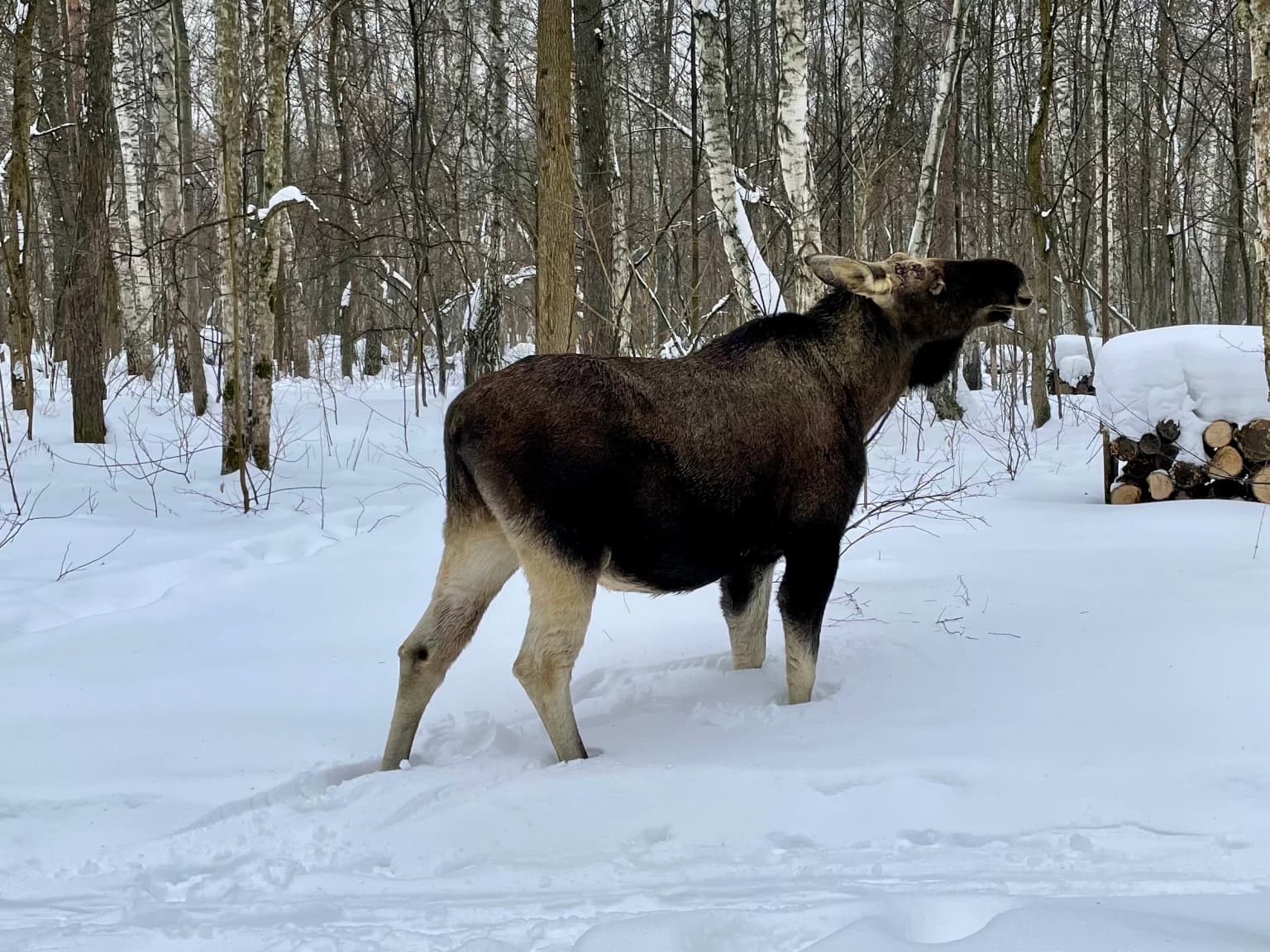
Losiny Ostrov is best known as Europe's largest urban national park, a place where Moscow residents can encounter wild animals in their natural habitat just minutes from the city center. The park's defining species is the moose, which still roams the forest in surprising numbers given the urban surroundings. The Elk Biological Station within the park offers visitors the opportunity to observe and learn about these magnificent animals up close. The park also stands out for its unique position as a centuries-old royal hunting ground that has retained its wild character despite being engulfed by the expanding Moscow metropolitan area, representing a living connection to the forested landscape that once surrounded the Russian capital.

Aerial view of a large pond surrounded by dense green forest with winding paths along the shore
Aerial view of Los Pond in Losiny Ostrov National Park

Losiny Ostrov National Park history and protected-area timeline

The history of Losiny Ostrov stretches back to the 14th century when the territory was documented in the testaments of Russian princes including Ivan Kalita, Dmitri Donskoi, and Vladimir of Serpukhov, who referenced the plowed lands and forests of the area. The site served as the exclusive hunting ground of Grand Princes and Russian tsars for centuries, earning its name which translates as Elk Island in reference to the prized game animals found there. Tsar Alexis I of Russia particularly enhanced the prosperity of Losiny Ostrov as a royal hunting territory during his reign. Following the transfer of the Russian capital to Saint Petersburg in the 18th century, the territory lost some of its exclusive royal significance but remained under government protection through imperial edicts, and in 1798 the forests passed to the newly formed forest department. The first systematic forest management was established in 1842 when the Losinoostrovskaya lesnaya dacha was opened, marking the beginning of organized forestry in the area. In 1934, Losiny Ostrov was incorporated into Moscow's 50-kilometer greenbelt. The park suffered significant damage during World War II when large areas of forest were cleared, and in the post-war period it faced pressure from land seizures for agriculture and illegal logging. The construction of the Moscow Ring Road in the late 1950s physically divided the forest into separate sectors. After years of advocacy, a resolution in 1979 organized Losiny Ostrov as a natural park, and in 1983 the Council of Ministers of the RSFSR officially established it as a national park. The Elk Biological Station began operations in 2002 and, after reconstruction, reopened in December 2015 as an educational facility where visitors can learn about and interact with the park's elk population.

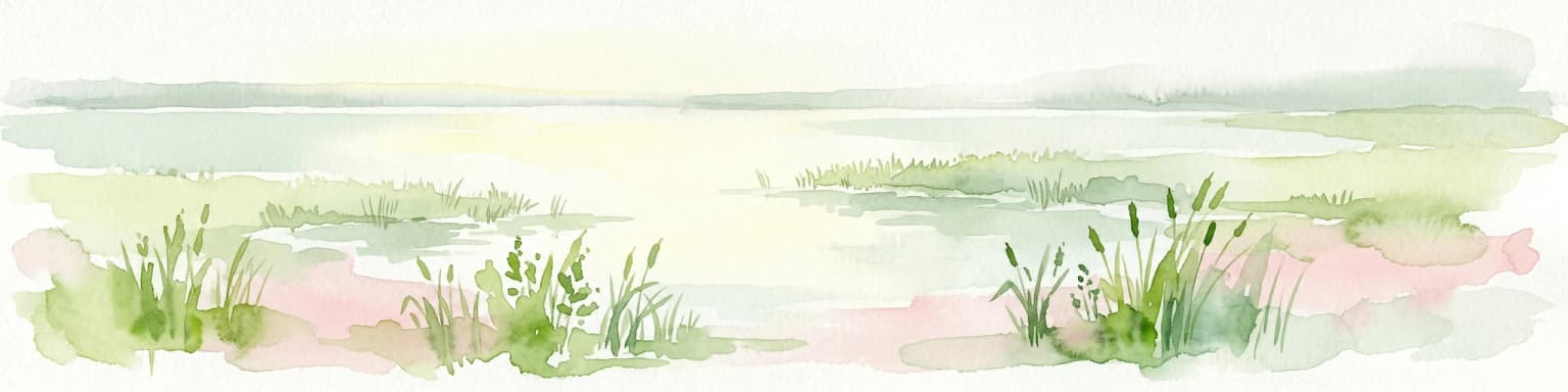
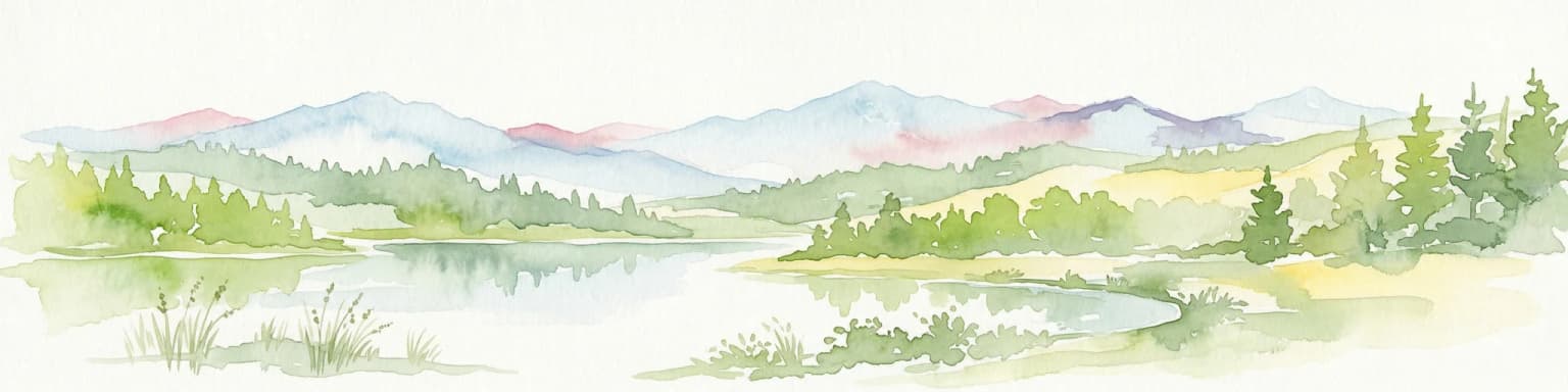
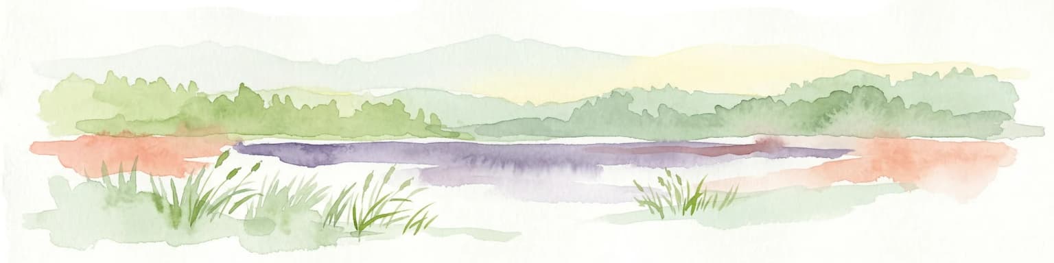
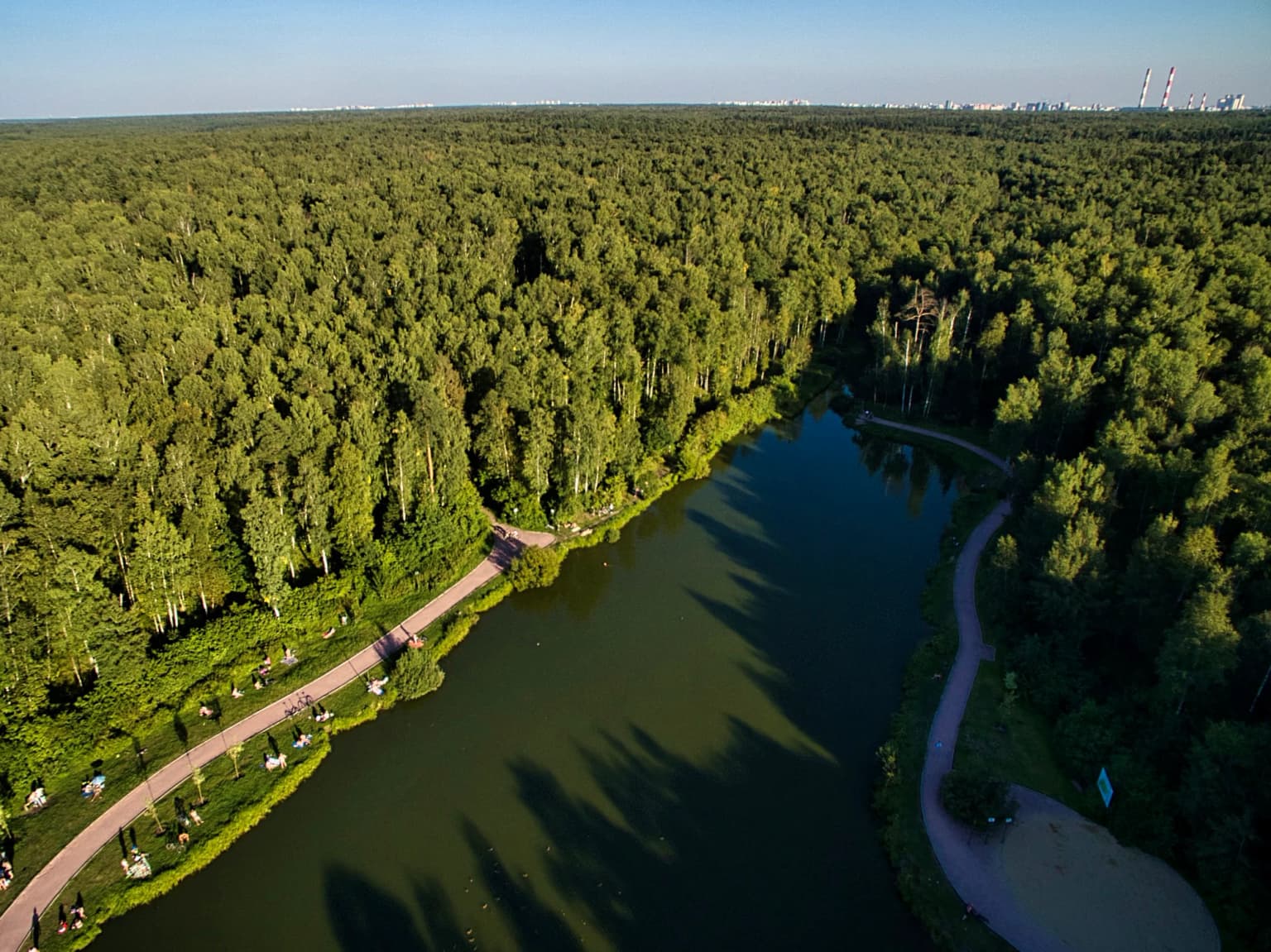
Losiny Ostrov National Park landscape and geographic character

The landscape of Losiny Ostrov National Park is characterized by gently undulating terrain typical of the Meshchera Lowlands, a vast lowland area in central Russia. The park sits at the watershed divide between the Moskva River and Klyazma River, creating a landscape defined by subtle elevation changes and the networks of small rivers and streams that flow from this drainage divide. The highest points reach approximately 175 meters above sea level while the lowest elevations of around 146 meters occur in the floodlands of the Yauza River. The southwestern portion of the park features the most visually dramatic terrain, where above-floodplain terraces of the Yauza River create clearly defined slopes descending to the river's floodplain. The park contains the headwaters of both the Yauza and Pekhorka rivers, though both watercourses have been significantly modified by human activity, with the Yauza's natural riverbed largely destroyed by peat extraction during the 1950s and 1970s. Approximately 5 percent of the park's area is classified as swamp, with the Upper Yauza Swamps representing the most significant wetland complex. The remaining landscape is dominated by forest, with scattered ponds and small water bodies adding visual and ecological diversity to the terrain.

Calm pond with a small grassy island, a wooden bridge structure on the left, and visitors standing on the island with green forest in the background.
A small grassy island in a calm pond within Losiny Ostrov National Park, with visitors gathered near a wooden structure.

Losiny Ostrov National Park ecosystems, habitats, and plant life

The ecological character of Losiny Ostrov is defined by its extensive forest cover, which occupies approximately 83 percent of the park's 116 square kilometers. The forests are predominantly mixed woodlands featuring coniferous species such as pine and spruce alongside various deciduous trees. This forest matrix supports a remarkable array of biodiversity for an urban area, with the park serving as a critical refuge for wildlife within the Moscow metropolitan region. The wetland ecosystems within the park, including the extensive swamp areas and the river valleys of the Yauza and Pekhorka, provide additional habitat diversity and support specialized plant and animal communities. The park's position at the ecological crossroads of different landscape zones contributes to the diversity of habitats found within its boundaries, combining elements of lowland forests, wetlands, and riparian zones. The protection afforded by national park status has allowed these ecosystems to persist despite the intense development pressure from the surrounding urban area, making Losiny Ostrov an important ecological island within one of Europe's largest cities.

A landscape painting showing tall pine trees, a winding river, grassy fields, and distant animals under a cloudy sky
Historical painting depicting a forested landscape with river and open fields

Losiny Ostrov National Park wildlife and species highlights

Losiny Ostrov supports an impressive diversity of wildlife given its urban setting, with 44 species of mammals, 170 bird species, 9 amphibian species, 5 reptile species, and 19 fish species recorded within the park boundaries. The park's namesake species, the moose, remains the most iconic wildlife resident and can be observed in various parts of the park, particularly in the more forested and wetland areas. The Elk Biological Station provides opportunities for visitors to learn about and observe these animals up close, contributing to environmental education and awareness. The bird population is particularly notable, with the diverse forest and wetland habitats supporting both resident species and migratory birds that use the area as a stopover or breeding ground. The wetland areas provide critical habitat for waterfowl and other bird species associated with aquatic environments, while the forest interior supports a variety of songbirds and birds of prey. The presence of species such as beavers, which have established colonies along the park's water bodies, further demonstrates the ecological health of this urban wilderness.

Parallel railway tracks with gravel ballast extending through a dense forest under a partly cloudy sky
Railway tracks running through a forested landscape in Losiny Ostrov National Park near Belokamennaya Station

Losiny Ostrov National Park conservation status and protection priorities

Losiny Ostrov National Park represents an important conservation achievement as one of the few large-scale protected areas within a major metropolitan region in Europe. The park's zoning system divides the territory into areas with varying levels of protection, with nearly half of the total area designated as especially protected and closed to public access to allow ecosystems to develop with minimal human disturbance. This approach recognizes the dual challenge of maintaining biodiversity while providing recreational opportunities for urban residents. The park's designation as a national park in 1983 provided formal legal protection for the area, building on the earlier protected status that dates back to 1799 when the territory was declared reserved. Conservation efforts focus on maintaining the ecological integrity of the forest and wetland ecosystems, protecting wildlife populations including the flagship moose species, and managing visitor impact through the zoning system. The park also serves a broader conservation function as part of Moscow's greenbelt system, connecting to other protected areas and green spaces to form a larger ecological network.

Losiny Ostrov National Park cultural meaning and human context

Losiny Ostrov carries deep historical significance as a landscape that has been associated with Russian state power and royal hunting traditions since the medieval period. The very name Elk Island reflects the importance of the area as a hunting ground for game species prized by the Russian aristocracy. This historical use as an exclusive royal hunting territory helped preserve the forest character of the area even as the surrounding lands were developed, creating the unusual situation where a medieval royal hunting ground has survived as a wilderness area within a modern megacity. The park also reflects the Soviet and post-Soviet approach to nature conservation, being established during the late Soviet period and continuing to operate within the Russian Federation. The ongoing challenges to the park's integrity, such as the highway construction approved in Korolyov in 2025, illustrate the continued tension between development pressures and conservation priorities in the Moscow region.

Moose standing in snow-covered forest with birch trees and stacked firewood
Moose standing in snow-covered forest of Losiny Ostrov National Park

Top sights and standout views in Losiny Ostrov National Park

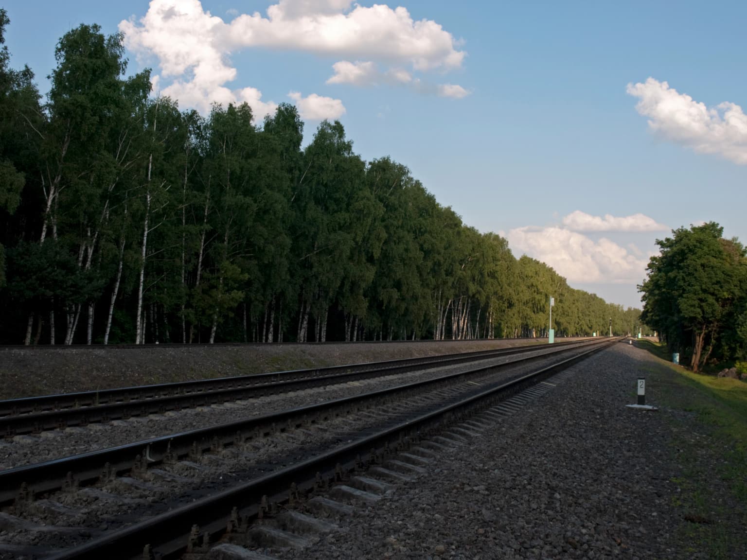
Losiny Ostrov stands out as a unique conservation space where the wild character of a centuries-old royal hunting ground has survived within one of Europe's largest cities, offering urban residents an authentic wilderness experience without leaving the metropolitan area. The Elk Biological Station provides one of the park's most distinctive visitor experiences, allowing close observation of moose in an educational setting while conveying information about the species' biology and conservation. The network of trails through different zones allows visitors to experience varied landscapes from dense forest to wetland marshes, while the portions of the Moscow Little Ring Railway that traverse the park add an unusual industrial element to the natural setting. The park's position at the watershed between two major river systems and its location at the ecological junction of different landscape zones contribute to the diversity of environments found within its relatively compact area.

Best time to visit Losiny Ostrov National Park

Losiny Ostrov can be visited throughout the year, with each season offering a distinct experience of the park's character. The summer months provide the most accessible trail conditions and offer the best opportunities for wildlife observation, particularly for spotting moose and other mammals in the early morning or evening hours. Autumn brings the changing colors of the deciduous trees, creating particularly scenic conditions throughout the park's extensive forests. Winter offers a different perspective on the landscape, with snow-covered terrain providing excellent conditions for tracking wildlife and observing the park's winter-adapted species. The shoulder seasons of spring and autumn tend to be less crowded while still offering pleasant conditions for hiking and wildlife observation. The park's status as an urban wilderness means that it can be affected by Moscow's climate, with the proximity to the city moderating some temperature extremes.

Park location guide

Geography guide, regional context, and park location map for Losiny Ostrov National Park

Losiny Ostrov National Park park geography, regions, and map view in Russia
Understand where Losiny Ostrov National Park sits in Russia through a broader geographic reading of the surrounding landscape, nearby location context, and its mapped position within the national park landscape.

How Losiny Ostrov National Park fits into Russia

Russia is a transcontinental nation spanning eleven time zones, bordered by fourteen countries. It is the world's largest country by area, covering 17,098,246 km². Moscow is the capital and largest city, while Saint Petersburg is the second-largest and a major cultural centre.

Wider geography shaping Losiny Ostrov National Park in Russia

Russia spans Eastern Europe and North Asia, covering 17,098,246 km². It shares land borders with fourteen countries, more than any other nation, and spans eleven time zones. The landscape includes vast plains, mountain ranges such as the Urals and Caucasus, and extensive coastlines along the Arctic Ocean, Pacific Ocean, Baltic Sea, Black Sea, and Caspian Sea.

Map view of Losiny Ostrov National Park

Use this park location map to pinpoint Losiny Ostrov National Park in Russia, understand its exact geographic position, and read its mapped placement within the surrounding landscape more clearly.

Pigeon | © OpenStreetMap contributors

Location context for Losiny Ostrov National Park

Moscow Oblast

Explore the diverse forest, wetland habitats, and urban wilderness character of Losiny Ostrov through visual imagery.

Losiny Ostrov National Park Photos, Landscape, and Protected Area Scenery
Visually discover the unique landscapes of Losiny Ostrov National Park, Russia's second oldest national park and Europe's largest urban green corridor. Examine how the mixed forests, wetland ecosystems, and subtle riverine terrain define its protected-area identity within the Moscow metropolitan region.

Aerial view of a large pond surrounded by dense green forest with winding paths along the shore

Wetland area with tall reeds, shallow water, and scattered birch trees under a partly cloudy sky

Calm pond with a small grassy island, a wooden bridge structure on the left, and visitors standing on the island with green forest in the background.

A landscape painting showing tall pine trees, a winding river, grassy fields, and distant animals under a cloudy sky

Parallel railway tracks with gravel ballast extending through a dense forest under a partly cloudy sky

A river reflecting in calm water surrounded by green grass and mixed trees including birch and conifers

Moose standing in snow-covered forest with birch trees and stacked firewood

Park atlas

Trace the broader park geography and compare diverse protected landscapes near Losiny Ostrov National Park

Explore National Parks and Protected Areas Surrounding Losiny Ostrov National Park
After exploring Losiny Ostrov National Park, you can browse other national parks and protected areas to understand their regional context and conservation characteristics. Geographic comparison offers deeper insights into varied terrains, ecosystems, and protected-area management strategies across the surrounding region.
National parkYaroslavl Oblast

Pleshcheyevo Ozero National Park: National Park Mapping and Regional Protected Area Atlas

Discover its protected landscape and geographic setting.

Pleshcheyevo Ozero National Park is a key protected area within the geography of Yaroslavl Oblast, Russia. This page offers detailed insights into the park's specific landscape character, its mapped boundaries, and its significance as a national park. It serves as an entry point for understanding the protected lands of the region and exploring its natural terrain within a broader atlas context.

Area
238 km²
Established
1997
IUCN
II
Relief
Lowland
Watercolor illustration of a lake surrounded by forests and mountains under a light sky
National parkTver Oblast

Zavidovo National Park: Exploring its Protected Landscape and Geographic Identity

Mapped protected areas within Tver Oblast's regional geography.

Delve into the specifics of Zavidovo National Park, a designated national park situated within the Tver Oblast. This detailed page provides a geographic lens, allowing for exploration of its protected landscape, mapped boundaries, and its regional context. Understand how this protected area contributes to the larger atlas of Russia's natural environments and discover its unique geographic features through structured, searchable data.

Area
1,329 km²
Established
2015
IUCN
II
Relief
Lowland
Watercolor painting of a lake surrounded by trees and distant hills
National parkVladimir Oblast

Meshchyora National Park: A Premier Wetland Protected Area in Vladimir Oblast

Explore its mapped boundaries and intricate floodplain geography.

Meshchyora National Park is a key protected landscape in central Russia, renowned for its expansive wetland ecosystems across the Meshchera Lowlands of Vladimir Oblast. Covering nearly 119,000 hectares, the park preserves a unique glacial terrain of peatlands, lakes, and meandering rivers, supporting remarkable biodiversity. Its role as a vital component of the Oka River basin and its conservation focus on restoring degraded peatlands make it a significant site for atlas-based geographic discovery and understanding protected area landscapes.

Area
1,189 km²
Established
1992
IUCN
II
Relief
Lowland
National parkRyazan Oblast

Meshchyorsky National Park: Ryazan Oblast Protected Landscape Exploration

National park geography and mapped terrain.

Investigate Meshchyorsky National Park, a key protected area situated in Ryazan Oblast, Russia. This page provides detailed atlas-level context, focusing on the park's geographic identity, its mapped boundaries, and its role as a national park within the regional landscape. Explore the natural terrain and discover the protected land's place in Central Russia's geography through structured data and mapping.

Area
66 km²
Established
1992
IUCN
II
Relief
Lowland
National park

Ugra National Park: Explore Russia's Protected Landscape and National Park Atlas

Mapped boundaries and regional geographic context.

Ugra National Park represents a crucial protected area within Russia, offering detailed geographic context for atlas-based exploration. This entry details the park's specific identity as a national park, highlighting its mapped boundaries and landscape character. Engage with the structured data to understand Ugra National Park's position within Russia's geography and its significance as a protected natural landscape, facilitating comprehensive map exploration.

Area
986,245 km²
Established
1997
IUCN
II
Relief
Lowland
National parkOryol Oblast

Orlovskoye Polesye National Park: National Park Geographic Discovery

Explore protected area maps and regional landscape context.

Delve into the protected landscape of Orlovskoye Polesye National Park, situated within Russia's Oryol Oblast. This page provides detailed geographic information, focusing on its mapped boundaries and its role as a key national park. Understand the unique regional context and how this protected area contributes to the atlas of Russia's natural landscapes. It's an essential resource for exploring the specific geography and mapped terrain of this important conservation area.

Area
777.45 km²
Established
1994
Relief
Lowland
Climate
Temperate
Watercolor illustration of a lake with green forests and grassy foreground, distant hills, and purple and orange water tones
National park

Valdaysky National Park: Russia's National Park & Protected Landscape Explorer

Discover its mapped boundaries and regional geographic context.

Valdaysky National Park represents a significant protected area, offering a focused entry into Russia's natural landscapes. This MoriAtlas page provides detailed geographic context, mapping the park's protected boundaries and its position within the regional terrain. Use this resource to understand the park's unique landscape identity and its value for structured atlas-based discovery of protected lands.

Area
1,585 km²
Established
1990
IUCN
II
Visitors
60K annual
National parkSmolensk Oblast

Smolenskoye Poozerye National Park: Protected Landscape and Regional Geography

Explore mapped boundaries and geographic context within Smolensk Oblast.

Smolenskoye Poozerye National Park is a protected natural area offering valuable insights into the geography of Smolensk Oblast. As a national park, its mapped boundaries define a significant landscape within Central Russia. This resource provides detailed information for atlas-based exploration, allowing users to understand the park's protected status and its place within the regional natural terrain.

Area
1,462 km²
Established
1992
IUCN
II
Visitors
250K annual

Common questions about visiting, size, designation, and location context for Losiny Ostrov National Park

Losiny Ostrov National Park FAQs for park facts, access, geography, and protected area context
Find quick answers about Losiny Ostrov National Park, including protected-area facts, park geography, trail and visitor context, and how the park fits into its surrounding country and regional landscape.
MoriAtlas Explorer

Continue Your Protected Areas Search Across the Global Atlas

Deepen your exploration by continuing the structured search for national parks and protected areas worldwide. Utilize the comprehensive filtering capabilities to compare different conservation landscapes and refine your understanding of global park geography. Discover more about the distribution and characteristics of protected natural areas.

Global natural geography