Why Lusenga Plain National Park stands out
Lusenga Plain National Park is best known for its dramatic waterfall, Lumangwe Falls, which ranks as Zambia's second-highest waterfall and forms a spectacular centerpiece along the Kalungwishi River. The park's extensive floodplain, which transforms dramatically between wet and dry seasons, creates a distinctive landscape of seasonal wetlands and grasslands that support recovering wildlife populations. The high rainfall environment, unusual among Zambia's protected areas, sustains relatively lush vegetation and creates habitat conditions more typical of areas further north. The presence of ancient rock paintings near Kundabwika Falls adds an archaeological dimension that distinguishes the park from many other Zambia reserves.
Lusenga Plain National Park history and protected-area timeline
Lusenga Plain's history as a protected area is relatively recent, reflecting Zambia's broader expansion of its national park network during the post-independence period. Prior to 1972, the area functioned primarily as a hunting ground, a designation that reflected its role as a landscape where local communities and colonial administrators pursued game for sport and subsistence. The conversion to national park status in 1972 represented a formalization of protection that aligned with Zambia's growing commitment to wildlife conservation following independence. The subsequent decades saw the park face significant wildlife depletion, as populations of large mammals declined due to hunting pressure and habitat modification. Beginning in 2007, systematic wildlife reintroduction programs commenced, introducing species that had been locally extirpated including Grant's zebra, puku, and impala. These efforts aimed to restore ecological balance to the park's ecosystems and re-establish viable populations of key herbivore species. The park's cultural history extends far deeper than its formal protection timeline, with the Luda and Chishinga peoples maintaining longstanding connections to the landscape that predate the establishment of protected area status.
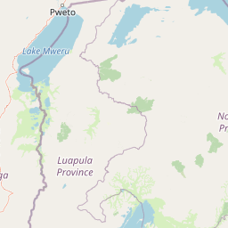
Lusenga Plain National Park landscape and geographic character
The physical landscape of Lusenga Plain National Park is dominated by an extensive floodplain that forms the valley floor of the Kalungwishi River system. This plain transforms dramatically between wet and dry seasons, with the river expanding during the rainy season to inundate vast areas of grassland before receding to leave behind fertile soils and residual pools that sustain wildlife through the dry months. The terrain rises gently from the floodplain to rocky uplands where the characteristic miombo woodland ecosystem predominates. Basalt formations create the geological foundation for Lumangwe Falls, where the Kalungwishi River encounters a hard rock ledge and plunges approximately 30 meters into a dramatic gorge, generating spray and thunder that can be heard from some distance. Rock outcrops along the river valley also contain the ancient paintings near Kundabwika Falls, evidence of long human presence in this landscape. The combination of waterfall, floodplain, and woodland creates a visually varied landscape that offers different characters depending on season and location within the park.
Lusenga Plain National Park ecosystems, habitats, and plant life
The ecological character of Lusenga Plain is shaped substantially by its high rainfall and the presence of the Kalungwishi River system, which creates habitat conditions atypical of much of Zambia. The floodplain supports seasonal wetland vegetation including various grasses and emergent plants that provide important grazing for herbivores during the dry season when other areas become parched. Riparian forests line the riverbanks, providing cover and food sources for forest-dwelling species and creating important corridors for wildlife movement. The higher ground supports miombo woodland dominated by Brachystegia and Julbernardia species, the characteristic tree cover of much of southern Africa's highlands. The rainfall patterns, substantially higher than most of Zambia, contribute to relatively lush vegetation that distinguishes the park from the drier savanna and woodland environments found in many other protected areas. This moisture also supports higher plant diversity and more continuous green cover throughout the year, creating favorable conditions for wildlife viewing even during the dry season.
Lusenga Plain National Park wildlife and species highlights
The wildlife of Lusenga Plain National Park reflects both the park's recovering status and its distinctive habitat conditions. Historically, the park experienced significant depletion of its fauna, with many large mammal species disappearing from the area due to hunting and habitat pressures. The reintroduction programs beginning in 2007 have sought to restore populations of several key species, including Grant's zebra, a distinctive subspecies adapted to grazing the open plains, puku, a medium-sized antelope favoring wetland grasslands, and impala, a common and ecologically adaptable species that can thrive in various habitats. The river systems support populations of hippos and crocodiles, while the riparian and woodland areas provide habitat for numerous bird species. The floodplain grasslands attract herds of grazers during the dry season when water becomes scarce elsewhere in the region. While wildlife populations remain recovering compared to older-established parks, the habitat conditions support meaningful wildlife experiences for visitors, particularly as reintroduction efforts continue to expand the species complement.
Lusenga Plain National Park conservation status and protection priorities
Lusenga Plain National Park represents an important component of Zambia's protected area network, classified as an IUCN Category II national park that aims to protect intact ecosystems and allow natural processes to continue with minimal human intervention. The park's conservation significance is elevated by its position in a high-rainfall zone that supports habitats and species assemblages not well-represented in other protected areas of the country. The floodplain ecosystem provides important ecological services including flood regulation, water filtration, and carbon sequestration while supporting biodiversity that includes both widespread and locally restricted species. The Lumangwe Falls area has been identified as a priority for tourism development given its dramatic scenery and potential to attract visitors who might also support conservation through tourism revenue. The wildlife reintroduction program demonstrates active conservation management, though the relatively recent establishment of formal protection means the park's ecosystems remain in a recovery phase.
Lusenga Plain National Park cultural meaning and human context
Lusenga Plain National Park holds deep cultural significance for local communities in the Luapula Province, particularly the Luda and Chishinga peoples whose ancestral connections to this landscape extend far beyond the park's establishment in 1972. The Luda people, governed by Chief Mwata Kazembe, conduct the Umutomboko Ceremony within the park boundaries, a cultural event of profound spiritual and social importance that reinforces community identity and connection to the land. Similarly, the Chishinga people, under Senior Chief Mushota, observe the annual Chishinga Malaila Ceremony, another traditional observance that ties cultural practice to specific locations within the park's landscape. These ceremonies represent living traditions that give the protected area cultural meaning beyond its ecological value, demonstrating how conservation and cultural heritage can intersect in African protected areas. The presence of ancient rock paintings near Kundabwika Falls provides physical evidence of even older human connections to this landscape, suggesting long-term cultural significance that predates the relatively recent formal establishment of the national park.
Top sights and standout views in Lusenga Plain National Park
Lusenga Plain National Park offers several standout features that distinguish it within Zambia's protected area network. Lumangwe Falls, one of Zambia's highest waterfalls, provides a spectacular natural attraction that ranks among the country's most impressive cascades. The seasonal floodplain creates a dynamic landscape where the extent of wetland coverage transforms dramatically between wet and dry seasons, offering different experiences for visitors at different times of year. The cultural dimension, with ongoing traditional ceremonies conducted by the Luda and Chishinga peoples, provides visitors with opportunities to experience living cultural practices rather than just historical heritage. The recovering wildlife populations, while not yet at the levels found in older-established parks, offer meaningful wildlife viewing opportunities, particularly along the river systems where animals congregate during the dry season.
Best time to visit Lusenga Plain National Park
The optimal time to visit Lusenga Plain National Park depends on the experience sought. The dry season, typically from May to October, offers easier wildlife viewing as animals concentrate around remaining water sources and vegetation thins to improve visibility. The floodplain during this period becomes a reliable location to observe reintroduced species including zebra and antelope. However, the wet season, from November to April, transforms the landscape dramatically as the plain becomes inundated, creating a vast wetland that supports different wildlife behavior and provides exceptional birdwatching opportunities. The high rainfall means the park retains its lush green character throughout the year compared to many other Zambia parks that become parched during the dry months. Waterfall viewing is impressive year-round, though flow may be reduced during the dry season.