Mori Atlas logo
Park earthquake history

Review documented historical seismic events, event magnitudes, and epicentre distances in the region.

Recorded Earthquake History and Seismic Activity Records for Lye Brook Wilderness

Explore a structured, date-organized catalogue of recorded seismic events associated with the geography of Lye Brook Wilderness. This collection provides access to historical earthquake data, including event magnitude, focal depth, and calculated epicentre proximity to the wilderness boundary. Access details from authoritative scientific sources to understand the regional seismic history near this high forested plateau.

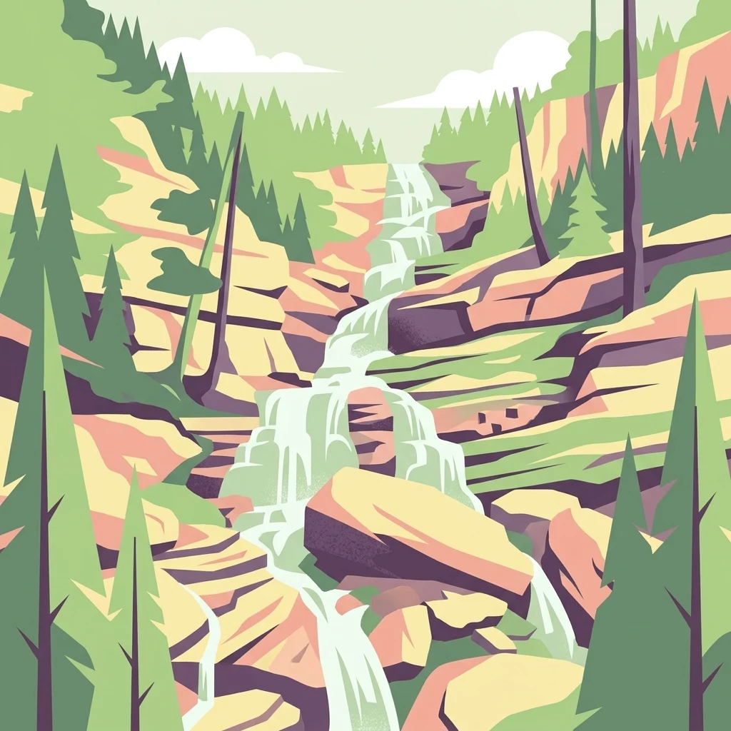
A stylized vector illustration of a multi-tiered waterfall flowing over layered rock formations, surrounded by pine trees under a simple sky.

One of Vermont's oldest wilderness areas, centered on a forested high plateau, the Long Trail, and Lye Brook Falls.

Lye Brook Wilderness

Lye Brook Wilderness is a federally designated wilderness area in southern Vermont, forming one of eight wilderness units within the Green Mountain National Forest. The area covers roughly 18,000 acres across parts of Bennington County and Windham County, northwest of the small town of Stratton. Created by the Eastern Wilderness Areas Act of 1975, it ranks among the oldest wilderness areas in Vermont and has been expanded by subsequent wilderness legislation in 1984 and 2006. The wilderness is defined by a high forested plateau that rises from about 900 feet at its low point to nearly 2,900 feet at its summit, with most of the terrain sitting above 2,500 feet. Northern hardwood forests dominate the landscape, interspersed with spruce thickets, brook valleys, ridgelines, and ponds. A defining feature is Lye Brook, which flows through the western half of the area, and Lye Brook Falls, one of the tallest waterfalls in Vermont. Lye Brook Wilderness is valued as a hiking and backcountry destination rather than a roadside attraction. The Long Trail crosses the wilderness through Stratton Pond, and a network of side trails such as the Lye Brook Trail and the Branch Pond Trail provides access to waterfalls, ponds, and remote ridgelines. Black bear, moose, deer, pine marten, and bobcat are among the wildlife that inhabit the area.

Location
United States of America
Park type
Wildlife reserve
Established
1975
Area
73.3 km²
Highest point
884 m
Lye Brook Wilderness Protected Area Map

Explore Lye Brook Wilderness records by depth and distance

Study historical recorded earthquakes around Lye Brook Wilderness

Lye Brook Wilderness’s collection positions reported epicentres around its southern Vermont boundary through calculated distance, separating the records from the Green Mountain plateau, northern hardwood forest, and stream valleys. Dates, magnitudes, depths, localities, sources, and wilderness distances support historical comparison without attributing landscape effects, current risk, or recurrence.

Sort by
Magnitude
Location

This page describes catalogued earthquakes associated with the park by epicentre location and distance. It does not establish causation, assess current danger, or predict future earthquakes.

No earthquake records match the current filters

Park atlas

Go beyond Lye Brook Wilderness earthquake records

Explore other protected parks beyond Lye Brook Wilderness

These onward routes follow Lye Brook Wilderness’s earthquake entries and widen discovery beyond its southern Vermont plateau, northern hardwood forest, waterfalls, brook, and backcountry setting. They are not recommendations based on matching wilderness status, waterways, nearby geography, geology, seismic history, source completeness, hazards, or risk; each linked park has its own context.
Watercolor painting of a lush green landscape featuring rolling hills in the distance, a meandering stream in the midground, and wetlands with cattails in the foreground.
Protected landscapeVermont
Park boundaries overlap#1 closest

North

Green Mountain National Forest: Mapped Geography and Protected Landscape Analysis

Examining the wilderness backbone of Vermont's mountainous terrain

Gain insight into the expansive boundaries of Green Mountain National Forest, an essential protected area spanning the Green Mountains of Vermont. This profile details the forest's composition, ranging from high-elevation spruce-fir zones to mixed hardwood slopes and extensive federal wilderness corridors, providing a foundational geographic understanding of this vital northeastern landscape.

Area
1,615.31 km²
Established
1932
Relief
Mountain
Climate
Temperate
Wildlife reserveBennington County
18 km away#2 closest

South

George D. Aiken Wilderness: Protected Forest Landscapes and Ridgelines in Vermont

Detailed geographic overview of a Green Mountain wilderness reserve

Spanning over 4,800 acres in Bennington County, the George D. Aiken Wilderness stands as a significant protected area within the southern Green Mountains. The terrain features narrow ridgelines, steep valleys, and a dense canopy of northern hardwoods that remain unmanaged to maintain wilderness standards. This area serves as a primary geographic anchor for Eastern wilderness preservation efforts in the United States.

Area
19 km²
Established
1984
IUCN
Ib
Relief
Mountain
Protected landscapeVermont
About 25 km away#3 closest

North

Robert T. Stafford White Rocks National Recreation Area: Protected Landscape and Regional Geography

Southern Vermont wilderness, quartzite formations, and Appalachian Trail corridors.

Robert T. Stafford White Rocks National Recreation Area represents a unique fusion of protected forest and rugged geological character in southern Vermont. Known for the quartzite rockslides of Chaos Canyon and its inclusion of two distinct wilderness areas, this territory offers a complex terrain profile. Spanning over 36,000 acres, it serves as a central hub for regional backcountry exploration, blending dense hardwood ecosystems with the prominent rocky outcrops that define its distinct mountainous identity.

Area
147 km²
Established
1984
Water
Major water bodies
Protected areaAddison County
About 82 km away#4 closest

North

Joseph Battell Wilderness: Mapping Protected Ridges in the Green Mountain National Forest

A high-elevation Appalachian landscape in Addison County, Vermont.

Spanning over twelve thousand acres, the Joseph Battell Wilderness preserves a critical core of the Green Mountains. This protected area features dramatic cliff faces like Mount Horrid and a continuous sequence of summits exceeding three thousand feet. The region provides a deep look at northern hardwood habitats and the geographic influence of the Long Trail within the broader Vermont mountain landscape.

Area
49.92 km²
Established
2006
Relief
Mountain
Climate
Temperate
Protected landscapeNew Hampshire
99 km away#5 closest

Northeast

White Mountain National Forest: Protected Landscape Atlas and Geographic Boundary Context

Mapping the alpine ridges and river valleys of New Hampshire

Delve into the geography of White Mountain National Forest, a primary federal protected landscape in the eastern United States. This overview details the mountainous terrain, including the Presidential Range and Pemigewasset Wilderness, providing a clear window into its spatial scale, watershed boundaries, and regional prominence within the New England landscape.

Area
3,038.59 km²
Established
1918
Relief
Mountain
Climate
Temperate
A horizontal watercolor painting showing a wide coastal estuary with gentle hills in the background, a winding body of water in the middle ground, and soft green trees and shrubs in the foreground.
Nature reserveNew Hampshire
About 166 km away#6 closest

East

Great Bay National Estuarine Research Reserve: Protected Coastal and Estuarine Geography

Regional tidal habitat and protected watershed in New Hampshire

Great Bay National Estuarine Research Reserve protects a vital coastal landscape characterized by broad tidal basins, fringing salt marshes, and inland woodlands. Located in southeastern New Hampshire, this nature reserve serves as an essential site for studying the intersection of freshwater and saltwater ecosystems, preserving a mosaic of land and water that illustrates the complex geography of the Atlantic coast.

Area
41.42 km²
Established
1989
Relief
Lowland
Climate
Temperate
A watercolor painting of a green, rolling coastal landscape with gentle hills and trees under a white background.
Protected landscapeMassachusetts
About 185 km away#7 closest

Southeast

Boston Harbor Islands National and State Park: Mapping Coastal Protected Landscapes

A diverse archipelago of islands and tidal harbors in Massachusetts

Boston Harbor Islands National and State Park offers an expansive look at coastal geography within the Massachusetts Bay. Spanning dozens of islands and peninsulas, this protected landscape captures a blend of drumlin terrain, tidal salt marshes, and historic maritime structures set directly against the urban skyline of Boston.

Area
6 km²
Established
1996
Visitors
28.2K annual
Relief
Lowland
Marine protected areaRhode Island
About 212 km away#8 closest

Southeast

Narragansett Bay National Estuarine Research Reserve: Island and Marine Protected Area Overview

A coastal research landscape in Rhode Island

Discover the geographic composition of the Narragansett Bay National Estuarine Research Reserve. This marine protected area spans the terrestrial and aquatic zones of three major islands within the Narragansett Bay system, providing a deep look at estuarine habitat conservation and regional island geography.

Area
15.9 km²
Established
1980
Relief
Lowland
Climate
Temperate
MoriAtlas Explorer

Continue Exploring the Protected Landscapes of Lye Brook Wilderness in Vermont

Delve into the precise mapping and geographic character of Lye Brook Wilderness. MoriAtlas provides a structured look at the terrain, elevation, and protected boundaries of this significant southern Vermont wildlife reserve, helping you understand its role within the wider Green Mountain National Forest.