
Mori Atlas logo
Nature reserveMacun-Seen

A crystalline silicate lake basin within the expansive Swiss National Park network

Macun-Seen Nature Reserve and High Alpine Plateau Geography in Graubünden Switzerland

(Nationalpark-Exklave Macun-Seen)

The Macun-Seen landscape comprises a remote high-alpine plateau in the Swiss canton of Graubünden, characterized by a unique cluster of 23 glacial cirque lakes. Set at an elevation of approximately 2600 metres, this protected area features distinct crystalline silicate geology that contrasts sharply with the surrounding dolomitic ranges of the Lower Engadine. The basin serves as an exclave of the Swiss National Park, preserving an untouched environment for alpine wildlife and rare high-altitude flora.

alpine plateaucirque lakesswiss national park exclavegraubundenlower engadinehigh-altitude landscape
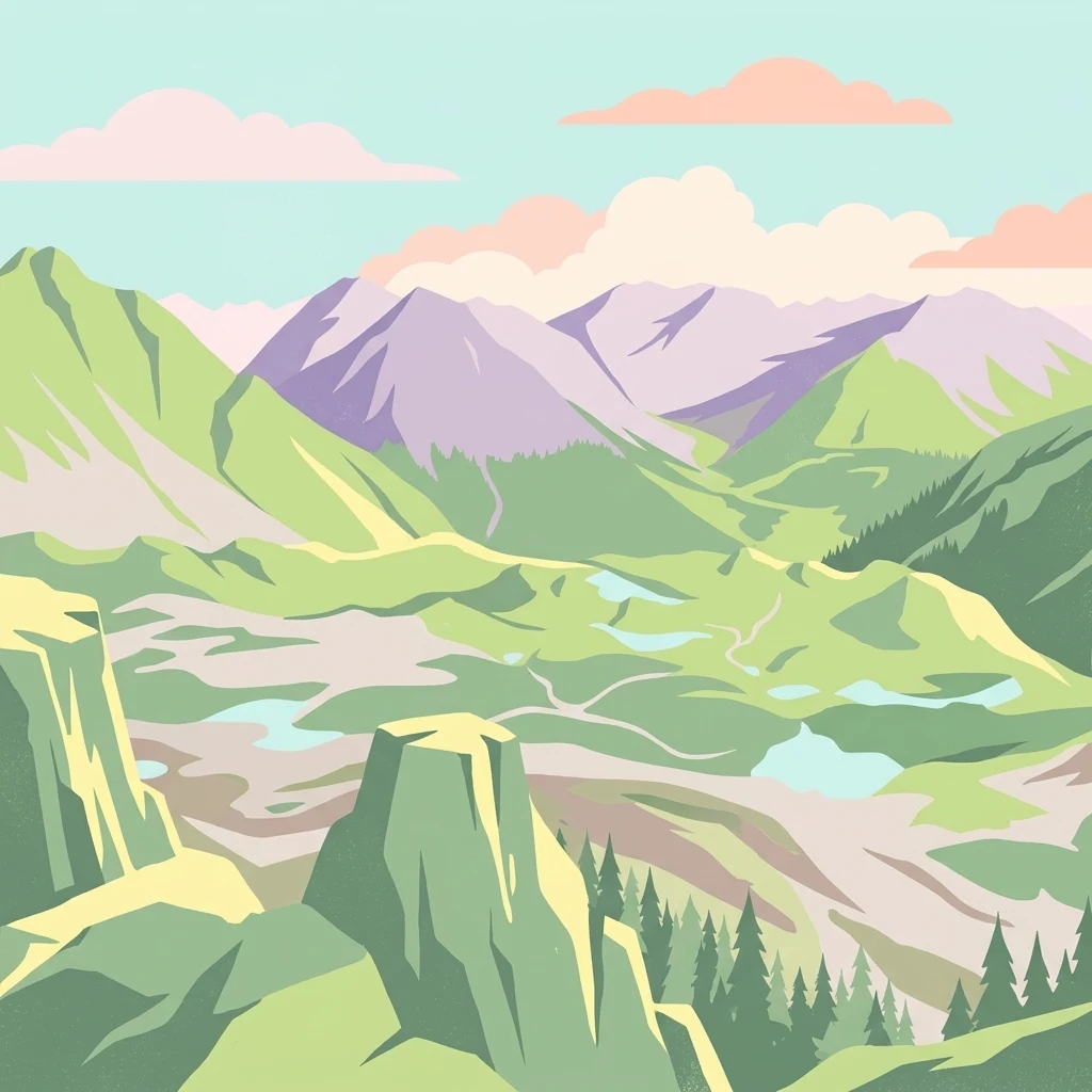
A stylized digital illustration of a high-alpine landscape featuring green rolling hills, multiple small blue glacial lakes, rocky cliffs, and purple-toned mountain peaks under a soft sky.

Macun-Seen

Nature reserve

Park overview

Structured park overview, official facts, and landscape profile for Macun-Seen

Macun-Seen park facts, protected area profile, and essential visitor context

Review the core facts for Macun-Seen, including designation, size, terrain, visitor scale, habitats, and operating context in one park-focused overview.

About Macun-Seen

The Macun-Seen are a small but ecologically distinctive high-alpine protected area in the Lower Engadine, Switzerland. Located in the municipality of Zernez and historically associated with the nearby village of Lavin, the plateau lies at around 2600 metres above sea level and forms a natural amphitheatre of cliffs, ridges, and small basins. Within this rocky setting, a remarkable concentration of 23 cirque lakes has formed, giving the area both its name and its main scenic appeal.

The plateau is enclosed by a ring of mountains reaching the 2900 to 3000 metre range, including Piz d'Arpiglias at 3027 metres, Piz Sursassa at 2968 metres, and roughly a dozen other unnamed summits of similar height. The eponymous Piz Macun, a 2889-metre peak whose Romansh name means ibex peak, lies just outside the protected area. Together, these mountains frame the lake basin and reinforce the area's sense of remoteness and wilderness.

Since August 2000, the Macun-Seen have formed an exclave of the Swiss National Park, separated from the main park area by the Val Laschadura valley. This administrative arrangement reflects both the ecological importance of the area and its practical separation from the rest of the park. Within the exclave, all plants are fully protected, visitors must remain on marked trails, and there are no food or accommodation facilities. The only designated rest area within the basin is near the smaller Lai d'Immez.

The Macun-Seen are most commonly approached on foot from Zernez via Munt Baselgia, with an alternative route from Lavin following the Val Zeznina. Both routes are classified as T3 mountain trails, reflecting their steep and exposed character. Outside the marked paths, the terrain is undeveloped, preserving the quiet, contemplative character of the landscape and making Macun one of the less-visited but most distinctive parts of the Swiss National Park system.

Quick facts and research context for Macun-Seen

The Macun-Seen plateau lies in the municipality of Zernez, canton of Graubünden, Switzerland, near the village of Lavin. The area covers about 3.6 square kilometres and was incorporated into the Swiss National Park as a separate exclave in August 2000.

The plateau consists of 23 cirque lakes at approximately 2600 metres elevation, surrounded by peaks rising to roughly 3000 metres, including Piz d'Arpiglias and Piz Sursassa. The name Macun derives from an old Romansh word for ibex, the species that still characterizes the area today.

Park context

Deeper park guide and search-rich context for Macun-Seen

Macun-Seen history, landscape, wildlife, and travel context

Explore Macun-Seen through its history, landscape character, ecosystems, wildlife, conservation priorities, cultural context, and seasonal travel timing in a structured park guide built for atlas discovery and search intent.

Why Macun-Seen stands out

The Macun-Seen are best known for their dense cluster of small cirque lakes perched on an open high-altitude plateau, a relatively unusual landscape feature for the region. Surrounded by prominent peaks such as Piz d'Arpiglias, Piz Sursassa, and a dozen other summits close to 3000 metres, the basin offers expansive views and a strikingly self-contained alpine setting. The area is also recognized for its ecological contrast with the rest of the Lower Engadine. Although its surroundings belong to the dolomitic Unterengadiner Dolomiten, the Macun plateau sits on crystalline silicate rock, which supports a distinct plant community, including the only Swiss locality of the pygmy buttercup. Combined with easy observation of ibex, chamois, marmots, and ptarmigan, this gives the area a strong identity within the broader Swiss National Park.
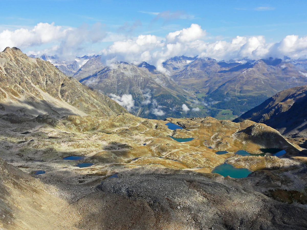
A wide aerial view of the Macun plateau in the Swiss Alps, showing numerous small, turquoise glacial lakes scattered across a rocky, high-alpine landscape with surrounding mountain peaks under a partly cloudy sky.
The high-altitude plateau of Macun, featuring its characteristic cluster of glacial tarns.

Macun-Seen history and protected-area timeline

The Macun-Seen were incorporated into the Swiss National Park as a separate exclave in August 2000. This extension broadened the park's protected territory beyond its original contiguous area in the Lower Engadine, adding a high-alpine lake landscape that had previously existed largely outside formal protection, apart from traditional alpine pasture use around its fringes.

Before the twentieth century, the lakes of the Macun plateau were used in the course of seasonal alpine pastoralism. Fish were introduced into several of the larger lakes beginning in the late nineteenth century as part of this traditional management, with stocking intensifying significantly from around 1970 onwards. These historical interventions shaped the present fish communities of the basin, which today include Canadian lake trout, minnows, and brown trout in seven of the larger lakes.

The cultural memory of the area is preserved in local legend. A sixteenth-century tale recounts a dragon living in the deep waters of Lai Grond, said to drag grazing cattle into the lake. Another legend describes dwarfs inhabiting a cave beside Lai Grond and forging stars from golden leaves during the winter. These stories were recorded in writing in 1953 by Maria Ritz in her Romansh work L'istorgia da Janaiverin, which remains a key reference to the folklore of the Macun region.

The establishment of the Macun-Seen exclave in 2000 formalised the protection of these landscapes and legends within the Swiss national system of protected areas, while preserving the area's traditionally low level of human presence.

Macun-Seen landscape and geographic character

The Macun-Seen plateau occupies a broad high-alpine basin at approximately 2600 metres above sea level, shaped by glacial action into a shallow, undulating surface dotted with small lakes. The terrain is composed of cirques and low rocky ridges that together create a relatively flat, walkable platform in contrast to the surrounding steep mountain walls. Twenty-three small cirque lakes occupy depressions across this surface, varying in size from small pools to the basin's main body of water.

The largest and deepest of these lakes is Lai Grond, with a surface area of roughly 1.5 hectares and a maximum depth of about 8.5 metres. Together with the surrounding smaller basins, the lakes form a characteristic pattern of clear, cold alpine waters that remain largely unmodified by human infrastructure. Drainage from the plateau flows, partly underground, into the Aua da Zeznina, which descends toward the Inn valley between Lavin and Guarda.

The plateau is encircled by a sequence of rocky peaks reaching into the high alpine zone. Piz d'Arpiglias, at 3027 metres, and Piz Sursassa, at 2968 metres, are the most prominent named summits, while the surrounding ridge includes about a dozen additional peaks close to the 3000-metre threshold. The eponymous Piz Macun, at 2889 metres, lies just outside the protected area but contributes to the visual identity of the landscape.

Geologically, the basin differs from much of the surrounding Lower Engadine. Where the nearby Unterengadiner Dolomiten consist of dolomitic rock, the Macun plateau is built from crystalline silicate bedrock, primarily gneiss. This geological distinction directly influences vegetation patterns and gives the area an ecological character distinct from its more famous neighbours.

Macun-Seen ecosystems, habitats, and plant life

The Macun-Seen host a different mix of plant species from the surrounding Lower Engadine because of their distinct underlying rock. While the nearby Unterengadiner Dolomiten are dominated by dolomitic substrates, the crystalline silicate and gneiss bedrock beneath Macun supports a contrasting alpine flora. Among the most notable botanical features is the pygmy buttercup, whose only known Swiss population grows on this plateau. As in the rest of the Swiss National Park, all plants in the Macun area are fully protected.

The lake basins themselves form a finely graduated set of cold-water habitats varying in size, depth, and connectivity. Seven of the larger lakes contain fish populations, while the smaller basins remain fish-free, creating a mosaic of aquatic environments across the plateau. The contrast between these lake types supports different invertebrate communities, including chironomid larvae and worms, while Lai Grond additionally supports pea mussels. Notably, both snails and dragonflies are absent from the Macun lakes, distinguishing the local aquatic fauna from many other alpine lake systems.

The combination of exposed rock surfaces, sparse alpine vegetation, and intersecting elevations across short distances creates a compressed ecological zonation typical of high-alpine environments. This mosaic of grassland patches, rock, scree, and water gives the Macun plateau its distinctive ecological identity within the broader Swiss National Park.

Macun-Seen wildlife and species highlights

The Macun plateau supports a rich community of typical high-alpine fauna, much of which is relatively easy to observe against the open terrain. Ibex are particularly characteristic of the area and frequently seen on the rocky slopes and ridges around the lakes. Their presence is historically central to the plateau's identity, since the Romansh name Macun itself derives from an old word for ibex. Chamois are also common, moving across the same rocky terrain, while Alpine marmots inhabit the more vegetated sections of the basin.

Among birds, the area is notable as a breeding ground for ptarmigan, which use the alpine habitats of the plateau during the summer months. The combination of open ground, rocky cover, and varied elevations provides habitat for a range of other alpine species typical of the Swiss National Park more broadly.

The lakes of Macun host a relatively limited but distinctive fish fauna. Seven of the larger lakes contain fish, primarily Canadian lake trout, minnows, and brown trout. These populations reflect historical human intervention, with fish first introduced in the late nineteenth century in connection with alpine pasture management and stocking intensifying from around 1970 onwards. Aquatic invertebrate life includes chironomid larvae and worms in multiple lakes, with pea mussels recorded specifically in Lai Grond, while snails and dragonflies are notably absent from the system.

Across land and water, the wildlife of Macun reflects a long-standing relationship between alpine fauna and a high-altitude environment shaped by both natural processes and centuries of light human use.

Macun-Seen conservation status and protection priorities

The Macun-Seen have been part of the Swiss National Park system since August 2000, when the plateau and its lakes were formally incorporated as a distinct exclave. This designation brings the area within one of the most strictly protected national park frameworks in the Alps, where all plant life is fully protected and visitors must stay on marked trails. The exclave status also recognises the geographic separation of Macun from the main park area by the Val Laschadura, a separation that has shaped both the ecological and the management context of the site.

Conservation significance at Macun arises from the unusual combination of high-alpine lake ecosystems and underlying crystalline bedrock in a region otherwise dominated by dolomite. This geological setting supports plant communities not found elsewhere in Swiss territory, including the sole Swiss population of the pygmy buttercup. By integrating the plateau into the national park, Swiss conservation authorities have ensured that this distinctive flora continues to develop under strict protection.

The aquatic environment is also managed with a conservation focus. Although historical fish introductions have shaped current populations, the smaller lakes remain fish-free, preserving reference conditions for alpine aquatic ecology. The absence of snails and dragonflies in the system is itself part of the area's ecological profile. By combining strict regulations, low visitor numbers, and minimal infrastructure, the Macun exclave functions as a relatively undisturbed reference site within the broader Swiss National Park.

Macun-Seen cultural meaning and human context

The Macun-Seen have a long-standing place in the oral and written culture of the Lower Engadine. Two recurring local legends centre on the deep waters of Lai Grond, the largest lake on the plateau. One tale from the sixteenth century describes a dragon said to have lived in the lake and to have pulled grazing cattle into its waters. Another story tells of dwarfs who inhabited a cave beside the lake and, during winter, forged stars from golden leaves.

These and other narratives about the area were gathered and written down in 1953 by Maria Ritz, in a work titled L'istorgia da Janaiverin, written in the Vallader dialect of Romansh. This collection preserves an important strand of regional cultural memory and reflects the deep association between local communities and the high-alpine landscape. The Romansh name Lais da Macun itself forms part of this cultural layer, embedding the area in the linguistic heritage of the Engadine, where it remains a recognised toponym today.

Top sights and standout views in Macun-Seen

The defining highlight of the Macun-Seen is the unusual concentration of 23 cirque lakes spread across a single high-alpine plateau, framed by peaks approaching 3000 metres. The largest of these, Lai Grond, combines substantial surface area with a notable depth, giving the basin a clear focal point for visitors.

Equally distinctive is the area's ecological contrast with the surrounding Lower Engadine. The crystalline silicate bedrock beneath Macun supports plant communities that differ sharply from the dolomitic regions around it, including unique local rarities that depend on the area's protected status within the Swiss National Park. The combination of unusual geology, accessible alpine wildlife such as ibex, chamois, marmots, and ptarmigan, and strict protection policies makes Macun a particularly complete example of a small, carefully preserved high-alpine landscape in Switzerland.

Best time to visit Macun-Seen

The Macun-Seen are best experienced in the warmer half of the year, when snow has melted from the plateau and its lakes become accessible on foot. Summer and early autumn typically bring clearer conditions, open lake surfaces, and the highest likelihood of observing ibex, chamois, marmots, and breeding ptarmigan across the basin.

Outside this window, the high elevation of the plateau (around 2600 metres) generally makes travel more demanding, as snow cover, ice on the lakes, and steep, exposed trails combine to limit both access and visual appeal. Visitors in late summer and early autumn benefit from stable weather and the open character of the landscape, while winter conditions restrict access to experienced mountaineers. As elsewhere in the Swiss National Park, visitors must also respect marked trails and the seasonal rules that protect the area.

Monthly climate preview

Long-term temperature and precipitation patterns across representative high-elevation terrain

Macun-Seen Climate Normals and Measured Annual Weather by Month

Representative coordinate records show sustained sub-zero winter minimums alongside moderate positive summer peaks for Macun-Seen in Graubünden. Analyzing the complete monthly climate profile reveals detailed temperature and precipitation fluctuations across the protected area.
Annual mean0 °C
-10 °C11 °C
Jan-10°
Feb-10°
Mar-6°
Apr-1°
May
Jun
Jul11°
Aug10°
Sep
Oct
Nov-4°
Dec-9°
Warmest month
July

10.6 °C

Coolest month
January

-10.1 °C

Wettest month
June

4.4 mm/day

Driest month
February

1.5 mm/day

Park location guide

Geography guide, regional context, and park location map for Macun-Seen

Macun-Seen park geography, regions, and map view in Switzerland

Understand where Macun-Seen sits in Switzerland through a broader geographic reading of the surrounding landscape, nearby location context, and its mapped position within the national park landscape.

How Macun-Seen fits into Switzerland

Switzerland is a landlocked federal republic in Central Europe comprising 26 cantons, with Bern as the federal city and Zurich as the largest city. The country features the Swiss Alps, Swiss Plateau, and Jura Mountains, with German, French, Italian, and Romansh as official languages. It is noted for its political neutrality, direct democracy traditions, and strong economy.

Wider geography shaping Macun-Seen in Switzerland

Switzerland is located in Central Europe at the intersection of Western and Southern Europe. It is bordered by Germany to the north, France to the west, Austria and Liechtenstein to the east, and Italy to the south. The country is geographically divided among the Swiss Alps (covering most of the territory), the Swiss Plateau (where most of the population resides), and the Jura Mountains. Switzerland is landlocked.

Map view of Macun-Seen

Use this park location map to pinpoint Macun-Seen in Switzerland, understand its exact geographic position, and read its mapped placement within the surrounding landscape more clearly.

Pigeon | © OpenStreetMap contributors

Location context for Macun-Seen

Graubünden

Visual reference of high-altitude cirque lakes and protected terrain

Macun-Seen Photos and Alpine Landscape Scenery

Visual documentation of Macun-Seen reveals twenty-three cold glacial lakes spread across an elevated silicate plateau. Detailed photography captures the remote high-alpine topography and protected habitats framed by towering mountain summits.

A wide aerial view of the Macun plateau in the Swiss Alps, showing numerous small, turquoise glacial lakes scattered across a rocky, high-alpine landscape with surrounding mountain peaks under a partly cloudy sky.

Park atlas

Compare surrounding regional geography and connected high-altitude landscapes

Exploring Parks Near Macun-Seen and Related Alpine Protected Areas

Continue exploring protected areas near Macun-Seen by examining adjacent alpine terrain and connected high-altitude ecosystems. Comparing regional park geography reveals broader conservation patterns across the surrounding mountain ranges.
National parkGraubünden
Mapped location lies within the park boundary#1 closest

Southeast

Swiss National Park: Geographic Context and Protected Alpine Wilderness in Graubünden

A comprehensive look at the Engadin valley's premier wilderness sanctuary

Spanning over 170 square kilometers in the canton of Graubünden, the Swiss National Park offers an unparalleled example of a strictly protected Alpine ecosystem. This atlas profile details the park's distinct topography, from the subalpine pine forests near the Ofenpass to the delicate karst lake basins at Macun, providing a deep look into its history as a central reference site for wilderness restoration and geological research.

Area
170.3 km²
Established
1914
IUCN
Ia
Relief
Mountain
Watercolor painting of a mountain range with a lake, green hills, and a sunset sky
National parkTrentino-Alto Adige/Südtirol
About 12 km away#2 closest

Southeast

Stelvio National Park National Park: Protected Landscape and Regional Geographic Context

Explore its mapped boundaries and natural terrain.

Navigate Stelvio National Park, a designated national park in Italy's Trentino-Alto Adige/Südtirol region, through a map-centric lens. This page provides critical context for understanding the park's protected landscape, its geographic position within the Alps, and its mapped terrain. Utilize MoriAtlas to grasp the park's boundaries and its place in regional geography for structured natural landscape discovery.

Established
1935
IUCN
II
Relief
Mountain
Scope
Terrestrial
A soft, horizontal watercolor painting showing rolling green hills, a winding river or lake, and misty mountain silhouettes in the background against a white backdrop.
Regional parkGraubünden
About 23 km away#3 closest

Southeast

Biosfera Val Müstair Regional Park: Alpine Landscapes and UNESCO Biosphere Geography

Protected glacial terrain and cultural alpine valleys in eastern Switzerland.

Discover the distinctive natural geography of Biosfera Val Müstair, where a dry inner-Alpine climate meets high-altitude glacial features like the Lai da Rims. This regional park protects an extensive area of Graubünden, balancing rare ecosystems, broad alluvial fans, and the traditional alpine economy of the Romansh-speaking community.

Area
198.65 km²
Established
2011
Relief
Mountain
Climate
Alpine
A soft watercolor painting of a river winding through a valley with green trees, grassy plains, and distant purple hills against a white background.
Nature reserveGraubünden
About 25 km away#4 closest

Southwest

Naturschutzgebiet Isla Glischa-Arvins-Seglias Nature Reserve in Graubünden

Mapped alluvial terrain and alpine river geography

Situated in the broad valley floor of the Upper Engadin, this nature reserve protects one of the most significant alpine floodplain zones in the Swiss canton of Graubünden. The area features a complex network of river channels, gravel lakes, and marshes that are currently undergoing active revitalization to restore natural riverine processes and support rare riparian ecosystems.

Area
0.867 km²
Established
1992
IUCN
IV
Relief
Upland
Watercolor illustration of a panoramic mountain landscape with soft green hills, rolling ridgelines in shades of pink and purple, and small patches of blue water in the foreground.
Regional parkCanton of Graubünden
About 36 km away#5 closest

Southwest

Parc Ela: Regional Nature Park and Alpine Geography in the Canton of Graubünden

A vertical protected landscape in the Swiss Alpine arc.

Parc Ela encompasses a remarkable span of Swiss Alpine geography, protecting everything from low-lying forested gorges at seven hundred meters to high-altitude peaks over three thousand meters. The park serves as a vital refuge for threatened insect species and large alpine mammals, while preserving the linguistic and architectural heritage of the Albula and Oberhalbstein valleys. Explore the mapped terrain where paleontological treasures meet historic trade routes.

Area
659 km²
Established
2012
Relief
Mountain
Climate
Alpine
A horizontal watercolor illustration showing stylized, overlapping mountain ridges in shades of soft green, pink, and yellow against a white background.
Natural monumentGraubünden
About 45 km away#6 closest

Southwest

Roseggletscher Natural Monument: Alpine Glacier Geography and Proglacial Lake Mapping

Protected landscape data for the Bernina range in Graubünden.

Examine the geographic boundaries and terrain of the Roseggletscher, a protected natural monument situated in the upper Val Roseg. This record captures its glacial extent, the emergence of the Lej da Vadret proglacial lake, and its role within the wider Bernina glacier ensemble of southeastern Switzerland.

Area
6.38 km²
Relief
Mountain
Climate
Alpine
Access
Moderate access
Regional parkGraubünden
About 49 km away#7 closest

West

Naturpark Beverin: Exploring Alpine Gorges and Cultural Landscapes in Graubünden

A regional nature park shaped by high alpine ridges and ancient settlement traditions.

Naturpark Beverin encompasses a vast, multi-layered environment in the Swiss Alps. The area is defined by the sharp vertical contrast between carved river gorges like the Viamala and high-elevation ridges. Beyond the rugged mountain terrain, this protected landscape preserves centuries of pastoral history through the distinct settlement traditions of its Romanesque and Walser valleys.

Area
515 km²
Established
2013
Relief
Mountain
Climate
Alpine
A soft watercolor painting depicting a wide river flowing through a green floodplain with distant mountains in the background.
Nature reserveGraubünden
About 56 km away#8 closest

West

Naturschutzgebiet Rhäzünser Rheinauen: Protected River Landscape and Floodplain Geography

Graubünden Alpine floodplain and alluvial river system

Located in the Swiss canton of Graubünden, Naturschutzgebiet Rhäzünser Rheinauen encompasses 157 hectares of rare, free-flowing river landscape. This protected area supports a diverse succession of plant communities, ranging from pioneer species on shifting gravel bars to mature softwood and hardwood floodplain forests, framed by the dramatic mountain terrain of the Hinterrhein valley.

Area
1.569 km²
Established
1992
IUCN
IV
Relief
Mountain

Common questions about visiting, size, designation, and location context for Macun-Seen

Macun-Seen FAQs for park facts, access, geography, and protected area context

Find quick answers about Macun-Seen, including protected-area facts, park geography, trail and visitor context, and how the park fits into its surrounding country and regional landscape.
MoriAtlas Explorer

Continue Your Protected Areas Search Across the Global Atlas

Deepen your exploration by continuing the structured search for national parks and protected areas worldwide. Utilize the comprehensive filtering capabilities to compare different conservation landscapes and refine your understanding of global park geography. Discover more about the distribution and characteristics of protected natural areas.

Global natural geography