
Mori Atlas logo
Marine protected areaMarine Park Aruba

A comprehensive look at the four distinct marine zones protecting reefs, mangrove lagoons, and biodiversity.

Marine Park Aruba: Mapping the Protected Marine Reserves and Coastal Ecosystems of the Island

Marine Park Aruba serves as a critical network of four marine protected areas surrounding the island. This platform maps the territorial extent of these reserves, which span from the mangrove-lined lagoons of Mangel Halto to the reef islands near Oranjestad and the rugged Arikok coastline. By analyzing these boundaries, users can better understand the regional geography and the conservation frameworks safeguarding essential coral reef and seagrass habitats in the southern Caribbean.

marine parkmarine protected areacoral reefmangroveseagrassCaribbean sea
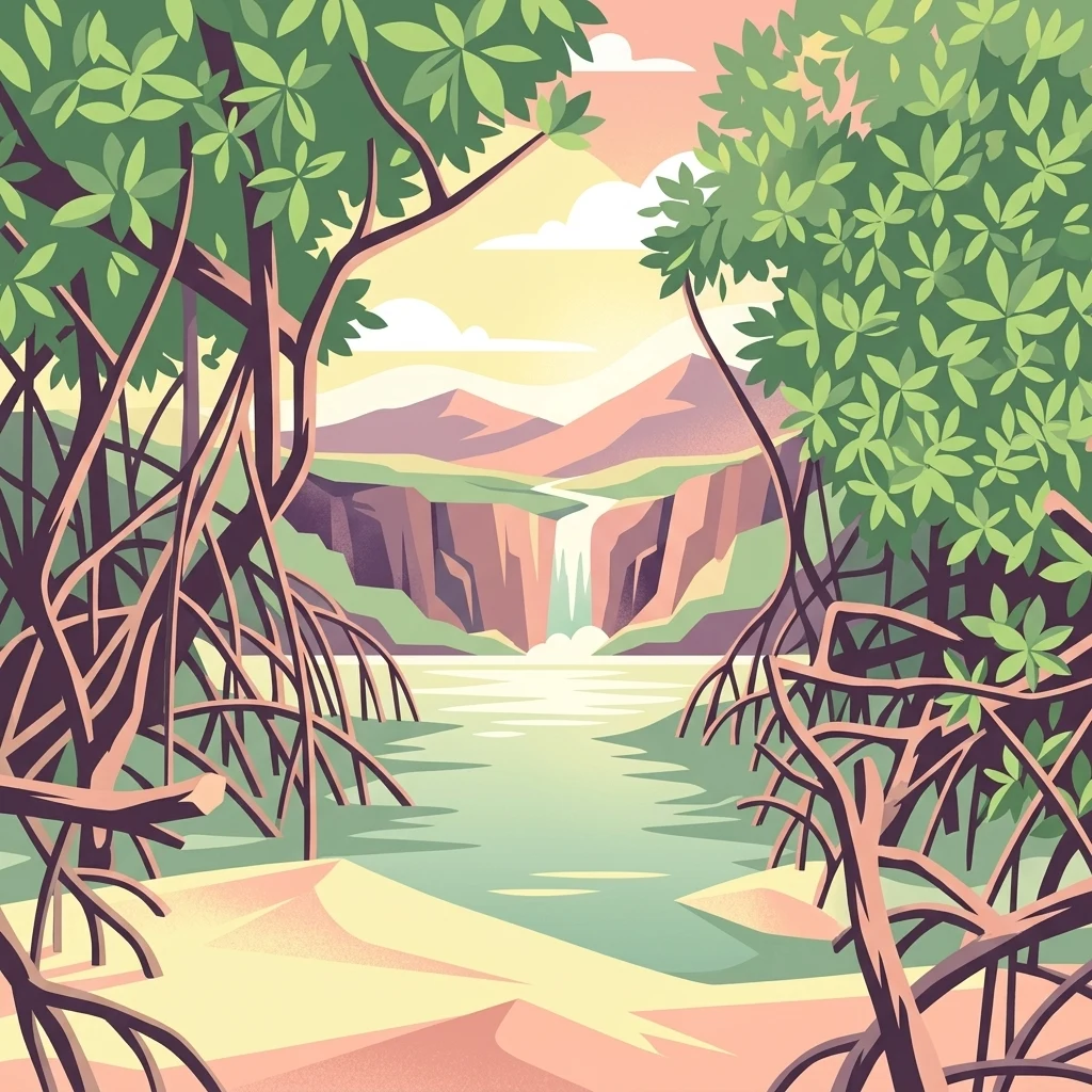
A digital illustration showing a view through mangrove trees towards a calm body of water, distant cliffs, and a small waterfall under a soft sky.

Marine Park Aruba

Marine protected area

Park overview

Structured park overview, official facts, and landscape profile for Marine Park Aruba

Marine Park Aruba park facts, protected area profile, and essential visitor context

Review the core facts for Marine Park Aruba, including designation, size, terrain, visitor scale, habitats, and operating context in one park-focused overview.

About Marine Park Aruba

Marine Park Aruba represents a nation-level commitment to safeguarding the coastal ecosystems that fringe Aruba, a small, arid Caribbean island known for both its tourism economy and its surprisingly rich marine life. Rather than functioning as a single contiguous reserve, the park operates as a coordinated network of four marine protected areas, each oriented around a distinct type of coastal habitat. Together, these reserves protect coral reefs, seagrass meadows, and mangrove forests that together support a large share of Aruba's nearshore biodiversity.

The park emerged from a recognition that Aruba's most valuable marine habitats were scattered along a coastline dominated by resorts, cruise operations, and the maritime infrastructure of Oranjestad. By designating specific zones, the park framework allows relatively high-impact areas of the shore to coexist with strictly protected sections that act as refuges for reef-building corals and the species that depend on them. This approach is similar in spirit to longer-established Caribbean marine park systems, such as Bonaire's, although Aruba's reserve footprint remains considerably smaller.

For visitors and residents alike, Marine Park Aruba functions as both a conservation instrument and a coherent identity for Aruban marine protection. The four component reserves each highlight a different facet of the island's marine character: the Arikok coastal waters reflect the island's wild, rugged interior; Seroe Colorado captures the eastern cape's reef and industrial-adjacent coastline; Mangel Halto showcases the mangrove-lined shallow waters; and the Oranjestad reef islands highlight the capital's marine landscape. Together they form a modern, state-managed foundation for the long-term resilience of Aruba's sea life.

Quick facts and research context for Marine Park Aruba

Marine Park Aruba is a national-scale marine protected area system located around the entire coastline of Aruba, a constituent country of the Kingdom of the Netherlands in the southern Caribbean Sea.

The park was legally established on December 21, 2018 and placed under the management of the Aruba National Park Foundation on April 16, 2019. It consists of four marine protected areas, each centered on a distinct coastal setting: the Arikok coast, the eastern cape of Seroe Colorado, the Mangel Halto mangrove and lagoon system, and the Oranjestad reef islands near the capital.

Protection and recognition

Examine the documented marine protection scope and formal designation timeline.

Marine Park Aruba Protection Status and Official Designation History

Marine Park Aruba maintains a documented marine protection scope established through formal designation records from 2018. Conservation researchers and regional analysts evaluate these verified administrative frameworks to understand official protected area management criteria.

Protection details

Protection scope
Marine
Designated year
2018
Transboundary protection
No
Park context

Deeper park guide and search-rich context for Marine Park Aruba

Marine Park Aruba history, landscape, wildlife, and travel context

Explore Marine Park Aruba through its history, landscape character, ecosystems, wildlife, conservation priorities, cultural context, and seasonal travel timing in a structured park guide built for atlas discovery and search intent.

Why Marine Park Aruba stands out

Marine Park Aruba is best known for its conservation of Caribbean coral reefs, seagrass beds, and mangrove ecosystems along one of the most tourism-influenced coastlines in the southern Caribbean. The park's four reserves are recognized for protecting important breeding and foraging grounds for sea turtles, seabirds, and shark species. The Mangel Halto area in particular is a defining feature, where extensive fringing mangroves meet the reef environment, creating overlapping nursery and feeding zones. Together, the reserves represent the principal legal safeguard for Aruba's most valuable nearshore marine biodiversity.
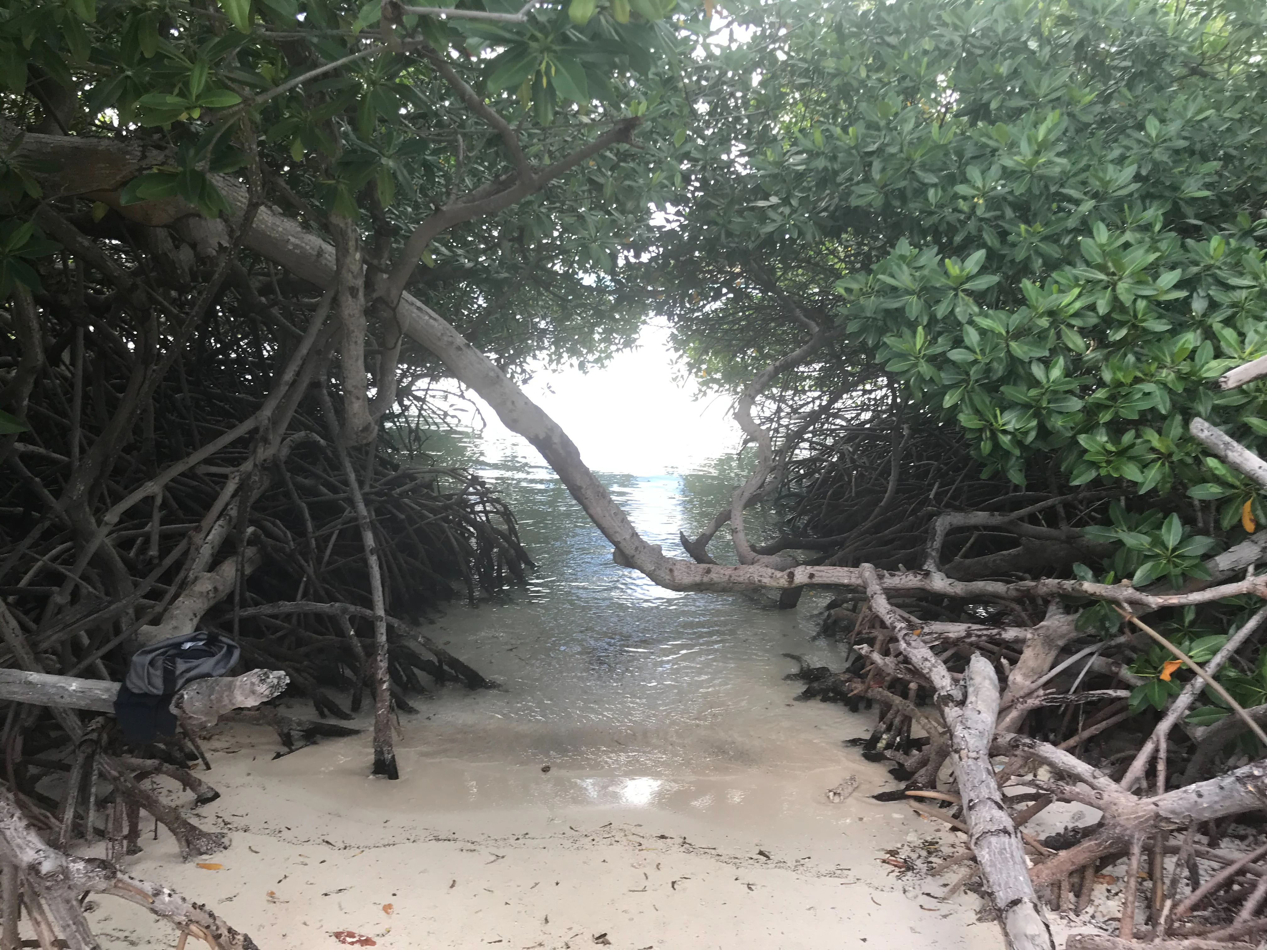
A view through dense mangrove trees looking out toward the turquoise water and light sand of Mangel Halto beach.
A narrow coastal path framed by mangrove trees at Mangel Halto, Marine Park Aruba.

Marine Park Aruba history and protected-area timeline

Marine Park Aruba was legally established on December 21, 2018, marking the first time the island's most ecologically significant coastal waters were placed under a unified national marine protection framework. The reserves were then transferred to the management of Fundacion Parke Nacional Aruba, the same public foundation that oversees the terrestrial Arikok National Park, on April 16, 2019.

The creation of the park came after years of recognition that, despite Aruba's relatively small landmass, its reefs, mangroves, and seagrass systems were under increasing pressure from coastal development, tourism activity, and maritime commerce. By grouping four existing or newly designated marine reserves into one management framework, policymakers aimed to give these ecosystems legal recognition and to consolidate conservation responsibility under a single national institution.

The establishment also reflected a regional awareness of how comparatively small marine reserves can make an outsized conservation difference when they target high-value habitats. Aruba's park draws conceptual parallels with neighboring Bonaire's much older marine park system, which has safeguarded comparable ecosystems since 1979, but represents a more recent and more spatially targeted approach tailored to Aruba's specific coastal geography.

Marine Park Aruba landscape and geographic character

Marine Park Aruba extends through a varied coastal landscape that includes mangrove-lined lagoons, fringing coral reefs along leeward shores, and open coastal waters around rocky eastern capes. The four component reserves capture much of the topographic and underwater diversity of Aruba's shoreline in compact form.

The Arikok reserve sits adjacent to the rugged, arid interior of the island, where dramatic volcanic and limestone formations meet the sea. The Seroe Colorado reserve wraps around the eastern cape of the island, an area historically associated with refinery infrastructure and tank farms, but where important reef communities continue to thrive. Mangel Halto represents the park's shallowest, most sheltered landscape: a calm lagoon fringed by dense mangroves and dotted with small cays such as Isla di Oro and Santo Largo. The Oranjestad reef islands reserve stretches along the leeward coast near the capital, incorporating reef patches between Governor's Bay Beach and Punta Brabo, while excluding the active cruise ship passage channel.

Even outside the protected zones, Aruba's leeward coastline between Mangel Halto and Oranjestad hosts some of the island's most intact reef formations. These unprotected sections illustrate both the richness of the broader marine landscape and the deliberate boundaries drawn around the formal marine parks.

Marine Park Aruba ecosystems, habitats, and plant life

The ecological identity of Marine Park Aruba is defined by the interplay of three principal marine habitats: coral reefs, seagrass meadows, and mangrove forests. Each reserve supports a different combination of these systems, creating a network that collectively mirrors the core habitat types of Aruba's coastal sea.

Coral reefs form the park's most visually and ecologically conspicuous habitat, extending along the leeward and southern shores and around the reef islands offshore of Oranjestad. Seagrass meadows occupy the calmer nearshore zones, particularly around Mangel Halto, where reduced wave energy allows submerged vegetation to flourish. Mangroves dominate the sheltered lagoons and tidal margins, where the dense root systems stabilize sediments, trap nutrients, and create structurally complex nursery environments for juvenile fish and invertebrates.

The combination of these three habitats in relatively close proximity gives the park unusually high ecological connectivity for such a small reserve network. Species can move between reef edges, seagrass beds, and mangrove roots over very short distances, supporting complex food webs in compact coastal areas.

Marine Park Aruba wildlife and species highlights

The wildlife profile of Marine Park Aruba is shaped by the species that depend on the interlinked coral, seagrass, and mangrove habitats protected across the four reserves. Sea turtles are among the park's most prominent inhabitants, using shallow coastal waters and reef edges for foraging, with resident and migratory individuals recorded throughout the system. The parks are also formally recognized as important habitat for sharks, whose presence reflects the relatively healthy state of several reef zones within the reserves.

Seabirds are a regular presence along the protected coasts, particularly around the mangrove fringes and reef islands, where they forage in the productive shallow waters and use the mangrove canopy for resting and nesting. The combination of reef, seagrass, and mangrove also supports a diverse fish assemblage, including juvenile reef fish that rely on mangroves as a nursery before transitioning to deeper reef habitat.

Although the reserve network covers only a small fraction of Aruba's territorial waters, the wildlife communities within the four designated zones represent a disproportionate share of the island's coastal biodiversity, especially in areas like Mangel Halto where mangrove and reef habitat overlap in dense formations.

Marine Park Aruba conservation status and protection priorities

Marine Park Aruba represents the principal legal mechanism for marine habitat protection in Aruba, focusing formal conservation effort on the island's most ecologically valuable coastal waters. Although the reserves together represent only about 0.2 percent of Aruba's territorial waters, they concentrate protection on reefs, seagrass beds, and mangroves that would otherwise remain subject to the cumulative pressures of coastal development, tourism, and shipping.

The decision to design the park as four separated reserves, rather than a single continuous zone, reflects a pragmatic effort to balance ecological protection with the island's economic activities. Cruise ship operations and the container port of Oranjestad continue to operate outside the protected areas, while the most vulnerable reef and mangrove systems receive formal safeguarding. This mirrors a broader Caribbean pattern in which relatively small but well-placed marine reserves deliver outsized biodiversity benefits.

The park's administration by Fundacion Parke Nacional Aruba also links marine conservation to the existing terrestrial conservation infrastructure around Arikok National Park, unifying the management of Aruba's principal natural assets under a single national institution.

Marine Park Aruba cultural meaning and human context

Marine Park Aruba reflects the small-island Caribbean context of Aruba itself, where a heavily tourism-oriented society has increasingly recognized the economic and ecological importance of protecting the surrounding sea. The park sits within a regional tradition of Caribbean marine conservation, drawing parallels with the longer-established marine park systems of nearby Bonaire and illustrating a broader awareness among the Dutch Caribbean islands of shared marine resource stewardship.

The park's name and bilingual signage also reflect Aruba's cultural identity as a constituent country of the Kingdom of the Netherlands with deep Caribbean, Latin American, and Dutch influences. While the marine reserves themselves are primarily ecological in character, their existence signals a public commitment by the Aruban nation to preserve the natural heritage of its coastal waters for future generations.

Top sights and standout views in Marine Park Aruba

The defining highlight of Marine Park Aruba is its four-component structure, with each reserve showcasing a different hallmark of Aruba's marine environment: Arikok's wild coastal waters, the eastern reefscape of Seroe Colorado, the mangrove-rich lagoon of Mangel Halto, and the reef islands along the Oranjestad coastline.

The Mangel Halto area stands out as a particularly distinctive highlight because dense mangroves fringe a calm, seagrass-rich lagoon dotted with small cays, creating an unusually compact mosaic of reef, seagrass, and mangrove habitat. The Oranjestad reef islands reserve, meanwhile, places formal marine protection directly alongside one of the Caribbean's busiest cruise destinations, making the park a notable example of how conservation zones can be threaded through a heavily trafficked coastal environment.

Best time to visit Marine Park Aruba

As a marine environment in the southern Caribbean, Aruba benefits from warm year-round sea conditions, and the protected waters of Marine Park Aruba remain biologically active in every season. The calmer conditions typically associated with the drier, less windy months of the year tend to coincide with the clearest snorkeling and diving visibility across the reef and seagrass zones, while the warmer waters support stable sea turtle foraging and active reef fish behavior throughout the year.

Visitors interested in observing the park's mangrove systems, such as those around Mangel Halto, generally find the calmer seasonal conditions more conducive to exploring shallow lagoons. The park's management by the Aruba National Park Foundation provides a stable institutional framework year-round, meaning that the core ecological character of the reserves remains consistent regardless of season, even as surface conditions vary.
Monthly climate preview

Long-term representative measurements outlining monthly weather patterns in Aruba

Marine Park Aruba Climate Normals, Annual Temperature and Precipitation Rhythm

Marine Park Aruba exhibits a steady annual temperature cycle alongside shifting monthly precipitation averages based on historical coordinates. Examining the complete twelve-month climate profile reveals detailed thermal ranges and precipitation trends across the protected area.
Annual mean27 °C
26 °C29 °C
Jan26°
Feb26°
Mar26°
Apr27°
May27°
Jun28°
Jul28°
Aug28°
Sep29°
Oct28°
Nov28°
Dec27°
Warmest month
September

28.6 °C

Coolest month
February

26.2 °C

Wettest month
November

2.7 mm/day

Driest month
March

0.3 mm/day

Park location guide

Geography guide, regional context, and park location map for Marine Park Aruba

Marine Park Aruba park geography, regions, and map view in Aruba

Understand where Marine Park Aruba sits in Aruba through a broader geographic reading of the surrounding landscape, nearby location context, and its mapped position within the national park landscape.

How Marine Park Aruba fits into Aruba

Aruba is a Caribbean island country and constituent realm of the Kingdom of the Netherlands, located in the southern Caribbean Sea near the Venezuelan coast. It gained country status within the Kingdom in 1986 and is part of the ABC islands alongside Bonaire and Curaçao. The island features a dry, arid climate contrasting with typical humid tropical Caribbean conditions, and operates as a parliamentary democracy under a constitutional monarchy with Dutch citizenship.

Wider geography shaping Marine Park Aruba in Aruba

Aruba is situated in the southern Caribbean Sea, approximately 29 kilometres north of the Paraguaná Peninsula in Venezuela and 80 kilometres northwest of Curaçao. The island measures 32 kilometres in length and 10 kilometres at its widest point. Geologically, it lies on the South American continental shelf, placing it within the continent of South America geographically. As part of the ABC islands, Aruba forms the westernmost of the three islands along with Bonaire and Curaçao.

Map view of Marine Park Aruba

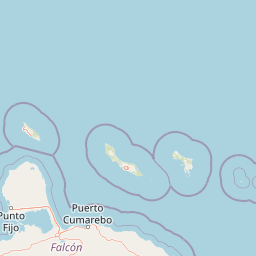
Use this park location map to pinpoint Marine Park Aruba in Aruba, understand its exact geographic position, and read its mapped placement within the surrounding landscape more clearly.

Pigeon | © OpenStreetMap contributors

Visual reference for mangrove lagoons, reef formations, and marine habitats across four reserves

Marine Park Aruba Photos, Coral Reef Scenery, and Protected Coastal Landscapes

Visual records capture the diverse marine environments, mangrove-lined lagoons, and coral reef ecosystems that define Marine Park Aruba. Studying these protected-area habitats reveals the distinct coastal terrain and nearshore geography surrounding the island.

A view through dense mangrove trees looking out toward the turquoise water and light sand of Mangel Halto beach.

Park atlas

Compare adjacent coastal reserves, coral reef networks, and regional marine landscapes

Exploring Parks Near Marine Park Aruba and Protected Areas in the Region

Visitors exploring Marine Park Aruba can compare adjacent coastal reserves and protected marine habitats across the surrounding region. Extending the geographic review helps map coral reef networks, mangrove lagoons, and connected island conservation zones.
A watercolor painting showing a wide, panoramic view of rolling green hills, distant mountains in shades of pink and muted green, and clusters of evergreen trees against a white background.
National parkAruba
About 4.4 km away#1 closest

East

Arikok National Park: Mapping the Protected Landscapes and Geological Features of Northern Aruba

Exploring the terrain, coastal cliffs, and cultural heritage of Aruba's premier reserve.

Spanning over 7,000 acres, Arikok National Park forms the core of Aruba's conservation landscape. The park showcases a complex geological story, from the ancient volcanic Aruba Lava Formation and Batholith to the younger, porous limestone plateaus of the south. This protected zone provides a vital refuge for endemic species such as the Aruban rattlesnake and burrowing owl, while preserving layered cultural remnants from Arawak petroglyphs to early gold mining ruins.

Area
32 km²
Established
2000
IUCN
II
Visitors
10K annual
National parkFalcón State
About 80 km away#2 closest

South

Médanos de Coro National Park: Venezuela's Unique Arid Landscape and Protected Dune System

Explore the mapped geography of this coastal desert in Falcón State.

Médanos de Coro National Park represents a remarkable protected area within Venezuela's Falcón State, renowned for its spectacular and active sand dune systems. This national park encompasses approximately 91 square kilometers of unique terrain, including large sand formations, salt marshes, and mangrove swamps, contributing to its designation as a key conservation site for arid coastal ecosystems. Users can explore the park's distinctive landscape, understand its geographic context, and discover the patterns of wind-sculpted dunes that define this Venezuelan national park.

Area
91 km²
Established
1974
IUCN
II
Relief
Lowland
Watercolor painting of a landscape featuring green trees, hills, and cacti under a light blue sky
National parkCuracao
About 94 km away#3 closest

East

Christoffelpark National Park: Curacao's Volcanic Terrain and Protected Landscape Atlas

Explore mapped boundaries and unique dry forest ecosystems.

Christoffelpark represents Curacao's most vital protected natural area, offering a deep dive into its unique geography and landscape. This national park preserves the island's highest peak, Christoffelberg, alongside distinctive dry forest ecosystems, endemic species, and the remnants of colonial plantations. Explore the mapped terrain, understand the regional context, and appreciate the rich natural and cultural heritage that defines this important protected landscape on Curacao.

Area
10.4 km²
Established
1978
IUCN
II
Relief
Mixed relief
A watercolor painting of a gentle landscape featuring a stream flowing through a grassy meadow bordered by trees with soft pastel colors.
National parkFalcón
About 152 km away#4 closest

South

Parque nacional Juan Crisóstomo Falcón: Karst Geology and Sierra de Falcón Geography

Protected karst mountains, cave systems, and water networks in northern Venezuela.

Parque nacional Juan Crisóstomo Falcón encompasses a distinct limestone landscape within the Sierra de Falcón. This protected area is recognized for vertical sinkholes, sprawling subterranean galleries, and the Fosa de San Luis. As a key water source for the region, the park presents a compact mosaic of varied mountain terrain, encompassing both cloud forest and arid woodland zones across its mountainous expanse.

Area
200 km²
Established
1987
IUCN
II
Relief
Mountain
National parkVenezuela
About 152 km away#5 closest

South

Juan Crisóstomo Falcón National Park: Venezuela's Protected Area and Landscape Geography

Mapped boundaries and regional context for this Venezuelan national park.

Juan Crisóstomo Falcón National Park represents a distinct protected area within Venezuela, offering specific insights into its geographic identity and mapped landscape. This entry facilitates a deeper understanding of the park's protected boundaries and its place within the national and regional atlas of South America. Explore the terrain and natural context that define this significant Venezuelan national park for structured geographic discovery.

National parkLa Guajira
About 153 km away#6 closest

West

Serranía de Macuira National Park: Protected Landscape and Regional Geography Atlas

Explore mapped boundaries of Serranía de Macuira.

Delve into the geography and protected status of Serranía de Macuira National Park, situated in the La Guajira region. This entity offers insight into the mapped terrain and the distribution of protected lands within Colombia. Understand its unique landscape context and its role within a broader geographic atlas.

Area
250 km²
Relief
Mountain
Climate
Arid
Access
Moderate access
National parkBonaire
About 170 km away#7 closest

East

Washington-Slagbaai National Park: Mapping the Protected Terrain of Northern Bonaire

Saline wetlands, volcanic peaks, and coastal ecology

Washington-Slagbaai National Park represents a cornerstone of Bonaire's conservation identity. The protected area features a striking blend of salt-tolerant mangrove systems, expansive salinas, and the rising slopes of Brandaris. This geographic overview highlights the physical characteristics and ecological distribution within one of the oldest national parks in the Dutch Caribbean, mapping the convergence of arid scrubland and marine environments.

Area
56.43 km²
Established
1969
Relief
Upland
Water
Major water bodies
National parkVenezuela
About 212 km away#8 closest

Southeast

Cueva de la Quebrada del Toro National Park: Venezuelan National Park Protected Landscape

Explore its mapped boundaries and regional geographic context.

This page details Cueva de la Quebrada del Toro National Park, highlighting its status as a national park within Venezuela. Understand the park's geographic setting, its role as a protected landscape, and its mapped presence within the country's natural reserves. It provides essential context for exploring its protected boundaries and regional significance for atlas-based discovery.

Area
48.85 km²
Established
1961
IUCN
II
Relief
Upland

Common questions about visiting, size, designation, and location context for Marine Park Aruba

Marine Park Aruba FAQs for park facts, access, geography, and protected area context

Find quick answers about Marine Park Aruba, including protected-area facts, park geography, trail and visitor context, and how the park fits into its surrounding country and regional landscape.
MoriAtlas Explorer

Continue Your Protected Areas Search Across the Global Atlas

Deepen your exploration by continuing the structured search for national parks and protected areas worldwide. Utilize the comprehensive filtering capabilities to compare different conservation landscapes and refine your understanding of global park geography. Discover more about the distribution and characteristics of protected natural areas.

Global natural geography