

Mori Atlas logo
Wildlife reserveMetropolitan Natural Park

Mapping the protected landscape and biodiversity of a unique urban wildlife refuge

Metropolitan Natural Park: A Vital Tropical Dry Forest Reserve in Panama City

Metropolitan Natural Park preserves a significant remnant of Pacific tropical dry forest along the slopes of the Panama Canal watershed. This wildlife reserve serves as a critical green lung within the urban limits of Panama City, offering an intact natural habitat for diverse bird species and endemic fauna. The terrain features forested ridges and seasonal streams that frame expansive views over the canal corridor and the surrounding capital skyline.

urban parktropical dry forestwildlife refugebirdwatchingPanama Canal watershedbiodiversity

Metropolitan Natural Park

Wildlife reserve

Park overview

Structured park overview, official facts, and landscape profile for Metropolitan Natural Park

Metropolitan Natural Park park facts, protected area profile, and essential visitor context

Review the core facts for Metropolitan Natural Park, including designation, size, terrain, visitor scale, habitats, and operating context in one park-focused overview.

About Metropolitan Natural Park

Metropolitan Natural Park, known locally as Parque Natural Metropolitano or simply PNM, is one of the most remarkable urban protected areas in Central America. Although it lies entirely within the boundaries of Panama City, it preserves a substantial block of tropical forest that functions as both a biological sanctuary and a recreational landscape for the metropolitan population.

The park occupies approximately 265 hectares of forested terrain on the slopes that descend toward the Panama Canal watershed. Its setting, between the densely built neighborhoods of Panama City and one of the world's most important waterway corridors, gives it a unique character: it is at once an urban park and a genuine tropical wilderness. Hiking trails crisscross the property, leading visitors through secondary forest, along streams, and up to viewpoints with sweeping vistas over the city and the canal.

Ecologically, the park's defining feature is its extensive cover of Pacific tropical dry forest, which accounts for roughly three quarters of its surface. This vegetation type has been heavily reduced elsewhere in Panama, making the park an important refuge for plant and animal communities that were once widespread along the Pacific lowlands. The presence of orchids, mosses, epiphytes, and lianas reflects the structural complexity of this forest, while the diverse fauna highlights its conservation value.

Given its accessibility, the park has become a center for environmental education, citizen science, and birdwatching in Panama. School groups, researchers, and casual visitors all use the trails, and the park has long served as an outdoor classroom for understanding tropical forest dynamics in an urban context. Despite the growth of the surrounding metropolis, it has remained the city's only formal wildlife refuge and a cornerstone of Panama's effort to integrate biodiversity protection with urban life.

Quick facts and research context for Metropolitan Natural Park

Metropolitan Natural Park covers roughly 265 hectares of tropical forest in Panama City, on the slopes adjacent to the Panama Canal watershed. It lies in the Ancón area of the capital along Avenida Juan Pablo II. Approximately three quarters of the park is Pacific tropical dry forest, an ecosystem largely lost elsewhere in Panama. The park harbors more than 220 bird species, dozens of mammal, reptile, and amphibian species, and hundreds of plant species.

Protection and recognition

Examine documented terrestrial protection metrics and official designation records for Metropolitan Natural Park.

Metropolitan Natural Park Protection Status and Conservation Scope

Metropolitan Natural Park maintains a documented terrestrial protection scope without supplementary international recognition sources. Reviewing these verified administrative metrics provides reliable context for understanding the protected area framework.

Protection details

Protection scope
Terrestrial
Transboundary protection
No
Park context

Deeper park guide and search-rich context for Metropolitan Natural Park

Metropolitan Natural Park history, landscape, wildlife, and travel context

Explore Metropolitan Natural Park through its history, landscape character, ecosystems, wildlife, conservation priorities, cultural context, and seasonal travel timing in a structured park guide built for atlas discovery and search intent.

Why Metropolitan Natural Park stands out

Metropolitan Natural Park is best known for preserving the largest accessible remnant of Pacific tropical dry forest within Panama City, supporting an unusually high diversity of birds and mammals in an urban setting, and offering a combination of forest trails and panoramic views over the Panama Canal and the capital. Its role as the only wildlife refuge inside Panama City gives it an outsized importance for conservation, education, and urban green space. The park's dry forest ecosystem, combined with its proximity to the canal watershed, defines its ecological character and its appeal to naturalists and birdwatchers.
Metropolitan Natural Park history and protected-area timeline

The origins of Metropolitan Natural Park date to the mid-1970s, when the first steps were taken to safeguard green space near the Panama Canal. In 1975, President Jorge Illueca toured the forested slopes above the canal and supported a proposal to create a Metropolitan Natural Park, establishing the conceptual foundation for what would later become the country's most prominent urban protected area.

In 1983, the area was designated as the Curundú Recreational Area, marking its transition into a formally managed public space. Two years later, Law No. 8 of July 5, 1985 formally created the park. After additional preparation, the park was inaugurated on June 5, 1988, opening to the public as a combined natural refuge and recreational landscape for the residents of Panama City.

Since its inauguration, the park has evolved from an early conservation initiative into a permanent feature of Panama City's environmental identity. It has weathered urban expansion around its borders and has continued to expand its role in biodiversity protection, scientific study, and public education around tropical dry forest ecosystems.

Metropolitan Natural Park landscape and geographic character

The landscape of Metropolitan Natural Park is shaped by the forested slopes that border the Panama Canal watershed within the urban perimeter of Panama City. The terrain features ridges, valleys, and seasonal drainages that descend toward the canal corridor, creating varied topography within a relatively compact area.

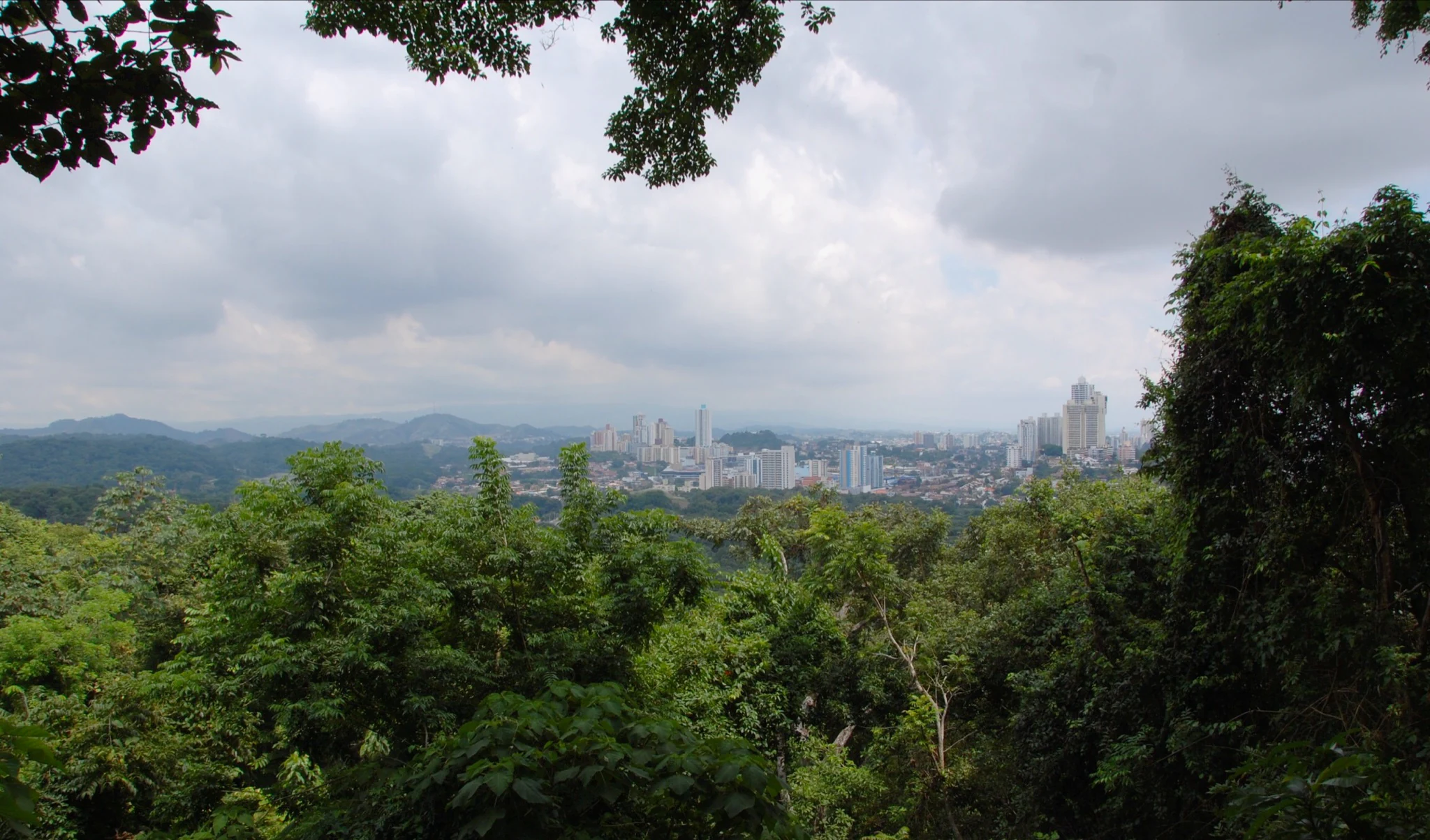
A defining visual feature of the park is the contrast between the dense tropical forest that covers most of its interior and the sweeping urban and canal views visible from higher points along the trail network. Visitors walking the park's paths encounter closed-canopy forest stretches interrupted by occasional clearings, seasonal streams, and elevated viewpoints that frame the modern skyline and the waterway below.

This blend of enclosed forest and open vantage points gives the park a layered scenic quality: areas of intimate, shaded woodland alternate with dramatic overlooks that place the dense green of the park against the broader Pacific landscape of the canal and the city. The dry forest cover also gives the slopes a distinctive seasonal character, with foliage changes that mark the dry and wet periods typical of Panama's Pacific side.

Metropolitan Natural Park ecosystems, habitats, and plant life

Metropolitan Natural Park protects one of the most significant remaining patches of Pacific tropical dry forest in Panama, covering roughly three quarters of its total area. This vegetation type once extended across much of the country's Pacific lowlands but has been drastically reduced by agricultural expansion and urban growth, making the park an important refuge for the ecological communities associated with it.

The forest is structurally diverse, with a mixture of mature trees, lianas, epiphytes, orchids, and mosses weaving together multiple layers of plant life. Around 284 plant species have been recorded, contributing to the complex habitat mosaic that supports a wide array of animals. Seasonal streams and microhabitats within the forest add further ecological variation to the slopes.

Beyond the dry forest itself, the park includes transitional vegetation and disturbed areas along its edges, which allow visitors and researchers to observe forest regeneration. This combination of intact dry forest, recovering areas, and riparian habitats underscores the park's ecological value as a living laboratory for tropical forest dynamics in an urban setting.

Metropolitan Natural Park wildlife and species highlights

Metropolitan Natural Park harbors a remarkably rich fauna for an urban protected area, supporting at least 227 bird species, 45 mammal species, 36 species of snakes, and 14 amphibian species. The density and diversity of wildlife are notable given the park's location within Panama City.

Among the mammals that find refuge in the park are species such as the marmoset monkey, the ñeque (a tropical rodent), squirrels, and a range of other small and medium-sized vertebrates typical of the Panamanian tropical forest. Reptiles are well represented, with a documented snake fauna of more than three dozen species.

Birds are perhaps the park's most celebrated asset. The combination of dry forest, riparian corridors, and proximity to the canal watershed attracts a varied avifauna, drawing both resident species and migrants. This has established the park as a key birdwatching destination in the country, where species typical of the Pacific dry forest can be observed in close proximity to the capital.

Metropolitan Natural Park conservation status and protection priorities

Metropolitan Natural Park holds significant conservation value as one of the last major remnants of Pacific tropical dry forest within Panama's metropolitan region. Roughly 75 percent of the park is covered by this ecosystem, which has been severely reduced elsewhere in the country due to agriculture and development. Protecting this habitat makes the park a critical reservoir for plant and animal species closely tied to dry forest environments.

Its role as the only wildlife refuge within Panama City amplifies its conservation importance. The park maintains habitat connectivity along the canal watershed slopes and provides refuge space for species that would otherwise be displaced by surrounding urban growth. This makes it a key component of green infrastructure for the metropolitan area.

Beyond habitat protection, the park serves as a center for environmental education, monitoring, and research. School programs, university studies, and bird surveys conducted within its boundaries have helped document the biodiversity of Panama's Pacific dry forests and have positioned the park as a model for integrating conservation with a major urban setting.

Metropolitan Natural Park cultural meaning and human context

Metropolitan Natural Park occupies a meaningful place in the identity of Panama City as a place where residents and visitors can experience tropical forest within the capital's own boundaries. Its location in the Ancón area, close to the Panama Canal, ties the park symbolically to the country's most prominent geographic and economic feature.

The park has long functioned as a space for outdoor recreation, environmental education for schoolchildren, and community engagement with nature. Over time it has become part of the everyday cultural fabric of the city, representing the effort to preserve tropical ecosystems against urban expansion and offering a shared natural space for residents across the metropolitan area.

Top sights and standout views in Metropolitan Natural Park

Metropolitan Natural Park offers a rare combination of dense tropical dry forest, panoramic canal and city views, and high biodiversity within an urban setting. Its trail network weaves through secondary forest and seasonal streams, leading to viewpoints that frame the park's green expanse against the skyline of Panama City and the waterway of the Panama Canal.

The park's most distinctive draws include its 227 recorded bird species, its dry forest cover that has largely vanished from the rest of Panama, and its unique position as the only wildlife refuge inside the capital. These qualities make it both a notable conservation site and an accessible natural escape in the heart of one of Central America's largest cities.

Best time to visit Metropolitan Natural Park

Metropolitan Natural Park can be visited year-round, but the experience varies with Panama's distinct Pacific dry and wet seasons. The dry season, generally from roughly December through April, brings clearer skies, firmer trails, and excellent conditions for panoramic views of the city and the Panama Canal from the park's higher viewpoints. Birdwatching remains rewarding through this period.

The wet season, roughly from May through November, brings more rainfall and lusher vegetation, with the dry forest responding visibly to moisture. Trails can be muddier and humidity higher, but the forest becomes more active and green. Visitors interested in amphibians, lush foliage, and a quieter atmosphere often favor this period, while those focused on sweeping vistas and easier walking typically prefer the drier months.
Monthly climate preview

Long-term representative point measurements tracking monthly temperature and precipitation cycles

Metropolitan Natural Park Climate Normals, Annual Temperature and Precipitation Rhythm

Representative coordinates record measured annual temperature and precipitation shifts across twelve distinct months for Metropolitan Natural Park. Exploring the comprehensive monthly climate profile reveals detailed long-term averages for temperature bounds and rainfall rates.
Annual mean27 °C
26 °C28 °C
Jan26°
Feb27°
Mar27°
Apr28°
May28°
Jun27°
Jul27°
Aug27°
Sep27°
Oct27°
Nov27°
Dec27°
Warmest month
April

28.1 °C

Coolest month
January

26.5 °C

Wettest month
September

8 mm/day

Driest month
February

0.4 mm/day

Park location guide

Geography guide, regional context, and park location map for Metropolitan Natural Park

Metropolitan Natural Park park geography, regions, and map view in Panama

Understand where Metropolitan Natural Park sits in Panama through a broader geographic reading of the surrounding landscape, nearby location context, and its mapped position within the national park landscape.

How Metropolitan Natural Park fits into Panama

Panama is a presidential republic located at the southern end of Central America in North America. It gained independence from Spain in 1821 and from Colombia in 1903, the latter enabling the construction of the Panama Canal under U.S. supervision between 1904 and 1914. The canal was transferred to Panamanian control in 1999 following the Torrijos-Carter Treaties. With a population of approximately 4.3 million and an area of about 75,400 km², Panama has a high-income economy driven primarily by canal tolls, banking, commerce, and tourism.

Wider geography shaping Metropolitan Natural Park in Panama

Panama is located at the southern end of the Central American isthmus, stretching from the Caribbean coast in the north to the Pacific coast in the south. The country shares land borders with Costa Rica to the west and Colombia to the southeast. The terrain consists of coastal plains, mountain ranges including the Cordillera Central and Cordillera de Talamanca, and river valleys. The Panama Canal bisects the country, connecting the Atlantic and Pacific Oceans.

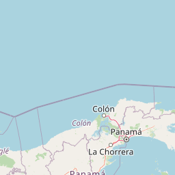
Map view of Metropolitan Natural Park

Use this park location map to pinpoint Metropolitan Natural Park in Panama, understand its exact geographic position, and read its mapped placement within the surrounding landscape more clearly.

Pigeon | © OpenStreetMap contributors
Park atlas

Compare surrounding regional geography and connected tropical forest reserves.

Explore Protected Areas and Parks Near Metropolitan Natural Park

Browse other protected areas and regional conservation zones connected to the Panama Canal watershed. Compare adjacent forest habitats and terrain variations to expand your understanding of the surrounding landscape.
National parkPanama
Mapped park locations coincide#1 closest

Metropolitan Natural Park: Urban Protected Area and Forest Geography in Panama

Tracing the boundaries of a rare city-based wildlife refuge

Metropolitan Natural Park offers a significant study of urban conservation in Panama, protecting 265 hectares of Pacific tropical dry forest. Situated along the Panama Canal watershed, the terrain provides essential forest connectivity and diverse microhabitats, serving as a critical sanctuary within the dense metropolitan fabric of Panama City.

Area
2.65 km²
Established
1985
IUCN
II
Relief
Upland
National parkColón Province
About 16 km away#2 closest

Northwest

Soberanía National Park: Panama National Park Atlas, Geography, and Protected Landscape Details

Explore the mapped boundaries and regional geography of this national park.

Investigate Soberanía National Park, a designated national park situated in Panama's Colón Province. This entry offers detailed geographic context, focusing on its mapped protected area, landscape character, and role within regional conservation. Understand the spatial distribution and atlas significance of this protected land, essential for a structured geographic discovery of Panama's natural heritage.

Area
220 km²
Established
1980
IUCN
II
Relief
Lowland
National parkPanamá Province
About 46 km away#3 closest

North

Chagres National Park: National Park Protected Landscape Atlas

Discover geographic boundaries and natural terrain context.

Chagres National Park is a crucial protected area situated in Panamá Province, Panama. This page serves as an atlas-style gateway to understanding its specific geographic identity, mapped boundaries, and the surrounding natural terrain. It is designed for users seeking detailed insights into the park's protected landscape and its contribution to regional geography and conservation mapping efforts.

Area
1,290 km²
Established
1985
IUCN
II
Relief
Upland
National parkPanamá Oeste Province
About 54 km away#4 closest

Southwest

Altos de Campana National Park: National Park Protected Landscape and Geographic Context

Mapped boundaries and regional geography in Panamá Oeste Province.

Gain a structured understanding of Altos de Campana National Park, a designated national park located in Panamá Oeste Province. This page details its identity as a protected landscape, offering insights into its geographic placement and mapped boundaries for comprehensive atlas-style exploration. Understand its regional context and its contribution to Panama's network of protected areas.

Area
48.16 km²
Established
1966
IUCN
II
Relief
Mountain
Wildlife reserveGuna Yala
About 94 km away#5 closest

Northeast

Nargana Wilderness Area: Protected Landscapes of the Guna Yala Caribbean Slope

A vertical transect of tropical rainforest and mountain terrain

The Nargana Wilderness Area represents a significant wildlife reserve in Panama, encompassing 954 square kilometres of diverse tropical ecosystems. Stretching from sea level to the San Blas ridge, the reserve showcases a continuous sequence of coastal lowlands and submontane habitats. This indigenous-governed region offers a unique geographic study of forest stratification and ecological connectivity along the Continental Divide, providing a protected mosaic of habitats that are essential to the broader Guna Yala landscape.

Area
954.14 km²
Established
1994
Relief
Mountain
Climate
Tropical
National parkPanama
About 123 km away#6 closest

West

Omar Torrijos "El Cope" National Park: Mapped Boundaries and Protected Landscape in Panama

Explore the geographic setting and natural terrain of this Panamanian national park.

Omar Torrijos "El Cope" National Park is a designated protected area offering rich opportunities for geographic discovery. Users can explore its mapped boundaries, understand its place within Panama's natural landscapes, and gain insight into the park's regional geographic context. This page provides a structured atlas-style view, highlighting the park's identity as a significant protected landform within Central America.

IUCN
II
Scope
Terrestrial
National parkHerrera Province
About 146 km away#7 closest

Southwest

Sarigua National Park: A Protected National Park Landscape in Herrera Province

Explore mapped boundaries and regional geographic context.

Sarigua National Park represents a significant protected area within Herrera Province, Panama. This page details its identity as a national park, emphasizing its mapped geography and the regional context it inhabits. Users seeking to understand the specific protected landscape, its boundaries, and its place within the broader atlas of natural areas will find comprehensive discovery-oriented content.

IUCN
II
Relief
Lowland
Climate
Tropical
Access
Access unknown
National parkDarién Province
About 158 km away#8 closest

Southeast

Darién National Park: Darién Province National Park Geographic and Map Exploration

Discover its protected landscape and regional geographic context.

Darién National Park serves as a key protected area within Darién Province, offering an essential focus for geographic and atlas-based discovery. This dedicated park detail page provides insights into its mapped boundaries and its significance as a national park. Users can explore the park's specific geographic footprint and its place within the regional landscape, facilitating a structured understanding of protected natural areas. Dive into the mapped terrain and conservation landscape context that defines Darién National Park for comprehensive atlas exploration.

Area
5,790 km²
Established
1980
IUCN
II
Relief
Mountain

Common questions about visiting, size, designation, and location context for Metropolitan Natural Park

Metropolitan Natural Park FAQs for park facts, access, geography, and protected area context

Find quick answers about Metropolitan Natural Park, including protected-area facts, park geography, trail and visitor context, and how the park fits into its surrounding country and regional landscape.
MoriAtlas Explorer

Continue Your Protected Areas Search Across the Global Atlas

Deepen your exploration by continuing the structured search for national parks and protected areas worldwide. Utilize the comprehensive filtering capabilities to compare different conservation landscapes and refine your understanding of global park geography. Discover more about the distribution and characteristics of protected natural areas.

Global natural geography