Mori Atlas logo
Nature reserveMłochowski Łęg Nature Reserve

Mapping the ecological boundaries of a rare wetland woodland in the Utrata River valley.

Młochowski Łęg Nature Reserve: A Protected Ash-Alder Floodplain Forest in Masovian Voivodeship

(Rezerwat przyrody Młochowski Łęg)

Młochowski Łęg Nature Reserve represents a critical fragment of ash-alder floodplain forest located within the Masovian Voivodeship of central Poland. Positioned in the lowland Łowicz-Błonie Plain, this protected area preserves vital wetland woodland habitats along the Utrata River valley. The site maintains ecological continuity through its mosaic of moist riparian terrain and oak-hornbeam forest patches, offering an essential glimpse into the natural riverine geography of the Polish lowlands.

floodplain forestash-alder woodlandriparian habitatlowland forestnature reservewetland woodland

Młochowski Łęg Nature Reserve

Nature reserve

Park overview

Structured park overview, official facts, and landscape profile for Młochowski Łęg Nature Reserve

Młochowski Łęg Nature Reserve park facts, protected area profile, and essential visitor context

Review the core facts for Młochowski Łęg Nature Reserve, including designation, size, terrain, visitor scale, habitats, and operating context in one park-focused overview.

About Młochowski Łęg Nature Reserve

Młochowski Łęg Nature Reserve is a compact protected woodland in central Poland, situated in the Masovian Voivodeship in the lowland landscape south of Warsaw. It belongs to the gminy Nadarzyn administrative area and lies firmly within the Łowicz-Błonie Plain (Równina Łowicko-Błońska), a mesoregion characterized by flat agricultural terrain crossed by slow-moving rivers and modest river valleys. The reserve occupies one such river valley, that of the Utrata, a lowland tributary system whose floodplain still supports fragments of natural forest vegetation.

The reserve was formally established on 4 July 1984 as a forest nature reserve, or rezerwat leśny, a Polish category of protected area dedicated specifically to the preservation of forest ecosystems. With an area of roughly 12 hectares, Młochowski Łęg is a small site, but its size is typical for many lowland forest reserves in Poland, where protection focuses on preserving representative examples of particular forest communities rather than on large wilderness tracts.

The defining feature of the reserve is its ash-alder floodplain forest (las łęgowy jesionowo-olszowy), a community type that develops on periodically flooded riverbanks with high groundwater levels. The canopy here is dominated by alder (olsza), with ash (jesion) and spruce (świerk) appearing occasionally. In addition to its main floodplain forest character, the reserve also protects fragments of grąd, a type of oak-hornbeam forest that occupies slightly higher and drier ground along the river valley. Together, these communities represent a mosaic of woodland habitats tied to the hydrology of the Utrata valley.

Underneath the canopy, the reserve's shrub layer (podszyt) features species characteristic of moist lowland forests: bird cherry (czeremcha pospolita), black and red currant (porzeczka czarna and czerwona), common spindle (trzmielina pospolita), rowan (jarząb pospolity), elderberry (bez czarny), and alder buckthorn (kruszyna pospolita). This well-developed shrub layer, typical of riverine woodland, adds structural diversity to the forest and contributes to its value as habitat for birds and small mammals.

In 2002, a family of seven European beavers (bóbr europejski) was released into the reserve. This introduction reflected an interest in restoring natural wetland processes and characteristic fauna within the protected site, giving the reserve an additional dimension as a small example of fauna reintroduction in lowland Polish forests.

The reserve is linked to a green-marked hiking trail (szlak zielony) that runs from Żelechów in the Grodzisk district through the reserve and onward to the neighboring Młochowski Grąd reserve and the village of Młochów. Together with Młochowski Grąd, which protects the drier oak-hornbeam counterpart community, Młochowski Łęg forms part of a paired protected landscape along a single river valley. An educational trail (ścieżka dydaktyczna) runs through the reserve and is supported by an information board explaining its character and conservation purpose.

Quick facts and research context for Młochowski Łęg Nature Reserve

Młochowski Łęg is a forest nature reserve (rezerwat leśny) in Masovian Voivodeship, Poland, within Gmina Nadarzyn. It was designated on 4 July 1984 by a legal notice published in the Polish Monitor (M.P. of 1984, No. 17, item 125). The reserve covers approximately 12.04 hectares in the floodplain of the Utrata River, in the Łowicz-Błonie Plain mesoregion.

The reserve's stated protection objective is to preserve ash-alder floodplain forest (las łęgowy jesionowo-olszowy) and fragments of oak-hornbeam forest (grąd) in the Utrata valley. A family of seven European beavers was released into the reserve in 2002, adding a notable faunal element to the site's conservation history.

Protection and recognition

Documented terrestrial conservation measures and recognition records

Młochowski Łęg Nature Reserve Protection Status and Governance Data

Młochowski Łęg Nature Reserve maintains a documented terrestrial protection status within the regional conservation network. Structured environmental records provide clear insight into official designation parameters and administrative management scope.

Protection details

Protection scope
Terrestrial
Transboundary protection
No
Park context

Deeper park guide and search-rich context for Młochowski Łęg Nature Reserve

Młochowski Łęg Nature Reserve history, landscape, wildlife, and travel context

Explore Młochowski Łęg Nature Reserve through its history, landscape character, ecosystems, wildlife, conservation priorities, cultural context, and seasonal travel timing in a structured park guide built for atlas discovery and search intent.

Why Młochowski Łęg Nature Reserve stands out

The reserve is best known for protecting a small but ecologically representative example of ash-alder floodplain forest, a habitat type that has become rare in the intensively farmed and suburbanized lowlands of central Poland. It is closely associated with the Utrata River valley and with complementary forest reserves in the area, such as the neighboring Młochowski Grąd reserve. This association with the river's floodplain system, and with the connected network of small woodland reserves, gives Młochowski Łęg its identity as a wetland woodland refugium in a heavily modified lowland landscape. The presence of beavers introduced in 2002 has also made the reserve an example of small-scale wetland fauna reintroduction within a protected forest site.
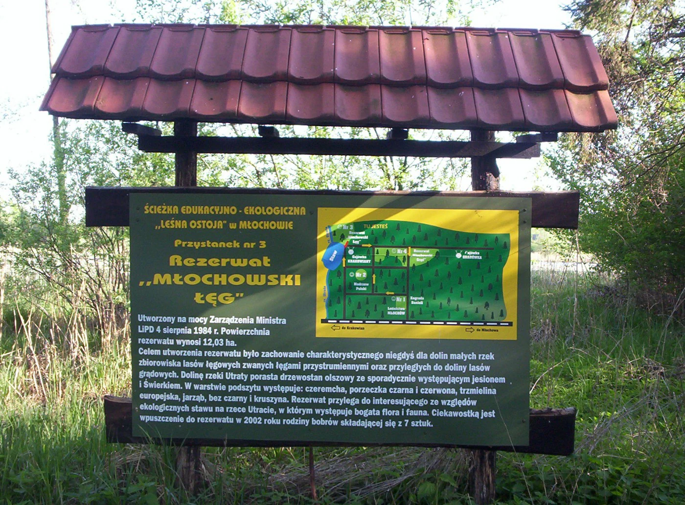
An outdoor educational information sign with a red tiled roof stands in a forest setting; the sign features text in Polish and a small map of the Młochowski Łęg Nature Reserve.
Educational signage at Młochowski Łęg Nature Reserve.

Młochowski Łęg Nature Reserve history and protected-area timeline

The reserve was legally established on 4 July 1984, through a provision published in the Polish legal gazette (Monitor Polski). Its founding aligned with a broader effort in late twentieth-century Poland to formally protect representative examples of lowland forest communities, especially those tied to wetland habitats that had been reduced by agricultural drainage and land conversion.

From the start, the reserve's explicit goal was to protect a specific forest type: the ash-alder floodplain forest of the Utrata valley, together with adjacent fragments of oak-hornbeam forest. The reserve has remained a small, focused site throughout its existence, with management aimed at maintaining the natural composition and hydrological conditions of its woodland.

Młochowski Łęg Nature Reserve landscape and geographic character

Młochowski Łęg sits within the flat lowland Łowicz-Błonie Plain, a part of central Poland's broader lowland belt south of Warsaw. The terrain here is predominantly gentle and agricultural, with broad valleys carved by small lowland rivers. The reserve occupies a section of the Utrata River valley, where flat alluvial ground and periodical flooding shape the conditions for wetland woodland.

The protected woodland is a mosaic of ash-alder floodplain forest along the lowest and wettest parts near the river, with patches of oak-hornbeam forest on slightly elevated, better-drained terrace margins. The presence of alder and occasional ash and spruce gives the canopy a distinctive deciduous and semi-moist character, while the shrub layer adds structural diversity typical of lowland riverine forests.

Młochowski Łęg Nature Reserve ecosystems, habitats, and plant life

Ecologically, Młochowski Łęg represents a fragment of natural floodplain forest at the edge of a heavily used lowland landscape. The site's main community, ash-alder floodplain forest, is a habitat defined by periodic inundation, high groundwater, and rich alluvial soils. Such habitats have become fragmented across central European lowlands and are considered valuable for conservation.

A second element of the reserve's ecological profile is the oak-hornbeam forest (grąd), which on slightly drier ground forms a complementary habitat. The combination of wet and mesic forest communities within one small valley gives the reserve additional ecological significance, creating a small-scale environmental gradient linked directly to the river's hydrology. The shrub layer, including bird cherry, currants, spindle, rowan, elderberry, and alder buckthorn, is a typical feature of such woodland and supports a range of lowland forest fauna.

Młochowski Łęg Nature Reserve wildlife and species highlights

The reserve supports the animal communities typical of moist lowland deciduous forests, with breeding birds, small mammals, and insects associated with alder-ash woodland and well-developed shrub understory. In 2002, a family of seven European beavers was released into the reserve, adding a notable large-mammal element to its wildlife profile. Beavers are characteristic of wetland and riverine habitats and are closely tied to the kind of floodplain environment the reserve protects.

Młochowski Łęg Nature Reserve conservation status and protection priorities

The reserve's conservation value lies in protecting a small but ecologically representative fragment of ash-alder floodplain forest and oak-hornbeam forest in the Utrata valley, within a broader region where such habitats have been heavily reduced. By safeguarding the natural forest composition and the riverine hydrology that sustains it, the reserve maintains ecosystem processes, habitat continuity, and landscape connectivity along the lowland river valley.

The reserve contributes to a wider pattern of conservation in the area: it is part of an interconnected system of small forest reserves, with the neighboring Młochowski Grąd protecting complementary forest types on the same valley system. The 2002 beaver release also marked an effort to reintroduce characteristic wetland fauna and reinforce the reserve's role in maintaining natural riverine dynamics.

Top sights and standout views in Młochowski Łęg Nature Reserve

A small Masovian forest reserve centered on ash-alder floodplain forest along the Utrata River, with patches of oak-hornbeam forest and a richly developed moist woodland shrub layer. It complements the neighboring Młochowski Grąd reserve and is crossed by a green-marked hiking trail and an educational path with information boards.

The reserve also stands out for a 2002 beaver reintroduction, which gave the site an additional dimension as a small lowland example of wetland fauna restoration within a protected woodland.

Best time to visit Młochowski Łęg Nature Reserve

Late spring and summer offer the most accessible experience of the reserve's wetland forest character, with a fully leafed-out canopy, active birdlife, and the educational trail at its most inviting. Autumn brings subdued colors in the alder and ash woodland, while winter reveals the structure of the floodplain forest more clearly. The trail remains a lowland forest walk in all seasons, though wet conditions along the river valley are typical at any time of year.

Monthly climate preview

Long-term representative point measurements tracking monthly averages from 1991 to 2020

Młochowski Łęg Nature Reserve Climate Normals and Annual Temperature Rhythm

Młochowski Łęg Nature Reserve experiences measured monthly temperature swings from sub-zero winter minimums to warm summer maximums alongside steady daily precipitation rates. Examining the full twelve-month profile reveals detailed historical baselines for temperature and moisture variations across the protected landscape.
Annual mean8 °C
-3 °C20 °C
Jan-3°
Feb-2°
Mar
Apr
May14°
Jun18°
Jul20°
Aug20°
Sep14°
Oct
Nov
Dec-2°
Warmest month
July

20.2 °C

Coolest month
January

-3.5 °C

Wettest month
July

2.5 mm/day

Driest month
March

1.3 mm/day

Park location guide

Geography guide, regional context, and park location map for Młochowski Łęg Nature Reserve

Młochowski Łęg Nature Reserve park geography, regions, and map view in Poland

Understand where Młochowski Łęg Nature Reserve sits in Poland through a broader geographic reading of the surrounding landscape, nearby location context, and its mapped position within the national park landscape.

How Młochowski Łęg Nature Reserve fits into Poland

Poland, officially the Republic of Poland, is a Central European country spanning from the Baltic Sea in the north to the Carpathian Mountains in the south. It borders Germany, Czech Republic, Slovakia, Ukraine, Belarus, Lithuania, and Kaliningrad Oblast. The country has a temperate climate, diverse landscapes, and is known for its rich history, cultural heritage, and strong economic position within the EU.

Wider geography shaping Młochowski Łęg Nature Reserve in Poland

Poland occupies 312,696 km2 in Central Europe, extending from the Baltic Sea coast in the north to the Sudetes and Carpathian Mountains in the south. It borders Germany to the west, Czech Republic and Slovakia to the south, Ukraine and Belarus to the east, and Lithuania and Kaliningrad Oblast to the northeast. The landscape includes lowland plains, uplands, and mountain ranges.

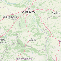
Map view of Młochowski Łęg Nature Reserve

Use this park location map to pinpoint Młochowski Łęg Nature Reserve in Poland, understand its exact geographic position, and read its mapped placement within the surrounding landscape more clearly.

Pigeon | © OpenStreetMap contributors

Location context for Młochowski Łęg Nature Reserve

Masovian Voivodeship

Visual exploration of ash alder floodplain forest and lowland riverine habitats

Młochowski Łęg Nature Reserve Photos and Landscape Scenery

Visual documentation captures the protected wetland woodland and river valley terrain of Młochowski Łęg Nature Reserve. Detailed photography reveals the unique canopy structure, moist soil habitats, and floodplain ecology of central Poland.

An outdoor educational information sign with a red tiled roof stands in a forest setting; the sign features text in Polish and a small map of the Młochowski Łęg Nature Reserve.

Park atlas

Compare connected lowland reserves and regional wetland woodland habitats

Other Parks Near Młochowski Łęg Nature Reserve and Surrounding Protected Areas

Browsing other protected areas near Młochowski Łęg Nature Reserve reveals a broader network of lowland river valley habitats across the surrounding region. Comparing adjacent woodland reserves provides essential context for understanding wetland conservation corridors in central Poland.
Nature reserveMasovian Voivodeship
About 1.1 km away#1 closest

North

Rezerwat przyrody Młochowski Grąd: Protected Forest Geography and Nature Reserve Map

Mapping lowland woodland communities in Masovian Voivodeship

Rezerwat przyrody Młochowski Grąd preserves a representative fragment of natural oak and pine forest within the flat plains of central Poland. Discover the ecological layout of this protected area, including its grąd deciduous communities and its role as a reference site for forest research in the Masovian Voivodeship landscape.

Area
0.27 km²
Established
1983
Relief
Lowland
Climate
Temperate
Nature reserveMasovian Voivodeship
About 16 km away#2 closest

West

Dąbrowa Radziejowska Nature Reserve: Protected Forest Geography in Masovian Voivodeship

An atlas entry for unique light oakwood forest landscapes and protected terrain.

Located in the Masovian Voivodeship, Dąbrowa Radziejowska Nature Reserve is a managed forest entity centered on the preservation of light-demanding oakwood habitats. This reserve provides important ecological insight into the forest composition and botanical diversity typical of the lowland plains in central Poland, offering a clear view of how small protected zones influence regional geography.

Area
0.517 km²
Established
1984
Relief
Lowland
Scope
Terrestrial
Nature reserveMasovian Voivodeship
About 20 km away#3 closest

South

Modrzewina Nature Reserve: Geographic Analysis of a Protected Polish Larch Forest

Protected forest landscape in the Masovian Voivodeship, Poland

Gain insights into the geographic and ecological structure of Modrzewina Nature Reserve. This protected area on the Wysoczyzna Rawska plateau serves as a critical site for the Polish larch, offering a unique window into the natural history and morainic terrain of central Poland.

Area
3.322 km²
Established
1959
Relief
Upland
Climate
Temperate
Protected landscapeMasovian Voivodeship
About 24 km away#4 closest

East

Chojnowski Park Krajobrazowy: Atlas of Protected Landscapes and Forested Terrain

Geographic overview of the Masovian Voivodeship forest belt

Investigate the topographical complexity of Chojnowski Park Krajobrazowy, where flat glacial plains meet the dramatic Vistula escarpment. This protected area offers detailed mapping of forest stands, aquatic habitats, and riparian zones within the Masovian landscape, providing an essential look at the ecological connectivity of the region south of Warsaw.

Area
67.96 km²
Established
1993
Relief
Lowland
Climate
Temperate
Watercolor painting of a meandering river landscape with gentle hills, light green foliage in the foreground, and soft washes of color.
Protected landscapeLodz Voivodeship
About 25 km away#5 closest

West

Bolimowski Park Krajobrazowy: Geography of a Central Polish Protected Landscape Area

Rawka River valley mapping and Puszcza Bolimowska forest terrain

Bolimowski Park Krajobrazowy encompasses a unique mosaic of postglacial plains and riverine ecosystems in central Poland. The area is defined by the Rawka River, which forms a network of meanders, oxbow lakes, and terraces, while surrounding forests retain historical links to the vast primeval woods of Puszcza Bolimowska. This protected territory offers a significant habitat for diverse wildlife, including moose and beaver, within a landscape characterized by its shifting transition between deep forest, wet meadows, and light oak groves.

Area
205.123 km²
Established
1986
Relief
Lowland
Climate
Temperate
National parkMasovian Voivodeship
About 28 km away#6 closest

North

Kampinos National Park: Geographic Profile and Protected Forest Landscape Map

Inland dune formations and wetland habitats in Masovian Voivodeship

The expansive woodland of Kampinos National Park represents a critical protected area in Poland, characterized by its parabolic sand dunes and low-lying marshes. Gain insights into the geomorphological features of this UNESCO biosphere reserve and trace the complex hydrological network that defines its unique forest environment.

Area
385.44 km²
Established
1959
IUCN
II
Relief
Lowland
A soft watercolor illustration of a marshy landscape with low rolling hills, scattered trees, and a winding stream, rendered in light green and yellow tones on a white background.
National parkMasovian Voivodeship
About 28 km away#7 closest

Northwest

Kampinoski Park Narodowy: Mapping the Inland Dune and Wetland Landscapes of Central Poland

A vital protected area in Masovian Voivodeship

The landscape of Kampinoski Park Narodowy is defined by the Grochalskie Piachy dune complex and diverse riparian habitats. This atlas entry covers the geological history and protected boundaries of this significant lowland forest, tracing the Vistula river valley's influence on the surrounding terrain and ecological character.

Area
385.443 km²
Established
1959
Visitors
1M annual
Relief
Lowland
A soft watercolor illustration of a winding river flowing through a green valley with forested hills in the background.
Nature reserveMazowieckie
About 29 km away#8 closest

Northeast

Rezerwat przyrody Morysin: Protected Floodplain Landscapes and Historic Forest Reserves

A riparian heritage site in the Mazowieckie region

Situated in the Vistula floodplain, Rezerwat przyrody Morysin stands as a significant protected area defined by its massive old-growth trees and layered cultural history. The terrain incorporates diverse wetland features, including the Sobieski Canal and Wilanówka stream, creating a vital habitat for cavity-nesting species and a rare example of integrated natural and historic preservation.

Area
0.535 km²
Established
1996
Relief
Lowland
Climate
Temperate

Common questions about visiting, size, designation, and location context for Młochowski Łęg Nature Reserve

Młochowski Łęg Nature Reserve FAQs for park facts, access, geography, and protected area context

Find quick answers about Młochowski Łęg Nature Reserve, including protected-area facts, park geography, trail and visitor context, and how the park fits into its surrounding country and regional landscape.
MoriAtlas Explorer

Continue Your Protected Areas Search Across the Global Atlas

Deepen your exploration by continuing the structured search for national parks and protected areas worldwide. Utilize the comprehensive filtering capabilities to compare different conservation landscapes and refine your understanding of global park geography. Discover more about the distribution and characteristics of protected natural areas.

Global natural geography