Mori Atlas logo
Nearby park discovery

Tracing regional landscape connections and protected-area proximity in Poland

Geographic Discovery of Protected Areas Near Rezerwat przyrody Moczydło, Mazowieckie

Explore the surrounding geography and regional network of protected landscapes neighboring Rezerwat przyrody Moczydło. This spatial overview highlights the distribution and geographic context of protected sites within the Mazowieckie region, providing a mapped perspective on local ecological and faunistic reserves.

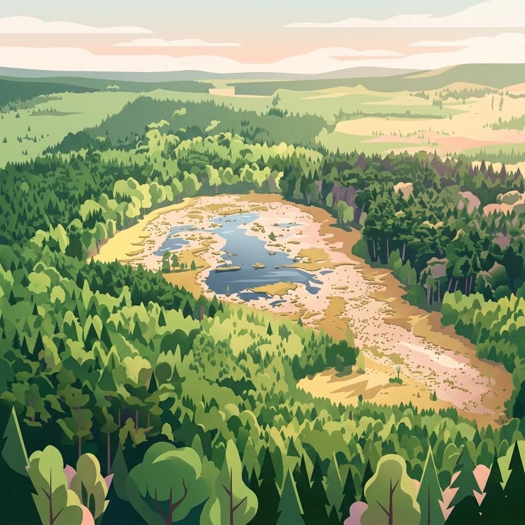
A digital illustration of a wetland area surrounded by a dense forest, featuring a central pond with sandy shores and coniferous tree stands, set under a soft morning or evening light.

A small faunistic reserve within the Nadbużański Landscape Park, dedicated to protecting rare and threatened breeding birds.

Moczydło Nature Reserve

Moczydło Nature Reserve is a small faunistic nature reserve located in the Masovian Voivodeship of east-central Poland, within the administrative area of Gmina Stoczek and the forestry district of Łochów. The reserve lies entirely inside the broader boundaries of the Nadbużański Landscape Park, a protected area associated with the Bug River valley in this part of Poland. The reserve was established to protect, for scientific and educational purposes, the breeding habitats of rare and threatened bird species as well as a richly diverse bird community. Surveys of the reserve have recorded a substantial number of bird species, including a wide range of breeding species associated with wetland, forest, and waterside habitats. Conservation attention here centers on maintaining habitat conditions that support continued nesting and seasonal residence of these bird populations. Although small in scale, Moczydło plays a meaningful local role in the network of faunistic reserves that complement the broader landscape-level protections of the Nadbużański Park Krajobrazowy, with implications for ornithological research, environmental education, and regional biodiversity conservation.

Location
Poland
Park type
Nature reserve
Established
1991
Area
0.6 km²
Rezerwat przyrody Moczydło Protected Area
Regional park map

See the ranked park cluster in its geographic setting

Nearby parks around Moczydło Nature Reserve

This regional map shows the same 17 nearby parks ranked below around Moczydło Nature Reserve. Select a ranked marker to highlight that park’s boundary where boundary data is available.
Reference park: Moczydło Nature ReserveRanked nearby park17 nearby parks shown
17 nearby parks

Distance ranked collection and regional geography surrounding the reserve

Parks and Protected Areas Geographically Near Rezerwat przyrody Moczydło

Geographic separation measurements rank surrounding protected areas by direct proximity to Rezerwat przyrody Moczydło across the regional landscape. Country context and recorded environmental characteristics provide structured comparison signals for evaluating adjacent conservation territories.
Nature reserveMazovia Voivodeship
About 15 km away#1 closest

North

Rezerwat przyrody Mokry Jegiel: Protected Wetland Forest Geography in Mazovia Voivodeship

A rare mosaic of bog and riparian forest communities

Rezerwat przyrody Mokry Jegiel functions as a key protected area within the Lower Bug valley of east-central Poland. The reserve preserves an increasingly rare sequence of hydrologically sensitive forest types, ranging from nutrient-poor coniferous bogs to dense alder swamps and periodically inundated riparian forests, making it a focal point for regional wetland studies.

Area
1.161 km²
Established
2002
Relief
Lowland
Climate
Temperate
A pale, soft-focus watercolor illustration showing a horizontal landscape of rolling green hills, distant hills in shades of purple and grey, and groups of conifer trees.
Protected landscapeMasovian Voivodeship
About 20 km away#2 closest

Northwest

Puszcza Biała Protected Landscape: Map and Geography of the Mazovian Lowland Forests

Extensive pine-dominated woodlands of Masovian Voivodeship

Puszcza Biała is a massive, continuous lowland forest in east-central Poland, characterized by its dominant Scots pine stands and post-glacial sandy soils. Positioned between the Bug and Narew rivers, this protected landscape provides a quiet, expansive green space that serves as an essential component of the regional natural geography of the Masovian Voivodeship.

Area
850 km²
Relief
Lowland
Scope
Terrestrial
Water
Major water bodies
A flat vector illustration of a grassy meadow with yellow dandelions, a winding dirt path lined with fence posts, a forest in the midground, and large mountains in the background under a sky with pink clouds.
Protected areaMazovia Voivodeship
About 38 km away#3 closest

Northwest

Bagno Pulwy: A Geographic Overview of the Mazovian Wetland and Peatland Mosaic

Protected marshland landscapes and Narew valley terrain

Bagno Pulwy represents an extensive lowland wetland in Poland's Mazovia region, characterized by its wide meadows, peat-rich soil, and intricate network of historical drainage canals. This protected area offers a distinct geographic contrast to the surrounding forested uplands, functioning as a vital open habitat situated within the broader Narew river valley drainage system.

Area
60 km²
Water
Major water bodies
A wide watercolor illustration showing a river flowing through a grassy landscape with a line of trees in the background, rendered in soft greens, pinks, and purples.
Nature reserveMazovian Voivodeship
About 40 km away#4 closest

West

Rezerwat przyrody Dębina Nature Reserve: Exploring Protected Landscapes in Mazovian Voivodeship

A preserved oak-hornbeam forest featuring glacial erratics and ancient woodland

Rezerwat przyrody Dębina is a significant nature reserve situated in the Mazovian Voivodeship, noted for its 200-year-old oak stands and multi-species deciduous canopy. As the oldest protected area in the region, it preserves a vital remnant of the Polish Lowlands landscape, offering a dense, ecologically rich forest environment defined by subtle topography and unique Pleistocene glacial boulders.

Area
0.512 km²
Established
1952
Relief
Lowland
Climate
Temperate
Nature reserveMazowieckie
About 49 km away#5 closest

East

Rezerwat przyrody Dębniak: Protected Forest Landscapes and Bug River Escarpment Geography

A preserved old-growth oak and linden woodland in Mazowieckie.

Rezerwat przyrody Dębniak offers an intimate look at the grąd deciduous forest ecosystem within the Mazowieckie landscape. Situated along the Bug River escarpment, this twenty-hectare reserve provides a rare glimpse into mature oak and linden woodland, monumental trees, and a floristically diverse understory. The area functions as a vital conservation zone, maintaining the integrity of riparian woodland transitions and providing a protected habitat for orchids and lilies on the slopes above the valley.

Area
0.208 km²
Established
1978
Relief
Lowland
Scope
Terrestrial
Nature reserveMazovia Voivodeship
About 56 km away#6 closest

South

Dąbrowy Seroczyńskie Nature Reserve: Protected Lowland Forest Geography and Mapped Boundaries

Regional woodland complex in Mazovia Voivodeship

Dąbrowy Seroczyńskie Nature Reserve protects a substantial sessile oak forest in central-eastern Poland. This lowland woodland area features varied topography between 175 and 192 meters above sea level, preserving significant forest floor plant communities and characteristic lowland fauna within the broader context of the Siedlce region and the Łuków protected landscape.

Area
5.502 km²
Established
1987
Relief
Lowland
Access
Access unknown
A pale, soft-focus watercolor painting of a wetland area with grassy banks, distant rolling hills, and a calm body of water reflecting sunset-toned light.
Nature reserveMazowieckie Voivodeship
About 61 km away#7 closest

Southwest

Rezerwat przyrody Bagno Bocianowskie: Protected Nature Reserve and Forest Geography

Inland dune and peatland mosaics in central Poland

The nature reserve Rezerwat przyrody Bagno Bocianowskie provides a protected study of how glacial sand dunes and peat-filled depressions shape forest distribution. Located in Mazowieckie Voivodeship, this site preserves rare wetland flora and diverse woodland communities within a 69-hectare lowland forest landscape.

Area
0.689 km²
Established
1982
Relief
Lowland
Climate
Temperate
Nature reserveMasovian Voivodeship
About 62 km away#8 closest

Southwest

Rezerwat przyrody Mszar Pogorzelski: Peatland Protected Area and Wetland Landscape Mapping

Regional landscape context in Masovian Voivodeship

Located in the eastern reaches of Otwock, Rezerwat przyrody Mszar Pogorzelski preserves a rare gradient of raised bogs and pine forest edge habitats. This site offers valuable insight into the sandy lowland geography of east-central Poland and acts as a localized refuge for bog vegetation within the protected Mazovian Landscape Park zone.

Area
0.351 km²
Established
1987
Relief
Lowland
Climate
Temperate
Nature reservePodlaskie Voivodeship
About 67 km away#9 closest

North

Rezerwat przyrody Dębowe Góry: Protected Sessile Oak Forest in Podlaskie Voivodeship

Ecologically intact lowland forest and rare plant habitat

Rezerwat przyrody Dębowe Góry stands as a protected sanctuary for light-loving sessile oak communities in Podlaskie Voivodeship. Its rolling lowland terrain and rich understory flora represent an essential fragment of Poland's natural woodland heritage, functioning as a key study area within the broader Czerwony Bór forest landscape context.

Area
0.993 km²
Established
2001
Relief
Lowland
Scope
Terrestrial
A soft watercolor illustration of a winding river flowing through a green valley with forested hills in the background.
Nature reserveMazowieckie
About 69 km away#10 closest

Southwest

Rezerwat przyrody Morysin: Protected Floodplain Landscapes and Historic Forest Reserves

A riparian heritage site in the Mazowieckie region

Situated in the Vistula floodplain, Rezerwat przyrody Morysin stands as a significant protected area defined by its massive old-growth trees and layered cultural history. The terrain incorporates diverse wetland features, including the Sobieski Canal and Wilanówka stream, creating a vital habitat for cavity-nesting species and a rare example of integrated natural and historic preservation.

Area
0.535 km²
Established
1996
Relief
Lowland
Climate
Temperate
Nature reservePodlaskie Voivodeship
About 73 km away#11 closest

Northeast

Rezerwat przyrody Bagno Wizna II: Protected Peatland and Bog Terrain in Podlaskie Voivodeship

Mapped nature reserve and raised bog geography in northeastern Poland.

Rezerwat przyrody Bagno Wizna II functions as a specialized nature reserve in the Kotlina Biebrzańska, protecting rare raised bog vegetation. The site illustrates the intersection of active conservation efforts and regional drainage history, serving as a distinct geographic landmark within the wider protected land network of Podlaskie Voivodeship.

Area
0.796 km²
Established
1967
Relief
Lowland
Climate
Temperate
Nature reserveMasovian Voivodeship
About 74 km away#12 closest

East

Rezerwat przyrody Mierzwice: Protected Nature Reserve and Botanical Landscape Atlas

Geographic context for the Bug River valley corridor

Rezerwat przyrody Mierzwice provides a concentrated look at xerothermic vegetation and mixed deciduous forests in eastern Poland. As part of the Ostoja Nadbużańska habitat network, this nature reserve is essential for mapping rare flora, including protected orchids and lily species, within a complex riverine landscape.

Area
0.13 km²
Established
2010
Relief
Lowland
Scope
Terrestrial
A soft watercolor illustration of a marshy landscape with low rolling hills, scattered trees, and a winding stream, rendered in light green and yellow tones on a white background.
National parkMasovian Voivodeship
About 75 km away#13 closest

West

Kampinos National Park

Inland dune formations and wetland habitats in Masovian Voivodeship

Kampinos National Park, in Masovian Voivodeship, Poland. Landscapes: forests, wetlands, and dunes.

Area
385.44 km²
Established
1959
IUCN
II
Visitors
1M annual
A stylized digital illustration of a peaceful river landscape flanked by dense forest, birch trees, and lush ferns under a soft sunset sky.
Protected landscapeMasovian Voivodeship
About 76 km away#14 closest

Southwest

Chojnowski Park Krajobrazowy: Atlas of Protected Landscapes and Forested Terrain

Geographic overview of the Masovian Voivodeship forest belt

Investigate the topographical complexity of Chojnowski Park Krajobrazowy, where flat glacial plains meet the dramatic Vistula escarpment. This protected area offers detailed mapping of forest stands, aquatic habitats, and riparian zones within the Masovian landscape, providing an essential look at the ecological connectivity of the region south of Warsaw.

Area
67.96 km²
Established
1993
Relief
Lowland
Climate
Temperate
Watercolor painting showing a winding river through marshy fields with distant hills
National parkPodlaskie Voivodeship
About 82 km away#15 closest

Northeast

Narew National Park: Discover Poland's Premier Wetland National Park with Unique River Geography

Explore its mapped boundaries and rich protected landscape.

Narew National Park represents a significant protected area within the Podlaskie Voivodeship, distinguished by its one-of-a-kind anastomosing river system where the Narew River splits into numerous interconnected channels. This dynamic wetland environment provides critical habitat and showcases a complex interplay of water, land, and diverse ecosystems. Users can explore the park's geographic features, understand its protected landscape status, and appreciate its vital role within the regional atlas through detailed mapping and factual context.

Area
73.5 km²
Established
1996
IUCN
II
Visitors
15K annual
Nature reserveMasovian Voivodeship
About 84 km away#16 closest

Northwest

Zachodniokurpiowskie Bory Sasankowe: Protected Forest Geography and Reserve Map

A study of dry pine habitats in the Masovian Voivodeship

The Zachodniokurpiowskie Bory Sasankowe nature reserve serves as an essential reference for continental pine forest ecosystems. By protecting the delicate interplay between sandy dune topographies and lichen-rich woodland floors, this site provides a rare window into the post-glacial geography of the Kurpie Plain.

Area
22.141 km²
Established
2018
Relief
Lowland
Climate
Temperate
Watercolor painting showing a wetland scene with reeds, patches of water, and trees under a light sky
National parkPodlaskie Voivodeship
About 85 km away#17 closest

Northeast

Biebrza National Park

Tracing the largest lowland peat bog complex in the European landscape

Biebrza National Park, in Podlaskie Voivodeship, Poland. Landscapes: wetlands, marshes, and rivers.

Area
592.23 km²
Established
1993
IUCN
II
Visitors
23.2K annual
Distance methodology

Geographic measurements, not driving distances

How nearby park distances are calculated

Distances use park boundaries whenever the available geometry allows it. When one or both boundaries are missing, the mapped park locations provide a clearly labelled estimate. Every value represents straight-line geographic separation and does not use roads or routing.

Boundary distance

Calculated between the nearest points of both park boundaries.

Location-to-boundary estimate

Estimated from one mapped park location to the nearest boundary of the other park.

Mapped-location estimate

Estimated between the mapped locations of both parks.

MoriAtlas Explorer

Trace the Protected Boundaries of Rezerwat przyrody Moczydło

Continue exploring the intricate wetland and forest geography of this important Polish faunistic reserve through the MoriAtlas structured database. Gain insight into how this protected landscape integrates with the wider Nadbużański region to support threatened avian populations and regional biodiversity.