

Mori Atlas logo
Marine protected areaMonitor National Marine Sanctuary

Investigating the submerged geography of the first designated U.S. National Marine Sanctuary

Monitor National Marine Sanctuary: Mapped Boundaries and Atlantic Cultural Heritage Site

Monitor National Marine Sanctuary protects the final resting place of the Civil War ironclad USS Monitor off the coast of North Carolina. This marine protected area encompasses a vertical column of ocean water extending to the seabed, where the wreckage now serves as both a significant archaeological site and a thriving artificial reef. The sanctuary represents a unique intersection of maritime history and Atlantic coastal conservation within the federal protected area system.

shipwreck sanctuaryCivil War historyUSS MonitorUnderwater archaeologyNOAA protected areaMarine cultural heritage

Monitor National Marine Sanctuary

Marine protected area

Park overview

Structured park overview, official facts, and landscape profile for Monitor National Marine Sanctuary

Monitor National Marine Sanctuary park facts, protected area profile, and essential visitor context

Review the core facts for Monitor National Marine Sanctuary, including designation, size, terrain, visitor scale, habitats, and operating context in one park-focused overview.

About Monitor National Marine Sanctuary

Monitor National Marine Sanctuary is a federally protected marine site located off the Atlantic coast of North Carolina, southeast of Cape Hatteras. Its purpose is uniquely cultural: rather than being centered on a coral reef, kelp forest, or breeding ground, the sanctuary revolves entirely around a single object, the submerged wreck of the USS Monitor, an iron-hulled warship that served in the American Civil War and fundamentally influenced the future of naval engineering.

Designated on February 5, 1975, Monitor National Marine Sanctuary was the first site in the United States to be recognized as a National Marine Sanctuary. The designation came years after the wreck had been located on the seabed in 1973 by an interdisciplinary research team from Duke University's Marine Laboratory, and after a joint 1974 expedition by the U.S. Navy and the National Geographic Society had confirmed the identity of the vessel and documented its condition. These early efforts established a model for how shipwreck sites of national importance could be identified, surveyed, and ultimately protected under federal marine authority.

The sanctuary itself is defined as a column of water one nautical mile in diameter, descending from the surface to the seabed, centered on the wreck. This compact but deep footprint reflects both the discrete nature of the resource under protection and the need to manage activities in the surrounding waters that could affect the site. Regulations administered by NOAA's National Ocean Service govern activities in and above the sanctuary, balancing preservation with broader maritime uses of the waters offshore of the Outer Banks.

Beyond its administrative significance, the site has become a touchstone in the history of American underwater archaeology and shipwreck conservation. The wreck of the Monitor, which sank in a storm on December 31, 1862 while under tow, has been the subject of multi-decade campaigns to study, document, and stabilize its remains. Major artifacts have been raised, conserved, and placed on public display, while the hull itself remains in place as both a memorial and a long-term conservation challenge. In 1986, the wreck was additionally designated a National Historic Landmark, reinforcing its standing as a site of exceptional national importance.

Quick facts and research context for Monitor National Marine Sanctuary

Monitor National Marine Sanctuary was the first National Marine Sanctuary ever designated in the United States, established February 5, 1975, and managed by NOAA's National Ocean Service. It is one of only two sanctuaries in the national system created primarily to protect a cultural resource rather than a living marine ecosystem.

The protected area covers about 0.785 square nautical miles, structured as a vertical column of water one nautical mile in diameter that extends from the sea surface down to the seafloor above the wreck of the USS Monitor. The wreck lies approximately 16 nautical miles south-southeast of Cape Hatteras, North Carolina, at an average depth of around 230 feet.

Protection and recognition

Explore documented marine protection scope and official designation records established in 1975

Monitor National Marine Sanctuary Protection Status and Designation History

Monitor National Marine Sanctuary holds a documented marine protection scope established through official designation records from 1975. Structured protection details provide clear insight into management frameworks and international recognition records.

Protection details

Protection scope
Marine
Designated year
1975
Transboundary protection
No
Park context

Deeper park guide and search-rich context for Monitor National Marine Sanctuary

Monitor National Marine Sanctuary history, landscape, wildlife, and travel context

Explore Monitor National Marine Sanctuary through its history, landscape character, ecosystems, wildlife, conservation priorities, cultural context, and seasonal travel timing in a structured park guide built for atlas discovery and search intent.

Why Monitor National Marine Sanctuary stands out

Monitor National Marine Sanctuary is best known as the final resting place of the USS Monitor, the revolutionary Civil War ironclad warship designed by Swedish engineer John Ericsson. The vessel pioneered the turreted monitor-class design that reshaped nineteenth-century naval warfare and was famously constructed in only 110 days. The sanctuary is equally well known for its pioneering role in American marine conservation as the country's first National Marine Sanctuary, for the dramatic recovery of iconic artifacts like the revolving gun turret and steam engine, and for the haunting discovery of the remains of two trapped sailors inside the turret, which were sent to Hawaii for formal identification.
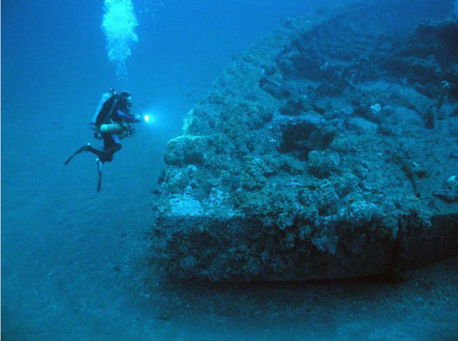
Diver at USS Monitor wreck
A diver examines the wreckage of the USS Monitor.

Monitor National Marine Sanctuary history and protected-area timeline

The history of Monitor National Marine Sanctuary begins not within the sanctuary system, but at sea in the final days of 1862. The USS Monitor, designed by John Ericsson and built in just 110 days, represented a leap forward in naval architecture as the prototype for an entire class of low-freeboard, turreted warships. After her celebrated engagement at Hampton Roads, the ironclad was being towed south by the sidewheel steamer USS Rhode Island when she foundered in heavy weather off Cape Hatteras on December 31, 1862. Sixteen of her 62 crewmen were lost in the storm, and the ship came to rest on the seafloor, forgotten beneath the waves for more than a century.

The modern era of the site began in 1973, when an interdisciplinary team from Duke University's Marine Laboratory used historical research and side-scan sonar to locate what they believed to be the wreck of the Monitor. The following year, a more definitive 1974 expedition conducted jointly by the U.S. Navy and the National Geographic Society confirmed the identity of the vessel and produced detailed photographic documentation of the site. These two expeditions transformed an obscure seafloor anomaly into a recognized piece of American naval heritage, and set the stage for federal protection.

On February 5, 1975, the site was formally designated as the nation's first National Marine Sanctuary, creating a new category of federal protection tailored to significant underwater locations. In 1986, the wreck of the Monitor was separately recognized as a National Historic Landmark, layering additional cultural and historical protections over the marine designation. In the late 1990s and early 2000s, NOAA undertook a series of increasingly ambitious recovery campaigns, raising the propeller in 1998, the massive steam engine in 2001, and the revolutionary revolving gun turret in 2002. The turret recovery was especially poignant: divers found the remains of two trapped sailors inside, who were transported to the Joint POW-MIA Accounting Command in Hawaii for identification. Today, conserved artifacts are housed and exhibited at the Mariners' Museum in Newport News, Virginia, with related collections at other institutions in Virginia, Georgia, and North Carolina.

Monitor National Marine Sanctuary landscape and geographic character

The landscape of Monitor National Marine Sanctuary is not one of cliffs, forests, or coastal plains, but of open Atlantic Ocean over a stretch of seafloor that has long been infamous among mariners. The sanctuary lies in the waters southeast of Cape Hatteras, a region where the warm Gulf Stream meets the colder Labrador Current, producing shifting conditions, frequent storms, and a long historical legacy of maritime losses known as the Graveyard of the Atlantic. There are no islands, headlands, or surface features within the sanctuary itself; its geographic identity is defined entirely from the waterline downward.

Beneath the surface, the seafloor in the area around the wreck is relatively flat at around 230 feet in depth, where the inverted hull and scattered components of the USS Monitor lie partially buried in sediment. Over time, the wreck's structure has deformed as iron corroded and deck plating collapsed under its own weight, creating a recognizable silhouette of debris that rises modestly from an otherwise featureless sandy bottom. The lack of strong currents and the depth of the site help explain why portions of the vessel have survived in recognizable form for more than a century and a half, despite continual exposure to saltwater.

Because the sanctuary is structured as a column of water descending to the seabed, its visual landscape for divers and researchers is more about immersion than vista: a descent through open ocean into a darker, colder mid-depth environment, where visibility can be limited and the seafloor comes into view only as divers approach the wreck itself. The broader context, however, is unmistakably the dynamic, hazard-prone coastal zone of Cape Hatteras, where weather, currents, and shipwrecks have shaped human memory of this corner of the American Atlantic for centuries.
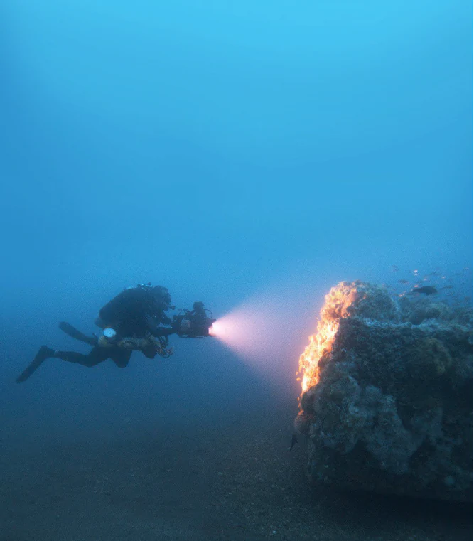
Diver at the USS Monitor wreck
A diver using a light to examine the wreckage of the USS Monitor

Monitor National Marine Sanctuary ecosystems, habitats, and plant life

Although Monitor National Marine Sanctuary was created to protect a cultural resource, the wreck of the Monitor has developed its own significant ecological character over more than 160 years on the seabed. Once the ironclad came to rest, its structure progressively became an artificial reef, attracting a range of marine life that now treats the hull and its surrounding debris field as habitat. This secondary ecological role is not the legal basis of the sanctuary, but it is central to the site's modern underwater identity.

The waters around Cape Hatteras sit at the intersection of two major Atlantic current systems, the warm Gulf Stream and the cooler Labrador Current, creating a productive and biologically rich environment. The combination of variable temperature regimes, nutrient mixing, and vertical water column structure typical of this part of the continental shelf supports a wide variety of fish species and invertebrates. The sanctuary's defined water column captures only a tiny fragment of this regional environment, but the concentration of structure provided by the wreck itself amplifies its importance as a focal point of life on an otherwise open and relatively featureless stretch of seafloor.

Over decades of monitoring and research dives, the reef community around the wreck has been observed to shift, with different species dominating at different times depending on water temperature, visibility, and disturbance events. Researchers have documented encrusting organisms on the iron hull, mobile predators hunting among the debris, and seasonal changes in the composition and behavior of fish around the site. The result is a small but meaningful convergence of human history and marine ecology, where a nineteenth-century warship has become both a memorial and a living seabed habitat.
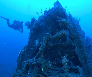
Monitor National Marine Sanctuary
Photograph courtesy of NOAA National Marine Sanctuaries

Monitor National Marine Sanctuary wildlife and species highlights

The wildlife profile of Monitor National Marine Sanctuary is shaped almost entirely by the reef effect of the USS Monitor wreck, which has drawn a varied community of fish and invertebrates to the otherwise open sandy seafloor. Researchers and divers documenting the site over the decades have reported recurring sightings of amberjack, black sea bass, oyster toadfish, and great barracuda, among other species that use the structure of the hull and its scattered components for shelter, ambush, and orientation.

The diversity of fish life around the wreck reflects the broader productivity of the waters off Cape Hatteras, where warm and cold current systems meet. This location supports both warm-water and cool-water species in close proximity, and the artificial reef provided by the Monitor concentrates that wider regional biodiversity in a small, definable area. Over time, the wreck has also accumulated encrusting marine growth on its iron surfaces, contributing to the prey base for larger predators and reinforcing the ecological value of the structure.

Because the site lies at significant depth and is subject to strong currents and frequent storms, the wildlife community around the Monitor is not as easily observed as that of shallower reefs. Researchers typically document it through technical diving expeditions and remotely operated vehicles, and observations vary by season. Still, the recurring presence of recognizable game fishes and reef-associated species has made the wreck a notable destination for marine biologists studying artificial reef communities on the continental shelf.

Monitor National Marine Sanctuary conservation status and protection priorities

Monitor National Marine Sanctuary sits at the intersection of two overlapping conservation frameworks: marine resource protection under the National Marine Sanctuaries Act and historic preservation under the National Historic Landmark program. Together, these designations reflect the unusual task of conserving a deteriorating iron-hulled shipwreck in a dynamic offshore environment, while also safeguarding the memory and physical remains of a vessel of exceptional national significance.

The wreck's iron hull, submerged in saltwater since 1862, has deteriorated continuously, with corrosion and structural collapse accelerating over time. Beginning in the late 1990s, NOAA developed a multi-part conservation plan focused both on in-situ stabilization of the wreck and on the recovery of major iconic components for conservation and public display. The propeller was raised in 1998, the steam engine in 2001, and the gun turret in 2002, in operations that set international precedents for large-scale shipwreck artifact recovery. These recoveries have allowed conservators to apply controlled laboratory techniques that would be impossible on the open seafloor.

Conservation at the site also carries a strong human dimension. The discovery of the remains of two trapped crew members inside the turret during the 2002 recovery led to a formal military identification process carried out by the Joint POW-MIA Accounting Command in Hawaii. This brought a new layer of stewardship responsibility: not just curating artifacts, but honoring the sailors lost with the ship. Today, the sanctuary's conservation mission encompasses continued monitoring of the in-situ wreck, long-term care of recovered artifacts held at the Mariners' Museum and partner institutions, and ongoing research into how best to preserve iron-hulled shipwrecks in marine environments.

Monitor National Marine Sanctuary cultural meaning and human context

Monitor National Marine Sanctuary carries a powerful cultural meaning that extends well beyond its formal boundaries at sea. The USS Monitor is widely remembered as the ship that revolutionized naval warfare, a vessel whose 1862 clash with the CSS Virginia at Hampton Roads reshaped how navies designed and built warships for decades afterward. The story of her loss in a storm off Cape Hatteras, and of her eventual discovery and protection, has become part of broader American narratives about Civil War memory and the hazards of the Atlantic coast.

Regionally, the site is closely tied to the maritime heritage of North Carolina's Outer Banks, an area long known as the Graveyard of the Atlantic for the sheer number of shipwrecks scattered along its shores. The sanctuary sits within that cultural landscape, and its work is shared with institutions such as the Graveyard of the Atlantic Museum in Hatteras, which displays Monitor artifacts alongside material from other coastal losses. Artifacts from the wreck are also exhibited at the Mariners' Museum in Newport News, Virginia, and at venues such as Nauticus in Norfolk, the Richmond National Battlefield Park, and the Civil War Naval Museum in Columbus, Georgia, extending the sanctuary's cultural reach well inland.

The site also holds a quieter, more somber cultural significance tied to its recovered human remains. The two sailors found inside the turret represent a tangible link to the individual human cost of the Civil War and to modern efforts to account for missing service members. This human dimension, combined with the ship's symbolic importance in naval history, transforms the sanctuary from a purely archaeological site into a place of national memory and ongoing commemoration.

Top sights and standout views in Monitor National Marine Sanctuary

Monitor National Marine Sanctuary stands out as the first National Marine Sanctuary ever designated in the United States, a foundational moment in American marine conservation that set a precedent for the system that protects sites from the Florida Keys to the Great Lakes. It is also uniquely focused on cultural heritage rather than living marine ecosystems, making it one of only two sanctuaries in the system with that profile.

Highlights include the dramatic recovery campaigns that brought the warship's turret, propeller, steam engine, and other artifacts to the surface, the moving discovery of two trapped sailors inside the turret, and the close partnerships with museums such as the Mariners' Museum that keep these objects accessible to the public. Together, these elements give the sanctuary an unusually rich identity, in which conservation, archaeology, military history, and remembrance converge in a single column of water off Cape Hatteras.

Best time to visit Monitor National Marine Sanctuary

Because the sanctuary is a submerged offshore site rather than a land-based park with visitor centers or trails, traditional seasonal visitation patterns are less central to its profile than at terrestrial parks. That said, conditions above and around Cape Hatteras vary significantly through the year, and they shape both research dives and any recreational diving access associated with the wreck. Late spring through early fall generally brings calmer surface conditions and warmer water temperatures off the Outer Banks, which is also the window when most organized diving expeditions and research campaigns have historically been conducted.

Winter and early spring, by contrast, often bring stronger storms, larger swells, colder water, and reduced visibility, conditions that contributed to the loss of the Monitor itself in 1862 and that continue to make the area one of the more challenging stretches of the U.S. Atlantic coast. Anyone interested in the site, whether for diving, museum visits to see the recovered artifacts, or simply understanding its setting, will find that the warmer months offer the most predictable conditions, while off-season visits emphasize the stormy maritime history that surrounds the sanctuary.
Monthly climate preview

Long term temperature and precipitation measurements across twelve monthly periods

Monitor National Marine Sanctuary Climate Normals and Annual Temperature Rhythm

Monitor National Marine Sanctuary exhibits a recorded mean monthly temperature range spanning from 13.2 degrees Celsius to 27.03 degrees Celsius alongside monthly precipitation varying between 3.24 and 6.05 millimeters per day. Examining the full twelve month profile reveals detailed long term meteorological patterns at the representative park coordinate.
Annual mean20 °C
13 °C27 °C
Jan13°
Feb13°
Mar15°
Apr18°
May22°
Jun25°
Jul27°
Aug27°
Sep25°
Oct22°
Nov18°
Dec15°
Warmest month
July

27 °C

Coolest month
January

13.2 °C

Wettest month
September

6.1 mm/day

Driest month
April

3.2 mm/day

Park location guide

Geography guide, regional context, and park location map for Monitor National Marine Sanctuary

Monitor National Marine Sanctuary park geography, regions, and map view in United States of America

Understand where Monitor National Marine Sanctuary sits in United States of America through a broader geographic reading of the surrounding landscape, nearby location context, and its mapped position within the national park landscape.

How Monitor National Marine Sanctuary fits into United States of America

The United States of America is a federal presidential republic and one of the world's largest countries by area and population. It consists of 50 states across a vast territory spanning multiple time zones, with its capital in Washington, D.C. and largest city in New York City. The nation has a diverse economy, influential political system, and significant cultural and military presence globally.

Wider geography shaping Monitor National Marine Sanctuary in United States of America

The United States occupies a vast territory in North America, bordered by Canada to the north and Mexico to the south. The 48 contiguous states stretch from the Atlantic to the Pacific Ocean, while Alaska occupies the northwestern region and Hawaii is an archipelago in the Pacific. The country encompasses diverse terrain including the Rocky Mountains, Appalachian Mountains, Great Plains, and extensive river systems.

Map view of Monitor National Marine Sanctuary

Use this park location map to pinpoint Monitor National Marine Sanctuary in United States of America, understand its exact geographic position, and read its mapped placement within the surrounding landscape more clearly.

Pigeon | © OpenStreetMap contributors

Location context for Monitor National Marine Sanctuary

North Carolina

Visual exploration of the historic wreck site, artificial reef habitats, and Atlantic seafloor environment

Monitor National Marine Sanctuary Photos and Submerged Landscape Scenery

Visual records capture the submerged wreckage, artifact recovery sites, and surrounding marine environment of Monitor National Marine Sanctuary. Detailed photography reveals the unique underwater terrain and artificial reef habitats formed along the Atlantic seafloor off Cape Hatteras.

Diver at USS Monitor wreck

USS Monitor sinking

Diver at the USS Monitor wreck

Monitor National Marine Sanctuary

Park atlas

Compare adjacent coastal reserves and protected marine landscapes across the region.

Explore Parks Near Monitor National Marine Sanctuary and Surrounding Waters

Browse other protected areas and marine reserves situated along the Atlantic coast near Cape Hatteras. Expanding the geographic comparison provides deeper context into regional conservation networks and maritime heritage preservation.
Protected landscapeNorth Carolina
About 27 km away#1 closest

North

Cape Hatteras National Seashore: Geographic Overview and Protected Coastal Landscape

Mapping the barrier island geography of North Carolina.

Cape Hatteras National Seashore encompasses an uninterrupted stretch of sandy beaches and shrub thickets along the Atlantic coast. This protected area serves as a primary case study for barrier island dynamics, featuring iconic lighthouses, extensive estuarine shorelines, and critical habitats within the North Carolina Outer Banks.

Area
122.83 km²
Established
1953
IUCN
V
Visitors
2.9M annual
Protected landscapeNorth Carolina
About 57 km away#2 closest

West

Cape Lookout National Seashore: Atlas of a Protected North Carolina Barrier Island System

Coastal geography and protected island landscapes

Navigate the wild, roadless environment of Cape Lookout National Seashore. This protected landscape spans three major barrier islands, offering a unique look at Atlantic coastal geography, including dunes, tidal flats, and maritime grasslands that define the Crystal Coast.

Area
114.3 km²
Established
1966
IUCN
V
Visitors
541.5K annual
Nature reserveNorth Carolina
About 244 km away#3 closest

West

North Carolina National Estuarine Research Reserve: Mapped Protected Coastal Terrain

Coastal habitat and biogeographic research corridor

Spanning from Currituck Banks to Zeke's Island, the North Carolina National Estuarine Research Reserve preserves a diverse coastal mosaic. This protected area supports essential estuarine functions and provides critical habitat for numerous aquatic species, defining the complex intersection of land and sea in the southeastern United States.

Area
42.76 km²
Established
1985
Relief
Lowland
Climate
Subtropical
Nature reserveVirginia
About 295 km away#4 closest

Northwest

Chesapeake Bay National Estuarine Research Reserve, Virginia: Coastal and Estuarine Atlas

Mapped protected landscapes of the York River estuary.

Spanning the critical salinity gradient of the York River, this nature reserve integrates diverse tidal habitats including expansive marshes, quiet creeks, and coastal islands. As a center for scientific monitoring, the reserve offers a layered view of Mid-Atlantic estuarine geography, protecting essential buffers and water channels that define the lower Chesapeake Bay region.

Established
1991
Relief
Lowland
Climate
Temperate
Access
Access unknown
Protected landscapeMaryland
About 317 km away#5 closest

North

Assateague Island National Seashore: Geographic Atlas and Protected Landscape Overview

Dynamic barrier island terrain in the Maryland region

Assateague Island National Seashore preserves one of the most naturally functioning barrier island ecosystems in the Mid-Atlantic. This protected stretch of coastline showcases the interaction between sediment movement, storm-driven overwash, and salt marsh development, offering a clear view of how barrier systems respond to environmental forces.

Area
167.2 km²
Established
1965
IUCN
V
Visitors
2.3M annual
Marine protected areaCharles County
About 411 km away#6 closest

Northwest

Mallows Bay, Potomac River National Marine Sanctuary: Mapping the Potomac River Ghost Fleet

A historic marine protected area in Charles County, Maryland.

The Mallows Bay, Potomac River National Marine Sanctuary preserves a significant maritime archaeology site within the Chesapeake Bay watershed. The protected area features the Ghost Fleet of World War I era steamships that have been reclaimed by river ecology. This region offers a distinct look at the intersection of cultural history and tidal freshwater habitats in Southern Maryland.

Area
47 km²
Established
2019
IUCN
V
Relief
Lowland
Wildlife reserveNelson County
About 450 km away#7 closest

Northwest

Priest Wilderness: A Deep Dive Into Appalachian Mountain Geography and Protected Forest Boundaries

High elevation ridge terrain in Nelson County, Virginia.

Priest Wilderness stands as a signature protected area in the Blue Ridge Mountains, defined by a dramatic 3,000 foot vertical gain and dense, mature hardwood forests. This documentation maps the rugged ridge and hollow topography that characterizes one of the most significant wilderness sections along the central Appalachian trail corridor.

Area
23.17 km²
Established
2000
IUCN
Ib
Relief
Mountain
Nature reserveDelaware
About 454 km away#8 closest

North

Delaware National Estuarine Research Reserve: Coastal Estuary and Wetland Protected Landscape

A paired nature reserve system in Delaware

Delaware National Estuarine Research Reserve preserves a significant coastal gradient across two distinct units in Kent County. From the freshwater wetlands and forests of Blackbird Creek to the tidal salt marshes of the St. Jones River, this protected area serves as a primary hub for estuarine research, monitoring aquatic conditions, and safeguarding biodiversity within the Delaware Bay ecological corridor.

Established
1937
IUCN
IV
Relief
Lowland
Climate
Temperate

Common questions about visiting, size, designation, and location context for Monitor National Marine Sanctuary

Monitor National Marine Sanctuary FAQs for park facts, access, geography, and protected area context

Find quick answers about Monitor National Marine Sanctuary, including protected-area facts, park geography, trail and visitor context, and how the park fits into its surrounding country and regional landscape.
MoriAtlas Explorer

Continue Your Protected Areas Search Across the Global Atlas

Deepen your exploration by continuing the structured search for national parks and protected areas worldwide. Utilize the comprehensive filtering capabilities to compare different conservation landscapes and refine your understanding of global park geography. Discover more about the distribution and characteristics of protected natural areas.

Global natural geography