
Mori Atlas logo
Nature reserveNaturschutzgebiet Moulin de Vert

A comprehensive atlas view of floodplain forests, wetland habitats, and biodiversity corridors

Naturschutzgebiet Moulin de Vert: Exploring Protected Riverine Landscapes in Geneva

Naturschutzgebiet Moulin de Vert represents a vital protected area within the Swiss Canton of Geneva, encompassing roughly 132 hectares of diverse riparian forest, wetland, and meadow ecosystems along the Rhône. This nature reserve serves as a nationally significant amphibian spawning site and a haven for high species diversity, including raptors and woodland mammals. By analyzing the mapped boundaries and terrain, visitors can gain a deeper understanding of how this river-influenced landscape functions as a conservation stronghold in the lowlands.

wetlandsriparian forestamphibian habitatbirdwatchingriver floodplainlowland reserve
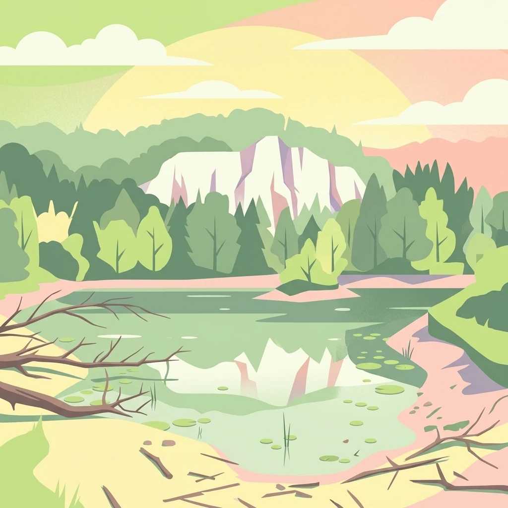
A stylized digital illustration of a nature reserve featuring a calm body of water with reflections, a central forested cliff, and a sunlit sky.

Naturschutzgebiet Moulin de Vert

Nature reserve

Park overview

Structured park overview, official facts, and landscape profile for Moulin de Vert Nature Reserve

Moulin de Vert Nature Reserve park facts, protected area profile, and essential visitor context

Review the core facts for Moulin de Vert Nature Reserve, including designation, size, terrain, visitor scale, habitats, and operating context in one park-focused overview.

About Moulin de Vert Nature Reserve

Moulin de Vert is a compact but ecologically dense nature reserve in western Switzerland, occupying a stretch of the Rhône floodplain downstream of the Verbois Dam. Despite its modest size of around 132 hectares, it has earned a strong reputation within Canton Geneva as one of the most biodiversity-rich protected sites, balancing active habitat management with the preservation of mature riverside forest.

Geographically, the reserve straddles the territories of Aire-la-Ville and Cartigny, anchored by the Étang des Isles and the Étang Robert Hainard. These ponds, along with surrounding meadows and woodland, form a mosaic of habitats that support amphibians, reptiles, birds of prey, and larger mammals such as wild boar and roe deer. A bird observation post and a walking trail run through the area, allowing visitors to engage with the reserve without disturbing its core functions.

Institutionally, Moulin de Vert holds two overlapping designations. It has been a site of cantonal protection since 1956 and a nature reserve since the 1970s, and in 2001 it was formally inscribed in Switzerland's federal inventory of amphibian spawning areas of national importance. Internationally, it appears in the World Database on Protected Areas under IUCN Category IV, reflecting its role as a habitat and species management area rather than a strict wilderness reserve. Across the river, the related Teppes de Verbois site extends the protected floodplain landscape, creating a binodal conservation zone along this section of the Rhône.

Quick facts and research context for Moulin de Vert Nature Reserve

Moulin de Vert is a 131.96-hectare nature reserve in Canton Geneva, Switzerland, classified as IUCN Category IV (Habitat/Species Management Area). It lies on the Rhône floodplain downstream of the Barrage de Verbois, between Aire-la-Ville and Cartigny, and has been recognized since 2001 as an amphibian spawning area of national importance, listed in the federal inventory under the code GE14.

The reserve contains a large riverside forest, several ponds (including the Étang des Isles and the Étang Robert Hainard), and meadows of cantonal significance. Established as a protected area in 1956 and developed into a nature reserve in the 1970s, it now ranks among the most species-rich protected sites in the canton, cataloguing over 700 plant species and more than 300 animal species.

Protection and recognition

Structured international recognition data and documented conservation status details

Naturschutzgebiet Moulin de Vert Protection Status and Designated Area Record

Naturschutzgebiet Moulin de Vert brings together verified protected area records and official designation entries within the global conservation database. Documented protection metrics provide clear reference points for evaluating the legal standing and administrative scope of the reserve.

Protection details

WDPA ID
347424
Park context

Deeper park guide and search-rich context for Moulin de Vert Nature Reserve

Moulin de Vert Nature Reserve history, landscape, wildlife, and travel context

Explore Moulin de Vert Nature Reserve through its history, landscape character, ecosystems, wildlife, conservation priorities, cultural context, and seasonal travel timing in a structured park guide built for atlas discovery and search intent.

Why Moulin de Vert Nature Reserve stands out

Moulin de Vert is best known for the exceptional biodiversity packed into a relatively small lowland floodplain reserve. The overlap of riverine forest, artificial ponds, and meadows creates habitat for an unusually wide array of amphibians, reptiles, birds, and mammals. The reserve is also recognised for its role as a nationally important amphibian spawning area, with habitat management initiatives including pond creation and long-term monitoring reflecting the site's value for wetland-dependent species.
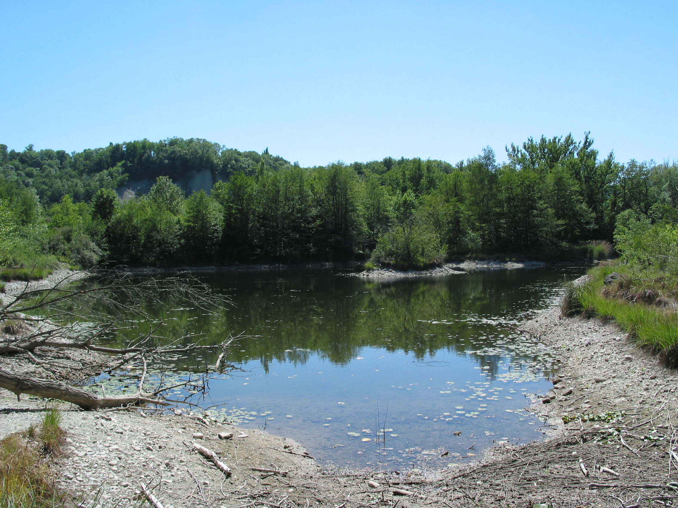
A calm, small pond surrounded by dense green forest and a pebbled shoreline under a clear blue sky.
A tranquil pond within the Moulin de Vert nature reserve, showcasing the diverse aquatic habitats of the Rhone river basin.

Moulin de Vert Nature Reserve history and protected-area timeline

The history of Moulin de Vert is closely tied to the transformation of the Rhône. What is now a forested floodplain reserve was once part of the active river channel, until the construction of the Barrage de Verbois in the 1940s canalised and straightened the river, leaving behind a tract of land shaped by the old watercourse.

In 1956, the area was designated as one of the first protected zones in Canton Geneva. Following this initial protection, the 1970s saw more deliberate creation of a nature reserve, and from the late 1970s onward active habitat shaping began. The Étang des Isles was created in 1978, and in 1992 the Étang Robert Hainard was added, with the reserve simultaneously expanded. Gravel uncovered during these works was sold to finance additional nature projects, embedding an unusual financial mechanism into the site's development.

The most significant formal step came in 2001, when Moulin de Vert was listed as an amphibian spawning area of national importance, a designation that has since shaped ongoing monitoring and management. By 2010, surveys had already documented a decline in amphibian populations since the inventory listing, signalling both the value of the reserve and the pressures facing wetland species in the region.

Moulin de Vert Nature Reserve landscape and geographic character

The landscape of Moulin de Vert is the classic Rhône floodplain profile of the Swiss Romande lowlands: a flat, river-influenced terrain dominated by woodland, interspersed with open water, wet meadows, and a network of paths. The reserve occupies land that the Rhône once shaped directly, giving it a slightly cupped, former-channel character visibly distinct from the engineered river it now fronts.

The dominant visual element is the large riverside forest that runs along the watercourse, offering dense canopy cover and edge habitats where woodland meets open meadow. Cut through this forest and meadow matrix are the artificial ponds of the reserve, particularly the Étang des Isles and the Étang Robert Hainard, which serve both as habitat features and as visual focal points within the otherwise continuous green cover.

Beyond the wetland and forest core, the reserve transitions into drier meadows of cantonal importance, supporting a different component of the site's flora. Across the Rhône, the topography continues into the Teppes de Verbois reserve, while the Verbois Dam upstream structures the broader river landscape, providing context for the altered hydrology that shaped the modern reserve.

Moulin de Vert Nature Reserve ecosystems, habitats, and plant life

Moulin de Vert's ecological identity rests on the close juxtaposition of four principal habitat elements: large riverside forest, permanent and seasonal ponds, wet meadows, and drier meadowland. This mosaic sustains the high species totals repeatedly attributed to the reserve and is the reason it has been integrated into both cantonal and national inventories.

The forest component provides structural diversity, with understorey and edge conditions that favour both small mammals and breeding birds. The pond network, especially the two named étangs, provides aquatic and semi-aquatic conditions for amphibians and invertebrates, while surrounding meadows support pollinator communities, herbaceous plant diversity, and reptile habitat along warmer, drier transitions.

More broadly, the reserve functions as a refuge for lowland wetland biodiversity in a region where much of the original Rhône floodplain has been engineered. The site's contribution to amphibian reproduction, in particular, gives it regional significance that extends well beyond its modest footprint.

Moulin de Vert Nature Reserve wildlife and species highlights

The wildlife profile of Moulin de Vert is unusually broad for a lowland Swiss reserve. The site is recorded as supporting more than 300 animal species, with the animal community spanning amphibians, reptiles, birds, mammals, and invertebrates.

Among mammals, the most visible residents are wild boar, roe deer, and European badgers, which use the wooded portions of the reserve. Reptile diversity is especially notable: 10 of the 11 reptile species native to Canton Geneva are reported here, including the asp viper, a venomous species of conservation interest, alongside turtle species that use meadow and pond-edge habitats.

Birdlife is similarly conspicuous. The reserve supports a breeding population that includes peregrine falcons, which favour cliff and large-tree nesting sites, and kingfishers, tied closely to the river and pond habitats. A dedicated bird observation post within the reserve underlines the importance of the site for birdwatching. Amphibians, the group that triggered the reserve's national designation, have been the focus of long-term monitoring; by 2010, observers had already recorded declines in amphibian populations since the 2001 inventory, indicating both the importance and the vulnerability of this component of the reserve's fauna.

Moulin de Vert Nature Reserve conservation status and protection priorities

Moulin de Vert is significant from a conservation perspective less for its size than for the layered protection framework it sits within and the biodiversity it concentrates. Its status in Switzerland's federal inventory of amphibian spawning areas of national importance gives the site a formal role in the country's wetland conservation strategy, while its earlier cantonal protection since 1956 places it among the older reserves in the Geneva landscape.

Management interventions have been deliberate and habitat-focused. The successive creation of the Étang des Isles in 1978 and the Étang Robert Hainard in 1992, together with the 1992 expansion, reflect an active approach to maintaining amphibian and aquatic habitat in the face of changing river dynamics. Gravel extracted during pond construction was sold to fund further conservation projects, illustrating an integrated financing approach to habitat restoration.

Internationally, the reserve is recognised under IUCN Category IV, classifying it as a habitat and species management area. The combination of national designation, cantonal protection, active habitat creation, and documented amphibian decline gives Moulin de Vert a clear conservation purpose: maintaining lowland floodplain biodiversity in a heavily engineered river landscape and acting as a long-term monitoring site for nationally important amphibian populations.

Moulin de Vert Nature Reserve cultural meaning and human context

The reserve does not have a strongly developed cultural narrative in the public record, but it carries a quiet local significance as one of Canton Geneva's earliest protected areas. Designated as early as 1956, it predates most modern Swiss nature reserve frameworks in the canton and forms part of the regional identity of the communes of Aire-la-Ville and Cartigny.

The naming of the Étang Robert Hainard, added in 1992, echoes the legacy of Swiss naturalist and conservationist Robert Hainard and ties the site to a broader Swiss tradition of naturalist-led landscape protection. The reserve's accessibility, with walking trails and an information panel, also reflects an intent to integrate local communities and visitors into the conservation story of the Rhône floodplain.

Top sights and standout views in Moulin de Vert Nature Reserve

A large riverside forest supporting more than 700 plant species and over 300 animal species, including wild boar, roe deer, badgers, and 10 of the 11 native reptile species of Canton Geneva.

Two created ponds, the Étang des Isles and the Étang Robert Hainard, central to the reserve's role as a nationally designated amphibian spawning area, paired with a dedicated bird observation post for peregrine falcons and kingfishers.

Best time to visit Moulin de Vert Nature Reserve

Moulin de Vert sits in the low-elevation Rhône valley around Geneva, where seasonal variation is moderate. Spring is typically the most rewarding season to visit, as rising temperatures coincide with amphibian breeding activity in the reserve's ponds and the surrounding meadows come into growth, while bird song and raptor presence are at their most conspicuous.

Summer offers dense forest cover, active reptile presence along meadow edges, and the most stable conditions for walking the reserve's trail. Autumn brings quieter conditions, visible mammal activity, and a different palette in the riverside woodland. Winter visits remain possible but are less rewarding for wildlife observation, when ponds may be cooler and amphibian activity minimal.

Monthly climate preview

Long term temperature and monthly precipitation patterns sampled across representative park coordinates

Naturschutzgebiet Moulin de Vert Climate Normals and Annual Weather Rhythm

Historical climate records for Naturschutzgebiet Moulin de Vert document sustained annual variations in mean monthly temperature and daily precipitation rates. Examining the full twelve month profile reveals detailed seasonal averages across the monitored elevation point.
Annual mean9 °C
-1 °C19 °C
Jan-1°
Feb
Mar
Apr
May12°
Jun16°
Jul19°
Aug19°
Sep14°
Oct10°
Nov
Dec
Warmest month
July

18.5 °C

Coolest month
January

-0.8 °C

Wettest month
December

3.5 mm/day

Driest month
March

2.6 mm/day

Park location guide

Geography guide, regional context, and park location map for Moulin de Vert Nature Reserve

Moulin de Vert Nature Reserve park geography, regions, and map view in Switzerland

Understand where Moulin de Vert Nature Reserve sits in Switzerland through a broader geographic reading of the surrounding landscape, nearby location context, and its mapped position within the national park landscape.

How Moulin de Vert Nature Reserve fits into Switzerland

Switzerland is a landlocked federal republic in Central Europe comprising 26 cantons, with Bern as the federal city and Zurich as the largest city. The country features the Swiss Alps, Swiss Plateau, and Jura Mountains, with German, French, Italian, and Romansh as official languages. It is noted for its political neutrality, direct democracy traditions, and strong economy.

Wider geography shaping Moulin de Vert Nature Reserve in Switzerland

Switzerland is located in Central Europe at the intersection of Western and Southern Europe. It is bordered by Germany to the north, France to the west, Austria and Liechtenstein to the east, and Italy to the south. The country is geographically divided among the Swiss Alps (covering most of the territory), the Swiss Plateau (where most of the population resides), and the Jura Mountains. Switzerland is landlocked.

Map view of Moulin de Vert Nature Reserve

Use this park location map to pinpoint Moulin de Vert Nature Reserve in Switzerland, understand its exact geographic position, and read its mapped placement within the surrounding landscape more clearly.

Pigeon | © OpenStreetMap contributors

Location context for Moulin de Vert Nature Reserve

Geneva

Visual reference for the riverine forest, wetlands, and floodplain habitats of Canton Geneva

Naturschutzgebiet Moulin de Vert Landscape, Scenery, and Park Photos

Visual documentation of Naturschutzgebiet Moulin de Vert reveals the flat, river-shaped terrain and dense canopy cover characteristic of Swiss lowland floodplains. Examining photographs of the reserve provides clear insight into its mosaic of artificial ponds, wet meadows, and mature riverside woodlands.

A calm, small pond surrounded by dense green forest and a pebbled shoreline under a clear blue sky.

Park atlas

Discover adjacent protected landscapes and river valley reserves in the surrounding region

Other Parks Near Naturschutzgebiet Moulin de Vert for Regional Geographic Comparison

Compare Naturschutzgebiet Moulin de Vert with other protected areas across the surrounding lowland geography and river corridors. Expanding the search helps reveal related wetland reserves, regional floodplains, and connected conservation landscapes.
A soft, light watercolor painting of a winding river flowing through a gentle, rolling landscape with trees and distant hills against a pale, warm sky.
Nature reserveAuvergne-Rhône-Alpes
About 17 km away#1 closest

West

Réserve naturelle régionale de la galerie du Pont-des-Pierres Regional Nature Reserve

Protected gorge landscapes and underground habitats in France

An essential record of the Réserve naturelle régionale de la galerie du Pont-des-Pierres, detailing its critical role in safeguarding cliff and underground habitats within the Valserine gorges. This protected land in the Ain department represents a vital ecological intersection of geological features and specialized faunal refuges.

Area
0.093 km²
Established
2009
IUCN
IV
Relief
Mountain
Wildlife reserveBourgogne-Franche-Comté
About 23 km away#2 closest

North

Tourbières et lacs de la montagne jurassienne: Mapping High-Altitude Wetlands and Glacial Landscapes

A vast protected wildlife reserve in the Bourgogne-Franche-Comté region

Covering more than 12,000 hectares, this wildlife reserve forms a crucial conservation benchmark for peatland and glacial lake systems in the Jura Massif. The landscape encompasses deep combes, broad plateaus, and clear-water basins like Lac de Saint-Point, providing a vital habitat mosaic for diverse flora and fauna across the French highlands.

Area
121.56 km²
Established
2021
Relief
Mountain
Climate
Temperate
Nature reserveAuvergne-Rhône-Alpes
About 29 km away#3 closest

West

Réserve naturelle régionale du récif fossile de Marchon - Christian Gourrat Geological Site

A protected Jurassic fossil reef in the Auvergne-Rhône-Alpes region

Located in the Ain department, this small nature reserve is scientifically renowned for its Kimmeridgian reef outcrop. The site protects a fossilized coral and rudist assemblage within the forêt de Marchon, offering a quiet, forested setting for studying France's ancient marine geological history.

Area
0.001 km²
Established
2015
IUCN
IV
Scope
Terrestrial
A horizontal watercolor painting depicting a soft, layered landscape with distant hills, gentle slopes, and clusters of evergreen trees in shades of green and purple.
Nature reserveBourgogne-Franche-Comté
About 39 km away#4 closest

North

Réserve naturelle régionale des tourbières du bief du Nanchez: Protected Jura Mountain Peatlands

Mapping bog systems and wet grassland geography in Eastern France

Located in the Jura department, this regional nature reserve preserves forty-nine hectares of vital peatland, including diverse mire communities and forested slopes. The site provides a critical look at montane landscape restoration, documenting significant bog flora and complex hydrological patterns along the Combe du Nanchez valley floor.

Area
0.488 km²
Established
2021
IUCN
IV
Relief
Upland
A horizontal watercolor painting depicting a gentle mountain silhouette behind a forested shoreline sloping toward the water.
Nature reserveFrance
About 40 km away#5 closest

South

Roc de Chère Nature Reserve: Mapping the Botanical Diversity and Geological Features of Haute-Savoie

A protected alpine promontory bordering Lake Annecy

Roc de Chère stands as a distinct geological landmark where limestone and sandstone soils create sharp microclimate contrasts. This protected reserve provides a critical habitat for diverse plant species and rare dragonflies within a small, defined area of the French Alps. The site acts as a key element of the Lake Annecy landscape, offering insight into the post-glacial environmental history of the Savoie region through its protected cliffs and hollows.

Area
0.69 km²
Established
1977
Relief
Mountain
Climate
Temperate
A soft, horizontal watercolor painting depicting a winding river flowing through a lush, green landscape with distant hills and sparse trees.
Nature reserveVaud
About 42 km away#6 closest

Northeast

Chanivaz, Delta de l’Aubonne: Geography, Map, and Protected Landscape Context

A rare glacial geotope and river delta on Lake Geneva.

Chanivaz, Delta de l’Aubonne provides a rich look at the alluvial fan of the River Aubonne. Explore its layered terrace terrain, protected reedbeds, and riparian forests in the canton of Vaud, representing one of the best-preserved natural river mouths remaining on the northern shore of Lake Geneva.

Area
3 km²
Established
2003
Relief
Lowland
Climate
Temperate
A soft, panoramic watercolor illustration of rolling hills, mountains, and trees in pastel shades of green, yellow, and pink.
Nature reserveAuvergne-Rhône-Alpes
About 47 km away#7 closest

West

Réserve naturelle nationale de la grotte de Hautecourt: Jura Mountain Cave Geography

Protected subterranean landscapes in the Ain department of France.

This nature reserve protects a complex underground environment characterized by a vertical 36-meter cave system and rich invertebrate biodiversity. Located on the flank of Mont Rosset in the Auvergne-Rhône-Alpes region, the area provides a crucial habitat that balances delicate subterranean passages with surface limestone ridges and dry grassland ecosystems.

Area
0.102 km²
Established
1980
IUCN
IV
Watercolor painting of a soft green alpine landscape with rolling hills, a central body of water, and evergreen trees against a light mountain background.
Nature reserveSavoie
About 60 km away#8 closest

Southeast

Réserve naturelle régionale de la tourbière des Saisies - Beaufortain - Val d'Arly Protected Area Map

High-altitude peatland geography in the Savoie department.

Investigate the complex topography and conservation significance of the Réserve naturelle régionale de la tourbière des Saisies - Beaufortain - Val d'Arly. This protected area stands as a unique alpine landmark, recognized for its subalpine boreal vegetation, rich bird populations, and critical role as a regional peatland sanctuary within the Savoie mountain range.

Area
2.93 km²
Established
2013
IUCN
IV

Common questions about visiting, size, designation, and location context for Moulin de Vert Nature Reserve

Moulin de Vert Nature Reserve FAQs for park facts, access, geography, and protected area context

Find quick answers about Moulin de Vert Nature Reserve, including protected-area facts, park geography, trail and visitor context, and how the park fits into its surrounding country and regional landscape.
MoriAtlas Explorer

Continue Your Protected Areas Search Across the Global Atlas

Deepen your exploration by continuing the structured search for national parks and protected areas worldwide. Utilize the comprehensive filtering capabilities to compare different conservation landscapes and refine your understanding of global park geography. Discover more about the distribution and characteristics of protected natural areas.

Global natural geography