Mori Atlas logo
Wildlife reserveMount Calavite Wildlife Sanctuary

Examining the ecological boundaries and rugged metamorphic ridges of this critical Philippine wildlife reserve.

Mount Calavite Wildlife Sanctuary: A Historic Protected Landscape and Mountain Terrain in Occidental Mindoro

Mount Calavite Wildlife Sanctuary stands as a foundational protected area in the Philippines, established to safeguard critical montane forest and lowland habitats in northwestern Occidental Mindoro. The sanctuary encompasses steep, dissected terrain formed by ancient metamorphic rock, rising from coastal fringes to the high-elevation grasslands surrounding the summit of Mount Calavite. This landscape acts as a vital refuge for endemic bird species and provides essential habitat for the critically endangered Tamaraw, representing a core node in the broader MIMAROPA biodiversity network.

wildlife sanctuaryendemic birdslowland rainforestmontane forestmountain landscapegrassland habitat

Mount Calavite Wildlife Sanctuary

Wildlife reserve

Park overview

Structured park overview, official facts, and landscape profile for Mount Calavite Wildlife Sanctuary

Mount Calavite Wildlife Sanctuary park facts, protected area profile, and essential visitor context

Review the core facts for Mount Calavite Wildlife Sanctuary, including designation, size, terrain, visitor scale, habitats, and operating context in one park-focused overview.

About Mount Calavite Wildlife Sanctuary

Mount Calavite Wildlife Sanctuary occupies a defining position in the northwestern portion of Mindoro, facing the Mindoro Strait and the broader seascape that separates the island from the rest of Luzon. The sanctuary encompasses a substantial mountainous block anchored by Mount Calavite, whose summit reaches roughly 1,510 meters and forms the most prominent high ground in that corner of the island. Surrounding the peak is a mosaic of terrain that ranges from coastal lowlands once blanketed by rainforest to high-elevation slopes and open grasslands suitable for the island's specialized grazers.

The protected area sits within Occidental Mindoro, with the small town of Paluan serving as the nearest population center. Its relative isolation, combined with the ruggedness of the interior terrain, has helped insulate parts of its forest cover from complete conversion even as surrounding lowlands have been opened up for agriculture over the course of the twentieth century. The result is a protected landscape in which intact upper-elevation habitat coexists with a patchwork of recovering forest, secondary growth, and disturbance legacies visible from the coast.

Ecologically, Mount Calavite Wildlife Sanctuary carries significance well beyond its boundaries because Mindoro is a recognized center of endemism within the Philippines, and the sanctuary protects a meaningful share of the island's surviving lowland and montane habitat. This makes it a critical anchor for the conservation of species that are not found anywhere else, including several restricted-range birds and the Tamaraw, the island's iconic dwarf buffalo. The sanctuary is administered as a wildlife sanctuary under the Philippine protected-area system and is part of the MIMAROPA region's network of forests, islands, and seascapes that collectively safeguard Mindoro's natural heritage.

Quick facts and research context for Mount Calavite Wildlife Sanctuary

Mount Calavite Wildlife Sanctuary is located in northwestern Mindoro in the Philippines, in the province of Occidental Mindoro, with the nearby town of Paluan the closest settlement. Established on 28 January 1920 as a game and bird reserve, it is among the earliest formally protected natural areas in the country, and its protection status was expanded in 1925 under Executive Order No. 9. The sanctuary covers roughly 18,150 hectares of mountainous terrain anchored by Mount Calavite, which rises to about 1,510 meters above sea level, making it the tallest peak in the range. Geologically, it overlies some of the oldest rocks on Mindoro, predominantly metamorphic formations of pre-Jurassic to Jurassic age.

Protection and recognition

Examine official terrestrial boundaries, conservation designations, and recognition data.

Mount Calavite Wildlife Sanctuary Protection Status and Management Scope

Mount Calavite Wildlife Sanctuary maintains a documented terrestrial protection scope within the regional conservation network. Review structured designation records, administrative metrics, and international recognition sources for this protected habitat.

Protection details

Protection scope
Terrestrial
Transboundary protection
No
Park context

Deeper park guide and search-rich context for Mount Calavite Wildlife Sanctuary

Mount Calavite Wildlife Sanctuary history, landscape, wildlife, and travel context

Explore Mount Calavite Wildlife Sanctuary through its history, landscape character, ecosystems, wildlife, conservation priorities, cultural context, and seasonal travel timing in a structured park guide built for atlas discovery and search intent.

Why Mount Calavite Wildlife Sanctuary stands out

Mount Calavite Wildlife Sanctuary is best known for being one of the Philippines' oldest formally protected areas and for the concentration of Mindoro-endemic and range-restricted bird species that survive within its forests. Four notable endemics have been documented here: the Mindoro Bleeding-heart, the Spotted Imperial Pigeon, the Mindoro Hornbill, and the Mindoro Flowerpecker, all of which are otherwise confined to this single island. The sanctuary is also recognized as an important habitat refuge for the Tamaraw, Mindoro's only large native mammal, whose precarious survival is closely tied to the grasslands and forest edges around Mount Calavite.

Mount Calavite Wildlife Sanctuary history and protected-area timeline

Mount Calavite Wildlife Sanctuary has one of the longest formal protection histories of any natural area in the Philippines. It was originally established on 28 January 1920 as a game reserve and bird sanctuary during the American colonial period, an early recognition of the area's importance for wildlife at a time when most landscapes across the archipelago were still being opened up for settlement and resource extraction.

On 26 January 1925, the sanctuary's protection status was strengthened through Executive Order No. 9, which formally designated approximately 17,000 hectares of the area as a legally protected reserve. This broadening of its protected classification laid the foundation for its continued existence as a formally recognized sanctuary even as surrounding lowlands and coastal forests on Mindoro were progressively cleared for agriculture.

Over the decades that followed, the sanctuary continued to function as a refuge for Mindoro's endemic wildlife, particularly the species most sensitive to forest loss. Despite persistent pressure from land conversion in adjacent areas, the ruggedness of the Mount Calavite range helped maintain forest cover in the upper watersheds. Today the sanctuary remains a key node in the Philippine protected-area network and is documented in international databases such as BirdLife International and the World Database on Protected Areas.

Mount Calavite Wildlife Sanctuary landscape and geographic character

The landscape of Mount Calavite Wildlife Sanctuary is dominated by the mountain range that gives the area its name, with Mount Calavite itself forming the highest point at roughly 1,510 meters above sea level. The terrain is steep and dissected, rising from coastal lowlands up through forested slopes to exposed ridgelines and high-elevation grasslands. The result is a vertical sequence of habitats compressed into a relatively compact area, with conditions shifting rapidly from humid lowland environments near sea level to cooler montane conditions in the upper reaches.

Geologically, the sanctuary sits on some of the oldest exposed rock on Mindoro. The formations are classified as pre-Jurassic to Jurassic metamorphic rocks of the Halcon series, dominated by soapstone, phyllite, and smaller amounts of other minerals and metamorphic types. These ancient rocks give the range a distinctive character and contribute to the often rugged, slope-prone terrain that has shaped both the drainage pattern and the vegetation pattern across the sanctuary.

In historical terms, the lower elevations of the area were once covered by rainforest that reached almost to the shoreline. Today that lowland forest is largely gone, replaced in places by agricultural land, and the surviving forest cover is concentrated in the more inaccessible middle and upper elevations. Above the forested zone, the landscape opens into grasslands and scrub that occupy the higher slopes around Mount Calavite and which provide habitat for the Tamaraw.

Mount Calavite Wildlife Sanctuary ecosystems, habitats, and plant life

Mount Calavite Wildlife Sanctuary protects a representative slice of Mindoro's natural vegetation, even though its original forest cover has been significantly reduced. The remaining forests are primarily lowland and lower montane rainforest, concentrated in the middle elevations where topography and distance from settlements have limited conversion. In the past these forests formed a continuous belt from the interior mountains down to the coast; today they exist as a more fragmented system bordered by cleared lowlands.

Above the closed forest, the vegetation transitions into high-elevation grasslands and open habitats that occupy the upper slopes around Mount Calavite. This grassland belt is ecologically significant because it supports species, such as the Tamaraw, that depend on open ground rather than closed forest. The combination of forest and grassland within a single protected landscape gives the sanctuary an unusually broad vertical ecological profile.

The mosaic of recovering forest, intact middle-elevation stands, open highland grasslands, and disturbed edges makes the sanctuary an important reservoir for biodiversity on Mindoro. It functions as a refuge for species that have lost much of their lowland habitat elsewhere on the island and as a source area for recolonization of adjacent landscapes when conditions allow.

Mount Calavite Wildlife Sanctuary wildlife and species highlights

Mount Calavite Wildlife Sanctuary is most notable from a wildlife perspective for the concentration of bird species that are endemic to Mindoro and found nowhere else in the world. Documented species of conservation significance within the sanctuary include the Mindoro Bleeding-heart, a highly secretive ground-dwelling dove; the Spotted Imperial Pigeon, a large forest pigeon with a limited Philippine distribution; the Mindoro Hornbill, a hornbill species whose entire global range is restricted to this single island; and the Mindoro Flowerpecker, a small flowerpecker also confined to Mindoro. The presence of all four species within the sanctuary underlines its outsized importance for Philippine avian endemism.

The sanctuary is also a key habitat for the Tamaraw, Mindoro's only large native mammal and one of the most endangered buffalo species in the world. The grassy high-elevation terrain around Mount Calavite provides some of the island's most important remaining habitat for this species, and the sanctuary has historically been one of the strongholds for its surviving population.

Together, these endemic birds and the Tamaraw give the sanctuary a wildlife profile that is exceptionally important relative to its size. The site is recognized internationally through BirdLife International and registers as a key biodiversity area contributing to the understanding of Mindoro's endemic fauna.

Mount Calavite Wildlife Sanctuary conservation status and protection priorities

Mount Calavite Wildlife Sanctuary holds an important place in Philippine conservation history as one of the country's earliest formally protected natural areas. Its original 1920 designation as a game and bird reserve, followed by the 1925 executive order expanding protection across roughly 17,000 hectares, placed it among the first landscapes in the Philippines to receive sustained legal protection. This long history makes it not just a current refuge but also a benchmark for the evolution of protected-area policy in the country.

In conservation terms, the sanctuary matters because it anchors the survival of Mindoro-endemic species, especially the restricted-range birds that depend on the remaining forest cover and the Tamaraw, whose habitat is increasingly confined to protected landscapes like this one. As lowland forest continues to be lost across much of Mindoro, the sanctuary's middle and upper elevation forests become disproportionately important for the persistence of species that cannot survive in the lowlands.

The sanctuary is also part of the broader MIMAROPA protected-area network, which links reserves across Mindoro and surrounding islands. This network approach is essential for a sanctuary like Mount Calavite, whose conservation value depends not only on what happens within its boundaries but also on how ecological processes and species movements are maintained across the wider landscape.

Top sights and standout views in Mount Calavite Wildlife Sanctuary

Mount Calavite Wildlife Sanctuary's strongest points of distinction are its combination of extreme age as a protected area, its role as a stronghold for Mindoro's endemic birds, and its position as one of the last significant habitat areas for the Tamaraw. The sanctuary's 1920 founding date places it among the very first formally protected landscapes in the Philippines, giving it a heritage that newer reserves do not share.

The presence of four endemics, including the Mindoro Hornbill and the Mindoro Bleeding-heart, makes the sanctuary a critical site for ornithological conservation and for the protection of Mindoro's unique evolutionary lineage. Add to this the high-elevation grasslands that support the Tamaraw, and the sanctuary stands out as a place where forest-dependent endemics and open-country large mammals are protected within a single landscape.

Best time to visit Mount Calavite Wildlife Sanctuary

The most practical conditions for visiting a protected area like Mount Calavite Wildlife Sanctuary generally correspond to the drier months of the year, when access roads through coastal and lowland terrain are more reliably passable and the forest interior is less affected by heavy rainfall. On Mindoro, the drier season typically falls within the first few months of the year, while the wetter monsoon months bring heavier rains and more challenging conditions in mountainous terrain.

That said, the sanctuary's wildlife viewing value is not strictly tied to a single season. Forest interior bird activity and flowering events that attract endemics like the Mindoro Flowerpecker can occur across different times of the year, and the upper grasslands around Mount Calavite have their own seasonal character. Visitors oriented around ecological experience rather than access convenience may find value in different periods depending on what species they hope to encounter.

Monthly climate preview

Long term monthly averages for temperature and precipitation patterns across the sanctuary

Mount Calavite Wildlife Sanctuary Climate Normals and Temperature Rhythms

Representative coordinate measurements record twelve month temperature variations alongside shifting daily precipitation rates at Mount Calavite Wildlife Sanctuary. Examining the complete monthly climate profile reveals detailed long term meteorological normals across the protected area.
Annual mean27 °C
25 °C29 °C
Jan25°
Feb26°
Mar27°
Apr28°
May29°
Jun28°
Jul27°
Aug27°
Sep27°
Oct27°
Nov27°
Dec26°
Warmest month
May

28.6 °C

Coolest month
January

25.3 °C

Wettest month
July

11.4 mm/day

Driest month
March

1.4 mm/day

Park location guide

Geography guide, regional context, and park location map for Mount Calavite Wildlife Sanctuary

Mount Calavite Wildlife Sanctuary park geography, regions, and map view in Philippines

Understand where Mount Calavite Wildlife Sanctuary sits in Philippines through a broader geographic reading of the surrounding landscape, nearby location context, and its mapped position within the national park landscape.

How Mount Calavite Wildlife Sanctuary fits into Philippines

The Philippines, officially the Republic of the Philippines, is an archipelagic nation in Southeast Asia comprising approximately 7,641 islands categorized into three main geographical divisions: Luzon, Visayas, and Mindanao. Located in the western Pacific Ocean, it shares maritime borders with Taiwan, Japan, Palau, Indonesia, Malaysia, Vietnam, and China. Manila serves as the capital city, while Quezon City is the most populated city, both within Metro Manila.

Wider geography shaping Mount Calavite Wildlife Sanctuary in Philippines

The Philippines is an archipelagic nation in Southeast Asia, positioned in the western Pacific Ocean. Its islands are bounded by the South China Sea to the west, Philippine Sea to the east, and Celebes Sea to the south. The country shares maritime borders with Taiwan to the north, Japan to the northeast, Palau to the east and southeast, Indonesia to the south, Malaysia to the southwest, Vietnam to the west, and China to the northwest.

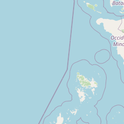
Map view of Mount Calavite Wildlife Sanctuary

Use this park location map to pinpoint Mount Calavite Wildlife Sanctuary in Philippines, understand its exact geographic position, and read its mapped placement within the surrounding landscape more clearly.

Pigeon | © OpenStreetMap contributors

Location context for Mount Calavite Wildlife Sanctuary

Occidental Mindoro
Park atlas

Discover adjacent protected landscapes and regional biodiversity networks across Mindoro

Explore Parks Near Mount Calavite Wildlife Sanctuary and Regional Protected Areas

Comparing other parks near Mount Calavite Wildlife Sanctuary reveals broader ecological patterns across the rugged mountain terrain and lowland rainforest remnants of Mindoro. Extending park exploration into the surrounding regional network illuminates the shared conservation history of protected habitats throughout the MIMAROPA islands.
A wide panoramic watercolor painting showing a body of water in the foreground, a green tree-lined shore in the midground, and faint mountains under a pink and yellow sky in the background.
Marine protected areaPhilippines
About 82 km away#1 closest

South

Apo Reef Marine Natural Park: Protected Coral Reef Atlas and Marine Geography

Marine protected area in the Mindoro Strait, Philippines

Apo Reef Marine Natural Park serves as a high-priority conservation landscape featuring two massive triangular coral banks and steep underwater drop-offs. This site provides a critical case study in marine geomorphology, characterized by its deep submarine trenches and unique atoll-like structure within the broader Philippine archipelagic geography.

Area
274.69 km²
Established
1996
Scope
Marine
Water
Water-dominated
Protected landscapeCalabarzon
About 86 km away#2 closest

Northeast

Taal Volcano Protected Landscape: Geographic Profile and Protected Area Map

Volcanic caldera and nested lake system in Calabarzon

Explore the layered topography of the Taal Volcano Protected Landscape. This protected area showcases a rare nested volcanic island within a freshwater lake, offering significant insights into the geological and aquatic geography of the Calabarzon region of the Philippines.

Area
622.92 km²
Established
1996
Water
Major water bodies
A watercolor painting showing a winding stream flowing through grassy wetlands toward distant low mountain ranges.
National parkPhilippines
About 90 km away#3 closest

Southeast

Lake Naujan National Park: An Atlas of Volcanic Lakes and Wetland Geography

Mapped protected landscapes in the Philippines

Lake Naujan National Park occupies a unique geographic position on Mindoro Island, centering on a vast volcanic freshwater lake. The protected area integrates diverse terrain ranging from aquatic wetland zones and thermal springs to lowland forests and managed agricultural buffers, providing an essential study in human-modified conservation landscapes.

National parkPhilippines
About 107 km away#4 closest

East

Naujan Lake National Park: Philippines National Park Atlas and Protected Landscape

Explore its mapped boundaries and regional geographic context.

Naujan Lake National Park offers a focused exploration of a distinct protected landscape within the Philippines. This page details the park's specific geographic footprint and its characteristics as a national park. Understand its place within the archipelago's broader geography, providing a valuable entry point for atlas-based discovery of protected natural areas and their mapped extents across Southeast Asia.

Scope
Terrestrial
Water
Water-dominated
National parkMindoro
About 110 km away#5 closest

Southeast

Mounts Iglit, Baco National Park: Philippines Protected Landscape and Geographic Identity

Explore Mindoro's significant national park and its mapped natural terrain.

Delve into Mounts Iglit, Baco National Park, a protected national park located on the island of Mindoro. This entry offers a detailed geographic perspective, focusing on its mapped boundaries and its role within the archipelago's conservation landscape. Understand the park's specific regional geography and its identity as a distinct protected area.

Relief
Mountain
Scope
Terrestrial
Watercolor painting of a rolling tropical mountain range with palm trees in the foreground, rendered in soft green, pink, and neutral tones.
Nature reserveCalabarzon
About 112 km away#6 closest

Northeast

Mount Makiling Nature Reserve: Volcanic Geography and Forest Landscapes in Calabarzon

A historic forest reserve and prominent volcanic landmark on Luzon

Mount Makiling represents a layered conservation landscape, functioning as both an active site for forest research and a significant volcanic massif within the Calabarzon region. The area features a complex of subsidiary cones, mud springs, and essential watersheds that define its ecological and cultural identity. Gain a deeper understanding of its geographic boundaries and its importance as a pioneering protected area in Philippine conservation history.

Established
1910
Relief
Mountain
Climate
Tropical
Access
Easy access
Watercolor illustration depicting a serene wetland scene with soft green marshland, a central body of water, and distant rolling hills.
Protected areaMetro Manila
About 128 km away#7 closest

Northeast

Las Piñas, Parañaque Wetland Park: Protected Coastal Geography in Metro Manila

Mangroves, tidal mudflats, and essential avian migratory corridors.

Discover the geographic layout and protected status of Las Piñas, Parañaque Wetland Park. This coastal refuge provides a rare natural contrast to the dense urbanization of Metro Manila, safeguarding critical mangrove habitats and tidal environments that support diverse migratory bird species.

Area
1.81 km²
Established
2007
Relief
Lowland
Climate
Tropical
National parkBataan
About 131 km away#8 closest

North

Bataan National Park: Philippines Protected Landscape and National Park Geography

Mapped boundaries and regional natural landscape context.

This detail entry for Bataan National Park provides essential context for understanding its role as a protected landscape within the Philippines. Users can explore the park's mapped boundaries, its geographic setting in the Bataan region, and its identity as a national park. The focus is on atlas-style discovery, allowing for a deeper appreciation of the park's natural terrain and its place within the country's protected area network.

Area
236.88 km²
Established
1945
IUCN
II
Relief
Mountain

Common questions about visiting, size, designation, and location context for Mount Calavite Wildlife Sanctuary

Mount Calavite Wildlife Sanctuary FAQs for park facts, access, geography, and protected area context

Find quick answers about Mount Calavite Wildlife Sanctuary, including protected-area facts, park geography, trail and visitor context, and how the park fits into its surrounding country and regional landscape.
MoriAtlas Explorer

Continue Your Protected Areas Search Across the Global Atlas

Deepen your exploration by continuing the structured search for national parks and protected areas worldwide. Utilize the comprehensive filtering capabilities to compare different conservation landscapes and refine your understanding of global park geography. Discover more about the distribution and characteristics of protected natural areas.

Global natural geography