

Mori Atlas logo
National parkMu Ko Ang Thong National Park

Discover the geographic features and protected park identity within Surat Thani Province.

Mu Ko Ang Thong National Park: Protected Landscape Geography and Mapped Boundaries in Surat Thani

Mu Ko Ang Thong National Park represents a significant protected landscape within Surat Thani Province, offering a unique geographic profile for atlas exploration. This national park's mapped boundaries define its protected area within the region, contributing to the understanding of natural land distribution in southern Thailand. By examining its landscape context, users can gain insight into the protected geography that characterizes this coastal province.

Marine National ParkIsland ArchipelagoRamsar WetlandCoral ReefsGulf of ThailandTropical Islands

Mu Ko Ang Thong National Park

National park

Park overview

Structured park overview, official facts, and landscape profile for Mu Ko Ang Thong National Park

Mu Ko Ang Thong National Park park facts, protected area profile, and essential visitor context
Review the core facts for Mu Ko Ang Thong National Park, including designation, size, terrain, visitor scale, habitats, and operating context in one park-focused overview.

About Mu Ko Ang Thong National Park

Mu Ko Ang Thong National Park represents one of Thailand's premier marine protected areas, safeguarding a remarkable archipelago of 42 islands in the Gulf of Thailand. The park's location in Surat Thani Province places it roughly 100 kilometers north of the popular island of Ko Samui, accessible by ferry from the mainland city of Surat Thani or directly from Samui. The terrestrial landscape features islands of varying sizes dominated by tropical deciduous forest and coastal mangrove vegetation, while the surrounding marine environment encompasses coral reefs, seagrass beds, and muddy substrates typical of shallow coastal waters. The park's establishment in 1980 reflected Thailand's growing commitment to preserving coastal and marine ecosystems, and its subsequent designation as a Ramsar Wetland in 2002 formalized international recognition of its ecological significance. Visitor facilities concentrate on Ko Wua Talap, the administrative center, where accommodations range from basic bungalows to camping areas, with a ranger station providing orientation and interpretation services.

Quick facts and research context for Mu Ko Ang Thong National Park

Mu Ko Ang Thong spans 102 square kilometers including 42 islands in Surat Thani Province, Thailand. The park was established in 1980 and receives approximately 134,315 annual visitors. It holds Ramsar Wetland designation since 2002 (site number 1184), recognizing its importance as a protected coastal ecosystem. The largest island is Ko Phaluai at 19.1 square kilometers with a resident population of around 500, while Ko Wua Talap hosts the main visitor facilities including ranger station, bungalows, and restaurant access at Ao Phi Beach.

Park context

Deeper park guide and search-rich context for Mu Ko Ang Thong National Park

Mu Ko Ang Thong National Park history, landscape, wildlife, and travel context
Explore Mu Ko Ang Thong National Park through its history, landscape character, ecosystems, wildlife, conservation priorities, cultural context, and seasonal travel timing in a structured park guide built for atlas discovery and search intent.

Why Mu Ko Ang Thong National Park stands out

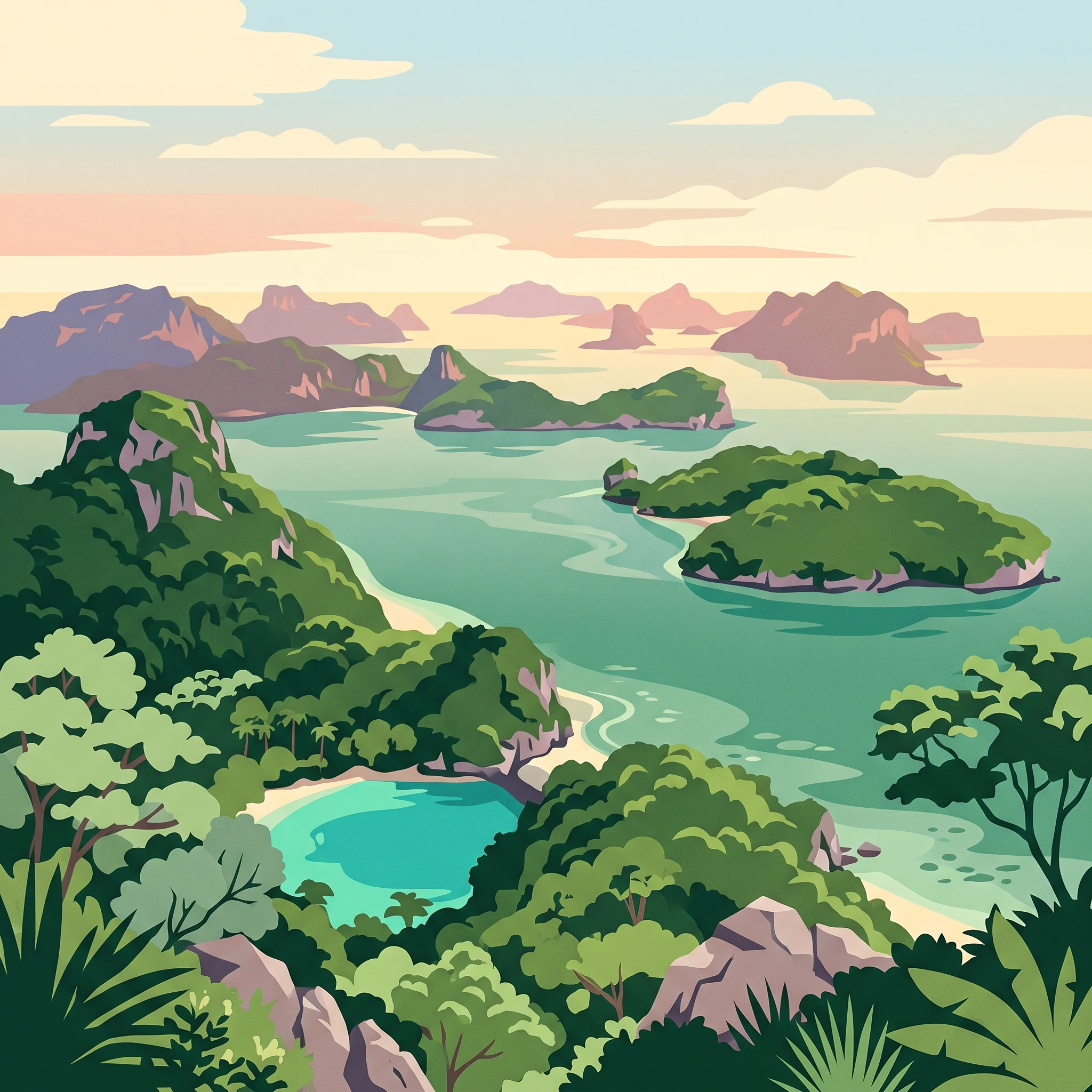
Mu Ko Ang Thong is best known for its pristine island archipelago setting with dramatic limestone karst formations, hidden lagoons, and secluded beaches. The marine park is distinguished by its shallow emerald waters, coral reefs, and the iconic Emerald Lake (Talay Nai) visible from viewpoint hikes on Ko Wua Talap. Visitors frequently cite the panoramic views from the park's elevated trails overlooking the scattered islands, as well as the snorkeling opportunities in the clear coastal waters surrounding the island group.

Mu Ko Ang Thong National Park history and protected-area timeline

Mu Ko Ang Thong was established as Thailand's 37th national park on 12 November 1980, marking a significant milestone in the country's marine conservation efforts during that period. The park's creation responded to increasing recognition of the ecological value represented by this island archipelago in the Gulf of Thailand, where coastal development pressures were intensifying. In 2002, the park received additional formal recognition through its designation as a Ramsar Wetland, joining the international convention's network of important wetland ecosystems. This designation specifically recognized the park's coastal and marine habitats, particularly the shallow water environments that support diverse ecological communities. The park's boundary includes the northern tip of Ko Phaluai, the largest island within the archipelago, ensuring protection extends to significant portions of the island's terrestrial and coastal ecosystems.

Mu Ko Ang Thong National Park landscape and geographic character

The physical landscape of Mu Ko Ang Thong is defined by its island archipelago setting in the shallow waters of the Gulf of Thailand. The islands feature characteristic limestone karst formations rising from the sea, creating dramatic cliffs, hidden caves, and distinctive rock shapes throughout the group. The terrain varies from the relatively flat surfaces of larger islands like Ko Phaluai to the steep, rocky profiles of smaller islets. The surrounding marine environment averages approximately 10 meters in depth, creating conditions suitable for coral reef development and seagrass communities. Beaches range from the long sandy stretches of Ao Phi on Ko Wua Talap to the small coves and rocky shores common throughout the islands. The park's islands support tropical vegetation including coconut palms, beach forests, and mangrove areas in sheltered coastal zones.

Mu Ko Ang Thong National Park ecosystems, habitats, and plant life

The ecological character of Mu Ko Ang Thong encompasses both terrestrial and marine habitats within a tropical island context. The islands support tropical deciduous forest ecosystems adapted to seasonal moisture patterns, with vegetation including palms, scrub, and emergent trees characteristic of coastal environments. The marine component represents the core ecological significance of the protected area, encompassing coral reef communities, seagrass beds, and the productive shallow water environments of the Gulf. These marine habitats support fish populations, invertebrate communities, and the overall biodiversity that led to the park's Ramsar designation. The wetland characteristics recognized under the Ramsar convention relate to the extensive shallow water areas, tidal zones, and coastal mangrove systems that combine to form a functional coastal ecosystem.

Mu Ko Ang Thong National Park wildlife and species highlights

The wildlife of Mu Ko Ang Thong reflects both the terrestrial island fauna and the marine species inhabiting the surrounding waters. Among the islands, bird species including various seabirds and shorebirds use the islands as nesting and feeding habitat. The surrounding marine environment supports reef fish communities, shellfish populations, and occasional marine mammals that transit through the Gulf waters. While specific species documentation in available sources is limited, the protected status of the marine area and the coral reef habitats provide sanctuary for numerous fish species and invertebrate groups. The small resident human populations on several islands have historically coexisted with these wildlife populations, with fishing forming part of the traditional livelihood in the broader region.

Mu Ko Ang Thong National Park conservation status and protection priorities

The conservation significance of Mu Ko Ang Thong derives from its dual protection of island terrestrial ecosystems and the surrounding marine environment within a single protected area framework. The Ramsar Wetland designation awarded in 2002 recognizes the park as a Wetland of International Importance, specifically acknowledging the coastal and marine wetland habitats that represent the core of the park's ecological value. This international recognition commits Thailand to maintaining the ecological character of the park's wetland components. The national park designation provides regulatory framework for managing visitor impacts, controlling development, and implementing conservation programs. The shallow marine waters averaging 10 meters depth support coral reef and seagrass communities that benefit from the protection from fishing and development pressures that would otherwise affect these vulnerable coastal ecosystems.

Mu Ko Ang Thong National Park cultural meaning and human context

The cultural context of Mu Ko Ang Thong reflects the traditional maritime communities that have inhabited the islands of the Gulf of Thailand for generations. The Thai name 'Ang Thong' meaning 'bowl of gold' likely derives from the visual impression of the islands viewed from the water, where the golden-brown limestone formations contrast with the blue sea. Several islands within the park support small resident populations, with Ko Phaluai hosting approximately 500 residents and Ko Nok Taphao accommodating around 200 inhabitants. These communities maintain connections to traditional fishing practices that have shaped the human use of this coastal marine environment over long periods. The park's establishment in 1980 introduced new regulatory frameworks for land and resource use while preserving the general character of the islands that local communities have long inhabited.

Top sights and standout views in Mu Ko Ang Thong National Park

Mu Ko Ang Thong offers visitors several distinctive experiences that define the park's appeal. The hike to the Emerald Lake viewpoint on Ko Wua Talap provides one of the archipelago's most celebrated vistas, where the enclosed lagoon with its vivid turquoise waters appears dramatically set among the surrounding island landscape. Snorkeling in the clear shallow waters around the islands reveals coral reef communities and diverse marine life accessible from numerous beach locations. The island-hopping opportunities between the 42 islands in the park allow visitors to experience varying scales of island character, from tiny rocky islets to the larger landmasses with their resident communities. The relatively undeveloped nature of most islands, combined with the protected status of the marine environment, creates conditions for a nature-focused island experience distinct from more heavily touristed destinations in the Gulf of Thailand.

Best time to visit Mu Ko Ang Thong National Park

The optimal period for visiting Mu Ko Ang Thong generally corresponds to Thailand's dry season, typically spanning from November through April. During these months, rainfall diminishes and sea conditions tend to be calmer, improving both accessibility by boat and underwater visibility for snorkeling activities. The park's location in the Gulf of Thailand means that the southwest monsoon season from approximately May through October brings increased rainfall and sometimes rougher sea conditions that may affect ferry services and boat travel between islands. Temperature patterns remain warm throughout the year given the tropical setting, though the dry months typically offer more comfortable conditions for hiking and outdoor activities. Visitors should note that peak tourist seasons around December and January may bring larger crowds to the popular islands, while shoulder season periods often provide a balance between favorable conditions and reduced visitor numbers.
Park location guide

Geography guide, regional context, and park location map for Mu Ko Ang Thong National Park

Mu Ko Ang Thong National Park park geography, regions, and map view in Thailand
Understand where Mu Ko Ang Thong National Park sits in Thailand through a broader geographic reading of the surrounding landscape, nearby location context, and its mapped position within the national park landscape.

How Mu Ko Ang Thong National Park fits into Thailand

Thailand is a Southeast Asian nation formerly called Siam, located in mainland Southeast Asia. It operates as a unitary parliamentary constitutional monarchy under King Vajiralongkorn. The country borders Myanmar, Laos, Cambodia, and Malaysia, with maritime boundaries involving Vietnam, Indonesia, and India. Thailand has a population of nearly 66 million and covers approximately 513,120 km². Historically, the Sukhothai Kingdom marks the beginning of Thai history, followed by the powerful Ayutthaya Kingdom.

Wider geography shaping Mu Ko Ang Thong National Park in Thailand

Thailand occupies mainland Southeast Asia with borders to Myanmar (west/northwest), Laos (east/northeast), Cambodia (southeast), and Malaysia (south). The country has coastline along the Gulf of Thailand to the southeast and the Andaman Sea to the southwest. The territory covers approximately 513,120 km².

Map view of Mu Ko Ang Thong National Park

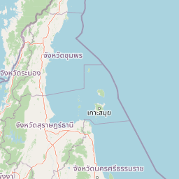
Use this park location map to pinpoint Mu Ko Ang Thong National Park in Thailand, understand its exact geographic position, and read its mapped placement within the surrounding landscape more clearly.

Pigeon | © OpenStreetMap contributors

Location context for Mu Ko Ang Thong National Park

Surat Thani Province
Park atlas

Trace the geography of other coastal protected landscapes and marine reserves within Thailand's Gulf.

Explore Nearby National Parks and Protected Areas Beyond Mu Ko Ang Thong National Park
After exploring Mu Ko Ang Thong National Park, browse other national parks and protected areas across the Gulf of Thailand, comparing diverse marine and island ecosystems. Trace how adjacent protected landscapes connect, mapping their geographic spread and conservation value within southern Thailand.
National parkSurat Thani Province

Than Sadet, Ko Pha-ngan National Park: A Royal Heritage Protected Landscape in Surat Thani

Island geography, royal rivers, and mountain terrain exploration.

Delve into Than Sadet, Ko Pha-ngan National Park, a protected area in Surat Thani Province renowned for its fusion of natural beauty and historical significance. This park protects diverse ecosystems, including dense forests, the famous Than Sadet waterfall and river system, and mountainous interiors, culminating in views from Khao Ra. As a key protected landscape, its mapped boundaries reveal a vital natural sanctuary with deep royal connections, inviting exploration of its unique geographic context and heritage within the Thai atlas.

Area
43 km²
Established
2018
IUCN
II
Visitors
158.1K annual
National parkNakhon Si Thammarat Province

Hat Khanom, Mu Ko Thale Tai National Park: National Park, Nakhon Si Thammarat Province, Thailand

Discover mapped boundaries and regional landscape context.

Hat Khanom, Mu Ko Thale Tai National Park is a designated national park offering a protected landscape within the geographic scope of Nakhon Si Thammarat Province. This entity provides a structured point for understanding its specific protected-area identity, its mapped terrain, and its contribution to the broader regional geography. Explore its geographic significance and atlas-relevant details to grasp its place in Thailand's natural landscape.

Area
312 km²
IUCN
II
Relief
Mixed relief
Climate
Tropical
National parkSurat Thani Province

Kaeng Krung National Park: Exploring Protected Area Boundaries and Regional Geography

A National Park within Surat Thani Province's diverse landscapes.

Kaeng Krung National Park is a distinct protected area situated in Surat Thani Province, Thailand. This page provides essential context for understanding the park's geographic significance, its mapped boundaries, and its contribution to the regional protected landscape atlas. Explore the fundamental geographic characteristics that define this important natural reserve and its surrounding terrain.

Area
541 km²
Established
1991
IUCN
II
Visitors
909 annual
National parkRanong

Laem Son National Park: A Protected National Park in Ranong's Geographic Landscape

Explore the mapped natural terrain and protected area boundaries.

Laem Son National Park is a key protected area within Thailand's Ranong province, offering valuable insights into regional geography and landscape preservation. This entry focuses on its status as a national park, providing a structured view of its protected boundaries and environmental context. Understand its unique position within the mapped geography, vital for any comprehensive atlas exploration of protected lands in the region.

Area
315 km²
Established
1983
IUCN
II
Visitors
21.9K annual
National parkSurat Thani Province

Khao Sok National Park: Protected Landscape Atlas and Geographic Detail

Explore mapped boundaries and regional terrain in Surat Thani Province.

Khao Sok National Park represents a crucial protected landscape within the expansive geography of Surat Thani Province, Thailand. This detailed entry focuses on the park's identity as a national park, emphasizing its mapped boundaries and the surrounding natural terrain. Through structured information and geographic context, users can gain a clear understanding of Khao Sok National Park's place in the atlas, contributing to a more informed approach to landscape discovery.

Area
739 km²
Established
1980
IUCN
II
Visitors
419.5K annual
National parkKrabi Province

Khao Phanom Bencha National Park: Protected Mountainous Rainforest and Waterfall Landscapes

Explore Krabi Province's unique protected area and its dramatic geographic features.

Khao Phanom Bencha National Park represents a core protected landscape within Krabi Province, Thailand. Dominated by the imposing Khao Phanom Bencha mountain range, its terrain includes steep, forested slopes and intricate valley systems that give rise to impressive waterfalls. This national park is an essential component of the region's protected natural areas, offering a detailed look at its unique ecosystem and geographic character through mapped landscape context and atlas exploration.

Area
50 km²
Established
1981
IUCN
II
Visitors
17.3K annual
National parkPrachuap Khiri Khan Province

Ao Siam National Park: Protected Landscape and Regional Geography within Thailand

Discover the mapped boundaries and natural terrain of this Thai national park.

Ao Siam National Park is a designated national park in Thailand, located within the Prachuap Khiri Khan Province. This protected landscape offers valuable insights into the regional geography of the Kra Isthmus. Users can explore its mapped boundaries and understand its significance as a natural area within the atlas of Thai protected lands. The park's setting provides a concrete example of protected territory contributing to the region's overall geographic context.

Area
31.94 km²
IUCN
II
Relief
Lowland
Climate
Subtropical
National parkPhang Nga Province

Khao Lak, Lam Ru National Park: Protected National Park Landscape and Geography

Explore its mapped boundaries and regional context in Phang Nga Province.

This entry focuses on Khao Lak, Lam Ru National Park, a designated national park offering a distinct protected landscape within Phang Nga Province, Thailand. It provides structured data and map context crucial for understanding its geographic scope and regional significance. Explore the park's mapped boundaries, its role as a protected area, and its contribution to the broader landscape of southern Thailand, fostering a deeper appreciation for its natural geography and atlas-derived insights.

Area
125 km²
Established
1991
IUCN
II
Visitors
72.2K annual

Common questions about visiting, size, designation, and location context for Mu Ko Ang Thong National Park

Mu Ko Ang Thong National Park FAQs for park facts, access, geography, and protected area context
Find quick answers about Mu Ko Ang Thong National Park, including protected-area facts, park geography, trail and visitor context, and how the park fits into its surrounding country and regional landscape.
MoriAtlas Explorer

Continue Your Protected Areas Search Across the Global Atlas

Deepen your exploration by continuing the structured search for national parks and protected areas worldwide. Utilize the comprehensive filtering capabilities to compare different conservation landscapes and refine your understanding of global park geography. Discover more about the distribution and characteristics of protected natural areas.

Global natural geography