

Mori Atlas logo
National parkMunga-Thirri–Simpson Desert National Park

Discover mapped boundaries and arid terrain within this significant national park.

Munga-Thirri–Simpson Desert National Park: South Australia's Vast Protected Landscape

Munga-Thirri–Simpson Desert National Park represents a significant protected area within South Australia, offering a unique glimpse into Australia's vast arid interior. This national park provides a crucial geographic anchor for understanding the region's desert landscapes, mapped boundaries, and ecological context. As part of MoriAtlas's comprehensive geographic data, this park detail allows for focused exploration of its protected territory and its place within the broader South Australian atlas.

Desert LandscapeDune SystemsProtected WildernessIUCN Category IaLargest National ParkSpinifex Grassland

Munga-Thirri–Simpson Desert National Park

National park

Park overview

Structured park overview, official facts, and landscape profile for Munga-Thirri, Simpson Desert National Park

Munga-Thirri, Simpson Desert National Park park facts, protected area profile, and essential visitor context

Review the core facts for Munga-Thirri, Simpson Desert National Park, including designation, size, terrain, visitor scale, habitats, and operating context in one park-focused overview.

About Munga-Thirri, Simpson Desert National Park

Munga-Thirri–Simpson Desert National Park stands as a monumental conservation achievement, protecting the most extensive tract of desert wilderness remaining in Australia's protected area network. The park's creation in November 2021 marked a significant milestone in Australian conservation history, consolidating what was previously a conservation park and regional reserve into a single national park that now accounts for a substantial portion of South Australia's protected lands. The Simpson Desert, which forms the core of the park, is characterized by its striking parallel dune fields that run in a generally north-south orientation across the landscape, a pattern formed over thousands of years of wind-driven sand deposition. These dunes support a complex ecosystem adapted to extreme aridity, with vegetation communities including drought-resistant spinifex grasses and hardy Acacia species that can access groundwater through their deep root systems. The park's playa lakes, which are dry salt pans for most of the time, transform into temporary wetlands when seasonal rains arrive, creating brief but ecologically important feeding and breeding grounds for waterbirds. Access to this remote park is limited, reflecting both its wilderness character and the need to protect its fragile desert environment from disturbance.

Quick facts and research context for Munga-Thirri, Simpson Desert National Park

Australia's largest national park at 3.6 million hectares, more than double the size of Kakadu and four times larger than Yellowstone. Located approximately 970 kilometres north of Adelaide in South Australia's remote far north. The park encompasses the Simpson Desert's distinctive parallel dune systems, with some dunes reaching heights of 20 metres. The region experiences extreme summer temperatures exceeding 50 degrees Celsius, necessitating seasonal access closures. First protected as Simpson Desert National Park in December 1967 under the National Parks Act 1966, later reclassified as a conservation park in 1972, and redesignated as a national park in 2021.

Protection and recognition

Analyzing the official terrestrial conservation framework established in 2021

Munga-Thirri, Simpson Desert National Park Protection Status and Designation

Browse the official protection status and conservation parameters assigned to Munga-Thirri, Simpson Desert National Park to understand its regional geographic boundaries. Structured atlas records track the 2021 terrestrial designation details to assist researchers exploring protected desert landscapes across the region.

Protection details

Protection scope
Terrestrial
Designated year
2021
Park context

Deeper park guide and search-rich context for Munga-Thirri, Simpson Desert National Park

Munga-Thirri, Simpson Desert National Park history, landscape, wildlife, and travel context

Explore Munga-Thirri, Simpson Desert National Park through its history, landscape character, ecosystems, wildlife, conservation priorities, cultural context, and seasonal travel timing in a structured park guide built for atlas discovery and search intent.

Why Munga-Thirri, Simpson Desert National Park stands out

The park is renowned for protecting one of the world's most intact dunal desert systems, with a remarkable network of parallel sand dunes that create a visually stunning and ecologically significant landscape. It contains extensive playa lakes that fill during rare rainfall events, supporting ephemeral wetland ecosystems in an otherwise arid environment. The park represents one of the world's best examples of dune desert protected area, with spinifex grasslands and Acacia woodlands providing habitat for specially adapted desert wildlife. Its classification as an IUCN Category Ia strict nature reserve places it among the most strictly protected areas in the international conservation system.

Munga-Thirri, Simpson Desert National Park history and protected-area timeline

The land within what is now Munga-Thirri–Simpson Desert National Park first received formal protected area status on 14 December 1967, when it was declared Simpson Desert National Park under the provisions of the National Parks Act 1966. This initial designation reflected growing recognition of the desert's scientific and conservation value during the mid-twentieth century. On 27 April 1972, the national park was reconstituted as Simpson Desert Conservation Park following the passage of the National Parks and Wildlife Act 1972, which introduced a new framework for protected area management in South Australia. At that time, the park covered approximately 6,932.68 square kilometres. The park underwent further evolution when, on 2 August 2018, the Government of South Australia renamed it Munga-Thirri–Simpson Desert Conservation Park, incorporating the Indigenous name Munga-Thirri to reflect the traditional custodianship of the land. The most significant transformation came in November 2021, when the conservation park was amalgamated with the Simpson Desert Regional Reserve to create Australia's largest national park, spanning 3.6 million hectares. The park experienced temporary closure to public access from December 2008 to March 2009 during an extreme heatwave, demonstrating the challenging environmental conditions that characterize this desert environment.

Munga-Thirri, Simpson Desert National Park landscape and geographic character

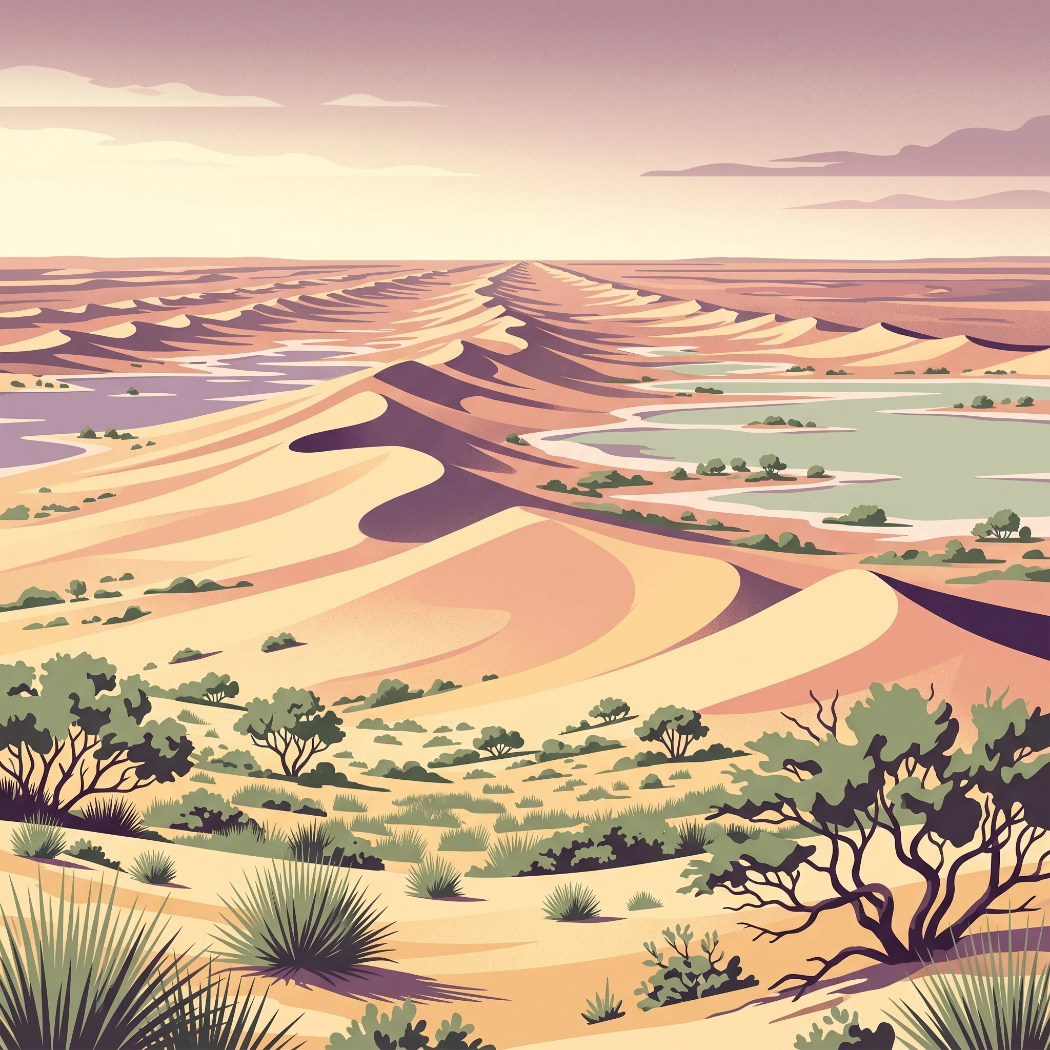
The Simpson Desert landscape within the national park is defined by its remarkable system of sand dunes, which rank among the most spectacular in the world. The dunes form a series of long, parallel ridges that stretch across the terrain, with heights typically ranging from 10 to 20 metres and lengths that can extend for many kilometres without interruption. These dunes were formed over millennia as wind-blown sand accumulated along stable vegetation lines, creating the characteristic regular spacing that gives the desert its distinctive appearance. Between the dune ridges lie swales, or interdune corridors, which contain different vegetation communities and occasionally support the playa lakes that represent the desert's most significant wetland features. The playa lakes are shallow depressions that hold water only after periods of sufficient rainfall, creating temporary inland seas that can stretch for dozens of kilometres before evaporating under the intense desert sun. The landscape also includes extensive spinifex grasslands, which form a tough, tussocky groundcover across the dune slopes and swales, and scattered Acacia woodlands that mark the locations of underground springs where water rises close to the surface. The overall impression is one of vast, empty, ancient wilderness where the horizontal dimension dominates and the sky meets the sand in an uninterrupted horizon.

Munga-Thirri, Simpson Desert National Park ecosystems, habitats, and plant life

The ecological character of Munga-Thirri–Simpson Desert National Park reflects the extreme conditions of a hyperarid desert environment where survival depends on specialized adaptations. The park protects a representative example of the Simpson Desert bioregion, which supports a surprisingly diverse array of plants and animals despite the harsh conditions. Vegetation is dominated by spinifex (Triodia species), a genus of tussock-forming grasses that have evolved to survive prolonged drought and regenerate after fire. Acacia woodlands occur in patches where groundwater is accessible, with species like Acacia cyperophylla and Acacia tetragonophylla forming small forests that provide critical habitat and food resources for wildlife. The park's desert flora has developed remarkable strategies for dealing with aridity, including deep root systems, water-storing tissues, and the ability to remain dormant until favourable conditions arrive. The ecological significance of the area extends beyond its terrestrial ecosystems to include the transient wetland environments created by playa lakes, which support communities of waterbirds, aquatic invertebrates, and temporary plant growth when water is present.

Munga-Thirri, Simpson Desert National Park wildlife and species highlights

The wildlife of Munga-Thirri–Simpson Desert National Park has evolved remarkable adaptations to survive in one of Australia's most challenging environments. Desert-dwelling mammals include small marsupials like the mulgara and various dasyurid species, as well as hopping mice and other rodents that have adapted to extract moisture from their food. Reptiles are particularly diverse, with numerous snake species including brown snakes and goannas being commonly encountered, along with legless lizards and dragons that are specialized for moving across loose sand. The birdlife, while less diverse than in more temperate regions, includes several species adapted to desert conditions, with birds of prey such as wedge-tailed eagles and falcons hunting across the dune fields. When the playa lakes fill with water, they attract temporary populations of waterbirds including ducks, grebes, and waders that exploit the brief period of abundant habitat. Many desert species are nocturnal, avoiding the extreme daytime heat by remaining in burrows or shaded microhabitats during daylight hours and becoming active only after sunset when the desert cools dramatically.

Munga-Thirri, Simpson Desert National Park conservation status and protection priorities

Munga-Thirri–Simpson Desert National Park represents one of the world's premier examples of protected desert landscapes and holds significant conservation importance at both national and international levels. Its designation as an IUCN Category Ia protected area, the strictest category in the international conservation system, reflects its primary purpose as a strict nature reserve where human disturbance is minimized to protect ecological processes and biodiversity. The park was listed on the now-defunct Register of the National Estate in 1980, acknowledging its outstanding natural values. The protection of the Simpson Desert is particularly important because the region remains one of the least disturbed desert environments on Earth, with relatively limited impacts from grazing, mining, or other development pressures that have affected desert regions elsewhere. The park forms part of a larger network of protected areas in the Simpson Desert region, including the Witjira National Park and the Simpson Desert Regional Reserve, creating a conservation landscape that allows for the movement of wildlife populations and the continuation of ecological processes across a broad geographical area.

Munga-Thirri, Simpson Desert National Park cultural meaning and human context

The Munga-Thirri–Simpson Desert National Park encompasses land of deep cultural significance to Aboriginal peoples who have maintained continuous connection to this desert country for tens of thousands of years. The name Munga-Thirri itself derives from Indigenous language and conveys the essential character of the landscape as a place of sand dunes. Traditional custodians have developed intricate knowledge of this harsh environment, including detailed understanding of water sources, edible plants, animal behaviour, and the seasonal patterns that determine where resources can be found throughout the year. The desert was not an empty land awaiting European discovery but rather a Country actively managed through fire regimes, resource management practices, and spiritual connection that sustained Aboriginal communities through the challenging conditions. The incorporation of the Indigenous name into the park's official title in 2018 represented an acknowledgment of this enduring connection and a recognition that effective conservation in this landscape must account for cultural values alongside ecological considerations.

Top sights and standout views in Munga-Thirri, Simpson Desert National Park

The sheer scale of Munga-Thirri–Simpson Desert National Park makes it a landmark in global conservation, with its 3.6 million hectares representing the largest protected desert area in Australia and one of the largest national parks in the world. The parallel dune systems of the Simpson Desert create one of the most visually distinctive arid landscapes on Earth, with regular ridges of golden sand stretching to every horizon. The park protects critical habitat for desert species that have evolved unique adaptations to survive in extreme aridity, with the Acacia woodlands around springs providing verdant pockets of life in an otherwise barren landscape. The playa lakes, though ephemeral, represent ecologically significant wetland habitat that supports populations of waterbirds during the brief periods when they hold water. The park's status as an IUCN Category Ia strict nature reserve ensures the highest level of protection, limiting development pressures and maintaining the wilderness character that makes this area exceptional.

Best time to visit Munga-Thirri, Simpson Desert National Park

Visiting Munga-Thirri–Simpson Desert National Park requires careful planning due to the extreme environmental conditions that characterize the Simpson Desert. The most suitable time for exploration is during the cooler months from May to September, when daytime temperatures are more moderate and nighttime temperatures are comfortable for camping. Summer temperatures in the desert regularly exceed 45 degrees Celsius and can reach above 50 degrees during heatwaves, creating dangerous conditions for visitors and prompting periodic closure of the park. Winter nights can be cold, occasionally dropping below freezing, but the generally dry and clear weather makes this season the most practical for access. Visitors should note that the park's remote location, limited infrastructure, and strict nature reserve status mean that access is controlled and not all areas are open to public visitation throughout the year.
Park guides

Targeted reference materials addressing core environmental timing questions for the protected area

Published Guides for Munga-Thirri–Simpson Desert National Park

Focused reference documents provide clear answers regarding optimal visitation periods across the vast desert landscape. Available materials examine visitor timing considerations for navigating regional environmental conditions safely.
Monthly climate preview

Track extreme temperature ranges and dry monthly precipitation patterns in South Australia

Munga-Thirri-Simpson Desert National Park Climate Normals and Weather by Month

Long-term weather by month measurements at a representative coordinate reveal an arid environment of extreme heat exceeding forty-five degrees Celsius alongside highly restricted precipitation. Accessing the comprehensive twelve-month profile provides detailed historical climate averages for comparing seasonal fluctuations across the protected South Australian desert.
Annual mean24 °C
13 °C33 °C
Jan33°
Feb32°
Mar28°
Apr24°
May18°
Jun14°
Jul13°
Aug16°
Sep21°
Oct25°
Nov29°
Dec31°
Warmest month
January

33.2 °C

Coolest month
July

13.5 °C

Wettest month
February

1.2 mm/day

Driest month
August

0.1 mm/day

Park location guide

Geography guide, regional context, and park location map for Munga-Thirri, Simpson Desert National Park

Munga-Thirri, Simpson Desert National Park park geography, regions, and map view in Australia

Understand where Munga-Thirri, Simpson Desert National Park sits in Australia through a broader geographic reading of the surrounding landscape, nearby location context, and its mapped position within the national park landscape.

How Munga-Thirri, Simpson Desert National Park fits into Australia

Australia is a constitutional monarchy and federal parliamentary democracy comprising six states and ten territories. With a population of nearly 28 million, it is one of the world's most urbanised countries, with most people concentrated on the eastern seaboard. The country has a high Human Development Index and is known for its cultural diversity, ancient Aboriginal heritage, and unique wildlife.

Wider geography shaping Munga-Thirri, Simpson Desert National Park in Australia

Australia occupies the entire Australian continent, the island of Tasmania, and numerous smaller islands. It is the world's flattest and driest inhabited continent, featuring vast deserts in the interior (the Outback), tropical rainforests along the eastern coast, and a coastline bordering the Indian and Pacific Oceans.

Map view of Munga-Thirri, Simpson Desert National Park

Use this park location map to pinpoint Munga-Thirri, Simpson Desert National Park in Australia, understand its exact geographic position, and read its mapped placement within the surrounding landscape more clearly.

Pigeon | © OpenStreetMap contributors

Location context for Munga-Thirri, Simpson Desert National Park

South Australia
Recorded earthquake history

Review the Historical Earthquake Catalogue for Munga-Thirri–Simpson Desert National Park

Examine the full record of earthquakes documented within proximity to Munga-Thirri–Simpson Desert National Park. This MoriAtlas collection offers clear access to historical event magnitudes and location data to support a deeper understanding of regional geography and seismic history.

Munga-Thirri–Simpson Desert National Park Earthquake History

Catalogued events

9 events

Strongest magnitude

Magnitude 4.5

Most recent event

May 2, 2006

This history includes earthquakes recorded inside the park or within 50 km of its borders

Park atlas

Compare Australia's vast desert landscapes and protected wilderness, tracing regional context and unique dunal systems.

Explore Nearby National Parks and Protected Areas from Munga-Thirri–Simpson Desert National Park

Continue your exploration of Munga-Thirri–Simpson Desert National Park by browsing other national parks and protected areas across Australia's arid interior, focusing on diverse desert landscapes. Deepen your atlas discovery by tracing the geographic spread of protected wilderness, comparing dunal systems, unique desert ecosystems, and regional conservation efforts.
National parkQueensland
Park boundaries overlap#1 closest

North

Munga-Thirri National Park: Queensland's Premier Desert Dune Protected Landscape

Explore the vast sand ridges and unique arid ecosystems of this national park.

Munga-Thirri National Park is Queensland's largest national park, preserving a spectacular desert landscape dominated by extensive parallel sand dunes. Situated in the remote central west, this protected area offers a unique lens into arid ecosystems, showcasing striking red dunes that define its geographic identity. Discover the mapped features and landscape context of this significant Australian protected land, offering a deep dive into the Simpson Desert's unique terrain and natural heritage.

Area
10,120 km²
Established
1967
IUCN
II
Relief
Lowland
National parkSouth Australia
Park boundaries overlap#2 closest

West

Witjira National Park: Explore its Protected Landscape and South Australian Geography

Mapped terrain and regional park context.

Witjira National Park in South Australia serves as a distinct protected area for detailed geographic exploration. This national park provides essential context for understanding its mapped boundaries and its role within the broader regional landscape of Australia. Discover the park's specific geographic identity and its significance as a protected natural area for atlas-based research and landscape appreciation.

Area
7,726.73 km²
Established
1985
IUCN
VI
Visitors
15K annual
Nature reserveSouth Australia
About 43 km away#3 closest

South

Kalamurina Sanctuary Nature Reserve: Geographic Overview and Protected Landscape Mapping

Arid terrain in the Lake Eyre Basin of South Australia

Covering roughly 6,700 square kilometres, Kalamurina Sanctuary serves as a critical protected node in the Australian interior. The property provides a continuous habitat mosaic of saline lakes, riparian channels, and arid uplands. This reserve bridges the gap between the Simpson Desert and the Lake Eyre landscape, supporting conservation-focused land management and the recovery of threatened arid-zone species.

Area
6,700 km²
Established
2007
Relief
Lowland
Climate
Arid
National parkSouth Australia
About 87 km away#4 closest

South

Kati Thanda-Lake Eyre National Park: National Park in South Australia's Geographic Atlas

Mapped protected area and landscape context.

Kati Thanda-Lake Eyre National Park represents a distinct protected landscape within South Australia, offering a valuable focal point for geographic discovery. As a national park, its mapped boundaries and environmental characteristics are crucial for understanding the regional terrain and the distribution of protected areas. This entry facilitates structured exploration of the park's identity within a broader atlas context, highlighting its significance as a natural landscape.

Area
13,488.4 km²
Established
1985
IUCN
II
Relief
Lowland
Wildlife reserveSouth Australia
111 km away#5 closest

South

Elliot Price Conservation Park: Arid Wildlife Reserve and Lake Eyre Shoreline Geography

Strict protected landscape on the Hunt Peninsula, South Australia.

Elliot Price Conservation Park represents a vital, ungrazed arid-zone benchmark in South Australia. The protected area features prominent limestone cliffs, saltpans, and sand hummocks across the Hunt Peninsula, offering a unique opportunity to study the region's natural ecology and geological character without the influence of pastoral activity.

Area
634.53 km²
Established
1967
IUCN
Ia
Relief
Lowland
Nature reserveNorthern Territory
About 118 km away#6 closest

Northwest

Mac Clark (Acacia peuce) Conservation Reserve: Northern Territory Protected Area

Arid-zone botany and outback landscape exploration.

Situated on the western edge of the Simpson Desert, this reserve preserves a rare population of Acacia peuce trees within a fenced, stony plain. It serves as an essential, protected botanical archive in the Northern Territory, showcasing the resilience of desert-adapted flora in a stark, wind-swept outback landscape of significant scientific and cultural interest.

Area
30.42 km²
Established
1982
IUCN
IV
Relief
Lowland
National parkSouth Australia
148 km away#7 closest

Southeast

Malkumba-Coongie Lakes National Park: A Protected Landscape in South Australia

Explore its mapped geography and regional park context.

Malkumba-Coongie Lakes National Park stands as a protected natural area within South Australia. This national park offers specific insights into the mapped landscape and regional geography of the Australian state. Understanding its boundaries and protected status contributes to a broader atlas view of conservation landscapes. Discover the unique geographic identity of this area for structured exploration and geographic context.

Area
266.69 km²
Established
2005
IUCN
II
Relief
Lowland
Nature reserveQueensland
About 239 km away#8 closest

North

Ethabuka Reserve: Protected Dunefields and Arid Wilderness in Queensland

Nature reserve geography and desert landforms

Ethabuka Reserve serves as a foundational piece of private conservation in the Australian interior. The reserve showcases a vast, ecologically intact landscape featuring linear dune ridges, expansive gibber plains, and gidgee woodlands. These diverse habitats support a rich suite of arid-zone species, forming a crucial block of protected desert territory alongside the neighbouring Pilungah Reserve.

Area
2,155 km²
Established
2004
Relief
Lowland
Scope
Terrestrial

Common questions about visiting, size, designation, and location context for Munga-Thirri, Simpson Desert National Park

Munga-Thirri, Simpson Desert National Park FAQs for park facts, access, geography, and protected area context

Find quick answers about Munga-Thirri, Simpson Desert National Park, including protected-area facts, park geography, trail and visitor context, and how the park fits into its surrounding country and regional landscape.
MoriAtlas Explorer

Continue Your Protected Areas Search Across the Global Atlas

Deepen your exploration by continuing the structured search for national parks and protected areas worldwide. Utilize the comprehensive filtering capabilities to compare different conservation landscapes and refine your understanding of global park geography. Discover more about the distribution and characteristics of protected natural areas.

Global natural geography